Bungay

Settlement in Suffolk East Suffolk

England

Bungay

4-8, Earsham Street, Bungay (Listed Building) C17 and early C18, 2 storey and attic.  C19 wood shop front to No 4. 

List Entry Number: 1234532 <span class="nowrap"><a title="https://historicengland.org.uk/listing/the-list/list-entry/1234532" rel="nofollow ugc noopener" href="https://historicengland.org.uk/listing/the-list/list-entry/1234532">Link</a><img style="margin-left:2px;" alt="External link" title="External link - shift click to open in new window" src="https://s1.geograph.org.uk/img/external.png" width="10" height="10"/></span>
4-8, Earsham Street, Bungay (Listed Building) Credit: Roger Jones

Bungay is a small market town located in the Waveney district of Suffolk, England. Situated on the River Waveney, it is approximately 20 miles southeast of Norwich and 15 miles northwest of Beccles. With a population of around 5,000 people, Bungay has a rich history dating back to the Anglo-Saxon era.

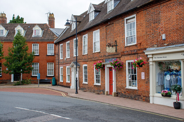
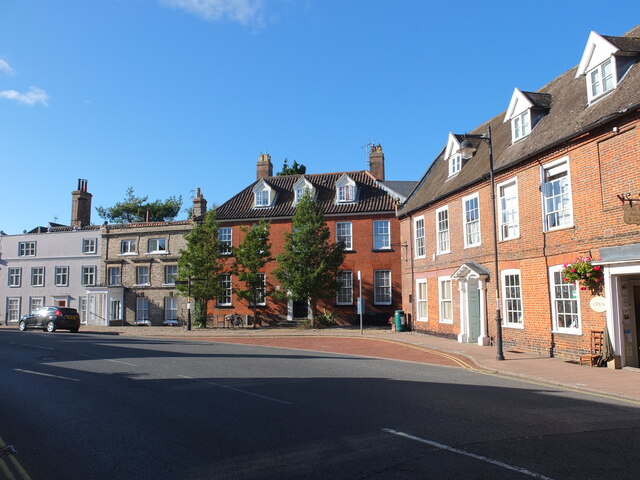
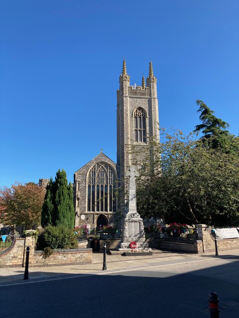
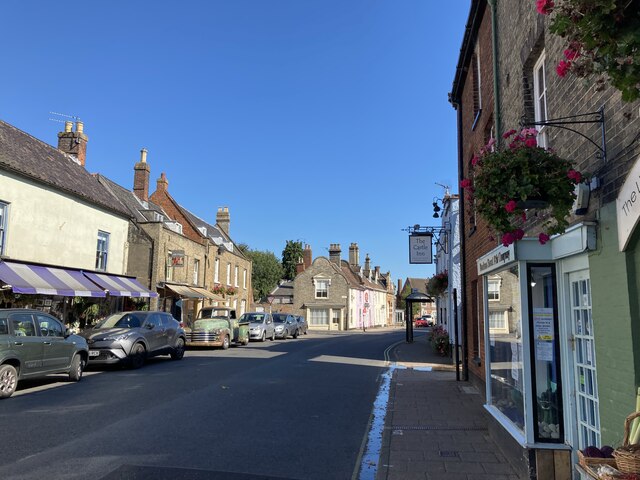
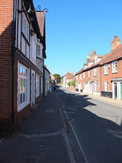
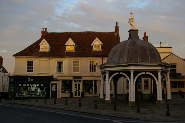
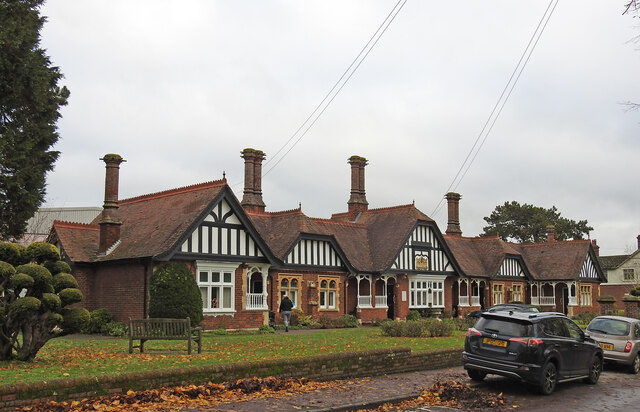
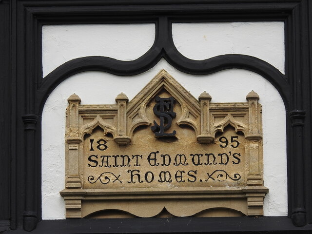
The town is known for its charming medieval architecture, with many timber-framed buildings lining its narrow streets. The centerpiece of Bungay is the impressive St. Mary's Church, a Grade I listed building that dates back to the 12th century. The church's tall tower offers panoramic views of the surrounding countryside.

Bungay is also famous for its annual street market, which has been held since the Middle Ages. The market takes place every Thursday and offers a variety of goods, including fresh produce, clothing, and household items. Additionally, the town hosts various events and festivals throughout the year, such as the Bungay Festival of Running and the Christmas Street Fair.

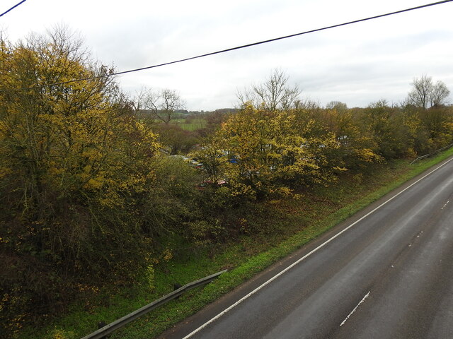
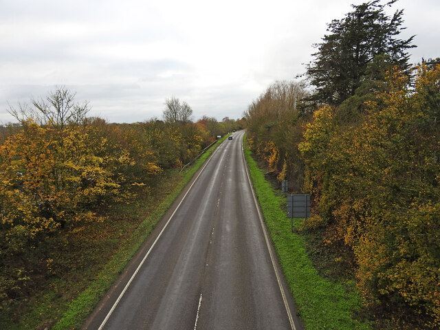
Nature enthusiasts will find Bungay to be a great base for exploring the surrounding countryside. The River Waveney provides opportunities for boating, fishing, and riverside walks, while the nearby Waveney Valley offers scenic landscapes and picturesque villages.

Overall, Bungay is a quaint and historic town that offers a peaceful and charming atmosphere, making it an ideal destination for those seeking a relaxing getaway or a glimpse into Suffolk's rich heritage.

If you have any feedback on the listing, please let us know in the comments section below.

Bungay Images

Images are sourced within 2km of 52.456101/1.437246 or Grid Reference TM3389. Thanks to Geograph Open Source API. All images are credited.

4-8, Earsham Street, Bungay (Listed Building) C17 and early C18, 2 storey and attic.  C19 wood shop front to No 4. 

List Entry Number: 1234532 <span class="nowrap"><a title="https://historicengland.org.uk/listing/the-list/list-entry/1234532" rel="nofollow ugc noopener" href="https://historicengland.org.uk/listing/the-list/list-entry/1234532">Link</a><img style="margin-left:2px;" alt="External link" title="External link - shift click to open in new window" src="https://s1.geograph.org.uk/img/external.png" width="10" height="10"/></span>
4-8, Earsham Street, Bungay (Listed Building)
C17 and early C18, 2 storey and attic. C19 wood shop front to No 4. List Entry Number: 1234532 LinkExternal link
Emmanuel Church, Upper Olland Street, Bungay
Houses on the corner of Earsham Street, Bungay
Bungay Castle
Bungay Castle
St Mary's church, Bungay St Mary's is a magnificent church which is now redundant and is cared for by The Church Conservation Trust and the Friends of St Mary’s Church: <span class="nowrap"><a title="https://stmaryschurchbungay.co.uk/" rel="nofollow ugc noopener" href="https://stmaryschurchbungay.co.uk/">Link</a><img style="margin-left:2px;" alt="External link" title="External link - shift click to open in new window" src="https://s1.geograph.org.uk/img/external.png" width="10" height="10"/></span>
St Mary's church, Bungay
St Mary's is a magnificent church which is now redundant and is cared for by The Church Conservation Trust and the Friends of St Mary’s Church: LinkExternal link
Earsham Street, Bungay
Upper Olland Street, Bungay
A143 east at Suffolk County border sign
Market Place, Bungay
Street sign, Popson Street, Bungay This design of street sign is common in Bungay and some, like this one, carry the date 1919 in the corner.
Street sign, Popson Street, Bungay
This design of street sign is common in Bungay and some, like this one, carry the date 1919 in the corner.
Fisher Theatre, Broad Street, Bungay Fisher Theatre is now a cinema.  On the right, the entrance to the pleasingly-named Cork Bricks, a short alley that cuts through to the next street.
Fisher Theatre, Broad Street, Bungay
Fisher Theatre is now a cinema. On the right, the entrance to the pleasingly-named Cork Bricks, a short alley that cuts through to the next street.
Drift House, Bungay The building has the appearance of being a church.
Drift House, Bungay
The building has the appearance of being a church.
Alms houses in Outney Road, Bungay St Edmund’s Almshouse, built in 1895 to the designs of E Banham, using funds donated by Frederick Smith (1833-1903), a local solicitor, is listed at Grade II, built of red brick laid in Flemish bond with stone dressings and plain red tiled roof covering.
Alms houses in Outney Road, Bungay
St Edmund’s Almshouse, built in 1895 to the designs of E Banham, using funds donated by Frederick Smith (1833-1903), a local solicitor, is listed at Grade II, built of red brick laid in Flemish bond with stone dressings and plain red tiled roof covering.
St Edmund's alms houses, Bungay - plaque detail The central gable, which is taller than those flanking it, contains this carved stone plaque with Gothic trefoil arches bearing the date of 1895 and St Edmund’s Homes with the entwined letters SE above.
St Edmund's alms houses, Bungay - plaque detail
The central gable, which is taller than those flanking it, contains this carved stone plaque with Gothic trefoil arches bearing the date of 1895 and St Edmund’s Homes with the entwined letters SE above.
St Edmund's alms houses, Bungay - chimney detail Above the steeply pitched roof are five tall octagonal chimneys shafts with moulded brick bases and star tops.
St Edmund's alms houses, Bungay - chimney detail
Above the steeply pitched roof are five tall octagonal chimneys shafts with moulded brick bases and star tops.
The site of the former Bungay Railway Station Now a car park for the employees of Clays Printing Works.
The station was 12¾ miles from Tivetshall and necessitated the building of two bridges numbers 1190 and 1192, within a half mile of each other, over the River Waveney as well as minor bridges over drainage ditches.
The station itself had two platforms although only a single line each side of the station. The signal box was located between the station building and the Outney overbridge. The station underwent an improvement and expansion in 1933 when the previous wooden buildings were replaced with purpose-built brick buildings with all the usual amenities plus a W H Smith newspaper and book stall. The goods yard which was separated from the passenger station by the Outney overbridge consisted of a large crossing loop sidings and a goods shed containing a 30 cwt crane, cattle pens and loading dock. Coal bunkers and a water tank (still in use at The North Norfolk Railway).
The site of the former Bungay Railway Station
Now a car park for the employees of Clays Printing Works. The station was 12¾ miles from Tivetshall and necessitated the building of two bridges numbers 1190 and 1192, within a half mile of each other, over the River Waveney as well as minor bridges over drainage ditches. The station itself had two platforms although only a single line each side of the station. The signal box was located between the station building and the Outney overbridge. The station underwent an improvement and expansion in 1933 when the previous wooden buildings were replaced with purpose-built brick buildings with all the usual amenities plus a W H Smith newspaper and book stall. The goods yard which was separated from the passenger station by the Outney overbridge consisted of a large crossing loop sidings and a goods shed containing a 30 cwt crane, cattle pens and loading dock. Coal bunkers and a water tank (still in use at The North Norfolk Railway).
The former site of Bungay Waveney Valley Railway Station In the trees and in part of the car park behind was the site of Bungay Railway Station. The station was 12¾ miles from Tivetshall and necessitated the building of two bridges numbers 1190 and 1192, within a half mile of each other, over the River Waveney as well as minor bridges over drainage ditches.
The station itself had two platforms although only a single line each side of the station. The signal box was located between the station building and the Outney overbridge. The station underwent an improvement and expansion in 1933 when the previous wooden buildings were replaced with purpose-built brick buildings with all the usual amenities plus a W H Smith newspaper and book stall. The goods yard which was separated from the passenger station by the Outney overbridge consisted of a large crossing loop sidings and a goods shed containing a 30 cwt crane, cattle pens and loading dock. Coal bunkers and a water tank which is still in use at Weybourne Station on the North Norfolk Railway.  <a href="https://www.geograph.org.uk/photo/7353291">TG1141 : Water tank at Weybourne railway station</a>
The former site of Bungay Waveney Valley Railway Station
In the trees and in part of the car park behind was the site of Bungay Railway Station. The station was 12¾ miles from Tivetshall and necessitated the building of two bridges numbers 1190 and 1192, within a half mile of each other, over the River Waveney as well as minor bridges over drainage ditches. The station itself had two platforms although only a single line each side of the station. The signal box was located between the station building and the Outney overbridge. The station underwent an improvement and expansion in 1933 when the previous wooden buildings were replaced with purpose-built brick buildings with all the usual amenities plus a W H Smith newspaper and book stall. The goods yard which was separated from the passenger station by the Outney overbridge consisted of a large crossing loop sidings and a goods shed containing a 30 cwt crane, cattle pens and loading dock. Coal bunkers and a water tank which is still in use at Weybourne Station on the North Norfolk Railway. TG1141 : Water tank at Weybourne railway station
Former line of the railway converted to a road (looking south) This was the line of the former Waveney Valley Railway. Bungay Station was to the left of the picture in and behind the trees. Just this side of the car in the distance is the bridge crossing the River Waveney taking us back into Norfolk.  The Bridge was designated the number 1190 by the WVR.  Next stop, Earsham.
Former line of the railway converted to a road (looking south)
This was the line of the former Waveney Valley Railway. Bungay Station was to the left of the picture in and behind the trees. Just this side of the car in the distance is the bridge crossing the River Waveney taking us back into Norfolk. The Bridge was designated the number 1190 by the WVR. Next stop, Earsham.
Show me another place!

Bungay is located at Grid Ref: TM3389 (Lat: 52.456101, Lng: 1.437246)

Administrative County: Suffolk

District: East Suffolk

Police Authority: Suffolk

What 3 Words

///treaty.deed.bundles. Near Bungay, Suffolk

Nearby Locations

Bungay

Related Wikis

Bungay

Bungay () is a market town, civil parish and electoral ward in the English county of Suffolk. It lies in the Waveney Valley, 5.5 miles (9 km) west of Beccles...

St Mary's Church, Bungay

St Mary's Church is a redundant Anglican church in the town of Bungay, Suffolk, England. The church and the ruins of the adjacent priory are recorded...
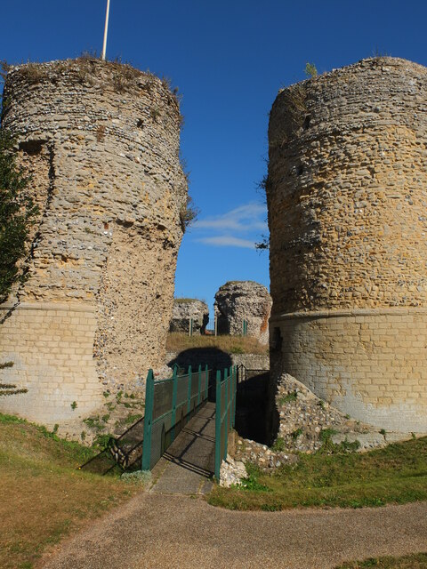
Bungay Castle

Bungay Castle is a Grade I listed building in the town of Bungay, Suffolk. == History == The site was originally a Norman castle built by Roger Bigod in...

Bungay Priory

Bungay Priory was a Benedictine nunnery in the town of Bungay in the English county of Suffolk. It was founded c. 1160-1185 by the Countess Gundreda, wife...

Bungay railway station

Bungay railway station was located on the now disused Waveney Valley Line which ran between Tivetshall and Beccles. The station was closed in 1953 and...

Bungay Town F.C.

Bungay Town Football Club is an English football club based in Bungay, Suffolk. The club are currently members of Anglian Combination Division One and...

Chicken roundabout

The chicken roundabout is a roundabout located on the A143 road, on the Bungay and Ditchingham bypass in Suffolk, United Kingdom. The roundabout was famous...

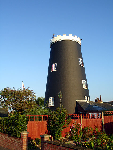
Flixton Road Mill, Bungay

Flixton Road Mill is a tower mill at Bungay, Suffolk, England which has been truncated and converted to residential accommodation. The structure is a Grade...

Nearby Amenities

Located within 500m of 52.456101,1.437246
Fixme: check NCN Route 30 course here
Lat/Long: 52.4562675/1.4372069
Bungay
Is In County: Suffolk
Is In District: Waveney
Name Ru: Банги
Place: town
Wikidata: Q1009468
Lat/Long: 52.4562248/1.4373413
Bus Stop
Holy Trinity Church
Bus: yes
Local Ref: NR
Naptan AtcoCode: 390070043
Naptan Bearing: SE
Naptan CommonName: Holy Trinity Church
Naptan Indicator: nr
Naptan Landmark: Holy Trinity Church
Naptan NaptanCode: sufgwapd
Naptan Street: Trinity Street
Naptan Verified: no
Public Transport: platform
Source: naptan_import
Lat/Long: 52.4556127/1.4392348
Bus Stop
Chaucer Street
Bus: yes
Naptan AtcoCode: 390070044
Naptan Bearing: W
Naptan CommonName: Chaucer Street
Naptan Indicator: opp
Naptan Landmark: Chaucer Street
Naptan NaptanCode: sufgwapg
Naptan Street: Earsham Street
Naptan Verified: no
Public Transport: platform
Source: naptan_import
Lat/Long: 52.4564852/1.4351995
Bus Stop
Cork Bricks
Bus: yes
Naptan AtcoCode: 390070045
Naptan Bearing: SE
Naptan CommonName: Cork Bricks
Naptan Indicator: adj
Naptan Landmark: Cork Bricks
Naptan NaptanCode: sufgwapj
Naptan Street: Earsham Street
Naptan Verified: no
Public Transport: platform
Source: naptan_import
Lat/Long: 52.4566529/1.436424
Bus Stop
opp Green Dragon
Bus: yes
Description: Broad Street. Opposite Green Dragon
Naptan AtcoCode: 390070046
Naptan Bearing: SE
Naptan CommonName: Green Dragon
Naptan Indicator: opp
Naptan Landmark: Green Dragon
Naptan NaptanCode: sufgwapm
Naptan Street: Broad Street
Naptan Verified: no
Public Transport: platform
Source: naptan_import
Lat/Long: 52.4576053/1.4356085
Bus Stop
Butter Cross
Bus: yes
Naptan AtcoCode: 390070047
Naptan Bearing: N
Naptan CommonName: Butter Cross
Naptan Indicator: opp
Naptan Landmark: Bus Shelter
Naptan NaptanCode: sufgwapt
Naptan Street: St Marys Street
Naptan Verified: no
Public Transport: platform
Shelter: yes
Source: naptan_import
Lat/Long: 52.4556399/1.4370181
Bus Stop
Garage
Bus: yes
Local Ref: NR
Naptan AtcoCode: 390070063
Naptan Bearing: SE
Naptan CommonName: Garage
Naptan Indicator: nr
Naptan Landmark: Garage
Naptan NaptanCode: sufgwdad
Naptan Street: Staithe Road
Naptan Verified: no
Public Transport: platform
Source: naptan_import
Lat/Long: 52.4544482/1.4428526
Bus Stop
Garage
Bus: yes
Naptan AtcoCode: 390070064
Naptan Bearing: NW
Naptan BusStopType: CUS
Naptan CommonName: Garage
Naptan Indicator: opp
Naptan Landmark: Garage
Naptan NaptanCode: sufgwdag
Naptan Street: Staithe Road
Naptan Verified: no
Public Transport: platform
Source: naptan_import
Lat/Long: 52.4543824/1.4426414
Bus Stop
adj Green Dragon
Bench: yes
Bus: yes
Description: Directly outside Green Dragon pub.
Lit: yes
Naptan AtcoCode: 390070972
Naptan Bearing: N
Naptan BusStopType: CUS
Naptan CommonName: Green Dragon
Naptan Indicator: o/s
Naptan Landmark: Green Dragon
Naptan NaptanCode: sufjmtja
Naptan Street: Broad Street
Naptan Verified: no
Public Transport: platform
Shelter: no
Source: naptan_import
Lat/Long: 52.4578714/1.4350305
Bus Stop
Wingfield Street
Bus: yes
Naptan AtcoCode: 390070992
Naptan Bearing: SE
Naptan BusStopType: CUS
Naptan CommonName: Wingfield Street
Naptan Indicator: adj
Naptan Landmark: Wingfield Street
Naptan NaptanCode: sufjpmdj
Naptan Street: Lower Olland Street
Naptan Verified: no
Public Transport: platform
Source: naptan_import
Lat/Long: 52.4525573/1.4407617
Bus Stop
garage, opp
Bus: yes
Naptan AtcoCode: 2900D0912
Naptan Bearing: NE
Naptan BusStopType: CUS
Naptan CommonName: garage
Naptan Indicator: opp
Naptan Landmark: garage
Naptan Locality: Ditchingham
Naptan NaptanCode: nfoamgta
Naptan ShortCommonName: garage
Naptan Street: Ditchingham Dam
Naptan Verified: no
Public Transport: platform
Source: naptan_import
Lat/Long: 52.4598417/1.4408001
Addr City: Bungay
Addr Postcode: NR35 1DD
Addr Street: Castle Orchard
Disused Amenity: cafe
Old Name: Jesters
Source Addr: FHRS Open Data
Lat/Long: 52.4556117/1.4363673
Fixme: Where does the A-road go for those going north?
Lat/Long: 52.457794/1.4353224
Barrier: kissing_gate
Foot: yes
Lat/Long: 52.4575907/1.4400275
Bench
Lat/Long: 52.4570231/1.4406511
Pub
Green Dragon
Addr City: Bungay
Addr Housenumber: 29
Addr Postcode: NR35 1EF
Addr Street: Broad Street
Brewery: yes
Fhrs Id: 1074352
Internet Access: wlan
Microbrewery: yes
Outdoor Seating: yes
Payment Cash: yes
Payment Contactless: yes
Payment Credit Cards: yes
Payment Debit Cards: yes
Smoking: outside
Website: https://www.greendragonbungay.co.uk/
Lat/Long: 52.4578203/1.4350401
Pharmacy
Boots
Addr City: Bungay
Addr Housenumber: 4
Addr Postcode: NR35 1AX
Addr Street: St Marys Street
Brand: Boots
Brand Wikidata: Q6123139
Brand Wikipedia: en:Boots UK
Fhrs Id: 1074378
Healthcare: pharmacy
Source Addr: FHRS Open Data
Website: https://www.boots.com/stores/5522-bungay-st-marys-nr35-1ax
Lat/Long: 52.4555551/1.4370029
Barrier: cycle_barrier
Bicycle: no
Lat/Long: 52.4559142/1.4353934
Crossing
Crossing: uncontrolled
Crossing Ref: zebra
Lat/Long: 52.4544858/1.4382103
Pub
The Three Tuns
Addr City: Bungay
Addr Postcode: NR35 1AG
Addr Street: Earsham Street
Fhrs Id: 1074361
Lat/Long: 52.4563778/1.4371482
Cafe
The Buttercross Tea Rooms
Addr City: Bungay
Addr Housenumber: 6
Addr Postcode: NR35 1AU
Addr Street: Cross Street
Fhrs Id: 1590673
Lat/Long: 52.4559361/1.4379141
Traffic Signals
Crossing: traffic_signals
Lat/Long: 52.4555048/1.437249
Kindergarten
Beehive Day Nursery
Addr Housename: Beehive Day Nursery
Addr Postcode: NR35 1DQ
Addr Street: Rose Lane
Fhrs Id: 1074790
Source: http://www.beehivedaynursery.org/
Lat/Long: 52.4535981/1.4376548
Gray's Emporium
Addr City: Bungay
Addr Housenumber: 11
Addr Street: Market Place
Disused Amenity: bank
Old Name: Lloyds Bank
Shop: antiques
Lat/Long: 52.4560306/1.4374237
Theatre
The Fisher Theatre
Addr City: Bungay
Addr Housenumber: 10A
Addr Postcode: NR35 1EE
Addr Street: Broad Street
Fhrs Id: 1074353
Source Addr: FHRS Open Data
Wikidata: Q26527752
Lat/Long: 52.4567673/1.437042
Leisure: playground
Lat/Long: 52.4543602/1.435934
Give Way
Lat/Long: 52.456277/1.4371608
Crossing
Lat/Long: 52.4563075/1.4376554
Barrier: cycle_barrier
Bicycle: no
Lat/Long: 52.4561636/1.4353179
Pub
The Fleece Inn
Addr City: Bungay
Addr Postcode: NR35 1AX
Addr Street: St Marys Street
Fhrs Id: 1074379
Source Addr: FHRS Open Data
Website: https://thefleeceinnbungay.co.uk/
Lat/Long: 52.4553872/1.4371927
Barrier: bollard
Lat/Long: 52.4531461/1.4366945
Barrier: cycle_barrier
Lat/Long: 52.4532277/1.4367507
Barrier: bollard
Lat/Long: 52.4533197/1.4363811
Barrier: bollard
Lat/Long: 52.4535214/1.4364821
Entrance: main
Lat/Long: 52.4546057/1.437097
Barrier: bollard
Lat/Long: 52.4547036/1.4362335
Bench
Backrest: yes
Seats: 3
Lat/Long: 52.4548282/1.4356722
Restaurant
Castle Inn
Addr City: Bungay
Addr Housenumber: 35
Addr Postcode: NR35 1AF
Addr Street: Earsham Street
Cuisine: english
Fhrs Id: 1383241
Source Addr: FHRS Open Data
Website: https://www.thecastleinn.net/
Lat/Long: 52.456426/1.4351566
Addr Housename: The Old Mill
Addr Unit: 3
Lat/Long: 52.4552744/1.4437265
Addr Housename: The Old Mill
Addr Unit: 2
Lat/Long: 52.4552683/1.4438184
Post Box
Collection Times: Mo-Fr 09:00; Sa 07:00
Operator: Royal Mail
Operator Wikidata: Q638098
Post Box Mounting: pier
Post Box Type: lamp
Ref: NR35 3529D
Royal Cypher: EIIR
Royal Cypher Wikidata: Q33102113
Lat/Long: 52.4578847/1.4401345
Imperial Wine Co
Addr City: Bungay
Addr Housenumber: 7
Addr Postcode: NR35 1EH
Addr Street: Trinity Street
Fhrs Id: 1074852
Shop: alcohol
Source Addr: FHRS Open Data
Lat/Long: 52.4561103/1.4383285
Bar
The Mayfair
Addr Housenumber: 18
Addr Postcode: NR35 1EE
Addr Street: Broad Street
Fhrs Id: 1691792
Old Name: Russell & Newnes
Source Addr: FHRS Open Data
Lat/Long: 52.4571686/1.4363723
Noexit: yes
Lat/Long: 52.4559862/1.4353216
Information: board
Tourism: information
Lat/Long: 52.4569459/1.4363579
Bungay Museum
Addr City: Bungay
Addr Postcode: NR35 1EE
Addr Street: Broad Street
Museum: history
Tourism: museum
Website: https://bungaymuseum.co.uk/
Lat/Long: 52.4569578/1.436287
Toilets
Lat/Long: 52.4544286/1.4370393
Parking
Lat/Long: 52.4556651/1.4437761
Parking
Lat/Long: 52.4554994/1.4437632
Tourism: viewpoint
Lat/Long: 52.4541432/1.4358859
Crossing
Crossing: unmarked
Crossing Markings: no
Lat/Long: 52.4597596/1.4333306
Crossing
Crossing: unmarked
Crossing Markings: no
Lat/Long: 52.4598485/1.4332256
Toilets
Cross Street Toilets
Addr Street: Cross Street
Operator: Bungay Town Council
Lat/Long: 52.4560408/1.4378467
Post Box
Operator: Royal Mail
Operator Wikidata: Q638098
Post Box Type: wall
Ref: NR35 3502
Lat/Long: 52.4523693/1.4410061
John Groom Butcher
Addr City: Suffolk
Addr Postcode: NR35 1EZ
Addr Street: Wingfield Street
Fhrs Id: 1125531
Shop: butcher
Lat/Long: 52.4530689/1.4422667
Cafe
Ma Belle Bakery
Addr City: Bungay
Addr Housenumber: 13
Addr Postcode: NR35 1AP
Addr Street: Market Place
Fhrs Id: 1074367
Wikidata: Q26528090
Lat/Long: 52.4559334/1.4375547
Bungay Shopper
Addr City: Bungay
Addr Housenumber: 2
Addr Postcode: NR35 1AX
Addr Street: St Marys Street
Fhrs Id: 1074377
Shop: convenience
Lat/Long: 52.4555944/1.4369149
Bungay Convenience Store
Addr City: Bungay
Addr Housenumber: 16
Addr Postcode: NR35 1AX
Addr Street: St Marys Street
Brand: Premier
Brand Wikidata: Q7240340
Brand Wikipedia: en:Premier Stores
Fhrs Id: 1074692
Shop: convenience
Website: https://www.premier-stores.co.uk/our-stores/bungay-convenience-store
Lat/Long: 52.455141/1.4374763
Fast Food
Suffolk Stonehouse
Addr City: Bungay
Addr Housenumber: 18
Addr Postcode: NR35 1AX
Addr Street: St Marys Street
Cuisine: pizza
Fhrs Id: 1074380
Website: https://www.suffolkstonehouse.co.uk/
Lat/Long: 52.4550753/1.4375339
Fast Food
Bungay Kebab
Addr City: Bungay
Addr Housenumber: 22
Addr Postcode: NR35 1AX
Addr Street: St Marys Street
Cuisine: kebab
Fhrs Id: 1074381
Lat/Long: 52.4549868/1.4376141
Fast Food
Skyway
Addr City: Bungay
Addr Housenumber: 32
Addr Postcode: NR35 1AX
Addr Street: St Marys Street
Contact Facebook: https://www.facebook.com/people/Skyway-Chinese-TakeAway-Bungay/100057139222791/
Cuisine: chinese
Fhrs Id: 1074382
Lat/Long: 52.4548985/1.4377061
Fast Food
Pex Fish & Chips
Addr City: Bungay
Addr Housenumber: 34
Addr Postcode: NR35 1AX
Addr Street: St Marys Street
Contact Facebook: https://www.facebook.com/Pexfishandchips/
Cuisine: fish_and_chips
Fhrs Id: 1074383
Lat/Long: 52.4548596/1.4377446
Fast Food
Bungay Tandoori
Addr City: Bungay
Addr Housenumber: 42
Addr Postcode: NR35 1AX
Addr Street: St Marys Street
Cuisine: indian
Fhrs Id: 1075016
Old Name: Spice Of Balti
Website: https://spiceofbalti.com/
Lat/Long: 52.4545933/1.437978
Cafe
The Front Room
Addr City: Bungay
Addr Housenumber: 28
Addr Postcode: NR35 1AQ
Addr Street: Earsham Street
Contact Facebook: https://www.facebook.com/frontroombungay/
Fhrs Id: 1489258
Lat/Long: 52.4566102/1.4351371
Restaurant
Fiano Restaurant
Addr City: Bungay
Addr Housenumber: 5
Addr Postcode: NR35 1AE
Addr Street: Earsham Street
Fhrs Id: 1548890
Old Name: Pomegranate Restaurant
Lat/Long: 52.4564458/1.4366267
Cafe
Earsham Street Cafe
Addr City: Bungay
Addr Housenumber: 11-13
Addr Postcode: NR35 1AE
Addr Street: Earsham Street
Fhrs Id: 1074357
Website: https://www.earshamstreetcafe.co.uk/
Lat/Long: 52.4565025/1.4361895
Giddens & Thompson Greengrocers
Addr City: Bungay
Addr Housenumber: 36B
Addr Postcode: NR35 1AQ
Addr Street: Earsham Street
Fhrs Id: 1074893
Not Addr Postcode: NR35 1AE
Shop: greengrocer
Source Addr Postcode: code-point_open
Website: https://www.giddensandthompson.co.uk/
Lat/Long: 52.456528/1.4347666
Farmhouse Bakery
Addr City: Bungay
Addr Housenumber: 12
Addr Postcode: NR35 1AW
Addr Street: Market Place
Fhrs Id: 1074369
Shop: bakery
Lat/Long: 52.455829/1.4370081
Cafe
The Old Bank
Addr City: Bungay
Addr Housenumber: 8
Addr Postcode: NR35 1AW
Addr Street: Market Place
Fhrs Id: 1375654
Lat/Long: 52.4559524/1.4370401
The Chocolate Box
Addr City: Bungay
Addr Housenumber: 6
Addr Postcode: NR35 1AW
Addr Street: Market Place
Contact Facebook: https://www.facebook.com/chocolateboxbungay/
Fhrs Id: 1074368
Shop: gift
Lat/Long: 52.4560559/1.4370512
Addr City: Bungay
Addr Housenumber: 1
Addr Postcode: NR35 1EG
Addr Street: Market Place
Disused Amenity: restaurant
Note: In the basement below the shop
Old Name: The Three Cooks
Lat/Long: 52.4564481/1.4375179
Earsham Street Delicatessen
Addr City: Bungay
Addr Housenumber: 51
Addr Postcode: NR35 1AF
Addr Street: Earsham Street
Fhrs Id: 1075077
Shop: deli
Website: https://www.earshamstreetdeli.co.uk/
Lat/Long: 52.4563138/1.4346251
Fast Food
Mermaid Fish Bar
Addr City: Bungay
Addr Housenumber: 49
Addr Postcode: NR35 1AF
Addr Street: Earsham Street
Cuisine: fish_and_chips
Fhrs Id: 1074360
Lat/Long: 52.4563416/1.43474
Little Green Wholefood Shop
Addr City: Bungay
Addr Housenumber: 39-41
Addr Postcode: NR35 1AF
Addr Street: Earsham Street
Fhrs Id: 1074663
Shop: health_food
Lat/Long: 52.456372/1.4348474
Earsham Street Fish Company
Addr City: Bungay
Addr Housenumber: 39A
Addr Postcode: NR35 1AF
Addr Street: Earsham Street
Fhrs Id: 1074359
Shop: seafood
Website: https://earshamstreetfish.co.uk/
Lat/Long: 52.4563845/1.4349151
A Sweet For You
Addr City: Bungay
Addr Housenumber: 31
Addr Postcode: NR35 1AF
Addr Street: Earsham Street
Fhrs Id: 1074870
Shop: confectionery
Website: https://www.asweetforyou.co.uk/
Lat/Long: 52.4564688/1.4354363
Micro Data Systems Ltd
Addr City: Bungay
Addr Housenumber: 12
Addr Postcode: NR35 1EE
Addr Street: Broad Street
Air Conditioning: yes
Description: IT Consultants. Cloud Hosting, Software Development.
Office: it
Opening Hours: Mo-Fr 09:00-17:00
Phone: +44 1986 232040
Website: https://microdata.systems/
Lat/Long: 52.4568829/1.4368489
Sprake and Kingsley
Addr City: Bungay
Addr Housenumber: 16
Addr Postcode: NR35 1EN
Addr Street: Broad Street
Office: lawyer
Website: https://sprakekingsley.co.uk/
Lat/Long: 52.4570038/1.4367631
Generator Method: photovoltaic
Generator Output Electricity: yes
Generator Source: solar
Generator Type: solar_photovoltaic_panel
Location: roof
Power: generator
Lat/Long: 52.4544297/1.4424451
Generator Method: photovoltaic
Generator Output Electricity: yes
Generator Source: solar
Generator Type: solar_photovoltaic_panel
Location: roof
Power: generator
Lat/Long: 52.4559211/1.4349443
Generator Method: photovoltaic
Generator Output Electricity: yes
Generator Source: solar
Generator Type: solar_photovoltaic_panel
Location: roof
Power: generator
Lat/Long: 52.4524202/1.4376305
Generator Method: photovoltaic
Generator Output Electricity: yes
Generator Source: solar
Generator Type: solar_photovoltaic_panel
Location: roof
Power: generator
Lat/Long: 52.4525907/1.437534
Power: pole
Lat/Long: 52.4525753/1.4336541
Power: pole
Lat/Long: 52.4527927/1.4344025
Power: pole
Lat/Long: 52.4530591/1.4352661
Grit Bin
Colour: yellow
Lat/Long: 52.4561875/1.4337587
Post Box
Collection Times: Mo-Fr 16:45; Sa 12:15
Operator: Royal Mail
Operator Wikidata: Q638098
Post Box Apertures: 2
Post Box Mounting: window
Post Box Type: wall
Ref: NR35 3500
Lat/Long: 52.4564873/1.434514
Give Way
Lat/Long: 52.4562235/1.4338915
Give Way
Lat/Long: 52.4565586/1.4353922
Give Way
Lat/Long: 52.4563667/1.4373631
Give Way
Lat/Long: 52.4563604/1.4375214
Give Way
Lat/Long: 52.4566873/1.4379207
Give Way
Lat/Long: 52.4579376/1.440019
DMP
Shop: car_parts
Lat/Long: 52.4542537/1.4383687
Addr City: Bungay
Addr Housenumber: 44
Addr Street: St Marys Street
Disused Shop: yes
Lat/Long: 52.4545414/1.4380214
Diva's Beauty Room
Addr City: Bungay
Addr Street: St Marys Street
Contact Facebook: https://www.facebook.com/divasbeautyroombungay/
Old Name: RSPCA
Shop: charity
Lat/Long: 52.455034/1.4375707
Coopers
Addr City: Bungay
Addr Street: St Marys Street
Shop: doityourself
Website: https://coopersdirect.com/
Lat/Long: 52.4551887/1.4374193
Sue Ryder
Addr City: Bungay
Addr Housenumber: 6
Addr Street: Saint Mary's Street
Brand: Sue Ryder
Brand Wikidata: Q7634271
Brand Wikipedia: en:Sue Ryder (charity)
Shop: charity
Website: https://www.sueryder.org/support-us/shop-with-us/our-shops/bungay
Lat/Long: 52.4554886/1.4370987
Four Seasons Home & Garden
Addr City: Bungay
Addr Housenumber: 23
Addr Street: Market Place
Old Name: Kitchen Kave
Shop: houseware
Lat/Long: 52.4557415/1.4372693
Sweeney's of Bungay
Addr City: Bungay
Addr Housenumber: 7
Addr Postcode: NR35 1AP
Addr Street: Market Place
Shop: hairdresser
Website: https://www.sweeneysofbungayltd.co.uk/
Lat/Long: 52.4561427/1.4374653
William H. Brown
Addr City: Bungay
Addr Postcode: NR35 1AE
Addr Street: Earsham Street
Brand: William H. Brown
Brand Wikidata: Q81787271
Office: estate_agent
Source Addr Postcode: code-point_open
Website: https://www.williamhbrown.co.uk/estate-agents/bungay
Lat/Long: 52.4564951/1.4357883
Crocks
Addr City: Bungay
Addr Postcode: NR35 1AE
Addr Street: Earsham Street
Shop: gift
Source Addr Postcode: code-point_open
Lat/Long: 52.4565089/1.4363528
East Anglia's Children's Hospices
Addr City: Bungay
Addr Street: Market Place
Operator: EACH
Shop: charity
Lat/Long: 52.4563665/1.4377124
Atm
Network: LINK
Opening Hours: 24/7
Lat/Long: 52.4569232/1.4363845
Post Office
Bungay Post Office
Addr City: Bungay
Addr Housename: Bungay Shopper
Addr Housenumber: 2
Addr Postcode: NR35 1AX
Addr Street: St Marys Street
Brand: Post Office
Brand Wikidata: Q1783168
Opening Hours: Mo-Sa 07:00-18:00; Su 08:00-13:00
Ref Pol Id: 178065
Source: pol_branch_list_2022‑05‑27
Website: https://www.postoffice.co.uk/branch-finder/0211362/bungay
Lat/Long: 52.455538/1.4368153
Parking Space
Capacity: 1
Parking Space: disabled
Lat/Long: 52.4522561/1.4401647
Parking Space
Capacity: 1
Parking Space: disabled
Lat/Long: 52.4522741/1.4402076
The Original Factory Shop
Addr City: Bungay
Addr Housenumber: 48B
Addr Postcode: NR35 1AX
Addr Street: St Marys Street
Brand: The Original Factory Shop
Brand Wikidata: Q7755366
Contact Facebook: https://www.facebook.com/tofsbungay/
Fhrs Id: 1647574
Shop: variety_store
Source Addr: FHRS Open Data
Lat/Long: 52.454711/1.4378538
Information: board
Tourism: information
Lat/Long: 52.4556803/1.4372566
Aggiev
Addr City: Bungay
Addr Housenumber: 10
Addr Postcode: NR35 1AW
Addr Street: Market Place
Shop: clothes
Source Addr Postcode: code-point_open
Lat/Long: 52.4558981/1.4370284
Clean & Dry
Addr City: Bungay
Addr Housenumber: 1
Addr Postcode: NR35 1AE
Addr Street: Earsham Street
Contact Facebook: https://www.facebook.com/people/Clean-n-Dry-Launderette-Dry-Cleaners/100063526092221/
Shop: dry_cleaning
Source Addr Postcode: code-point_open
Lat/Long: 52.4563444/1.4368417
Bungay Computers
Addr City: Bungay
Addr Housenumber: 2a
Addr Postcode: NR35 1AG
Addr Street: Earsham Street
Shop: computer
Source Addr Postcode: code-point_open
Website: http://www.bungaycomputers.co.uk/
Lat/Long: 52.4564579/1.4369803
Musker McIntyre Estate Agents & Financial Services
Addr City: Bungay
Addr Housenumber: 3
Addr Postcode: NR35 1AE
Addr Street: Earsham Street
Office: estate_agent
Source Addr Postcode: code-point_open
Website: https://www.muskermcintyre.co.uk/branches/bungay
Lat/Long: 52.4563916/1.4367466
Muse
Addr City: Bungay
Addr Housenumber: 4
Addr Postcode: NR35 1AG
Addr Street: Earsham Street
Old Name: Butterfli
Shop: clothes
Source Addr Postcode: code-point_open
Lat/Long: 52.4565924/1.4366822
Cork Brick Antiques & Gallery
Addr City: Bungay
Addr Housenumber: 6
Addr Postcode: NR35 1AG
Addr Street: Earsham Street
Shop: antiques
Source Addr Postcode: code-point_open
Website: https://www.corkbrickgallery.co.uk/
Lat/Long: 52.4566414/1.4366002
Palfrey And Hall
Addr City: Bungay
Addr Housenumber: 29
Addr Postcode: NR35 1AF
Addr Street: Earsham Street
Fhrs Id: 1371498
Old Name: Aurina
Shop: butcher
Website: https://www.palfreyandhall.co.uk/
Lat/Long: 52.4564744/1.4355339
The Art Trading Company
Addr City: Bungay
Addr Postcode: NR35 1AF
Addr Street: Earsham Street
Shop: art
Source Addr Postcode: code-point_open
Website: https://thearttradingcompany.co.uk/
Lat/Long: 52.4562978/1.4345234
New Beginnings
Addr City: Bungay
Addr Housenumber: 32-34
Addr Postcode: NR35 1AQ
Addr Street: Earsham Street
Shop: florist
Website: https://www.newbeginningsflorist.co.uk/
Lat/Long: 52.4565723/1.4349515
The Bell Gallery
Addr City: Bungay
Addr Housenumber: 40
Addr Postcode: NR35 1AQ
Addr Street: Earsham Street
Fhrs Id: 1596162
Old Name: Bells of Suffolk
Shop: furniture
Source Addr Postcode: code-point_open
Website: https://bellsofsuffolk.com/
Wikidata: Q26565591
Lat/Long: 52.4565016/1.4346694
Citizens Advice Bureau
Office: lawyer
Website: https://nesuffolkcab.org.uk/
Lat/Long: 52.4569804/1.4351241
Defibrillator
Defibrillator Location: outside Boots, St Mary's Street, Bungay
Emergency: defibrillator
Indoor: no
Ref GB The Circuit: 6F804E60-CCC1-4BE6-81BA-AFC600D952F7
Lat/Long: 52.4555965/1.437007
Post Box
Collection Times: Mo-Fr 16:30; Sa 12:00
Post Box Design: type_b
Post Box Type: pillar
Ref: NR35 3501
Royal Cypher: EIIR
Lat/Long: 52.4556095/1.4370451
Historic: memorial
Memorial: war_memorial
Lat/Long: 52.4555263/1.4373437
Telephone
Booth: K6
Covered: booth
Listed Status: Grade II
Phone: +44 1986 892724
Lat/Long: 52.455654/1.4372658
Telephone
Booth: K6
Covered: booth
Listed Status: Grade II
Operator: BT
Operator Wikidata: Q593786
Phone: +44 1986 892745
Lat/Long: 52.4564798/1.4346083
Bicycle Parking
Bicycle Parking: stands
Capacity: 8
Covered: no
Lat/Long: 52.4564496/1.4343911
Bus Stop
Wingfield Street
Bus: yes
Naptan AtcoCode: 390071065
Naptan Bearing: NW
Naptan CommonName: Wingfield Street
Naptan Indicator: Opposite
Naptan NaptanCode: sufjtpdm
Naptan Street: Lower Olland Street
Naptan Verified: no
Public Transport: platform
Source: naptan;bing;naptan_compare_tool
Lat/Long: 52.4525158/1.4405872
Fixme: Where does the A-road go for those going north?
Lat/Long: 52.4577491/1.4351494
Addr City: Bungay
Addr Housename: Aldeby House
Addr Postcode: NR35 1EG
Addr Street: Market Place
Disused Shop: clothes
Old Name: Abbotts Countrywide;Lavender & Jude
Lat/Long: 52.456418/1.4374508
Redz
Addr City: Bungay
Addr Housenumber: 12
Addr Postcode: NR35 1AX
Addr Street: St Marys Street
Shop: hairdresser
Website: https://www.redzhairstylists.co.uk/bungay-salon/
Lat/Long: 52.4552371/1.4373663
St Elizabeth Hospice
Addr City: Bungay
Addr Housenumber: 46
Addr Street: St Marys Street
Brand Wikidata: Q112666885
Fixme: Is this shop still here?
Shop: charity
Website: https://www.stelizabethhospice.org.uk/charity-shop/bungay/
Lat/Long: 52.4544942/1.4380583
Recycled Weasel
Addr City: Bungay
Addr Housenumber: 48
Addr Postcode: NR35 1AX
Addr Street: St Marys Street
Contact Facebook: https://www.facebook.com/profile.php?id=100064149277928
Fhrs Id: 1389730
Shop: health_food
Source: Mapillary
Source Addr: FHRS Open Data
Lat/Long: 52.4544237/1.4381201
Entrance: main
Lat/Long: 52.4567282/1.4363047
Addr City: Bungay
Addr Postcode: NR35 1AG
Addr Street: Earsham Street
Disused Amenity: restaurant
Old Name: Bahn Thai
Source: Mapillary
Source Addr Postcode: code-point_open
Lat/Long: 52.4566468/1.4356416
Little Black Dog Wardrobe
Addr City: Bungay
Addr Housenumber: 36A
Addr Postcode: NR35 1AQ
Addr Street: Earsham Street
Contact Facebook: https://www.facebook.com/littleblackdogwardrobe/
Shop: clothes
Source Addr Postcode: code-point_open
Lat/Long: 52.4565447/1.434841
Interiors @ No. 11
Addr City: Bungay
Addr Housenumber: 30
Addr Postcode: NR35 1AQ
Addr Street: Earsham Street
Contact Facebook: https://www.facebook.com/interiorsatno11/
Old Name: Julie Phipps
Shop: interior_decoration
Lat/Long: 52.4565979/1.4350761
No. 4
Addr City: Bungay
Addr Housenumber: 4
Addr Postcode: NR35 1AW
Addr Street: Market Place
Contact Facebook: https://www.facebook.com/profile.php?id=100063669962166
Shop: antiques
Source Addr Postcode: code-point_open
Lat/Long: 52.4561246/1.4370243
Addr City: Bungay
Addr Postcode: NR35 1AW
Addr Street: Market Place
Disused Amenity: pub
Disused Tourism: hotel
Note: As of 2024-02-24 the building is all borded up.
Old Name: King's Head Hotel
Source Addr Postcode: code-point_open
Lat/Long: 52.4562255/1.4369358
Community Centre
Number 8
Addr City: Bungay
Addr Housenumber: 8A
Addr Postcode: NR35 1AW
Addr Street: Market Place
Note: Leased by Bungay Town Council
Source Addr Postcode: code-point_open
Lat/Long: 52.4559955/1.4370451
Addr City: Bungay
Addr Housenumber: 14
Addr Postcode: NR35 1AW
Addr Street: Market Place
Disused Shop: convenience
Old Name: McColl's
Source Addr Postcode: code-point_open
Survey Date: 2024-02-24
Lat/Long: 52.4557757/1.436972
Ice Cream
Gelato & Sorbetto
Addr City: Bungay
Addr Housenumber: 9
Addr Postcode: NR35 1AP
Addr Street: Market Place
Fhrs Id: 1615266
Source Addr Postcode: FHRS Open Data
Lat/Long: 52.4560759/1.4373459
Give Way
Lat/Long: 52.4548733/1.4410628
Give Way
Lat/Long: 52.4548921/1.4411511
Give Way
Lat/Long: 52.4542893/1.4429459
Give Way
Lat/Long: 52.4546356/1.4425021
Give Way
Lat/Long: 52.4540982/1.4430011
Give Way
Lat/Long: 52.4539331/1.4433348
Give Way
Lat/Long: 52.4545028/1.4404217
Crossing
Crossing: unmarked
Lat/Long: 52.4546969/1.4406765
Barrier: kerb
Kerb: lowered
Tactile Paving: yes
Wheelchair: yes
Lat/Long: 52.4546742/1.4407066
Barrier: kerb
Kerb: lowered
Tactile Paving: yes
Wheelchair: yes
Lat/Long: 52.4547229/1.4406421
Crossing
Crossing: unmarked
Lat/Long: 52.4540421/1.44298
Crossing
Crossing: unmarked
Lat/Long: 52.4539218/1.4432606
Crossing
Crossing: unmarked
Lat/Long: 52.4542935/1.4429477
Bicycle Parking
Bicycle Parking: stands
Capacity: 12
Lat/Long: 52.4556246/1.4367961
Waste Basket
Lat/Long: 52.4562046/1.4435309
Rosedale Funeral Home
Shop: funeral_directors
Lat/Long: 52.4537915/1.4381937
International Food
Shop: convenience
Lat/Long: 52.454068/1.438172
Eclipse
Shop: hairdresser
Lat/Long: 52.4568898/1.4382349
Draganfly Motorcycles
Shop: motorcycle
Lat/Long: 52.4568681/1.4374355
Belchers Garage
Shop: car_repair
Lat/Long: 52.4570602/1.4336975
Addr City: Bungay
Addr Housenumber: 2
Addr Street: Upper Olland Street
Disused Shop: yes
Lat/Long: 52.4541943/1.4381747
Addr City: Bungay
Addr Housenumber: 12
Addr Street: Upper Olland Street
Disused Shop: yes
Lat/Long: 52.4538418/1.4382067
Addr City: Bungay
Addr Housenumber: 16
Addr Street: Upper Olland Street
Disused Shop: yes
Lat/Long: 52.4535748/1.4382343
Addr City: Bungay
Addr Housenumber: 14
Addr Street: Upper Olland Street
Disused Shop: yes
Lat/Long: 52.4536636/1.4382244
Martin Storey Opthalmic Opticians
Shop: optician
Lat/Long: 52.4540234/1.4383888
Defibrillator
Defibrillator Location: On outside wall of Beehive Day Nursery, under the covered porch over the main entrance from Rose Lane.
Emergency: defibrillator
Ref GB The Circuit: 619640C2-15B3-4D4B-A770-AD3600923EFA
Lat/Long: 52.4535633/1.4376148
Social Facility
Waveney Foodbank
Operator: Tussel Trust
Social Facility: food_bank
Lat/Long: 52.4525634/1.4376185
Waterway: weir
Lat/Long: 52.4564199/1.4434955
Defibrillator
Defibrillator Location: On outside wall of the Riverside Centre, just to the right of the main entrance.
Emergency: defibrillator
Ref GB The Circuit: 47DBF71C-990B-42B2-BF0D-AD91014E7811
Lat/Long: 52.4557117/1.4439594
Entrance: main
Lat/Long: 52.4557199/1.4439625
Addr Housename: The Old Mill
Addr Unit: 5
Lat/Long: 52.4552316/1.4438409
Addr Housename: The Old Mill
Addr Unit: 1
Lat/Long: 52.4551737/1.4438219
Starking & Watson
Addr City: Bungay
Addr Housenumber: 57a
Addr Postcode: NR35 1AF
Addr Street: Earsham Street
Office: estate_agent
Website: https://www.starkingsandwatson.co.uk/our-offices/bungay-office/
Lat/Long: 52.4562539/1.4343344
Recycling
Recycling Glass: yes
Recycling Type: container
Lat/Long: 52.4568704/1.4343097
Black Dog Judo Club
Club: sport
Sport: judo
Lat/Long: 52.4574751/1.4345145
Golden Scissors
Addr City: Bungay
Addr Street: Earsham Street
Shop: hairdresser
Lat/Long: 52.4565521/1.4367523
Peacock Hairdressers
Addr City: Bungay
Addr Housename: Crown Court
Addr Street: Cross Street
Addr Unit: 2
Contact Facebook: https://www.facebook.com/peacockhairdressersbungay.co.uk/
Shop: hairdresser
Lat/Long: 52.4558615/1.4376367
Addr City: Bungay
Addr Housename: Crown Court
Addr Street: Cross Street
Addr Unit: 3
Disused Shop: yes
Lat/Long: 52.4558382/1.4375696
Tail & Chase
Addr City: Bungay
Addr Housenumber: 2-4
Addr Postcode: NR35 1AU
Addr Street: Cross Street
Contact Facebook: https://www.facebook.com/tailandchasebungay/
Pet: dog
Shop: pet_grooming
Website: https://tailandchasebungay.co.uk/
Lat/Long: 52.4558893/1.4377187
Addr City: Bungay
Addr Street: Market Place
Disused Shop: yes
Lat/Long: 52.4558166/1.4374885
Addr City: Bungay
Addr Housenumber: 21
Addr Street: Market Place
Fixme: Name?
Note: No name visible from the street
Shop: hardware
Lat/Long: 52.4557808/1.437386
Art, Antiques and Interiors
Addr City: Bungay
Addr Street: St Marys Street
Shop: interior_decoration
Lat/Long: 52.4549371/1.4376713
The Hair Lounge
Addr City: Bungay
Addr Housenumber: 11a
Addr Street: Market Place
Shop: hairdresser
Lat/Long: 52.4559852/1.4374988
Addr City: Bungay
Addr Street: Earsham Street
Disused Shop: yes
Lat/Long: 52.4565228/1.43687
Mouse Design
Addr City: Bungay
Addr Street: Earsham Street
Office: yes
Lat/Long: 52.4564984/1.4358689
Pretty's Beauty Salon
Addr City: Bungay
Addr Housenumber: 21
Addr Street: Earsham Street
Shop: beauty
Lat/Long: 52.4564901/1.4356793
Addr City: Bungay
Addr Housenumber: 3
Addr Street: Beccles Road
Building: house
Lat/Long: 52.4541158/1.4438398
Addr City: Bungay
Addr Housenumber: 1
Addr Street: Beccles Road
Building: house
Lat/Long: 52.4541477/1.4435823
The data included in this document is from www.openstreetmap.org. The data is made available under ODbL.

Have you been to Bungay?

Leave your review of Bungay below (or comments, questions and feedback).