Blue Anchor Wood

Wood, Forest in Pembrokeshire

Wales

Blue Anchor Wood

Welshman's Bay Welshman's Bay with Short Point being the big slabby cliff beyond. The next headland is Long Point, which sort of makes sense.
Welshman's Bay Credit: Gordon Hatton

Blue Anchor Wood is a picturesque woodland located in Pembrokeshire, Wales. Covering an area of approximately 50 acres, the wood is a popular destination for nature lovers and outdoor enthusiasts.

The wood is characterized by its diverse range of tree species, including oak, beech, and birch trees, which create a dense canopy overhead. This provides a habitat for a variety of wildlife, such as birds, squirrels, and deer, making it a great spot for birdwatching and wildlife spotting.

Visitors can explore the wood via a network of well-maintained walking trails, which wind through the trees and offer stunning views of the surrounding countryside. The wood is also home to a number of picnic areas and benches, making it a great place for a relaxing day out.

Blue Anchor Wood is open to the public year-round and is free to visit. It is easily accessible by car and is located just a short drive from the town of Haverfordwest. Whether you're looking for a peaceful walk in nature or a chance to spot some wildlife, Blue Anchor Wood is a must-visit destination in Pembrokeshire.

If you have any feedback on the listing, please let us know in the comments section below.

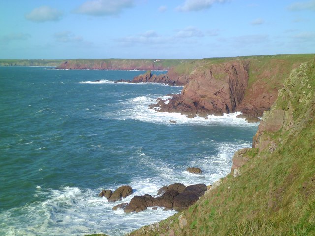
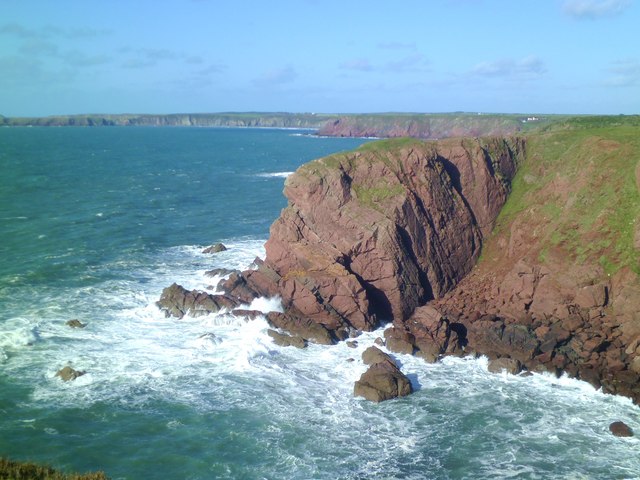
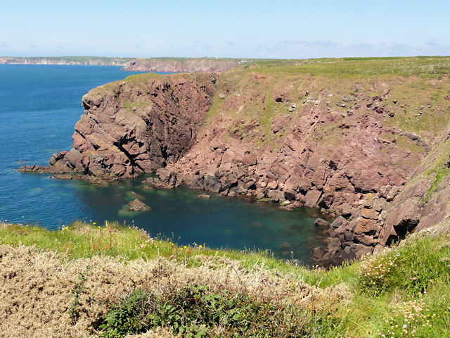
Blue Anchor Wood Images

Images are sourced within 2km of 51.706222/-5.1714078 or Grid Reference SM8005. Thanks to Geograph Open Source API. All images are credited.

Welshman's Bay Welshman's Bay with Short Point being the big slabby cliff beyond. The next headland is Long Point, which sort of makes sense.
Welshman's Bay
Welshman's Bay with Short Point being the big slabby cliff beyond. The next headland is Long Point, which sort of makes sense.
Short Point Old red sandstone rocks form the cliffs here, the sandstone beds dipping steeply to the north. Note the change in cliff colour in the distance where the rocks become Silurian sandstones etc and look grey by comparison.
Short Point
Old red sandstone rocks form the cliffs here, the sandstone beds dipping steeply to the north. Note the change in cliff colour in the distance where the rocks become Silurian sandstones etc and look grey by comparison.
Long Point A blustery day on the Pembrokeshire Coast Path, with big seas, blue skies and widespread views including the islands of Skokholm [left], Skomer [right of centre], and with distant Grassholm just visible between the two.
Long Point
A blustery day on the Pembrokeshire Coast Path, with big seas, blue skies and widespread views including the islands of Skokholm [left], Skomer [right of centre], and with distant Grassholm just visible between the two.
Great Castle Head Approaching this coastal feature from the south on the coast path. Beyond the headland is Westdale Bay.
Great Castle Head
Approaching this coastal feature from the south on the coast path. Beyond the headland is Westdale Bay.
Westdale Bay Beautiful Bay with fine sands, but with a reputation for dangerous rip tides making it unsafe for swimming.
Westdale Bay
Beautiful Bay with fine sands, but with a reputation for dangerous rip tides making it unsafe for swimming.
Atlantic surf, Westdale Bay Sand and surf at Westdale Bay, with the island of Skokholm some 6km out to sea.
Atlantic surf, Westdale Bay
Sand and surf at Westdale Bay, with the island of Skokholm some 6km out to sea.
Advancing tide at Westdale Bay Shining wet sands with the rocks at the base of Great Castle Head marching out into the Atlantic.
Advancing tide at Westdale Bay
Shining wet sands with the rocks at the base of Great Castle Head marching out into the Atlantic.
Skeleton framework of a former hangar on Dale airfield
Dispersal area on the edge of Dale airfield Rather nice view over the upper reaches of Dale harbour in the background.
Dispersal area on the edge of Dale airfield
Rather nice view over the upper reaches of Dale harbour in the background.
Short Point Short Point is the name of the headland across this little bay, named presumably in imaginative contrast to the headland named Long Point a little further along.
Short Point
Short Point is the name of the headland across this little bay, named presumably in imaginative contrast to the headland named Long Point a little further along.
Iron Point Looking down the cliffside to the jagged sandstone rocks of Iron Point. On the horizon, on the right is the coastline of The Marloes, Gateholm Island and behind it Skomer Island. Over to the left is Skokholm Island.
Iron Point
Looking down the cliffside to the jagged sandstone rocks of Iron Point. On the horizon, on the right is the coastline of The Marloes, Gateholm Island and behind it Skomer Island. Over to the left is Skokholm Island.
Ger / Near Iron Point Creigiau y mor ger Iron Point.

Sea rocks near Iron Point.
Ger / Near Iron Point
Creigiau y mor ger Iron Point. Sea rocks near Iron Point.
Westdale Bay Seen from the coast path
Westdale Bay
Seen from the coast path
Great Castle Head Fort It appears that much has fallen into the sea from this promontory fort
Great Castle Head Fort
It appears that much has fallen into the sea from this promontory fort
Remains of Buildings at RAF Kete Just a lot of brick, concrete and rubble remaining to indicate the past importance of this site ..... <span class="nowrap"><a title="http://www.derelictplaces.co.uk/main/ww2-defences/15230-st-annes-head-defences-pembrokeshire.html" rel="nofollow ugc noopener" href="http://www.derelictplaces.co.uk/main/ww2-defences/15230-st-annes-head-defences-pembrokeshire.html">Link</a><img style="margin-left:2px;" alt="External link" title="External link - shift click to open in new window" src="https://s1.geograph.org.uk/img/external.png" width="10" height="10"/></span>
Remains of Buildings at RAF Kete
Just a lot of brick, concrete and rubble remaining to indicate the past importance of this site ..... LinkExternal link
Pembrokeshire Coastal Path View from Pembrokeshire Coastal Path with Skokholm Island on the horizon.
Skokholm or Skokholm Island is an island 2.5 miles off the coast of Pembrokeshire, Wales, south of the neighbouring island of Skomer. The surrounding waters are a marine reserve and all are part of the Pembrokeshire Coast National Park. Both islands are listed as Sites of Special Scientific Interest. *Wikipedia
Pembrokeshire Coastal Path
View from Pembrokeshire Coastal Path with Skokholm Island on the horizon. Skokholm or Skokholm Island is an island 2.5 miles off the coast of Pembrokeshire, Wales, south of the neighbouring island of Skomer. The surrounding waters are a marine reserve and all are part of the Pembrokeshire Coast National Park. Both islands are listed as Sites of Special Scientific Interest. *Wikipedia
Dale Airfield & The Hookses **For those who know the Hookses, that hidden, hook-shaped valley cut out of the Pembrokeshire cliffs, the name has an almost mythical quality. It is intimately associated with John Stott, the author, evangelist, and church leader who bought its abandoned cottage and associated outhouses in 1954, restored them, and made them available as a place of writing, retreat, and renewal ever after.
** Courtesy Church Times.
Dale Airfield & The Hookses
**For those who know the Hookses, that hidden, hook-shaped valley cut out of the Pembrokeshire cliffs, the name has an almost mythical quality. It is intimately associated with John Stott, the author, evangelist, and church leader who bought its abandoned cottage and associated outhouses in 1954, restored them, and made them available as a place of writing, retreat, and renewal ever after. ** Courtesy Church Times.
Kissing gate and stile at Westdale Bay The path from Dale joins the Coast Path here
Kissing gate and stile at Westdale Bay
The path from Dale joins the Coast Path here
Show me another place!

Blue Anchor Wood is located at Grid Ref: SM8005 (Lat: 51.706222, Lng: -5.1714078)

Unitary Authority: Pembrokeshire

Police Authority: Dyfed Powys

What 3 Words

///glove.notifying.sailed. Near Dale, Pembrokeshire

Related Wikis

Dale, Pembrokeshire

Dale is both a small village and a community in Pembrokeshire, Wales, located on the peninsula which forms the northern side of the entrance to the Milford...

Dale Castle

Dale Castle is a 13th-century castle located close to the village of Dale in Pembrokeshire, Wales. In 1910, part of the castle was removed and other parts...

Dale Fort

Dale Fort is a mid-19th-century coastal artillery fort at Dale Head, a rocky promontory near Dale, Pembrokeshire, west of Milford Haven in Wales. It is...

Watwick Point Beacon

Watwick Point Beacon is a leading light, which is a type of lighthouse, located near Dale, Pembrokeshire, in Wales. It is designed to lead ships into Milford...

Nearby Amenities

Located within 500m of 51.706222,-5.1714078
Source: PGS
Lat/Long: 51.7069573/-5.1683199
Source: PGS
Lat/Long: 51.7095805/-5.1685211
Dale
Created By: Potlatch 0.8b
Is In: Pembrokeshire
Place: village
Wikidata: Q3012283
Lat/Long: 51.7075201/-5.1694437
Parking
Dale
Description: pay and display
Fee: yes
Operator: Pembroke County Council
Operator Type: public
Parking: surface
Payment Cash: yes
Lat/Long: 51.7086213/-5.1694501
Toilets
Access: yes
Changing Table: yes
Fee: no
Female: yes
Toilets Disposal: flush
Wheelchair: yes
Lat/Long: 51.7073185/-5.1696633
Dale Post Office
Disused Amenity: post_office
Lat/Long: 51.7068712/-5.1690481
Pub
Griffin Inn
Addr Postcode: SA62 3RB
Fhrs Id: 856500
Phone: +44 1646 636227
Source Addr Postcode: FHRS Open Data
Website: https://griffindale.co.uk
Wikidata: Q29496571
Lat/Long: 51.7071954/-5.1689657
Allenbrook
Addr City: Dale
Addr Housename: Allenbrook
Addr Postcode: SA62 3RN
Addr Street: Castle Way
Tourism: guest_house
Website: https://www.allenbrook-dale.co.uk/
Lat/Long: 51.7092872/-5.1705872
Defibrillator
Access: yes
Defibrillator Location: Mounted on external wall
Emergency: defibrillator
Indoor: yes
Lat/Long: 51.7078222/-5.1780673
Power: pole
Lat/Long: 51.7053436/-5.1768753
Power: pole
Lat/Long: 51.7060866/-5.1754966
Location Transition: yes
Power: pole
Lat/Long: 51.7060649/-5.1745713
Power: pole
Lat/Long: 51.7057874/-5.1735681
Power: pole
Lat/Long: 51.7055065/-5.1727071
Power: pole
Lat/Long: 51.7047418/-5.1723129
Power: pole
Lat/Long: 51.7041617/-5.1720125
Power: pole
Lat/Long: 51.7035966/-5.1717228
Power: pole
Lat/Long: 51.7030447/-5.1714277
Power: pole
Lat/Long: 51.7022352/-5.1711246
Power: pole
Lat/Long: 51.7020158/-5.1698533
Location Transition: yes
Power: pole
Lat/Long: 51.7098213/-5.1737344
Location Transition: yes
Power: pole
Lat/Long: 51.7090742/-5.1736848
Power: pole
Lat/Long: 51.7093135/-5.1723705
Power: pole
Lat/Long: 51.7094348/-5.1717483
Power: pole
Lat/Long: 51.7095412/-5.171134
Power: pole
Lat/Long: 51.7096733/-5.1704367
Direction: S
Generator Method: photovoltaic
Generator Output Electricity: yes
Generator Solar Modules: 20
Generator Source: solar
Generator Type: solar_photovoltaic_panel
Location: roof
Power: generator
Lat/Long: 51.7067543/-5.1710076
Direction: 165
Generator Method: photovoltaic
Generator Output Electricity: yes
Generator Solar Modules: 10
Generator Source: solar
Generator Type: solar_photovoltaic_panel
Location: roof
Power: generator
Lat/Long: 51.7067622/-5.1763026
Direction: 165
Generator Method: photovoltaic
Generator Output Electricity: yes
Generator Solar Modules: 13
Generator Source: solar
Generator Type: solar_photovoltaic_panel
Location: roof
Power: generator
Lat/Long: 51.7088099/-5.1739168
Direction: SE
Generator Method: photovoltaic
Generator Output Electricity: yes
Generator Solar Modules: 8
Generator Source: solar
Generator Type: solar_photovoltaic_panel
Location: roof
Power: generator
Lat/Long: 51.7065719/-5.1768337
Direction: 165
Generator Method: photovoltaic
Generator Output Electricity: yes
Generator Solar Modules: 10
Generator Source: solar
Generator Type: solar_photovoltaic_panel
Location: roof
Power: generator
Lat/Long: 51.7105151/-5.1693825
Direction: 190
Generator Method: photovoltaic
Generator Output Electricity: yes
Generator Solar Modules: 8
Generator Source: solar
Generator Type: solar_photovoltaic_panel
Location: roof
Power: generator
Lat/Long: 51.7067531/-5.1743996
Direction: 165
Generator Method: photovoltaic
Generator Output Electricity: yes
Generator Solar Modules: 14
Generator Source: solar
Generator Type: solar_photovoltaic_panel
Location: roof
Power: generator
Lat/Long: 51.7089803/-5.172911
Direction: SE
Generator Method: photovoltaic
Generator Output Electricity: yes
Generator Solar Modules: 8
Generator Source: solar
Generator Type: solar_photovoltaic_panel
Location: roof
Power: generator
Lat/Long: 51.706611/-5.1767653
Cafe
Boathouse Cafe
Lat/Long: 51.7075903/-5.1693388
Man Made: water_well
Lat/Long: 51.7082254/-5.1766678
Post Box
Brand: Royal Mail
Brand Wikidata: Q638098
Collection Times: Mo-Fr 12:15; Sa 12:15
Operator: Royal Mail
Operator Wikidata: Q638098
Post Box Type: lamp
Ref: SA62 168
Royal Cypher: EIIR
Royal Cypher Wikidata: Q33102113
Lat/Long: 51.7085133/-5.1754654
Post Box
Brand: Royal Mail
Brand Wikidata: Q638098
Collection Times: Mo-Fr 16:00; Sa 12:00
Operator: Royal Mail
Operator Wikidata: Q638098
Post Box Type: lamp
Ref: SA62 147
Royal Cypher: EIIR
Royal Cypher Wikidata: Q33102113
Lat/Long: 51.7068371/-5.1690365
Post Box
Brand: Royal Mail
Brand Wikidata: Q638098
Collection Times: Mo-Fr 12:30; Sa 12:30
Operator: Royal Mail
Operator Wikidata: Q638098
Post Box Type: lamp
Ref: SA62 169
Royal Cypher: EIIR
Royal Cypher Wikidata: Q33102113
Lat/Long: 51.7097003/-5.1694424
The data included in this document is from www.openstreetmap.org. The data is made available under ODbL.

Have you been to Blue Anchor Wood?

Leave your review of Blue Anchor Wood below (or comments, questions and feedback).