Bache Hill

Hill, Mountain in Radnorshire

Wales

Bache Hill

The power-line at the top of Bach Brook dingle, Radnor Forest. The top post of the power-line that runs up Bach dingle and seems to stop abruptly with nowhere for the cable to continue on to - doesn't obviously carry on to the communications mast on Black Mixen. The Whimble (599 m./1965 ft.) is the summit in the distance.
The power-line at the top of Bach Brook dingle, Radnor Forest. Credit: Peter Evans

Bache Hill is a prominent hill located in Radnorshire, Wales. Standing at an elevation of 610 meters (2,000 feet), it is a part of the Cambrian Mountains range. The hill is situated near the village of Hundred House, approximately 15 kilometers (9 miles) southwest of the town of Llandrindod Wells.

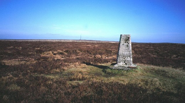
Bache Hill offers breathtaking panoramic views of the surrounding countryside and is a popular destination for hikers, nature enthusiasts, and photographers. The hill's summit is marked by a trig point, providing a perfect vantage point for capturing the picturesque landscapes that stretch out in all directions.

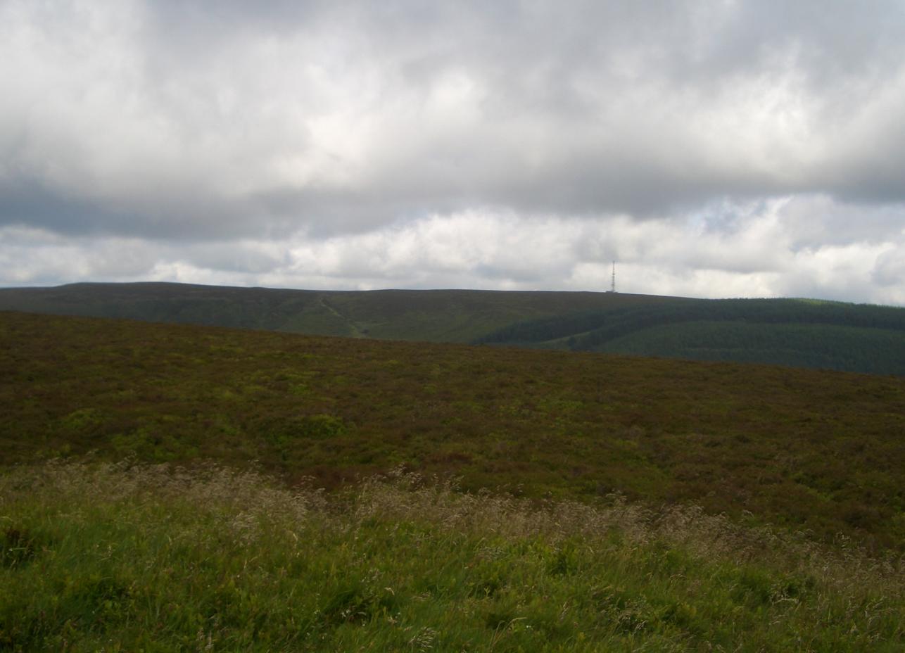
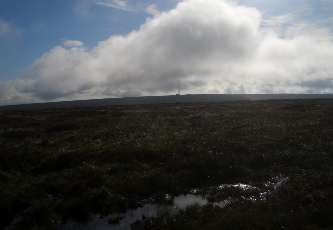
The hill's terrain is mostly comprised of moorland and heather, with scattered rocky outcrops adding to its rugged charm. The area is rich in diverse flora and fauna, including heather, bilberry, and various species of birds and butterflies.

There are several walking routes that lead to the summit of Bache Hill, catering to different levels of difficulty and preferences. The hill's proximity to the Glyndwr's Way National Trail also makes it a popular stop for long-distance walkers exploring the trail.

Bache Hill's peaceful and tranquil atmosphere, combined with its outstanding natural beauty, makes it an ideal place for those seeking solace in nature or wanting to explore the great outdoors. Whether it's for a leisurely stroll or a challenging hike, Bache Hill offers a rewarding experience for all.

If you have any feedback on the listing, please let us know in the comments section below.

Bache Hill Images

Images are sourced within 2km of 52.264908/-3.1546111 or Grid Reference SO2163. Thanks to Geograph Open Source API. All images are credited.

The power-line at the top of Bach Brook dingle, Radnor Forest. The top post of the power-line that runs up Bach dingle and seems to stop abruptly with nowhere for the cable to continue on to - doesn't obviously carry on to the communications mast on Black Mixen. The Whimble (599 m./1965 ft.) is the summit in the distance.
The power-line at the top of Bach Brook dingle, Radnor Forest.
The top post of the power-line that runs up Bach dingle and seems to stop abruptly with nowhere for the cable to continue on to - doesn't obviously carry on to the communications mast on Black Mixen. The Whimble (599 m./1965 ft.) is the summit in the distance.
Fair warning !. Ystol Bach Brook Ample warning given against crossing the fence-line at the top of Ystol Bach Brook dingle. The path/drovers road runs down the dingle and skirts the Whimble (588m./1965ft.) in the distance before running down to New Radnor.
Fair warning !. Ystol Bach Brook
Ample warning given against crossing the fence-line at the top of Ystol Bach Brook dingle. The path/drovers road runs down the dingle and skirts the Whimble (588m./1965ft.) in the distance before running down to New Radnor.
Ystol Bach Brook dingle path The path/drovers road that runs down the dingle and skirts the Whimble (588m./1965ft.) in the distance before running down to New Radnor.
Ystol Bach Brook dingle path
The path/drovers road that runs down the dingle and skirts the Whimble (588m./1965ft.) in the distance before running down to New Radnor.
B4372 at Upper Bank
B4372 at Upper Bank
Trig point on Bache Hill
The Whimble
The Whimble
Radnor forest track
Radnor forest track
Path above Mutton Dingle on Knowle Hill near New Radnor A path that steadily climbs up the valley side and a joy to walk up early on a spring morning.
Path above Mutton Dingle on Knowle Hill near New Radnor
A path that steadily climbs up the valley side and a joy to walk up early on a spring morning.
Path north of Knowle Hill north of New Radnor The rounded and gentle shape of Knowle Hill with its square of forestry can be admired from here.
Path north of Knowle Hill north of New Radnor
The rounded and gentle shape of Knowle Hill with its square of forestry can be admired from here.
Path up the Whimble from Knowle Hill and New Radnor This path would have bordered a forestry plantation and following some clear felling the area is now a lot more pleasant. Hazy spring views over the Radnor valley area. This is at around 400m above sea level.
Path up the Whimble from Knowle Hill and New Radnor
This path would have bordered a forestry plantation and following some clear felling the area is now a lot more pleasant. Hazy spring views over the Radnor valley area. This is at around 400m above sea level.
Path and forestry track on the Whimble It's a hazy spring morning but even at this height there are distant views to many of the significant summits of the region. Titterstone Clee Hill caught my eye on the far horizon.
Path and forestry track on the Whimble
It's a hazy spring morning but even at this height there are distant views to many of the significant summits of the region. Titterstone Clee Hill caught my eye on the far horizon.
Path below the Whimble in Radnor Forest This area is still depicted as a forestry plantation on my O/S map but has obviously been clear felled for a few years now. The views open up towards the heathery slopes of the Whimble.
Path below the Whimble in Radnor Forest
This area is still depicted as a forestry plantation on my O/S map but has obviously been clear felled for a few years now. The views open up towards the heathery slopes of the Whimble.
Big shed between Whimble and Bache Hill in Radnor Forest Lambing shed I guess. Sheltered spot between two domed hills.
Big shed between Whimble and Bache Hill in Radnor Forest
Lambing shed I guess. Sheltered spot between two domed hills.
Approach up Whimble's eastern slopes When I see a hill like this I just have to get up it to the top. Sensational little summit. (Like a mini version of the Sugar Loaf at Abergavenny - though I really hesitate to compare it with anywhere else). Now firmly one of my fave spots. Repays the effort to ascend tenfold.
Approach up Whimble's eastern slopes
When I see a hill like this I just have to get up it to the top. Sensational little summit. (Like a mini version of the Sugar Loaf at Abergavenny - though I really hesitate to compare it with anywhere else). Now firmly one of my fave spots. Repays the effort to ascend tenfold.
View to Whinyard Rocks from Whimble's eastern slopes A small flock of sure footed sheep are grazing in and over the rocky outcrop. At first I thought they might be goats. One of the tumuli on the southern end of Bache Hill stands out against the blue sky.
View to Whinyard Rocks from Whimble's eastern slopes
A small flock of sure footed sheep are grazing in and over the rocky outcrop. At first I thought they might be goats. One of the tumuli on the southern end of Bache Hill stands out against the blue sky.
Mountain goats, sorry sheep on Whinyard Rocks This flock are obviously having fun. Two or three adventurous ones are standing on the rocks of this outcrop, sunning themselves and confidently taking in the views.
Mountain goats, sorry sheep on Whinyard Rocks
This flock are obviously having fun. Two or three adventurous ones are standing on the rocks of this outcrop, sunning themselves and confidently taking in the views.
On top of the tumulus on the summit of Whimble in Radnor Forest The summit area of the Whimble offers extensive all round views. It is 599m above sea level so you can identify many significant summits across South Wales and the Welsh Marches and into distant Mid Wales.

The tumulus is a Bronze Age burial mound, one of several in the area, (where at least 19 have been identified), including many on the valley floor (now long ploughed out but showing up in aerial photos in the right conditions), not just on high points on skylines etc.

The three distinctive gullies on Great Rhos running down into Harley Dingle are called the Three Riggles, a nice colloquial nickname.
On top of the tumulus on the summit of Whimble in Radnor Forest
The summit area of the Whimble offers extensive all round views. It is 599m above sea level so you can identify many significant summits across South Wales and the Welsh Marches and into distant Mid Wales. The tumulus is a Bronze Age burial mound, one of several in the area, (where at least 19 have been identified), including many on the valley floor (now long ploughed out but showing up in aerial photos in the right conditions), not just on high points on skylines etc. The three distinctive gullies on Great Rhos running down into Harley Dingle are called the Three Riggles, a nice colloquial nickname.
View eastwards from Whimble's summit in spring It is a hazy and bright March morning following a heavy frost so the views are far from crystal clear, however Titterstone Clee Hill over at Ludlow stands out on the skyline.

I can recall years ago standing on high ground in the Mortimer Forest such as Mary's Knoll and looking yearningly westwards and wondering what that distant but distinctive summit could be. Now I'm on it, looking back.
View eastwards from Whimble's summit in spring
It is a hazy and bright March morning following a heavy frost so the views are far from crystal clear, however Titterstone Clee Hill over at Ludlow stands out on the skyline. I can recall years ago standing on high ground in the Mortimer Forest such as Mary's Knoll and looking yearningly westwards and wondering what that distant but distinctive summit could be. Now I'm on it, looking back.
Show me another place!

Bache Hill is located at Grid Ref: SO2163 (Lat: 52.264908, Lng: -3.1546111)

Unitary Authority: Powys

Police Authority: Dyfed Powys

What 3 Words

///dices.equal.deodorant. Near Whitton, Powys

Nearby Locations

Bache Hill

Related Wikis

Bache Hill

Bache Hill (Welsh: Bryn Bach) is a subsidiary summit of Rhos Fawr or Great Rhos, in the Radnor Forest in Wales. It is located to the east of Black Mixen...

Radnor Forest

Radnor Forest (Welsh: Fforest Clud) is a rock dome composed of Silurian shales, mudstones and limestone in the historic county of Radnorshire, Powys, Mid...

Black Mixen

Black Mixen (Welsh: Y Domen Ddu) is a subsidiary summit of Rhos Fawr or Great Rhos in the Radnor Forest. The summit is large peat bog plateau. The summit...

New Radnor

New Radnor (Welsh: Maesyfed) is a village in Powys, Wales, to the south of Radnor Forest, and was the county town of Radnorshire. In the 2001 census, the...

Nearby Amenities

Located within 500m of 52.264908,-3.1546111
Bâch Hill
Ele: 610
Natural: peak
Source: NLS - OS 1:25k 1937-61
Lat/Long: 52.2653916/-3.1533194
Man Made: survey_point
Ref: S8074
Source: survey
Lat/Long: 52.265332/-3.1533185
The data included in this document is from www.openstreetmap.org. The data is made available under ODbL.

Have you been to Bache Hill?

Leave your review of Bache Hill below (or comments, questions and feedback).