Ynys Bery

Island in Pembrokeshire

Wales

Ynys Bery

Port Lieuog With adult grey seals and their pups.
Port Lieuog Credit: David Lally

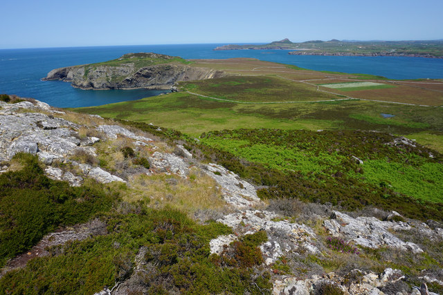
Ynys Bery is a small island located off the coast of Pembrokeshire, Wales. It is situated in the St. Brides Bay, approximately 1.5 miles southwest of the village of Solva. The island measures about 200 meters in length and 100 meters in width, with an area of around 2 hectares.

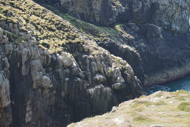
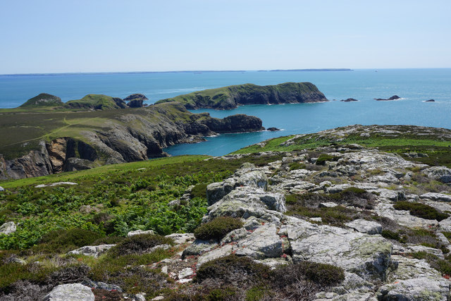
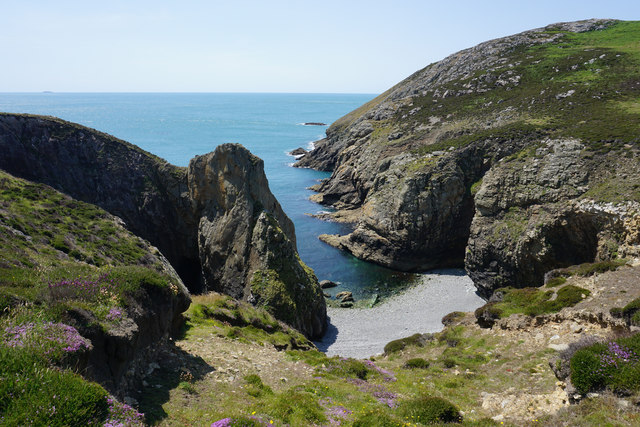
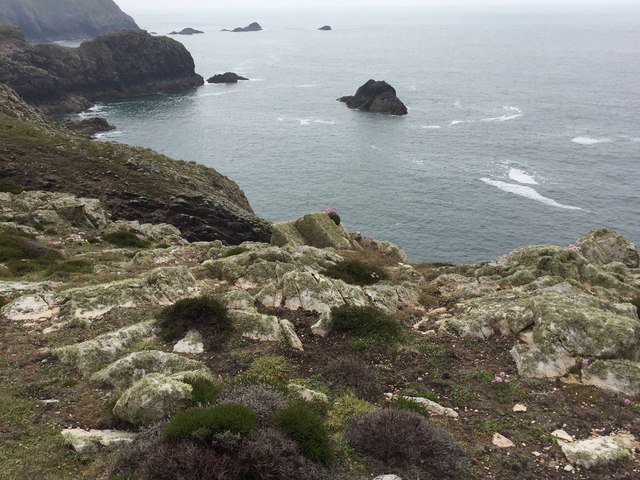
The island is known for its rugged and picturesque landscape, characterized by towering cliffs and rocky outcrops. It is mostly composed of sandstone and shale, with some areas covered in grass and low-lying vegetation. Ynys Bery is a designated Special Area of Conservation, as it is home to various seabird colonies and other wildlife species.

Access to the island is highly dependent on tidal conditions, as it is only reachable during low tide. At high tide, Ynys Bery is completely cut off from the mainland. Visitors must exercise caution and plan their visit accordingly to avoid being stranded on the island.

The island has a rich history, with evidence of human occupation dating back to the Neolithic period. Archaeological excavations have uncovered remnants of ancient settlement and burial sites, suggesting that Ynys Bery was inhabited for centuries.

Today, Ynys Bery attracts visitors who enjoy its natural beauty and tranquility. It offers opportunities for birdwatching, nature walks, and photography. The surrounding waters are also popular for kayaking and other water sports. However, visitors are encouraged to respect the fragile ecosystem and follow any conservation guidelines in place to preserve the island's unique environment.

If you have any feedback on the listing, please let us know in the comments section below.

Ynys Bery Images

Images are sourced within 2km of 51.8496/-5.3371 or Grid Reference SM7022. Thanks to Geograph Open Source API. All images are credited.
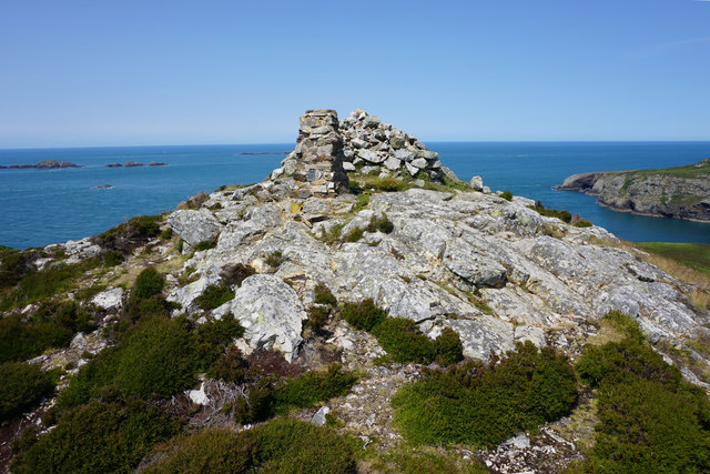
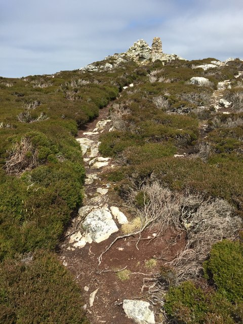
Port Lieuog With adult grey seals and their pups.
Port Lieuog
With adult grey seals and their pups.
Pembrokeshire skyline View from the arched doorway of St Non’s Chapel, Ramsey Island silhouetted by the evening sun.

From Ynys Bery, Ynys Cantwr and Foel Fawr on the left, to Carn Llundain, the highest point of Ramsey Island, on the right.
Pembrokeshire skyline
View from the arched doorway of St Non’s Chapel, Ramsey Island silhouetted by the evening sun. From Ynys Bery, Ynys Cantwr and Foel Fawr on the left, to Carn Llundain, the highest point of Ramsey Island, on the right.
Ramsey Island at sunset Across the bay from St Justinian’s.
Ramsey Island at sunset
Across the bay from St Justinian’s.
Carn Llundain The highest point on Ramsey Island.
Carn Llundain
The highest point on Ramsey Island.
Sunset behind Ramsey Island
Carreg-gwylan and Trwyn Bendro: Ramsey
Trig point on Ramsey Island The rustic triangulation pillar which has an Ordnance Survey flush bracket bench mark serial number S7057 is described in detail at <span class="nowrap"><a title="http://trigpointinguk.com/trigs/trig-details.php?t=5580" rel="nofollow ugc noopener" href="http://trigpointinguk.com/trigs/trig-details.php?t=5580">Link</a><img style="margin-left:2px;" alt="External link" title="External link - shift click to open in new window" src="https://s1.geograph.org.uk/img/external.png" width="10" height="10"/></span>
Trig point on Ramsey Island
The rustic triangulation pillar which has an Ordnance Survey flush bracket bench mark serial number S7057 is described in detail at LinkExternal link
Carnllundain, Ramsey Island
Ogof Colomennod, Ramsey Island
The eastern side of Carnllundain From the trig point, you can see all over the island and also to the mainland, where Whitesands and St David's are clearly visible. In the far distance are the Preseli Hills.
The eastern side of Carnllundain
From the trig point, you can see all over the island and also to the mainland, where Whitesands and St David's are clearly visible. In the far distance are the Preseli Hills.
Cliffs in Ogof Colomennod There is still a colony of guillemots on one of the ledges towards the bottom.
Cliffs in Ogof Colomennod
There is still a colony of guillemots on one of the ledges towards the bottom.
Trig point and cairn on Carnllundain The highest point of Ramsey Island.
Trig point and cairn on Carnllundain
The highest point of Ramsey Island.
The north-eastern side of Carnllundain Giving good views over the northern end of Ramsey Island and also over the Whitesands Bay on the mainland.
The north-eastern side of Carnllundain
Giving good views over the northern end of Ramsey Island and also over the Whitesands Bay on the mainland.
Exposed rock on the subsidiary summit of Carnllundain This spot gives views over the southern end of Ramsey Island and the collection of smaller islands there.
Exposed rock on the subsidiary summit of Carnllundain
This spot gives views over the southern end of Ramsey Island and the collection of smaller islands there.
Porth Lleuog The elements have penetrated well into the cliffs in this cove. On the skyline is the island of Grassholm.
Porth Lleuog
The elements have penetrated well into the cliffs in this cove. On the skyline is the island of Grassholm.
Carnllundain Boat from St Justinian then a 3 TUMP island circuit on a sunny day, Carnysgubor, Carnllundain and finally Foel Fawr.
Name: Carnllundain
Hill number: 5252
Height: 136m / 446ft
Parent (Ma/M): none
Section: 31C: South-West Wales
County/UA: Pembrokeshire [Sir Benfro] (CoU)
Island: Ramsey
Maritime Area: Pembrokeshire Coast - West
Class: Hump, Tump (100-199m), SIB
Grid ref: SM 69612 23462
Summit feature: cairn 2m N of trig point
Drop: 136m
Col: Sea
Carnllundain
Boat from St Justinian then a 3 TUMP island circuit on a sunny day, Carnysgubor, Carnllundain and finally Foel Fawr. Name: Carnllundain Hill number: 5252 Height: 136m / 446ft Parent (Ma/M): none Section: 31C: South-West Wales County/UA: Pembrokeshire [Sir Benfro] (CoU) Island: Ramsey Maritime Area: Pembrokeshire Coast - West Class: Hump, Tump (100-199m), SIB Grid ref: SM 69612 23462 Summit feature: cairn 2m N of trig point Drop: 136m Col: Sea
Trwyn Mynachdy View from coast path above Porth Lleuog towards Trwyn Mynachdy.
Trwyn Mynachdy
View from coast path above Porth Lleuog towards Trwyn Mynachdy.
Carn Llundain Approaching Carn Llundain on Ramsey Island.
Carn Llundain
Approaching Carn Llundain on Ramsey Island.
Show me another place!

Ynys Bery is located at Grid Ref: SM7022 (Lat: 51.8496, Lng: -5.3371)

Unitary Authority: Pembrokeshire

Police Authority: Dyfed Powys

What 3 Words

///humid.defenders.failed. Near St Davids, Pembrokeshire

Related Wikis

Ynys Bery

Ynys Bery is a small island south of Ramsey Island, Pembrokeshire, Wales, in the community of St David's and the Cathedral Close. == Etymology == The island...

Ramsey Island

Ramsey Island (Welsh: Ynys Dewi) is an island about 1 kilometre (1⁄2 nautical mile) off St David's Head in Pembrokeshire on the northern side of St Brides...

Carnllundain

Carnllundain or Carn Llundain is the highest elevation of Ramsey Island in Pembrokeshire, Wales. == Geography == The 136-metre (446 ft) high hill stands...

Pen Dal-aderyn

Pen Dal-aderyn is the westernmost point of mainland Wales. It is in Pembrokeshire, west of St Davids. It means 'Bird-catching Head' in Welsh. == External... ==

Have you been to Ynys Bery?

Leave your review of Ynys Bery below (or comments, questions and feedback).