Castell Dolwyddelan
Heritage Site in Caernarfonshire
Wales
Castell Dolwyddelan

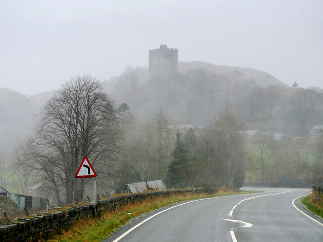
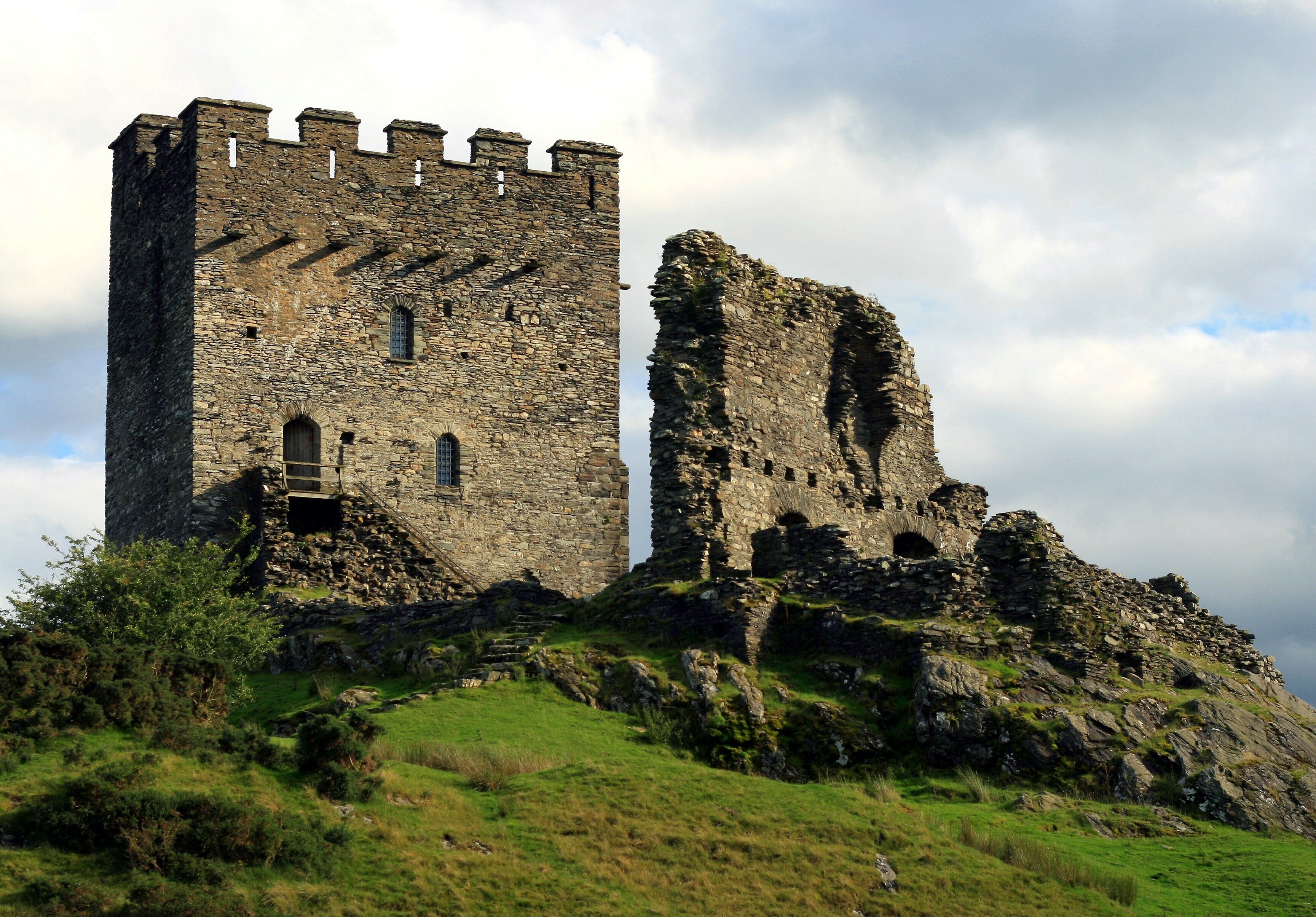
Castell Dolwyddelan is a historic Welsh castle located in the village of Dolwyddelan in Caernarfonshire, Wales. Situated on a rocky outcrop in the Snowdonia National Park, this medieval fortress is considered a significant heritage site in the region.
The castle was constructed in the early 13th century by Llywelyn the Great, a prominent ruler of Gwynedd. It was strategically built to control the Lledr Valley and to serve as a defensive stronghold against English invasions. The castle's position provides stunning panoramic views of the surrounding mountains and valleys.
The structure of Castell Dolwyddelan consists of a rectangular tower, which was the original keep, along with a curtain wall and a gatehouse. Built with local stone, the castle exhibits the typical architectural features of Welsh castles of the era. Visitors can explore the remains of the tower, which still retains some of its original features such as fireplaces and window openings.
The castle played an important role in Welsh history, witnessing several conflicts between the Welsh rulers and English forces. After Llywelyn the Great's death, the castle was captured and controlled by different factions. It fell into disrepair in the 14th century and was later restored in the 19th century.
Today, Castell Dolwyddelan is managed by Cadw, the Welsh historic environment service, and is open to the public. Visitors can enjoy the interactive exhibitions and displays that provide insights into the castle's history and its significance in Welsh heritage. The site also offers picturesque walking trails, allowing visitors to explore the beautiful surrounding landscape.
If you have any feedback on the listing, please let us know in the comments section below.
Castell Dolwyddelan Images
Images are sourced within 2km of 53.0531/-3.9084 or Grid Reference SH7252. Thanks to Geograph Open Source API. All images are credited.


Castell Dolwyddelan is located at Grid Ref: SH7252 (Lat: 53.0531, Lng: -3.9084)
Unitary Authority: Conwy
Police Authority: North Wales
Also known as: Dolwyddelan Castle
What 3 Words
///putter.shippers.grumbling. Near Blaenau-Ffestiniog, Gwynedd
Nearby Locations
Related Wikis
Dolwyddelan Castle
Dolwyddelan Castle ( dol-with-EL-an; Welsh: Castell Dolwyddelan; Welsh pronunciation: [kastɛɬ dɔlwɪð’ɛlan]) is a thirteenth-century castle located west...

Chwarel Ddu quarry
Chwarel Ddu quarry was the earliest slate quarry in the Lledr Valley. It was working before 1810, and continued in sporadic operation until the late 1920s...
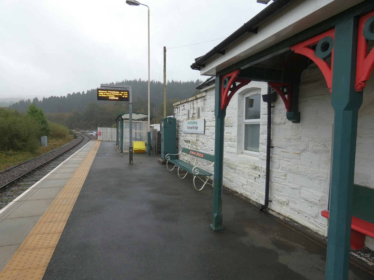
Roman Bridge railway station
Roman Bridge railway station (Welsh: Pont Rufeinig) is a request stop passenger station in the Lledr Valley, Wales, on the Conwy Valley Line from Llandudno...
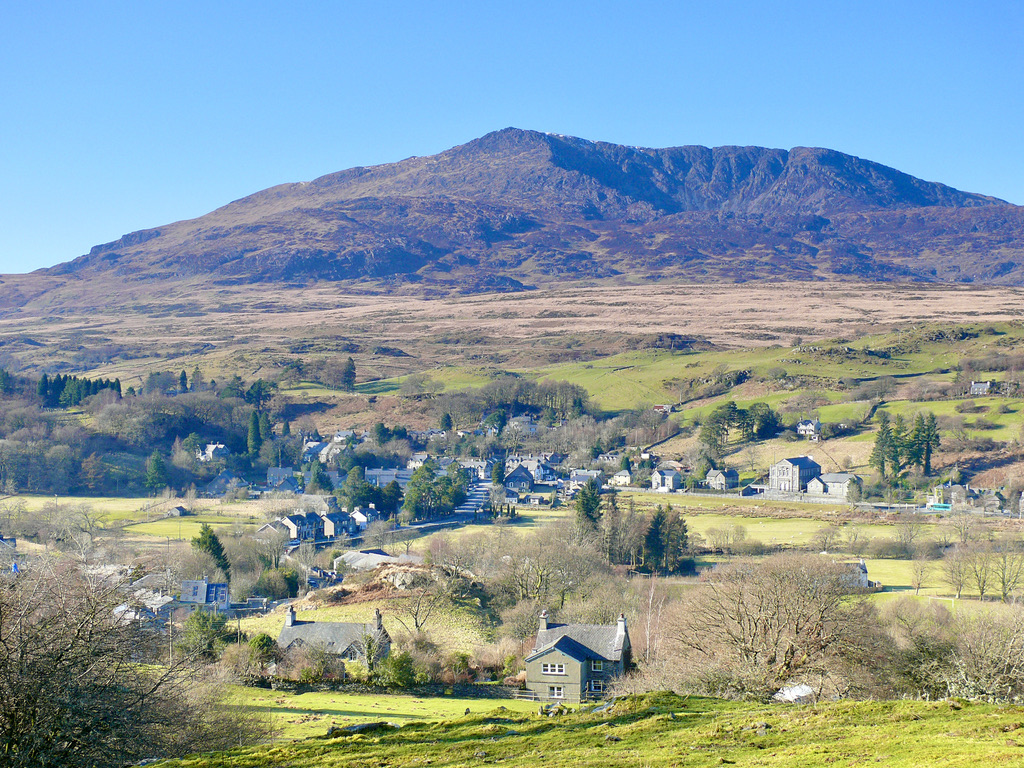
Dolwyddelan
Dolwyddelan (English: dol-with-EL-an; Welsh: [ˌdɔlwɪˈðɛlan]; ) is a village and community in Conwy County Borough, Wales. The community occupies most...
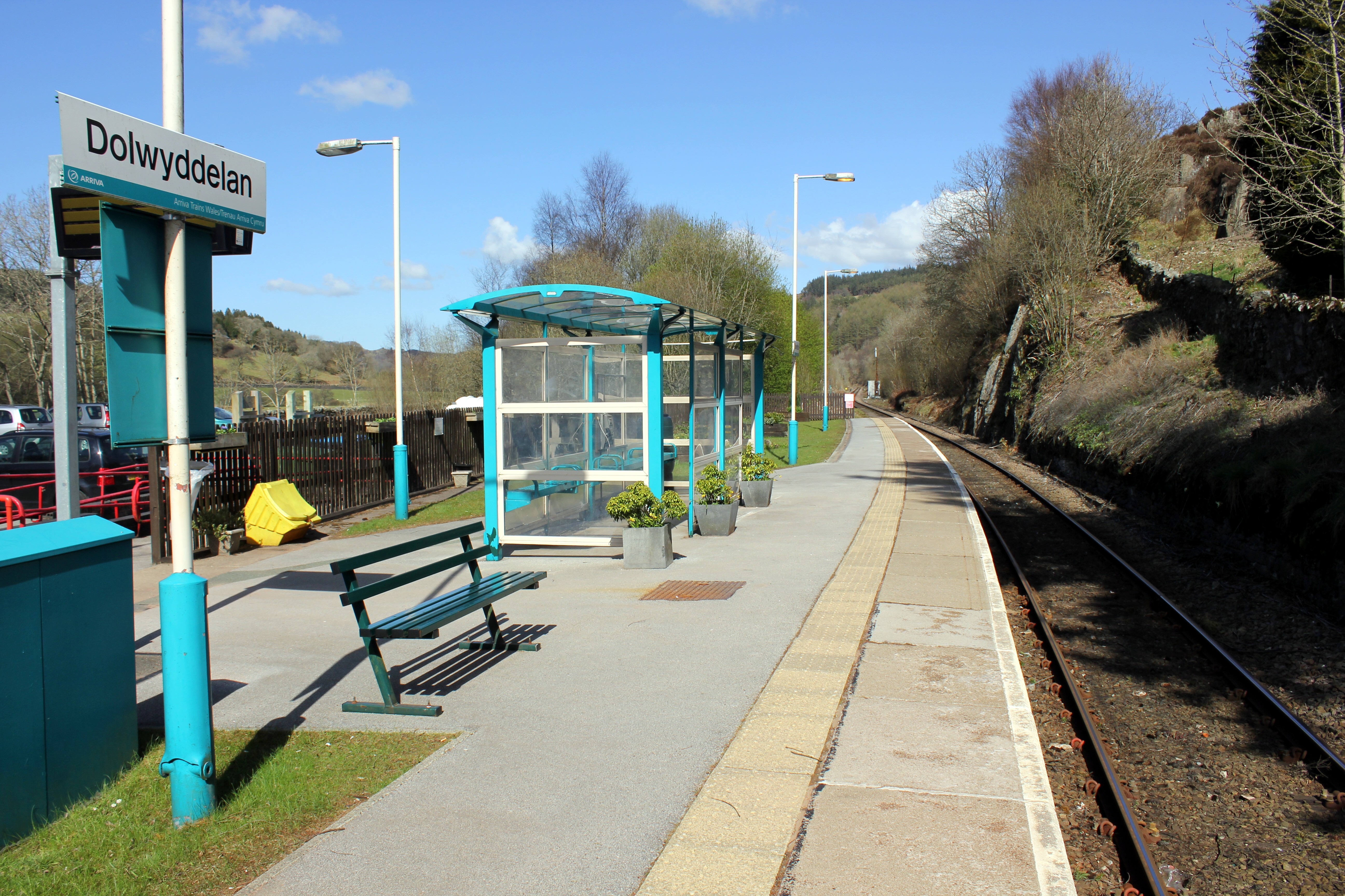
Dolwyddelan railway station
Dolwyddelan railway station is a passenger station in the Lledr Valley, Wales, on the Conwy Valley Line from Llandudno Junction to Blaenau Ffestiniog,...
Pentre Bont
Pentre Bont is a small village in the Dolwyddelan community, in the historic county of Caernarfonshire and county borough of Conwy. == References... ==
Ty'n-y-bryn quarry
Ty'n-y-bryn quarry (also known as Bwlch y Llan quarry or Lledr Vale quarry) was a slate quarry that was worked from the 1840s to about 1914. It stands...

Prince Llewellyn quarry
The Prince Llewellyn quarry (also known as Bwlch Cynnud quarry, Y Foel quarry, Hendre Ddu quarry, or Prince Llywelyn quarry) was a slate quarry that stands...
Nearby Amenities
Located within 500m of 53.0531,-3.9084Have you been to Castell Dolwyddelan?
Leave your review of Castell Dolwyddelan below (or comments, questions and feedback).