Yearsley

Civil Parish in Yorkshire Hambleton

England

Yearsley

The road to Brandsby Minor road from Yearsley to Brandsby near Intake Lodge.
The road to Brandsby Credit: Gordon Hatton

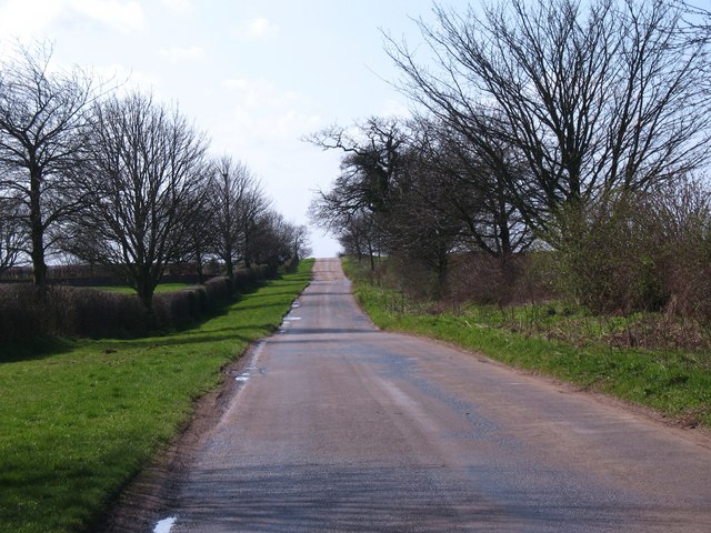
Yearsley is a civil parish located in the Ryedale district of North Yorkshire, England. Situated within the Howardian Hills Area of Outstanding Natural Beauty, this rural community offers breathtaking scenery and a tranquil environment. The parish covers an area of approximately 5 square miles and is home to a small population.

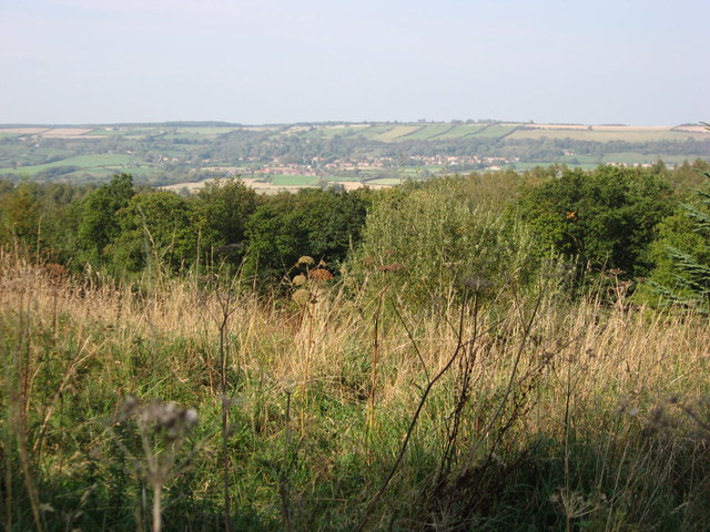
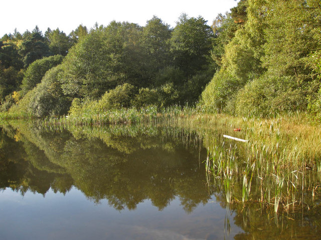
The centerpiece of Yearsley is the picturesque Yearsley Moor, a vast expanse of heather-clad moorland that attracts nature enthusiasts and hikers alike. The moor is also known for its diverse wildlife, including rare bird species such as the merlin and the short-eared owl.

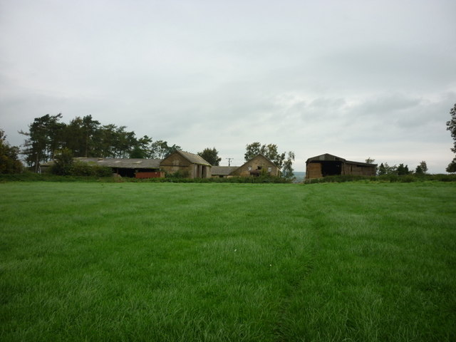
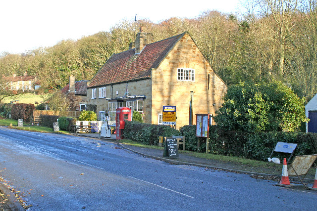
The village of Yearsley itself is a small, charming settlement with a tight-knit community. It features a few traditional stone houses, a church dating back to the 12th century, and a local pub where residents and visitors can enjoy a friendly atmosphere and traditional Yorkshire hospitality.

Despite its rural character, Yearsley benefits from its proximity to major towns and cities. The bustling market town of Easingwold is just a short drive away, offering a range of amenities including shops, schools, and leisure facilities. The city of York, with its rich history and cultural attractions, is also within easy reach.

Yearsley is a haven for those seeking a peaceful countryside retreat while still enjoying access to modern conveniences. Its natural beauty, historical charm, and welcoming community make it a truly special place to live or visit.

If you have any feedback on the listing, please let us know in the comments section below.

Yearsley Images

Images are sourced within 2km of 54.164376/-1.110163 or Grid Reference SE5874. Thanks to Geograph Open Source API. All images are credited.

The road to Brandsby Minor road from Yearsley to Brandsby near Intake Lodge.
The road to Brandsby
Minor road from Yearsley to Brandsby near Intake Lodge.
Oulston Reservoir
Oulston Reservoir
A path leading to Yearsley
Walking towards High Lions Lodge
Walking towards Low Lions Lodge
Looking North from Yearsley Forest Looking North from the deserted farmhouse in Yearsley Forest, Ampleforth in the distance.
Looking North from Yearsley Forest
Looking North from the deserted farmhouse in Yearsley Forest, Ampleforth in the distance.
Lower Fish Pond A tranquil pond on the Ampleforth Abbey Estate which covers over 2000 acres. The Estate is carefully managed and encompasses grassland, farmland and woodland and is located in an AONB. The Higher Fish Ponds lie to the Southeast in Park Wood.
Lower Fish Pond
A tranquil pond on the Ampleforth Abbey Estate which covers over 2000 acres. The Estate is carefully managed and encompasses grassland, farmland and woodland and is located in an AONB. The Higher Fish Ponds lie to the Southeast in Park Wood.
Reedbed in the Lower Fish Pond A tranquil pond on the Ampleforth Abbey Estate which covers over 2000 acres. The Estate is carefully managed and encompasses grassland, farmland and woodland and is located in an AONB.
Reedbed in the Lower Fish Pond
A tranquil pond on the Ampleforth Abbey Estate which covers over 2000 acres. The Estate is carefully managed and encompasses grassland, farmland and woodland and is located in an AONB.
Clearing, Elder Slack
Old Farmstead, Gilling Wood
Beckfield  House  Farm From the footpath to Burton House
Beckfield House Farm
From the footpath to Burton House
Ford  near  Burton  House  Farm
Ford near Burton House Farm
Oulston  Reservoir On a very wet day!
Oulston Reservoir
On a very wet day!
Pond  Head  Farm
Pond Head Farm
Forestry  track  to  Pond  Head  Wood
Forestry track to Pond Head Wood
Thinning  Out  in  Rutter's  Plantation
Thinning Out in Rutter's Plantation
Gateway  to  the  long  Drive Just north of High Lions Lodge
Gateway to the long Drive
Just north of High Lions Lodge
Show me another place!

Yearsley is located at Grid Ref: SE5874 (Lat: 54.164376, Lng: -1.110163)

Division: North Riding

Administrative County: North Yorkshire

District: Hambleton

Police Authority: North Yorkshire

What 3 Words

///simply.deluded.snowboard. Near Easingwold, North Yorkshire

Related Wikis

Yearsley

Yearsley is a small village and civil parish in the district of Hambleton in North Yorkshire, England. The population of the civil parish was less than...

Ampleforth railway station

Ampleforth railway station, served the village of Ampleforth, in the Northern English county of North Yorkshire. It was located on a line which ran from...

Brandsby

Brandsby is a village in North Yorkshire, England. The village is the main constituent of the Brandsby-cum-Stearsby Civil Parish in the District of Hambleton...

Oulston

Oulston is a village and civil parish in Hambleton district of North Yorkshire, England. It lies about 3 miles (5 km) north-east of Easingwold. Remains...

Nearby Amenities

Located within 500m of 54.164376,-1.110163
Yearsley
Place: village
Wikidata: Q1905568
Wikipedia: en:Yearsley
Lat/Long: 54.1624685/-1.1044417
Manor House Farm
Place: farm
Lat/Long: 54.1623785/-1.1070365
Post Box
Collection Times: Mo-Fr 17:15; Sa 11:15
Post Box Type: wall
Ref: YO61 41
Royal Cypher: EIIR
Royal Cypher Wikidata: Q33102113
Lat/Long: 54.1623798/-1.1045154
Barrier: kissing_gate
Lat/Long: 54.1633856/-1.1059149
Vending Machine
Note: Just an honesty box
Vending: eggs
Lat/Long: 54.1601969/-1.1126084
The data included in this document is from www.openstreetmap.org. The data is made available under ODbL.

Have you been to Yearsley?

Leave your review of Yearsley below (or comments, questions and feedback).