Wrose

Civil Parish in Yorkshire Bradford

England

Wrose

Construction, Otley Road (A6038), Shipley
Construction, Otley Road (A6038), Shipley Credit: habiloid

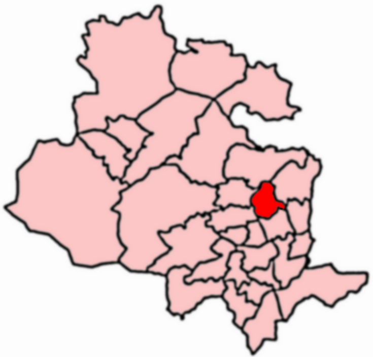
Wrose is a civil parish located in the metropolitan borough of Bradford, in the county of West Yorkshire, England. It is situated approximately 4 miles north of the city center of Bradford and is bordered by the neighborhoods of Idle, Eccleshill, and Thackley.

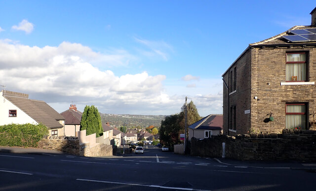
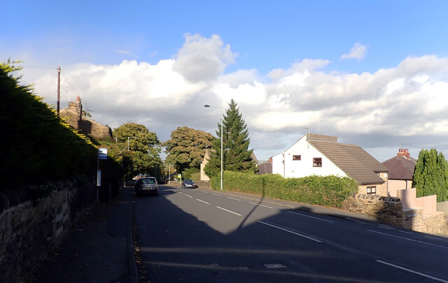
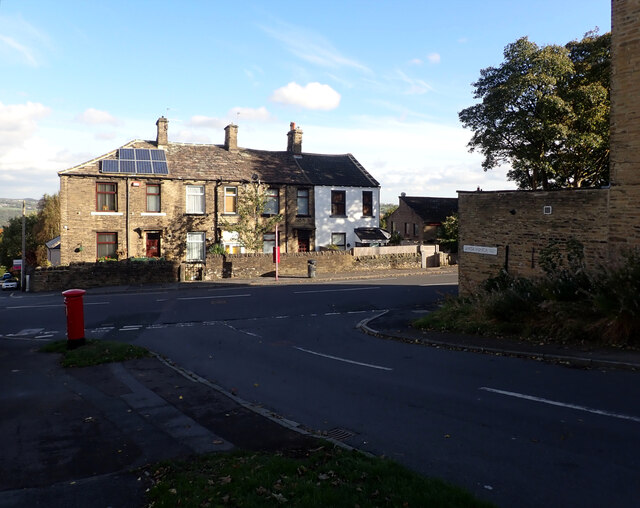
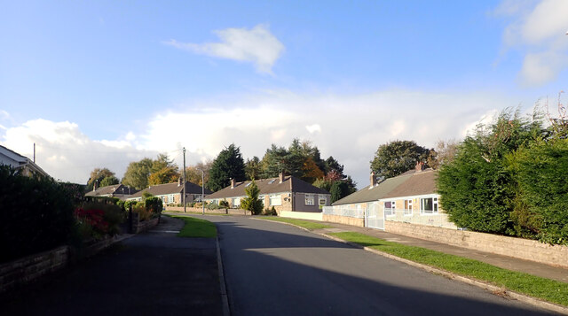
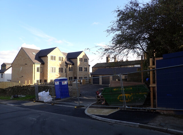
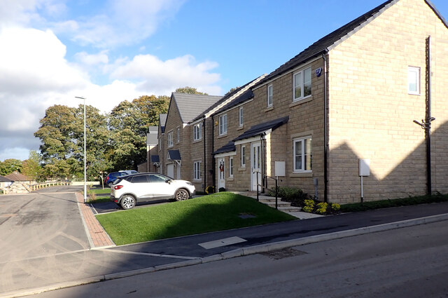
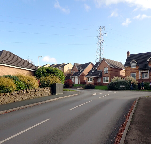
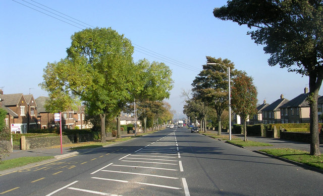
The area of Wrose is primarily residential, with a mix of housing types including detached, semi-detached, and terraced houses. The parish is known for its quiet and family-friendly atmosphere, making it an attractive place for families and professionals alike.

Wrose is well-served by amenities and facilities, including a range of local shops, supermarkets, and eateries. The area also benefits from several primary schools, making it a popular choice for families with children.

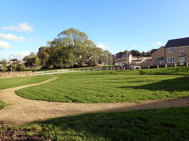
The parish is surrounded by green spaces, offering residents opportunities for outdoor activities and recreation. Nearby parks and nature reserves, such as Idle Moor and Buck Wood, provide picturesque landscapes for walking, jogging, and enjoying nature.

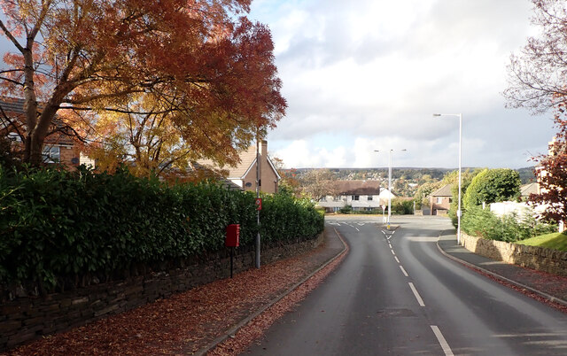
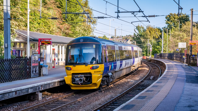
Transport links in Wrose are convenient, with several bus routes connecting the area to Bradford city center and neighboring towns. The nearby Apperley Bridge railway station also provides easy access to Leeds, Bradford, and other major cities in the region.

In summary, Wrose is a peaceful and well-connected civil parish in Yorkshire, offering a range of amenities, green spaces, and a strong sense of community.

If you have any feedback on the listing, please let us know in the comments section below.
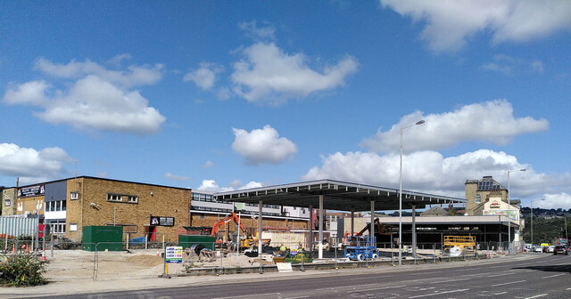
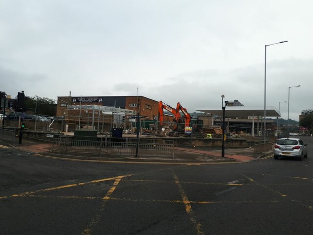
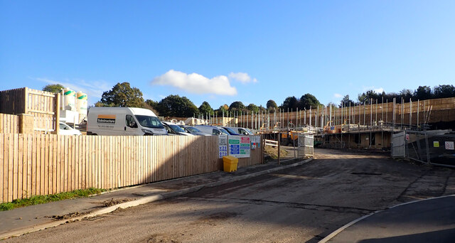
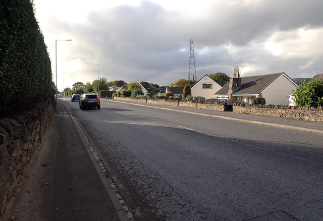
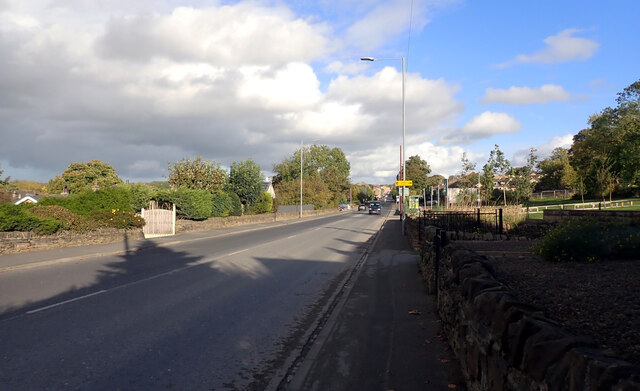
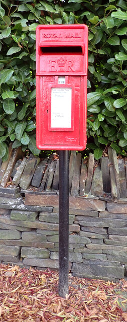
Wrose Images

Images are sourced within 2km of 53.827808/-1.750667 or Grid Reference SE1636. Thanks to Geograph Open Source API. All images are credited.

Construction, Otley Road (A6038), Shipley
Construction site on Otley Road This was snapped from a passing bus, but it seems another contributor took a clearer photo from a different angle the week before <a href="https://www.geograph.org.uk/photo/6946197">SE1437 : Construction, Otley Road (A6038), Shipley</a> as well as the demolition of the previous buildings at the start of the year <a href="https://www.geograph.org.uk/photo/6742695">SE1437 : Demolition site, Otley Road (A6038), Shipley</a>. 
 It looks like a new filling station being built, judging by the canopy.
Construction site on Otley Road
This was snapped from a passing bus, but it seems another contributor took a clearer photo from a different angle the week before SE1437 : Construction, Otley Road (A6038), Shipley as well as the demolition of the previous buildings at the start of the year SE1437 : Demolition site, Otley Road (A6038), Shipley. It looks like a new filling station being built, judging by the canopy.
Post box, Santa Monica Road, Idle, Bradford This post box can be seen in context in <a href="https://www.geograph.org.uk/photo/7002152">SE1737 : The junction of Santa Monica Road and Highfield Road, Idle, Bradford</a>.
Post box, Santa Monica Road, Idle, Bradford
Ley Fleaks Road seen from Highfield Road, Idle, Bradford
Highfield Road, Idle, Bradford
The junction of Santa Monica Road and Highfield Road, Idle, Bradford A close-up of the post box can be seen in <a href="https://www.geograph.org.uk/photo/7002148">SE1737 : Post box, Santa Monica Road, Idle, Bradford</a>.
The junction of Santa Monica Road and Highfield Road, Idle, Bradford
A close-up of the post box can be seen in SE1737 : Post box, Santa Monica Road, Idle, Bradford.
Santa Monica Road, Idle, Bradford
New housing development, Santa Monica Road, Idle, Bradford
Housing development, Crooked Lane, Thackley, Bradford
Little Cote View, Thackley, Bradford
Leeds Road (A657), Thackley, Bradford The A657 runs 8.4 miles from Saltaire to Bramley. <span class="nowrap"><a title="https://www.sabre-roads.org.uk/wiki/index.php?title=A657" rel="nofollow ugc noopener" href="https://www.sabre-roads.org.uk/wiki/index.php?title=A657">Link</a><img style="margin-left:2px;" alt="External link" title="External link - shift click to open in new window" src="https://s1.geograph.org.uk/img/external.png" width="10" height="10"/></span>
Leeds Road (A657), Thackley, Bradford
The A657 runs 8.4 miles from Saltaire to Bramley. LinkExternal link
New housing seen from Leeds Road (A657), Thackley, Bradford Houses on Little Cote View, Crooked Road and Brackendale Way are in the background.
New housing seen from Leeds Road (A657), Thackley, Bradford
Houses on Little Cote View, Crooked Road and Brackendale Way are in the background.
Cote Farm Lane, Thackley, Bradford A close-up of the post box can be seen in <a href="https://www.geograph.org.uk/photo/7002171">SE1638 : Post box, Cote Farm Lane, Thackley, Bradford</a>.
Cote Farm Lane, Thackley, Bradford
A close-up of the post box can be seen in SE1638 : Post box, Cote Farm Lane, Thackley, Bradford.
Post box, Cote Farm Lane, Thackley, Bradford This post box can be seen in context in <a href="https://www.geograph.org.uk/photo/7002169">SE1638 : Cote Farm Lane, Thackley, Bradford</a>
Post box, Cote Farm Lane, Thackley, Bradford
This post box can be seen in context in SE1638 : Cote Farm Lane, Thackley, Bradford
Cote Farm Lane, Thackley, Bradford
The junction of Cote Farm Lane and Stead Hill Way, Thackley
333006 departing for Leeds
Show me another place!

Wrose is located at Grid Ref: SE1636 (Lat: 53.827808, Lng: -1.750667)

Division: West Riding

Administrative County: West Yorkshire

District: Bradford

Police Authority: West Yorkshire

What 3 Words

///push.career.direct. Near Shipley, West Yorkshire

Nearby Locations

Wrose Wrose

Related Wikis

Wrose

Wrose is a village and civil parish in the City of Bradford metropolitan borough of West Yorkshire, England, about three miles north of Bradford city centre...

Eccleshill United F.C.

Eccleshill United Football Club is a football club based in Wrose, Bradford, West Yorkshire, England. They are currently members of the Northern Counties...

Sunrise Radio (Yorkshire)

Sunrise Radio is an Asian radio station in Bradford, West Yorkshire, in the United Kingdom. == Availability == The station broadcasts 24 hours a day on...

BCB 106.6fm

BCB 106.6fm (106.6 FM) is a radio station that allows the community to get involved and record and broadcast their own programmes. Licensed to Bradford...

Windhill and Wrose

Windhill and Wrose (population 14,541 - 2001 UK census) is a ward within the City of Bradford Metropolitan District Council in the county of West Yorkshire...

Eccleshill, Bradford

Eccleshill is an area, former village, and ward within the City of Bradford Metropolitan District Council in the county of West Yorkshire, England. The...

Bradford Christian School

Bradford Christian School is a private school situated in Bradford, West Yorkshire, England. It has a pre-school, primary, middle and upper school, and...

Hanson Academy

Hanson Academy (formerly Hanson Grammar School and then Hanson School) is a co-educational secondary school and sixth-form located in Bradford, West Yorkshire...

Nearby Amenities

Located within 500m of 53.827808,-1.750667
Source: survey
Lat/Long: 53.8277883/-1.7526873
Source: survey
Lat/Long: 53.8308812/-1.7475468
Source: survey
Lat/Long: 53.8290372/-1.7522593
Source: survey
Lat/Long: 53.8285471/-1.7514259
Source: survey
Lat/Long: 53.8284946/-1.751515
Source: survey
Lat/Long: 53.8280029/-1.750776
Source: survey
Lat/Long: 53.8276908/-1.7496145
Source: survey
Lat/Long: 53.8271102/-1.7469001
Source: survey
Lat/Long: 53.8268135/-1.7455823
Turning Circle
Source: survey
Lat/Long: 53.8264728/-1.7442972
Source: survey
Lat/Long: 53.8297205/-1.7492669
Source: survey
Lat/Long: 53.8288976/-1.7477801
Source: survey
Lat/Long: 53.827704/-1.7456707
Source: survey
Lat/Long: 53.8270978/-1.744023
Source: survey
Lat/Long: 53.8279576/-1.7434888
Source: survey
Lat/Long: 53.8280225/-1.7438436
Source: survey
Lat/Long: 53.8280831/-1.7439733
Source: survey
Lat/Long: 53.8281958/-1.7439989
Source: survey
Lat/Long: 53.8287122/-1.7437706
Source: survey
Lat/Long: 53.8288233/-1.7436846
Source: survey
Lat/Long: 53.8288981/-1.7435603
Source: survey
Lat/Long: 53.828858/-1.7434409
Source: survey
Lat/Long: 53.8273946/-1.7451608
Source: survey
Lat/Long: 53.8278474/-1.7447332
Source: survey
Lat/Long: 53.8278012/-1.7445374
Source: survey
Lat/Long: 53.8275238/-1.7467014
Source: survey
Lat/Long: 53.8278975/-1.7474067
Turning Circle
Source: survey
Lat/Long: 53.8280076/-1.7477651
Source: survey
Lat/Long: 53.8262009/-1.7460087
Source: survey
Lat/Long: 53.8270773/-1.7500171
Source: survey
Lat/Long: 53.8281332/-1.7490464
Source: survey
Lat/Long: 53.8293049/-1.7485787
Source: survey
Lat/Long: 53.8269784/-1.7463145
Source: survey
Lat/Long: 53.8272637/-1.7461041
Source: survey
Lat/Long: 53.8307534/-1.746081
Source: survey
Lat/Long: 53.8295265/-1.7447918
Source: survey
Lat/Long: 53.8294713/-1.7446439
Source: survey
Lat/Long: 53.8294612/-1.7444188
Source: survey
Lat/Long: 53.8302707/-1.7443117
Source: survey
Lat/Long: 53.8285869/-1.7556672
Source: survey
Lat/Long: 53.8287589/-1.7566388
Source: survey
Lat/Long: 53.8287801/-1.7574884
Source: survey
Lat/Long: 53.8279652/-1.7454285
Post Box
Operator: Royal Mail
Operator Wikidata: Q638098
Post Box Type: pillar
Ref: BD2 318
Royal Cypher: GVIR
Royal Cypher Wikidata: Q33102169
Source: survey
Lat/Long: 53.8267397/-1.7479653
Man Made: tower
Lat/Long: 53.8294886/-1.7447255
Post Box
Brand: Royal Mail
Brand Wikidata: Q638098
Brand Wikipedia: en:Royal Mail
Operator: Royal Mail
Operator Wikidata: Q638098
Post Box Type: wall
Ref: BD10 329
Source: survey
Lat/Long: 53.830833/-1.747304
Source: survey
Lat/Long: 53.8312895/-1.7501763
Source: survey
Lat/Long: 53.8271452/-1.7503021
Source: survey
Lat/Long: 53.823391/-1.751038
Source: survey
Lat/Long: 53.8281733/-1.7520861
Source: survey
Lat/Long: 53.8287305/-1.7530331
Source: survey
Lat/Long: 53.8288009/-1.7530006
Source: survey
Lat/Long: 53.8280607/-1.7537364
Source: survey
Lat/Long: 53.8284938/-1.7534016
Turning Circle
Source: survey
Lat/Long: 53.8283294/-1.7529304
Source: survey
Lat/Long: 53.8283619/-1.7548693
Source: survey
Lat/Long: 53.8288523/-1.7546557
Place Of Worship
Wrose Methodist Church
Addr City: Shipley
Addr Postcode: BD18 1NJ
Addr Street: Thornacre Road
Addr Village: Wrose
Denomination: methodist
Fhrs Id: 327855
Religion: christian
Source: survey
Lat/Long: 53.8285632/-1.7545007
Crossing
Crossing: traffic_signals
Source: survey
Lat/Long: 53.8287085/-1.7562689
Pub
The Bold Privateer
Addr City: Shipley
Addr Housenumber: 69
Addr Postcode: BD18 1HX
Addr Street: Wrose Road
Fhrs Id: 327923
Source: survey
Website: https://www.boldprivateer.co.uk
Lat/Long: 53.8289485/-1.7571623
Source: survey
Lat/Long: 53.8296171/-1.7572587
Source: survey
Lat/Long: 53.8303846/-1.7561208
Source: survey
Lat/Long: 53.8293808/-1.7573418
Source: survey
Lat/Long: 53.8293099/-1.7555319
Source: survey
Lat/Long: 53.8289881/-1.7552048
Source: survey
Lat/Long: 53.8298024/-1.7542804
Source: survey
Lat/Long: 53.8300579/-1.754277
Source: survey
Lat/Long: 53.830239/-1.7544553
Source: survey
Lat/Long: 53.8303846/-1.7546814
Source: survey
Lat/Long: 53.8304747/-1.7550631
Source: survey
Lat/Long: 53.8305262/-1.7556846
Source: survey
Lat/Long: 53.8297855/-1.7564168
Source: survey
Lat/Long: 53.8298891/-1.7552157
Source: survey
Lat/Long: 53.8295158/-1.7553902
Source: survey
Lat/Long: 53.8287431/-1.754009
Source: survey
Lat/Long: 53.8293242/-1.7537027
Source: survey
Lat/Long: 53.8297332/-1.7540618
Source: survey
Lat/Long: 53.8306291/-1.7542343
Source: survey
Lat/Long: 53.8309445/-1.7539072
Source: survey
Lat/Long: 53.8318325/-1.7534165
Source: survey
Lat/Long: 53.8310539/-1.7531112
Source: survey
Lat/Long: 53.8312083/-1.7526096
Source: survey
Lat/Long: 53.8309728/-1.7537502
Source: survey
Lat/Long: 53.830565/-1.7535757
Source: survey
Lat/Long: 53.8302985/-1.7533064
Source: survey
Lat/Long: 53.8302072/-1.7533129
Source: survey
Lat/Long: 53.8288906/-1.7507742
Source: survey
Lat/Long: 53.8305097/-1.7526596
Source: survey
Lat/Long: 53.8309357/-1.7517892
Source: survey
Lat/Long: 53.8298482/-1.7498312
Source: survey
Lat/Long: 53.8300071/-1.750312
Source: survey
Lat/Long: 53.8317698/-1.7526772
Source: survey
Lat/Long: 53.8305848/-1.7512321
Source: survey
Lat/Long: 53.831108/-1.7502291
Source: survey
Lat/Long: 53.8301609/-1.7505375
Noexit: yes
Lat/Long: 53.8306703/-1.7494916
Source: survey
Lat/Long: 53.8297017/-1.7511661
Source: survey
Lat/Long: 53.8301222/-1.7519918
Turning Circle
Lat/Long: 53.825402/-1.7539157
Source: survey
Lat/Long: 53.8274544/-1.7538057
Source: survey
Lat/Long: 53.8274662/-1.7544652
Source: survey
Lat/Long: 53.8272834/-1.7546951
Source: survey
Lat/Long: 53.8268588/-1.7546951
Source: survey
Lat/Long: 53.826558/-1.7548549
Source: survey
Lat/Long: 53.8274077/-1.7547064
Source: survey
Lat/Long: 53.8277198/-1.754795
Source: survey
Lat/Long: 53.8277552/-1.7545452
Source: survey
Lat/Long: 53.8278164/-1.75504
Source: survey
Lat/Long: 53.8280337/-1.7551502
Source: survey
Lat/Long: 53.8278632/-1.7529813
Source: survey
Lat/Long: 53.826872/-1.753018
Source: survey
Lat/Long: 53.8259158/-1.7529684
Source: survey
Lat/Long: 53.8252698/-1.752955
Source: survey
Lat/Long: 53.825054/-1.7529534
Source: survey
Lat/Long: 53.8248341/-1.752217
Source: survey
Lat/Long: 53.8269144/-1.7538463
Source: survey
Lat/Long: 53.8276572/-1.752191
Source: survey
Lat/Long: 53.8269544/-1.7522651
Source: survey
Lat/Long: 53.8267598/-1.7521975
Source: survey
Lat/Long: 53.8252181/-1.7519762
Source: survey
Lat/Long: 53.8259854/-1.7520867
Source: survey
Lat/Long: 53.8258136/-1.7520599
Source: survey
Lat/Long: 53.8268515/-1.7514706
Source: survey
Lat/Long: 53.8267503/-1.7506898
Source: survey
Lat/Long: 53.8272899/-1.7507792
Traffic Signals
Lat/Long: 53.8257712/-1.7444333
Crossing
Lat/Long: 53.8233454/-1.7515172
Source: survey
Lat/Long: 53.826637/-1.7574375
Place Of Worship
Bolton Villas United Reformed Church
Alt Name: Bolton Villas Family Church
Religion: christian
Website: https://boltonvillasfamily.church/
Wikimedia Commons: File:Bolton Villas United Reformed Church - Livingstone Road - geograph.org.uk - 641520.jpg
Lat/Long: 53.8254746/-1.7443143
Source: survey
Lat/Long: 53.8234766/-1.7522748
Source: survey
Lat/Long: 53.8235538/-1.752401
Source: survey
Lat/Long: 53.8236897/-1.7525354
Source: survey
Lat/Long: 53.8240738/-1.7526805
Source: survey
Lat/Long: 53.8242925/-1.7530393
Source: survey
Lat/Long: 53.8243152/-1.7533261
Source: survey
Lat/Long: 53.8243367/-1.7537474
Turning Circle
Source: survey
Lat/Long: 53.824049/-1.7544372
Source: survey
Lat/Long: 53.8239981/-1.7542586
Source: survey
Lat/Long: 53.8240142/-1.7538154
Source: survey
Lat/Long: 53.8246096/-1.753933
Source: survey
Lat/Long: 53.8247541/-1.7543422
Source: survey
Lat/Long: 53.8248136/-1.7549617
Source: survey
Lat/Long: 53.8245981/-1.7550223
Source: survey
Lat/Long: 53.824337/-1.7551859
Source: survey
Lat/Long: 53.8248129/-1.7559258
Source: survey
Lat/Long: 53.8251293/-1.7558888
Turning Circle
Source: survey
Lat/Long: 53.8252654/-1.7565095
Source: survey
Lat/Long: 53.8253088/-1.7559823
Source: survey
Lat/Long: 53.8256525/-1.7557502
Turning Circle
Source: survey
Lat/Long: 53.8257841/-1.7561933
Turning Circle
Source: survey
Lat/Long: 53.8260768/-1.7561398
Source: survey
Lat/Long: 53.8257331/-1.75564
Source: survey
Lat/Long: 53.8258971/-1.7552451
Turning Circle
Source: survey
Lat/Long: 53.8259575/-1.7548721
Source: survey
Lat/Long: 53.8250947/-1.7549713
Source: survey
Lat/Long: 53.8252964/-1.7549699
Turning Circle
Source: survey
Lat/Long: 53.8255415/-1.7549623
Source: survey
Lat/Long: 53.8256083/-1.755774
Source: survey
Lat/Long: 53.825587/-1.7557023
Source: survey
Lat/Long: 53.8253731/-1.7558531
Source: survey
Lat/Long: 53.8252181/-1.7554547
Source: survey
Lat/Long: 53.8252349/-1.7553263
Source: survey
Lat/Long: 53.8252962/-1.7551793
Source: survey
Lat/Long: 53.8251084/-1.7553049
Source: survey
Lat/Long: 53.8286648/-1.7560564
Source: survey
Lat/Long: 53.8268852/-1.7561019
Source: survey
Lat/Long: 53.826757/-1.7562423
Source: survey
Lat/Long: 53.8267535/-1.7565068
Source: survey
Lat/Long: 53.8268013/-1.7569268
Source: survey
Lat/Long: 53.8269436/-1.756946
Source: survey
Lat/Long: 53.8287741/-1.7569302
Source: survey
Lat/Long: 53.8287824/-1.757831
Source: survey
Lat/Long: 53.8279415/-1.7578229
Source: survey
Lat/Long: 53.8276805/-1.7579029
Source: survey
Lat/Long: 53.8271481/-1.757925
Source: survey
Lat/Long: 53.8254382/-1.7555078
Source: survey
Lat/Long: 53.8253272/-1.7555761
Source: survey
Lat/Long: 53.8253964/-1.755136
Source: survey
Lat/Long: 53.8254759/-1.755155
Source: survey
Lat/Long: 53.8313477/-1.7551555
Source: survey
Lat/Long: 53.8315278/-1.7548746
Source: survey
Lat/Long: 53.8308342/-1.7549924
Source: survey
Lat/Long: 53.8308648/-1.7555616
Source: survey
Lat/Long: 53.8311168/-1.7552437
Source: survey
Lat/Long: 53.8285821/-1.7505227
Source: landsat
Lat/Long: 53.8281699/-1.7449979
Power: tower
Lat/Long: 53.8295882/-1.7438846
Power: tower
Lat/Long: 53.8273667/-1.7459176
Power: tower
Lat/Long: 53.8243635/-1.7480696
Source: survey
Lat/Long: 53.8256775/-1.7555888
Source: survey
Lat/Long: 53.8253158/-1.7559322
Source: survey
Lat/Long: 53.8251997/-1.7559519
Source: survey
Lat/Long: 53.8251637/-1.7550826
Source: survey
Lat/Long: 53.8255561/-1.7550216
Source: survey
Lat/Long: 53.8237468/-1.7524913
Source: survey
Lat/Long: 53.8235704/-1.7523408
Source: survey
Lat/Long: 53.8235351/-1.7522801
Source: survey
Lat/Long: 53.8234947/-1.7521821
Source: survey
Lat/Long: 53.8235156/-1.7521846
Source: survey
Lat/Long: 53.8237525/-1.7522052
Source: landsat
Lat/Long: 53.8268534/-1.7574728
Source: landsat
Lat/Long: 53.82618/-1.7575375
Source: landsat
Lat/Long: 53.8266053/-1.7574804
Source: landsat
Lat/Long: 53.8242366/-1.7507794
Source: landsat
Lat/Long: 53.8243752/-1.749745
Source: landsat
Lat/Long: 53.8270801/-1.7503346
Source: landsat
Lat/Long: 53.8268636/-1.7493614
Source: landsat
Lat/Long: 53.8253445/-1.7467998
Source: landsat
Lat/Long: 53.8248982/-1.7469576
Source: landsat
Lat/Long: 53.8242625/-1.7491217
Source: landsat
Lat/Long: 53.8239615/-1.7489031
Source: landsat
Lat/Long: 53.8238058/-1.7495408
Source: landsat
Lat/Long: 53.8238227/-1.7509582
Source: landsat
Lat/Long: 53.8238663/-1.7506751
Source: landsat
Lat/Long: 53.8310059/-1.7511705
All Alone Garage
Shop: car_repair
Lat/Long: 53.8305878/-1.7455943
Bus Stop
Wrose Road Plumpton Walk
Bus: yes
Local Ref: 45016670
Naptan AtcoCode: 450016670
Naptan Bearing: NW
Naptan CommonName: Wrose Rd Plumpton Walk
Naptan Crossing: Plumpton Walk
Naptan Indicator: Stop 45016670
Naptan NaptanCode: 45016670
Naptan Notes: L/C No number
Naptan PlusbusZoneRef: LEEDS
Naptan ShortCommonName: Plumpton Walk
Naptan Street: Wrose Road
Naptan Verified: no
Public Transport: platform
Source: naptan_import
Lat/Long: 53.8262494/-1.7464078
Bus Stop
Wrose Road Plumpton Walk
Local Ref: 45016671
Naptan AtcoCode: 450016671
Naptan Bearing: SE
Naptan CommonName: Wrose Road Plumpton Walk
Naptan Crossing: Plumpton Walk
Naptan Indicator: Stop 45016671
Naptan Landmark: Electric Sub Station
Naptan PlusbusZoneRef: LEEDS
Naptan ShortCommonName: Plumpton Walk
Naptan Street: Wrose Road
Source: naptan_import
Lat/Long: 53.8263664/-1.7464831
Bus Stop
Wrose Road Claremont Grove
Bus: yes
Local Ref: 45016672
Naptan AtcoCode: 450016672
Naptan Bearing: E
Naptan CommonName: Wrose Road Claremont Grove
Naptan Crossing: Claremont Grove
Naptan Indicator: Stop 45016672
Naptan PlusbusZoneRef: LEEDS
Naptan ShortCommonName: Claremont Grove
Naptan Street: Wrose Road
Naptan Verified: no
Public Transport: platform
Source: naptan_import
Lat/Long: 53.8273282/-1.750792
Bus Stop
Wrose Road Claremont Grove
Bus: yes
Local Ref: 45016673
Naptan AtcoCode: 450016673
Naptan Bearing: NW
Naptan CommonName: Wrose Road Claremont Grove
Naptan Crossing: Claremont Grove
Naptan Indicator: Stop 45016673
Naptan PlusbusZoneRef: LEEDS
Naptan ShortCommonName: Claremont Grove
Naptan Street: Wrose Road
Naptan Verified: no
Public Transport: platform
Source: naptan_import
Lat/Long: 53.8273381/-1.7512174
Bus Stop
Wrose Road Westfield Lane
Bus: yes
Local Ref: 45016674
Naptan AtcoCode: 450016674
Naptan Bearing: SE
Naptan CommonName: Wrose Road Westfield Lane
Naptan Crossing: Westfield Lane
Naptan Indicator: Stop 45016674
Naptan Notes: L/C 39
Naptan PlusbusZoneRef: LEEDS
Naptan ShortCommonName: Westfield Lane
Naptan Street: Wrose Road
Naptan Verified: no
Public Transport: platform
Source: naptan_import
Lat/Long: 53.8279623/-1.7531584
Bus Stop
Wrose Road Wrose Mount
Bus: yes
Local Ref: 45016675
Naptan AtcoCode: 450016675
Naptan Bearing: NW
Naptan CommonName: Wrose Road Wrose Mount
Naptan Crossing: Wrose Mount
Naptan Indicator: Stop 45016675
Naptan PlusbusZoneRef: LEEDS
Naptan ShortCommonName: Wrose Mount
Naptan Street: Wrose Road
Naptan Verified: no
Public Transport: platform
Source: naptan_import
Lat/Long: 53.8279269/-1.7534321
Bus Stop
Wrose Road Oakdale Drive
Bus: yes
Local Ref: 45016676
Naptan AtcoCode: 450016676
Naptan Bearing: E
Naptan CommonName: Wrose Road Oakdale Drive
Naptan Crossing: Oakdale Drive
Naptan Indicator: Stop 45016676
Naptan Landmark: Public Library
Naptan PlusbusZoneRef: LEEDS
Naptan ShortCommonName: Oakdale Drive
Naptan Street: Wrose Road
Public Transport: platform
Source: naptan_import
Lat/Long: 53.8288238/-1.7568909
Bus Stop
Wrose Road Oakdale Grove
Bus: yes
Local Ref: 45016677
Naptan AtcoCode: 450016677
Naptan Bearing: W
Naptan CommonName: Wrose Road Oakdale Grove
Naptan Crossing: Oakdale Grove
Naptan Indicator: Stop 45016677
Naptan Landmark: Post Office
Naptan PlusbusZoneRef: LEEDS
Naptan ShortCommonName: Wrose Garage
Naptan Street: Wrose Road
Public Transport: platform
Source: naptan_import
Lat/Long: 53.8287453/-1.7580764
Bus Stop
Cotswold Avenue Westfield Lane
Bus: yes
Local Ref: 45024049
Naptan AtcoCode: 450024049
Naptan Bearing: SE
Naptan CommonName: Cotswold Avenue Westfield Lane
Naptan Crossing: Westfield Lane
Naptan Indicator: Stop 45024049
Naptan PlusbusZoneRef: LEEDS
Naptan ShortCommonName: Westfield Lane
Naptan Street: Cotswold Avenue
Naptan Verified: no
Public Transport: platform
Source: naptan_import
Lat/Long: 53.8297887/-1.7496835
Bus Stop
Cotswold Avenue Bodmin Avenue
Bus: yes
Local Ref: 45024050
Naptan AtcoCode: 450024050
Naptan Bearing: SE
Naptan CommonName: Cotswold Avenue Bodmin Avenue
Naptan Crossing: Bodmin Avenue
Naptan Indicator: Stop 45024050
Naptan Notes: OSR taken place 160805
Naptan PlusbusZoneRef: LEEDS
Naptan ShortCommonName: Bodmin Avenue
Naptan Street: Cotswold Avenue
Naptan Verified: no
Public Transport: platform
Source: naptan_import
Lat/Long: 53.8307089/-1.7513494
Bus Stop
Kingsway Kings Road
Bus: yes
Local Ref: 45024348
Naptan AtcoCode: 450024348
Naptan Bearing: SE
Naptan CommonName: Kingsway Kings Road
Naptan Crossing: Kings Road
Naptan Indicator: Stop 45024348
Naptan PlusbusZoneRef: LEEDS
Naptan ShortCommonName: Plumpton Avenue
Naptan Street: Kingsway
Naptan Verified: no
Public Transport: platform
Ref: 450 24348
Source: naptan_import
Lat/Long: 53.8269529/-1.7433043
Bus Stop
Kingsway Kings Road
Bus: yes
Local Ref: 45024046
Naptan AtcoCode: 450024046
Naptan Bearing: NW
Naptan CommonName: Kingsway Kings Road
Naptan Crossing: Kings Road
Naptan Indicator: Stop 45024046
Naptan PlusbusZoneRef: LEEDS
Naptan ShortCommonName: Kings Road
Naptan Street: Kingsway
Naptan Verified: no
Public Transport: platform
Ref: 450 24046
Source: naptan_import
Lat/Long: 53.8269355/-1.7435626
Bus Stop
Kingsway Plumpton Walk
Bus: yes
Local Ref: 45024047
Naptan AtcoCode: 450024047
Naptan Bearing: SE
Naptan CommonName: Kingsway Plumpton Walk
Naptan Crossing: Plumpton Walk
Naptan Indicator: Stop 45024047
Naptan Landmark: Eccleshill United Football Club
Naptan PlusbusZoneRef: LEEDS
Naptan ShortCommonName: Plumpton Walk
Naptan Street: Kingsway
Naptan Verified: no
Public Transport: platform
Ref: 450 24047
Source: naptan_import
Lat/Long: 53.8276678/-1.7455636
Bus Stop
Kingsway Plumpton Drive
Bus: yes
Local Ref: 45024048
Naptan AtcoCode: 450024048
Naptan Bearing: NW
Naptan CommonName: Kingsway Plumpton Drive
Naptan Crossing: Plumpton Drive
Naptan Indicator: Stop 45024048
Naptan PlusbusZoneRef: LEEDS
Naptan ShortCommonName: Plumpton Drive
Naptan Street: Kingsway
Naptan Verified: no
Public Transport: platform
Ref: 450 24048
Source: naptan_import
Lat/Long: 53.8291568/-1.7483806
Bus Stop
Westfield Lane Westfield Grove
Bus: yes
Local Ref: 45025354
Naptan AtcoCode: 450025354
Naptan Bearing: SW
Naptan CommonName: Westfield Lane Westfield Grove
Naptan Crossing: Westfield Grove
Naptan Indicator: Stop 45025354
Naptan PlusbusZoneRef: LEEDS
Naptan ShortCommonName: Westfield Grove
Naptan Street: Westfield Lane
Naptan Verified: no
Public Transport: platform
Source: naptan_import
Lat/Long: 53.8286769/-1.7510271
Bus Stop
High Ash Spring Hill
Bus: yes
Local Ref: 45025367
Naptan AtcoCode: 450025367
Naptan Bearing: SE
Naptan CommonName: High Ash Spring Hill
Naptan Crossing: Nr-At Spring Hill
Naptan Indicator: Stop 45025367
Naptan PlusbusZoneRef: LEEDS
Naptan ShortCommonName: Spring Hill
Naptan Street: High Ash
Naptan Verified: no
Public Transport: platform
Source: naptan_import
Lat/Long: 53.8298945/-1.7530559
Bus Stop
Kingsway Plumpton Walk
Bus: yes
Local Ref: 45051381
Naptan AtcoCode: 450051381
Naptan Bearing: NW
Naptan BusStopType: CUS
Naptan CommonName: Kingsway Plumpton Walk
Naptan Indicator: Stop 45051381
Naptan PlusbusZoneRef: LEEDS
Naptan ShortCommonName: Plumpton Walk
Naptan Street: Kingsway
Naptan Verified: no
Public Transport: platform
Ref: 450 24047
Source: naptan_import
Lat/Long: 53.827614/-1.7456551
Bus Stop
Kingsway Plumpton Drive
Bus: yes
Local Ref: 45051382
Naptan AtcoCode: 450051382
Naptan Bearing: SE
Naptan BusStopType: CUS
Naptan CommonName: Kingsway Plumpton Drive
Naptan Indicator: Stop 45051382
Naptan PlusbusZoneRef: LEEDS
Naptan ShortCommonName: Plumpton Drive
Naptan Street: Kingsway
Naptan Verified: no
Public Transport: platform
Ref: 450 24048
Source: naptan_import
Lat/Long: 53.8292195/-1.7482891
Bus Stop
Cotswold Avenue Westfield Lane
Bus: yes
Local Ref: 45051383
Naptan AtcoCode: 450051383
Naptan Bearing: NW
Naptan BusStopType: CUS
Naptan CommonName: Cotswold Avenue Westfield Lane
Naptan Indicator: Stop 45051383
Naptan PlusbusZoneRef: LEEDS
Naptan ShortCommonName: Westfield Lane
Naptan Street: Cotswold Avenue
Naptan Verified: no
Public Transport: platform
Source: naptan_import
Lat/Long: 53.8297349/-1.7497598
Bus Stop
Cotswold Avenue Bodmin Avenue
Bus: yes
Local Ref: 45051384
Naptan AtcoCode: 450051384
Naptan Bearing: NW
Naptan BusStopType: CUS
Naptan CommonName: Cotswold Avenue Bodmin Avenue
Naptan Indicator: Stop 45051384
Naptan PlusbusZoneRef: LEEDS
Naptan ShortCommonName: Spring Hill
Naptan Street: Cotswold Avenue
Naptan Verified: no
Public Transport: platform
Source: naptan_import
Lat/Long: 53.8306731/-1.7514255
Bus Stop
Westfield Lane Westfield Grove
Bus: yes
Local Ref: 45051531
Naptan AtcoCode: 450051531
Naptan Bearing: NE
Naptan BusStopType: CUS
Naptan CommonName: Westfield Lane Westfield Grove
Naptan Indicator: Stop 45051531
Naptan PlusbusZoneRef: LEEDS
Naptan ShortCommonName: High Ash
Naptan Street: Westfield Lane
Naptan Verified: no
Public Transport: platform
Ref: 450 25354
Source: naptan_import
Lat/Long: 53.8287581/-1.7511634
Bus Stop
High Ash Wrose
Bus: yes
Local Ref: 45051533
Naptan AtcoCode: 450051533
Naptan Bearing: NW
Naptan BusStopType: CUS
Naptan CommonName: High Ash Wrose
Naptan Indicator: Stop 45051533
Naptan PlusbusZoneRef: LEEDS
Naptan ShortCommonName: Spring Hill
Naptan Street: High Ash
Naptan Verified: no
Public Transport: platform
Source: naptan_import
Lat/Long: 53.8298767/-1.7531471
Wrose
Is In County: West Yorkshire
Is In Municipality: Bradford
Place: village
Source: OS_OpenData_StreetView
Lat/Long: 53.8291459/-1.7530639
Crossing
Lat/Long: 53.8234153/-1.7512123
Bench
Backrest: yes
Lat/Long: 53.8260354/-1.7491813
Bench
Backrest: yes
Lat/Long: 53.8259744/-1.7496916
Bench
Backrest: yes
Lat/Long: 53.8260335/-1.7493093
Bench
Backrest: yes
Lat/Long: 53.825988/-1.7493946
Bench
Backrest: yes
Lat/Long: 53.8259395/-1.7497688
Parking
Lat/Long: 53.8283928/-1.7452261
Crossing
Lat/Long: 53.8262816/-1.7459499
Crossing
Lat/Long: 53.8271661/-1.7499601
Crossing
Lat/Long: 53.8278487/-1.7526197
Crossing
Lat/Long: 53.8281324/-1.7537127
Crossing
Lat/Long: 53.8284232/-1.7548222
Crossing
Crossing: unmarked
Crossing Island: no
Tactile Paving: yes
Lat/Long: 53.8288631/-1.7574814
Crossing
Lat/Long: 53.8275944/-1.7521976
Crossing
Lat/Long: 53.8280097/-1.7537422
Crossing
Lat/Long: 53.8278057/-1.7529834
Crossing
Lat/Long: 53.8272078/-1.7507611
Crossing
Lat/Long: 53.8241221/-1.7512292
Generator Method: photovoltaic
Generator Output Electricity: yes
Generator Source: solar
Generator Type: solar_photovoltaic_panel
Power: generator
Lat/Long: 53.8311716/-1.7555208
Power: pole
Lat/Long: 53.8309573/-1.7467201
Idle Hill
Fixme: trigpoint is somewhere around here
Natural: peak
Lat/Long: 53.8321376/-1.7510973
Fast Food
Papa John's
Addr City: Shipley
Addr Housenumber: 105
Addr Postcode: BD18 1HX
Addr Street: Wrose Road
Addr Unit: Unit 3
Brand: Papa John's
Brand Wikidata: Q2759586
Cuisine: pizza
Fhrs Id: 769785
Takeaway: yes
Website: https://www.papajohns.co.uk/stores/bradford-shipley
Lat/Long: 53.8289381/-1.7559685
The Co-operative Food
Addr City: Shipley
Addr Housenumber: 105
Addr Postcode: BD18 1HX
Addr Street: Wrose Road
Addr Village: Wrose
Brand: The Co-operative Food
Brand Wikidata: Q107617274
Fhrs Id: 1683019
Operator: The Co-operative Group
Operator Wikidata: Q117202
Shop: supermarket
Source Addr: FHRS Open Data
Website: https://www.coop.co.uk/store-finder/BD18-1HX/unit-1-105-wrose-road
Lat/Long: 53.8290165/-1.7561804
Crossing
Crossing: uncontrolled
Crossing Markings: zebra
Lat/Long: 53.8271147/-1.7501739
Source: survey
Lat/Long: 53.8287791/-1.7573971
The data included in this document is from www.openstreetmap.org. The data is made available under ODbL.

Have you been to Wrose?

Leave your review of Wrose below (or comments, questions and feedback).