Bulby

Settlement in Lincolnshire South Kesteven

England

Bulby

Entrance to village of Bulby
Entrance to village of Bulby Credit: Tim Heaton

Bulby is a small village located in the county of Lincolnshire, England. Situated approximately 8 miles north-east of the town of Bourne, Bulby falls within the South Kesteven district. The village is nestled amidst the picturesque Lincolnshire countryside, providing residents and visitors with a serene and tranquil environment.

With a population of around 200 people, Bulby is known for its close-knit community and friendly atmosphere. The village is primarily residential, characterized by a mix of traditional cottages and newer housing developments. The charming St. Nicholas Church, dating back to the 13th century, stands as a prominent landmark in the village.

Despite its small size, Bulby offers a range of amenities to its residents. These include a village hall, which serves as a hub for community events and gatherings, and a children's play area. The village is also home to a popular pub, where locals and visitors can enjoy a drink or a meal.

Bulby's rural location makes it an ideal destination for outdoor enthusiasts. The surrounding countryside offers ample opportunities for walking, cycling, and exploring nature. The nearby Grimsthorpe Castle, a stately home with stunning gardens and a historic deer park, is a popular attraction for both locals and tourists.

Overall, Bulby is a charming and peaceful village, perfect for those seeking a tranquil rural lifestyle, while still remaining within reach of larger towns and cities.

If you have any feedback on the listing, please let us know in the comments section below.
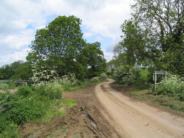
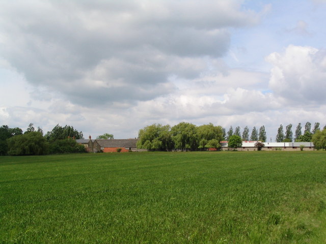
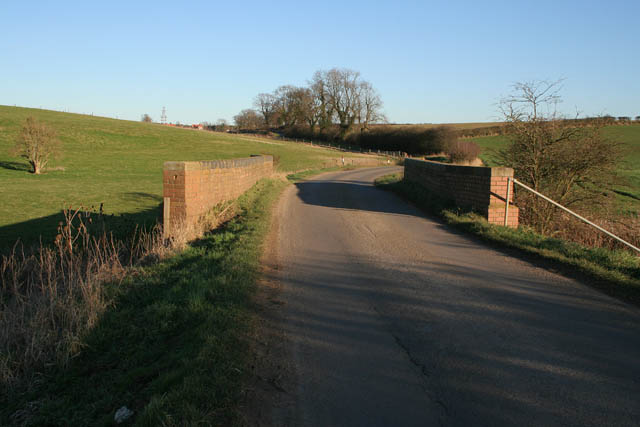
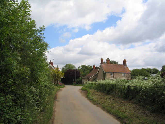
Bulby Images

Images are sourced within 2km of 52.822171/-0.441737 or Grid Reference TF0526. Thanks to Geograph Open Source API. All images are credited.

Entrance to village of Bulby
Ford and bridge, entrance to Bulby
Road to Bulby from Irnham
Marwood House Farm
Marwood House Farm
Leaving Elsthorpe on the road to Bulby The bridge on the left crosses the East Glen River
Leaving Elsthorpe on the road to Bulby
The bridge on the left crosses the East Glen River
Elsthorpe Grange
Elsthorpe Grange
Communications mast near Kirkby Underwood Communications mast, bristling with dishes for collecting and relaying data, sited north of Callan's Lane Wood near Kirkby Underwood
Communications mast near Kirkby Underwood
Communications mast, bristling with dishes for collecting and relaying data, sited north of Callan's Lane Wood near Kirkby Underwood
Staddle stone base at Rookery Farm This looks like a staddle stone base, but no sign of the top stone. Located right by the footpath from Callan's Lane, close to Rookery Farm Hawthorpe
Staddle stone base at Rookery Farm
This looks like a staddle stone base, but no sign of the top stone. Located right by the footpath from Callan's Lane, close to Rookery Farm Hawthorpe
Transco gas station Transco high pressure gas station: location 191700 Kirkby Underwood
Transco gas station
Transco high pressure gas station: location 191700 Kirkby Underwood
Dead tree in foreground and communications mast behind Dead tree, with evidence of lightning strikes on trunk, in the foreground with  a many-dish communications mast 500m behind.
Dead tree in foreground and communications mast behind
Dead tree, with evidence of lightning strikes on trunk, in the foreground with a many-dish communications mast 500m behind.
King Street Roman Road course of, no surface evidence left This image shows no surface evidence of the Roman Road King Street which crossed this field, at this position, in a northwest--southeast direction. Perhaps the farmer finds too many stones when cultivating here, or is it a 6 metre strip round the field that he receives payment to leave uncultivated?
King Street Roman Road course of, no surface evidence left
This image shows no surface evidence of the Roman Road King Street which crossed this field, at this position, in a northwest--southeast direction. Perhaps the farmer finds too many stones when cultivating here, or is it a 6 metre strip round the field that he receives payment to leave uncultivated?
Callan's Lane Wood at dusk This is owned by the Forestry Commission and there is a network of surfaced and unsurfaced forest walks. The wood is a popular place with walkers and dog owners. There is a small carpark on Callan's Lane.
Callan's Lane Wood at dusk
This is owned by the Forestry Commission and there is a network of surfaced and unsurfaced forest walks. The wood is a popular place with walkers and dog owners. There is a small carpark on Callan's Lane.
Bracket fungus on a fallen branch In Callan's Lane Wood.
Bracket fungus on a fallen branch
In Callan's Lane Wood.
In Callan's Lane Wood This ancient woodland is part of the Kesteven Forest, see <span class="nowrap"><a title="http://www.forestry.gov.uk/kestevenforest" rel="nofollow ugc noopener" href="http://www.forestry.gov.uk/kestevenforest">Link</a><img style="margin-left:2px;" alt="External link" title="External link - shift click to open in new window" src="https://s1.geograph.org.uk/img/external.png" width="10" height="10"/></span>
In Callan's Lane Wood
This ancient woodland is part of the Kesteven Forest, see LinkExternal link
Weir on the East Glen River near Hawthorpe Hawthorpe Road crosses the river via the brick bridge. The wooden structure houses an Environment Agency gauging station.
Weir on the East Glen River near Hawthorpe
Hawthorpe Road crosses the river via the brick bridge. The wooden structure houses an Environment Agency gauging station.
Hawthorpe Road The bridge crosses the East Glen River. Hawthorpe is on the horizon.
Hawthorpe Road
The bridge crosses the East Glen River. Hawthorpe is on the horizon.
Small limestone pit near Irnham There were several of these small "quarries" in this square.
Small limestone pit near Irnham
There were several of these small "quarries" in this square.
Gate into a field
Gate into a field
Show me another place!

Bulby is located at Grid Ref: TF0526 (Lat: 52.822171, Lng: -0.441737)

Division: Parts of Kesteven

Administrative County: Lincolnshire

District: South Kesteven

Police Authority: Lincolnshire

What 3 Words

///sing.croutons.gives. Near Corby Glen, Lincolnshire

Nearby Locations

Bulby

Related Wikis

Bulby

Bulby is a hamlet in the South Kesteven district of Lincolnshire, England, and in the civil parish of Irnham, Bulby and Hawthorpe. The village is situated...

Hawthorpe, Lincolnshire

Hawthorpe is a hamlet in the South Kesteven district of Lincolnshire, England, and the civil parish of Irnham, Bulby and Hawthorpe. It is west from the...

Elsthorpe

Elsthorpe is a hamlet in the South Kesteven district of Lincolnshire, England. It is situated 5 miles (8 km) north-west from the town of Bourne, and in...

Kirkby Underwood

Kirkby Underwood is a village and civil parish in the South Kesteven district of Lincolnshire, England. The population of the civil parish was 200 at the...

Nearby Amenities

Located within 500m of 52.822171,-0.441737
Bulby
Is In: Lincolnshire, England, UK
Place: hamlet
Lat/Long: 52.8226726/-0.4408705
Ford: yes
Source: OS_OpenData_StreetView
Lat/Long: 52.8214081/-0.4477631
Pumping Station
Naptan AtcoCode: 270000014554
Naptan Bearing: SE
Naptan BusStopType: CUS
Naptan CommonName: Pumping Station
Naptan Indicator: opp
Naptan Landmark: Pumping Station
Naptan NaptanCode: linjpwmd
Naptan Street: Bulby
Naptan Verified: no
Source: naptan_import
Lat/Long: 52.8225349/-0.4381535
Pumping Station
Naptan AtcoCode: 270000014555
Naptan Bearing: NW
Naptan BusStopType: CUS
Naptan CommonName: Pumping Station
Naptan Indicator: adj
Naptan Landmark: Pumping Station
Naptan NaptanCode: linjpwmg
Naptan Street: Bulby
Naptan Verified: no
Source: naptan_import
Lat/Long: 52.8224277/-0.4382018
Hall Farm
Place: farm
Source: Bing
Lat/Long: 52.8249133/-0.4388022
Grange Farm
Alt Name: The Grange
Place: farm
Source: Bing
Lat/Long: 52.821827/-0.442664
Manor Farm
Place: farm
Source: Bing
Lat/Long: 52.8231231/-0.4394635
Wood Farm
Place: farm
Source: Bing
Lat/Long: 52.8231332/-0.4413235
Bulby Hall
Place: isolated_dwelling
Source: Bing
Lat/Long: 52.818689/-0.4412478
The Lodge
Place: isolated_dwelling
Source: Bing
Lat/Long: 52.818733/-0.4379259
Give Way
Source: Bing
Lat/Long: 52.8227766/-0.4386726
Telephone
Booth: K6
Covered: booth
Man Made: telephone_box
Tourism: information
Lat/Long: 52.8226318/-0.4410856
Defibrillator
Defibrillator Location: attached to outside of the red phone box on Main Street in Bulby
Emergency: defibrillator
Indoor: no
Lat/Long: 52.8226314/-0.4410716
The data included in this document is from www.openstreetmap.org. The data is made available under ODbL.

Have you been to Bulby?

Leave your review of Bulby below (or comments, questions and feedback).