Wokingham

Civil Parish in Berkshire

England

Wokingham

Lake on the Golf Course The map shows a number of small ponds in this area. This looks to be the largest.
Lake on the Golf Course Credit: Des Blenkinsopp

Wokingham is a civil parish located in the county of Berkshire, England. It is situated approximately 40 miles west of London and is part of the larger Wokingham Borough. The town of Wokingham serves as the administrative center of the borough.

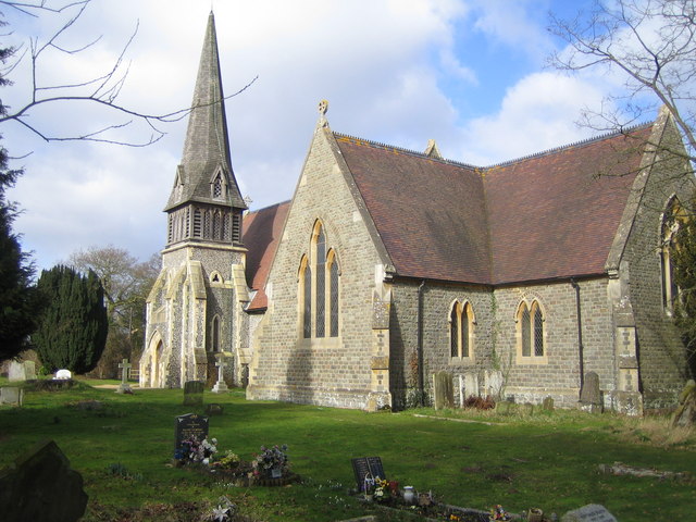
With a history dating back to the Anglo-Saxon era, Wokingham is a town rich in heritage. It is characterized by its charming market square, which is surrounded by historic buildings, including the Grade I listed Town Hall. The town also features a number of well-preserved medieval buildings, such as the 15th-century Old Forge and the 17th-century Rose Street Cottage of Curiosities.

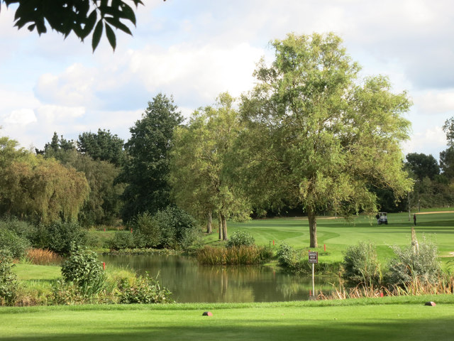
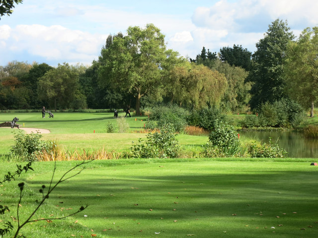
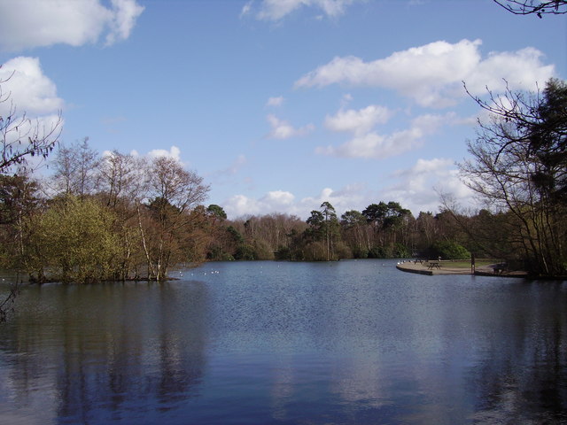
Wokingham is known for its strong sense of community and offers a range of amenities and services to its residents. The town center is home to a variety of independent shops, supermarkets, restaurants, and cafes, providing a vibrant shopping and dining scene. There are also several parks and green spaces, including the popular Dinton Pastures Country Park, which offers picturesque lakes, nature reserves, and walking trails.

Education is well catered for in Wokingham, with a number of primary and secondary schools serving the area. Wokingham also has excellent transport links, with regular train services to London and other major towns in the region. The town is conveniently located near major road networks, including the M4 motorway, making it easily accessible by car.

Overall, Wokingham offers a pleasant living environment with its blend of historical charm, community spirit, and modern amenities.

If you have any feedback on the listing, please let us know in the comments section below.
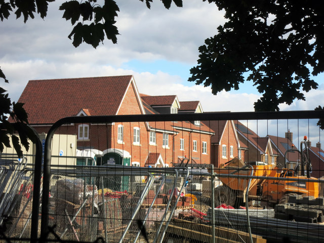
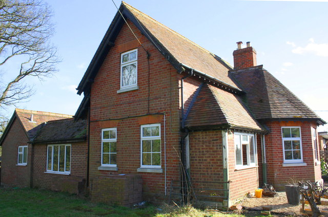
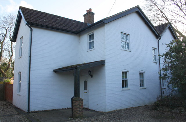
Wokingham Images

Images are sourced within 2km of 51.389644/-0.850727 or Grid Reference SU8066. Thanks to Geograph Open Source API. All images are credited.

Lake on the Golf Course The map shows a number of small ponds in this area. This looks to be the largest.
Lake on the Golf Course
The map shows a number of small ponds in this area. This looks to be the largest.
Sand Martins Golf Course
Fields at Randall's Farm
Clearing by the Footpath A plot of empty land probably waiting for the builders to turn up, like so many plots of land round here.
Clearing by the Footpath
A plot of empty land probably waiting for the builders to turn up, like so many plots of land round here.
Hazel Close, Wokingham One of a group of short, new residential streets all named after trees.
The next estate along, all the streets are named after birds.
Before that, the real things were here.
Hazel Close, Wokingham
One of a group of short, new residential streets all named after trees. The next estate along, all the streets are named after birds. Before that, the real things were here.
Building Site, Folly Court New housing going up off Barkham Road.
Building Site, Folly Court
New housing going up off Barkham Road.
Benchmark on St James's Church Ordnance Survey cut mark benchmark described on the Bench Mark Database at <span class="nowrap"><a title="http://www.bench-marks.org.uk/bm27568" rel="nofollow ugc noopener" href="http://www.bench-marks.org.uk/bm27568">Link</a><img style="margin-left:2px;" alt="External link" title="External link - shift click to open in new window" src="https://s1.geograph.org.uk/img/external.png" width="10" height="10"/></span>
Benchmark on St James's Church
Ordnance Survey cut mark benchmark described on the Bench Mark Database at LinkExternal link
St James's Church There is an OS benchmark <a href="https://www.geograph.org.uk/photo/5192199">SU7866 : Benchmark on St James's Church</a> on the inside face of the buttress on the near right hand corner of the church.
St James's Church
There is an OS benchmark SU7866 : Benchmark on St James's Church on the inside face of the buttress on the near right hand corner of the church.
Barkham Square buildings hidden behind bushes
Benchmark on Mortimers Lodge Farm Ordnance Survey cut mark benchmark described on the Bench Mark Database at <span class="nowrap"><a title="http://www.bench-marks.org.uk/bm65039" rel="nofollow ugc noopener" href="http://www.bench-marks.org.uk/bm65039">Link</a><img style="margin-left:2px;" alt="External link" title="External link - shift click to open in new window" src="https://s1.geograph.org.uk/img/external.png" width="10" height="10"/></span>
Benchmark on Mortimers Lodge Farm
Ordnance Survey cut mark benchmark described on the Bench Mark Database at LinkExternal link
Mortimers Lodge Farm, Edney's Hill There is an OS benchmark <a href="https://www.geograph.org.uk/photo/5192662">SU7867 : Benchmark on Mortimers Lodge Farm</a> on the gable of the house between the vertical white cable duct and a pile of bricks.
Mortimers Lodge Farm, Edney's Hill
There is an OS benchmark SU7867 : Benchmark on Mortimers Lodge Farm on the gable of the house between the vertical white cable duct and a pile of bricks.
Benchmark on barn at Edneys Hill Farm Ordnance Survey cut mark benchmark described on the Bench Mark Database at <span class="nowrap"><a title="http://www.bench-marks.org.uk/bm65040" rel="nofollow ugc noopener" href="http://www.bench-marks.org.uk/bm65040">Link</a><img style="margin-left:2px;" alt="External link" title="External link - shift click to open in new window" src="https://s1.geograph.org.uk/img/external.png" width="10" height="10"/></span>
Benchmark on barn at Edneys Hill Farm
Ordnance Survey cut mark benchmark described on the Bench Mark Database at LinkExternal link
Barn and log shed at Edneys Hill Farm There is an OS benchmark <a href="https://www.geograph.org.uk/photo/5193105">SU7866 : Benchmark on barn at Edneys Hill Farm</a> on the bricks at the middle of the face of the barn
Barn and log shed at Edneys Hill Farm
There is an OS benchmark SU7866 : Benchmark on barn at Edneys Hill Farm on the bricks at the middle of the face of the barn
Greenfields Farm
Greenfields Farm
Benchmark on Evendon's Lodge Ordnance Survey cut mark benchmark described on the Bench Mark Database at <span class="nowrap"><a title="http://www.bench-marks.org.uk/bm65041" rel="nofollow ugc noopener" href="http://www.bench-marks.org.uk/bm65041">Link</a><img style="margin-left:2px;" alt="External link" title="External link - shift click to open in new window" src="https://s1.geograph.org.uk/img/external.png" width="10" height="10"/></span>
Benchmark on Evendon's Lodge
Ordnance Survey cut mark benchmark described on the Bench Mark Database at LinkExternal link
Evendon's Lodge There is an OS benchmark <a href="https://www.geograph.org.uk/photo/5193193">SU7966 : Benchmark on Evendon's Lodge</a> on the side of the house (right of the two ground floor windows) at a junction in the brickwork, suggesting the house has been extended/rebuilt since the 1964-7 Map was published.
Evendon's Lodge
There is an OS benchmark SU7966 : Benchmark on Evendon's Lodge on the side of the house (right of the two ground floor windows) at a junction in the brickwork, suggesting the house has been extended/rebuilt since the 1964-7 Map was published.
Swan Family, Longmoor Lake The southern end of the lake in California Country Park.
Swan Family, Longmoor Lake
The southern end of the lake in California Country Park.
Welcome to California Entrance to the California chalet and touring park.
Welcome to California
Entrance to the California chalet and touring park.
Show me another place!

Wokingham is located at Grid Ref: SU8066 (Lat: 51.389644, Lng: -0.850727)

Unitary Authority: Wokingham

Police Authority: Thames Valley

What 3 Words

///short.liability.valley. Near Barkham, Berkshire

Related Wikis

Luckley House School

Luckley House School (formerly Luckley-Oakfield School) is an independent day and boarding school, located in Berkshire in England. It has a community...

California Country Park

California Country Park is a 100-acre (40 ha) country park covering Long Moor at California in the north of the civil parish of Finchampstead in the English...

Ludgrove School

Ludgrove School is an English independent boys' preparatory boarding school. Ludgrove was founded in 1892 at Ludgrove Hall in Middlesex by the Old Etonian...

Wixenford School

Wixenford School, also known as Wixenford Preparatory School and Wixenford-Eversley, was a private preparatory school for boys near Wokingham, founded...

Wixenford

Wixenford is an area of the civil parish of Wokingham Without in which Ludgrove School stands. It adjoins Wokingham and is in the English county of Berkshire...

California, Berkshire

California is a village in the north of the civil parish of Finchampstead in the English county of Berkshire. It is situated approximately 1.9 mi (3.1...

Longmoor Bog

Longmoor Bog is a 14-hectare (35-acre) biological Site of Special Scientific Interest north of Finchampstead in Berkshire. An area of 11.8 hectares (29...

Barkham

Barkham is a village and civil parish in the borough of Wokingham in Berkshire, England, located around 2 miles (3.2 km) southwest of the town of Wokingham...

Nearby Amenities

Located within 500m of 51.389644,-0.850727
Turning Circle
Lat/Long: 51.3874702/-0.8566686
Crossing
Bicycle: yes
Crossing: unmarked
Kerb: lowered
Sloped Curb: yes
Lat/Long: 51.3873518/-0.8479089
Crossing
Crossing Island: yes
Kerb: lowered
Sloped Curb: yes
Lat/Long: 51.3883607/-0.8474206
Crossing
Crossing Island: yes
Kerb: lowered
Sloped Curb: yes
Lat/Long: 51.3883589/-0.8473642
Crossing
Crossing Island: yes
Kerb: lowered
Lat/Long: 51.3880724/-0.8472188
Crossing
Crossing: unmarked
Kerb: lowered
Sloped Curb: yes
Source: Bing
Lat/Long: 51.3878612/-0.8470022
Crossing
Crossing: unmarked
Kerb: lowered
Sloped Curb: yes
Source: Bing
Lat/Long: 51.3880724/-0.8477064
Crossing
Bicycle: yes
Crossing Island: yes
Kerb: lowered
Sloped Curb: yes
Lat/Long: 51.3880396/-0.847298
Barrier: cycle_barrier
Lat/Long: 51.3879019/-0.8476454
Direction: 150
Generator Method: photovoltaic
Generator Output Electricity: yes
Generator Solar Modules: 12
Generator Source: solar
Generator Type: solar_photovoltaic_panel
Location: roof
Power: generator
Lat/Long: 51.3866505/-0.8560173
Direction: 170
Generator Method: photovoltaic
Generator Output Electricity: yes
Generator Solar Modules: 16
Generator Source: solar
Generator Type: solar_photovoltaic_panel
Location: roof
Power: generator
Lat/Long: 51.3872348/-0.8567673
Turning Loop
Lat/Long: 51.3878086/-0.8565489
Direction: 205
Generator Method: photovoltaic
Generator Output Electricity: yes
Generator Solar Modules: 16
Generator Source: solar
Generator Type: solar_photovoltaic_panel
Location: roof
Power: generator
Lat/Long: 51.3869856/-0.8473793
Direction: 210
Generator Method: photovoltaic
Generator Output Electricity: yes
Generator Solar Modules: 12
Generator Source: solar
Generator Type: solar_photovoltaic_panel
Location: roof
Power: generator
Lat/Long: 51.3902526/-0.8496587
Direction: 185
Generator Method: photovoltaic
Generator Output Electricity: yes
Generator Solar Modules: 16
Generator Source: solar
Generator Type: solar_photovoltaic_panel
Location: roof
Power: generator
Lat/Long: 51.3902061/-0.8488344
Direction: 185
Generator Method: photovoltaic
Generator Output Electricity: yes
Generator Solar Modules: 12
Generator Source: solar
Generator Type: solar_photovoltaic_panel
Location: roof
Power: generator
Lat/Long: 51.3914039/-0.8478733
Direction: 185
Generator Method: photovoltaic
Generator Output Electricity: yes
Generator Solar Modules: 4
Generator Source: solar
Generator Type: solar_photovoltaic_panel
Location: roof
Power: generator
Lat/Long: 51.3898687/-0.8488262
Direction: 185
Generator Method: photovoltaic
Generator Output Electricity: yes
Generator Solar Modules: 8
Generator Source: solar
Generator Type: solar_photovoltaic_panel
Location: roof
Power: generator
Lat/Long: 51.3891686/-0.8485966
Direction: 185
Generator Method: photovoltaic
Generator Output Electricity: yes
Generator Solar Modules: 20
Generator Source: solar
Generator Type: solar_photovoltaic_panel
Location: roof
Power: generator
Lat/Long: 51.3891878/-0.8487534
Direction: 140
Generator Method: photovoltaic
Generator Output Electricity: yes
Generator Solar Modules: 10
Generator Source: solar
Generator Type: solar_photovoltaic_panel
Location: roof
Power: generator
Lat/Long: 51.3876121/-0.8460624
Direction: 50
Generator Method: photovoltaic
Generator Output Electricity: yes
Generator Solar Modules: 12
Generator Source: solar
Generator Type: solar_photovoltaic_panel
Location: roof
Power: generator
Lat/Long: 51.3876612/-0.8460531
The data included in this document is from www.openstreetmap.org. The data is made available under ODbL.

Have you been to Wokingham?

Leave your review of Wokingham below (or comments, questions and feedback).