Beguildy
Settlement in Radnorshire
Wales
Beguildy

Beguildy is a small village located in the county of Radnorshire, Wales. Situated in the picturesque countryside, it is nestled within the rolling hills of the Welsh Marches. With a population of around 300 people, Beguildy maintains a close-knit community atmosphere.
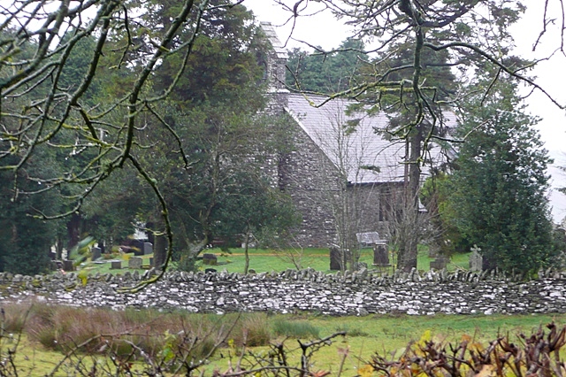
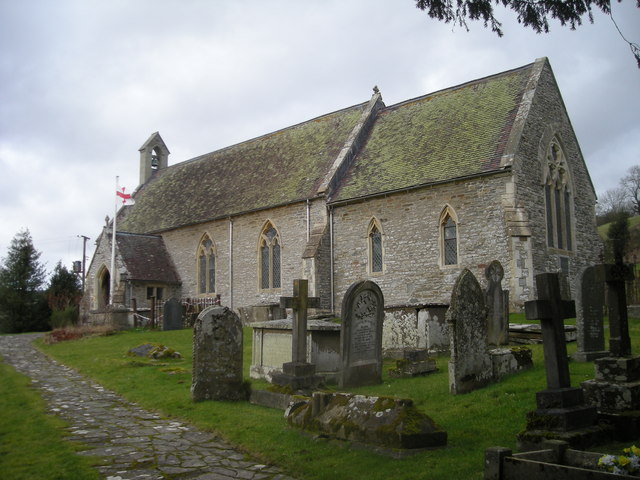
The village is known for its charming and traditional architecture, with many of the houses built using locally sourced red sandstone. The St. Michael's Church, a Grade II listed building, stands as a prominent feature, dating back to the 13th century and offering a glimpse into the area's rich history.
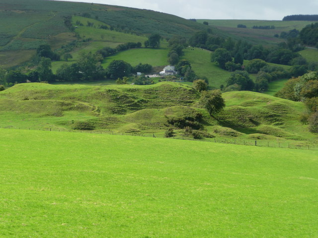
Surrounded by stunning natural beauty, Beguildy is a haven for outdoor enthusiasts. The village is located near the Offa's Dyke Path, a long-distance trail that traverses the border between England and Wales. This makes it a popular destination for hikers, nature lovers, and birdwatchers, who can enjoy the breathtaking views and tranquil surroundings.
Despite its small size, Beguildy offers some amenities to its residents and visitors. The village boasts a community-run pub, providing a cozy and welcoming atmosphere for locals and tourists alike. Additionally, a primary school serves the village and the surrounding area, ensuring that families have access to education for their children.
Overall, Beguildy is a picturesque and idyllic village that offers a peaceful escape from the hustle and bustle of urban life. With its rich history, stunning landscapes, and warm community spirit, it is a hidden gem in the heart of Radnorshire.
If you have any feedback on the listing, please let us know in the comments section below.
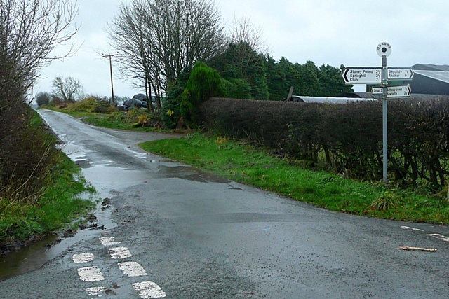
Beguildy Images
Images are sourced within 2km of 52.409445/-3.184985 or Grid Reference SO1979. Thanks to Geograph Open Source API. All images are credited.


Beguildy is located at Grid Ref: SO1979 (Lat: 52.409445, Lng: -3.184985)
Unitary Authority: Powys
Police Authority: Dyfed Powys
Also known as: Beguildy
What 3 Words
///powerful.hotspots.roadshow. Near Mainstone, Shropshire
Nearby Locations
Related Wikis

Beguildy
Beguildy (Welsh: Bugeildy) is a village and community in Powys, Wales. It lies in a remote tract of countryside, 8 miles (13 km) northwest of Knighton...
East Wales
East Wales (Welsh: Dwyrain Cymru) is either a ITL 3 statistical region of Wales or generally a region encompassing the easternmost parts of the country...
Quabbs
Quabbs is a small, scattered hamlet in the southwest of Shropshire, near the border between England and Wales. The name, which also occurs in Gloucestershire...
Bettws-y-Crwyn
Bettws-y-Crwyn (Welsh: Betws-y-crwyn / Betwsycrowyn) is a small, remote village and civil parish in south-west Shropshire, England. It is close to the...
Beacon Hill, Powys
Beacon Hill (Welsh: Mynydd Disglair) is a hill in the county of Radnorshire, Wales. It lies within the Powys unitary council area. It is located north...

Ale Oak
Ale Oak is a hamlet in Shropshire, England. == External links == Media related to Ale Oak at Wikimedia Commons
Bryn Amlwg Castle
Bryn Amlwg Castle (Welsh: Castell Bryn Amlwg, lit. 'castle on a prominent hill') was an enclosure castle near Anchor, Shropshire, abutting the England...
Llanfair Waterdine
Llanfair Waterdine, sometimes written as Llanvair Waterdine and meaning St Mary's Church Waterdine, is a small village and civil parish in Shropshire,...
Nearby Amenities
Located within 500m of 52.409445,-3.184985Have you been to Beguildy?
Leave your review of Beguildy below (or comments, questions and feedback).