Budleigh

Settlement in Somerset Somerset West and Taunton

England

Budleigh

Northern slopes of Blackdown Hills from Angersleigh Looking SSW from near Angersleigh church across farmland towards Leigh Hill
Northern slopes of Blackdown Hills from Angersleigh Credit: Derek Harper

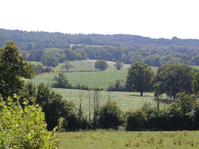
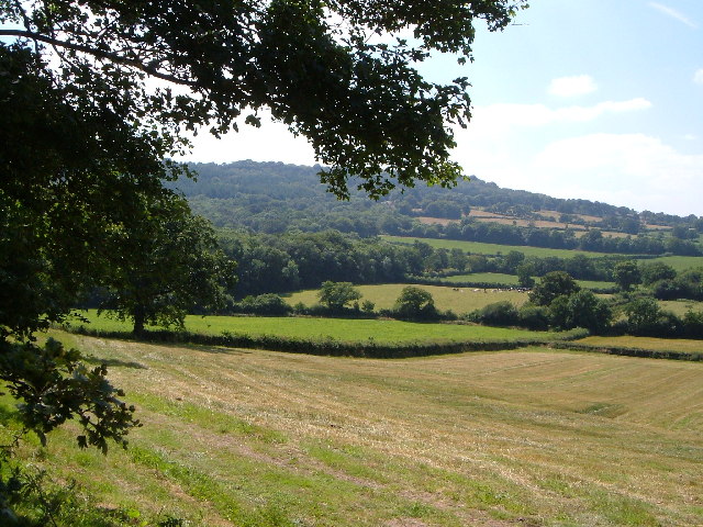
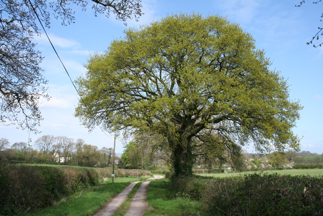
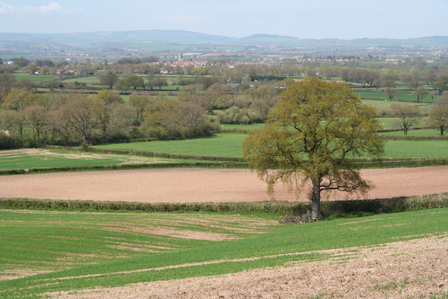
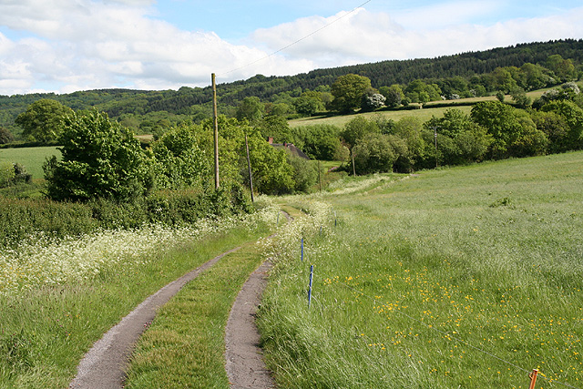
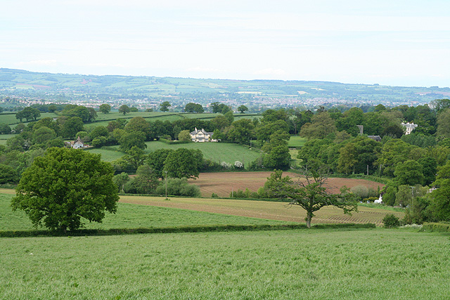
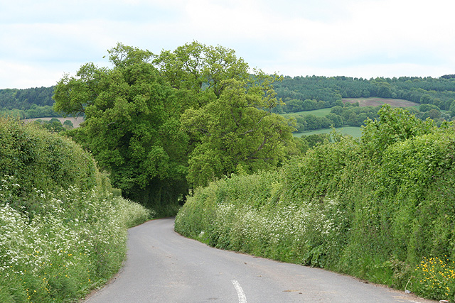
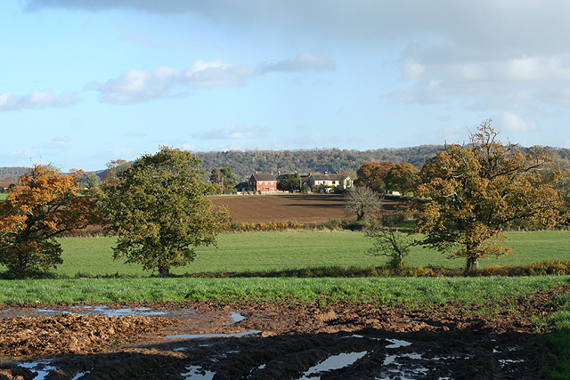
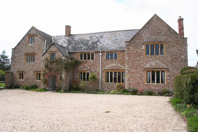
Budleigh is a picturesque village located in the county of Somerset, England. Situated in the South West region, it lies approximately 8 miles east of the bustling town of Taunton. The village is nestled in the beautiful countryside, surrounded by rolling hills and lush green fields.

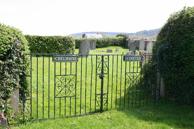
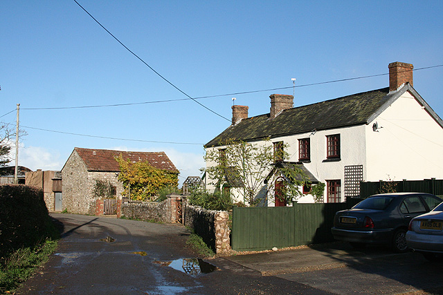
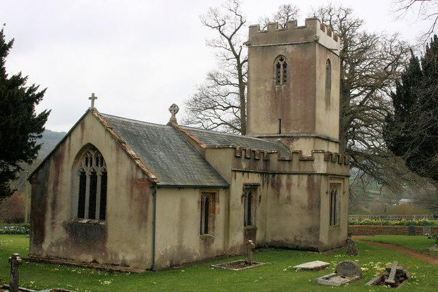
Budleigh can trace its history back to the Domesday Book of 1086 when it was recorded as "Bodelei." The village has a rich heritage, with several historic buildings and landmarks. St. Michael's Church, a magnificent 13th-century structure, stands proudly in the heart of the village, offering visitors a glimpse into the past.

The village itself is relatively small, with a close-knit community and a population of around 500 residents. It exudes a tranquil and peaceful atmosphere, making it an ideal place for those seeking a slower pace of life. Budleigh boasts an excellent sense of community spirit, and residents often come together to organize events and activities.

Despite its small size, Budleigh offers a range of amenities to cater to the needs of its residents. These include a village hall, a primary school, a local pub, and a small convenience store. The village is also well-connected, with good transport links to neighboring towns and cities.

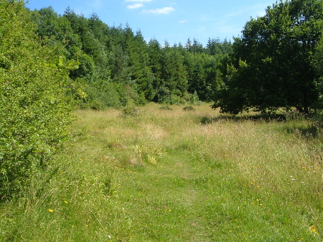
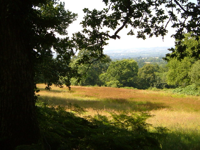
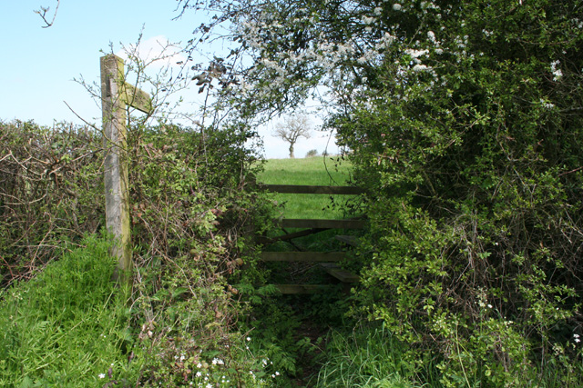
Surrounded by beautiful countryside, Budleigh provides ample opportunities for outdoor activities. The village is located close to the Blackdown Hills Area of Outstanding Natural Beauty, offering stunning landscapes and a plethora of walking and cycling routes.

Overall, Budleigh is a charming and idyllic village that combines a rich history with natural beauty, making it a desirable place to live or visit.

If you have any feedback on the listing, please let us know in the comments section below.

Budleigh Images

Images are sourced within 2km of 50.968958/-3.156357 or Grid Reference ST1819. Thanks to Geograph Open Source API. All images are credited.

Northern slopes of Blackdown Hills from Angersleigh Looking SSW from near Angersleigh church across farmland towards Leigh Hill
Northern slopes of Blackdown Hills from Angersleigh
Looking SSW from near Angersleigh church across farmland towards Leigh Hill
Farmland SE of Ruggin Looking WSW across the northern slopes of the Blackdown Hills, with Buckland Wood and Hill behind
Farmland SE of Ruggin
Looking WSW across the northern slopes of the Blackdown Hills, with Buckland Wood and Hill behind
Quants Nature Reserve Hidden within steep woods on the north-facing slopes of the Blackdown Hills, this meadow forms part of Quants SSSI, rich in plants indicative of ancient woodland, butterflies and other fauna
Quants Nature Reserve
Hidden within steep woods on the north-facing slopes of the Blackdown Hills, this meadow forms part of Quants SSSI, rich in plants indicative of ancient woodland, butterflies and other fauna
Woodland meadow near Farm Wood Bungalow Here the lower north-facing slopes of the Blackdown Hills form a patchwork of woods (here oak) and fields. Looking northwards, with a view across the Vale of Taunton Deane in the background.
Woodland meadow near Farm Wood Bungalow
Here the lower north-facing slopes of the Blackdown Hills form a patchwork of woods (here oak) and fields. Looking northwards, with a view across the Vale of Taunton Deane in the background.
West Buckland: footpath to Buckland Farm The path starts here, near Five Cross Way. Looking east-south-east
West Buckland: footpath to Buckland Farm
The path starts here, near Five Cross Way. Looking east-south-east
West Buckland: the way to Buckland Farm The notice on the post indicates that this is a private road. With the oak tree just coming into leaf
West Buckland: the way to Buckland Farm
The notice on the post indicates that this is a private road. With the oak tree just coming into leaf
Pitminster: near Chelmsine Looking west-north-west over farmland. Wellington, with its church tower, can be seen in mid distance
Pitminster: near Chelmsine
Looking west-north-west over farmland. Wellington, with its church tower, can be seen in mid distance
Pitminster: cemetery at Chelmsine chapel Looking east-south-east with the Blackdown Hills beyond.
Pitminster: cemetery at Chelmsine chapel
Looking east-south-east with the Blackdown Hills beyond.
West Buckland: track to Perry Meade The track also serves as a public footpath to Ruggin. The thatched roof of Perry Meade is just visible beyond trees. Looking south-south-east on the edge of the Blackdown Hills
West Buckland: track to Perry Meade
The track also serves as a public footpath to Ruggin. The thatched roof of Perry Meade is just visible beyond trees. Looking south-south-east on the edge of the Blackdown Hills
Pitminster: towards Angersleigh Looking north-north-east on the road from Forches Corner (The Marry Harriers). Ahead The Glebe House stands by the road to Taunton. To the right the church of St Michael and All Angels and Leigh Court are half hidden by trees. Taunton lies in the distance
Pitminster: towards Angersleigh
Looking north-north-east on the road from Forches Corner (The Marry Harriers). Ahead The Glebe House stands by the road to Taunton. To the right the church of St Michael and All Angels and Leigh Court are half hidden by trees. Taunton lies in the distance
Pitminster: approaching Angersleigh Looking south on the road from Taunton with Leigh Hill on the Blackdowns providing the backdrop
Pitminster: approaching Angersleigh
Looking south on the road from Taunton with Leigh Hill on the Blackdowns providing the backdrop
Pitminster: cottages at Howleigh Hillcrest and Hillcrest Cottage, looking north-north-east
Pitminster: cottages at Howleigh
Hillcrest and Hillcrest Cottage, looking north-north-east
Pitminster: towards Sellick’s Green Looking east near Howleigh Farm with Pickeridge Hill providing the backdrop
Pitminster: towards Sellick’s Green
Looking east near Howleigh Farm with Pickeridge Hill providing the backdrop
Angersleigh Church
Angersleigh Church
Angersleigh Church window
Angersleigh Church window Six Apostles.
Angersleigh Church window
Six Apostles.
Angersleigh Church window Six Apostles.
Angersleigh Church window
Six Apostles.
Leigh Court View from the footpath which begins at the church.
Leigh Court
View from the footpath which begins at the church.
Show me another place!

Budleigh is located at Grid Ref: ST1819 (Lat: 50.968958, Lng: -3.156357)

Administrative County: Somerset

District: Somerset West and Taunton

Police Authority: Avon and Somerset

What 3 Words

///pens.elsewhere.twins. Near Taunton, Somerset

Nearby Locations

Budleigh

Related Wikis

Taunton Deane services

Taunton Deane services is a double sided motorway service station on the M5 motorway near Taunton, England. It is owned by Roadchef. == Location == The...

Church of St Michael, Angersleigh

The Anglican Church of St Michael in Angersleigh, Somerset, England was built in the 14th century. It is a Grade II* listed building. == History == The...

West Buckland

West Buckland is a village and civil parish in Somerset, England, situated 5 miles (8.0 km) south west of Taunton. The parish has a population of 1,189...

Leigh Reservoir

Leigh Reservoir, or Leigh Hill Reservoir, is a small reservoir in Somerset, England. It was built in 1893 to supply water to the town of Taunton, Somerset...

Quants Reserve

Quants Reserve is a nature reserve north west of Burnworthy in Somerset, England. It consists of a grassland clearing in a forestry plantation. It is well...

Luxhay Reservoir

Luxhay Reservoir is an artificial reservoir near Angersleigh, Somerset, England. It is now owned by Wessex Water. It was built in 1905 by the town corporation...

Gerbestone Manor

Gerbestone Manor in West Buckland, Somerset, England was largely rebuilt in the late 16th century, although some fabric from the 13th century house remains...

Poundisford Park

Poundisford Park north of Pitminster, Somerset, England is an English country house that typifies progressive housebuilding on the part of the West Country...

Nearby Amenities

Located within 500m of 50.968958,-3.156357
Budleigh
Place: hamlet
Lat/Long: 50.9693552/-3.1563593
The data included in this document is from www.openstreetmap.org. The data is made available under ODbL.

Have you been to Budleigh?

Leave your review of Budleigh below (or comments, questions and feedback).