Buckley Mountain

Settlement in Flintshire

Wales

Buckley Mountain

A494 between New Brighton and Alltami The A494 is a primary trunk route which runs for almost 62 miles between the terminus of the M56 motorway between Mollington and Capenhurst and the A470 at Dolgellau. Its northern sections remain among the busiest roads in Wales. As well as passing through part of the Snowdonia National Park, the A494 also forms part of the North Wales coast route between the A55 and M56.
A494 between New Brighton and Alltami Credit: David Dixon

Buckley Mountain is a small hill located in Flintshire, a county in northeast Wales. It is situated near the town of Buckley, which lies approximately seven miles west of the city of Chester in England. The mountain, also known as Moel Fammau, stands at an elevation of 550 feet (168 meters) above sea level, offering panoramic views of the surrounding countryside.

Buckley Mountain is known for its natural beauty and is a popular destination for hikers, nature enthusiasts, and locals looking for a peaceful retreat. The hill is covered in lush greenery, with a variety of plant species, including heather and gorse, creating a vibrant landscape.

At the summit of Buckley Mountain, there is a stone cairn which was erected in memory of those who lost their lives during the Second World War. The cairn serves as a poignant reminder of the area's history and acts as a focal point for visitors.

The mountain is also home to a number of walking trails, offering different levels of difficulty, making it accessible to people of all ages and abilities. The most popular route is the Clwydian Way, which passes through Buckley Mountain and provides stunning views of the Clwydian Range, an Area of Outstanding Natural Beauty.

Overall, Buckley Mountain is a picturesque location that offers a tranquil escape from the hustle and bustle of everyday life, making it a must-visit destination for those who appreciate the beauty of the Welsh countryside.

If you have any feedback on the listing, please let us know in the comments section below.

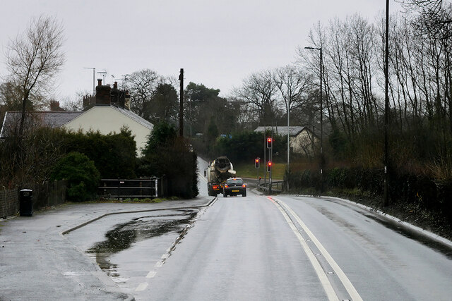
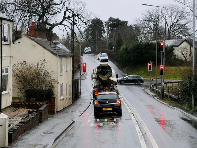
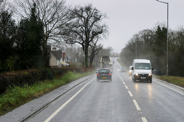
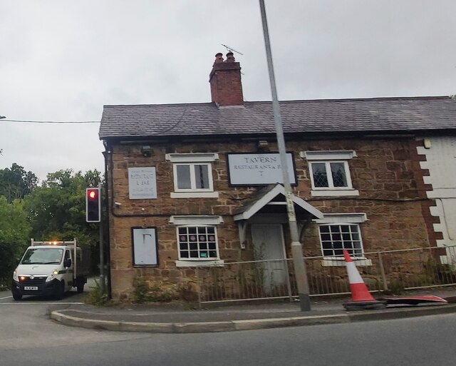
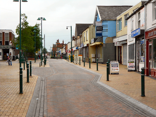
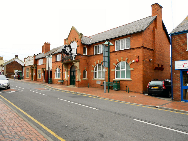
Buckley Mountain Images

Images are sourced within 2km of 53.176261/-3.083212 or Grid Reference SJ2764. Thanks to Geograph Open Source API. All images are credited.

A494 between New Brighton and Alltami The A494 is a primary trunk route which runs for almost 62 miles between the terminus of the M56 motorway between Mollington and Capenhurst and the A470 at Dolgellau. Its northern sections remain among the busiest roads in Wales. As well as passing through part of the Snowdonia National Park, the A494 also forms part of the North Wales coast route between the A55 and M56.
A494 between New Brighton and Alltami
The A494 is a primary trunk route which runs for almost 62 miles between the terminus of the M56 motorway between Mollington and Capenhurst and the A470 at Dolgellau. Its northern sections remain among the busiest roads in Wales. As well as passing through part of the Snowdonia National Park, the A494 also forms part of the North Wales coast route between the A55 and M56.
A494 Crossroads at Alltami The A494 is a primary trunk route which runs for almost 62 miles between the terminus of the M56 motorway between Mollington and Capenhurst and the A470 at Dolgellau. Its northern sections remain among the busiest roads in Wales. As well as passing through part of the Snowdonia National Park, the A494 also forms part of the North Wales coast route between the A55 and M56.
A494 Crossroads at Alltami
The A494 is a primary trunk route which runs for almost 62 miles between the terminus of the M56 motorway between Mollington and Capenhurst and the A470 at Dolgellau. Its northern sections remain among the busiest roads in Wales. As well as passing through part of the Snowdonia National Park, the A494 also forms part of the North Wales coast route between the A55 and M56.
Mold Road (A494) The A494 is a primary trunk route which runs for almost 62 miles between the terminus of the M56 motorway between Mollington and Capenhurst and the A470 at Dolgellau. Its northern sections remain among the busiest roads in Wales. As well as passing through part of the Snowdonia National Park, the A494 also forms part of the North Wales coast route between the A55 and M56.
Mold Road (A494)
The A494 is a primary trunk route which runs for almost 62 miles between the terminus of the M56 motorway between Mollington and Capenhurst and the A470 at Dolgellau. Its northern sections remain among the busiest roads in Wales. As well as passing through part of the Snowdonia National Park, the A494 also forms part of the North Wales coast route between the A55 and M56.
Ewloe Interchange (Junction 34), North Wales Expressway (A55) The A55, also known as the North Wales Expressway (Gwibffordd Gogledd Cymru), is the major road in North Wales running for 88 miles between Chester and Holyhead via Conwy and Bangor. 

The A55 is a very high quality road, much of it rebuilt since the 1970s in response to traffic problems in Colwyn Bay, Colwyn and Llandudno caused by traffic having to pass through town centres on totally unsuitable streets, (especially in Conwy where lorries often scraped their paintwork as they passed through 12th century arches in the town's walls), leading to the construction of an east-west expressway bypassing the urban centres. It is a dual carriageway primary route for its entire length with the exception of the point where it crosses the Britannia Bridge over the Menai Strait. All of its junctions are grade separated except for two roundabouts; one east of Penmaenmawr and one in Llanfairfechan. The road originally ran from Chester to Bangor but was extended parallel to the A5 across Anglesey right into Holyhead Docks in 2001.

<span class="nowrap"><a title="http://www.sabre-roads.org.uk/wiki/index.php?title=A55" rel="nofollow ugc noopener" href="http://www.sabre-roads.org.uk/wiki/index.php?title=A55">Link</a><img style="margin-left:2px;" alt="External link" title="External link - shift click to open in new window" src="https://s1.geograph.org.uk/img/external.png" width="10" height="10"/></span>  SABRE
Ewloe Interchange (Junction 34), North Wales Expressway (A55)
The A55, also known as the North Wales Expressway (Gwibffordd Gogledd Cymru), is the major road in North Wales running for 88 miles between Chester and Holyhead via Conwy and Bangor. The A55 is a very high quality road, much of it rebuilt since the 1970s in response to traffic problems in Colwyn Bay, Colwyn and Llandudno caused by traffic having to pass through town centres on totally unsuitable streets, (especially in Conwy where lorries often scraped their paintwork as they passed through 12th century arches in the town's walls), leading to the construction of an east-west expressway bypassing the urban centres. It is a dual carriageway primary route for its entire length with the exception of the point where it crosses the Britannia Bridge over the Menai Strait. All of its junctions are grade separated except for two roundabouts; one east of Penmaenmawr and one in Llanfairfechan. The road originally ran from Chester to Bangor but was extended parallel to the A5 across Anglesey right into Holyhead Docks in 2001. LinkExternal link SABRE
Former Tavern Restaurant at Alltami
McDonald's restaurant at Northop Services
Benchmark on Bistre Methodist Chapel, Spon Green, Buckley Ordnance Survey benchmark on the northeast corner of Bistre Methodist Chapel, Spon Green, Buckley. Levelled at 142.055m above Newlyn Datum, verified 1959. For a view of the chapel from the opposite side see <a href="https://www.geograph.org.uk/photo/7517001">SJ2863 : Bistre Methodist Chapel, Spon Green, Buckley</a>                
Benchmark database: <span class="nowrap"><a title="https://www.bench-marks.org.uk/bm195201" rel="nofollow ugc noopener" href="https://www.bench-marks.org.uk/bm195201">Link</a><img style="margin-left:2px;" alt="External link" title="External link - shift click to open in new window" src="https://s1.geograph.org.uk/img/external.png" width="10" height="10"/></span>
Benchmark on Bistre Methodist Chapel, Spon Green, Buckley
Ordnance Survey benchmark on the northeast corner of Bistre Methodist Chapel, Spon Green, Buckley. Levelled at 142.055m above Newlyn Datum, verified 1959. For a view of the chapel from the opposite side see SJ2863 : Bistre Methodist Chapel, Spon Green, Buckley Benchmark database: LinkExternal link
Bistre Methodist Chapel, Spon Green, Buckley Looking across Spon Green towards the Bistre Methodist Chapel. There is an Ordnance Survey benchmark on the other side of the building, on the far right hand corner <a href="https://www.geograph.org.uk/photo/7516911">SJ2863 : Benchmark on Bistre Methodist Chapel, Spon Green, Buckley</a>   In 2023 the chapel has closed its doors and a planning application has been made to convert it into living accommodation.
Bistre Methodist Chapel, Spon Green, Buckley
Looking across Spon Green towards the Bistre Methodist Chapel. There is an Ordnance Survey benchmark on the other side of the building, on the far right hand corner SJ2863 : Benchmark on Bistre Methodist Chapel, Spon Green, Buckley In 2023 the chapel has closed its doors and a planning application has been made to convert it into living accommodation.
Benchmark in Mount Pleasant Road, Burntwood Pentre Ordnance Survey benchmark on an old bridge abutment, which is no longer a bridge, in Mount Pleasant Road, Burntwood Pentre. Levelled at 141.830m above Newlyn Datum. For a wider view see <a href="https://www.geograph.org.uk/photo/7517250">SJ2864 : Bridge abutment in Mount Pleasant Road, Burntwood Pentre</a> 
Benchmark database: <span class="nowrap"><a title="https://www.bench-marks.org.uk/bm195205" rel="nofollow ugc noopener" href="https://www.bench-marks.org.uk/bm195205">Link</a><img style="margin-left:2px;" alt="External link" title="External link - shift click to open in new window" src="https://s1.geograph.org.uk/img/external.png" width="10" height="10"/></span>
Benchmark in Mount Pleasant Road, Burntwood Pentre
Ordnance Survey benchmark on an old bridge abutment, which is no longer a bridge, in Mount Pleasant Road, Burntwood Pentre. Levelled at 141.830m above Newlyn Datum. For a wider view see SJ2864 : Bridge abutment in Mount Pleasant Road, Burntwood Pentre Benchmark database: LinkExternal link
Bridge abutment in Mount Pleasant Road, Burntwood Pentre The brick abutment is the only sign that there was ever a railway bridge crossing the road here. In times past this area was a hive of activity with brick and tile works as well as coal mines to power the furnaces, all long gone. There is an Ordnance Survey benchmark low down on the corner of the abutment, but it is partly hidden by ivy <a href="https://www.geograph.org.uk/photo/7517223">SJ2864 : Benchmark in Mount Pleasant Road, Burntwood Pentre</a>
Bridge abutment in Mount Pleasant Road, Burntwood Pentre
The brick abutment is the only sign that there was ever a railway bridge crossing the road here. In times past this area was a hive of activity with brick and tile works as well as coal mines to power the furnaces, all long gone. There is an Ordnance Survey benchmark low down on the corner of the abutment, but it is partly hidden by ivy SJ2864 : Benchmark in Mount Pleasant Road, Burntwood Pentre
Rivet benchmark on St Matthew's parish church tower, Buckley Ordnance Survey rivet benchmark on the south west buttress of  the tower of St Matthew's parish church, Buckley. Levelled at 160.413m above Newlyn Datum, verified 1959. For a view of the buttress see <a href="https://www.geograph.org.uk/photo/7518145">SJ2864 : Tower door of St Matthew's parish church, Buckley</a>                             
Benchmark database: <span class="nowrap"><a title="https://www.bench-marks.org.uk/bm102814" rel="nofollow ugc noopener" href="https://www.bench-marks.org.uk/bm102814">Link</a><img style="margin-left:2px;" alt="External link" title="External link - shift click to open in new window" src="https://s1.geograph.org.uk/img/external.png" width="10" height="10"/></span>
Rivet benchmark on St Matthew's parish church tower, Buckley
Ordnance Survey rivet benchmark on the south west buttress of the tower of St Matthew's parish church, Buckley. Levelled at 160.413m above Newlyn Datum, verified 1959. For a view of the buttress see SJ2864 : Tower door of St Matthew's parish church, Buckley Benchmark database: LinkExternal link
Tower door of St Matthew's parish church, Buckley There is an Ordnance Survey rivet benchmark on the angled buttress below the lamp <a href="https://www.geograph.org.uk/photo/7518130">SJ2864 : Rivet benchmark on St Matthew's parish church tower, Buckley</a>
Tower door of St Matthew's parish church, Buckley
There is an Ordnance Survey rivet benchmark on the angled buttress below the lamp SJ2864 : Rivet benchmark on St Matthew's parish church tower, Buckley
Benchmark on the Horse & Jockey in Drury Lane, Buckley Ordnance Survey benchmark on the side wall of the Horse & Jockey public house in Drury Lane, Buckley. Levelled at 157.070m above Newlyn Datum. For a wider view see <a href="https://www.geograph.org.uk/photo/7518246">SJ2864 : The side wall of the Horse & Jockey, Drury Lane, Buckley</a>                          
Benchmark database: <span class="nowrap"><a title="https://www.bench-marks.org.uk/bm195298" rel="nofollow ugc noopener" href="https://www.bench-marks.org.uk/bm195298">Link</a><img style="margin-left:2px;" alt="External link" title="External link - shift click to open in new window" src="https://s1.geograph.org.uk/img/external.png" width="10" height="10"/></span>
Benchmark on the Horse & Jockey in Drury Lane, Buckley
Ordnance Survey benchmark on the side wall of the Horse & Jockey public house in Drury Lane, Buckley. Levelled at 157.070m above Newlyn Datum. For a wider view see SJ2864 : The side wall of the Horse & Jockey, Drury Lane, Buckley Benchmark database: LinkExternal link
The side wall of the Horse & Jockey, Drury Lane, Buckley The side wall of the Horse & Jockey in Drury Lane has an Ordnance Survey benchmark <a href="https://www.geograph.org.uk/photo/7518234">SJ2864 : Benchmark on the Horse & Jockey in Drury Lane, Buckley</a>
The side wall of the Horse & Jockey, Drury Lane, Buckley
The side wall of the Horse & Jockey in Drury Lane has an Ordnance Survey benchmark SJ2864 : Benchmark on the Horse & Jockey in Drury Lane, Buckley
A55 sign gantry west of Ewloe Green
Buckley Fire Station
Brunswick Road, Buckley
Buckley Swimming Baths and Public Library The swimming baths and library on Brunswick Road. The council offices can be seen further down the road.
Buckley Swimming Baths and Public Library
The swimming baths and library on Brunswick Road. The council offices can be seen further down the road.
Show me another place!

Buckley Mountain is located at Grid Ref: SJ2764 (Lat: 53.176261, Lng: -3.083212)

Unitary Authority: Flintshire

Police Authority: North Wales

What 3 Words

///dispenser.hotspots.power. Near Buckley, Flintshire

Related Wikis

Elfed High School

Elfed High School (Welsh: Ysgol Uwchradd Elfed) is an 11–16 mixed, English-medium community secondary school in Buckley, Flintshire, Wales. == History... ==

Buckley, Flintshire

Buckley (Welsh: Bwcle [ˈbʊklɛ]) is a town and community in Flintshire, north-east Wales, two miles (3 km) from the county town of Mold and contiguous with...

Buckley Claypits and Commons

Buckley Claypits and Commons is a Site of Special Scientific Interest in the preserved county of Clwyd, north Wales. It is an important reserve for the...

District of Alyn and Deeside

Alyn and Deeside (Welsh: Alun a Glannau Dyfrdwy) was one of six local government districts in the county of Clwyd, north-east Wales from 1974 to 1996....

Nearby Amenities

Located within 500m of 53.176261,-3.083212
Traffic Signals
Lat/Long: 53.1760113/-3.076245
Mini Roundabout
Lat/Long: 53.177769/-3.0806862
Turning Circle
Lat/Long: 53.1745289/-3.0790053
Pub
The Hope and Anchor
Wikidata: Q80855068
Lat/Long: 53.1776144/-3.0807826
Kerb: no
Lat/Long: 53.1744529/-3.0821223
Post Box
Post Box Design: type_g
Post Box Type: pillar
Ref: CH7 112
Royal Cypher: EIIR
Royal Cypher Wikidata: Q33102113
Lat/Long: 53.1761181/-3.076913
Barrier: bollard
Bollard: fixed
Lat/Long: 53.1736121/-3.08826
Barrier: bollard
Bollard: fixed
Lat/Long: 53.1740399/-3.0885874
Direction: 165
Generator Method: photovoltaic
Generator Output Electricity: yes
Generator Solar Modules: 12
Generator Source: solar
Generator Type: solar_photovoltaic_panel
Location: roof
Power: generator
Lat/Long: 53.1770786/-3.0877532
Direction: WSW
Generator Method: photovoltaic
Generator Output Electricity: yes
Generator Solar Modules: 17
Generator Source: solar
Generator Type: solar_photovoltaic_panel
Location: roof
Power: generator
Lat/Long: 53.1775673/-3.0886652
Direction: 255
Generator Method: photovoltaic
Generator Output Electricity: yes
Generator Solar Modules: 16
Generator Source: solar
Generator Type: solar_photovoltaic_panel
Location: roof
Power: generator
Lat/Long: 53.1773776/-3.0880188
Direction: 170
Generator Method: photovoltaic
Generator Output Electricity: yes
Generator Solar Modules: 15
Generator Source: solar
Generator Type: solar_photovoltaic_panel
Location: roof
Power: generator
Lat/Long: 53.1724/-3.0863311
Direction: 170
Generator Method: photovoltaic
Generator Output Electricity: yes
Generator Solar Modules: 15
Generator Source: solar
Generator Type: solar_photovoltaic_panel
Location: roof
Power: generator
Lat/Long: 53.1723541/-3.0866644
Direction: 260
Generator Method: photovoltaic
Generator Output Electricity: yes
Generator Solar Modules: 16
Generator Source: solar
Generator Type: solar_photovoltaic_panel
Location: roof
Power: generator
Lat/Long: 53.173162/-3.088387
Direction: SSE
Generator Method: photovoltaic
Generator Output Electricity: yes
Generator Solar Modules: 12
Generator Source: solar
Generator Type: solar_photovoltaic_panel
Location: roof
Power: generator
Lat/Long: 53.1733618/-3.0872478
Direction: SSE
Generator Method: photovoltaic
Generator Output Electricity: yes
Generator Solar Modules: 12
Generator Source: solar
Generator Type: solar_photovoltaic_panel
Location: roof
Power: generator
Lat/Long: 53.1733376/-3.0873215
Direction: 195
Generator Method: photovoltaic
Generator Output Electricity: yes
Generator Solar Modules: 10
Generator Source: solar
Generator Type: solar_photovoltaic_panel
Location: roof
Power: generator
Lat/Long: 53.1733826/-3.0870908
Direction: 215
Generator Method: photovoltaic
Generator Output Electricity: yes
Generator Solar Modules: 10
Generator Source: solar
Generator Type: solar_photovoltaic_panel
Location: roof
Power: generator
Lat/Long: 53.1733296/-3.0868803
Direction: 215
Generator Method: photovoltaic
Generator Output Electricity: yes
Generator Solar Modules: 10
Generator Source: solar
Generator Type: solar_photovoltaic_panel
Location: roof
Power: generator
Lat/Long: 53.1732983/-3.0867985
Direction: 195
Generator Method: photovoltaic
Generator Output Electricity: yes
Generator Solar Modules: 10
Generator Source: solar
Generator Type: solar_photovoltaic_panel
Location: roof
Power: generator
Lat/Long: 53.1733601/-3.0869862
Direction: 215
Generator Method: photovoltaic
Generator Output Electricity: yes
Generator Solar Modules: 10
Generator Source: solar
Generator Type: solar_photovoltaic_panel
Location: roof
Power: generator
Lat/Long: 53.1732022/-3.086659
Direction: 215
Generator Method: photovoltaic
Generator Output Electricity: yes
Generator Solar Modules: 10
Generator Source: solar
Generator Type: solar_photovoltaic_panel
Location: roof
Power: generator
Lat/Long: 53.1731756/-3.086596
Direction: 175
Generator Method: photovoltaic
Generator Output Electricity: yes
Generator Solar Modules: 12
Generator Source: solar
Generator Type: solar_photovoltaic_panel
Location: roof
Power: generator
Lat/Long: 53.1730965/-3.0864484
Direction: 175
Generator Method: photovoltaic
Generator Output Electricity: yes
Generator Solar Modules: 12
Generator Source: solar
Generator Type: solar_photovoltaic_panel
Location: roof
Power: generator
Lat/Long: 53.1731005/-3.0863639
Direction: 215
Generator Method: photovoltaic
Generator Output Electricity: yes
Generator Solar Modules: 12
Generator Source: solar
Generator Type: solar_photovoltaic_panel
Location: roof
Power: generator
Lat/Long: 53.1734084/-3.086364
Direction: 215
Generator Method: photovoltaic
Generator Output Electricity: yes
Generator Solar Modules: 14
Generator Source: solar
Generator Type: solar_photovoltaic_panel
Location: roof
Power: generator
Lat/Long: 53.1734405/-3.0864391
Direction: 215
Generator Method: photovoltaic
Generator Output Electricity: yes
Generator Solar Modules: 12
Generator Source: solar
Generator Type: solar_photovoltaic_panel
Location: roof
Power: generator
Lat/Long: 53.1735314/-3.086543
Direction: 215
Generator Method: photovoltaic
Generator Output Electricity: yes
Generator Solar Modules: 12
Generator Source: solar
Generator Type: solar_photovoltaic_panel
Location: roof
Power: generator
Lat/Long: 53.1735639/-3.0866054
Direction: 195
Generator Method: photovoltaic
Generator Output Electricity: yes
Generator Solar Modules: 12
Generator Source: solar
Generator Type: solar_photovoltaic_panel
Location: roof
Power: generator
Lat/Long: 53.1736511/-3.0867663
Direction: 195
Generator Method: photovoltaic
Generator Output Electricity: yes
Generator Solar Modules: 12
Generator Source: solar
Generator Type: solar_photovoltaic_panel
Location: roof
Power: generator
Lat/Long: 53.1736697/-3.0868487
Direction: 170
Generator Method: photovoltaic
Generator Output Electricity: yes
Generator Solar Modules: 12
Generator Source: solar
Generator Type: solar_photovoltaic_panel
Location: roof
Power: generator
Lat/Long: 53.1736612/-3.0870426
Direction: 170
Generator Method: photovoltaic
Generator Output Electricity: yes
Generator Solar Modules: 12
Generator Source: solar
Generator Type: solar_photovoltaic_panel
Location: roof
Power: generator
Lat/Long: 53.1736536/-3.0871298
Direction: 170
Generator Method: photovoltaic
Generator Output Electricity: yes
Generator Solar Modules: 10
Generator Source: solar
Generator Type: solar_photovoltaic_panel
Location: roof
Power: generator
Lat/Long: 53.1736254/-3.087284
Direction: SSE
Generator Method: photovoltaic
Generator Output Electricity: yes
Generator Solar Modules: 10
Generator Source: solar
Generator Type: solar_photovoltaic_panel
Location: roof
Power: generator
Lat/Long: 53.173588/-3.0874891
Direction: SSE
Generator Method: photovoltaic
Generator Output Electricity: yes
Generator Solar Modules: 10
Generator Source: solar
Generator Type: solar_photovoltaic_panel
Location: roof
Power: generator
Lat/Long: 53.1735591/-3.0875562
Direction: 170
Generator Method: photovoltaic
Generator Output Electricity: yes
Generator Solar Modules: 10
Generator Source: solar
Generator Type: solar_photovoltaic_panel
Location: roof
Power: generator
Lat/Long: 53.1736143/-3.0873538
Direction: 195
Generator Method: photovoltaic
Generator Output Electricity: yes
Generator Solar Modules: 12
Generator Source: solar
Generator Type: solar_photovoltaic_panel
Location: roof
Power: generator
Lat/Long: 53.174994/-3.0872189
Direction: SSW
Generator Method: photovoltaic
Generator Output Electricity: yes
Generator Solar Modules: 12
Generator Source: solar
Generator Type: solar_photovoltaic_panel
Location: roof
Power: generator
Lat/Long: 53.1750076/-3.0862882
Direction: SSW
Generator Method: photovoltaic
Generator Output Electricity: yes
Generator Solar Modules: 11
Generator Source: solar
Generator Type: solar_photovoltaic_panel
Location: roof
Power: generator
Lat/Long: 53.1753575/-3.0861588
Direction: 185
Generator Method: photovoltaic
Generator Output Electricity: yes
Generator Solar Modules: 12
Generator Source: solar
Generator Type: solar_photovoltaic_panel
Location: roof
Power: generator
Lat/Long: 53.1761357/-3.0859465
Direction: 255
Generator Method: photovoltaic
Generator Output Electricity: yes
Generator Solar Modules: 10
Generator Source: solar
Generator Type: solar_photovoltaic_panel
Location: roof
Power: generator
Lat/Long: 53.1763246/-3.0852271
Direction: 165
Generator Method: photovoltaic
Generator Output Electricity: yes
Generator Solar Modules: 16
Generator Source: solar
Generator Type: solar_photovoltaic_panel
Location: roof
Power: generator
Lat/Long: 53.1770553/-3.0868146
Direction: 165
Generator Method: photovoltaic
Generator Output Electricity: yes
Generator Solar Modules: 16
Generator Source: solar
Generator Type: solar_photovoltaic_panel
Location: roof
Power: generator
Lat/Long: 53.1770247/-3.0869648
Bus Stop
Buckley, Liverpool Road / Buckley Medical Centre
Bus: yes
Naptan AtcoCode: 5120WDB47578
Naptan Bearing: N
Naptan CommonName: Buckly Medical Centre
Naptan Indicator: o/s
Naptan LocalityName: Buckley
Naptan NaptanCode: flimwjp
Naptan Street: Liverpool Road
Naptan Verified: no
Public Transport: platform
Public Transport Version: 2
Source: naptan_import
Lat/Long: 53.1731224/-3.0794482
Bus Stop
Buckley, Liverpool Road / Post Office
Bus: yes
Naptan AtcoCode: 5120WDB22097
Naptan Bearing: SW
Naptan CommonName: Post Office
Naptan Crossing: Ewloe Place
Naptan Indicator: nr
Naptan Landmark: Liverpool Road Post Office
Naptan LocalityName: Buckley
Naptan NaptanCode: flijtam
Naptan Street: Liverpool Road
Naptan Verified: no
Public Transport: platform
Public Transport Version: 2
Shelter: no
Source: naptan_import
Lat/Long: 53.1756939/-3.0764253
Bus Stop
Buckley, Liverpool Road / Post Office
Bus: yes
Naptan AtcoCode: 5120AWF80968
Naptan Bearing: NE
Naptan CommonName: Post Office
Naptan Crossing: Ewloe Place
Naptan Indicator: nr
Naptan Landmark: Liverpool Road Post Office
Naptan LocalityName: Buckley
Naptan NaptanCode: fliagpa
Naptan Street: Liverpool Road
Naptan Verified: no
Public Transport: platform
Public Transport Version: 2
Shelter: yes
Source: naptan_import
Lat/Long: 53.1757606/-3.0766185
Buckley Mountain
Place: neighbourhood
Lat/Long: 53.1753599/-3.0831389
Elvis
Artwork Type: statue
Tourism: artwork
Lat/Long: 53.1738251/-3.0793974
Direction: 260
Generator Method: photovoltaic
Generator Output Electricity: yes
Generator Solar Modules: 10
Generator Source: solar
Generator Type: solar_photovoltaic_panel
Location: roof
Power: generator
Lat/Long: 53.1741718/-3.0786469
Direction: 80
Generator Method: photovoltaic
Generator Output Electricity: yes
Generator Solar Modules: 6
Generator Source: solar
Generator Type: solar_photovoltaic_panel
Location: roof
Power: generator
Lat/Long: 53.1741747/-3.0785751
Direction: SSW
Generator Method: photovoltaic
Generator Output Electricity: yes
Generator Solar Modules: 2
Generator Source: solar
Generator Type: solar_photovoltaic_panel
Location: roof
Power: generator
Lat/Long: 53.1755203/-3.0897532
Direction: WNW
Generator Method: photovoltaic
Generator Output Electricity: yes
Generator Solar Modules: 3
Generator Source: solar
Generator Type: solar_photovoltaic_panel
Location: roof
Power: generator
Lat/Long: 53.1755355/-3.0897975
Direction: NNE
Generator Method: photovoltaic
Generator Output Electricity: yes
Generator Solar Modules: 5
Generator Source: solar
Generator Type: solar_photovoltaic_panel
Location: roof
Power: generator
Lat/Long: 53.1755416/-3.0897355
Direction: ESE
Generator Method: photovoltaic
Generator Output Electricity: yes
Generator Solar Modules: 1
Generator Source: solar
Generator Type: solar_photovoltaic_panel
Location: roof
Power: generator
Lat/Long: 53.1756537/-3.0893402
Direction: NNE
Generator Method: photovoltaic
Generator Output Electricity: yes
Generator Solar Modules: 3
Generator Source: solar
Generator Type: solar_photovoltaic_panel
Location: roof
Power: generator
Lat/Long: 53.1756818/-3.0893523
Direction: WNW
Generator Method: photovoltaic
Generator Output Electricity: yes
Generator Solar Modules: 3
Generator Source: solar
Generator Type: solar_photovoltaic_panel
Location: roof
Power: generator
Lat/Long: 53.1756722/-3.0894019
Direction: SSW
Generator Method: photovoltaic
Generator Output Electricity: yes
Generator Solar Modules: 3
Generator Source: solar
Generator Type: solar_photovoltaic_panel
Location: roof
Power: generator
Lat/Long: 53.1756412/-3.0893858
Direction: 190
Generator Method: photovoltaic
Generator Output Electricity: yes
Generator Solar Modules: 12
Generator Source: solar
Generator Type: solar_photovoltaic_panel
Location: roof
Power: generator
Lat/Long: 53.175886/-3.0887783
Direction: 100
Generator Method: photovoltaic
Generator Output Electricity: yes
Generator Solar Modules: 8
Generator Source: solar
Generator Type: solar_photovoltaic_panel
Location: roof
Power: generator
Lat/Long: 53.1744777/-3.0868632
Direction: 280
Generator Method: photovoltaic
Generator Output Electricity: yes
Generator Solar Modules: 8
Generator Source: solar
Generator Type: solar_photovoltaic_panel
Location: roof
Power: generator
Lat/Long: 53.1745219/-3.086943
Direction: W
Generator Method: photovoltaic
Generator Output Electricity: yes
Generator Solar Modules: 8
Generator Source: solar
Generator Type: solar_photovoltaic_panel
Location: roof
Power: generator
Lat/Long: 53.1769329/-3.085514
Direction: E
Generator Method: photovoltaic
Generator Output Electricity: yes
Generator Solar Modules: 8
Generator Source: solar
Generator Type: solar_photovoltaic_panel
Location: roof
Power: generator
Lat/Long: 53.1769323/-3.0854711
Direction: 265
Generator Method: photovoltaic
Generator Output Electricity: yes
Generator Solar Modules: 16
Generator Source: solar
Generator Type: solar_photovoltaic_panel
Location: roof
Power: generator
Lat/Long: 53.1771303/-3.0844572
Direction: 85
Generator Method: photovoltaic
Generator Output Electricity: yes
Generator Solar Modules: 14
Generator Source: solar
Generator Type: solar_photovoltaic_panel
Location: roof
Power: generator
Lat/Long: 53.1774226/-3.0847389
Direction: 185
Generator Method: photovoltaic
Generator Output Electricity: yes
Generator Solar Modules: 16
Generator Source: solar
Generator Type: solar_photovoltaic_panel
Location: roof
Power: generator
Lat/Long: 53.1780651/-3.0851781
Direction: 195
Generator Method: photovoltaic
Generator Output Electricity: yes
Generator Solar Modules: 6
Generator Source: solar
Generator Type: solar_photovoltaic_panel
Location: roof
Power: generator
Lat/Long: 53.1752429/-3.0790982
Direction: 195
Generator Method: photovoltaic
Generator Output Electricity: yes
Generator Solar Modules: 6
Generator Source: solar
Generator Type: solar_photovoltaic_panel
Location: roof
Power: generator
Lat/Long: 53.175288/-3.079184
Direction: 185
Generator Method: photovoltaic
Generator Output Electricity: yes
Generator Solar Modules: 6
Generator Source: solar
Generator Type: solar_photovoltaic_panel
Location: roof
Power: generator
Lat/Long: 53.1743527/-3.0790566
Direction: WNW
Generator Method: photovoltaic
Generator Output Electricity: yes
Generator Solar Modules: 9
Generator Source: solar
Generator Type: solar_photovoltaic_panel
Location: roof
Power: generator
Lat/Long: 53.1752333/-3.0859365
Direction: 255
Generator Method: photovoltaic
Generator Output Electricity: yes
Generator Solar Modules: 6
Generator Source: solar
Generator Type: solar_photovoltaic_panel
Location: roof
Power: generator
Lat/Long: 53.1763136/-3.0852582
Direction: 125
Generator Method: photovoltaic
Generator Output Electricity: yes
Generator Solar Modules: 7
Generator Source: solar
Generator Type: solar_photovoltaic_panel
Location: roof
Power: generator
Lat/Long: 53.1774164/-3.0805814
Crossing
Crossing: traffic_signals
Crossing Island: no
Crossing Ref: puffin
Tactile Paving: yes
Lat/Long: 53.1726206/-3.0798693
Bus Stop
Buckley, Liverpool Road / Buckley Medical Centre
Bus: yes
Naptan AtcoCode: 5120WDB47581
Naptan Bearing: S
Naptan CommonName: Buckley Medical Centre
Naptan Indicator: opp
Naptan LocalityName: Buckley
Naptan NaptanCode: flimwmd
Naptan Street: Liverpool Road
Public Transport: platform
Source: naptan_import
Lat/Long: 53.1730792/-3.0792273
Bus Stop
Buckley, Liverpool Road / Belmont Crescent
Bus: yes
Naptan AtcoCode: 5120WDB22066
Naptan Bearing: SW
Naptan CommonName: Belmont Crescent
Naptan Crossing: Belmont Crescent
Naptan Indicator: after
Naptan LocalityName: Buckley
Naptan NaptanCode: flijptm
Naptan Street: Liverpool Road
Public Transport: platform
Source: naptan_import
Lat/Long: 53.1737528/-3.0786093
Bus Stop
Buckley, Liverpool Road / Belmont Crescent
Bus: yes
Naptan AtcoCode: 5120AWF80969
Naptan Bearing: NE
Naptan CommonName: Belmont Crescent
Naptan Crossing: Belmont Crescent
Naptan Indicator: before
Naptan LocalityName: Buckley
Naptan NaptanCode: flidjgw
Naptan Street: Liverpool Road
Public Transport: platform
Source: naptan_import
Lat/Long: 53.1737929/-3.0787813
Bus Stop
Buckley, Liverpool Road / Hawkesbury Road
Bus: yes
Naptan AtcoCode: 5120WDB22065
Naptan Bearing: NE
Naptan CommonName: Hawkesbury Road
Naptan Crossing: Hawkesbury Road
Naptan Indicator: after
Naptan LocalityName: Buckley
Naptan NaptanCode: flijptj
Naptan Street: Liverpool Road
Public Transport: platform
Source: naptan_import
Lat/Long: 53.1725923/-3.0800071
Bus Stop
Buckley, Liverpool Road / Hawkesbury Road
Bus: yes
Naptan AtcoCode: 5120FLX17117
Naptan Bearing: SW
Naptan CommonName: Hawkesbury Road
Naptan Crossing: Hawkesbury Road
Naptan Indicator: before
Naptan LocalityName: Buckley
Naptan NaptanCode: flidjpd
Naptan Street: Liverpool Road
Public Transport: platform
Source: naptan_import
Lat/Long: 53.1725565/-3.0798724
The data included in this document is from www.openstreetmap.org. The data is made available under ODbL.

Have you been to Buckley Mountain?

Leave your review of Buckley Mountain below (or comments, questions and feedback).