West Malling

Civil Parish in Kent Tonbridge and Malling

England

West Malling

West Malling by-pass and cycle path A well designed cycle path beside the A228 just before the main entrance into the Kings Hill estate.
West Malling by-pass and cycle path Credit: Ron Lee

West Malling is a civil parish located in the county of Kent, England. Situated approximately 35 miles southeast of London, it is part of the borough of Tonbridge and Malling. The parish covers an area of around 2.6 square miles and has a population of approximately 3,800.

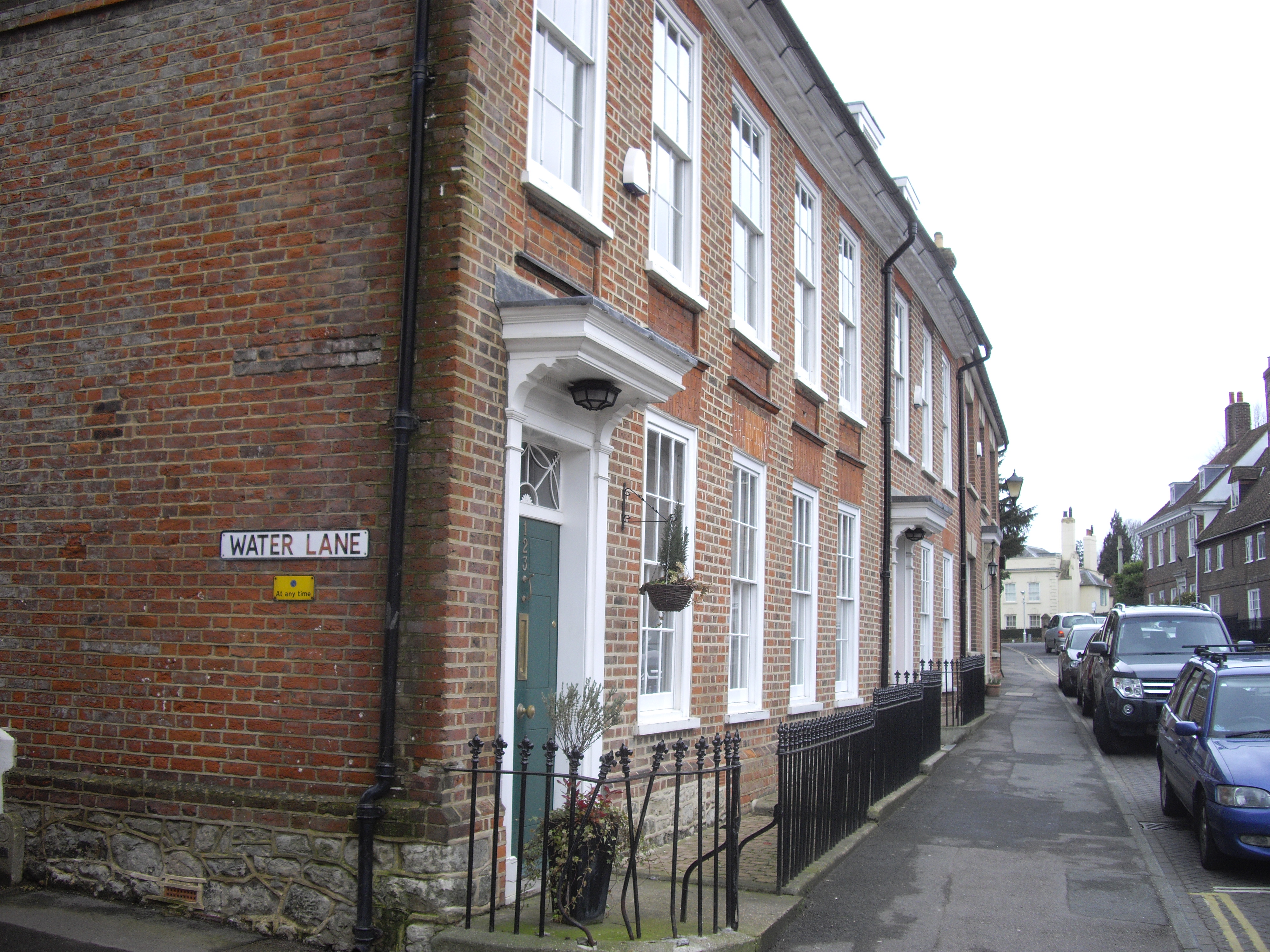
The town of West Malling is known for its rich history, with evidence of human settlement dating back to the Neolithic period. It was an important market town during the medieval period and features several well-preserved historic buildings. One notable landmark is St. Mary's Abbey, a former Benedictine abbey founded in the 11th century.

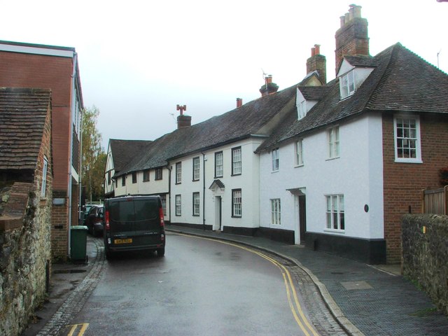
Today, West Malling is a thriving community with a mix of residential, commercial, and retail areas. The town center offers a variety of shops, restaurants, and cafes, catering to both locals and visitors. It is also home to a weekly market where local produce and goods can be purchased.

The parish benefits from its strategic location, with good transport links to London and other major towns in Kent. West Malling railway station provides regular services to London Victoria and Maidstone, making it an attractive place for commuters.

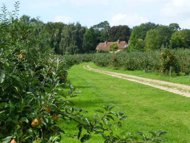
The area surrounding West Malling is characterized by its picturesque countryside, offering ample opportunities for outdoor activities such as walking and cycling. There are also several parks and green spaces within the parish, providing residents with places to relax and enjoy nature.

Overall, West Malling is a charming and historic parish, offering a mix of heritage, modern amenities, and natural beauty.

If you have any feedback on the listing, please let us know in the comments section below.

West Malling Images

Images are sourced within 2km of 51.288967/0.402848 or Grid Reference TQ6757. Thanks to Geograph Open Source API. All images are credited.

West Malling by-pass and cycle path A well designed cycle path beside the A228 just before the main entrance into the Kings Hill estate.
West Malling by-pass and cycle path
A well designed cycle path beside the A228 just before the main entrance into the Kings Hill estate.
Footpath through orchard from Broadwater Lane
Footpath through an orchard from Lavenders Lane to Broadwater road
Water Lane West Malling Just before its junction with the High Street
Water Lane West Malling
Just before its junction with the High Street
The Rising Sun, East Malling
Blacklands, East Malling
Clare Lane, East Malling
Broadwater Road, East Malling
Swan Street, West Malling
Lobster Pot, West Malling
Police Station Road, West Malling
Swan Street, West Malling
High Street, West Malling
King Street, West Malling
Ryarsh Lane, West Malling
The Bull, West Malling
Town Hill, West Malling
Show me another place!

West Malling is located at Grid Ref: TQ6757 (Lat: 51.288967, Lng: 0.402848)

Administrative County: Kent

District: Tonbridge and Malling

Police Authority: Kent

What 3 Words

///opposites.laptop.remove. Near West Malling, Kent

Related Wikis

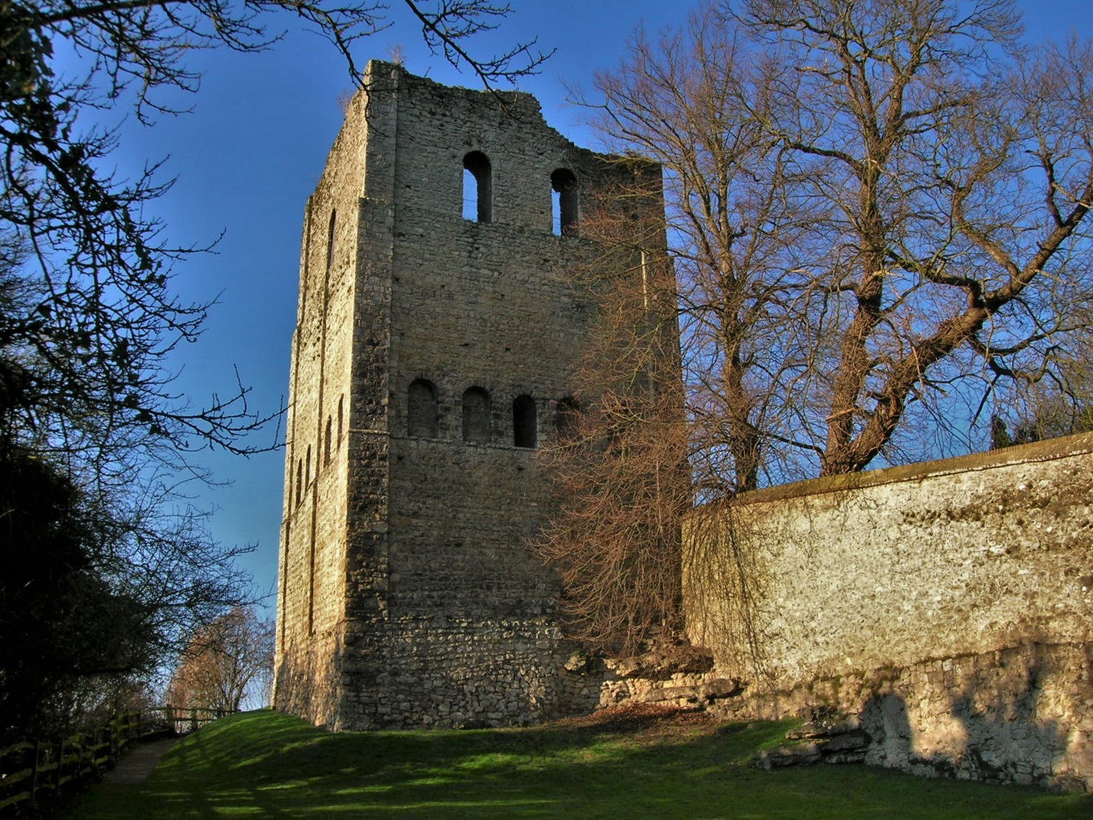
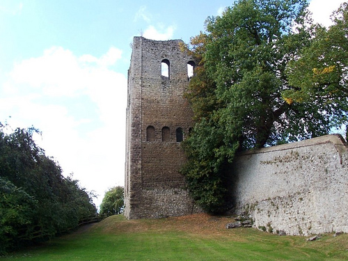
St Leonard's Tower, West Malling

St Leonard's Tower is a probable Norman keep in West Malling, in the county of Kent, England. The tower was probably built by Gundulf, the Bishop of Rochester...

Manor Park Country Park

Manor Park Country Park is a country park in West Malling, Kent, England. The 52-acre (210,000 m2) park, formerly the private gardens of the nearby Douces...

Malling Rural District

Malling was a rural district in Kent, England which covered West Malling, East Malling, Snodland, Larkfield, Borough Green and Aylesford. From after the...

St Augustine's College of Theology

St Augustine's College of Theology is a non-residential Anglican theological college in the Southeast of England. Founded in 1994 as the South East Institute...

Old County Ground

The Old County Ground is cricket ground, located at West Malling, historically called Town Malling, in the English county of Kent. It is known to have...

Malling Abbey

St Mary's Abbey, also known as Malling Abbey, is an abbey of Anglican Benedictine nuns located in West Malling, Kent, England. It was founded around 1090...

West Malling

West Malling ( MAW-ling, historically Town Malling) is a market town in the Tonbridge and Malling district of Kent, England. It has a population of 2,590...

West Malling railway station

West Malling railway station (sometimes shown as West Malling for Kings Hill) lies to the east of West Malling, Kent, England, and is close to Kings Hill...

Nearby Amenities

Located within 500m of 51.288967,0.402848
Pub
The Scared Crow
Cuisine: mexican
Lat/Long: 51.2931716/0.4031319
Turning Circle
Lat/Long: 51.292619/0.4005822
Bus Stop
Public Transport: platform
Lat/Long: 51.2926332/0.4020708
Post Box
Postal Code: ME19
Ref: ME19 123
Lat/Long: 51.2872026/0.4021226
Bus Stop
Naptan AtcoCode: 2400A000120A
Naptan NaptanCode: kntadjpa
Public Transport: platform
Lat/Long: 51.2868881/0.4019514
Post Box
Operator: Royal Mail
Post Box Type: wall
Ref: ME19 171
Royal Cypher: VR
Royal Cypher Wikidata: Q33102356
Lat/Long: 51.2905357/0.3976875
Bus Stop
Manor Park Country Park
Bus: yes
Naptan AtcoCode: 2400A000070A
Naptan Bearing: NE
Naptan CommonName: Manor Park Country Park
Naptan Indicator: opp
Naptan Landmark: O\S Douces Manor
Naptan NaptanCode: kntadjmg
Naptan Street: St Leonards Street
Naptan Verified: no
Public Transport: platform
Shelter: no
Source: naptan_import
Lat/Long: 51.2898096/0.4049292
Bus Stop
St Leonards Street
Naptan AtcoCode: 2400A000120A
Naptan Bearing: SW
Naptan CommonName: St Leonards Street
Naptan Indicator: SW-bound
Naptan Landmark: O\S Chestnuts
Naptan NaptanCode: kntadjpa
Naptan Street: St Leonards Street
Naptan Verified: no
Public Transport: platform
Source: naptan_import
Lat/Long: 51.2868588/0.4019065
Bus Stop
Offham Road
Naptan AtcoCode: 2400A000590A
Naptan Bearing: SW
Naptan CommonName: Offham Road
Naptan Indicator: SW-bound
Naptan Landmark: Fartherwell Avenue
Naptan NaptanCode: kntadmjt
Naptan Street: Offham Road
Naptan Verified: no
Public Transport: platform
Source: naptan_import
Lat/Long: 51.292726/0.4021841
Bus Stop
Offham Road
Flag: no
Naptan AtcoCode: 2400A000600A
Naptan Bearing: NE
Naptan BusStopType: CUS
Naptan CommonName: Offham Road
Naptan Indicator: NE-bound
Naptan Landmark: Fartherwell Avenue
Naptan NaptanCode: kntadmjw
Naptan Street: Offham Road
Naptan Verified: no
Public Transport: platform
Source: naptan_import
Lat/Long: 51.2928793/0.4021634
Parking
Capacity: 2
Parking: surface
Lat/Long: 51.2881316/0.4025432
Bicycle Parking
Lat/Long: 51.2880755/0.4060696
Tourism: information
Lat/Long: 51.2882203/0.402612
Cafe
The Green Cafe
Cuisine: sandwich
Lat/Long: 51.2878444/0.4066588
Generator Method: photovoltaic
Generator Output Electricity: yes
Generator Source: solar
Generator Type: solar_photovoltaic_panel
Location: roof
Power: generator
Lat/Long: 51.2913131/0.4015294
Generator Method: photovoltaic
Generator Output Electricity: yes
Generator Source: solar
Generator Type: solar_photovoltaic_panel
Location: roof
Power: generator
Lat/Long: 51.291381/0.4017667
Generator Method: photovoltaic
Generator Output Electricity: yes
Generator Source: solar
Generator Type: solar_photovoltaic_panel
Location: roof
Power: generator
Lat/Long: 51.2921383/0.400883
Generator Method: photovoltaic
Generator Output Electricity: yes
Generator Source: solar
Generator Type: solar_photovoltaic_panel
Location: roof
Power: generator
Lat/Long: 51.2870306/0.4008266
The data included in this document is from www.openstreetmap.org. The data is made available under ODbL.

Have you been to West Malling?

Leave your review of West Malling below (or comments, questions and feedback).