Wadworth

Civil Parish in Yorkshire Doncaster

England

Wadworth

Old milestone At the southern end of the hamlet of Wilsic by a wooden post is this old stone, ivy-covered in January 2020.   It was set up about 1750 by Thomas Watson-Wentworth, the first Marquis of Rockingham.  It is one of only two remaining on this route from his home at Wentworth Woodhouse to Blyth and the Great North Road. This is at 13 miles from Wentworth. Passing it next time there will be secateurs in hand to clear the vegetation.  The 11 mile stone is in the wall surrounding Crookhill Golf Course in Conisbrough, SK5271 9742.
Old milestone Credit: Chris Minto

Wadworth is a civil parish located in the county of Yorkshire, England. Situated approximately five miles south of Doncaster, it is part of the Metropolitan Borough of Doncaster. The parish covers an area of around 8 square miles and has a population of around 600 residents.

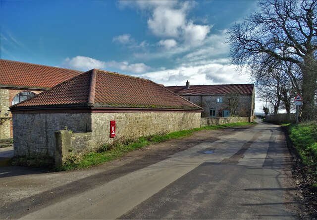
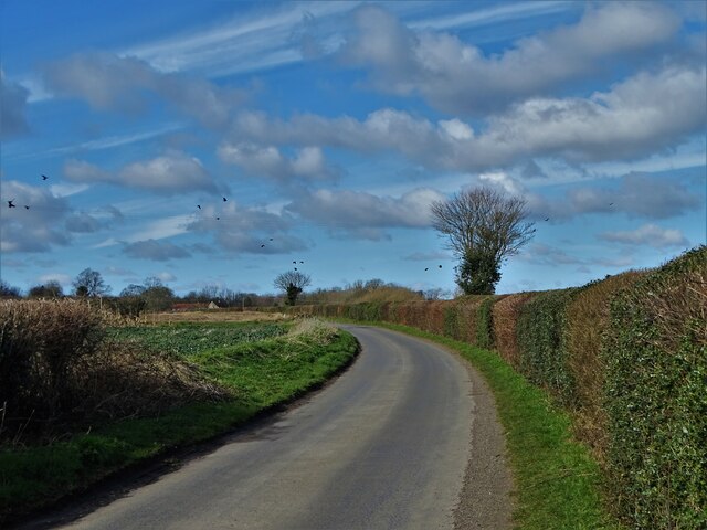
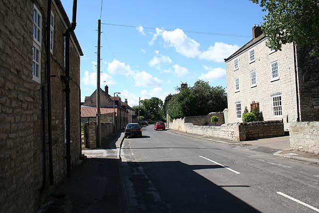
The village of Wadworth is known for its beautiful rural setting, with picturesque countryside views and a peaceful atmosphere. It is surrounded by farmland and open fields, making it an ideal location for those seeking a quiet and idyllic lifestyle. The area is also characterized by its traditional stone-built houses and charming cottages, adding to its charm and character.

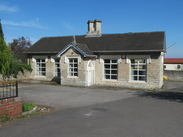
Despite its small size, Wadworth offers a range of amenities and facilities for its residents. These include a primary school, a village hall, and a local pub, which serves as a community hub. The village is well-connected to the surrounding areas through a network of roads, making it easy for residents to access nearby towns and cities.

For outdoor enthusiasts, Wadworth offers plenty of opportunities for leisure activities. The surrounding countryside provides ample space for walking, cycling, and horse riding. The nearby River Torne also offers fishing opportunities for those interested in angling.

Overall, Wadworth is a picturesque and peaceful civil parish, offering a rural lifestyle with access to necessary amenities. Its beautiful surroundings and community-oriented atmosphere make it an attractive place to live for those seeking a tranquil and close-knit community.

If you have any feedback on the listing, please let us know in the comments section below.
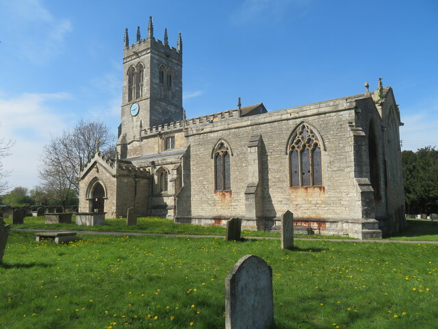
Wadworth Images

Images are sourced within 2km of 53.47021/-1.141109 or Grid Reference SK5797. Thanks to Geograph Open Source API. All images are credited.

Old milestone At the southern end of the hamlet of Wilsic by a wooden post is this old stone, ivy-covered in January 2020.   It was set up about 1750 by Thomas Watson-Wentworth, the first Marquis of Rockingham.  It is one of only two remaining on this route from his home at Wentworth Woodhouse to Blyth and the Great North Road. This is at 13 miles from Wentworth. Passing it next time there will be secateurs in hand to clear the vegetation.  The 11 mile stone is in the wall surrounding Crookhill Golf Course in Conisbrough, SK5271 9742.
Old milestone
At the southern end of the hamlet of Wilsic by a wooden post is this old stone, ivy-covered in January 2020. It was set up about 1750 by Thomas Watson-Wentworth, the first Marquis of Rockingham. It is one of only two remaining on this route from his home at Wentworth Woodhouse to Blyth and the Great North Road. This is at 13 miles from Wentworth. Passing it next time there will be secateurs in hand to clear the vegetation. The 11 mile stone is in the wall surrounding Crookhill Golf Course in Conisbrough, SK5271 9742.
By Home Farm, Wilsic Wilsic is a very small village but it boasts a special school that caters for children with autism  and other complex needs.
By Home Farm, Wilsic
Wilsic is a very small village but it boasts a special school that caters for children with autism and other complex needs.
On Wilsic Lane heading to Wilsic
Church of St John the Baptist A large church in what would have been a small village in medieval times. The church is described across almost two full pages of the Pevsner/Harman guide to this part of the old West Riding, but entry on this occasion was barred by locked gates.
Church of St John the Baptist
A large church in what would have been a small village in medieval times. The church is described across almost two full pages of the Pevsner/Harman guide to this part of the old West Riding, but entry on this occasion was barred by locked gates.
Wadworth Hall Only the upper floors of this mid 18th century house are visible from the road, but it is described by Pevsner/Harman as 'A gracious house of no great size but nevertheless one of James Paine's most dramatic designs'.
Wadworth Hall
Only the upper floors of this mid 18th century house are visible from the road, but it is described by Pevsner/Harman as 'A gracious house of no great size but nevertheless one of James Paine's most dramatic designs'.
East Lodge, Wadworth Hall Like the hall itself, the lodges either side of the gateway are part hidden behind trees and hedges, so details are obscured. The lodges are of a similar age to the hall, whilst the door surrounds are described by Harman/Pevsner as rather in the style of Vanbrugh.
East Lodge, Wadworth Hall
Like the hall itself, the lodges either side of the gateway are part hidden behind trees and hedges, so details are obscured. The lodges are of a similar age to the hall, whilst the door surrounds are described by Harman/Pevsner as rather in the style of Vanbrugh.
Former school, Wadworth There's a date of 1840 over the porch and the building is shown as a school on the OS 25" map of 1892.
Former school, Wadworth
There's a date of 1840 over the porch and the building is shown as a school on the OS 25" map of 1892.
Church of St John the Baptist Grade I listed parish church dating from the 12th century
Church of St John the Baptist
Grade I listed parish church dating from the 12th century
Church of St John the Baptist Grade I listed parish church dating from the 12th century
Church of St John the Baptist
Grade I listed parish church dating from the 12th century
Wadworth village sign On the B6094 Church Road approach to the village.
Wadworth village sign
On the B6094 Church Road approach to the village.
Boundary fence Beside the public footpath to the west of Wilsic.
Boundary fence
Beside the public footpath to the west of Wilsic.
A glimpse of Wilsic Hall School The hedged boundary provides privacy for this special school.
A glimpse of Wilsic Hall School
The hedged boundary provides privacy for this special school.
Private reservoir near Wilsic Possibly constructed to provide irrigation to the surrounding fields.
Private reservoir near Wilsic
Possibly constructed to provide irrigation to the surrounding fields.
Paddock Lane A bridleway to the west of Wadworth
Paddock Lane
A bridleway to the west of Wadworth
Flooded area in Wadworth Wood
Logpiles beside a track in Wadworth Wood
Logpile in Wadworth Wood
Fallen tree in Wadworth Wood
Show me another place!

Wadworth is located at Grid Ref: SK5797 (Lat: 53.47021, Lng: -1.141109)

Division: West Riding

Administrative County: South Yorkshire

District: Doncaster

Police Authority: South Yorkshire

What 3 Words

///panthers.plankton.blacken. Near Wadworth, South Yorkshire

Related Wikis

Wadworth

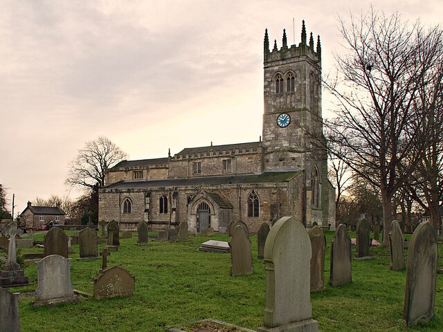
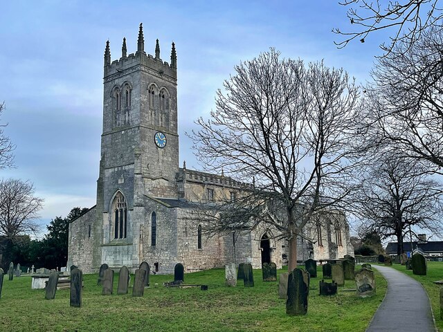
Wadworth is a village and civil parish in the City of Doncaster in South Yorkshire, England. The parish had a population of 1,137 at the 2011 Census, a...
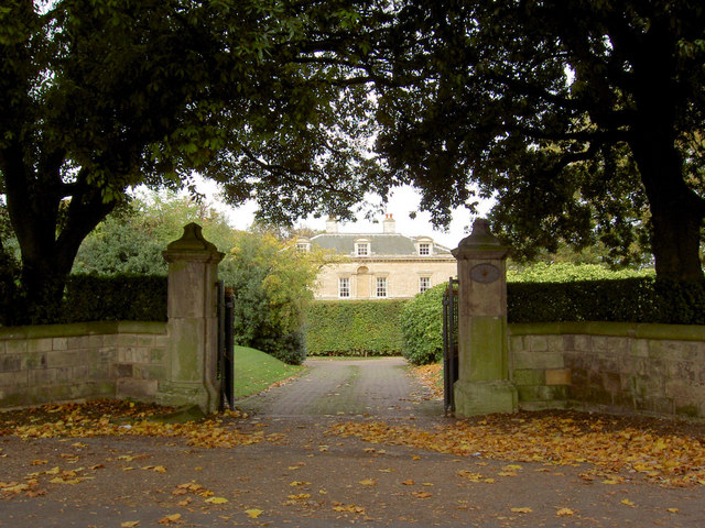
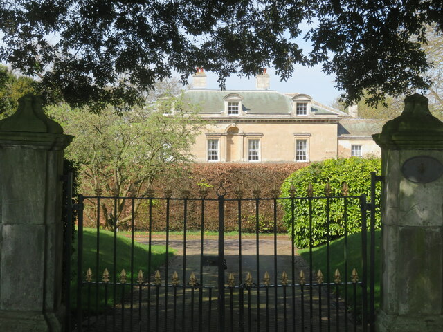
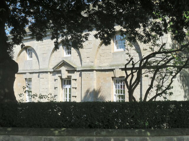
Wadworth Hall

Wadworth Hall is a grade I listed Manor House, in the village of Wadworth (near Doncaster), England. It was built in 1749 for the Wordsworth family by...

Loversall

Loversall is a village and civil parish in the Metropolitan Borough of Doncaster in South Yorkshire, England. It has a population of 128, increasing to...

Tickhill and Wadworth railway station

Tickhill and Wadworth railway station, originally simply known as Tickhill, was located where the road linking the town of Tickhill and the village of...

Don Valley (UK Parliament constituency)

Don Valley is a constituency in South Yorkshire represented in the House of Commons of the UK Parliament since 2019 by Nick Fletcher of the Conservative...

Doncaster iPort

Doncaster iPort or Doncaster Inland Port is an intermodal rail terminal; a Strategic Rail Freight Interchange, under construction in Rossington, Doncaster...

St Catherine's Hospital, Doncaster

St Catherine's Hospital was a mental healthcare hospital located in Doncaster, South Yorkshire, England, approximately three miles (4.8 km) from its centre...

Edlington

Edlington is a town and civil parish in the City of Doncaster, South Yorkshire, England, lying to the south west of Doncaster and Warmsworth. It has a...

Nearby Amenities

Located within 500m of 53.47021,-1.141109
Bus Stop
Main Street/Ratten Row
Alt Name: Main Street/Ratten Row
Naptan AltCommonName: Main Street/Ratten Row
Naptan AtcoCode: 370040187
Naptan Bearing: N
Naptan CommonName: Main Street/Ratten Row
Naptan Indicator: 40187
Naptan Landmark: 40187
Naptan PlusbusZoneRef: ROTHCEN
Naptan Street: Main Street
Naptan Verified: no
Source: naptan_import
Lat/Long: 53.4673689/-1.1425205
Bus Stop
Wadworth Hill/Rockcliffe Drive
Naptan AtcoCode: 370040191
Naptan Bearing: S
Naptan CommonName: Wadworth Hill/Rockcliffe Drive
Naptan Indicator: 40191
Naptan Landmark: A1m
Naptan PlusbusZoneRef: ROTHCEN
Naptan Street: Wadworth Hill
Naptan Verified: no
Source: naptan_import
Lat/Long: 53.4698829/-1.1427996
Bus Stop
Wadworth Hill/Rockcliffe Drive
Naptan AtcoCode: 370045216
Naptan Bearing: N
Naptan CommonName: Wadworth Hill/Rockcliffe Drive
Naptan Indicator: 45216
Naptan Landmark: A1m
Naptan PlusbusZoneRef: ROTHCEN
Naptan Street: Wadworth Hill
Naptan Verified: no
Shelter: yes
Source: naptan_import
Lat/Long: 53.470459/-1.1429085
Church Road/Main Street
Naptan AtcoCode: 370046068
Naptan Bearing: W
Naptan BusStopType: CUS
Naptan CommonName: Church Road/Main Street
Naptan Indicator: 46068
Naptan Landmark: 46068
Naptan PlusbusZoneRef: ROTHCEN
Naptan Street: Church Road
Naptan Verified: no
Source: naptan_import
Lat/Long: 53.4659219/-1.1432409
Church Road/Main Street
Naptan AtcoCode: 370046069
Naptan Bearing: E
Naptan BusStopType: CUS
Naptan CommonName: Church Road/Main Street
Naptan Indicator: 46069
Naptan Landmark: 46069
Naptan PlusbusZoneRef: ROTHCEN
Naptan Street: Church Road
Naptan Verified: no
Source: naptan_import
Lat/Long: 53.4660745/-1.1432077
Bus Stop
Main Street/Church Road
Alt Name: Main Street/Church Road
Naptan AltCommonName: Main Street/Church Road
Naptan AtcoCode: 370045544
Naptan Bearing: N
Naptan CommonName: Main Street/Church Road
Naptan Indicator: 45544
Naptan Landmark: Post Office
Naptan PlusbusZoneRef: ROTHCEN
Naptan Street: Main Street
Naptan Verified: no
Shelter: yes
Source: naptan_import
Lat/Long: 53.4669521/-1.1427381
Phone
Check Date: 2022-08-19
Emergency: phone
Ref: 9104 B
Lat/Long: 53.4691823/-1.1362606
Phone
Check Date: 2023-12-31
Emergency: phone
Ref: 9104 A
Lat/Long: 53.4690331/-1.1366113
Power: pole
Lat/Long: 53.4731269/-1.1413806
Power: pole
Lat/Long: 53.4735348/-1.1399872
Power: pole
Lat/Long: 53.4739451/-1.1385634
Post Box
Collection Times: Mo-Fr 16:00; Sa 10:45; Su off
Drive Through: no
Operator: Royal Mail
Post Box Type: pillar
Ref: DN11 110
Royal Cypher: EIIR
Royal Cypher Wikidata: Q33102113
Source: survey
Lat/Long: 53.4671055/-1.1424051
Bella
Clothes: women
Shop: clothes
Source: survey
Lat/Long: 53.4671342/-1.1423515
News, Food & Wine
Shop: convenience
Source: survey
Lat/Long: 53.4671941/-1.1423568
Picture It of Wadworth
Shop: frame
Source: survey
Lat/Long: 53.4670919/-1.1423475
Pub
White Hart
Lat/Long: 53.467515/-1.1423213
Booth: K6
Man Made: telephone_box
Lat/Long: 53.4674088/-1.1423683
Post Office
Wadworth Post Office
Addr City: Doncaster
Addr Country: GB
Addr Housename: The White Hart
Addr Postcode: DN11 9AZ
Addr Street: Main Street
Addr Suburb: Edlington
Brand: Post Office
Brand Wikidata: Q1783168
Check Date: 2022-05-27
Contact Website: https://www.postoffice.co.uk/branch-finder/2844710/wadworth
Opening Hours: Mo 13:00-16:30; Fr 12:00-15:00
Ref Pol Id: 129203
Lat/Long: 53.4675184/-1.1423258
The data included in this document is from www.openstreetmap.org. The data is made available under ODbL.

Have you been to Wadworth?

Leave your review of Wadworth below (or comments, questions and feedback).