Waddington

Civil Parish in Lincolnshire North Kesteven

England

Waddington

Roadway to Lowfields Farm
Roadway to Lowfields Farm Credit: Jonathan Thacker

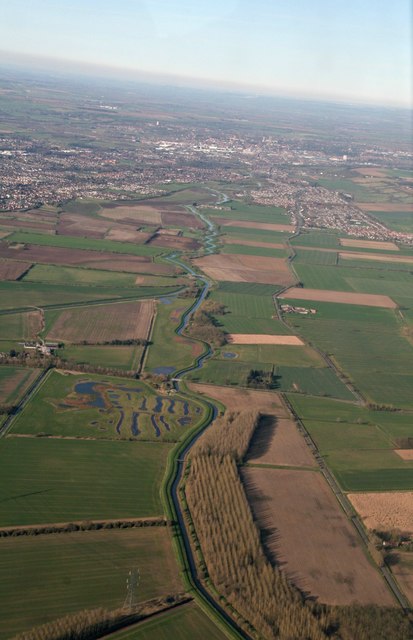
Waddington is a civil parish located in the North Kesteven district of the county of Lincolnshire, England. Situated approximately 4 miles south of the city of Lincoln, it covers an area of about 4.7 square miles and has a population of around 5,000 residents.

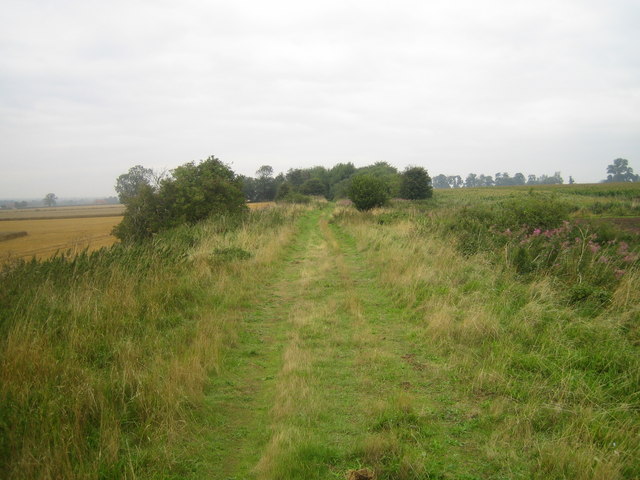
The village of Waddington has a long and rich history, dating back to Roman times. It is known for its picturesque setting, with beautiful countryside surrounding the village. The River Witham flows nearby, adding to the natural beauty and providing opportunities for outdoor activities such as fishing and boating.

Waddington is well-connected to nearby towns and cities via road and rail networks. The A15 road runs through the village, connecting it to Lincoln and other major towns in the region. The village also benefits from a train station located on the Nottingham to Lincoln line, providing convenient transport links for residents and visitors.

The parish has a range of amenities and services to cater to the needs of its residents. These include shops, pubs, restaurants, and a post office. There are also several schools in the area, ensuring that educational needs are met.

Waddington is home to the Royal Air Force base, RAF Waddington, which plays a significant role in the defense and security of the country. The base is the hub of UK Intelligence, Surveillance, Target Acquisition, and Reconnaissance (ISTAR) capabilities, making it an important strategic asset.

Overall, Waddington offers a peaceful and attractive place to live, with a strong sense of community and access to a range of amenities and services. Its rich history and natural surroundings make it an appealing destination for visitors as well.

If you have any feedback on the listing, please let us know in the comments section below.

Waddington Images

Images are sourced within 2km of 53.168386/-0.566229 or Grid Reference SK9564. Thanks to Geograph Open Source API. All images are credited.

Roadway to Lowfields Farm
Signpost by a catchwater drain, North Hykeham A signpost indicating the direction of public footpaths rises above burnet-saxifrage wildflowers, looking northwestwards along the banks of a catchwater drain by the eastern suburbs of North Hykeham.

This photograph was taken on a cool morning in mid-May. For just over a kilometre the catchwater drain (here running parallel to the fences) marks the boundary between North Hykeham's eastern suburbs and the undeveloped floodplain of the River Witham. The estate on the right is primarily composed of bungalows and has no direct access to this walkway.

The footpath from which this image was taken is part of a network of local routes maintained by the Hill Holt Wood charity, as indicated by the lower 'Stepping Out' pair of signs. From this point southwards the path changes from wide and flat to narrow and uneven, and while admiring the view across the Witham floodplain one must take care not to lose one's footing.

For the same view fifteen years earlier, please see <a href="https://www.geograph.org.uk/photo/682240">SK9566 : Lowfields walk</a> by Richard Croft.
Signpost by a catchwater drain, North Hykeham
A signpost indicating the direction of public footpaths rises above burnet-saxifrage wildflowers, looking northwestwards along the banks of a catchwater drain by the eastern suburbs of North Hykeham. This photograph was taken on a cool morning in mid-May. For just over a kilometre the catchwater drain (here running parallel to the fences) marks the boundary between North Hykeham's eastern suburbs and the undeveloped floodplain of the River Witham. The estate on the right is primarily composed of bungalows and has no direct access to this walkway. The footpath from which this image was taken is part of a network of local routes maintained by the Hill Holt Wood charity, as indicated by the lower 'Stepping Out' pair of signs. From this point southwards the path changes from wide and flat to narrow and uneven, and while admiring the view across the Witham floodplain one must take care not to lose one's footing. For the same view fifteen years earlier, please see SK9566 : Lowfields walk by Richard Croft.
Footpath towards new houses, North Hykeham A public footpath cuts through the site of a housing estate under construction, looking northeastwards towards the East Village estate on Cleveland Avenue, the latest addition to North Hykeham's ever-expanding southern suburbs.

This photograph was taken on a warm morning in late May. There is perhaps nothing more geographically representative of this corner of North Hykeham than fields being consumed by new housing estates, and beyond the metal fencing on both sides of the path sits the next lot of land primed to meet the insatiable demand for housing nationwide.

This being the first day of a Bank Holiday weekend the site was deserted of workers, and with many of the new 'luxury houses' in frame still vacant the estate was eerily quiet for such a pleasant Saturday morning. There was once a distant eastwards view across the River Witham towards the village of Waddington from this path, but this is now partially obscured by the fencing.
Footpath towards new houses, North Hykeham
A public footpath cuts through the site of a housing estate under construction, looking northeastwards towards the East Village estate on Cleveland Avenue, the latest addition to North Hykeham's ever-expanding southern suburbs. This photograph was taken on a warm morning in late May. There is perhaps nothing more geographically representative of this corner of North Hykeham than fields being consumed by new housing estates, and beyond the metal fencing on both sides of the path sits the next lot of land primed to meet the insatiable demand for housing nationwide. This being the first day of a Bank Holiday weekend the site was deserted of workers, and with many of the new 'luxury houses' in frame still vacant the estate was eerily quiet for such a pleasant Saturday morning. There was once a distant eastwards view across the River Witham towards the village of Waddington from this path, but this is now partially obscured by the fencing.
Wheat field near Waddington
Barley field near Waddington On the scarp of the Lincoln Edge.
Barley field near Waddington
On the scarp of the Lincoln Edge.
Allotments near Waddington Caught in a rain shower.
Allotments near Waddington
Caught in a rain shower.
Waddington Old Village Store Most of the shops in Waddington are at the east end of Bar Lane. This one is at the other end of the street closer to the original village centre.
Waddington Old Village Store
Most of the shops in Waddington are at the east end of Bar Lane. This one is at the other end of the street closer to the original village centre.
Waddington Community Hub and Parish Office The place to go for help and information.
Waddington Community Hub and Parish Office
The place to go for help and information.
Waddington Village Clock A memorial to members of 463 and 467 Squadrons of the Royal Australian Air Force who served and died with No.5 Group RAF Bomber Command.
Waddington Village Clock
A memorial to members of 463 and 467 Squadrons of the Royal Australian Air Force who served and died with No.5 Group RAF Bomber Command.
Worsdell's Mill Just part of the shell of the building remains, all equipment and internal features have gone.
Worsdell's Mill
Just part of the shell of the building remains, all equipment and internal features have gone.
Field edge near Worsdell's Mill The buildings are associated with the former windmill.
Field edge near Worsdell's Mill
The buildings are associated with the former windmill.
The different ages of straw Some still standing, some baled last year and some baled recently. Green Farm, Waddington.
The different ages of straw
Some still standing, some baled last year and some baled recently. Green Farm, Waddington.
Junction to A607 from RAF Waddington  Lincoln is to the right.
Junction to A607 from RAF Waddington
Lincoln is to the right.
Worsdell's Mill, Waddington Built in 1820, this replaced a post mill. It worked until c.1908 and then was left to become derelict. The two remaining sails were removed in 1927 and the upper part of the tower was pulled down early in the war because of its proximity to an airfield. It now stands disused as a derelict shell. There were four patent sails driving three pairs of stones, two grey and one French.
Worsdell's Mill, Waddington
Built in 1820, this replaced a post mill. It worked until c.1908 and then was left to become derelict. The two remaining sails were removed in 1927 and the upper part of the tower was pulled down early in the war because of its proximity to an airfield. It now stands disused as a derelict shell. There were four patent sails driving three pairs of stones, two grey and one French.
Disused railway, the Cliff, Cliff villages from Harmston to Bracebridge Heath: aerial 2017 See also <a href="https://www.geograph.org.uk/gridref/SK9762">SK9762</a>.
Disused railway, the Cliff, Cliff villages from Harmston to Bracebridge Heath: aerial 2017
See also SK9762.
Confluence of Rivers Brant and Witham south of Lincoln: aerial 2017
Drain off Meadow Lane A new plantation (Pan's Coppice) on the left.
Drain off Meadow Lane
A new plantation (Pan's Coppice) on the left.
Drain alongside the River Witham The River Witham is beyond the high bank.
Drain alongside the River Witham
The River Witham is beyond the high bank.
Show me another place!

Waddington is located at Grid Ref: SK9564 (Lat: 53.168386, Lng: -0.566229)

Administrative County: Lincolnshire

District: North Kesteven

Police Authority: Lincolnshire

What 3 Words

///disprove.sofa.workroom. Near Waddington, Lincolnshire

Related Wikis

River Brant

The River Brant is a 14 mi-long (23 km) tributary of the River Witham that flows entirely in the county of Lincolnshire, in the east of England. In 1855...

Waddington railway station

Waddington railway station was a station in Waddington, Lincolnshire which opened on 15 April 1867 but closed for passengers on 10 September 1962 and for...

Waddington, Lincolnshire

Waddington is a village and civil parish in the North Kesteven district of Lincolnshire, England, situated approximately 4 miles (6 km) south of Lincoln...

North Hykeham Priory

North Hykeham Priory was a priory in Lincolnshire, England. This priory is only mentioned in the Patent Roll of Edward IV, 1462, when it was granted to...

Hykeham

Hykeham is a southern suburb of Lincoln, Lincolnshire in England. It is served by Hykeham railway station.

Harmston railway station

Harmston railway station was a station in Harmston, Lincolnshire on the Grantham and Lincoln railway line. It closed in 1962 but the line remained open...

North Hykeham

North Hykeham is a town and civil parish in the North Kesteven district, in the county of Lincolnshire, England. It forms part of the Lincoln Urban Area...

South Hykeham

South Hykeham is a village and civil parish in the North Kesteven district of Lincolnshire, England. The population of the civil parish at the 2011 census...

Nearby Amenities

Located within 500m of 53.168386,-0.566229
Waddington Low Fields
Place: locality
Source: Bing
Lat/Long: 53.1716147/-0.5620307
Note: Proposed Toucan Crossing
Lat/Long: 53.1673986/-0.5712757
The data included in this document is from www.openstreetmap.org. The data is made available under ODbL.

Have you been to Waddington?

Leave your review of Waddington below (or comments, questions and feedback).