Ulley

Civil Parish in Yorkshire Rotherham

England

Ulley

View from Conduit Trig Point
View from Conduit Trig Point Credit: thejackrustles

Ulley is a civil parish located in the county of Yorkshire, England. Situated in the metropolitan borough of Rotherham, Ulley is a small village surrounded by picturesque countryside. It is located approximately 5 miles east of Rotherham town center.

The village of Ulley is known for its tranquil and idyllic setting, with rolling hills, green fields, and a charming village atmosphere. The community is primarily residential, consisting of a mix of traditional stone-built houses and more modern developments. The village is home to a close-knit community that takes pride in maintaining the area's natural beauty and preserving its historical character.

One of the notable features of Ulley is its picturesque reservoir, which covers an area of around 25 acres. The reservoir is a popular spot for fishing and sailing, attracting enthusiasts from the surrounding areas. Additionally, the reservoir and its surrounding grounds are a haven for wildlife, making it a popular destination for birdwatching and nature enthusiasts.

Ulley also boasts a small but well-maintained village hall, which serves as a hub for community events and gatherings. The village hall hosts a range of activities, including fitness classes, social clubs, and local meetings.

In terms of amenities, Ulley is serviced by a nearby primary school and is within easy reach of the larger towns of Rotherham and Sheffield, offering a wider range of services and amenities. The village is well-connected by road, with easy access to the M1 motorway and nearby rail links.

Overall, Ulley offers a peaceful and picturesque setting, making it an ideal place for those seeking a rural lifestyle within reach of urban amenities.

If you have any feedback on the listing, please let us know in the comments section below.

Ulley Images

Images are sourced within 2km of 53.382576/-1.296344 or Grid Reference SK4687. Thanks to Geograph Open Source API. All images are credited.

View from Conduit Trig Point
Conduit Trig Point Flush Bracket S1845
Old milestone The 4 mile from Rotherham milestone is on the west side of the A618 road.   Unfortunately it is quite damaged with the protruding section lost and toppled over.   It can just be seen in this photo if you look carefully.
Old milestone
The 4 mile from Rotherham milestone is on the west side of the A618 road. Unfortunately it is quite damaged with the protruding section lost and toppled over. It can just be seen in this photo if you look carefully.
Old milestone The photograph <a href="https://www.geograph.org.uk/photo/6126471">SK4587 : Old Milestone by the A618, near Ulley Reservoir</a> was taken by me in 2002 when Rotherham Council had recently painted all their milestones including this damaged one.   Twenty years on, it has been pushed over, perhaps by the verge cutter and is now very rusty. Lack of roadside maintenance means it is hidden unless you know just where to search.   The other 6 West Riding CC milestones on this 7 mile route to the Derbyshire border are all in reasonable condition.
Old milestone
The photograph SK4587 : Old Milestone by the A618, near Ulley Reservoir was taken by me in 2002 when Rotherham Council had recently painted all their milestones including this damaged one. Twenty years on, it has been pushed over, perhaps by the verge cutter and is now very rusty. Lack of roadside maintenance means it is hidden unless you know just where to search. The other 6 West Riding CC milestones on this 7 mile route to the Derbyshire border are all in reasonable condition.
Traffic signs at a road junction The junction of Long Road and Hawk Hill Lane
Traffic signs at a road junction
The junction of Long Road and Hawk Hill Lane
Brampton en le morthen village sign. On the northern edge of the village.
Brampton en le morthen village sign.
On the northern edge of the village.
Ulley Country Park Originally created in the 1870s as a reservoir to supply drinking water for Rotherham, a hundred years later in 1987 it was sold to Rotherham Council for £1 and is now a Country park and wildlife haven.
Ulley Country Park
Originally created in the 1870s as a reservoir to supply drinking water for Rotherham, a hundred years later in 1987 it was sold to Rotherham Council for £1 and is now a Country park and wildlife haven.
Ulley Reservoir Ulley Country park was originally built as a reservoir in the 1870's to provide the town of Rotherham with drinking water.   situated within the South Yorkshire Forest, it is a scenic haven for wildlife 
Weblink <span class="nowrap"><a title="http://www.ulleyweb.co.uk" rel="nofollow ugc noopener" href="http://www.ulleyweb.co.uk">Link</a><img style="margin-left:2px;" alt="External link" title="External link - shift click to open in new window" src="https://s1.geograph.org.uk/img/external.png" width="10" height="10"/></span>
Ulley Reservoir
Ulley Country park was originally built as a reservoir in the 1870's to provide the town of Rotherham with drinking water. situated within the South Yorkshire Forest, it is a scenic haven for wildlife Weblink LinkExternal link
Lake or Sky? The colour of the sky and the lake in this picture match so well that if you turn your head upside down, and ignore the grass growing from the sky, the picture still works.
Lake or Sky?
The colour of the sky and the lake in this picture match so well that if you turn your head upside down, and ignore the grass growing from the sky, the picture still works.
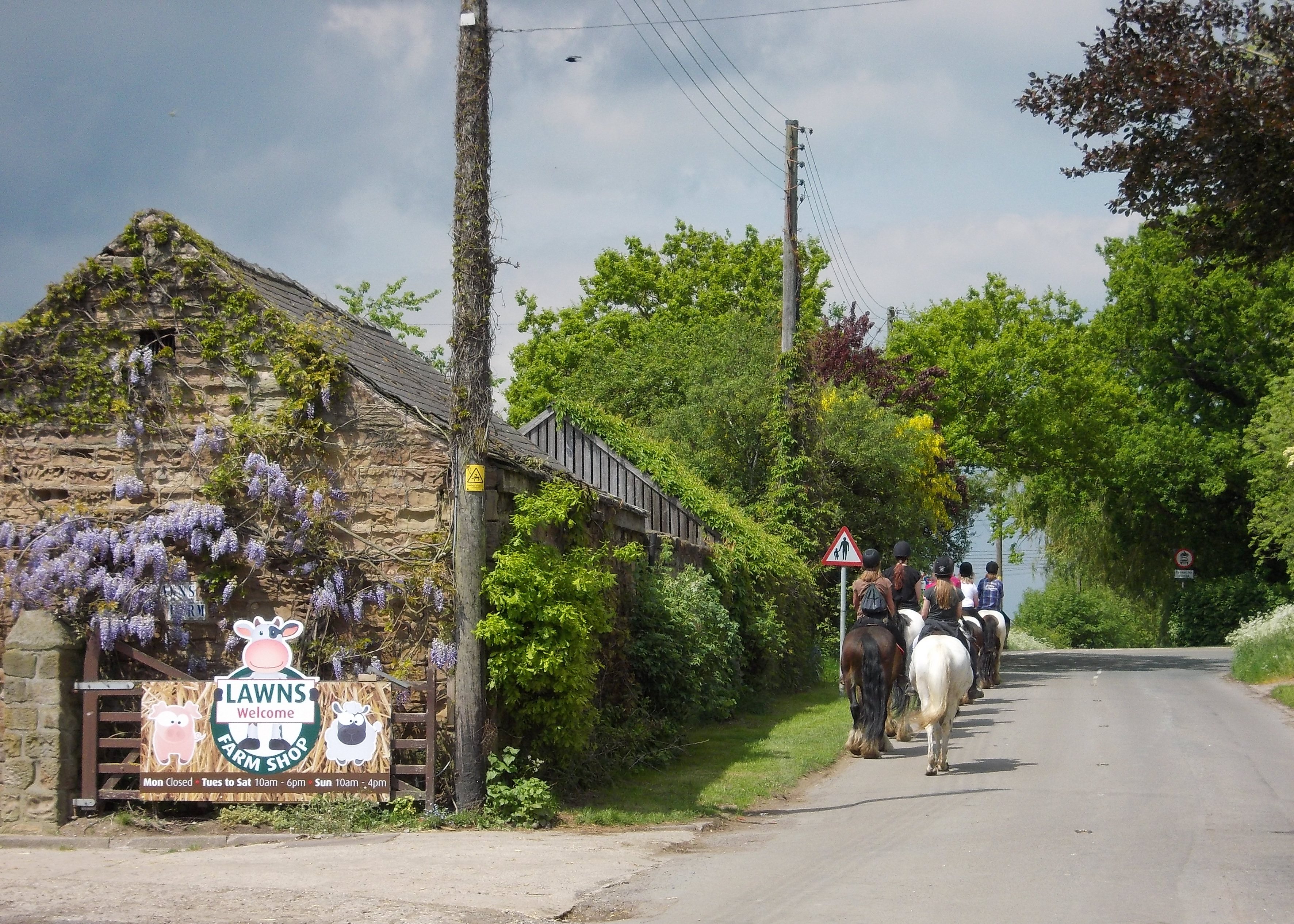
Ulley Lane Ulley Lane climbs steeply up from the stream that feeds the nearby reservoir to the top off the hill where it meets the A618.
Ulley Lane
Ulley Lane climbs steeply up from the stream that feeds the nearby reservoir to the top off the hill where it meets the A618.
Ulley Church Holy Trinity Church in Ulley is located almost exactly centrally in this grid square.
Ulley Church
Holy Trinity Church in Ulley is located almost exactly centrally in this grid square.
Penny Hill Lane Despite its romantic name Penny Hill Lane is now crossed by the M1 at the point where the M18 begins, and ends too I suppose.
Penny Hill Lane
Despite its romantic name Penny Hill Lane is now crossed by the M1 at the point where the M18 begins, and ends too I suppose.
Conduit trig Looking SE from position
Conduit trig
Looking SE from position
Brampton en le Morthen Other than the buildings behind the camera this picture captures almost the entire village of Brampton en le Morthen, including a red K6 phone box.
Brampton en le Morthen
Other than the buildings behind the camera this picture captures almost the entire village of Brampton en le Morthen, including a red K6 phone box.
M1 M18 Triangle The M1 carrying surprisingly little traffic given the time was 8.45 on a Tuesday morning. The M18, in the distance, joins the M1 northbound just around this corner.
M1 M18 Triangle
The M1 carrying surprisingly little traffic given the time was 8.45 on a Tuesday morning. The M18, in the distance, joins the M1 northbound just around this corner.
Kissing Gate Kissing gate access to one of the Rotherham areas Doorstep Walks.
Kissing Gate
Kissing gate access to one of the Rotherham areas Doorstep Walks.
Route 6 to Rotherham This track forms part of Route 6 of the National Cycle Network.  Just around this corner it crosses the M1 over a bridge.
Route 6 to Rotherham
This track forms part of Route 6 of the National Cycle Network. Just around this corner it crosses the M1 over a bridge.
Bridleway to Ulley This bridleway drops steeply from 100 metres down to 70 metres in a valley bottom.  It then climbs back up to Ulley at 100 metres as can be seen on the distant horizon.
Bridleway to Ulley
This bridleway drops steeply from 100 metres down to 70 metres in a valley bottom. It then climbs back up to Ulley at 100 metres as can be seen on the distant horizon.
Show me another place!

Ulley is located at Grid Ref: SK4687 (Lat: 53.382576, Lng: -1.296344)

Division: West Riding

Administrative County: South Yorkshire

District: Rotherham

Police Authority: South Yorkshire

What 3 Words

///cone.employ.circle. Near Ulley, South Yorkshire

Nearby Locations

Ulley Ulley

Related Wikis

Morthen

Morthen is a hamlet in South Yorkshire in England, lying between Brampton-en-le-Morthen and Laughton-en-le-Morthen. The population of the hamlet as taken...

Ulley Reservoir

Ulley Reservoir is a reservoir a few hundred yards to the west and downhill of the village of Ulley, 4 miles (6.4 km) south of Rotherham, South Yorkshire...

Thurcroft Interchange

The Thurcroft Interchange is a large motorway junction in South Yorkshire (the Metropolitan Borough of Rotherham). == History == === M1 === Early designs...

Ulley

Ulley is a village and civil parish of the Metropolitan Borough of Rotherham in South Yorkshire, England. The population of the civil parish as of the...

Nearby Amenities

Located within 500m of 53.382576,-1.296344
Ulley
Place: village
Wikidata: Q2283323
Wikipedia: en:Ulley
Lat/Long: 53.3820936/-1.3014092
Pub
Royal Oak
Addr City: Sheffield
Addr Housenumber: 12
Addr Postcode: S26 3YG
Addr Street: Turnshaw Road
Addr Suburb: Ulley
Fhrs Id: 462331
Lat/Long: 53.3825197/-1.3014624
Bus Stop
Turnshaw Road/Main Street
Alt Name: Turnshaw Road/Main Street
Naptan AltCommonName: Turnshaw Road/Main Street
Naptan AtcoCode: 370030010
Naptan Bearing: N
Naptan CommonName: Turnshaw Road/Main Street
Naptan Indicator: 30010
Naptan Landmark: OUTSIDE ROYAL OAK PUB
Naptan PlusbusZoneRef: ROTHCEN
Naptan Street: Turnshaw Road
Naptan Verified: no
Source: naptan_import
Lat/Long: 53.3824538/-1.3012
Bus Stop
Main Street/Turnshaw Road
Alt Name: Main Street/Turnshaw Road
Naptan AltCommonName: Main Street/Turnshaw Road
Naptan AtcoCode: 370030011
Naptan Bearing: E
Naptan CommonName: Main Street/Turnshaw Road
Naptan Indicator: 30011
Naptan Landmark: PARISH CHURCH
Naptan PlusbusZoneRef: ROTHCEN
Naptan Street: Main Street
Naptan Verified: no
Source: naptan_import
Lat/Long: 53.3827982/-1.3016905
Bus Stop
Ulley/Main Street
Naptan AtcoCode: 370030012
Naptan Bearing: E
Naptan CommonName: Ulley/Main Street
Naptan Indicator: 30012
Naptan Landmark: FARM
Naptan PlusbusZoneRef: ROTHCEN
Naptan Street: Main Street
Naptan Verified: no
Source: naptan_import
Lat/Long: 53.3826907/-1.3032859
Bus Stop
Ulley/Main Street
Naptan AtcoCode: 370030013
Naptan Bearing: SE
Naptan CommonName: Ulley/Main Street
Naptan Indicator: 30013
Naptan Landmark: OPPOSITE HOUSE NUMBER 16
Naptan PlusbusZoneRef: ROTHCEN
Naptan Street: Main Street
Naptan Verified: no
Source: naptan_import
Lat/Long: 53.3828175/-1.3034492
Generator Method: wind_turbine
Generator Source: wind
Generator Type: horizontal_axis
Power: generator
Lat/Long: 53.3825439/-1.2888815
Barrier: stile
Lat/Long: 53.3833235/-1.3031402
Defibrillator
Access: yes
Check Date: 2023-03-09
Defibrillator Location: Free standing. Available 24/7. Outside Ulley Village Hall
Emergency: defibrillator
Indoor: no
Opening Hours: 24/7
Ref GB The Circuit: 20004588-8120-49A6-AD72-AD78008C0CE3
Lat/Long: 53.3826448/-1.3017998
Post Box
Collection Times: Mo-Fr 09:00; Sa 07:00
Post Box Type: wall
Ref: S26 218D
Royal Cypher: EIIR
Royal Cypher Wikidata: Q33102113
Lat/Long: 53.3826686/-1.3020776
Bench
Backrest: no
Lat/Long: 53.3826788/-1.2995065
Public Bookcase
Booth: K6
Covered: booth
Disused Amenity: telephone
Man Made: telephone_box
Public Bookcase Type: phone_box
Lat/Long: 53.3822056/-1.3009479
Bench
Backrest: no
Lat/Long: 53.3826941/-1.2992825
Barrier: hedge
Lat/Long: 53.3796345/-1.2923073
Man Made: flagpole
Lat/Long: 53.3827065/-1.3016617
The data included in this document is from www.openstreetmap.org. The data is made available under ODbL.

Have you been to Ulley?

Leave your review of Ulley below (or comments, questions and feedback).