Uggeshall

Civil Parish in Suffolk East Suffolk

England

Uggeshall

Church of St Margaret, Stoven <span class="nowrap"><a title="https://historicengland.org.uk/listing/the-list/list-entry/1032100?section=official-list-entry" rel="nofollow ugc noopener" href="https://historicengland.org.uk/listing/the-list/list-entry/1032100?section=official-list-entry">Link</a><img style="margin-left:2px;" alt="External link" title="External link - shift click to open in new window" src="https://s1.geograph.org.uk/img/external.png" width="10" height="10"/></span>
Church of St Margaret, Stoven Credit: Sandy Gerrard

Uggeshall is a civil parish located in the county of Suffolk, England. It is situated in the Waveney District, approximately 5 miles southwest of the town of Beccles. The parish covers an area of around 5 square miles and has a population of about 300 residents.

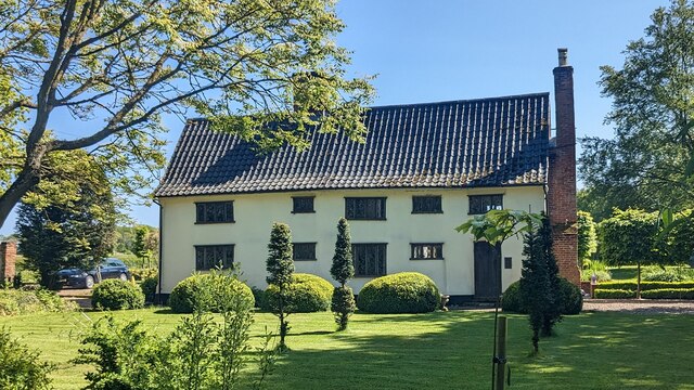
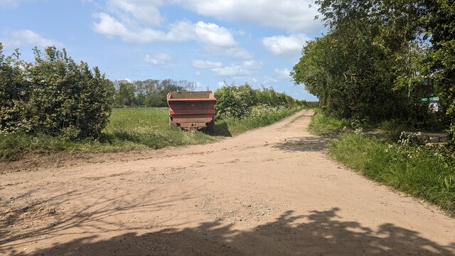
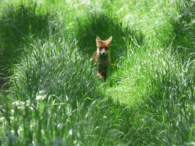
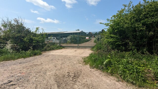
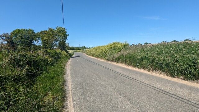
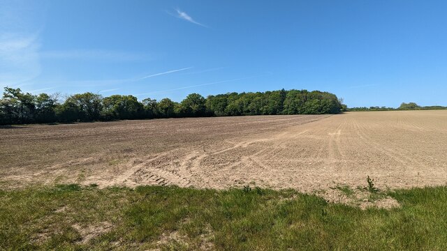
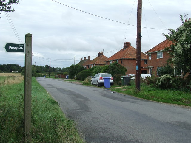
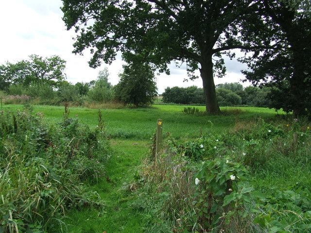
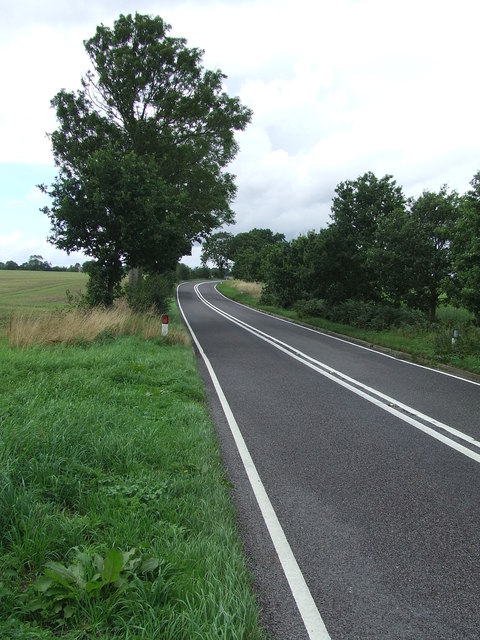
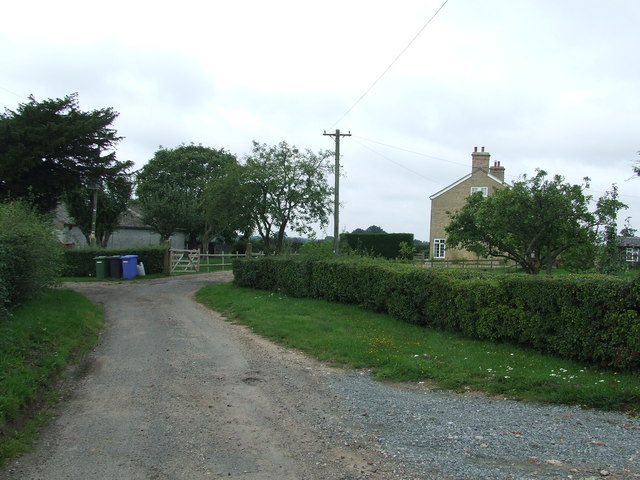
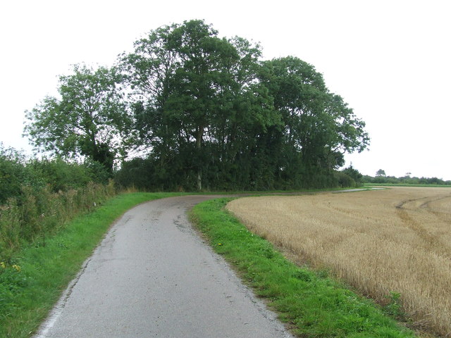
Uggeshall is a predominantly rural area, characterized by open fields, farmland, and scattered residential properties. The landscape is mainly flat, with the presence of several small streams and a few woodlands. The parish is surrounded by other rural communities, such as Brampton, Ringsfield, and Shadingfield.

The history of Uggeshall dates back to medieval times, and the name itself is believed to have Anglo-Saxon origins. The area has seen a long-standing agricultural tradition, with farming being the main economic activity in the parish. Today, agriculture still plays a significant role in the local economy, with crops like wheat, barley, and sugar beet being cultivated in the area.

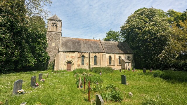
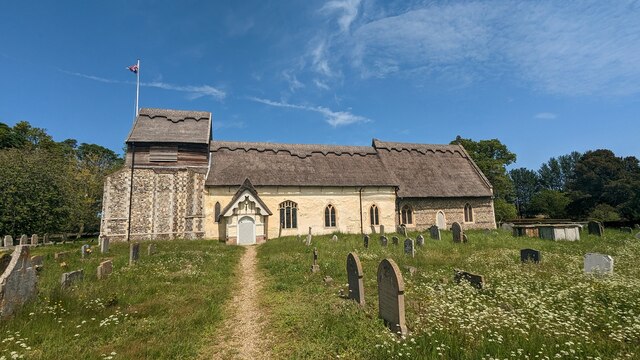
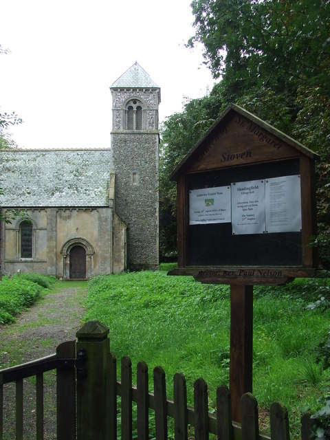
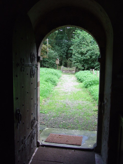
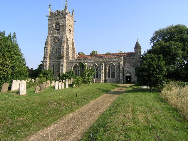
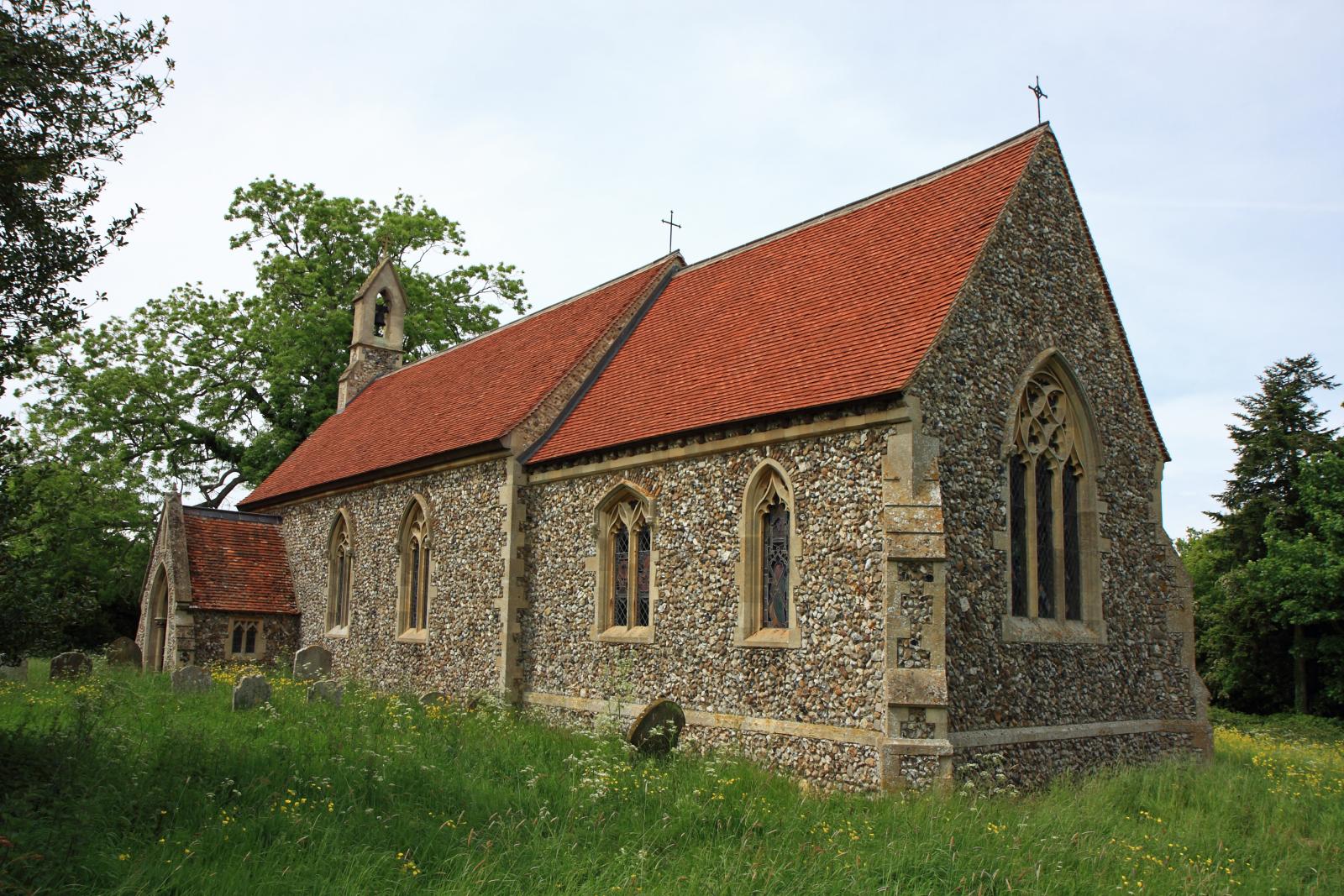
Uggeshall is known for its peaceful and picturesque setting, attracting visitors who enjoy the tranquility of the countryside. The parish has a small church, dedicated to St. Mary, which is a Grade II listed building. The church dates back to the 14th century and features some interesting architectural elements.

Overall, Uggeshall offers a rural retreat for its residents and visitors, with its charming countryside, agricultural heritage, and a strong sense of community.

If you have any feedback on the listing, please let us know in the comments section below.

Uggeshall Images

Images are sourced within 2km of 52.370624/1.609703 or Grid Reference TM4580. Thanks to Geograph Open Source API. All images are credited.

Church of St Margaret, Stoven <span class="nowrap"><a title="https://historicengland.org.uk/listing/the-list/list-entry/1032100?section=official-list-entry" rel="nofollow ugc noopener" href="https://historicengland.org.uk/listing/the-list/list-entry/1032100?section=official-list-entry">Link</a><img style="margin-left:2px;" alt="External link" title="External link - shift click to open in new window" src="https://s1.geograph.org.uk/img/external.png" width="10" height="10"/></span>
Church of St Margaret, Stoven
Church of St. Mary, Uggeshall <span class="nowrap"><a title="https://historicengland.org.uk/listing/the-list/list-entry/1284129?section=official-list-entry" rel="nofollow ugc noopener" href="https://historicengland.org.uk/listing/the-list/list-entry/1284129?section=official-list-entry">Link</a><img style="margin-left:2px;" alt="External link" title="External link - shift click to open in new window" src="https://s1.geograph.org.uk/img/external.png" width="10" height="10"/></span>
Church of St. Mary, Uggeshall
Goughs, Frostenden <span class="nowrap"><a title="https://historicengland.org.uk/listing/the-list/list-entry/1352547?section=official-list-entry" rel="nofollow ugc noopener" href="https://historicengland.org.uk/listing/the-list/list-entry/1352547?section=official-list-entry">Link</a><img style="margin-left:2px;" alt="External link" title="External link - shift click to open in new window" src="https://s1.geograph.org.uk/img/external.png" width="10" height="10"/></span>
Goughs, Frostenden
Green Lane at the Primrose Lane Junction
Fox at Block's Lane, Stoven
End of the Footpath Gate denotes the end of a rather pointless footpath. From this point the only option is to return back along the way you have just walked.  A sign at the previous junction denoting the fact that it is a dead-end would have been helpful.
End of the Footpath
Gate denotes the end of a rather pointless footpath. From this point the only option is to return back along the way you have just walked. A sign at the previous junction denoting the fact that it is a dead-end would have been helpful.
Road from Wangford to Uggeshall
Blomfield Wood
Blomfield Wood
Old Post Office at Wangford <span class="nowrap"><a title="https://historicengland.org.uk/listing/the-list/list-entry/1182410?section=official-list-entry" rel="nofollow ugc noopener" href="https://historicengland.org.uk/listing/the-list/list-entry/1182410?section=official-list-entry">Link</a><img style="margin-left:2px;" alt="External link" title="External link - shift click to open in new window" src="https://s1.geograph.org.uk/img/external.png" width="10" height="10"/></span>
Old Post Office at Wangford
Maltings at Elms Farm <span class="nowrap"><a title="https://historicengland.org.uk/listing/the-list/list-entry/1352534?section=official-list-entry" rel="nofollow ugc noopener" href="https://historicengland.org.uk/listing/the-list/list-entry/1352534?section=official-list-entry">Link</a><img style="margin-left:2px;" alt="External link" title="External link - shift click to open in new window" src="https://s1.geograph.org.uk/img/external.png" width="10" height="10"/></span>
Maltings at Elms Farm
Footpath Sign Footpath sign of minor road at Stoven, Suffolk.
Footpath Sign
Footpath sign of minor road at Stoven, Suffolk.
St Margaret Stoven The church and church notice board of St Margaret, Stoven, Suffolk for info on the church see <span class="nowrap"><a title="http://www.suffolkchurches.co.uk/stoven.htm" rel="nofollow ugc noopener" href="http://www.suffolkchurches.co.uk/stoven.htm">Link</a><img style="margin-left:2px;" alt="External link" title="External link - shift click to open in new window" src="https://s1.geograph.org.uk/img/external.png" width="10" height="10"/></span>
St Margaret Stoven
The church and church notice board of St Margaret, Stoven, Suffolk for info on the church see LinkExternal link
War Memorial War memorial and roll of honour for the village of Stoven, Suffolk in the village church of St Margaret.
War Memorial
War memorial and roll of honour for the village of Stoven, Suffolk in the village church of St Margaret.
View from the door View from the door of St Margaret, Stoven, Suffolk.
View from the door
View from the door of St Margaret, Stoven, Suffolk.
Turn Right Footpath sign guiding you to the right as seen near to Stoven, Suffolk.
Turn Right
Footpath sign guiding you to the right as seen near to Stoven, Suffolk.
The A145 Looking north along the A145 near to Stoven, Suffolk.
The A145
Looking north along the A145 near to Stoven, Suffolk.
Brick Kiln Farm Brick Kiln Farm near to Clay Common, Suffolk.
Brick Kiln Farm
Brick Kiln Farm near to Clay Common, Suffolk.
Track Footpath and farm track near to Clay Common, Suffolk.
Track
Footpath and farm track near to Clay Common, Suffolk.
Show me another place!

Uggeshall is located at Grid Ref: TM4580 (Lat: 52.370624, Lng: 1.609703)

Administrative County: Suffolk

District: East Suffolk

Police Authority: Suffolk

What 3 Words

///dripped.upward.butlers. Near Southwold, Suffolk

Nearby Locations

Uggeshall Hog's Corner

Related Wikis

Stoven

Stoven is a village and former civil parish now in the parish of Brampton with Stoven, in the East Suffolk district of the English county of Suffolk. It...

Uggeshall

Uggeshall is a village and civil parish in the East Suffolk district, in the county of Suffolk, England, located approximately 6 miles (10 km) south of...

Wangford Priory

The Cluniac Priory of Wangford was a small religious house in Wangford in the English county of Suffolk. It was founded before 1159 as a dependency of...

Wangford

Wangford is a village and former civil parish, now in the parish of Wangford with Henham, in the East Suffolk district, in the county of Suffolk, England...

Wangford with Henham

Wangford with Henham is a civil parish in the East Suffolk district of the English county of Suffolk. It is around 5.5 miles (8.9 km) east of Halesworth...

Sotherton

Sotherton is a dispersed village and civil parish in the East Suffolk district, in the English county of Suffolk. It is located approximately 7 miles...

Frostenden

Frostenden is a village and civil parish in the East Suffolk district of the English county of Suffolk. It is around 8 miles (13 km) south-west of Lowestoft...

Henham, Suffolk

Henham is a former civil parish now in the parish of Wangford with Henham, in the East Suffolk district, in the county of Suffolk, England. In 1961 the...

Nearby Amenities

Located within 500m of 52.370624,1.609703
Bus Stop
St Mary's Church
Bus: yes
Naptan AtcoCode: 390060102
Naptan Bearing: NW
Naptan BusStopType: CUS
Naptan CommonName: St Mary's Church
Naptan Indicator: o/s
Naptan Landmark: St Mary's Church
Naptan NaptanCode: sufgmptp
Naptan Street: Wangford Road
Naptan Verified: no
Public Transport: platform
Source: naptan_import
Lat/Long: 52.3670831/1.6053494
Bus Stop
St Mary's Church
Bus: yes
Naptan AtcoCode: 390060103
Naptan Bearing: SE
Naptan BusStopType: CUS
Naptan CommonName: St Mary's Church
Naptan Indicator: opp
Naptan Landmark: St Mary's Church
Naptan NaptanCode: sufgmptw
Naptan Street: Wangford Road
Naptan Verified: no
Public Transport: platform
Source: naptan_import
Lat/Long: 52.367113/1.6055024
Fixme: continue
Lat/Long: 52.3674693/1.6052257
Barrier: kissing_gate
Foot: yes
Lat/Long: 52.3673179/1.6051076
Noexit: yes
Lat/Long: 52.3681498/1.6111198
Noexit: yes
Lat/Long: 52.3684413/1.6112512
The data included in this document is from www.openstreetmap.org. The data is made available under ODbL.

Have you been to Uggeshall?

Leave your review of Uggeshall below (or comments, questions and feedback).