Todwick

Civil Parish in Yorkshire Rotherham

England

Todwick

Field path at the edge of the village
Field path at the edge of the village Credit: Graham Hogg

Todwick is a civil parish located in the Metropolitan Borough of Rotherham, South Yorkshire, England. Situated approximately 12 miles southeast of Sheffield, it is a small rural village with a population of around 1,500 people. Historically, Todwick was primarily an agricultural village, but it has undergone gradual urbanization in recent years.

The village is surrounded by beautiful countryside, offering picturesque views and an abundance of green spaces. The main focal point of Todwick is the village green, which is a popular spot for residents to gather and socialize. The green is also home to the village's war memorial, commemorating the locals who lost their lives in both World Wars.

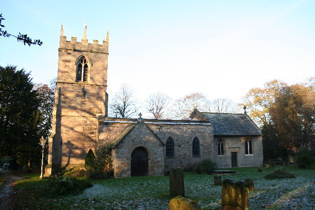
Todwick is known for its strong sense of community and has a variety of amenities to cater to its residents. These include a primary school, a community hall, a church, and a pub. The primary school, Todwick Primary Academy, provides education to children aged 4 to 11.

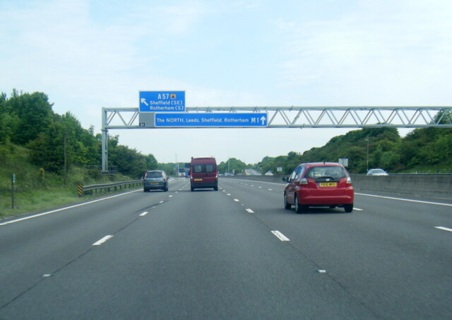
Transport links in Todwick are convenient, with easy access to the M1 motorway and nearby railway stations providing connections to Sheffield, Rotherham, and other major cities in the region. The village is also served by several bus routes, ensuring good connectivity to neighboring areas.

Overall, Todwick offers a peaceful and idyllic countryside lifestyle while providing essential amenities and good transport links for its residents. It is a close-knit community that takes pride in its heritage and continues to embrace modern developments.

If you have any feedback on the listing, please let us know in the comments section below.
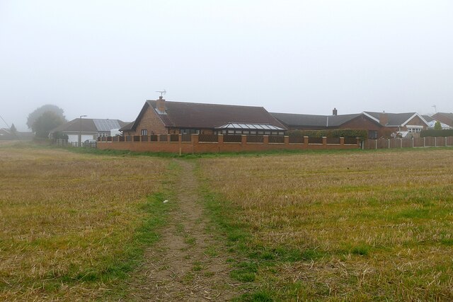
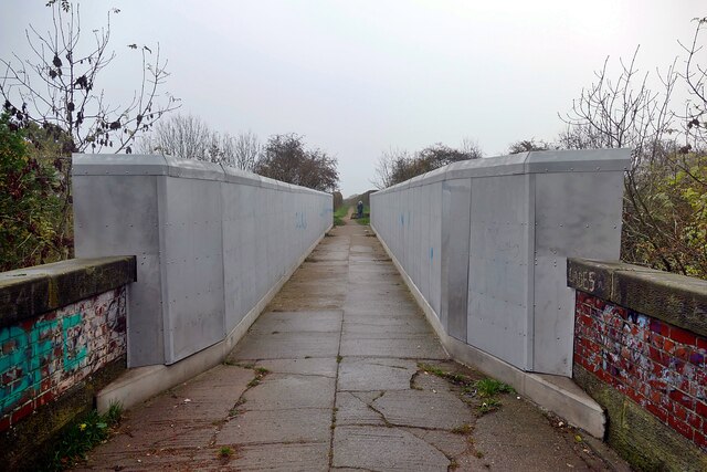
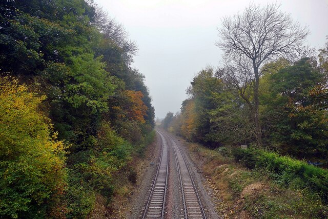
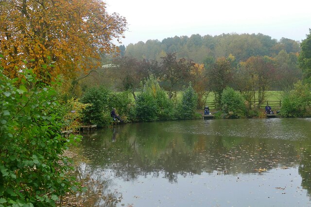
Todwick Images

Images are sourced within 2km of 53.357669/-1.265291 or Grid Reference SK4884. Thanks to Geograph Open Source API. All images are credited.

Field path at the edge of the village
Footbridge over the Sheffield-Lincoln railway The railway here is adjacent to a large comprehensive school and I suspect that the severe design is intended to discourage vandalism
Footbridge over the Sheffield-Lincoln railway
The railway here is adjacent to a large comprehensive school and I suspect that the severe design is intended to discourage vandalism
The Sheffield-Lincoln railway running through Wales Wales, the suburb of Rotherham that is. This shot looks west from a farm access bridge.
The Sheffield-Lincoln railway running through Wales
Wales, the suburb of Rotherham that is. This shot looks west from a farm access bridge.
Fishing in Fiddle Neck Pond
M1 nearing Junction 31
Pond in Straight Mile Fisheries A purpose-built fishery off Common Road
Pond in Straight Mile Fisheries
A purpose-built fishery off Common Road
Old milestone On the A57 between junction 31 of the M1 and Todwick cross-roads is the third in the sequence of milestones after Sheffield 8 and 9.  Sheffield 10/Worksop 8.   They may date from the turnpike era.   The Worksop to Attercliffe turnpike was operative from 1764 to 1881.   It was 16 miles long with 5 main gates and 3 side gates.   The plate from this stone may have been removed in 1940.  There is an OS pin in the top.   It is Grade II listed 1151906.
Old milestone
On the A57 between junction 31 of the M1 and Todwick cross-roads is the third in the sequence of milestones after Sheffield 8 and 9. Sheffield 10/Worksop 8. They may date from the turnpike era. The Worksop to Attercliffe turnpike was operative from 1764 to 1881. It was 16 miles long with 5 main gates and 3 side gates. The plate from this stone may have been removed in 1940. There is an OS pin in the top. It is Grade II listed 1151906.
Kiveton Bridge station
Kiveton Bridge station With Colliery Road behind
Kiveton Bridge station
With Colliery Road behind
Todwick Road Looking SW to the junction with Common Road
Todwick Road
Looking SW to the junction with Common Road
Hedgerow between stubble fields Viewed through a gap in the hedge on Common Road
Hedgerow between stubble fields
Viewed through a gap in the hedge on Common Road
Track and Bridleway in Kiveton Park Gravel road and farmland between Kiveton and Anston.
Track and Bridleway in Kiveton Park
Gravel road and farmland between Kiveton and Anston.
Common Road near North Anston Looking towards the B6463 Todwick Road crossroads.
Common Road near North Anston
Looking towards the B6463 Todwick Road crossroads.
Hole in t' Wall - Axle Lane Axle Lane is a bridleway connecting the villages of Todwick and South Anston in South Yorkshire, and is thought to have once been a coach road leading to nearby Keeton Hall, one-time home of the Second Duke of Leeds on the outskirts of Kiveton Park near Todwick. The former Duke’s 600 acre estate was used for hunting by the Duke and his guests and is the very reason why the village of Kiveton was later renamed Kiveton Park (indeed, the old definition of ‘Park’ is “an enclosed area of land stocked with game and held by royal prescription”.  The wall in this picture marked the estate’s northern boundary. The “hole in t’ wall” is located midway along Axle Lane between South Anston and Todwick at the junction of several public footpaths and bridleways. More remnants of this boundary wall exist in nearby Anston Stones Wood, and a short section of what is thought to have once marked the southern boundary stands beside the Chesterfield Canal on the west side of Devils Hole Bridge (No.33) one mile east of Kiveton Park Station.

This image also appears on Flickr: <span class="nowrap"><a title="https://www.flickr.com/photos/128783627@N03/33071344280/in/photostream/" rel="nofollow ugc noopener" href="https://www.flickr.com/photos/128783627@N03/33071344280/in/photostream/">Link</a><img style="margin-left:2px;" alt="External link" title="External link - shift click to open in new window" src="https://s1.geograph.org.uk/img/external.png" width="10" height="10"/></span>
Hole in t' Wall - Axle Lane
Axle Lane is a bridleway connecting the villages of Todwick and South Anston in South Yorkshire, and is thought to have once been a coach road leading to nearby Keeton Hall, one-time home of the Second Duke of Leeds on the outskirts of Kiveton Park near Todwick. The former Duke’s 600 acre estate was used for hunting by the Duke and his guests and is the very reason why the village of Kiveton was later renamed Kiveton Park (indeed, the old definition of ‘Park’ is “an enclosed area of land stocked with game and held by royal prescription”. The wall in this picture marked the estate’s northern boundary. The “hole in t’ wall” is located midway along Axle Lane between South Anston and Todwick at the junction of several public footpaths and bridleways. More remnants of this boundary wall exist in nearby Anston Stones Wood, and a short section of what is thought to have once marked the southern boundary stands beside the Chesterfield Canal on the west side of Devils Hole Bridge (No.33) one mile east of Kiveton Park Station. This image also appears on Flickr: LinkExternal link
Bridleway off the A57 Anston Footpath No.6 runs from the A57 west of South Anston up to the ‘Hole in t' wall’ on Axle Lane between South Anston and Todwick.
Bridleway off the A57
Anston Footpath No.6 runs from the A57 west of South Anston up to the ‘Hole in t' wall’ on Axle Lane between South Anston and Todwick.
Poppies and Oilseed Rape Looking north-west towards the A57 from Axle Lane between Todwick and South Anston.
Poppies and Oilseed Rape
Looking north-west towards the A57 from Axle Lane between Todwick and South Anston.
Old Milestone by the A57, Sheffield Road, Todwick Parish Iron plate on stone post by the A57, in parish of Todwick (Rotherham District), roadside, by the road.

Inscription reads:- : SHEFFIELD / 11 / WORKSOP / 7 :

Lost since 1990

Milestone Society National ID: YS_SFWS11.
Old Milestone by the A57, Sheffield Road, Todwick Parish
Iron plate on stone post by the A57, in parish of Todwick (Rotherham District), roadside, by the road. Inscription reads:- : SHEFFIELD / 11 / WORKSOP / 7 : Lost since 1990 Milestone Society National ID: YS_SFWS11.
A57 east of Todwick
A57 east of Todwick
Show me another place!

Todwick is located at Grid Ref: SK4884 (Lat: 53.357669, Lng: -1.265291)

Division: West Riding

Administrative County: South Yorkshire

District: Rotherham

Police Authority: South Yorkshire

What 3 Words

///unique.anyone.croutons. Near Todwick, South Yorkshire

Nearby Locations

Todwick Common Todwick

Related Wikis

Todwick

Todwick is a village in the Metropolitan Borough of Rotherham in South Yorkshire, England. It has a population of 1,637, reducing marginally to 1,634...

Kiveton Hall

Kiveton Hall is a Grade II listed house in Kiveton Park, Wales, near Rotherham, South Yorkshire, England. == History == The house was built on the side...

Wales High School

Wales High School is an academy school for 11- to 19-year-olds, in Kiveton, near Rotherham, South Yorkshire, England. Opened in 1970, the school provides...

Kiveton Bridge railway station

Kiveton Bridge railway station serves the village of Kiveton Park in South Yorkshire, England. It also served the now closed Kiveton Park Colliery which...

Kiveton Park

Kiveton Park is a village within the Metropolitan Borough of Rotherham, in South Yorkshire, England. Historically a part of the West Riding of Yorkshire...

Kiveton Park Colliery Cricket Club

Kiveton Park Colliery Cricket Club is an English cricket club based in Kiveton Park, South Yorkshire. == History == The club has been a member of the Bassetlaw...

Kiveton Park F.C.

Kiveton Park Football Club is a football club based in Kiveton Park, South Yorkshire, England. They are currently members of the Sheffield & Hallamshire...

Kiveton Park Colliery

Kiveton Park Colliery was a coal mine in the village of Kiveton Park, near Rotherham, South Yorkshire, England. == History == Until 1845, Kiveton was a...

Nearby Amenities

Located within 500m of 53.357669,-1.265291
Defibrillator
Access: yes
Check Date: 2023-03-09
Defibrillator Location En: On outside wall
Emergency: defibrillator
Indoor: no
Ref GB The Circuit: A4DC54F0-349F-4836-9379-AD4900D85019
Lat/Long: 53.353682/-1.2651567
Barrier: stile
Stile: stepover
Lat/Long: 53.3574709/-1.2585002
Barrier: stile
Step Count: 2
Stile: stepover
Lat/Long: 53.3594036/-1.2718132
Barrier: stile
Step Count: 1
Stile: stepover
Lat/Long: 53.3597501/-1.2709513
Barrier: stile
Stile: stepover
Lat/Long: 53.3596668/-1.2695334
Barrier: stile
Step Count: 1
Stile: stepover
Lat/Long: 53.3596961/-1.2703886
Bench
Backrest: yes
Lat/Long: 53.3552979/-1.265051
Bench
Backrest: yes
Lat/Long: 53.3583678/-1.2720468
The data included in this document is from www.openstreetmap.org. The data is made available under ODbL.

Have you been to Todwick?

Leave your review of Todwick below (or comments, questions and feedback).