Timworth

Civil Parish in Suffolk St Edmundsbury

England

Timworth

New Road at Ampton This wooded area is known as The Plains and is part of Ampton Wood.
New Road at Ampton Credit: Robert Edwards

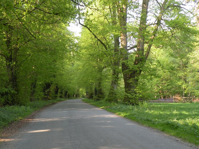
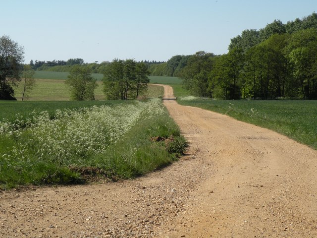
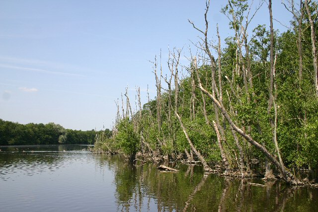
Timworth is a small civil parish located in the county of Suffolk, England. It is situated approximately 4 miles east of the town of Bury St Edmunds and covers an area of around 5 square miles. The parish is predominantly rural, characterized by open fields, agricultural land, and a few scattered residential properties.

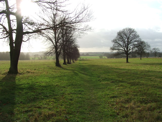
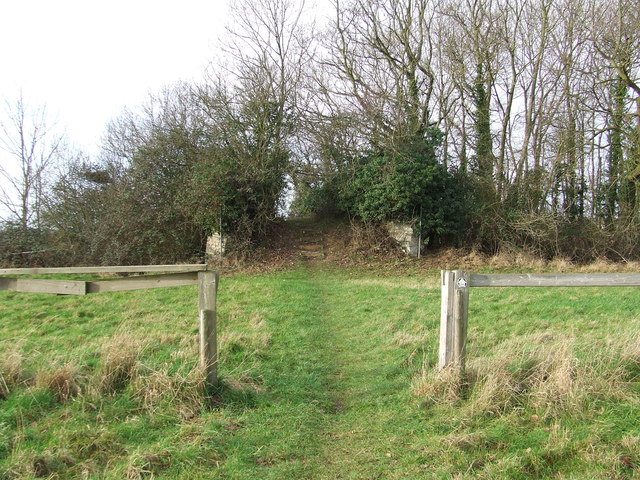
The village of Timworth itself is a tight-knit community with a population of around 150 residents. It has a charming and picturesque setting, with traditional cottages and farmhouses dotting the landscape. The parish is surrounded by beautiful countryside, offering residents and visitors ample opportunities for outdoor activities such as walking, cycling, and horse riding.

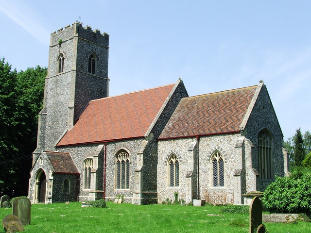
One notable landmark in Timworth is the St Andrew's Church, a historic Grade II listed building that dates back to the 14th century. The church is known for its impressive architecture and stained glass windows, attracting visitors interested in history and architecture.

The local economy is primarily based on agriculture, with many residents involved in farming and related industries. The parish benefits from its proximity to Bury St Edmunds, which provides additional employment opportunities and access to amenities such as schools, shops, and healthcare facilities.

Overall, Timworth offers a quiet and peaceful lifestyle, ideal for those seeking a rural retreat away from the hustle and bustle of larger towns and cities. With its picturesque setting, rich history, and strong community spirit, Timworth is a hidden gem in the Suffolk countryside.

If you have any feedback on the listing, please let us know in the comments section below.

Timworth Images

Images are sourced within 2km of 52.287838/0.736066 or Grid Reference TL8669. Thanks to Geograph Open Source API. All images are credited.

New Road at Ampton This wooded area is known as The Plains and is part of Ampton Wood.
New Road at Ampton
This wooded area is known as The Plains and is part of Ampton Wood.
A track that leads to Ampton Water The track also continues on to Ampton Field.
A track that leads to Ampton Water
The track also continues on to Ampton Field.
Footpath Footpath across Ampton Field near to Ingham, Suffolk.
Footpath
Footpath across Ampton Field near to Ingham, Suffolk.
Old Bridge Old bridge across the disused Bury to Thetford railway line, now only used as a footbridge near to Ingham, Suffolk.
Old Bridge
Old bridge across the disused Bury to Thetford railway line, now only used as a footbridge near to Ingham, Suffolk.
Grazing land, Ampton Park
New Road heading south towards Timworth
Ordnance Survey Cut Mark This OS cut mark can be found on the south face of St Bartholomew's Church. It marks a point 50.158m above mean sea level.
Ordnance Survey Cut Mark
This OS cut mark can be found on the south face of St Bartholomew's Church. It marks a point 50.158m above mean sea level.
Footbridge over Ampton Water
Ingham War Memorial The names on the Memorial are: B.M. PARSON,  W.G.S. HOLLAND,  S. AMES,  W. JOHNSON,  R.D.  BUSSELL,  R.I. SMITH,  E. SMITH,  R. DILLON,  T. JASPER. Headstones with the names and Regiments are close by. <a title="https://www.geograph.org.uk/photo/4466099" href="https://www.geograph.org.uk/photo/4466099">Link</a>
<a title="https://www.geograph.org.uk/photo/4466086" href="https://www.geograph.org.uk/photo/4466086">Link</a>
Ingham War Memorial
The names on the Memorial are: B.M. PARSON, W.G.S. HOLLAND, S. AMES, W. JOHNSON, R.D. BUSSELL, R.I. SMITH, E. SMITH, R. DILLON, T. JASPER. Headstones with the names and Regiments are close by. Link Link
A second World War One Memorial at Ingham church None of the names on this Memorial match any of those on the one in the churchyard yet some are on the Roll of Honour. 
The names are Felix WYATT the primary subject of the Memorial and Edward OSBORNE,  Bertie KING,  M. Gaskoin EDGELEY, William Henry SEELEY, Frank SMITH, Charles DENNIS, Frank FENTON, William BETTS, Walter CHAPMAN and Bertie OSBORNE. It is not known what if any connection they had with this parish.  <a title="https://www.geograph.org.uk/photo/4466099" href="https://www.geograph.org.uk/photo/4466099">Link</a>
A second World War One Memorial at Ingham church
None of the names on this Memorial match any of those on the one in the churchyard yet some are on the Roll of Honour. The names are Felix WYATT the primary subject of the Memorial and Edward OSBORNE, Bertie KING, M. Gaskoin EDGELEY, William Henry SEELEY, Frank SMITH, Charles DENNIS, Frank FENTON, William BETTS, Walter CHAPMAN and Bertie OSBORNE. It is not known what if any connection they had with this parish. Link
The Roll of Honour at Ingham Bearing some of the names of those on the Memorials.
<a title="https://www.geograph.org.uk/photo/4466086" href="https://www.geograph.org.uk/photo/4466086">Link</a>
The Roll of Honour at Ingham
Bearing some of the names of those on the Memorials. Link
Avenue of trees through Ampton Wood
Wadgate plantation
Wadgate plantation
Ingham Church St Bartholomew's Church, Ingham, near Bury St Edmunds
Ingham Church
St Bartholomew's Church, Ingham, near Bury St Edmunds
Footbridge at Ampton Water This artificial serpentine lake is a haven for birdlife, especially geese.  The centre of this footbridge, which is also a public footpath, is a camouflaged bird hide.
Footbridge at Ampton Water
This artificial serpentine lake is a haven for birdlife, especially geese. The centre of this footbridge, which is also a public footpath, is a camouflaged bird hide.
Oldbroom Plantation A public footpath runs through this wood, at the side of Ampton Water.
Oldbroom Plantation
A public footpath runs through this wood, at the side of Ampton Water.
Ampton Water These waterlogged trees have died, leaving an eerie presence.
Ampton Water
These waterlogged trees have died, leaving an eerie presence.
Bird hide at Ampton Water A number of these hides have been built around the edge of the lake.  Access is by a rickety walkway.
Bird hide at Ampton Water
A number of these hides have been built around the edge of the lake. Access is by a rickety walkway.
Show me another place!

Timworth is located at Grid Ref: TL8669 (Lat: 52.287838, Lng: 0.736066)

Administrative County: Suffolk

District: St Edmundsbury

Police Authority: Suffolk

What 3 Words

///caused.hovered.snapper. Near Great Barton, Suffolk

Related Wikis

Timworth

Timworth is a village and civil parish 65 mi (105 km) north east of London and 26 mi (42 km) east of Cambridge in the West Suffolk district of Suffolk...
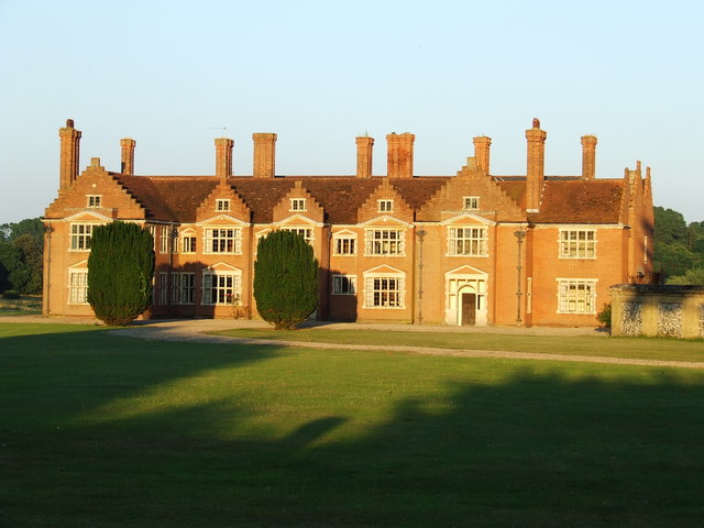
Ampton Hall

Ampton Hall is a Grade II-listed Jacobean style manor house in Ampton, Suffolk, England. Ampton Hall was the birthplace in 1805 of Robert FitzRoy, who...

Ingham railway station

Ingham railway station was a railway station in Ingham, Suffolk which was located was on the route between Thetford and Bury St Edmunds. == History... ==

Ampton

Ampton is a village and civil parish in the West Suffolk District of Suffolk, England, about five miles north of Bury St Edmunds. According to Eilert Ekwall...

Ingham, Suffolk

Ingham is a village and civil parish in the West Suffolk district of Suffolk in eastern England, located about six miles north of Bury St Edmunds on the...

Fornham St Genevieve

Fornham St Genevieve is a village and civil parish in the West Suffolk district of Suffolk in eastern England. It is one of a trio of contiguous villages...
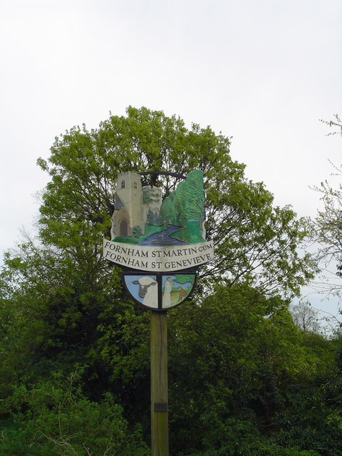
Fornham St Martin

Fornham St Martin is a village and civil parish in the West Suffolk district of Suffolk in eastern England. Located on the northern outskirts of Bury St...

Conyer's Green

Conyer's Green is a village in the civil parish of Great Barton, in the West Suffolk district, in the county of Suffolk, England.

Nearby Amenities

Located within 500m of 52.287838,0.736066
Power: pole
Lat/Long: 52.2889239/0.7424985
Power: pole
Lat/Long: 52.2892594/0.741549
Power: pole
Lat/Long: 52.289188/0.74
Power: pole
Lat/Long: 52.2891076/0.7382713
Power: pole
Lat/Long: 52.2890445/0.7366969
Power: pole
Lat/Long: 52.2889805/0.7353276
Power: pole
Lat/Long: 52.2889067/0.7336579
Power: pole
Lat/Long: 52.2888271/0.7319641
Power: pole
Lat/Long: 52.2887336/0.7299525
The data included in this document is from www.openstreetmap.org. The data is made available under ODbL.

Have you been to Timworth?

Leave your review of Timworth below (or comments, questions and feedback).