Thorpe Salvin
Civil Parish in Yorkshire Rotherham
England
Thorpe Salvin

Thorpe Salvin is a civil parish located in the Rotherham district of South Yorkshire, England. Situated approximately 8 miles southeast of the town of Rotherham, the village is nestled on the eastern banks of the River Ryton. The parish covers an area of about 1,000 acres and is known for its picturesque countryside and charming rural setting.
The village of Thorpe Salvin is home to a small population of around 200 residents, making it a close-knit community. It is characterized by its quaint and traditional architecture, with a mix of stone-built cottages and larger, more modern houses. The village is centered around a village green, which serves as a focal point for community events and gatherings.
One of the key attractions in Thorpe Salvin is the historic Thorpe Salvin Hall, a Grade II listed building dating back to the 16th century. The hall is set within beautiful grounds and is known for its stunning gardens. The village also boasts a 12th-century church, St. Peter's, which is well-preserved and adds to the historical charm of the area.
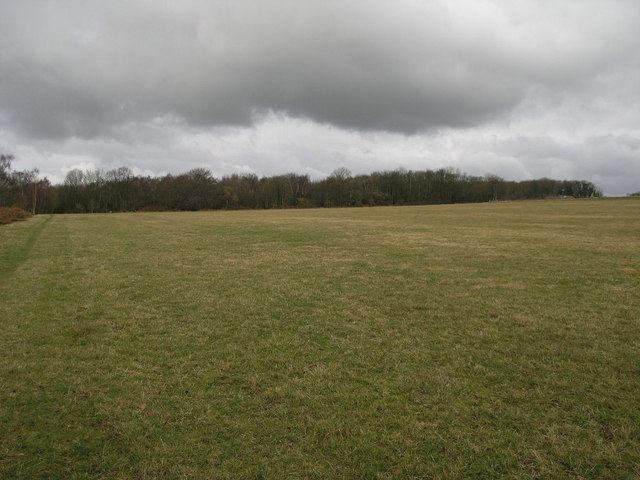
The village offers a peaceful and tranquil setting, with ample opportunities for outdoor activities such as walking, cycling, and fishing. The surrounding countryside is rich in wildlife and offers beautiful views of the River Ryton and the rolling hills beyond.
Overall, Thorpe Salvin is a delightful rural village, steeped in history and natural beauty. It provides a serene escape from the hustle and bustle of nearby urban areas, appealing to those seeking a peaceful and idyllic lifestyle.
If you have any feedback on the listing, please let us know in the comments section below.
Thorpe Salvin Images
Images are sourced within 2km of 53.32033/-1.213299 or Grid Reference SK5280. Thanks to Geograph Open Source API. All images are credited.


Thorpe Salvin is located at Grid Ref: SK5280 (Lat: 53.32033, Lng: -1.213299)
Division: West Riding
Administrative County: South Yorkshire
District: Rotherham
Police Authority: South Yorkshire
What 3 Words
///rash.parrot.drifters. Near Harthill, South Yorkshire
Nearby Locations
Related Wikis

Thorpe Salvin
Thorpe Salvin is a village and a civil parish in the Metropolitan Borough of Rotherham in South Yorkshire, England, on the border with Nottinghamshire...

Netherthorpe Airfield
Netherthorpe Aerodrome (ICAO: EGNF) is located 2 NM (3.7 km; 2.3 mi) west by north of Worksop, Nottinghamshire, England. The aerodrome is in the Metropolitan...

Harry Crofts Colliery
Harry Crofts Colliery was a small, short lived coal mine within the parish of South Anston, near Rotherham, South Yorkshire. The colliery was sunk between...

Kiveton Park railway station
Kiveton Park railway station serves Kiveton Park in South Yorkshire, England. The original station was opened by the Sheffield and Lincolnshire Junction...
Anston Stones Wood
Anston Stones Wood (grid reference SK531831) is a 33.7 hectare (88.3 acre) biological site of Special Scientific Interest in South Yorkshire. The site...

All Saints' Church, Steetley
All Saints’ Church, Steetley is a Grade I listed parish church in the Church of England in Whitwell, Derbyshire. == History == The church dates from the...

Lindrick Golf Club
Lindrick Golf Club is a golf club in South Yorkshire, England; it is near Worksop. The club has an 18-hole championship golf course that has hosted many...

Shireoaks Hall
Shireoaks Hall is a grade II* listed 17th-century country house in the hamlet of Shireoaks, 2+1⁄4 miles (3.6 km) north-west of Worksop, Nottinghamshire...
Nearby Amenities
Located within 500m of 53.32033,-1.213299Have you been to Thorpe Salvin?
Leave your review of Thorpe Salvin below (or comments, questions and feedback).