Thanington Without

Civil Parish in Kent Canterbury

England

Thanington Without

Golden Hill The view from the National Trust owned 'Golden Hill'
Golden Hill Credit: Ben Charlton

Thanington Without is a civil parish located in the county of Kent, England. Situated approximately 2 miles east of the historic city of Canterbury, this rural area covers an area of around 8.5 square miles.

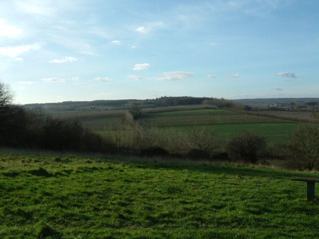
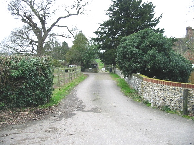
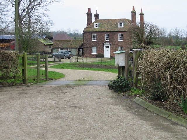
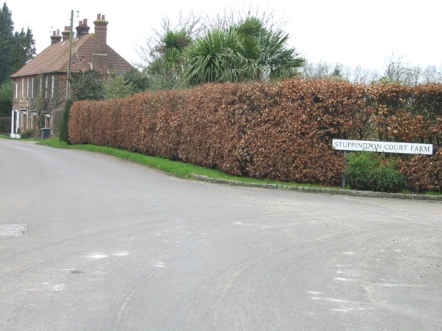
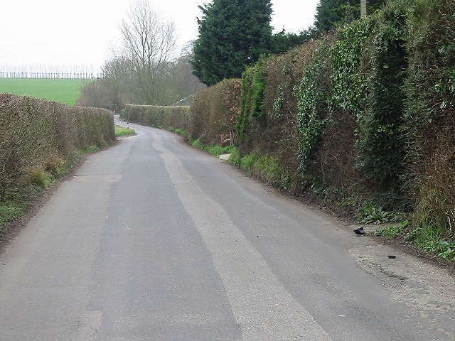
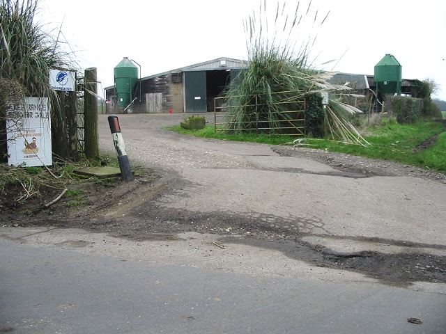
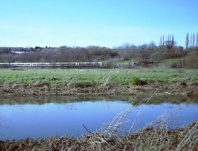
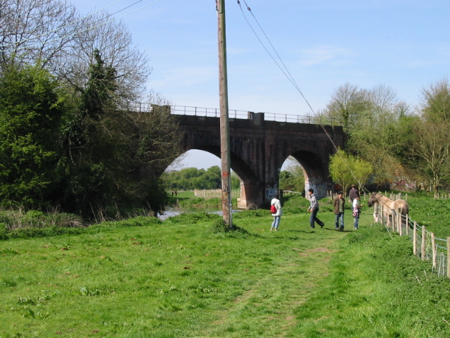
The parish is bordered by the River Stour to the north, providing picturesque views and recreational opportunities for residents and visitors alike. The landscape is predominantly characterized by agricultural land, with fields and pastures dotting the countryside. The village of Thanington Without itself is a small settlement, with a population of around 800 people.

The area boasts a rich history, with evidence of human habitation dating back to the Bronze Age. In more recent times, the parish played a significant role during World War II, serving as an important military camp for the British Army.

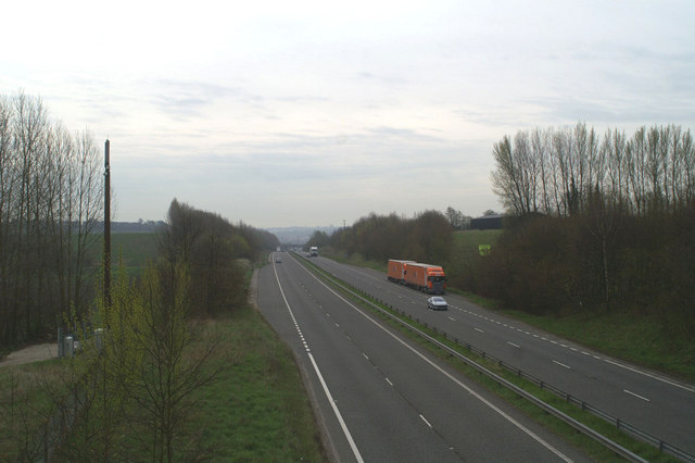
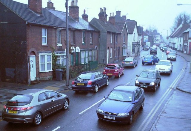
Today, Thanington Without offers a peaceful and tranquil setting for those seeking a rural lifestyle. The local community is tight-knit, with a range of amenities including a village hall, a primary school, and a church. The area is well-connected to nearby Canterbury, with regular bus services providing convenient transportation options.

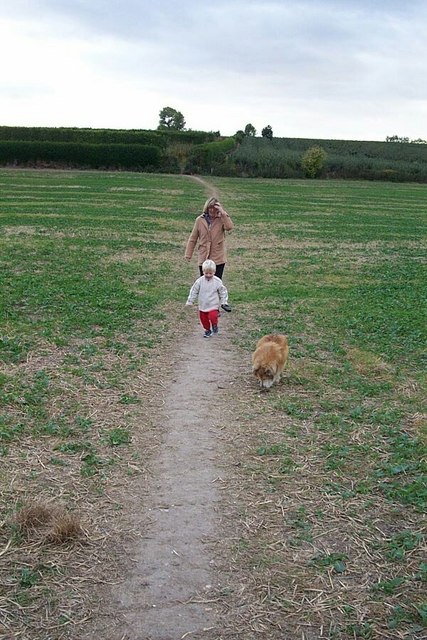
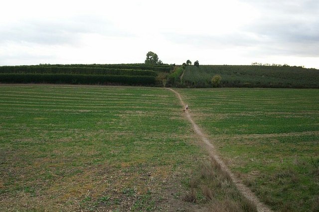
Nature enthusiasts are drawn to Thanington Without for its scenic beauty and abundant wildlife. The River Stour is a popular spot for fishing and boating, while the surrounding countryside offers ample opportunities for walking and exploring the great outdoors.

Overall, Thanington Without is a charming and idyllic civil parish, combining a rich history with a peaceful rural setting.

If you have any feedback on the listing, please let us know in the comments section below.

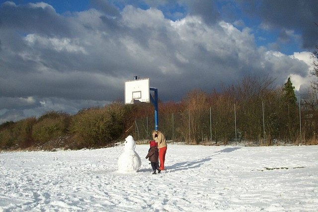
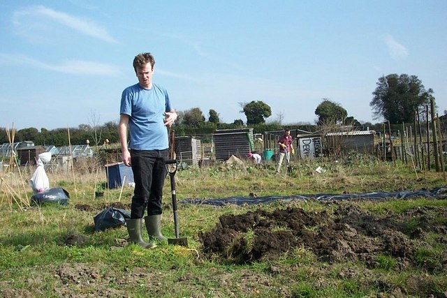
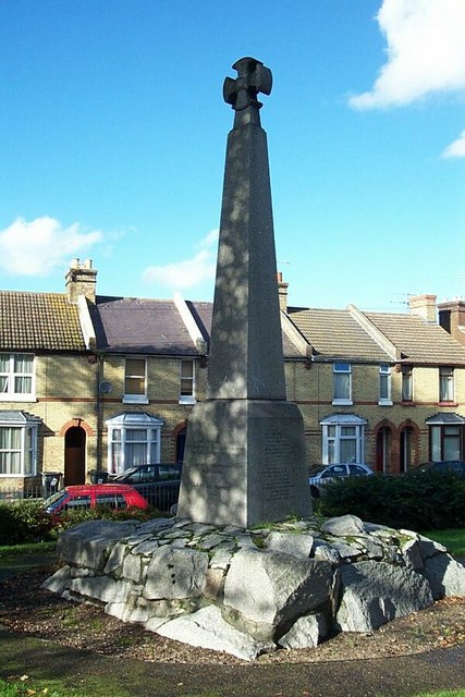
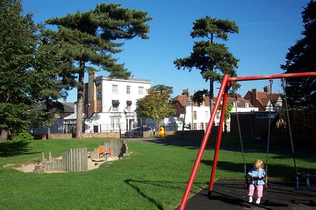
Thanington Without Images

Images are sourced within 2km of 51.262976/1.052436 or Grid Reference TR1355. Thanks to Geograph Open Source API. All images are credited.

Golden Hill The view from the National Trust owned 'Golden Hill'
Golden Hill
The view from the National Trust owned 'Golden Hill'
The A2, by-passing Canterbury at Harbledown
The Pilgrims Way to the shrine of St. Thomas of Canterbury
Stuppington Court Farm
Entrance to Iffin Farm
Merton Farm, Merton Lane
View looking W along Merton Lane
Junction of Merton Lane and Iffin Lane
Looking S along Iffin Lane
Outbuildings at Meadows Farm
Canterbury Footpath from Lime Kiln Road to the apple orchard
Canterbury
Footpath from Lime Kiln Road to the apple orchard
Canterbury Footpath from Heaton Road / Lime Kiln Road to Apple Orchard
Canterbury
Footpath from Heaton Road / Lime Kiln Road to Apple Orchard
Canterbury - the games fields behind Heaton Road This was taken the year the Kent had real snow!
The trees are hiding the track of a disused railway line.
Canterbury - the games fields behind Heaton Road
This was taken the year the Kent had real snow! The trees are hiding the track of a disused railway line.
Allotments off Norfolk Road, Canterbury The first dig of the year.
Allotments off Norfolk Road, Canterbury
The first dig of the year.
Martyrs Monument, Martyrs Field Road, Canterbury Commemorates the event in the 1550's when more than 40 Protestants were burnt at the stake during the short-lived Counter-Reformation in the reign of Queen Mary
Martyrs Monument, Martyrs Field Road, Canterbury
Commemorates the event in the 1550's when more than 40 Protestants were burnt at the stake during the short-lived Counter-Reformation in the reign of Queen Mary
Wincheap, Canterbury Playpark off Wincheap Road.

On a recent visit, I was struck by the quality and age of the trees and the even height of the walls enclosing this park and am led to think it was originally a walled garden.
Wincheap, Canterbury
Playpark off Wincheap Road. On a recent visit, I was struck by the quality and age of the trees and the even height of the walls enclosing this park and am led to think it was originally a walled garden.
Great Stour Looking north across the Stour towards Harbledown and the London Road housing estate, taken from behind the Wincheap industrial estate. The train is approaching Canterbury from Ashford.
Great Stour
Looking north across the Stour towards Harbledown and the London Road housing estate, taken from behind the Wincheap industrial estate. The train is approaching Canterbury from Ashford.
Wincheap Traffic crawling along Wincheap on a damp Friday lunchtime. Looking SW towards the junction with the A2. There is an Esso petrol station to the right of the photo and the local shops are just out of the sight, further up on the left hand side next to the layby.
Wincheap
Traffic crawling along Wincheap on a damp Friday lunchtime. Looking SW towards the junction with the A2. There is an Esso petrol station to the right of the photo and the local shops are just out of the sight, further up on the left hand side next to the layby.
Show me another place!

Thanington Without is located at Grid Ref: TR1355 (Lat: 51.262976, Lng: 1.052436)

Administrative County: Kent

District: Canterbury

Police Authority: Kent

What 3 Words

///hogs.intervals.safely. Near Chartham, Kent

Nearby Locations

Thanington Without

Related Wikis

Thanington

Thanington is a civil parish on the west edge of Canterbury, Kent, United Kingdom. It extends to the south-west of A2 from Wincheap to the Milton Bridge...

Chartham

Chartham is a village and civil parish in the Canterbury district of Kent, England. It is situated on the Ashford side of the city, and is in the North...

Larkey Valley Wood

Larkey Valley Wood is a 44.1-hectare (109-acre) biological Site of Special Scientific Interest south of Canterbury in Kent. It is also a Local Nature Reserve...

Canterbury Parkway railway station

Canterbury Parkway railway station is a proposed interchange between the Ashford–Ramsgate line and the Chatham Main Line near Canterbury, Kent. == Location... ==

Wincheap

Wincheap is a road and suburb in Canterbury, Kent, England. The road forms part of the A28 road, stretching for around 1 mile (1.6 km) from the city wall...

Whitehall Meadows

Whitehall Meadows is a 11.6-hectare (29-acre) Local Nature Reserve in Canterbury in Kent. It is owned and managed by Canterbury City Council.This wet...

The Canterbury Academy

The Canterbury Academy is a co-educational 11-19 academy school in Canterbury, Kent, England. It is a specialist Sports College and 15% of its 1081 pupils...

Whitehall Dyke

Whitehall Dyke is a tributary of the Great Stour river in Kent, England. The stream runs from its source near Harbledown, 5.6 kilometres, to the Great...

Nearby Amenities

Located within 500m of 51.262976,1.052436
Post Box
Collection Times: Mo-Fr 09:00; Sa 07:00
Postal Code: CT1
Ref: CT1 373
Royal Cypher: EIIR
Royal Cypher Wikidata: Q33102113
Source: survey
Lat/Long: 51.2657947/1.0554358
Bus Stop
Strangers Lane
Flag: no
Naptan AtcoCode: 2400100653
Naptan Bearing: SW
Naptan BusStopType: CUS
Naptan CommonName: Strangers Lane
Naptan Indicator: opp
Naptan Landmark: Strangers Lane
Naptan Street: Cockering Road
Naptan Verified: no
Public Transport: platform
Source: naptan_import
Lat/Long: 51.2659907/1.0563114
Bus Stop
Stranger's Lane
Bench: no
Bin: no
Lit: yes
Naptan AtcoCode: 2400A039450A
Naptan Bearing: NE
Naptan CommonName: Stranger's Lane
Naptan Indicator: adj
Naptan Landmark: Stranger's Lane
Naptan NaptanCode: kntdpmgp
Naptan PlusbusZoneRef: CNTBE
Naptan Street: Cockering Road
Naptan Verified: no
Shelter: no
Source: naptan_import
Tactile Paving: no
Lat/Long: 51.2661774/1.0563955
Bus Stop
Ashenden Close
Bench: no
Bin: no
Lit: yes
Naptan AtcoCode: 2400A039490A
Naptan Bearing: N
Naptan CommonName: Ashenden Close
Naptan Indicator: adj
Naptan Landmark: Cockering Road
Naptan NaptanCode: kntdpmjd
Naptan PlusbusZoneRef: CNTBE
Naptan Street: Stranger's Lane
Naptan Verified: no
Shelter: no
Source: naptan_import
Tactile Paving: no
Lat/Long: 51.2666024/1.0552767
Barrier: stile
Foot: yes
Source: survey
Lat/Long: 51.2654382/1.0471679
Generator Method: photovoltaic
Generator Orientation: 242
Generator Output Electricity: yes
Generator Solar Modules: 10
Generator Source: solar
Generator Type: solar_photovoltaic_panel
Location: roof
Power: generator
Lat/Long: 51.2654487/1.0540625
Generator Method: photovoltaic
Generator Orientation: 62
Generator Output Electricity: yes
Generator Solar Modules: 10
Generator Source: solar
Generator Type: solar_photovoltaic_panel
Location: roof
Power: generator
Lat/Long: 51.2654671/1.0541188
Generator Method: photovoltaic
Generator Orientation: 161
Generator Output Electricity: yes
Generator Solar Modules: 10
Generator Source: solar
Generator Type: solar_photovoltaic_panel
Location: roof
Power: generator
Lat/Long: 51.2669386/1.0540377
Generator Method: photovoltaic
Generator Orientation: 186
Generator Output Electricity: yes
Generator Solar Modules: 12
Generator Source: solar
Generator Type: solar_photovoltaic_panel
Location: roof
Power: generator
Lat/Long: 51.266203/1.0558851
Generator Method: photovoltaic
Generator Orientation: 161
Generator Output Electricity: yes
Generator Solar Modules: 12
Generator Source: solar
Generator Type: solar_photovoltaic_panel
Location: roof
Power: generator
Lat/Long: 51.266952/1.0541725
Generator Method: photovoltaic
Generator Orientation: 248
Generator Output Electricity: yes
Generator Solar Modules: 10
Generator Source: solar
Generator Type: solar_photovoltaic_panel
Location: roof
Power: generator
Lat/Long: 51.2674617/1.0528442
Generator Method: photovoltaic
Generator Orientation: 237
Generator Output Electricity: yes
Generator Solar Modules: 8
Generator Source: solar
Generator Type: solar_photovoltaic_panel
Location: roof
Power: generator
Lat/Long: 51.2655804/1.0557524
Generator Method: photovoltaic
Generator Orientation: 147
Generator Output Electricity: yes
Generator Solar Modules: 6
Generator Source: solar
Generator Type: solar_photovoltaic_panel
Location: roof
Power: generator
Lat/Long: 51.2655679/1.0558127
Generator Method: photovoltaic
Generator Orientation: 151
Generator Output Electricity: yes
Generator Solar Modules: 3
Generator Source: solar
Generator Type: solar_photovoltaic_panel
Location: roof
Power: generator
Lat/Long: 51.2643808/1.0527188
Generator Method: photovoltaic
Generator Orientation: 341
Generator Output Electricity: yes
Generator Solar Modules: 6
Generator Source: solar
Generator Type: solar_photovoltaic_panel
Location: roof
Power: generator
Lat/Long: 51.2669683/1.0540209
Grit Bin
Colour: yellow
Lat/Long: 51.2660075/1.0546232
Traffic Calming: table
Lat/Long: 51.265905/1.0578502
Crossing: informal
Lat/Long: 51.266035/1.0565484
Traffic Calming: table
Lat/Long: 51.2656861/1.0570463
Entrance: yes
Lat/Long: 51.2649475/1.0574372
Entrance: yes
Lat/Long: 51.2648988/1.0574756
Entrance: yes
Lat/Long: 51.2648536/1.0575115
Entrance: yes
Lat/Long: 51.2648058/1.0575494
The data included in this document is from www.openstreetmap.org. The data is made available under ODbL.

Have you been to Thanington Without?

Leave your review of Thanington Without below (or comments, questions and feedback).