Tattenhall and District

Civil Parish in Cheshire

England

Tattenhall and District

Fingerpost, Tattenhall Opposite Chester Rd. Old style direction plates, with a detent ring to fix the position of the fingers.

Inscription: Huxley 3 / Chester 8 // Burwardsley 2½ / Beeston 4 // Milton Green 2 / Broxton 3

Milestone Society National ID: CH_SJ4858A
Fingerpost, Tattenhall Credit: Mr Red

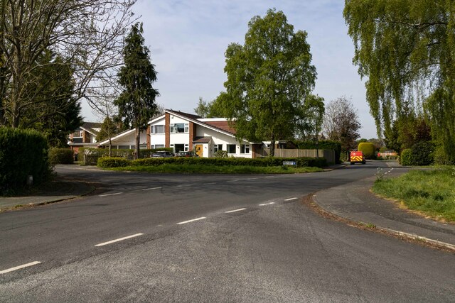
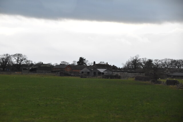
Tattenhall and District is a civil parish located in the county of Cheshire, England. It is situated approximately 9 miles south-east of the city of Chester and covers an area of about 10 square miles. The civil parish includes the village of Tattenhall, as well as nearby hamlets such as Burwardsley, Handley, and Golborne Bellow.

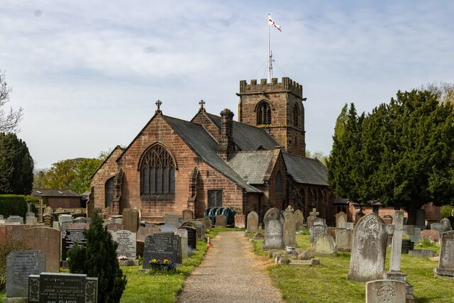
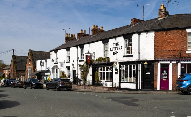
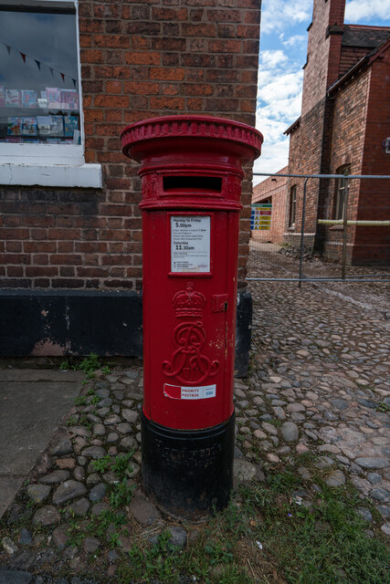
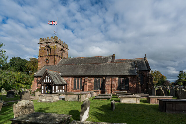
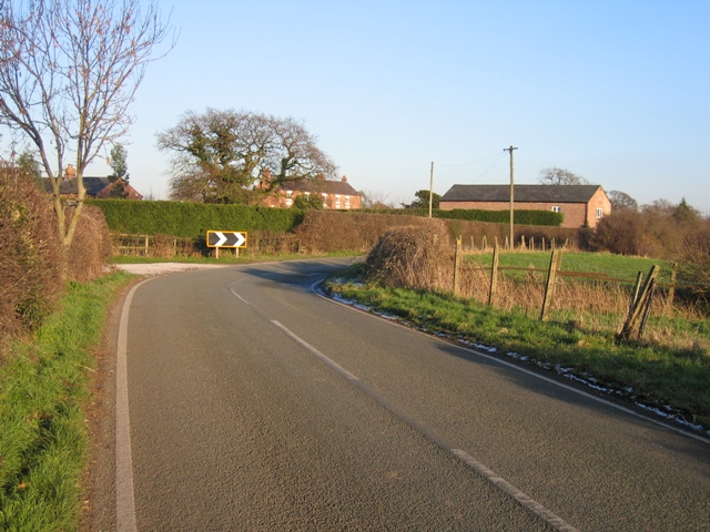
Tattenhall is a picturesque village with a rich history dating back to the Roman times. It is known for its charming black and white timber-framed buildings, including the 14th-century St. Alban's Church and the popular Bear and Ragged Staff pub. The village also boasts a range of amenities, including shops, cafes, and a primary school.

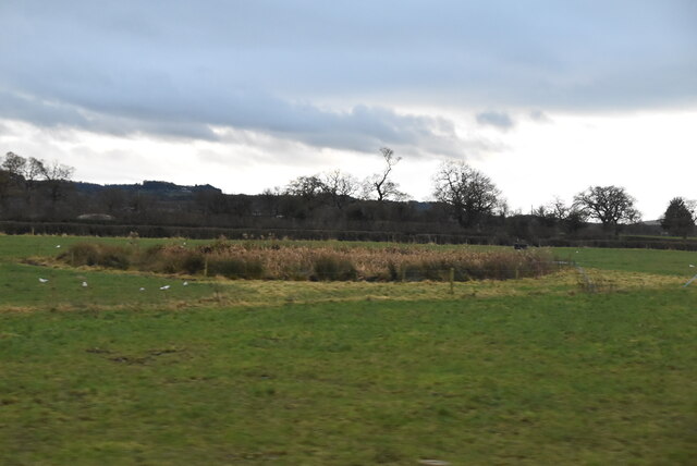
The surrounding countryside of Tattenhall and District is renowned for its natural beauty, with rolling hills, lush farmland, and scenic walks. The area is popular among outdoor enthusiasts, with opportunities for hiking, cycling, and horse riding. The Sandstone Trail, a long-distance footpath, passes through the parish and offers stunning views of the Cheshire Plains.

In addition to its natural attractions, Tattenhall and District hosts various events throughout the year, including a popular annual village festival and a Christmas market. The community is vibrant and inclusive, with a strong sense of local pride.

Overall, Tattenhall and District offers a blend of historic charm, natural beauty, and community spirit, making it an attractive place to live or visit in Cheshire.

If you have any feedback on the listing, please let us know in the comments section below.

Tattenhall and District Images

Images are sourced within 2km of 53.124509/-2.757396 or Grid Reference SJ4958. Thanks to Geograph Open Source API. All images are credited.

Fingerpost, Tattenhall Opposite Chester Rd. Old style direction plates, with a detent ring to fix the position of the fingers.

Inscription: Huxley 3 / Chester 8 // Burwardsley 2½ / Beeston 4 // Milton Green 2 / Broxton 3

Milestone Society National ID: CH_SJ4858A
Fingerpost, Tattenhall
Opposite Chester Rd. Old style direction plates, with a detent ring to fix the position of the fingers. Inscription: Huxley 3 / Chester 8 // Burwardsley 2½ / Beeston 4 // Milton Green 2 / Broxton 3 Milestone Society National ID: CH_SJ4858A
Fingerpost, Tattenhall At the junction of Rock & Frog Lanes.

Inscription: Burwardsley 2/ Huxley 2½ // Broxton 3 / Harthill 2½ // Milton Green 1½

Milestone Society National ID: CH_SJ4858

Made by: Smith & Co Whitchurch
Fingerpost, Tattenhall
At the junction of Rock & Frog Lanes. Inscription: Burwardsley 2/ Huxley 2½ // Broxton 3 / Harthill 2½ // Milton Green 1½ Milestone Society National ID: CH_SJ4858 Made by: Smith & Co Whitchurch
Greenlands House on Greenlands in Tattenhall.
Greenlands
House on Greenlands in Tattenhall.
St Alban's Church St Alban's Church in Tattenhall.
St Alban's Church
St Alban's Church in Tattenhall.
Tattenhall The Letters Inn in Tattenhall.
Tattenhall
The Letters Inn in Tattenhall.
Tattenhall Road
Tattenhall Road
Whitehead Farm Impressive collection of Rover cars at Whitehead Farm.
Whitehead Farm
Impressive collection of Rover cars at Whitehead Farm.
Edward VII (1901-1910) Post Box, Tattenhall
St. Alban's Church, Tattenhall It is thought that a church may have existed on this site at the time of the Norman conquest. The tower and parts of the present church date from the early 16th century. The church was restored and largely remodelled in 1869–70. During this time the remains of an earlier church which had been destroyed by fire were discovered. Also discovered were a skeleton of a large man outside the north wall and a coffin containing bones under the floor of the church. 

<span class="nowrap"><a title="https://en.wikipedia.org/wiki/St_Alban%27s_Church,_Tattenhall" rel="nofollow ugc noopener" href="https://en.wikipedia.org/wiki/St_Alban%27s_Church,_Tattenhall">Link</a><img style="margin-left:2px;" alt="External link" title="External link - shift click to open in new window" src="https://s1.geograph.org.uk/img/external.png" width="10" height="10"/></span>
St. Alban's Church, Tattenhall
It is thought that a church may have existed on this site at the time of the Norman conquest. The tower and parts of the present church date from the early 16th century. The church was restored and largely remodelled in 1869–70. During this time the remains of an earlier church which had been destroyed by fire were discovered. Also discovered were a skeleton of a large man outside the north wall and a coffin containing bones under the floor of the church. LinkExternal link
Tree ice cream sculpture at Cheshire Ice Cream Farm If you wait long enough, it will even squirt out some foam every half hour or so...
Tree ice cream sculpture at Cheshire Ice Cream Farm
If you wait long enough, it will even squirt out some foam every half hour or so...
Mini golf at Cheshire Ice Cream Farm
Cheshire Ice Cream Farm I believe this is the same building as <a href="https://www.geograph.org.uk/photo/160757">SJ4959 : Cheshire Farm</a> (which may have incorrect photo subject location). This building, which I suspect has been re-clad, now houses a cafe and a soft play. The whole facility has been significantly overhauled in the intervening 17 years.
Cheshire Ice Cream Farm
I believe this is the same building as SJ4959 : Cheshire Farm (which may have incorrect photo subject location). This building, which I suspect has been re-clad, now houses a cafe and a soft play. The whole facility has been significantly overhauled in the intervening 17 years.
Dutton's Bridge Grade II listed. Listing number 1230413. Canal accommodation bridge: c.1779 for Chester Canal Company.
Dutton's Bridge
Grade II listed. Listing number 1230413. Canal accommodation bridge: c.1779 for Chester Canal Company.
Cooloo Cottage
Cooloo Cottage
Marshy pond
Marshy pond
Ford Farm
Ford Farm
Ford Farm
Ford Farm
Show me another place!

Tattenhall and District is located at Grid Ref: SJ4958 (Lat: 53.124509, Lng: -2.757396)

Unitary Authority: Cheshire West and Chester

Police Authority: Cheshire

What 3 Words

///shelved.treaty.blackbird. Near Tattenhall, Cheshire

Nearby Locations

Tattenhall and District

Related Wikis

Tattenhall

Tattenhall is a village and former civil parish, now in the parish of Tattenhall and District, 8 miles (13 km) south-east of Chester, in the unitary authority...

St Alban's Church, Tattenhall

St Alban's Church is in the village of Tattenhall, Cheshire, England. It is an active Anglican parish church in the diocese of Chester, the archdeaconry...

The Rookery, Tattenhall

The Rookery is a former country house in the village of Tattenhall, Cheshire, England. The house was originally owned by the Orton family. It was reconstructed...

Newton-by-Tattenhall

Newton is a settlement and as Newton-by-Tattenhall a former civil parish, now in the parish of Tattenhall and District in the Cheshire West and Chester...

Tattenhall Hall

Tattenhall Hall is a country house standing to the south of the village of Tattenhall, Cheshire, England. The house is designated by English Heritage as...

Tattenhall Road railway station

Tattenhall Road railway station was a railway station situated a mile to the north of the village of Tattenhall, Cheshire on the Chester and Crewe Railway...

Tattenhall railway station

Tattenhall railway station was a railway station in the village of Tattenhall, Cheshire on the Whitchurch and Tattenhall Railway or Chester-Whitchurch...

Golborne Bellow

Golborne Bellow is a former civil parish, now in the parish of Tattenhall and District, in the Cheshire West and Chester district, and ceremonial county...

Nearby Amenities

Located within 500m of 53.124509,-2.757396
Bus Stop
Tattenhall, Tattenhall Road / Greenlands
Bus: yes
Naptan AtcoCode: 0610CH1275
Naptan Bearing: S
Naptan CommonName: Greenlands
Naptan Crossing: Greenlands
Naptan Indicator: opp
Naptan Landmark: Number 100
Naptan LocalityName: Tattenhall
Naptan NaptanCode: chwdtwm
Naptan ShortCommonName: Greenlands
Naptan Street: Tattenhall Road
Naptan Verified: no
Operator: Cheshire West and Chester Council
Operator Wikidata: Q16829360
Public Transport: platform
Source: naptan_import
Lat/Long: 53.1264282/-2.7634287
Bus Stop
Tattenhall, Tattenhall Road / Greenlands
Bus: yes
Naptan AtcoCode: 0610CH1276
Naptan Bearing: N
Naptan CommonName: Greenlands
Naptan Crossing: Greenlands
Naptan Indicator: nr
Naptan Landmark: House number 100
Naptan LocalityName: Tattenhall
Naptan NaptanCode: chwdtwp
Naptan ShortCommonName: Greenlands
Naptan Street: Tattenhall Road
Naptan Verified: no
Operator: Cheshire West and Chester Council
Operator Wikidata: Q16829360
Public Transport: platform
Source: naptan_import
Lat/Long: 53.1267535/-2.7635116
Bus Stop
Tattenhall, Keysbrook / Smithfields
Bus: yes
Naptan AtcoCode: 0610CH682
Naptan Bearing: NE
Naptan BusStopType: CUS
Naptan CommonName: Smithfields
Naptan Crossing: Smithfields
Naptan Indicator: opp
Naptan Landmark: Smithfields
Naptan LocalityName: Tattenhall
Naptan NaptanCode: chwdtda
Naptan ShortCommonName: Smithfields
Naptan Street: Keysbrook
Naptan Verified: no
Public Transport: platform
Source: naptan_import
Lat/Long: 53.1251105/-2.7631836
Access: yes
Barrier: kissing_gate
Bicycle: no
Foot: designated
Horse: no
Kissing Gate: circular_profile
Motor Vehicle: no
Wheelchair: no
Lat/Long: 53.1212223/-2.7622097
Direction: both
Surface: paving_stones
Traffic Calming: table
Lat/Long: 53.1236478/-2.7618615
Direction: both
Surface: paving_stones
Traffic Calming: table
Lat/Long: 53.1254188/-2.7585377
Direction: both
Surface: asphalt
Traffic Calming: table
Lat/Long: 53.1259226/-2.7596689
Generator Method: photovoltaic
Generator Output Electricity: yes
Generator Source: solar
Generator Type: solar_photovoltaic_panel
Location: roof
Power: generator
Lat/Long: 53.1258372/-2.7604005
Generator Method: photovoltaic
Generator Output Electricity: yes
Generator Source: solar
Generator Type: solar_photovoltaic_panel
Location: roof
Power: generator
Lat/Long: 53.1258469/-2.7605292
Generator Method: photovoltaic
Generator Output Electricity: yes
Generator Source: solar
Generator Type: solar_photovoltaic_panel
Location: roof
Power: generator
Lat/Long: 53.1269349/-2.7603468
Generator Method: photovoltaic
Generator Output Electricity: yes
Generator Source: solar
Generator Type: solar_photovoltaic_panel
Location: roof
Power: generator
Lat/Long: 53.1269204/-2.76032
Traffic Sign: city_limit
Lat/Long: 53.1273593/-2.7630777
Post Box
Brand: Royal Mail
Brand Wikidata: Q638098
Brand Wikipedia: en:Royal Mail
Collection Times: Mo-Fr 09:00; Sa 07:00; Su off
Drive Through: no
Operator: Royal Mail
Operator Wikidata: Q638098
Post Box Type: lamp
Ref: CH3 306D
Lat/Long: 53.1266274/-2.7633165
Give Way
Direction: forward
Lat/Long: 53.1263461/-2.7636485
Give Way
Direction: backward
Lat/Long: 53.1269165/-2.7632385
Give Way
Direction: backward
Lat/Long: 53.1233991/-2.7641247
Give Way
Direction: backward
Lat/Long: 53.1253038/-2.7628784
Give Way
Direction: forward
Lat/Long: 53.123443/-2.7644866
Give Way
Direction: backward
Lat/Long: 53.1231228/-2.7631685
Give Way
Direction: backward
Lat/Long: 53.1250577/-2.761962
Give Way
Lat/Long: 53.1251093/-2.7619296
Give Way
Direction: backward
Lat/Long: 53.1251093/-2.7619296
Crossing
Crossing: unmarked
Crossing Island: no
Crossing Markings: no
Tactile Paving: yes
Lat/Long: 53.1234345/-2.7644933
Direction: both
Surface: paving_stones
Traffic Calming: table
Lat/Long: 53.1249136/-2.7592498
Maxspeed: 20 mph
Traffic Sign: maxspeed
Lat/Long: 53.1263221/-2.7637415
Maxspeed: 30 mph
Traffic Sign: maxspeed
Lat/Long: 53.1263993/-2.7636985
Street Lamp
Lamp Mount: straight_mast
Lamp Type: led
Support: pole
Lat/Long: 53.1263881/-2.7640848
Street Lamp
Lamp Mount: bent_mast
Lamp Type: led
Support: pole
Lat/Long: 53.124443/-2.7648117
Street Lamp
Lamp Mount: bent_mast
Lamp Type: led
Support: pole
Lat/Long: 53.1248188/-2.7646682
Street Lamp
Lamp Mount: bent_mast
Lamp Type: led
Support: pole
Lat/Long: 53.1255198/-2.7641706
Street Lamp
Lamp Mount: straight_mast
Lamp Type: led
Support: pole
Lat/Long: 53.125906/-2.7637804
Street Lamp
Lamp Mount: straight_mast
Lamp Type: led
Support: pole
Lat/Long: 53.1263285/-2.7635416
Street Lamp
Lamp Mount: bent_mast
Lamp Type: led
Support: pole
Lat/Long: 53.1268838/-2.7633552
The data included in this document is from www.openstreetmap.org. The data is made available under ODbL.

Have you been to Tattenhall and District?

Leave your review of Tattenhall and District below (or comments, questions and feedback).