Tarrant Crawford

Civil Parish in Dorset North Dorset

England

Tarrant Crawford

Crawford Corner, Spetisbury
Crawford Corner, Spetisbury Credit: Roger Cornfoot

Tarrant Crawford is a civil parish located in the county of Dorset, England. It is situated in the Tarrant Valley, approximately 20 miles north of the coastal town of Bournemouth. The parish covers an area of around 6 square miles and is home to a small population.

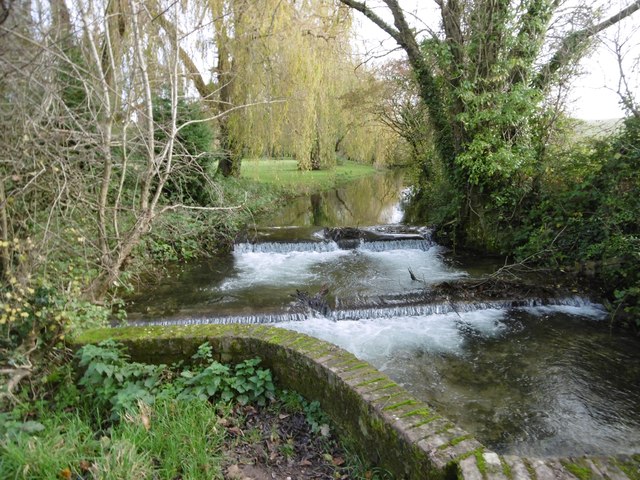
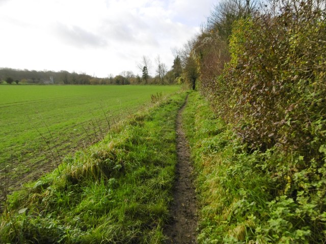
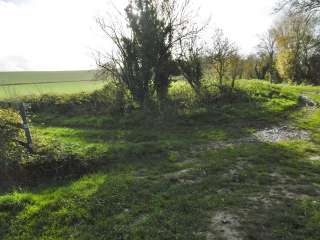
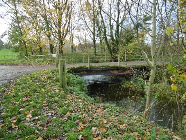
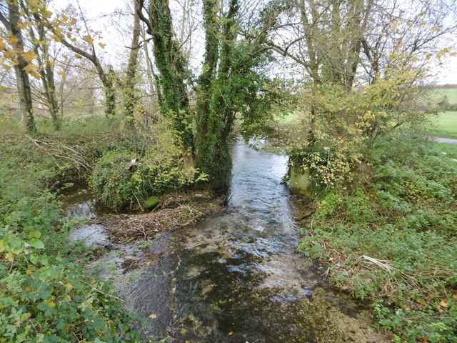
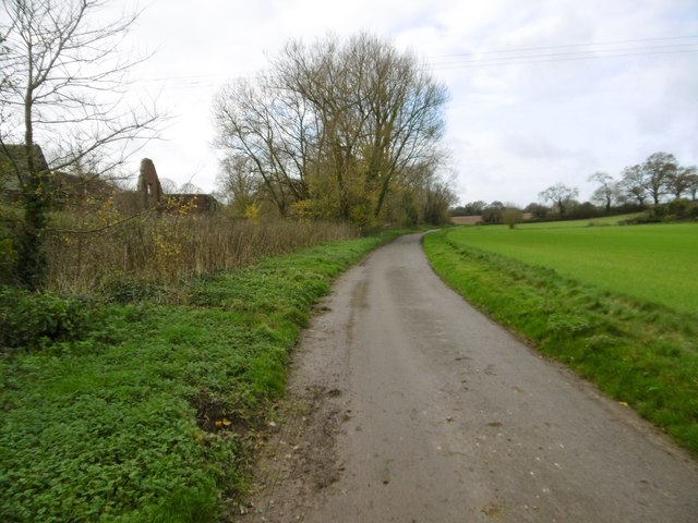
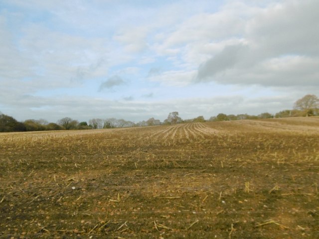
The landscape of Tarrant Crawford is predominantly rural, characterized by rolling hills, farmland, and meandering rivers. The River Tarrant flows through the parish, adding to its scenic beauty. The area is known for its picturesque countryside, making it a popular destination for nature enthusiasts and outdoor activities such as hiking and fishing.

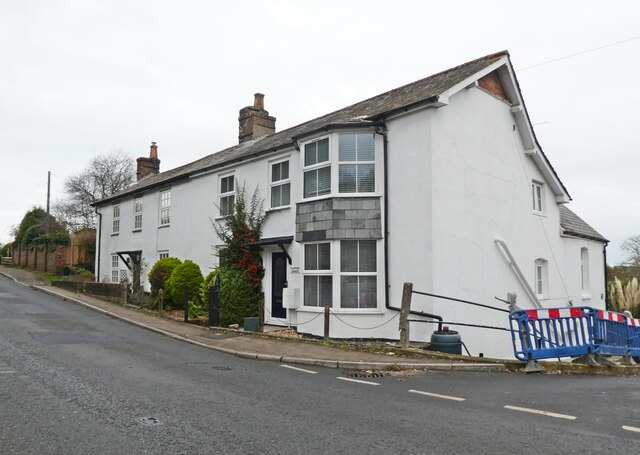
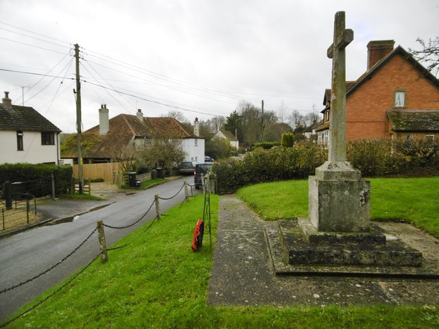
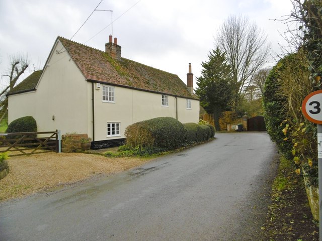
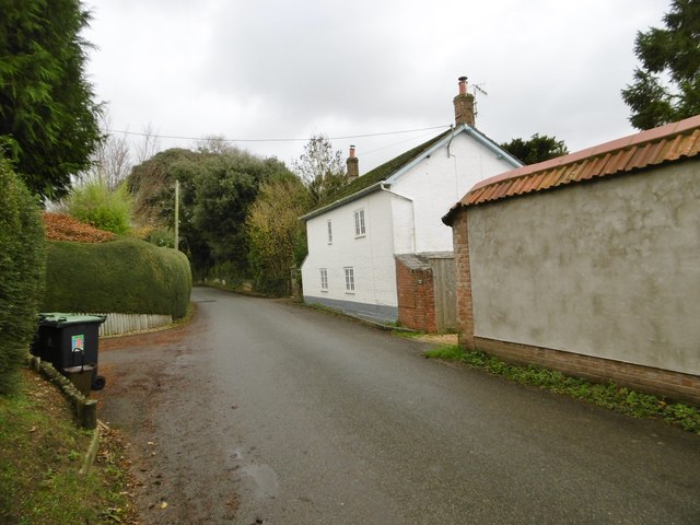
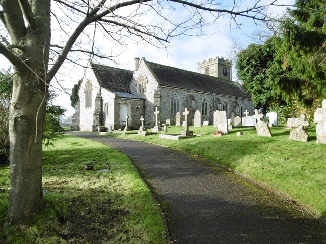
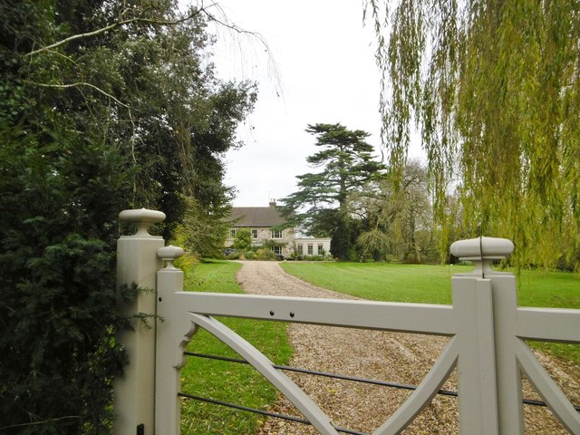
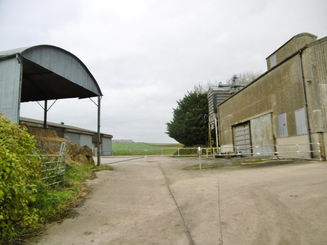
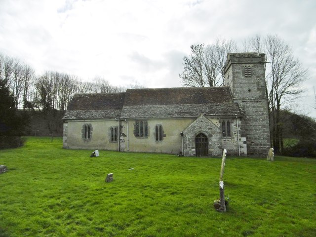
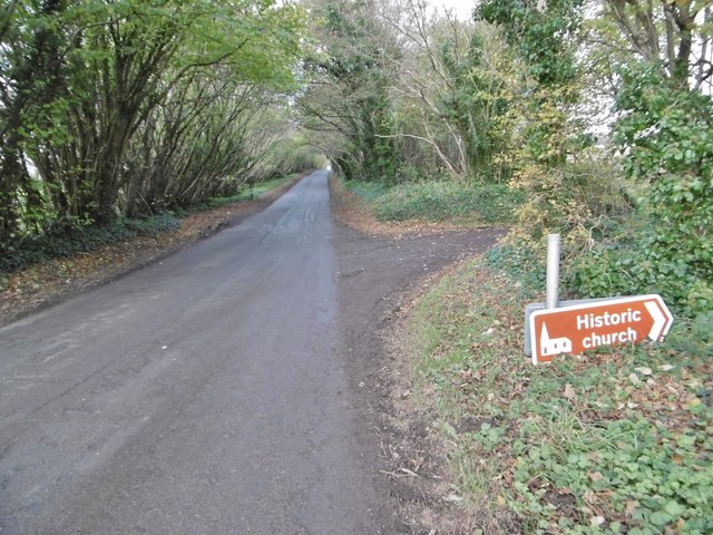
The parish is home to a few scattered residential properties, with the majority of the land used for agriculture. The village itself consists of a handful of historic buildings, including the Grade II listed Tarrant Crawford House, a country manor dating back to the 18th century. The local church, St. Mary's, is a charming medieval building that adds to the village's quaint charm.

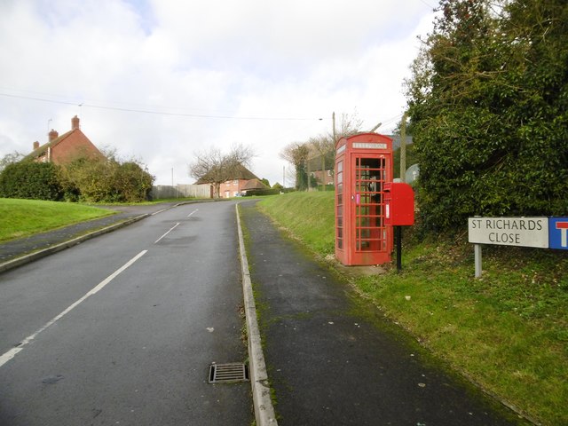
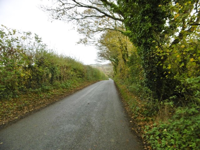
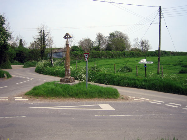
Tarrant Crawford has a peaceful and close-knit community, with residents enjoying a tranquil rural lifestyle. The parish is well-connected to neighboring towns and villages by road, allowing for easy access to amenities and services. Despite its small size, Tarrant Crawford offers a serene and idyllic setting for those seeking a slower pace of life in the heart of Dorset's countryside.

If you have any feedback on the listing, please let us know in the comments section below.

Tarrant Crawford Images

Images are sourced within 2km of 50.827699/-2.111129 or Grid Reference ST9203. Thanks to Geograph Open Source API. All images are credited.

Crawford Corner, Spetisbury
Tarrant Keyneston, war memorial On the village street; commemorating eight men fallen in WWI.
Tarrant Keyneston, war memorial
On the village street; commemorating eight men fallen in WWI.
Tarrant Keyneston, Corner Cottage On a bend in the village street; with C17 roots, and listed by English Heritage: <span class="nowrap"><a title="http://www.imagesofengland.org.uk/Details/Default.aspx?id=103768&mode=adv" rel="nofollow ugc noopener" href="http://www.imagesofengland.org.uk/Details/Default.aspx?id=103768&mode=adv">Link</a><img style="margin-left:2px;" alt="External link" title="External link - shift click to open in new window" src="https://s1.geograph.org.uk/img/external.png" width="10" height="10"/></span>
Tarrant Keyneston, Corner Cottage
On a bend in the village street; with C17 roots, and listed by English Heritage: LinkExternal link
Tarrant Keyneston, Brookfield Cottage On the village street; in the vernacular style, with flint and bands of brick, though now painted.
Tarrant Keyneston, Brookfield Cottage
On the village street; in the vernacular style, with flint and bands of brick, though now painted.
Tarrant Keyneston, boxes EIIR post box, and behind it a phone box; at the corner of St Richards Close and the village street.
Tarrant Keyneston, boxes
EIIR post box, and behind it a phone box; at the corner of St Richards Close and the village street.
Tarrant Keyneston, All Saints On the village street; parish church with C15 roots, listed by English Heritage (Grade II*): <span class="nowrap"><a title="http://www.imagesofengland.org.uk/Details/Default.aspx?id=103758&mode=adv" rel="nofollow ugc noopener" href="http://www.imagesofengland.org.uk/Details/Default.aspx?id=103758&mode=adv">Link</a><img style="margin-left:2px;" alt="External link" title="External link - shift click to open in new window" src="https://s1.geograph.org.uk/img/external.png" width="10" height="10"/></span>
Tarrant Keyneston, All Saints
On the village street; parish church with C15 roots, listed by English Heritage (Grade II*): LinkExternal link
Tarrant Keyneston, weir On the Tarrant, looking upstream; the river here forms the boundary between Tarrant Keyneston (left) and Tarrant Crawford (right). Behind is the garden of Manor Farmhouse.
Tarrant Keyneston, weir
On the Tarrant, looking upstream; the river here forms the boundary between Tarrant Keyneston (left) and Tarrant Crawford (right). Behind is the garden of Manor Farmhouse.
Tarrant Keyneston, Manor Farmhouse On the village street; C18, listed by English Heritage: <span class="nowrap"><a title="http://www.imagesofengland.org.uk/Details/Default.aspx?id=103771&mode=adv" rel="nofollow ugc noopener" href="http://www.imagesofengland.org.uk/Details/Default.aspx?id=103771&mode=adv">Link</a><img style="margin-left:2px;" alt="External link" title="External link - shift click to open in new window" src="https://s1.geograph.org.uk/img/external.png" width="10" height="10"/></span>
Tarrant Keyneston, Manor Farmhouse
On the village street; C18, listed by English Heritage: LinkExternal link
Tarrant Keyneston, farm buildings At Manor Farm.
Tarrant Keyneston, farm buildings
At Manor Farm.
Tarrant Crawford, country road From the crossroads at Keyneston Mill to Tarrant Keyneston.
Tarrant Crawford, country road
From the crossroads at Keyneston Mill to Tarrant Keyneston.
Tarrant Crawford, bridleway Between farmland and the Tarrant (behind the hedge), from the village street to Abbey Farm and beyond.
Tarrant Crawford, bridleway
Between farmland and the Tarrant (behind the hedge), from the village street to Abbey Farm and beyond.
Tarrant Crawford, bridleway junction Left, to downland; ahead, to Abbey Farm.
Tarrant Crawford, bridleway junction
Left, to downland; ahead, to Abbey Farm.
Tarrant Crawford, bridge Across the Tarrant, from Tarrant Crawford church and surrounding farmland.
Tarrant Crawford, bridge
Across the Tarrant, from Tarrant Crawford church and surrounding farmland.
Tarrant Crawford, the Tarrant Looking downstream from <a href="https://www.geograph.org.uk/photo/4754736">ST9203 : Tarrant Crawford, bridge</a>.
Tarrant Crawford, the Tarrant
Looking downstream from ST9203 : Tarrant Crawford, bridge.
Tarrant Crawford, St. Mary's Former parish church, now redundant and cared for by the Churches Conservation Trust; C12 and later. The exterior is part rendered and part stone and flint. Listed by English Heritage (Grade I). <span class="nowrap"><a title="http://www.imagesofengland.org.uk/Details/Default.aspx?id=103746&mode=adv" rel="nofollow ugc noopener" href="http://www.imagesofengland.org.uk/Details/Default.aspx?id=103746&mode=adv">Link</a><img style="margin-left:2px;" alt="External link" title="External link - shift click to open in new window" src="https://s1.geograph.org.uk/img/external.png" width="10" height="10"/></span>
Tarrant Crawford, St. Mary's
Former parish church, now redundant and cared for by the Churches Conservation Trust; C12 and later. The exterior is part rendered and part stone and flint. Listed by English Heritage (Grade I). LinkExternal link
Tarrant Crawford, farm road Farm road and bridleway, from <a href="https://www.geograph.org.uk/photo/4754763">ST9203 : Tarrant Crawford, St. Mary's</a> and neighbouring farmland to the public road.
Tarrant Crawford, farm road
Farm road and bridleway, from ST9203 : Tarrant Crawford, St. Mary's and neighbouring farmland to the public road.
Tarrant Crawford, stubble field
Tarrant Crawford, road sign On the road to Keyneston Mill Corner; road sign T105, to <a href="https://www.geograph.org.uk/photo/4754763">ST9203 : Tarrant Crawford, St. Mary's</a>. <span class="nowrap"><a title="http://www.legislation.gov.uk/uksi/2002/3113/made" rel="nofollow ugc noopener" href="http://www.legislation.gov.uk/uksi/2002/3113/made">Link</a><img style="margin-left:2px;" alt="External link" title="External link - shift click to open in new window" src="https://s1.geograph.org.uk/img/external.png" width="10" height="10"/></span>
Tarrant Crawford, road sign
On the road to Keyneston Mill Corner; road sign T105, to ST9203 : Tarrant Crawford, St. Mary's. LinkExternal link
Show me another place!

Tarrant Crawford is located at Grid Ref: ST9203 (Lat: 50.827699, Lng: -2.111129)

Administrative County: Dorset

District: North Dorset

Police Authority: Dorset

What 3 Words

///cycled.chaos.flexibly. Near Charlton Marshall, Dorset

Related Wikis

Tarrant Crawford

Tarrant Crawford is a small village and civil parish at the lower end of the Tarrant Valley in Dorset, England. The River Tarrant joins the larger River...

St Mary the Virgin, Tarrant Crawford

The Church of St Mary the Virgin in Tarrant Crawford, Dorset, England, was built in the 12th century. It is recorded in the National Heritage List for...

River Tarrant

The River Tarrant is a 12 km long tributary of the River Stour in Dorset. The valley lies to the east of Blandford Forum. The river rises near Cranborne...

Tarrant Abbey

Tarrant Abbey was a Cistercian nunnery in Tarrant Crawford, Dorset, England. == History == The abbey was founded as an independent monastery in 1186 by...

Nearby Amenities

Located within 500m of 50.827699,-2.111129
Tarrant Crawford
Place: hamlet
Lat/Long: 50.8294821/-2.113447
Material: wood
Power: pole
Source: bing
Transformer: distribution
Lat/Long: 50.8304543/-2.1123161
Material: wood
Power: pole
Source: bing
Lat/Long: 50.8312997/-2.1125226
Information: guidepost
Tourism: information
Lat/Long: 50.8239073/-2.1104289
Fixme: Continues
Lat/Long: 50.8241042/-2.1110755
Fire Hydrant
Emergency: fire_hydrant
Fire Hydrant Diameter: 100
Fire Hydrant Type: underground
Ref: 009933
Source: survey
Lat/Long: 50.823953/-2.110628
Inscription: This way side cross was restored & set on new steps on the old site by many friends of Tarrant Crawford anno dom MDCCCCXIV
Man Made: cross
Lat/Long: 50.8239523/-2.1105122
Marker: post
Note: W D C;R M;Dp 1-12M;Ds 10-80M;45° BEND
Lat/Long: 50.8239908/-2.1108227
Entrance: main
Lat/Long: 50.8307648/-2.1107885
The data included in this document is from www.openstreetmap.org. The data is made available under ODbL.

Have you been to Tarrant Crawford?

Leave your review of Tarrant Crawford below (or comments, questions and feedback).