Tabley Inferior
Civil Parish in Cheshire
England
Tabley Inferior
Tabley Inferior is a civil parish located in the county of Cheshire, England. It is situated approximately 3 miles south of the town of Knutsford and covers an area of about 2.3 square miles. The parish is part of the Cheshire East unitary authority.
Tabley Inferior is primarily a rural area characterized by its picturesque landscape and agricultural activities. The land is predominantly flat, with fertile fields and patches of woodland scattered throughout. The River Bollin flows through the parish, adding to its natural beauty.
The parish is home to a small population, with a mix of residential properties and a few scattered farms. The architecture in the area is largely traditional, with a number of historic buildings and cottages that add to its charm. One notable landmark is Tabley Hall, a Grade I listed country house dating back to the 18th century. The hall is surrounded by well-maintained gardens and a deer park, making it a popular attraction for visitors.
Despite its rural nature, Tabley Inferior benefits from its proximity to nearby towns and amenities. The town of Knutsford provides a range of services, including shops, schools, and healthcare facilities. The parish also enjoys good transport links, with major roads such as the A556 and M6 motorway nearby, offering easy access to the wider region.
Overall, Tabley Inferior offers a tranquil and idyllic setting, making it an attractive place to live for those seeking a peaceful rural lifestyle.
If you have any feedback on the listing, please let us know in the comments section below.
Tabley Inferior Images
Images are sourced within 2km of 53.290396/-2.423492 or Grid Reference SJ7177. Thanks to Geograph Open Source API. All images are credited.
Tabley Inferior is located at Grid Ref: SJ7177 (Lat: 53.290396, Lng: -2.423492)
Unitary Authority: Cheshire East
Police Authority: Cheshire
What 3 Words
///succumbs.manhole.verges. Near Knutsford, Cheshire
Nearby Locations
Related Wikis
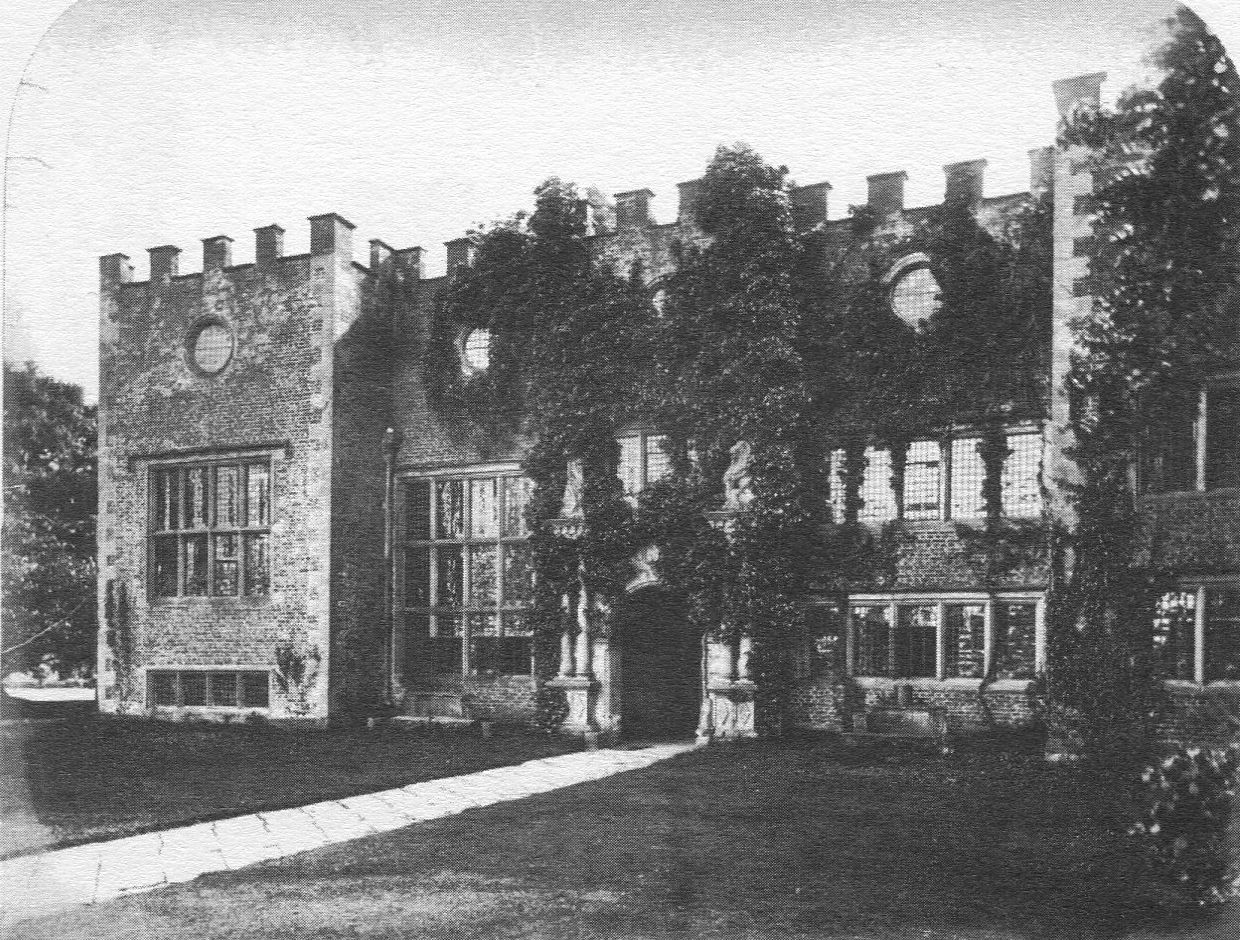
Tabley Old Hall
The ruin of Tabley Old Hall (more properly known as Nether Tabley Old Hall) is on an island surrounded by a moat in the civil parish of Tabley Inferior...
Tabley Inferior
Tabley Inferior is a civil parish in the Borough of Cheshire East and ceremonial county of Cheshire in England. It has a population of 137. Tabley House...

Cuckooland Museum
The Cuckooland Museum, previously known as the Cuckoo Clock Museum, is a museum that exhibits mainly cuckoo clocks, located in Tabley, Cheshire, England...
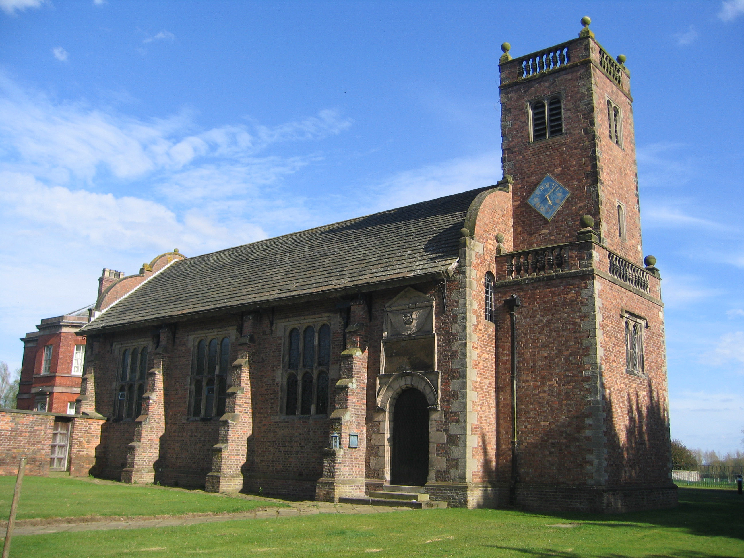
St Peter's Church, Tabley
St Peter's Church is a chapel to the west of Tabley House near Knutsford, Cheshire, England. It is recorded in the National Heritage List for England...
Nearby Amenities
Located within 500m of 53.290396,-2.423492Have you been to Tabley Inferior?
Leave your review of Tabley Inferior below (or comments, questions and feedback).