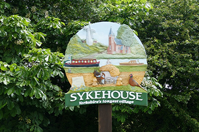
Sykehouse

Civil Parish in Yorkshire Doncaster

England

Sykehouse

Canal near Smallhedge Farm National Cycle Network route 62 runs along the towpath beside New Junction Canal.
Canal near Smallhedge Farm Credit: DS Pugh

Sykehouse is a civil parish located in the county of Yorkshire, England. Situated in the Metropolitan Borough of Doncaster, it is nestled in the fertile countryside of South Yorkshire. The parish covers an area of approximately 10 square kilometers and is home to a population of around 600 residents.

The village of Sykehouse is known for its picturesque landscapes, characterized by rolling hills, lush meadows, and charming farmland. The area benefits from its proximity to the River Don, which flows through the parish, providing a source of water and recreational opportunities.

Historically, Sykehouse has been an agricultural community, with farming being a significant aspect of its economy. The parish is dotted with traditional farmhouses and barns, showcasing the area's rural heritage. However, like many rural communities, the village has seen a decline in the number of working farms in recent years.

In terms of amenities, Sykehouse boasts a church, St. Oswald's, which dates back to the 12th century and stands as a testament to the village's long-standing history. The church serves as a focal point for the community, hosting regular services and community events.

Sykehouse offers a peaceful and close-knit community atmosphere, with residents benefitting from the tranquility and natural beauty of the surrounding countryside. Despite its small size, the village has a strong sense of community spirit, with various local groups and organizations providing opportunities for social interaction and engagement.

Overall, Sykehouse is a charming and idyllic civil parish in Yorkshire, offering residents a rural lifestyle amidst beautiful landscapes and a strong sense of community.

If you have any feedback on the listing, please let us know in the comments section below.
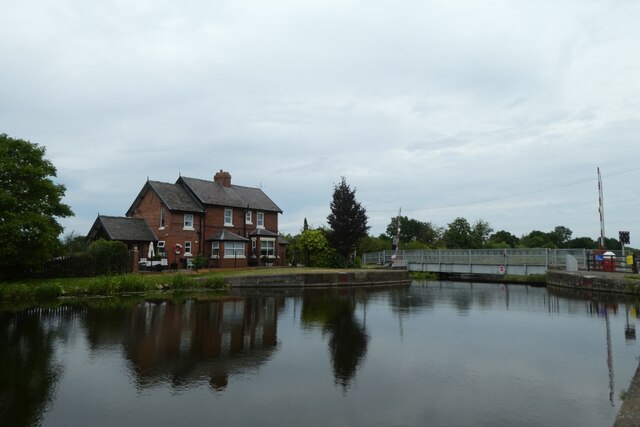
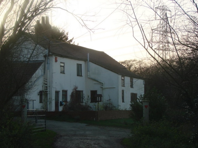
Sykehouse Images

Images are sourced within 2km of 53.644311/-1.029052 or Grid Reference SE6416. Thanks to Geograph Open Source API. All images are credited.

Canal near Smallhedge Farm National Cycle Network route 62 runs along the towpath beside New Junction Canal.
Canal near Smallhedge Farm
National Cycle Network route 62 runs along the towpath beside New Junction Canal.
Towpath near Smallhedge Farm National Cycle Network route 62 runs along the towpath beside New Junction Canal.
Towpath near Smallhedge Farm
National Cycle Network route 62 runs along the towpath beside New Junction Canal.
Powerlines crossing New Junction Canal National Cycle Network route 62 runs along the towpath beside New Junction Canal.
Powerlines crossing New Junction Canal
National Cycle Network route 62 runs along the towpath beside New Junction Canal.
Moored boat south of Sykehouse Lock Bridge National Cycle Network route 62 runs along the towpath beside New Junction Canal.
Moored boat south of Sykehouse Lock Bridge
National Cycle Network route 62 runs along the towpath beside New Junction Canal.
Boats waiting at Sykehouse Lock There was a queue of boats for the lock, with Canal and River Trust staff in attendance. The lock wouldn't open, with a staff member advising it was a software error. National Cycle Network route 62 runs along the towpath beside New Junction Canal.
Boats waiting at Sykehouse Lock
There was a queue of boats for the lock, with Canal and River Trust staff in attendance. The lock wouldn't open, with a staff member advising it was a software error. National Cycle Network route 62 runs along the towpath beside New Junction Canal.
Sykehouse Lock There was a queue of boats for the lock, with Canal and River Trust staff in attendance. The lock wouldn't open, with a staff member advising it was a software error. National Cycle Network route 62 runs along the towpath beside New Junction Canal.
Sykehouse Lock
There was a queue of boats for the lock, with Canal and River Trust staff in attendance. The lock wouldn't open, with a staff member advising it was a software error. National Cycle Network route 62 runs along the towpath beside New Junction Canal.
Lock basin at Sykehouse Lock There was a queue of boats for the lock, with Canal and River Trust staff in attendance. The lock wouldn't open, with a staff member advising it was a software error. National Cycle Network route 62 runs along the towpath beside New Junction Canal.
Lock basin at Sykehouse Lock
There was a queue of boats for the lock, with Canal and River Trust staff in attendance. The lock wouldn't open, with a staff member advising it was a software error. National Cycle Network route 62 runs along the towpath beside New Junction Canal.
North entrance to Sykehouse Lock There was a queue of boats for the lock on the south side, with Canal and River Trust staff in attendance. The lock wouldn't open, with a staff member advising it was a software error. National Cycle Network route 62 runs along the towpath beside New Junction Canal, crossing sides at this lock.
North entrance to Sykehouse Lock
There was a queue of boats for the lock on the south side, with Canal and River Trust staff in attendance. The lock wouldn't open, with a staff member advising it was a software error. National Cycle Network route 62 runs along the towpath beside New Junction Canal, crossing sides at this lock.
Swans north of Sykehouse Lock National Cycle Network route 62 runs along the towpath beside New Junction Canal.
Swans north of Sykehouse Lock
National Cycle Network route 62 runs along the towpath beside New Junction Canal.
Kirk Lane Bridge National Cycle Network route 62 runs along the towpath beside New Junction Canal.
Kirk Lane Bridge
National Cycle Network route 62 runs along the towpath beside New Junction Canal.
Kirk Lane Swing Bridge National Cycle Network route 62 runs along the towpath beside New Junction Canal.
Kirk Lane Swing Bridge
National Cycle Network route 62 runs along the towpath beside New Junction Canal.
Towpath north of Kirk Lane Bridge National Cycle Network route 62 runs along the towpath beside New Junction Canal.
Towpath north of Kirk Lane Bridge
National Cycle Network route 62 runs along the towpath beside New Junction Canal.
Canal at Sykehouse Road Bridge National Cycle Network route 62 runs along the towpath beside New Junction Canal.
Canal at Sykehouse Road Bridge
National Cycle Network route 62 runs along the towpath beside New Junction Canal.
Canal north of Sykehouse Road New Junction Canal links the Aire and Calder Navigation with the Stainforth and Keadby Canal and the Sheffield and South Don Navigation.
Canal north of Sykehouse Road
New Junction Canal links the Aire and Calder Navigation with the Stainforth and Keadby Canal and the Sheffield and South Don Navigation.
New Junction Canal north of Sykehouse Road New Junction Canal links the Aire and Calder Navigation with the Stainforth and Keadby Canal and the Sheffield and South Don Navigation.
New Junction Canal north of Sykehouse Road
New Junction Canal links the Aire and Calder Navigation with the Stainforth and Keadby Canal and the Sheffield and South Don Navigation.
New Beginnings moored on the canal New Junction Canal links the Aire and Calder Navigation with the Stainforth and Keadby Canal and the Sheffield and South Don Navigation.
New Beginnings moored on the canal
New Junction Canal links the Aire and Calder Navigation with the Stainforth and Keadby Canal and the Sheffield and South Don Navigation.
Canal south of Went End Footbridge New Junction Canal links the Aire and Calder Navigation with the Stainforth and Keadby Canal and the Sheffield and South Don Navigation. Ahead the canal crosses the River Went on an aqueduct.
Canal south of Went End Footbridge
New Junction Canal links the Aire and Calder Navigation with the Stainforth and Keadby Canal and the Sheffield and South Don Navigation. Ahead the canal crosses the River Went on an aqueduct.
New Junction Canal from Went End Footbridge New Junction Canal links the Aire and Calder Navigation with the Stainforth and Keadby Canal and the Sheffield and South Don Navigation. Behind the canal crosses the River Went on an aqueduct.
New Junction Canal from Went End Footbridge
New Junction Canal links the Aire and Calder Navigation with the Stainforth and Keadby Canal and the Sheffield and South Don Navigation. Behind the canal crosses the River Went on an aqueduct.
Show me another place!

Sykehouse is located at Grid Ref: SE6416 (Lat: 53.644311, Lng: -1.029052)

Division: West Riding

Administrative County: South Yorkshire

District: Doncaster

Police Authority: South Yorkshire

What 3 Words

///swear.capillary.deed. Near Pollington, East Yorkshire

Nearby Locations

Sykehouse Mawson Green

Related Wikis

Topham, South Yorkshire

Topham is a small rural hamlet upon the River Went in rural Yorkshire within the Metropolitan Borough of Doncaster in northern England. The hamlet runs...

Sykehouse

Sykehouse is a village and civil parish in the City of Doncaster, South Yorkshire, England, on the border with the East Riding of Yorkshire. It was part...

Snaith and Pollington railway station

Snaith and Pollington railway station was a station on the Hull and Barnsley and Great Central Joint Railway between Sykehouse and Carlton. It was built...

Sykehouse railway station

Sykehouse railway station was a station on the Hull and Barnsley and Great Central Joint Railway between Thorpe-in-Balne and Snaith and Pollington. It...

Nearby Amenities

Located within 500m of 53.644311,-1.029052
Bus Stop
Kirk Lane
Alt Name: Kirk Lane
Naptan AltCommonName: Kirk Lane
Naptan AtcoCode: 370040533
Naptan Bearing: N
Naptan CommonName: Kirk Lane
Naptan Indicator: 40533
Naptan Landmark: Kirk Lane Bridge
Naptan PlusbusZoneRef: ROTHCEN
Naptan Street: Kirk Lane
Naptan Verified: no
Source: naptan_import
Lat/Long: 53.6420862/-1.0335001
Bus Stop
Kirk Lane
Alt Name: Kirk Lane
Naptan AltCommonName: Kirk Lane
Naptan AtcoCode: 370040534
Naptan Bearing: N
Naptan CommonName: Kirk Lane
Naptan Indicator: 40534
Naptan Landmark: TITHEDALE FARM
Naptan PlusbusZoneRef: ROTHCEN
Naptan Street: Kirk Lane
Naptan Verified: no
Source: naptan_import
Lat/Long: 53.6430826/-1.0344455
Bus Stop
Sykehouse Road
Alt Name: Sykehouse Road
Naptan AltCommonName: Sykehouse Road
Naptan AtcoCode: 370040538
Naptan Bearing: E
Naptan CommonName: Sykehouse Road
Naptan Indicator: 40538
Naptan Landmark: 40538
Naptan PlusbusZoneRef: ROTHCEN
Naptan Street: Sykehouse Road
Naptan Verified: no
Source: naptan_import
Lat/Long: 53.6483878/-1.0280004
Bus Stop
Sykehouse Road
Alt Name: Sykehouse Road
Naptan AltCommonName: Sykehouse Road
Naptan AtcoCode: 370040539
Naptan Bearing: E
Naptan CommonName: Sykehouse Road
Naptan Indicator: 40539
Naptan Landmark: BT Pole
Naptan PlusbusZoneRef: ROTHCEN
Naptan Street: Sykehouse Road
Naptan Verified: no
Source: naptan_import
Lat/Long: 53.6482211/-1.0318318
Sykehouse Road
Alt Name: Sykehouse Road
Naptan AltCommonName: Sykehouse Road
Naptan AtcoCode: 370045976
Naptan Bearing: W
Naptan BusStopType: CUS
Naptan CommonName: Sykehouse Road
Naptan Indicator: 45976
Naptan Landmark: BRIDGE
Naptan PlusbusZoneRef: ROTHCEN
Naptan Street: Sykehouse Road
Naptan Verified: no
Source: naptan_import
Lat/Long: 53.648244/-1.0280037
Sykehouse Road/Marsh Hills
Naptan AtcoCode: 370045977
Naptan Bearing: W
Naptan BusStopType: CUS
Naptan CommonName: Sykehouse Road/Marsh Hills
Naptan Indicator: 45977
Naptan Landmark: OPPOSITE MARSH HILLS/ROAD BRID
Naptan PlusbusZoneRef: ROTHCEN
Naptan Street: Sykehouse Road
Naptan Verified: no
Source: naptan_import
Lat/Long: 53.6481044/-1.0318496
The data included in this document is from www.openstreetmap.org. The data is made available under ODbL.

Have you been to Sykehouse?

Leave your review of Sykehouse below (or comments, questions and feedback).