Swindon

Civil Parish in Staffordshire South Staffordshire

England

Swindon

Ashwood Lower Lane at Greensforge, Staffordshire The Navigation Inn is on the right. Greensforge Bridge ahead crosses the Staffordshire and Worcestershire Canal by Greensforge Lock.
Ashwood Lower Lane at Greensforge, Staffordshire Credit: Roger Kidd

Swindon is a civil parish located in the county of Staffordshire, England. Situated in the West Midlands region, it is part of the district of Stafford. The parish is nestled on the outskirts of the town of Stafford and covers an area of approximately 5 square kilometers.

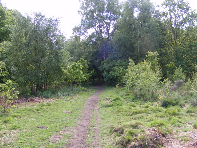
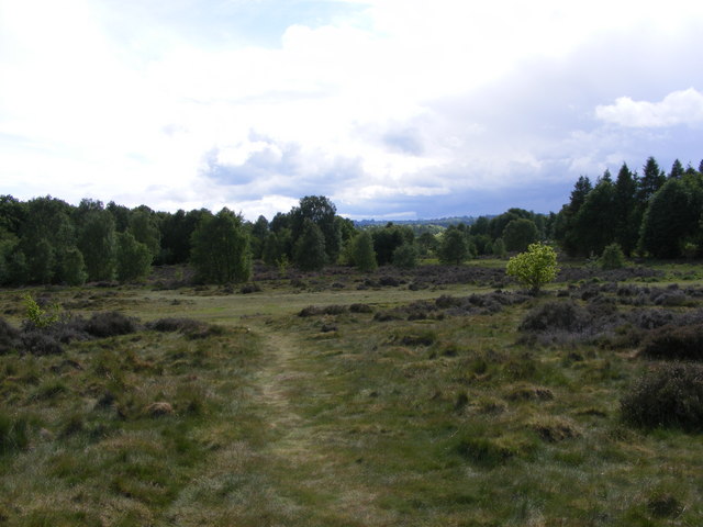
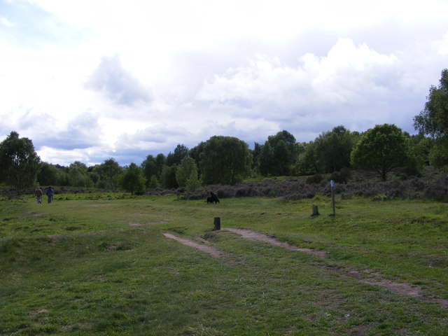
Swindon is a predominantly rural area with a small population of around 500 residents. The landscape is characterized by rolling hills, open fields, and picturesque countryside, offering a tranquil and peaceful environment for its inhabitants. The parish is primarily residential, with a mix of detached houses, cottages, and farmhouses scattered throughout.

Despite its rural setting, Swindon benefits from its proximity to Stafford, which provides easy access to a range of amenities and services. The town offers a variety of shops, supermarkets, restaurants, and recreational facilities, ensuring that residents have access to essential goods and services without having to travel far.

The area surrounding Swindon is known for its natural beauty, with several walking trails and outdoor recreational opportunities available for residents and visitors alike. The nearby Cannock Chase, an Area of Outstanding Natural Beauty, offers an array of activities, including hiking, cycling, and wildlife spotting.

Swindon is well-connected to other parts of Staffordshire, with good transport links. The A34 road passes nearby, providing easy access to the wider road network, and the nearby Stafford railway station offers regular services to major cities such as Birmingham, Manchester, and London.

Overall, Swindon offers a peaceful and idyllic countryside setting, with convenient access to nearby amenities, making it an attractive place to live for those seeking a rural lifestyle within reach of urban conveniences.

If you have any feedback on the listing, please let us know in the comments section below.
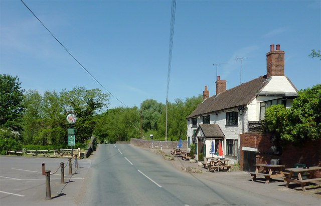
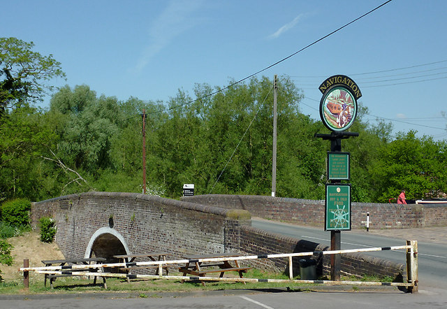
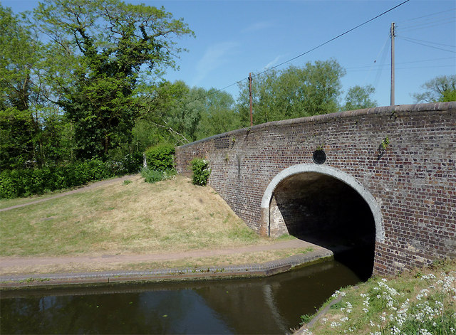
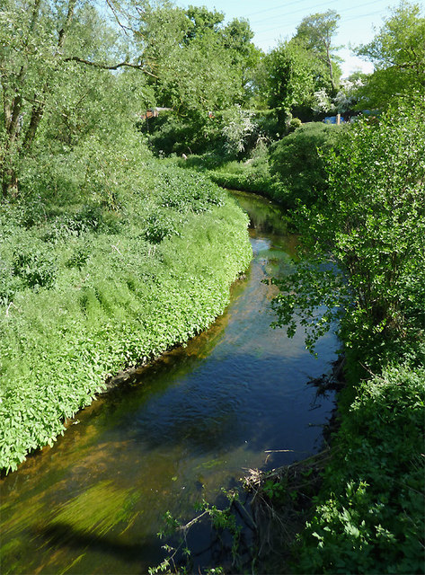
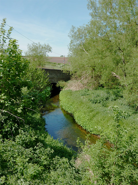
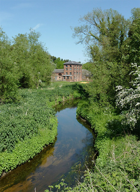
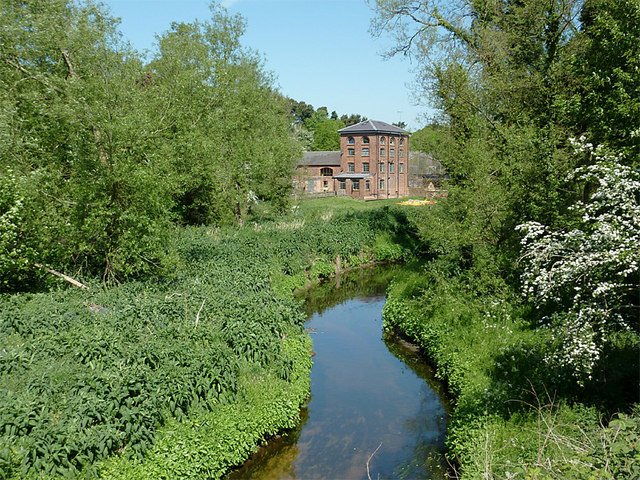
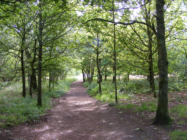
Swindon Images

Images are sourced within 2km of 52.512383/-2.213997 or Grid Reference SO8590. Thanks to Geograph Open Source API. All images are credited.

Ashwood Lower Lane at Greensforge, Staffordshire The Navigation Inn is on the right. Greensforge Bridge ahead crosses the Staffordshire and Worcestershire Canal by Greensforge Lock.
Ashwood Lower Lane at Greensforge, Staffordshire
The Navigation Inn is on the right. Greensforge Bridge ahead crosses the Staffordshire and Worcestershire Canal by Greensforge Lock.
Greensforge Bridge near Kingswinford, Staffordshire This is Bridge No 37 across the Staffordshire and Worcestershire Canal. The pub sign refers to The Navigation Inn, off to the right. The woman in red (top right) is at the tiller of a narrowboat negotiating Greensforge Lock.

<a href="https://www.geograph.org.uk/photo/2398674">SO8688 : Ashwood Lower Lane at Greensforge, Staffordshire</a>
Greensforge Bridge near Kingswinford, Staffordshire
This is Bridge No 37 across the Staffordshire and Worcestershire Canal. The pub sign refers to The Navigation Inn, off to the right. The woman in red (top right) is at the tiller of a narrowboat negotiating Greensforge Lock. SO8688 : Ashwood Lower Lane at Greensforge, Staffordshire
Greensforge Bridge near Kingswinford, Staffordshire This is Bridge No 37 across the Staffordshire and Worcestershire Canal. Narrowboats entering the bridge hole here go directly into Greensforge Lock.
Greensforge Bridge near Kingswinford, Staffordshire
This is Bridge No 37 across the Staffordshire and Worcestershire Canal. Narrowboats entering the bridge hole here go directly into Greensforge Lock.
The Smestow River at Greensforge, Staffordshire The river is flowing south,towards the camera. It meets the River Stour about two miles away. Above the bank on the right, narrowboats moored on the Staffordshire and Worcestershire Canal are just visible.

Much work has been done on the Smestow Brook in recent years to reduce the frequency of its flooding. Apparently, the dredging work has increased the depth in places to four feet (1.25m) resulting in the brook's upgrading to "river" status, but map makers are not yet cognisant of this (everyone still calls it Smestow Brook anyway!). Of course, such work needs constant maintenance. <span class="nowrap"><a title="http://www.roman-britain.org/places/greensforge.htm" rel="nofollow ugc noopener" href="http://www.roman-britain.org/places/greensforge.htm">Link</a><img style="margin-left:2px;" alt="External link" title="External link - shift click to open in new window" src="https://s1.geograph.org.uk/img/external.png" width="10" height="10"/></span>
The Smestow River at Greensforge, Staffordshire
The river is flowing south,towards the camera. It meets the River Stour about two miles away. Above the bank on the right, narrowboats moored on the Staffordshire and Worcestershire Canal are just visible. Much work has been done on the Smestow Brook in recent years to reduce the frequency of its flooding. Apparently, the dredging work has increased the depth in places to four feet (1.25m) resulting in the brook's upgrading to "river" status, but map makers are not yet cognisant of this (everyone still calls it Smestow Brook anyway!). Of course, such work needs constant maintenance. LinkExternal link
The Smestow River at Greensforge, Staffordshire The river is flowing south, away from the camera. It meets the River Stour about two miles downstream. 
Much work has been done on the Smestow Brook in recent years to reduce the frequency of its flooding. Apparently, the dredging work has increased the depth in places to four feet (1.25m) resulting in the brook's upgrading to "river" status, but map makers are not yet cognisant of this (everyone still calls it Smestow Brook anyway!). Of course, such work needs constant maintenance. <span class="nowrap"><a title="http://www.roman-britain.org/places/greensforge.htm" rel="nofollow ugc noopener" href="http://www.roman-britain.org/places/greensforge.htm">Link</a><img style="margin-left:2px;" alt="External link" title="External link - shift click to open in new window" src="https://s1.geograph.org.uk/img/external.png" width="10" height="10"/></span>
The Smestow River at Greensforge, Staffordshire
The river is flowing south, away from the camera. It meets the River Stour about two miles downstream. Much work has been done on the Smestow Brook in recent years to reduce the frequency of its flooding. Apparently, the dredging work has increased the depth in places to four feet (1.25m) resulting in the brook's upgrading to "river" status, but map makers are not yet cognisant of this (everyone still calls it Smestow Brook anyway!). Of course, such work needs constant maintenance. LinkExternal link
The Smestow River at Greensforge, Staffordshire The river is flowing south, towards the camera. It meets the River Stour about two miles away. On the far bank is Greensforge Mill.

Much work has been done on the Smestow Brook in recent years to reduce the frequency of its flooding. Apparently, the dredging work has increased the depth in places to four feet (1.25m) resulting in the brook's upgrading to "river" status, but map makers are not yet cognisant of this (everyone still calls it Smestow Brook anyway!). Of course, such work needs constant maintenance. <span class="nowrap"><a title="http://www.roman-britain.org/places/greensforge.htm" rel="nofollow ugc noopener" href="http://www.roman-britain.org/places/greensforge.htm">Link</a><img style="margin-left:2px;" alt="External link" title="External link - shift click to open in new window" src="https://s1.geograph.org.uk/img/external.png" width="10" height="10"/></span>

There has been a mill on this site since at least the 16th century. In 1602 the existing corn mill was converted into a hammer mill. It was rebuilt in the late 19th century and was a corn mill again until it closed in about 1925. Further conversion into apartments has now taken place.
The Smestow River at Greensforge, Staffordshire
The river is flowing south, towards the camera. It meets the River Stour about two miles away. On the far bank is Greensforge Mill. Much work has been done on the Smestow Brook in recent years to reduce the frequency of its flooding. Apparently, the dredging work has increased the depth in places to four feet (1.25m) resulting in the brook's upgrading to "river" status, but map makers are not yet cognisant of this (everyone still calls it Smestow Brook anyway!). Of course, such work needs constant maintenance. LinkExternal link There has been a mill on this site since at least the 16th century. In 1602 the existing corn mill was converted into a hammer mill. It was rebuilt in the late 19th century and was a corn mill again until it closed in about 1925. Further conversion into apartments has now taken place.
The Smestow River at Greensforge, Staffordshire The river is flowing south, towards the camera. It meets the River Stour about two miles away. On the far bank is Greensforge Mill.

Much work has been done on the Smestow Brook in recent years to reduce the frequency of its flooding. Apparently, the dredging work has increased the depth in places to four feet (1.25m) resulting in the brook's upgrading to "river" status, but map makers are not yet cognisant of this (everyone still calls it Smestow Brook anyway). Of course, such work needs constant maintenance. <span class="nowrap"><a title="http://www.roman-britain.org/places/greensforge.htm" rel="nofollow ugc noopener" href="http://www.roman-britain.org/places/greensforge.htm">Link</a><img style="margin-left:2px;" alt="External link" title="External link - shift click to open in new window" src="https://s1.geograph.org.uk/img/external.png" width="10" height="10"/></span>

There has been a mill on this site since at least the 16th century. In 1602 the existing corn mill was converted into a hammer mill. It was rebuilt in the late 19th century and was a corn mill again until it closed in about 1925. Further conversion into apartments has now taken place.
The Smestow River at Greensforge, Staffordshire
The river is flowing south, towards the camera. It meets the River Stour about two miles away. On the far bank is Greensforge Mill. Much work has been done on the Smestow Brook in recent years to reduce the frequency of its flooding. Apparently, the dredging work has increased the depth in places to four feet (1.25m) resulting in the brook's upgrading to "river" status, but map makers are not yet cognisant of this (everyone still calls it Smestow Brook anyway). Of course, such work needs constant maintenance. LinkExternal link There has been a mill on this site since at least the 16th century. In 1602 the existing corn mill was converted into a hammer mill. It was rebuilt in the late 19th century and was a corn mill again until it closed in about 1925. Further conversion into apartments has now taken place.
Highgate Path The view from near White House Lane of the footpath on Highgate Common Country Park.
Highgate Path
The view from near White House Lane of the footpath on Highgate Common Country Park.
Highgate Clearing The view of the footpath on Highgate Common Country Park.
Highgate Clearing
The view of the footpath on Highgate Common Country Park.
Highgate View The view from Birches Coppice Car Park off White House Lane over Highgate Common Country Park.
Highgate View
The view from Birches Coppice Car Park off White House Lane over Highgate Common Country Park.
Highgate Common View The view over Highgate Common Country Park.
Highgate Common View
The view over Highgate Common Country Park.
View over Gates and Barriers on the Mile Flat These barriers in the gateways are there to prevent unlawful access. In the distance is Swindon to the right and Camp Hill to the left.
View over Gates and Barriers on the Mile Flat
These barriers in the gateways are there to prevent unlawful access. In the distance is Swindon to the right and Camp Hill to the left.
Chasepool Lodge trig in evening sunshine Looking NNE across the autumn fields, with Chasepool Farm in the middle distance.
Chasepool Lodge trig in evening sunshine
Looking NNE across the autumn fields, with Chasepool Farm in the middle distance.
Navigation Inn and Greenforge Lock
The Old Bush (1), Swindon Road, Hinksford Judging by the large number of cars in the car park, this is quite a popular pub. It was built in the mid to late 1930's and replaced an older pub of the same name, dating from 1874 or earlier. That pub was adjacent to the nearby Staffs & Worcs Canal, and was then demolished. The new pub was apparently designed with a ship's bridge in mind, based on the luxury liner the Queen Mary, which was launched in September 1934. A second pub was also rather similarly designed. This was the Nautical William, on the Kidderminster to Bridgnorth road at Alveley. This is now a residential home for the elderly.

The Old Bush should not be confused with the pub of the same name, in the village of Swindon, Staffs, which is only a mile or two away.

<a href="https://www.geograph.org.uk/photo/2817472">SO8689 : The Old Bush (2), Swindon Road, Hinksford</a>.
<a href="https://www.geograph.org.uk/photo/2817486">SO8689 : The Old Bush (3) - sign, Swindon Road, Hinksford</a>.
The Old Bush (1), Swindon Road, Hinksford
Judging by the large number of cars in the car park, this is quite a popular pub. It was built in the mid to late 1930's and replaced an older pub of the same name, dating from 1874 or earlier. That pub was adjacent to the nearby Staffs & Worcs Canal, and was then demolished. The new pub was apparently designed with a ship's bridge in mind, based on the luxury liner the Queen Mary, which was launched in September 1934. A second pub was also rather similarly designed. This was the Nautical William, on the Kidderminster to Bridgnorth road at Alveley. This is now a residential home for the elderly. The Old Bush should not be confused with the pub of the same name, in the village of Swindon, Staffs, which is only a mile or two away. SO8689 : The Old Bush (2), Swindon Road, Hinksford. SO8689 : The Old Bush (3) - sign, Swindon Road, Hinksford.
The Old Bush (2), Swindon Road, Hinksford A large 1930's pub, which also does food.

<a href="https://www.geograph.org.uk/photo/2817465">SO8689 : The Old Bush (1), Swindon Road, Hinksford</a>.
<a href="https://www.geograph.org.uk/photo/2817486">SO8689 : The Old Bush (3) - sign, Swindon Road, Hinksford</a>.
The Old Bush (2), Swindon Road, Hinksford
The Old Bush (3) - sign, Swindon Road, Hinksford The sign, on the edge of the car park adjacent to the road, shows two Roman soldiers on horseback. They appear to be outside a building with a bush attached. The Romans, who ruled the areas now known as England and Wales for almost 400 years, built long straight roads. Along these were built tavernae, from which our word tavern is derived. These tavernae supplied food, drink and overnight accommodation. Tavernae were required to display branches of evergreens outside, so as to identify themselves. This symbolised Bacchus, the Greek god of wine. From this was derived probably the earliest pub name the Bush, or more often the Old Bush or the Holly Bush, and similar names. It is believed that the old saying, "a good wine needs no bush", refers to these early names.

<a href="https://www.geograph.org.uk/photo/2817465">SO8689 : The Old Bush (1), Swindon Road, Hinksford</a>.
<a href="https://www.geograph.org.uk/photo/2817472">SO8689 : The Old Bush (2), Swindon Road, Hinksford</a>.
The Old Bush (3) - sign, Swindon Road, Hinksford
The sign, on the edge of the car park adjacent to the road, shows two Roman soldiers on horseback. They appear to be outside a building with a bush attached. The Romans, who ruled the areas now known as England and Wales for almost 400 years, built long straight roads. Along these were built tavernae, from which our word tavern is derived. These tavernae supplied food, drink and overnight accommodation. Tavernae were required to display branches of evergreens outside, so as to identify themselves. This symbolised Bacchus, the Greek god of wine. From this was derived probably the earliest pub name the Bush, or more often the Old Bush or the Holly Bush, and similar names. It is believed that the old saying, "a good wine needs no bush", refers to these early names. SO8689 : The Old Bush (1), Swindon Road, Hinksford. SO8689 : The Old Bush (2), Swindon Road, Hinksford.
Hicksford Sub Station
Show me another place!

Swindon is located at Grid Ref: SO8590 (Lat: 52.512383, Lng: -2.213997)

Administrative County: Staffordshire

District: South Staffordshire

Police Authority: Staffordshire

What 3 Words

///couch.geologist.swung. Near Wombourn, Staffordshire

Nearby Locations

Swindon

Related Wikis

Swindon, Staffordshire

Swindon is a village and civil parish located in the West Midlands. The nearest major town is Dudley, approximately five miles eastwards. It stands halfway...

Greensforge

Greensforge is a scattered hamlet on the boundary of Kinver and Swindon parishes, in South Staffordshire, England. It is noted for its Roman associations...

Highgate Common

Highgate Common is a Staffordshire Wildlife Trust reserve containing a mix of heathland and woodland. It is about 129 hectares or 320 acres in size. The...

Himley railway station

Himley was a station on the Wombourne Branch Line. Unlike other stops along the route, it was deemed worthy of full station status. It was opened by the...

Himley

Himley is a small village and civil parish in Staffordshire, England, 4 miles (6.4 km) west of Dudley and 5 mi (8.0 km) southwest of Wolverhampton. At...

Wall Heath

Wall Heath is a suburban village in the Dudley Metropolitan Borough in the West Midlands of England. It is located on the A449 road, approximately 1.5...

Ashwood, Staffordshire

Ashwood is a small area of Staffordshire, England. It is situated in the South Staffordshire district, approximately two miles west of the West Midlands...

Wombourne

Wombourne is a village and civil parish located in the district of South Staffordshire, in the county of Staffordshire, England. It is 4 miles (6 km) south...

Nearby Amenities

Located within 500m of 52.512383,-2.213997
Colour: white
Marker: post
Material: concrete
Utility: oil
Lat/Long: 52.5106333/-2.2174772
Colour: white
Marker: post
Material: concrete
Utility: oil
Lat/Long: 52.5105065/-2.2175259
Colour: white
Description: white post with black striped red hat
Marker: aerial
Utility: oil
Lat/Long: 52.5106382/-2.2174776
The data included in this document is from www.openstreetmap.org. The data is made available under ODbL.

Have you been to Swindon?

Leave your review of Swindon below (or comments, questions and feedback).