Brynllywarch

Settlement in Montgomeryshire

Wales

Brynllywarch

Old Milepost by the B4368, Cilthriew, Pentre, Kerry parish Turner Arrow Casting by the B4368, in parish of Kerry (Powys District), Pentre, 100m South of Cilthriew farm buildings, on verge, East side of road. Broken on top.

Inscription reads:-
: ANCHOR / 4 - M / KNIGHTON / 17 - M / {arrow->} : : KERRY / 1½ - M / NEWTOWN / 4½ - M / {<-arrow} : 

Grade II listed by Cadw.
Reference Number: 17309 <span class="nowrap"><a title="https://cadwpublic-api.azurewebsites.net/reports/listedbuilding/FullReport?lang=&id=17309" rel="nofollow ugc noopener" href="https://cadwpublic-api.azurewebsites.net/reports/listedbuilding/FullReport?lang=&id=17309">Link</a><img style="margin-left:2px;" alt="External link" title="External link - shift click to open in new window" src="https://s1.geograph.org.uk/img/external.png" width="10" height="10"/></span>

Surveyed

Milestone Society National ID: MOT_KNNT17
Old Milepost by the B4368, Cilthriew, Pentre, Kerry parish Credit: Milestone Society

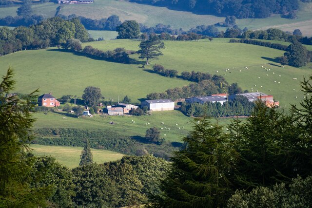
Brynllywarch is a small village located in the county of Montgomeryshire, Wales. Situated in the heart of the picturesque Welsh countryside, it is surrounded by rolling hills and lush green landscapes. The village is nestled between the towns of Newtown and Welshpool, providing easy access to essential amenities and services.

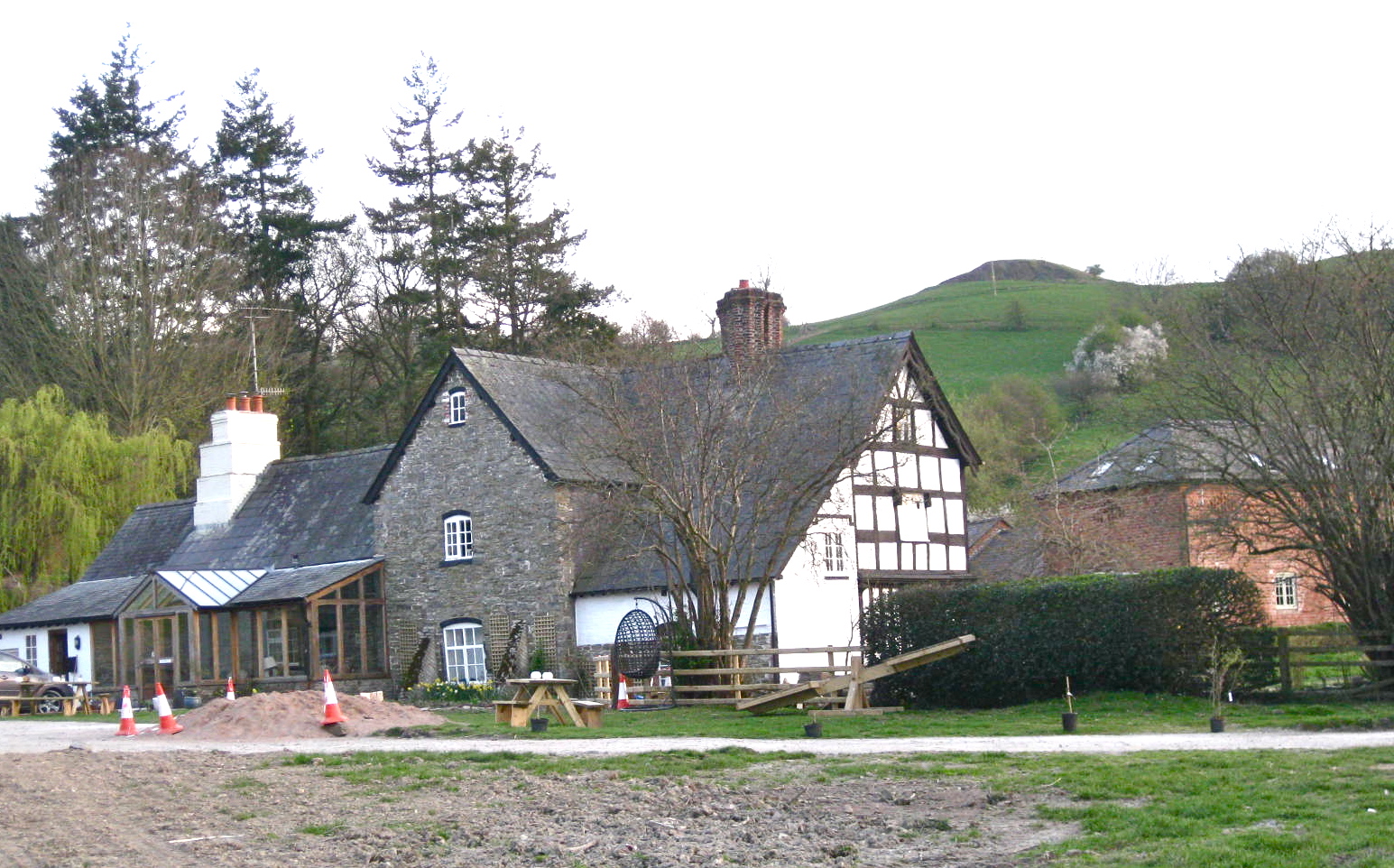
With a population of around 500 residents, Brynllywarch maintains a close-knit community atmosphere. The village is characterized by its charming stone houses and traditional Welsh architecture, giving it a timeless and rustic feel. The local economy primarily revolves around agriculture, with many residents working in farming or related industries.

Brynllywarch offers a range of recreational activities for residents and visitors alike. The village is home to a community center that hosts various events and gatherings throughout the year, fostering a strong sense of community spirit. Additionally, the surrounding natural beauty provides ample opportunities for outdoor pursuits such as hiking, cycling, and birdwatching.

Despite its small size, Brynllywarch has a rich history. The village is home to an ancient church, which dates back several centuries and serves as a reminder of the area's heritage. Historical landmarks and sites of interest can also be found in the nearby towns and villages, making Brynllywarch an ideal base for exploring the region.

Overall, Brynllywarch offers a tranquil and idyllic setting for those seeking a peaceful retreat in the heart of the Welsh countryside. Its strong sense of community, natural beauty, and historical significance make it a hidden gem in Montgomeryshire.

If you have any feedback on the listing, please let us know in the comments section below.
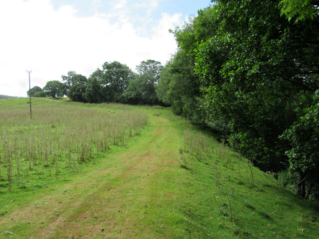
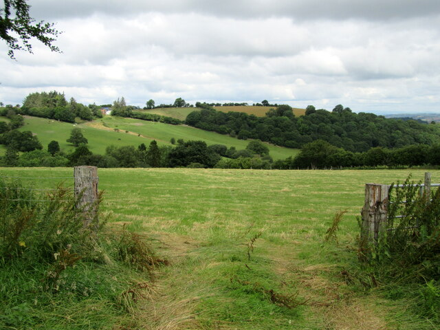
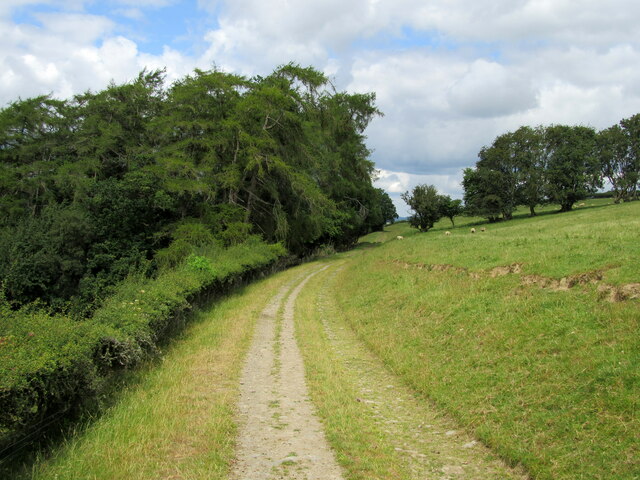
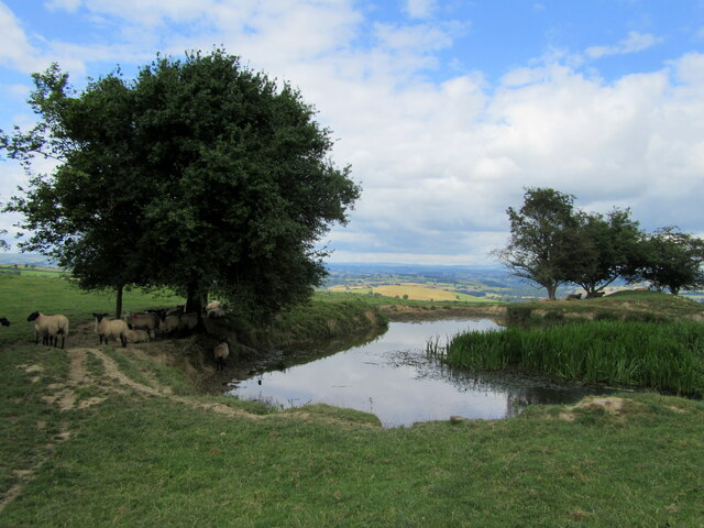
Brynllywarch Images

Images are sourced within 2km of 52.492263/-3.2533514 or Grid Reference SO1589. Thanks to Geograph Open Source API. All images are credited.

Old Milepost by the B4368, Cilthriew, Pentre, Kerry parish Turner Arrow Casting by the B4368, in parish of Kerry (Powys District), Pentre, 100m South of Cilthriew farm buildings, on verge, East side of road. Broken on top.

Inscription reads:-
: ANCHOR / 4 - M / KNIGHTON / 17 - M / {arrow->} : : KERRY / 1½ - M / NEWTOWN / 4½ - M / {<-arrow} : 

Grade II listed by Cadw.
Reference Number: 17309 <span class="nowrap"><a title="https://cadwpublic-api.azurewebsites.net/reports/listedbuilding/FullReport?lang=&id=17309" rel="nofollow ugc noopener" href="https://cadwpublic-api.azurewebsites.net/reports/listedbuilding/FullReport?lang=&id=17309">Link</a><img style="margin-left:2px;" alt="External link" title="External link - shift click to open in new window" src="https://s1.geograph.org.uk/img/external.png" width="10" height="10"/></span>

Surveyed

Milestone Society National ID: MOT_KNNT17
Old Milepost by the B4368, Cilthriew, Pentre, Kerry parish
Turner Arrow Casting by the B4368, in parish of Kerry (Powys District), Pentre, 100m South of Cilthriew farm buildings, on verge, East side of road. Broken on top. Inscription reads:- : ANCHOR / 4 - M / KNIGHTON / 17 - M / {arrow->} : : KERRY / 1½ - M / NEWTOWN / 4½ - M / {<-arrow} : Grade II listed by Cadw. Reference Number: 17309 LinkExternal link Surveyed Milestone Society National ID: MOT_KNNT17
Building in progress A new property being built in Common Road, Kerry.
Building in progress
A new property being built in Common Road, Kerry.
Farm building at Lower Bryn-Llwyarch
Field near Black Hall
A clear path Unlike the official route which is down to the left in an overgrown hollow way; impassable.
A clear path
Unlike the official route which is down to the left in an overgrown hollow way; impassable.
Gateway and field With a view across the valley.
Gateway and field
With a view across the valley.
Footpath on farm track
Farm pond Providing water for sheep.
Farm pond
Providing water for sheep.
Llwyn-y-rhwd
Llwyn-y-rhwd
Herbert Arms Kerry On A489 opposite shop
Herbert Arms Kerry
On A489 opposite shop
Common Road Common Road Kerry which takes you to Brynllywarch Hall School
Common Road
Common Road Kerry which takes you to Brynllywarch Hall School
Kerry Village Hall Kerry Village Hall from the road to the car park
Kerry Village Hall
Kerry Village Hall from the road to the car park
Kerry Bowling club Which can be found just beside the Village Hall, the car park is off to the right.
Kerry Bowling club
Which can be found just beside the Village Hall, the car park is off to the right.
Afon Miwl A ford on a farm track where it crosses the Afon Miwl / The Mule.
Afon Miwl
A ford on a farm track where it crosses the Afon Miwl / The Mule.
Field access between the houses This is already an outlying part of Kerry.
Field access between the houses
This is already an outlying part of Kerry.
Autumn leaves and lane junction near Kerry A bale is being transported by the tractor ahead.
Autumn leaves and lane junction near Kerry
A bale is being transported by the tractor ahead.
Rolling green field near Kerry There is a motte and bailey castle up there somewhere, but you cannot see it from this road.
Rolling green field near Kerry
There is a motte and bailey castle up there somewhere, but you cannot see it from this road.
Show me another place!

Brynllywarch is located at Grid Ref: SO1589 (Lat: 52.492263, Lng: -3.2533514)

Unitary Authority: Powys

Police Authority: Dyfed Powys

What 3 Words

///smashes.stickler.hourglass. Near Newtown, Powys
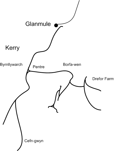
Related Wikis

Garthmyl Hall, Berriew

Garthmyl Hall is a Grade II listed house in Berriew, in the historic county of Montgomeryshire, now Powys. The house stood close to the site of a large...

Cilthriew, Kerry (Montgomeryshire)

Cilthriew is a Grade II listed house and former farm in Kerry, Powys, in the historic county of Montgomeryshire, now Powys. Cilthriew was used by the...

Kerry, Powys

Kerry (Welsh: Ceri) is a village and geographically large community in Montgomeryshire, Powys, Wales. The village lies on the A489 road 2.8 miles (4.5...

Kerry Tramway

The Kerry Tramway was a 2 ft (610 mm) narrow gauge railway built in 1887 to serve the timber workings and slab quarry to the south of the village of Kerry...

St Michael and All Angels Church, Kerry

St Michael's Church is the parish church of Kerry, in the historic county of Montgomeryshire, now Powys. Kerry is sited about 3 miles to the S E of Newtown...

Kerry F.C. (Wales)

Kerry Football Club is a Welsh football team based in the village of Kerry, Powys, Wales. They play in the Central Wales Northern Division, which is in...

Glanmule

Glanmule (Welsh: Glan-miwl) is a small village in the north of Powys, Wales. It is located in Montgomeryshire, approximately 2.5 miles to the east of Newtown...

Kerry railway station

Kerry railway station was a station in Glanmule, Powys, Wales. The station was opened in July 1863, closed to passengers on 9 February 1931 and closed...

Nearby Amenities

Located within 500m of 52.492263,-3.2533514
Place: farm
Lat/Long: 52.4905293/-3.2560893
Building: yes
Lat/Long: 52.4920579/-3.2536002
Building: yes
Lat/Long: 52.4920971/-3.2514973
Building: yes
Lat/Long: 52.4931406/-3.2466093
Building: yes
Lat/Long: 52.4929642/-3.2462552
Place: farm
Lat/Long: 52.4949108/-3.2483903
Direction: 215
Generator Method: photovoltaic
Generator Output Electricity: yes
Generator Solar Modules: 8
Generator Source: solar
Generator Type: solar_photovoltaic_panel
Location: roof
Power: generator
Lat/Long: 52.4930848/-3.2465367
Direction: 175
Generator Method: photovoltaic
Generator Output Electricity: yes
Generator Solar Modules: 16
Generator Source: solar
Generator Type: solar_photovoltaic_panel
Location: roof
Power: generator
Lat/Long: 52.4920743/-3.2530857
The data included in this document is from www.openstreetmap.org. The data is made available under ODbL.

Have you been to Brynllywarch?

Leave your review of Brynllywarch below (or comments, questions and feedback).