Stetchworth

Civil Parish in Cambridgeshire East Cambridgeshire

England

Stetchworth

"the kings head", Dullingham Someone tell them about capital letters please! Still, it's a service in TL65 and there aren't many.
"the kings head", Dullingham Credit: Hugh Venables

Stetchworth is a civil parish located in the county of Cambridgeshire, England. Situated approximately 9 miles east of Cambridge, it is nestled in the heart of the picturesque East Cambridgeshire district. The parish covers an area of about 1,574 acres and is home to a population of around 500 residents.

The village of Stetchworth boasts a rich history, dating back to medieval times when it was mentioned in the Domesday Book of 1086. Its name is derived from the Old English words "stecce" meaning "a post" and "worth" meaning "an enclosure or homestead," suggesting its origins as a fenced settlement.

The landscape of Stetchworth is characterized by its vast countryside, with expansive fields and meadows surrounding the village. The area is known for its horse racing heritage, as it is home to the renowned Newmarket Racecourse, which is just a stone's throw away. The presence of the racecourse has had a significant impact on the local economy, attracting visitors and providing employment opportunities.

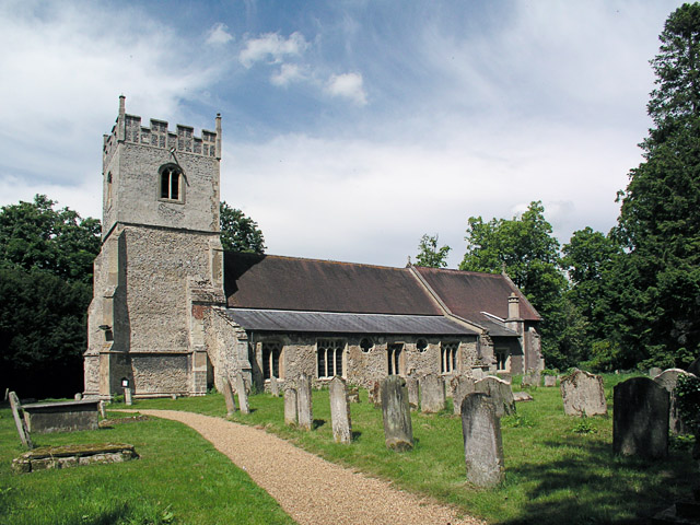
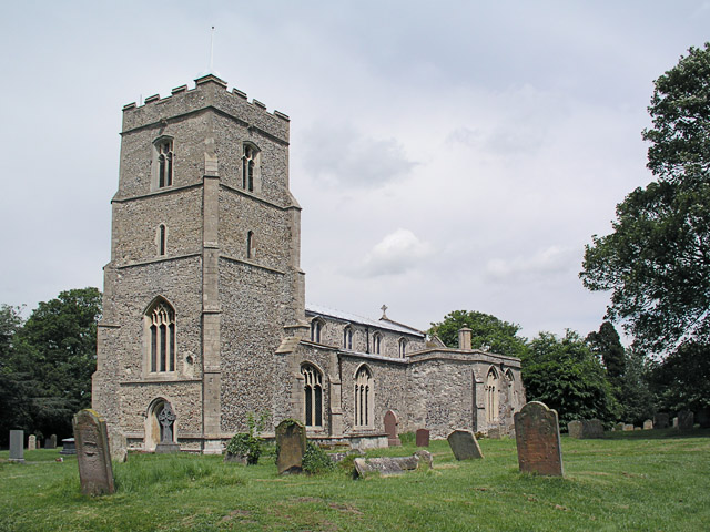
Stetchworth is a close-knit community with a strong sense of identity. The village is served by St Peter and St Paul's Church, a beautiful medieval building that stands as a testament to the parish's religious heritage. There is also a primary school, a village hall, and a pub, providing essential amenities for residents.

Overall, Stetchworth offers a tranquil and picturesque setting, combining rural charm with easy access to nearby urban centers. Its historical significance, natural beauty, and close proximity to Newmarket make it an attractive place to live for those seeking a peaceful and idyllic countryside lifestyle.

If you have any feedback on the listing, please let us know in the comments section below.
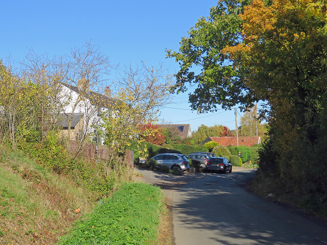
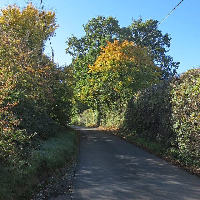
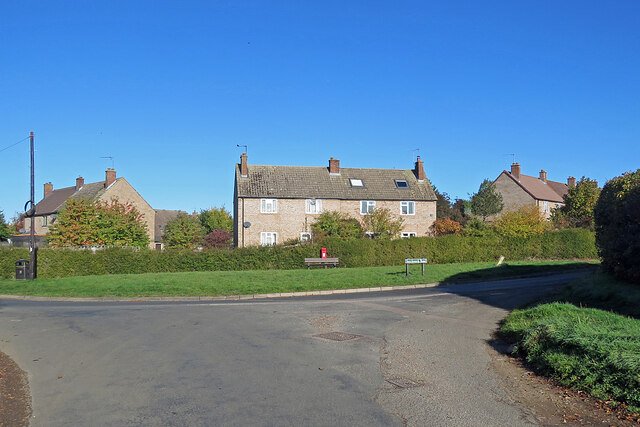
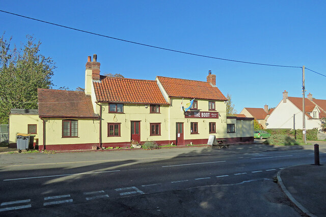
Stetchworth Images

Images are sourced within 2km of 52.206665/0.392845 or Grid Reference TL6359. Thanks to Geograph Open Source API. All images are credited.

"the kings head", Dullingham Someone tell them about capital letters please! Still, it's a service in TL65 and there aren't many.
"the kings head", Dullingham
Someone tell them about capital letters please! Still, it's a service in TL65 and there aren't many.
Bridle path and farm track This bridle way leads from Woodditton to the B1061 between Dullingham and Newmarket. A sign on the gate behind the camera insists that the land is private and asks users to stick to the public right of way.
Bridle path and farm track
This bridle way leads from Woodditton to the B1061 between Dullingham and Newmarket. A sign on the gate behind the camera insists that the land is private and asks users to stick to the public right of way.
Devil's Ditch In the United Kingdom, a scheduled monument is a 'nationally important' archaeological site or historic building, given protection against unauthorised change.
There are about 20,000 scheduled monuments in England representing about 37,000 heritage assets. Of the tens of thousands of scheduled monuments in the UK, most are inconspicuous archaeological sites, but some are large ruins.
Wikipedia: <span class="nowrap"><a title="https://en.wikipedia.org/wiki/Scheduled_monument" rel="nofollow ugc noopener" href="https://en.wikipedia.org/wiki/Scheduled_monument">Link</a><img style="margin-left:2px;" alt="External link" title="External link - shift click to open in new window" src="https://s1.geograph.org.uk/img/external.png" width="10" height="10"/></span>
Devil's Ditch
In the United Kingdom, a scheduled monument is a 'nationally important' archaeological site or historic building, given protection against unauthorised change. There are about 20,000 scheduled monuments in England representing about 37,000 heritage assets. Of the tens of thousands of scheduled monuments in the UK, most are inconspicuous archaeological sites, but some are large ruins. Wikipedia: LinkExternal link
Houses at Cross Green A straggle of houses on the road from Dullingham Ley to Dullingham.
Houses at Cross Green
A straggle of houses on the road from Dullingham Ley to Dullingham.
Light, shade and changing colours A cloudless October morning in the horse-racing country south of Newmarket. This is the single-track dead-end lane to Dullingham Ley and Widgham Green, serving a scattering of houses and a number of stud farms.
Light, shade and changing colours
A cloudless October morning in the horse-racing country south of Newmarket. This is the single-track dead-end lane to Dullingham Ley and Widgham Green, serving a scattering of houses and a number of stud farms.
A fine autumn morning in East Cambridgeshire The road from Woodditton to Stetchworth.
A fine autumn morning in East Cambridgeshire
The road from Woodditton to Stetchworth.
Signpost near Lower Ley Farm This is where the lane to Stetchworth Ley and Stetchworth Park Farm (no through road) leaves the road from Stetchworth to Woodditton.
Signpost near Lower Ley Farm
This is where the lane to Stetchworth Ley and Stetchworth Park Farm (no through road) leaves the road from Stetchworth to Woodditton.
Stetchworth: flint and pantiles A row of cottages whose Gothick ground-floor window and door reveals suggest they might have been built early in the 19th century.
Stetchworth: flint and pantiles
A row of cottages whose Gothick ground-floor window and door reveals suggest they might have been built early in the 19th century.
Stetchworth: The Marquis of Granby A 19th-century brick pub at the corner of High Street (ahead) and Tea Kettle Lane the road to Dullingham.
Stetchworth: The Marquis of Granby
A 19th-century brick pub at the corner of High Street (ahead) and Tea Kettle Lane the road to Dullingham.
Entering Stetchworth Bright sunlight and deep shadows on a fine October morning. This is where the road from Dullingham meets Mill Lane (left) and Tea Kettle Lane (ahead).
Entering Stetchworth
Bright sunlight and deep shadows on a fine October morning. This is where the road from Dullingham meets Mill Lane (left) and Tea Kettle Lane (ahead).
Down Stetchworth Road Council-built houses between Stetchworth and Dullingham (ahead).
Down Stetchworth Road
Council-built houses between Stetchworth and Dullingham (ahead).
Dullingham: houses on the corner Council-built houses on the sharp corner where the dead-end lane from Dullingham Ley meets Stetchworth Road on the edge of Dullingham.
Dullingham: houses on the corner
Council-built houses on the sharp corner where the dead-end lane from Dullingham Ley meets Stetchworth Road on the edge of Dullingham.
Dullingham: St Mary All things bright and beautiful on a lovely October morning. St Mary's is Grade I listed - see <span class="nowrap"><a title="http://www.britishlistedbuildings.co.uk/en-49159-parish-church-of-st-mary-dullingham-cambr" rel="nofollow ugc noopener" href="http://www.britishlistedbuildings.co.uk/en-49159-parish-church-of-st-mary-dullingham-cambr">Link</a><img style="margin-left:2px;" alt="External link" title="External link - shift click to open in new window" src="https://s1.geograph.org.uk/img/external.png" width="10" height="10"/></span> .
Dullingham: St Mary
All things bright and beautiful on a lovely October morning. St Mary's is Grade I listed - see LinkExternal link .
Dullingham: The Boot Photographed from the shadows of Church Close on a bright October morning. The pub was flying a Ukrainian flag during the eighth month of the Russian invasion of Ukraine.
Dullingham: The Boot
Photographed from the shadows of Church Close on a bright October morning. The pub was flying a Ukrainian flag during the eighth month of the Russian invasion of Ukraine.
Dullingham: a house with a history The Grade II listing for the house on the left begins "Originally the workhouse, now dwellings. Late C17 or early C18. Local red brick; red pantile roof. Two symmetrical stacks and rear stack. Two storeys and attic with outshut. Central facade gable with round window."
Dullingham: a house with a history
The Grade II listing for the house on the left begins "Originally the workhouse, now dwellings. Late C17 or early C18. Local red brick; red pantile roof. Two symmetrical stacks and rear stack. Two storeys and attic with outshut. Central facade gable with round window."
A crossroads near Stetchworth Park The road to the left leads to Dullingham, the one ahead is the road from Stetchworth to Newmarket and the one to the right to Cheveley. The lodge at the entrance to Stetchworth Park is out of the picture on the right.
A crossroads near Stetchworth Park
The road to the left leads to Dullingham, the one ahead is the road from Stetchworth to Newmarket and the one to the right to Cheveley. The lodge at the entrance to Stetchworth Park is out of the picture on the right.
Six miles to Reach on The Devil's Dyke This is the wooded southern section of the Dyke, which ends about a mile behind the camera, near Woodditton.

The Devil's Dyke is the largest and longest of Cambridgeshire's Anglo-Saxon defensive ramparts, which date from the 6th and 7th centuries. It stretches from the edge of the fens at Reach across Newmarket Heath to what was once the edge of impenetrable forest at Woodditton.
Six miles to Reach on The Devil's Dyke
This is the wooded southern section of the Dyke, which ends about a mile behind the camera, near Woodditton. The Devil's Dyke is the largest and longest of Cambridgeshire's Anglo-Saxon defensive ramparts, which date from the 6th and 7th centuries. It stretches from the edge of the fens at Reach across Newmarket Heath to what was once the edge of impenetrable forest at Woodditton.
Steps on The Devil's Dyke This is where the path on the rampart of The Devil's Dyke drops down to cross the road from Dullingham and Stetchworth to Cheveley. The steps and handrails make the task easier when the path is slippery, or if you are a septuagenarian like the man with the camera. This section of the Dyke is wooded, unlike the stretch across Newmarket Heath and at the fens' edge near Reach (ahead).

The Devil's Dyke is the largest and longest of Cambridgeshire's Anglo-Saxon defensive ramparts, which date from the 6th and 7th centuries. It stretches from the edge of the fens at Reach across Newmarket Heath to what was once the edge of impenetrable forest at Woodditton.
Steps on The Devil's Dyke
This is where the path on the rampart of The Devil's Dyke drops down to cross the road from Dullingham and Stetchworth to Cheveley. The steps and handrails make the task easier when the path is slippery, or if you are a septuagenarian like the man with the camera. This section of the Dyke is wooded, unlike the stretch across Newmarket Heath and at the fens' edge near Reach (ahead). The Devil's Dyke is the largest and longest of Cambridgeshire's Anglo-Saxon defensive ramparts, which date from the 6th and 7th centuries. It stretches from the edge of the fens at Reach across Newmarket Heath to what was once the edge of impenetrable forest at Woodditton.
Show me another place!

Stetchworth is located at Grid Ref: TL6359 (Lat: 52.206665, Lng: 0.392845)

Administrative County: Cambridgeshire

District: East Cambridgeshire

Police Authority: Cambridgeshire

What 3 Words

///stir.atomic.spans. Near Newmarket, Suffolk

Related Wikis

Stetchworth

Stetchworth is a small village and civil parish in East Cambridgeshire, England, 3 miles (5 km) to the south of the horse-racing centre of Newmarket and...

Dullingham

Dullingham is a small village and civil parish in East Cambridgeshire, England. It is situated 4 miles (6 km) south of Newmarket and 14 miles (23 km) east...

Dullingham railway station

Dullingham is a railway station that serves the village of Dullingham in Cambridgeshire, England. It is about 1 mile (1.6 km) north-west of the centre...

Woodditton

Woodditton is a village and civil parish in East Cambridgeshire, England. The other settlements in the parish are Ditton Green, Little Ditton and Saxon...

Nearby Amenities

Located within 500m of 52.206665,0.392845
The data included in this document is from www.openstreetmap.org. The data is made available under ODbL.

Have you been to Stetchworth?

Leave your review of Stetchworth below (or comments, questions and feedback).