Stanton by Bridge
Civil Parish in Derbyshire South Derbyshire
England
Stanton by Bridge

Stanton by Bridge is a civil parish located in the South Derbyshire district of Derbyshire, England. Situated approximately 7 miles south of Derby city center, this small village is nestled between the River Trent and the A514 road. The parish covers an area of about 600 acres and has a population of around 200 people.
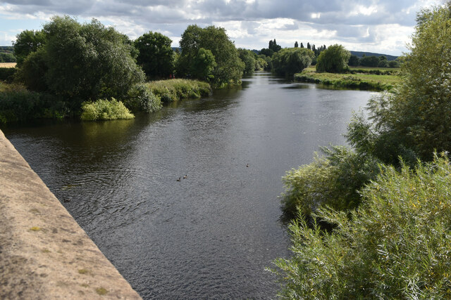
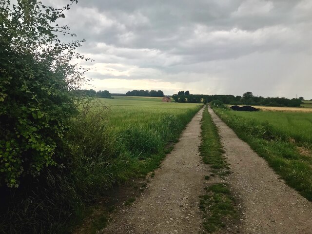
Stanton by Bridge is known for its picturesque countryside and charming rural setting. The village is surrounded by rolling hills, green fields, and woodlands, offering residents and visitors a tranquil and idyllic escape from the hustle and bustle of city life. The River Trent, which borders the parish, provides excellent opportunities for fishing and boating enthusiasts.
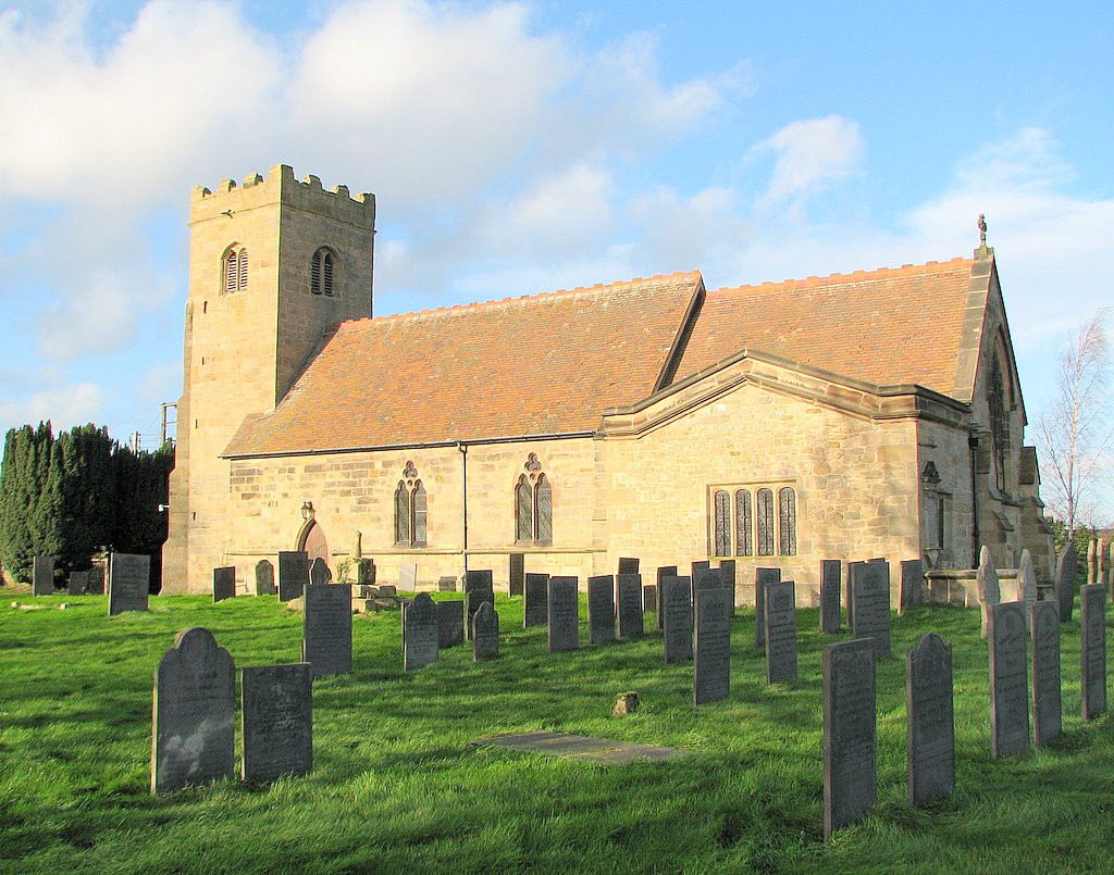
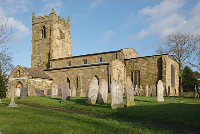
The village itself is home to a small but tight-knit community. The architecture in Stanton by Bridge is predominantly traditional, with many charming cottages and farmhouses dotting the landscape. The village church, St. Michael and All Angels, is a prominent feature and dates back to the 13th century. It is a Grade I listed building and has a rich history.
Despite its small size, Stanton by Bridge offers a range of amenities and services to its residents. These include a village hall, a primary school, and a local pub, providing a sense of community and meeting places for residents to socialize.
Stanton by Bridge is also well-connected to surrounding areas, with good transportation links to Derby and other nearby towns. It offers a peaceful and scenic living environment, making it an attractive place to reside for those seeking a rural lifestyle within easy reach of urban amenities.
If you have any feedback on the listing, please let us know in the comments section below.
Stanton by Bridge Images
Images are sourced within 2km of 52.835447/-1.457435 or Grid Reference SK3626. Thanks to Geograph Open Source API. All images are credited.


Stanton by Bridge is located at Grid Ref: SK3626 (Lat: 52.835447, Lng: -1.457435)
Administrative County: Derbyshire
District: South Derbyshire
Police Authority: Derbyshire
What 3 Words
///unguarded.waistcoat.sedated. Near Melbourne, Derbyshire
Nearby Locations
Related Wikis

St Michael's Church, Stanton by Bridge
St Michael's Church, Stanton by Bridge is a Grade I listed parish church in the Church of England in Stanton by Bridge, Derbyshire. == History == The church...
Stanton by Bridge
Stanton by Bridge is a village and civil parish in the English county of Derbyshire. The population of the civil parish at the 2011 census was 246. �...
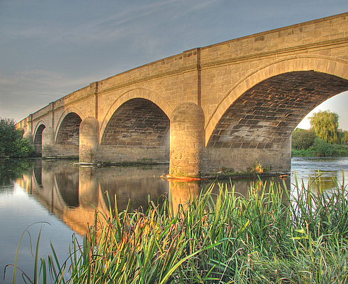
Swarkestone Bridge
Swarkestone Bridge is a medieval bridge crossing the River Trent between the villages of Swarkestone and Stanton by Bridge, about 6 miles south of Derby...

Ingleby, Derbyshire
Ingleby is a hamlet and civil parish in South Derbyshire, England, situated to the south of the River Trent on a rise between Stanton by Bridge and Repton...

Swarkestone
Swarkestone is a village and civil parish in the South Derbyshire district of Derbyshire, England. The population at the 2011 Census was 187.Swarkestone...
St James' Church, Swarkestone
St James’ Church, Swarkestone is a Grade II* listed parish church in the Church of England in Swarkestone, Derbyshire. == History == The church dates from...
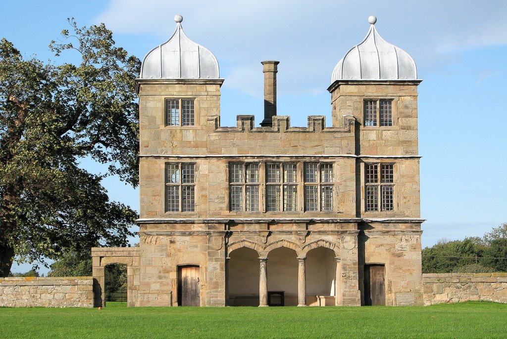
Swarkestone Hall Pavilion
Swarkestone Hall Pavilion, also known as Swarkestone Stand and The Grandstand, is a 17th-century pavilion 200 metres north of the ruins of Swarkestone...
St Wilfrid's Church, Barrow-upon-Trent
St Wilfrid’s Church, Barrow upon Trent is a Grade I listed parish church in the Church of England in Barrow upon Trent, Derbyshire. == History == The Church...
Nearby Amenities
Located within 500m of 52.835447,-1.457435Have you been to Stanton by Bridge?
Leave your review of Stanton by Bridge below (or comments, questions and feedback).