St. Mellion

Civil Parish in Cornwall

England

St. Mellion

Bealbury Methodist Church
Bealbury Methodist Church Credit: Paul Barnett

St. Mellion is a civil parish located in the county of Cornwall, in southwestern England. Situated approximately 10 miles northwest of the city of Plymouth, it is nestled in the rolling countryside of the Tamar Valley Area of Outstanding Natural Beauty. The parish covers an area of around 5 square miles and has a population of approximately 1,200 people.

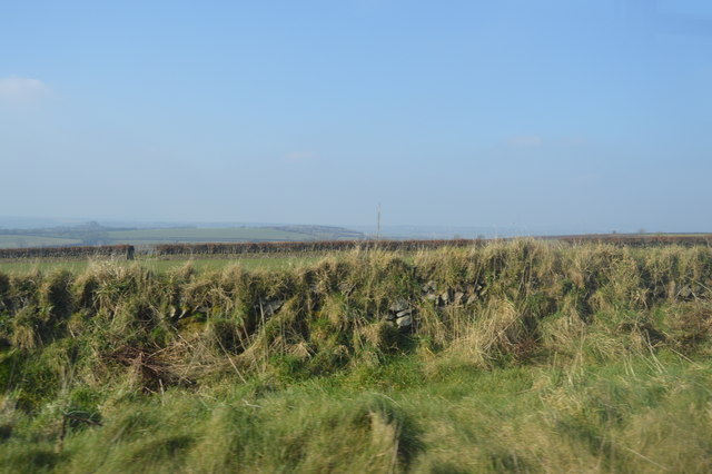
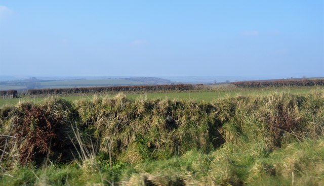
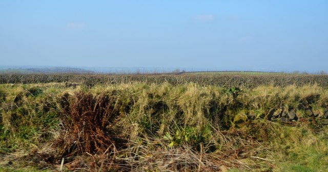
St. Mellion is renowned for its picturesque landscapes, with lush green fields, woodlands, and the meandering River Lynher running through it. The area is dotted with charming traditional Cornish cottages and historic buildings, showcasing the region's rich cultural heritage.

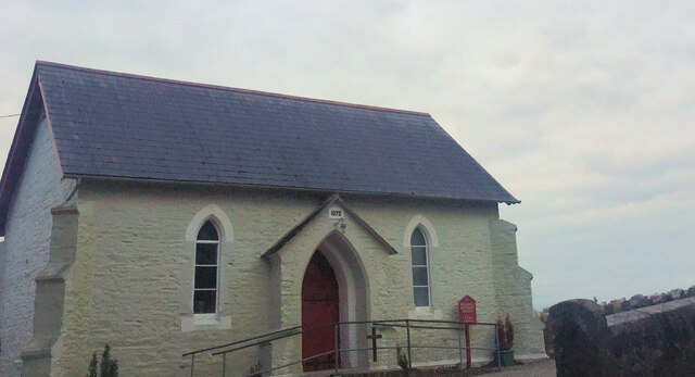
One of the prominent landmarks in St. Mellion is the St. Mellanus Church, a Grade I listed building dating back to the 15th century. The church features an impressive tower and exquisite stained glass windows, attracting visitors and historians alike.

Golf enthusiasts will find St. Mellion particularly appealing, as it is home to the St. Mellion Golf Club. The club boasts two championship golf courses, the Nicklaus Course and the Kernow Course, which have hosted international tournaments and attract players from around the world.

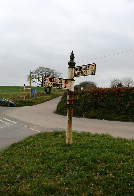
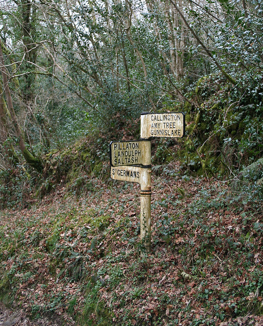
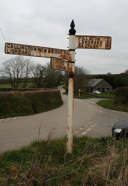
The parish is well-connected, with easy access to major transportation routes. The A388 road passes through St. Mellion, providing convenient links to nearby towns and cities. Additionally, the neighboring village of Pillaton offers a railway station, ensuring good connectivity to the wider region.

Overall, St. Mellion offers a tranquil and picturesque setting, making it an ideal destination for those seeking natural beauty, historic charm, and recreational pursuits in the heart of Cornwall.

If you have any feedback on the listing, please let us know in the comments section below.

St. Mellion Images

Images are sourced within 2km of 50.47483/-4.301333 or Grid Reference SX3666. Thanks to Geograph Open Source API. All images are credited.

Bealbury Methodist Church
Old Milestone south of Callington Carved stone post by the UC road, in parish of CALLINGTON (CARADON District), Axford, "St Germans Road", South of Rill Farm, buried in bank and overgrown, on West side of road. Callington C tombstone, erected by the Callington turnpike trust in the 18th century. 

Inscription reads:-
C
1 

Grade II Listed. List Entry Number: 1392535
<span class="nowrap"><a title="https://historicengland.org.uk/listing/the-list/list-entry/1392535" rel="nofollow ugc noopener" href="https://historicengland.org.uk/listing/the-list/list-entry/1392535">Link</a><img style="margin-left:2px;" alt="External link" title="External link - shift click to open in new window" src="https://s1.geograph.org.uk/img/external.png" width="10" height="10"/></span>

Milestone Society National ID: CW_CLSG01.
Old Milestone south of Callington
Carved stone post by the UC road, in parish of CALLINGTON (CARADON District), Axford, "St Germans Road", South of Rill Farm, buried in bank and overgrown, on West side of road. Callington C tombstone, erected by the Callington turnpike trust in the 18th century. Inscription reads:- C 1 Grade II Listed. List Entry Number: 1392535 LinkExternal link Milestone Society National ID: CW_CLSG01.
Old Milestone north east of Clapper Bridge Carved stone post by the UC road, in parish of ST MELLION (CARADON District), Freeres Farm, Bramble Wood, South of T-junction, high on verge, clear of bank, on North side of road. Callington C tombstone, erected by the Callington turnpike trust in the 18th century. 

Inscription reads:-
C
3 
Carved benchmark and rivet on top.

Grade II Listed. List Entry Number: 1392534
<span class="nowrap"><a title="https://historicengland.org.uk/listing/the-list/list-entry/1392534" rel="nofollow ugc noopener" href="https://historicengland.org.uk/listing/the-list/list-entry/1392534">Link</a><img style="margin-left:2px;" alt="External link" title="External link - shift click to open in new window" src="https://s1.geograph.org.uk/img/external.png" width="10" height="10"/></span>

Milestone Society National ID: CW_CLSG03.
Old Milestone north east of Clapper Bridge
Carved stone post by the UC road, in parish of ST MELLION (CARADON District), Freeres Farm, Bramble Wood, South of T-junction, high on verge, clear of bank, on North side of road. Callington C tombstone, erected by the Callington turnpike trust in the 18th century. Inscription reads:- C 3 Carved benchmark and rivet on top. Grade II Listed. List Entry Number: 1392534 LinkExternal link Milestone Society National ID: CW_CLSG03.
Modern Milestone by the A388, south of Westcott Lodge Carved stone post by the A388, in parish of ST DOMINICK (CARADON District), Westcott Lodge, by the road. Callington C gravestone. 
Replacement erected by a Society group in the 20th century. 

Inscription reads:-
1½
C 

The original 19th century stone was Grade II Listed.
List Entry Number: 1140165 
<span class="nowrap"><a title="https://historicengland.org.uk/listing/the-list/list-entry/1140165" rel="nofollow ugc noopener" href="https://historicengland.org.uk/listing/the-list/list-entry/1140165">Link</a><img style="margin-left:2px;" alt="External link" title="External link - shift click to open in new window" src="https://s1.geograph.org.uk/img/external.png" width="10" height="10"/></span>

Milestone Society National ID: CW_CLSH01R.
Modern Milestone by the A388, south of Westcott Lodge
Carved stone post by the A388, in parish of ST DOMINICK (CARADON District), Westcott Lodge, by the road. Callington C gravestone. Replacement erected by a Society group in the 20th century. Inscription reads:- 1½ C The original 19th century stone was Grade II Listed. List Entry Number: 1140165 LinkExternal link Milestone Society National ID: CW_CLSH01R.
Old Milestone by the former A388, north of Vernigo Cross Carved stone post by the UC road (was A388), in parish of ST MELLION (CARADON District), Viverdon Plantation, road section now by-passed, on bank, 4ft above road, on East side of road. Callington C gravestone, erected by the Callington turnpike trust in the 18th century. 

Inscription reads:-
2½
C 

Grade II Listed. List Entry Number: 1392531
<span class="nowrap"><a title="https://historicengland.org.uk/listing/the-list/list-entry/1392531" rel="nofollow ugc noopener" href="https://historicengland.org.uk/listing/the-list/list-entry/1392531">Link</a><img style="margin-left:2px;" alt="External link" title="External link - shift click to open in new window" src="https://s1.geograph.org.uk/img/external.png" width="10" height="10"/></span>

Milestone Society National ID: CW_CLSH02.
Old Milestone by the former A388, north of Vernigo Cross
Carved stone post by the UC road (was A388), in parish of ST MELLION (CARADON District), Viverdon Plantation, road section now by-passed, on bank, 4ft above road, on East side of road. Callington C gravestone, erected by the Callington turnpike trust in the 18th century. Inscription reads:- 2½ C Grade II Listed. List Entry Number: 1392531 LinkExternal link Milestone Society National ID: CW_CLSH02.
Grassy bank by A388
Grassy bank by A388
Road to St Mellion Country Club
Lane to Dunstan Quoin
Earthbank by A388
Earthbank by A388
Earthbank by A388
Earthbank by A388
Earthbank, Viverdon Down
Grass verge, A388
Grass verge, A388
Old Direction Sign - Signpost by Amy Tree, St Mellion Pyramid finial - 2 arms; Cornwall by the UC road, in parish of St Mellion (Caradon District), Amy Tree, where six lanes meet, Axford Hill. Signpost CW_SX3666A is visible across the junction: <a href="https://www.geograph.org.uk/photo/6072083">SX3666 : Old Direction Sign - Signpost by Amy Tree, St Mellion</a>

Surveyed

Milestone Society National ID: CW_SX3666B
Old Direction Sign - Signpost by Amy Tree, St Mellion
Pyramid finial - 2 arms; Cornwall by the UC road, in parish of St Mellion (Caradon District), Amy Tree, where six lanes meet, Axford Hill. Signpost CW_SX3666A is visible across the junction: SX3666 : Old Direction Sign - Signpost by Amy Tree, St Mellion Surveyed Milestone Society National ID: CW_SX3666B
Old Direction Sign - Signpost Missing finial - Visick cone by the UC road, in parish of St Mellion (Caradon District), above Clapper Bridge (North bank), at UC road junction, in bank, East of milestone: CW_CLSG03 <a href="https://www.geograph.org.uk/photo/5623256">SX3565 : Old Milestone north east of Clapper Bridge</a>

Surveyed

Milestone Society National ID: CW_SX3565
Old Direction Sign - Signpost
Missing finial - Visick cone by the UC road, in parish of St Mellion (Caradon District), above Clapper Bridge (North bank), at UC road junction, in bank, East of milestone: CW_CLSG03 SX3565 : Old Milestone north east of Clapper Bridge Surveyed Milestone Society National ID: CW_SX3565
Old Direction Sign - Signpost by Amy Tree, St Mellion Pyramid finial - 3 arms; Cornwall by the UC road, in parish of St Mellion (Caradon District), Amy Tree, where six lanes meet. Signpost CW_SX3666B is visible across the junction: <a href="https://www.geograph.org.uk/photo/6048299">SX3666 : Old Direction Sign - Signpost by Amy Tree, St Mellion</a>

Cornwall & Scilly HER.
HER Number: MCO56951 <span class="nowrap"><a title="https://www.heritagegateway.org.uk/Gateway/Results_Single.aspx?uid=MCO56951&resourceID=1020" rel="nofollow ugc noopener" href="https://www.heritagegateway.org.uk/Gateway/Results_Single.aspx?uid=MCO56951&resourceID=1020">Link</a><img style="margin-left:2px;" alt="External link" title="External link - shift click to open in new window" src="https://s1.geograph.org.uk/img/external.png" width="10" height="10"/></span>

Surveyed

Milestone Society National ID: CW_SX3666A
Old Direction Sign - Signpost by Amy Tree, St Mellion
Pyramid finial - 3 arms; Cornwall by the UC road, in parish of St Mellion (Caradon District), Amy Tree, where six lanes meet. Signpost CW_SX3666B is visible across the junction: SX3666 : Old Direction Sign - Signpost by Amy Tree, St Mellion Cornwall & Scilly HER. HER Number: MCO56951 LinkExternal link Surveyed Milestone Society National ID: CW_SX3666A
Old Milestone south of Callington Carved stone post by the UC road, in parish of CALLINGTON (CARADON District), Axford, "St Germans Road", South of Rill Farm, buried in bank and overgrown, on West side of road. Callington 'C' tombstone, erected by the Callington turnpike trust in the 18th century. 

Inscription reads:-
C
1

Grade II listed. 
List Entry Number: 1392535 <span class="nowrap"><a title="https://historicengland.org.uk/listing/the-list/list-entry/1392535" rel="nofollow ugc noopener" href="https://historicengland.org.uk/listing/the-list/list-entry/1392535">Link</a><img style="margin-left:2px;" alt="External link" title="External link - shift click to open in new window" src="https://s1.geograph.org.uk/img/external.png" width="10" height="10"/></span>

Milestone Society National ID: CW_CLSG01.
Old Milestone south of Callington
Carved stone post by the UC road, in parish of CALLINGTON (CARADON District), Axford, "St Germans Road", South of Rill Farm, buried in bank and overgrown, on West side of road. Callington 'C' tombstone, erected by the Callington turnpike trust in the 18th century. Inscription reads:- C 1 Grade II listed. List Entry Number: 1392535 LinkExternal link Milestone Society National ID: CW_CLSG01.
Old Milestone south of Newton Ferrers, by Bramble Wood Carved stone post by the UC road, in parish of ST MELLION (CARADON District), Freeres Farm, Bramble Wood, South of T-junction, high on verge, clear of bank, on North side of road. Callington 'C' tombstone, erected by the Callington turnpike trust in the 18th century. 

Inscription reads:-
C
3 
Carved benchmark and rivet on top.

Grade II listed. 
List Entry Number: 1392534 <span class="nowrap"><a title="https://historicengland.org.uk/listing/the-list/list-entry/1392534" rel="nofollow ugc noopener" href="https://historicengland.org.uk/listing/the-list/list-entry/1392534">Link</a><img style="margin-left:2px;" alt="External link" title="External link - shift click to open in new window" src="https://s1.geograph.org.uk/img/external.png" width="10" height="10"/></span>

Milestone Society National ID: CW_CLSG03
Old Milestone south of Newton Ferrers, by Bramble Wood
Carved stone post by the UC road, in parish of ST MELLION (CARADON District), Freeres Farm, Bramble Wood, South of T-junction, high on verge, clear of bank, on North side of road. Callington 'C' tombstone, erected by the Callington turnpike trust in the 18th century. Inscription reads:- C 3 Carved benchmark and rivet on top. Grade II listed. List Entry Number: 1392534 LinkExternal link Milestone Society National ID: CW_CLSG03
Modern Milestone by the A388, south of Westcott Lodge Carved stone post by the A388, in parish of ST DOMINICK (CARADON District), Westcott Lodge, by the road, East side of road. Callington 'C' gravestone, replacement erected by a Society group in the 20th century. 

Inscription reads:-
1½
C 

Grade II listed. 
List Entry Number: 1140165 <span class="nowrap"><a title="https://historicengland.org.uk/listing/the-list/list-entry/1140165" rel="nofollow ugc noopener" href="https://historicengland.org.uk/listing/the-list/list-entry/1140165">Link</a><img style="margin-left:2px;" alt="External link" title="External link - shift click to open in new window" src="https://s1.geograph.org.uk/img/external.png" width="10" height="10"/></span>

Milestone Society National ID: CW_CLSH01R.
Modern Milestone by the A388, south of Westcott Lodge
Carved stone post by the A388, in parish of ST DOMINICK (CARADON District), Westcott Lodge, by the road, East side of road. Callington 'C' gravestone, replacement erected by a Society group in the 20th century. Inscription reads:- 1½ C Grade II listed. List Entry Number: 1140165 LinkExternal link Milestone Society National ID: CW_CLSH01R.
Show me another place!

St. Mellion is located at Grid Ref: SX3666 (Lat: 50.47483, Lng: -4.301333)

Unitary Authority: Cornwall

Police Authority: Devon & Cornwall

What 3 Words

///mouths.vibrate.from. Near Pillaton, Cornwall

Nearby Locations

St. Mellion Amy Down

Related Wikis

Bealbury

Bealbury is a hamlet in St Mellion civil parish in east Cornwall, England, United Kingdom. It is two miles south of Callington. == References ==

Pillaton

Pillaton (Cornish: Trebeulyow) is a village and civil parish in south east Cornwall, England, United Kingdom. The parish extends to approximately 4.6 square...

St Mellion

St Mellion (Cornish: Sen Melyan) is a village and rural civil parish in east Cornwall, England, United Kingdom. The parish is about 3 miles (5 km) south...

Cadson Bury

Cadson Bury is an Iron Age hillfort about 2 miles (3.2 km) south-west of Callington, in Cornwall, England. It is owned by the National Trust, and it is...

Nearby Amenities

Located within 500m of 50.47483,-4.301333
Generator Method: photovoltaic
Generator Output Electricity: yes
Generator Source: solar
Generator Type: solar_photovoltaic_panel
Power: generator
Lat/Long: 50.4785254/-4.3015804
Generator Method: photovoltaic
Generator Output Electricity: yes
Generator Source: solar
Generator Type: solar_photovoltaic_panel
Power: generator
Lat/Long: 50.4786946/-4.3027872
Generator Method: photovoltaic
Generator Output Electricity: yes
Generator Source: solar
Generator Type: solar_photovoltaic_panel
Power: generator
Lat/Long: 50.4786259/-4.302933
The data included in this document is from www.openstreetmap.org. The data is made available under ODbL.

Have you been to St. Mellion?

Leave your review of St. Mellion below (or comments, questions and feedback).