St. Albans

Civil Parish in Nottinghamshire Gedling

England

St. Albans

Arnold, Nottinghamshire Recreating this 'First' for the square <a title="https://www.geograph.org.uk/photo/32037" href="https://www.geograph.org.uk/photo/32037">Link</a> . The title is taken from the original; this is St Mary's Church, to be specific.
Arnold, Nottinghamshire Credit: Alan Murray-Rust

St. Albans is a small civil parish located in the district of Newark and Sherwood, Nottinghamshire, England. Situated approximately 16 miles north of Nottingham, the parish covers an area of around 7 square miles and is home to a population of approximately 500 residents.

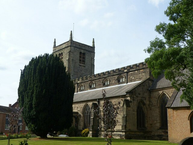
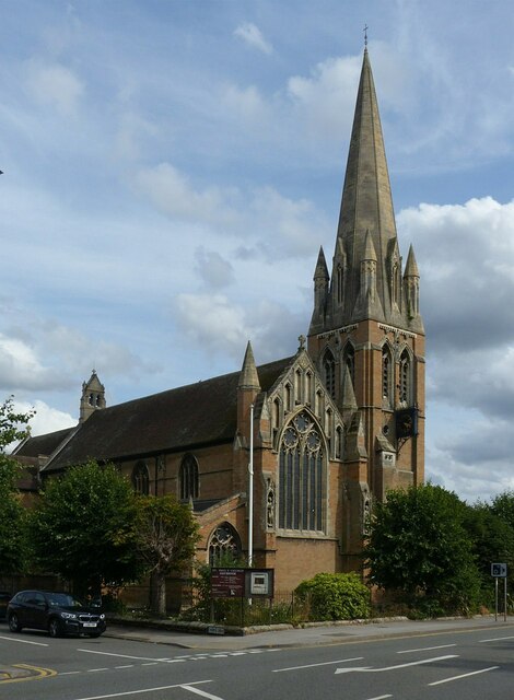
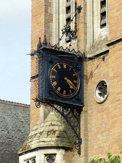
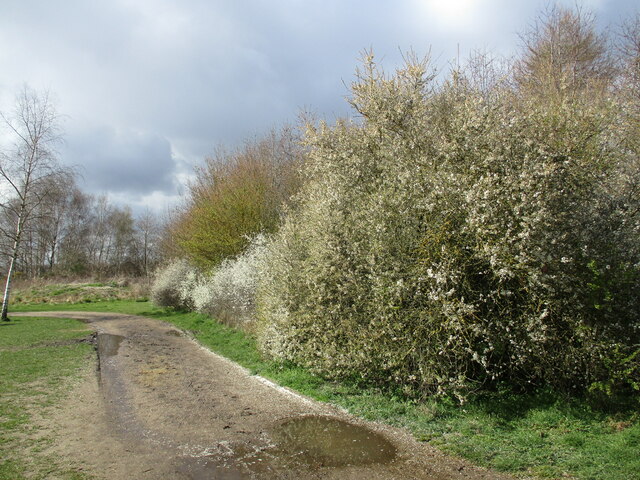
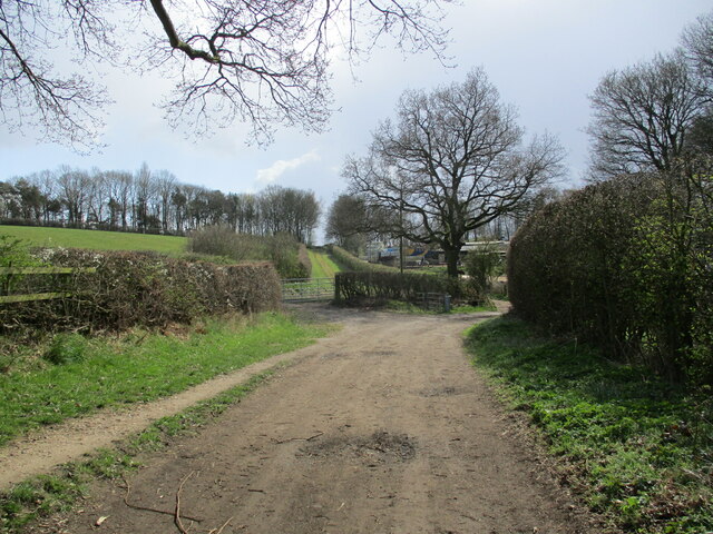
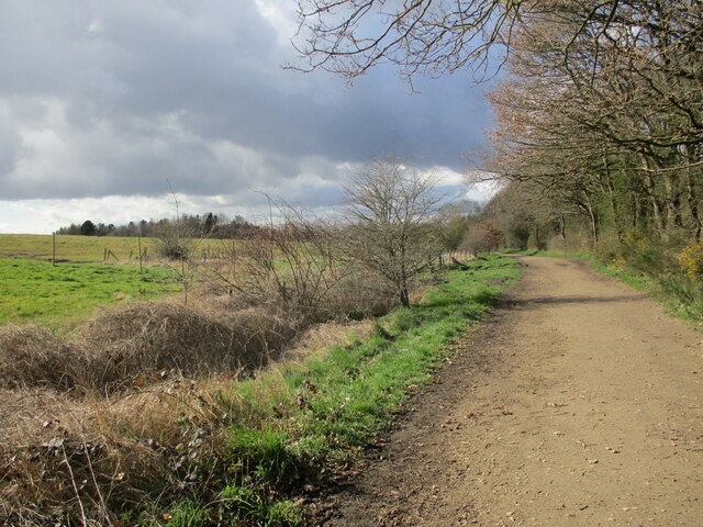
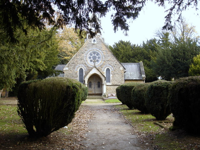
The parish is primarily rural in nature, characterized by rolling countryside, picturesque landscapes, and scattered farms. It is named after the historic St. Albans Church, which serves as a focal point within the community. The church, dating back to the 12th century, is a Grade I listed building and features stunning architectural details.

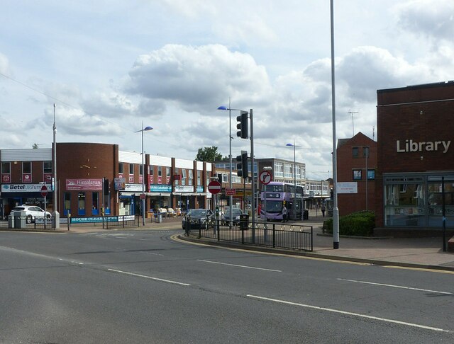
Despite its small size, St. Albans has a strong sense of community and offers a range of amenities for its residents. These include a village hall, a primary school, and a post office. The local pub also serves as a popular gathering spot for both locals and visitors, offering a friendly atmosphere and traditional pub fare.

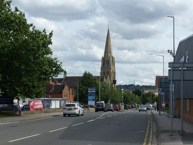
The parish is well-connected to surrounding areas by road, with the A1 and A46 providing easy access to larger towns and cities. Additionally, St. Albans benefits from its proximity to Sherwood Forest, a renowned national nature reserve and popular tourist destination.

Overall, St. Albans, Nottinghamshire offers a peaceful and idyllic setting for residents seeking a rural lifestyle, while still providing convenient access to nearby amenities and attractions.

If you have any feedback on the listing, please let us know in the comments section below.
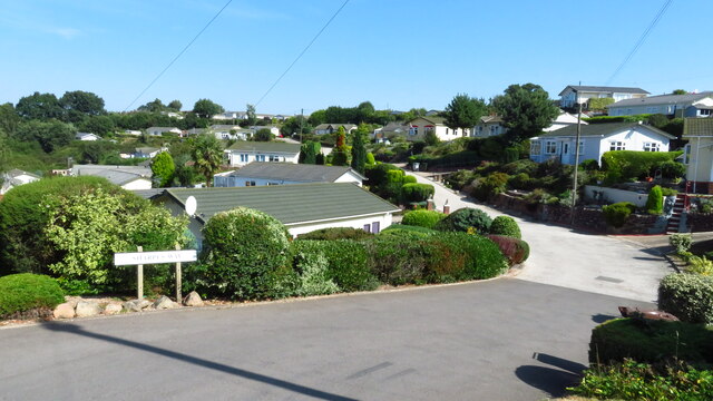
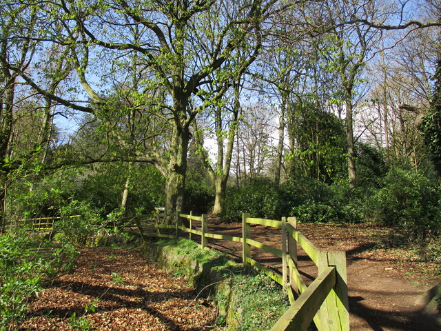
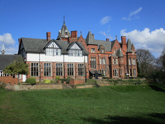
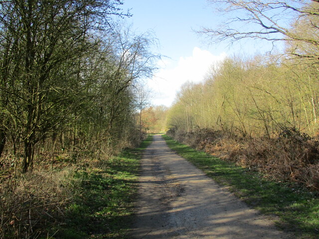
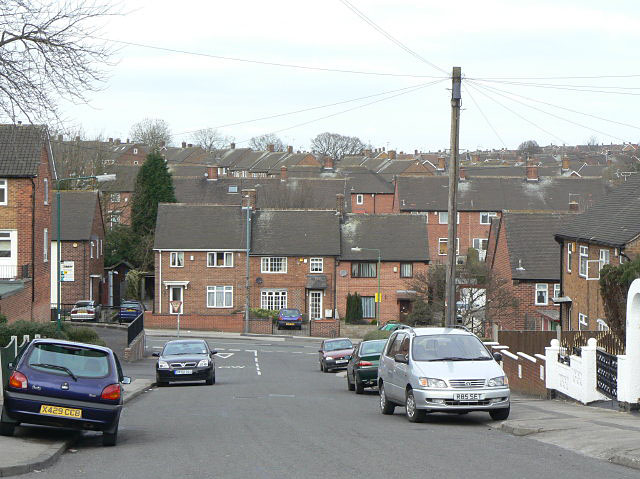
St. Albans Images

Images are sourced within 2km of 53.012871/-1.152364 or Grid Reference SK5646. Thanks to Geograph Open Source API. All images are credited.

Arnold, Nottinghamshire Recreating this 'First' for the square <a title="https://www.geograph.org.uk/photo/32037" href="https://www.geograph.org.uk/photo/32037">Link</a> . The title is taken from the original; this is St Mary's Church, to be specific.
Arnold, Nottinghamshire
Recreating this 'First' for the square Link . The title is taken from the original; this is St Mary's Church, to be specific.
Lavender walk The main approach to St Mary's Church, Arnold.
Lavender walk
The main approach to St Mary's Church, Arnold.
Front St, Arnold Recreating this 'First' for the square <a title="https://www.geograph.org.uk/photo/35572" href="https://www.geograph.org.uk/photo/35572">Link</a> . Not quite the precise camera location as the junction was remodelled in around 2015 and I would have had to have been standing in the middle of a busy road.
Front St, Arnold
Recreating this 'First' for the square Link . Not quite the precise camera location as the junction was remodelled in around 2015 and I would have had to have been standing in the middle of a busy road.
Church for sale The former Cross Street Baptist Church.
Church for sale
The former Cross Street Baptist Church.
Mansfield Rd, Daybrook Recreating this 'First' for the square <a title="https://www.geograph.org.uk/photo/35570" href="https://www.geograph.org.uk/photo/35570">Link</a> . I did not attempt to get to exactly the original camera position!
Mansfield Rd, Daybrook
Recreating this 'First' for the square Link . I did not attempt to get to exactly the original camera position!
Church of St Paul, Daybrook - 1 A fine church, consecrated in 1895, by the renowned late Victorian gothic-revival architect, J L Pearson. A mix of Early English and Decorated styles. The tower and spire were added in 1897. Listed Grade II*
Church of St Paul, Daybrook - 1
A fine church, consecrated in 1895, by the renowned late Victorian gothic-revival architect, J L Pearson. A mix of Early English and Decorated styles. The tower and spire were added in 1897. Listed Grade II*
Church of St Paul, Daybrook - 2 The west window and gable; by the renowned late Victorian gothic-revival architect, J L Pearson. A mix of Early English and Decorated styles. Listed Grade II*.
Church of St Paul, Daybrook - 2
The west window and gable; by the renowned late Victorian gothic-revival architect, J L Pearson. A mix of Early English and Decorated styles. Listed Grade II*.
Church of St Paul, Daybrook - 3 The spire, added to the church in 1897; by the renowned late Victorian gothic-revival architect, J L Pearson. A mix of Early English and Decorated styles. Listed Grade II*.
Church of St Paul, Daybrook - 3
The spire, added to the church in 1897; by the renowned late Victorian gothic-revival architect, J L Pearson. A mix of Early English and Decorated styles. Listed Grade II*.
Church of St Paul, Daybrook - 4 The unusual bracket clock on the west face of the tower is a fine piece of wrought- and cast-iron work. Made by Gillet and Johnson of Croydon c.1900.
Church of St Paul, Daybrook - 4
The unusual bracket clock on the west face of the tower is a fine piece of wrought- and cast-iron work. Made by Gillet and Johnson of Croydon c.1900.
Home Brewery buildings, Daybrook Recreating this 'First' for the square <a title="https://www.geograph.org.uk/photo/18594" href="https://www.geograph.org.uk/photo/18594">Link</a>

Dating from 1936, designed for Home Ales Brewery by T. Cecil Howitt, also architect for Nottingham' Council House. Listed Grade II.
Home Brewery buildings, Daybrook
Recreating this 'First' for the square Link Dating from 1936, designed for Home Ales Brewery by T. Cecil Howitt, also architect for Nottingham' Council House. Listed Grade II.
Alexandra Lodges, Big Wood, Bestwood Village
Killarney Park, Bestwood Village
Footpath along the edge of Lodge Gardens
Bestwood Lodge A large country house built for the 10th Duke of St. Albans. Designed by S.S. Teulon 1862. Now a hotel. <span class="nowrap"><a title="https://historicengland.org.uk/listing/the-list/list-entry/1227444?section=official-list-entry" rel="nofollow ugc noopener" href="https://historicengland.org.uk/listing/the-list/list-entry/1227444?section=official-list-entry">Link</a><img style="margin-left:2px;" alt="External link" title="External link - shift click to open in new window" src="https://s1.geograph.org.uk/img/external.png" width="10" height="10"/></span>
Bestwood Lodge
A large country house built for the 10th Duke of St. Albans. Designed by S.S. Teulon 1862. Now a hotel. LinkExternal link
Track to Bestwood Village, Bestwood Country Park
Footpath and blackthorn, Bestwood Country Park
Footpath approaching Violet Hill
Track to Bestwood Village, Bestwood Country Park
Show me another place!

St. Albans is located at Grid Ref: SK5646 (Lat: 53.012871, Lng: -1.152364)

Administrative County: Nottinghamshire

District: Gedling

Police Authority: Nottinghamshire

What 3 Words

///sang.pokers.risks. Near Arnold, Nottinghamshire

Related Wikis

St Albans, Nottinghamshire

St. Albans is a civil parish in the Gedling borough of Nottinghamshire, England. It was part of the wider Bestwood St. Albans parish, which ceased to exist...

The Oakwood Academy

The Oakwood Academy (formerly Big Wood School)' is a secondary school located on Bewcastle Road, Warren Hill, Nottingham, England. It is for 11- to 16...

Warren Hill, Nottinghamshire

Warren Hill is an area within the market town of Arnold in the English ceremonial county of Nottinghamshire. Located in the civil parish of St. Albans...

Bestwood Park

Bestwood Park is a large post-war council estate located to the north of the city of Nottingham, England, and roughly bounded by Beckhampton Road, Oxclose...

Nearby Amenities

Located within 500m of 53.012871,-1.152364
Post Box
Collection Times: Mo-Fr 09:00; Sa 07:00
Post Box Type: pillar
Ref: NG5 513D
Royal Cypher: EIIR
Royal Cypher Wikidata: Q33102113
Source: survey
Lat/Long: 53.0128156/-1.1594713
Give Way
Direction: forward
Lat/Long: 53.0137881/-1.1590906
Give Way
Direction: forward
Lat/Long: 53.0113177/-1.1580477
Bus Stop
Muirfield Road
Bus: yes
Ele: 100.582886
Local Ref: GE0585
Naptan AtcoCode: 3300GE0585
Naptan Bearing: N
Naptan CommonName: Muirfield Road
Naptan Crossing: Muirfield Road
Naptan Indicator: adj
Naptan NaptanCode: ntsapata
Naptan Notes: (This stop renumbered to 3300TV02)
Naptan PlusbusZoneRef: NTNG
Naptan Street: Bewcastle Road
Naptan Verified: yes
Public Transport: platform
Shelter: no
Source: naptan_import;GPS;survey
Lat/Long: 53.012427/-1.159484
Bus Stop
Muirfield Road
Bus: yes
Local Ref: GE0592
Naptan AtcoCode: 3300GE0592
Naptan Bearing: SW
Naptan CommonName: Muirfield Road
Naptan Crossing: Muirfield Road
Naptan Indicator: opp
Naptan NaptanCode: ntsgdmdw
Naptan Notes: (This stop renumbered to 3300TV23)
Naptan PlusbusZoneRef: NTNG
Naptan Street: Bewcastle Road
Naptan Verified: yes
Public Transport: platform
Shelter: yes
Source: naptan_import
Lat/Long: 53.0132916/-1.1592078
Bus Stop
Emmanuel Avenue
Bus: yes
Local Ref: GE0593
Naptan AtcoCode: 3300GE0593
Naptan Bearing: SE
Naptan CommonName: Emmanuel Avenue
Naptan Crossing: Emmanuel Avenue
Naptan Indicator: opp
Naptan NaptanCode: ntsgdmga
Naptan Notes: (This stop renumbered to 3300TV24)
Naptan PlusbusZoneRef: NTNG
Naptan Street: Bewcastle Road
Naptan Verified: yes
Public Transport: platform
Shelter: yes
Source: naptan_import
Lat/Long: 53.0122356/-1.1591547
Give Way
Direction: forward
Lat/Long: 53.0135734/-1.1566859
Give Way
Direction: backward
Lat/Long: 53.0086099/-1.1547563
Entrance: main
Lat/Long: 53.0129451/-1.1527447
Toilets
Check Date: 2024-05-11
Lat/Long: 53.0119234/-1.1497794
Barrier: kissing_gate
Lat/Long: 53.0120014/-1.1570381
Give Way
Direction: backward
Lat/Long: 53.0128629/-1.1596096
Traffic Calming: yes
Lat/Long: 53.0139187/-1.1590474
Barrier: bollard
Lat/Long: 53.0128958/-1.156607
Barrier: kissing_gate
Lat/Long: 53.0115144/-1.1573038
Barrier: bollard
Lat/Long: 53.0121589/-1.1570277
Barrier: kissing_gate
Lat/Long: 53.0118761/-1.1560244
Give Way
Direction: forward
Lat/Long: 53.0136609/-1.1583595
Give Way
Direction: forward
Lat/Long: 53.0136167/-1.1590106
Bench
Source: survey
Lat/Long: 53.0104328/-1.1518758
Bench
Source: survey
Lat/Long: 53.01046/-1.1523576
Bench
Source: survey
Lat/Long: 53.0104749/-1.1527006
Bench
Source: survey
Lat/Long: 53.0105036/-1.153174
Entrance: main
Lat/Long: 53.0120814/-1.1574403
Entrance: main
Lat/Long: 53.0123368/-1.1576282
Barrier: kissing_gate
Lat/Long: 53.0130499/-1.1505919
Fixme: Continues
Lat/Long: 53.0133009/-1.1515315
Barrier: kissing_gate
Lat/Long: 53.0166311/-1.1544075
Generator Method: photovoltaic
Generator Output Electricity: yes
Generator Source: solar
Generator Type: solar_photovoltaic_panel
Location: roof
Notional Area: 15 sq m
Power: generator
Lat/Long: 53.0091539/-1.1561984
Generator Method: photovoltaic
Generator Output Electricity: yes
Generator Source: solar
Generator Type: solar_photovoltaic_panel
Location: roof
Power: generator
Lat/Long: 53.0086339/-1.1544628
Generator Method: photovoltaic
Generator Output Electricity: yes
Generator Source: solar
Generator Type: solar_photovoltaic_panel
Location: roof
Power: generator
Lat/Long: 53.0094326/-1.1549513
Generator Method: photovoltaic
Generator Output Electricity: yes
Generator Source: solar
Generator Type: solar_photovoltaic_panel
Location: roof
Power: generator
Lat/Long: 53.0094676/-1.155636
Generator Method: photovoltaic
Generator Output Electricity: yes
Generator Source: solar
Generator Type: solar_photovoltaic_panel
Location: roof
Power: generator
Lat/Long: 53.0130563/-1.1561106
Generator Method: photovoltaic
Generator Output Electricity: yes
Generator Source: solar
Generator Type: solar_photovoltaic_panel
Location: roof
Power: generator
Lat/Long: 53.0131071/-1.1560018
Generator Method: photovoltaic
Generator Output Electricity: yes
Generator Source: solar
Generator Type: solar_photovoltaic_panel
Location: roof
Power: generator
Lat/Long: 53.0092483/-1.1498035
Generator Method: photovoltaic
Generator Output Electricity: yes
Generator Source: solar
Generator Type: solar_photovoltaic_panel
Location: roof
Power: generator
Lat/Long: 53.0096975/-1.1506618
Generator Method: photovoltaic
Generator Output Electricity: yes
Generator Source: solar
Generator Type: solar_photovoltaic_panel
Location: roof
Power: generator
Lat/Long: 53.0091851/-1.1550921
Generator Method: photovoltaic
Generator Output Electricity: yes
Generator Source: solar
Generator Type: solar_photovoltaic_panel
Location: roof
Power: generator
Lat/Long: 53.0101872/-1.1567895
Generator Method: photovoltaic
Generator Output Electricity: yes
Generator Source: solar
Generator Type: solar_photovoltaic_panel
Location: roof
Power: generator
Lat/Long: 53.0100503/-1.1563361
Generator Method: photovoltaic
Generator Output Electricity: yes
Generator Source: solar
Generator Type: solar_photovoltaic_panel
Location: roof
Power: generator
Lat/Long: 53.0099623/-1.1559888
Generator Method: photovoltaic
Generator Output Electricity: yes
Generator Source: solar
Generator Type: solar_photovoltaic_panel
Location: roof
Power: generator
Lat/Long: 53.0099459/-1.155637
Direction: SW
Generator Method: photovoltaic
Generator Output Electricity: yes
Generator Solar Modules: 12
Generator Source: solar
Generator Type: solar_photovoltaic_panel
Location: roof
Power: generator
Source: Bing
Lat/Long: 53.0099896/-1.1493303
Direction: SW
Generator Method: photovoltaic
Generator Output Electricity: yes
Generator Solar Modules: 14
Generator Source: solar
Generator Type: solar_photovoltaic_panel
Location: roof
Power: generator
Source: Bing
Lat/Long: 53.0100965/-1.1493991
Direction: ENE
Generator Method: photovoltaic
Generator Output Electricity: yes
Generator Solar Modules: 8
Generator Source: solar
Generator Type: solar_photovoltaic_panel
Location: roof
Power: generator
Lat/Long: 53.0142647/-1.158077
Direction: WSW
Generator Method: photovoltaic
Generator Output Electricity: yes
Generator Solar Modules: 8
Generator Source: solar
Generator Type: solar_photovoltaic_panel
Location: roof
Power: generator
Lat/Long: 53.0142515/-1.1581312
Direction: 170
Generator Method: photovoltaic
Generator Output Electricity: yes
Generator Solar Modules: 15
Generator Source: solar
Generator Type: solar_photovoltaic_panel
Location: roof
Power: generator
Lat/Long: 53.0138294/-1.1581492
Direction: WSW
Generator Method: photovoltaic
Generator Output Electricity: yes
Generator Solar Modules: 8
Generator Source: solar
Generator Type: solar_photovoltaic_panel
Location: roof
Power: generator
Lat/Long: 53.0129268/-1.155744
Give Way
Direction: backward
Lat/Long: 53.0137755/-1.1578785
Give Way
Direction: forward
Lat/Long: 53.0128637/-1.1564674
Give Way
Direction: forward
Lat/Long: 53.014897/-1.1566626
Give Way
Direction: forward
Lat/Long: 53.0143649/-1.1565676
Give Way
Direction: forward
Lat/Long: 53.0140635/-1.1568859
Give Way
Direction: forward
Lat/Long: 53.0140244/-1.1573806
Give Way
Direction: forward
Lat/Long: 53.0118274/-1.1588506
Generator Method: photovoltaic
Generator Output Electricity: yes
Generator Source: solar
Generator Type: solar_photovoltaic_panel
Location: roof
Power: generator
Lat/Long: 53.0102747/-1.1547588
Generator Method: photovoltaic
Generator Output Electricity: yes
Generator Source: solar
Generator Type: solar_photovoltaic_panel
Location: roof
Power: generator
Lat/Long: 53.0104396/-1.1540285
Give Way
Direction: forward
Lat/Long: 53.0106874/-1.1548375
Give Way
Direction: forward
Lat/Long: 53.0101304/-1.1551983
Give Way
Direction: forward
Lat/Long: 53.0093298/-1.1556277
Give Way
Direction: backward
Lat/Long: 53.0090085/-1.1491475
Give Way
Direction: backward
Lat/Long: 53.0091618/-1.1511167
Give Way
Direction: backward
Lat/Long: 53.0104257/-1.1505059
Give Way
Direction: forward
Lat/Long: 53.0099713/-1.1506629
The data included in this document is from www.openstreetmap.org. The data is made available under ODbL.

Have you been to St. Albans?

Leave your review of St. Albans below (or comments, questions and feedback).