Bryncir

Settlement in Caernarfonshire

Wales

Bryncir

Looking towards Garndolbenmaen from the summit of Graig-y-garn
Looking towards Garndolbenmaen from the summit of Graig-y-garn Credit: Meirion

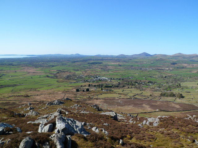
Bryncir is a small village located in the county of Caernarfonshire, Wales. Situated in the northwest part of the country, it is surrounded by picturesque countryside and is approximately 6 miles southeast of the town of Porthmadog. The village is part of the community of Garndolbenmaen and falls within the Snowdonia National Park.

Bryncir is known for its agricultural heritage, with farming being a significant industry in the area. The village is home to Bryncir Agricultural Cooperative, a prominent agricultural business that provides services and supplies to local farmers. The cooperative hosts regular livestock markets, attracting buyers and sellers from the surrounding areas.

Despite its small size, Bryncir offers a range of amenities to its residents and visitors. These include a village hall, a primary school, a post office, and a convenience store. The nearby town of Porthmadog provides additional facilities and services, including secondary schools, supermarkets, and a wider range of shops and restaurants.

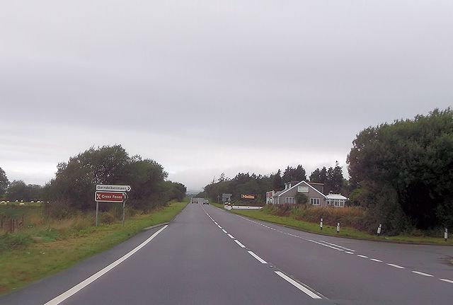
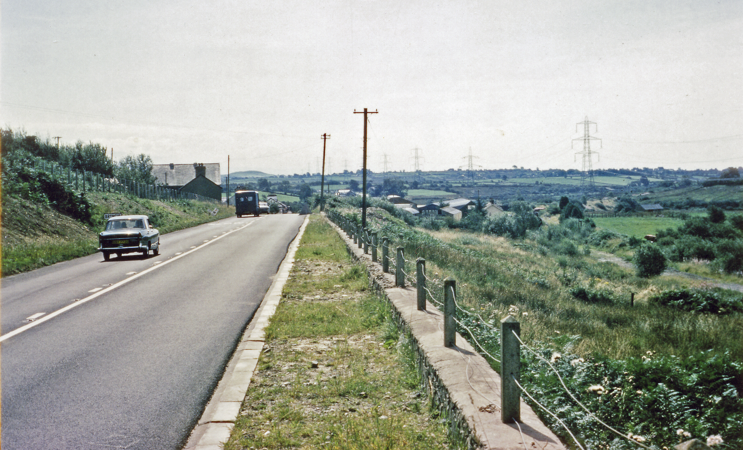
The village is well-connected by road, with the A487 passing through Bryncir, providing easy access to nearby towns and cities. Its location within the Snowdonia National Park also makes it a popular destination for outdoor enthusiasts. The surrounding area offers ample opportunities for hiking, climbing, and exploring the natural beauty of the region.

In summary, Bryncir is a small village in Caernarfonshire, Wales, known for its agricultural heritage and its location within the beautiful Snowdonia National Park. It offers a range of amenities and is well-connected by road, making it an attractive place to live or visit for those seeking a rural lifestyle or outdoor adventures.

If you have any feedback on the listing, please let us know in the comments section below.

Bryncir Images

Images are sourced within 2km of 52.976966/-4.263979 or Grid Reference SH4844. Thanks to Geograph Open Source API. All images are credited.

Looking towards Garndolbenmaen from the summit of Graig-y-garn
Bryncir Station Site of the former railway station, now part of the Lôn Eifion cycle path.
Bryncir Station
Site of the former railway station, now part of the Lôn Eifion cycle path.
Former Railway Bridge Former railway bridge, now part Lôn Eifion cycle path.
Former Railway Bridge
Former railway bridge, now part Lôn Eifion cycle path.
Approaching site of Bryncir/Brynkir station on the A487 View southward, towards Afon Wen: ex-LNW (Bangor) - Caernarfon - Afon Wen line. The station at Bryncir (Brynkir in the railway timetable), which about 200 yards ahead on the right, was closed along with the whole line from 7/12/64.
Approaching site of Bryncir/Brynkir station on the A487
View southward, towards Afon Wen: ex-LNW (Bangor) - Caernarfon - Afon Wen line. The station at Bryncir (Brynkir in the railway timetable), which about 200 yards ahead on the right, was closed along with the whole line from 7/12/64.
Water column and tank at Bryncir
Turning for Cross Foxes from A487
Approaching B4411 junction from A487
Entering Bryncir from the south
Road junction at Dafarn Faig
Pylon near the B4411
Energy beyond a gate
Tractor Sales - Bryncir
The A487 North of Bryncir
The lane to Dafarn Faig
A487 close to Dafain-faig Nebo Transmitter mast can be seen in the distance
A487 close to Dafain-faig
Nebo Transmitter mast can be seen in the distance
Farmland east of Ty'r Dewin Looking south-east from the minor road.
Farmland east of Ty'r Dewin
Looking south-east from the minor road.
Scrubby woodland on the valley floor East of Ty'r Dewin, along a tributary of Afon Dwyfach.
Scrubby woodland on the valley floor
East of Ty'r Dewin, along a tributary of Afon Dwyfach.
Farm track running east from Ty'r Dewin Dropping down to the scrubby valley floor.
Farm track running east from Ty'r Dewin
Dropping down to the scrubby valley floor.
Show me another place!

Bryncir is located at Grid Ref: SH4844 (Lat: 52.976966, Lng: -4.263979)

Unitary Authority: Gwynedd

Police Authority: North Wales

What 3 Words

///reissued.fury.wake. Near Criccieth, Gwynedd

Nearby Locations

Bryncir

Related Wikis

Lôn Las Menai

Lôn Las Menai is part of Lôn Las Cymru, the Welsh National Cycle Route, which is about 400 km (250 mi) long. Lôn Las Menai is the section which runs for...

Brynkir railway station

Brynkir railway station was opened by the Carnarvonshire Railway on the western edge of the village of Bryncir, Gwynedd, Wales. The station was not heavily...

Pen Llystyn

Pen Llystyn, sometimes referred to as Pen Llys Tyn, was a Roman fort located to the north of Bryncir, between Porthmadog and Caernarfon in Gwynedd, north...

Garndolbenmaen

Garndolbenmaen, known colloquially as Garn, is a village in the county of Gwynedd, Wales. It lies near the A487, approximately 6 miles (10 km) north west...

Nearby Amenities

Located within 500m of 52.976966,-4.263979
Bryncir
Is In: Gwynedd,Wales,UK
Name Cy: Bryncir
Name En: Bryncir
Place: hamlet
Source: local knowledge
Lat/Long: 52.9770928/-4.2637098
Power: tower
Lat/Long: 52.9726018/-4.2651221
Power: tower
Lat/Long: 52.978649/-4.2698868
Power: tower
Lat/Long: 52.9755848/-4.2675032
Brynkir
Historic Railway: station
Railway: site
Wikidata: Q15205294
Wikipedia: en:Brynkir railway station
Lat/Long: 52.9770526/-4.2659622
Pen Llystyn Roman Fort
Archaeological Site: fortification
Historic: archaeological_site
Historic Civilization: roman
Wikidata: Q7162092
Wikipedia: en:Pen Llystyn
Lat/Long: 52.9804844/-4.2642154
Landuse: quarry
Lat/Long: 52.9794173/-4.2637372
Parking
Lat/Long: 52.9805143/-4.2670559
Direction: 75
Generator Method: photovoltaic
Generator Output Electricity: yes
Generator Solar Modules: 8
Generator Source: solar
Generator Type: solar_photovoltaic_panel
Location: roof
Power: generator
Lat/Long: 52.9776196/-4.2658764
The data included in this document is from www.openstreetmap.org. The data is made available under ODbL.

Have you been to Bryncir?

Leave your review of Bryncir below (or comments, questions and feedback).