Bryn-berian

Settlement in Pembrokeshire

Wales

Bryn-berian

Mountain ponies on Waun Mawn The peak to the left is Carn Ingli about 2.5 miles away, with Newport Bay barely visible through the mist.
Mountain ponies on Waun Mawn Credit: Alan Hughes

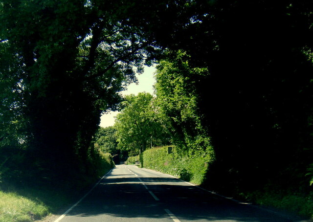
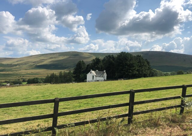
Bryn-berian is a small village located in the county of Pembrokeshire, Wales. Situated in the southwestern part of the country, it lies approximately 10 miles northwest of the town of Newport. Known for its picturesque setting, Bryn-berian is surrounded by rolling hills and lush green countryside.

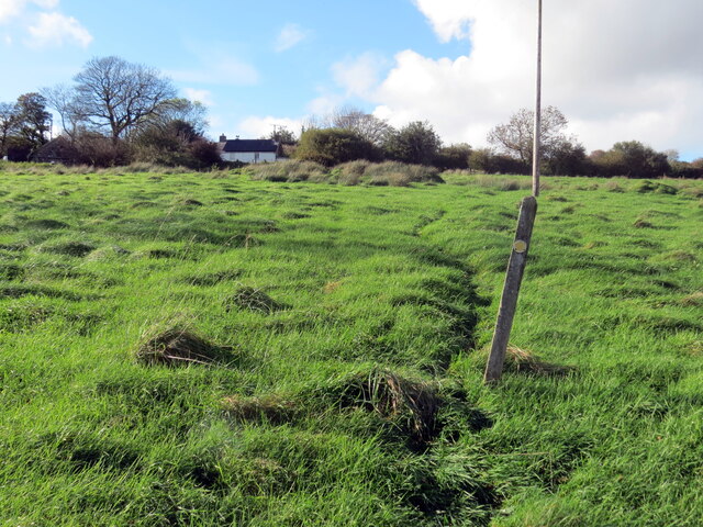
The village itself is home to a tight-knit community and has a population of around 300 residents. It boasts a quaint and charming atmosphere, with traditional stone houses and narrow winding streets. The local economy is predominantly based on agriculture, with farming being a significant occupation in the area.

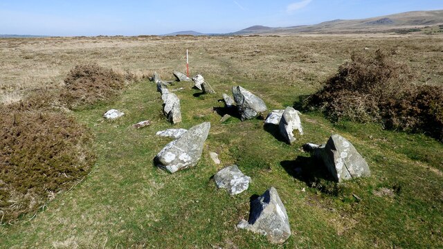
Bryn-berian is also known for its rich history. The village has a number of ancient monuments and archaeological sites, including a prehistoric burial chamber known as the Pentre Ifan. This Neolithic dolmen is considered one of the finest examples of its kind in Wales and attracts visitors from far and wide.

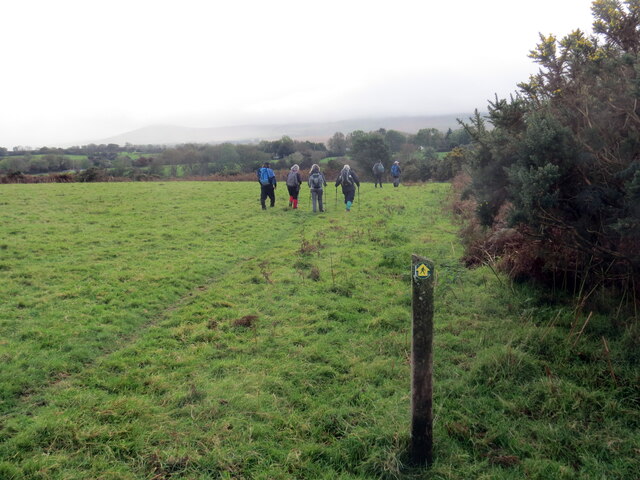
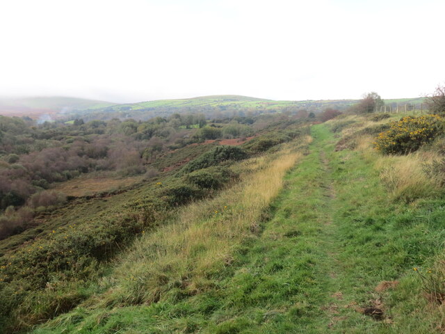
Nature enthusiasts are drawn to Bryn-berian for its proximity to the Pembrokeshire Coast National Park. The park, with its stunning coastline and diverse wildlife, offers a range of outdoor activities such as hiking, bird-watching, and exploring the numerous walking trails.

Although Bryn-berian is a small village, it provides essential amenities for its residents and visitors. These include a local pub, a village hall, and a primary school. For a wider range of services and facilities, the nearby town of Newport offers additional options.

Overall, Bryn-berian is a charming and historic village nestled in the beautiful Pembrokeshire countryside, providing a peaceful and scenic retreat for both residents and visitors alike.

If you have any feedback on the listing, please let us know in the comments section below.
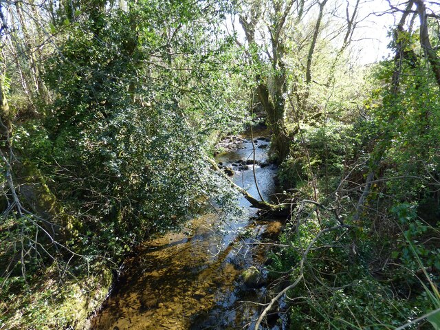
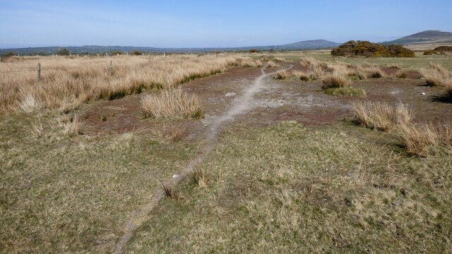
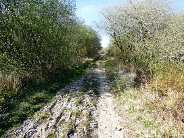
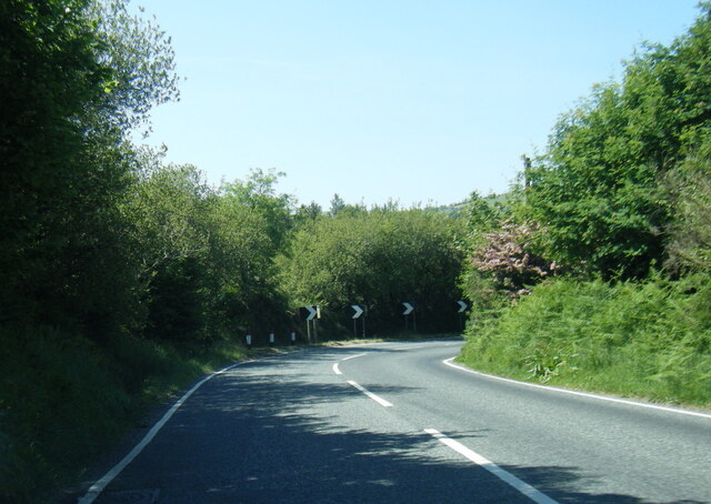
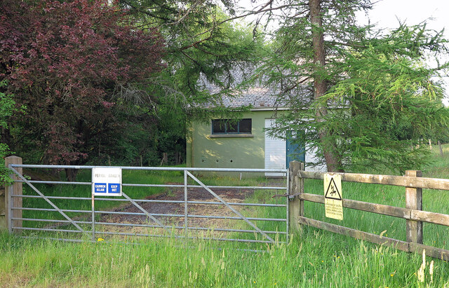
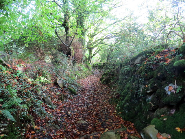
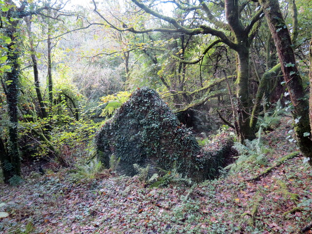
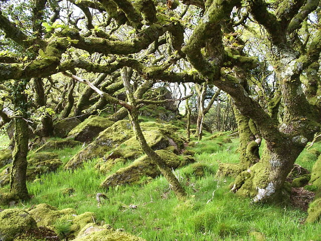
Bryn-berian Images

Images are sourced within 2km of 51.981977/-4.766149 or Grid Reference SN1035. Thanks to Geograph Open Source API. All images are credited.

Mountain ponies on Waun Mawn The peak to the left is Carn Ingli about 2.5 miles away, with Newport Bay barely visible through the mist.
Mountain ponies on Waun Mawn
The peak to the left is Carn Ingli about 2.5 miles away, with Newport Bay barely visible through the mist.
Pentre Ifan stones Dating back 5000 years, these stones were at the centre of a larger monument. The cap-stone weighs 16 tonnes. It's apparently uncertain what it might have been for.
Pentre Ifan stones
Dating back 5000 years, these stones were at the centre of a larger monument. The cap-stone weighs 16 tonnes. It's apparently uncertain what it might have been for.
B4329 west of Brynberian
Pennant Isaf South-west of Brynberian
Pennant Isaf
South-west of Brynberian
Llwybr Penparce / Penparce path Llwybr troed cyhoeddus yn mynd i gyfeiriad anhedd-dy o'r ene Penparce.

A public footpath heading in the direction of a property known as Penparce (trans. top of the fields).
Llwybr Penparce / Penparce path
Llwybr troed cyhoeddus yn mynd i gyfeiriad anhedd-dy o'r ene Penparce. A public footpath heading in the direction of a property known as Penparce (trans. top of the fields).
Beddyrafanc Passage Grave A relatively well preserved Neolithic chambered tomb (Scale 1m) <span class="nowrap"><a title="https://www.megalithic.co.uk/article.php?sid=4258" rel="nofollow ugc noopener" href="https://www.megalithic.co.uk/article.php?sid=4258">Link</a><img style="margin-left:2px;" alt="External link" title="External link - shift click to open in new window" src="https://s1.geograph.org.uk/img/external.png" width="10" height="10"/></span>
Beddyrafanc Passage Grave
A relatively well preserved Neolithic chambered tomb (Scale 1m) LinkExternal link
Afon Brynberian View upstream from bridge on the B4329.
Afon Brynberian
View upstream from bridge on the B4329.
The path from Beddyrafanc Usually this would be rather damp underfoot, but on this occasion it was solid.
The path from Beddyrafanc
Usually this would be rather damp underfoot, but on this occasion it was solid.
Track to Beddyrafanc Looks like it could be rough going when the conditions are wet.
Track to Beddyrafanc
Looks like it could be rough going when the conditions are wet.
B4329 at Pont-Saeson
B4329 nearing Brynberian
Brynberian Pumping Station Water pumping station beside the Brynberian Brook.
Brynberian Pumping Station
Water pumping station beside the Brynberian Brook.
Llwybr ceffyl Feidr Ddwr / Feidr Ddwr bridleway Llwybr ceffyl hynafol wrth ei olwg a elwir Feidr Ddwr.

An ancient looking bridleway known as Feidr Ddwr (trans. water lane).
Llwybr ceffyl Feidr Ddwr / Feidr Ddwr bridleway
Llwybr ceffyl hynafol wrth ei olwg a elwir Feidr Ddwr. An ancient looking bridleway known as Feidr Ddwr (trans. water lane).
Llwybr ger Pen-rhiwlas / Path near Pen-rhiwlas Cerddwyr yn dilyn llwybr troed cyhoeddus ger anhedd-dy o'r enw Pen-rhiwlas.

Walkers following a footpath near  a property known as Pen-rhiwlas (trans. top of the green hill).
Llwybr ger Pen-rhiwlas / Path near Pen-rhiwlas
Cerddwyr yn dilyn llwybr troed cyhoeddus ger anhedd-dy o'r enw Pen-rhiwlas. Walkers following a footpath near a property known as Pen-rhiwlas (trans. top of the green hill).
Llwybr uwchben Cwm / Path above a valley Llwybr troed cyhoeddus uwchben Cwm Brynberian.

A public footpath above Cwm Brynberian.
Llwybr uwchben Cwm / Path above a valley
Llwybr troed cyhoeddus uwchben Cwm Brynberian. A public footpath above Cwm Brynberian.
Gweddillion Hen-felin / The remains of Hen-felin Gweddillion Hen-felin ar lan Afon Brynberian.

The remains of Hen-felin (trans. old mill) on the banks of Afon Brynberian.
Gweddillion Hen-felin / The remains of Hen-felin
Gweddillion Hen-felin ar lan Afon Brynberian. The remains of Hen-felin (trans. old mill) on the banks of Afon Brynberian.
Craig Rhosyfelin Craig Rhosyfelin lle cred rhai archaeolegwyr fod o leiaf un o'r cerrig glesision yng Nghor y Cewri wedi dod o'r fan hon.

Craig Rhosyfelin (trans. mill moor rock) where some archaeologists believe that at least one of the bluestones at Stonehenge came from.
Craig Rhosyfelin
Craig Rhosyfelin lle cred rhai archaeolegwyr fod o leiaf un o'r cerrig glesision yng Nghor y Cewri wedi dod o'r fan hon. Craig Rhosyfelin (trans. mill moor rock) where some archaeologists believe that at least one of the bluestones at Stonehenge came from.
Craig Rhosyfelin Craig Rhosyfelin lle cred rhai archaeolegwyr fod rhai cerrig glesision yng Nghor y Cewri wedi dod o'r fan hon. Mae'r slaben fawr yn y blandir yn edrych ei bod fel petai wedi ei pharatoi i'w chludo i ffwrdd. 

Craig Rhosyfelin (trans. mill moor rock) where some archaeologists believe some of the bluestones at Stonehenge came from. The large slab in the foreground looks as if it's been positioned ready for transportation.
Craig Rhosyfelin
Craig Rhosyfelin lle cred rhai archaeolegwyr fod rhai cerrig glesision yng Nghor y Cewri wedi dod o'r fan hon. Mae'r slaben fawr yn y blandir yn edrych ei bod fel petai wedi ei pharatoi i'w chludo i ffwrdd. Craig Rhosyfelin (trans. mill moor rock) where some archaeologists believe some of the bluestones at Stonehenge came from. The large slab in the foreground looks as if it's been positioned ready for transportation.
Show me another place!

Bryn-berian is located at Grid Ref: SN1035 (Lat: 51.981977, Lng: -4.766149)

Unitary Authority: Pembrokeshire

Police Authority: Dyfed Powys

Also known as: Brynberian

What 3 Words

///obliging.destiny.reduce. Near Nevern, Pembrokeshire

Nearby Locations

Bryn-berian Brynberian

Related Wikis

Brynberian

Brynberian is a small village in north Pembrokeshire, Wales, in the foothills of the Preseli Mountains in the Pembrokeshire Coast National Park. It is...

Penbanc

Penbanc is a 19th-century thatched Pembrokeshire longhouse (tŷ hir in Welsh) about 1.5 kilometres (0.9 miles) northwest of the hamlet of Brynberian in...

Craig Rhos-y-felin

Craig Rhos-y-felin is a rocky outcrop on the north side of the Preseli Mountains in Wales, which is designated as a RIGS site on the basis of its geological...

Tŷ Canol National Nature Reserve

Tŷ Canol National Nature Reserve is a national nature reserve which lies south of the village of Felindre Farchog, Pembrokeshire, Wales, between the Preseli...

Nearby Amenities

Located within 500m of 51.981977,-4.766149
Give Way
Direction: forward
Lat/Long: 51.9816368/-4.7623534
Power: pole
Lat/Long: 51.9791125/-4.7709654
Power: pole
Lat/Long: 51.9792275/-4.7696994
Power: pole
Lat/Long: 51.9793292/-4.7685367
Power: pole
Lat/Long: 51.9793998/-4.7677457
Power: pole
Lat/Long: 51.9794816/-4.7668754
Post Box
Post Box Type: lamp
Lat/Long: 51.9829788/-4.7633037
Public Bookcase
Llyfrgell Cyfnewid
Defibrillator
Booth: K6
Colour: red
Defibrillator Location: inside old red phone box (that is now book swap) in Brynberian
Disused Amenity: telephone
Emergency: defibrillator
Man Made: telephone_box
Name En: Swop Library
Public Bookcase Type: phone_box
Lat/Long: 51.9832778/-4.7637919
Brynberian
Name Cy: Brynberian
Place: hamlet
Lat/Long: 51.9831828/-4.7640382
The data included in this document is from www.openstreetmap.org. The data is made available under ODbL.

Have you been to Bryn-berian?

Leave your review of Bryn-berian below (or comments, questions and feedback).