Smith's Wood

Civil Parish in Warwickshire Solihull

England

Smith's Wood

The Farthings public house, Castle Bromwich
The Farthings public house, Castle Bromwich Credit: Ian S

Smith's Wood is a civil parish located in the borough of Solihull, Warwickshire, England. It is situated approximately 10 miles east of Birmingham city center. The area was originally developed in the 1950s and 1960s as part of the post-war housing expansion in the region.

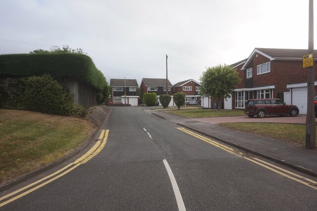
Smith's Wood is a primarily residential area, consisting mainly of semi-detached houses and low-rise apartment buildings. The community is home to a diverse population, with a mix of families, young professionals, and retirees. The parish is well connected to nearby towns and cities, with good public transport links and easy access to major roads such as the M6 and M42 motorways.

The area is served by a range of amenities, including a shopping center, supermarkets, and a variety of local shops and services. There are also several schools in the area, providing education for children of all ages. Smith's Wood is surrounded by green spaces, including parks and nature reserves, providing opportunities for outdoor activities and recreation.

The community is known for its strong sense of community spirit, with various local organizations and groups working together to improve the area and organize events and activities for residents. There are also several community centers and sports facilities where residents can engage in social and recreational activities.

Overall, Smith's Wood offers a pleasant and convenient living environment, with a range of amenities and a strong community spirit.

If you have any feedback on the listing, please let us know in the comments section below.
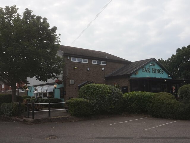
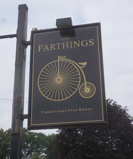
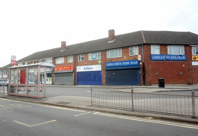
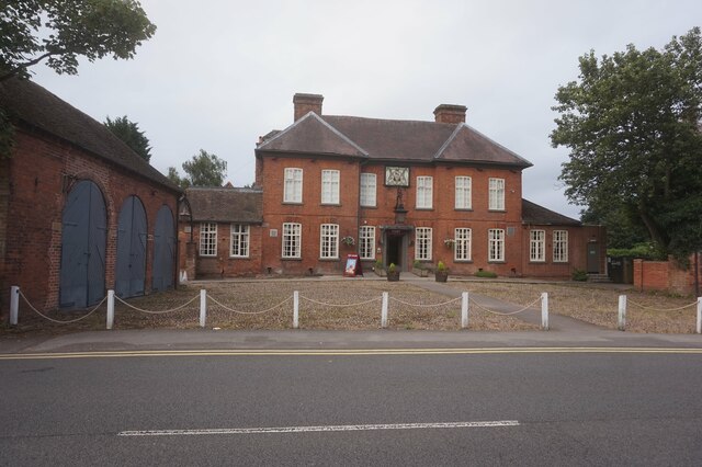
Smith's Wood Images

Images are sourced within 2km of 52.502489/-1.747212 or Grid Reference SP1789. Thanks to Geograph Open Source API. All images are credited.

The Farthings public house, Castle Bromwich
Postbox on Water Orton Road, Castle Bromwich
Water Orton Road, Castle Bromwich
West Avenue from Green Lane, Castle Bromwich
Shops on Green Lane, Castle Bromwich
Auckland Drive, Castle Bromwich
Swift Close off Auckland Drive, Castle Bromwich
Sandra Croft off Auckland Drive, Castle Bromwich
The Centurion public house On Forth Drive, Fordbridge.
The Centurion public house
On Forth Drive, Fordbridge.
The Centurion public house On Forth Drive, Fordbridge.
The Centurion public house
On Forth Drive, Fordbridge.
Chester Road, Castle Bromwich
Castle Bromwich Shopping, Chester Road
Bradford Arms Public House, Castle Bromwich
Chester Road, Castle Bromwich
Bradford Arms Public House, Castle Bromwich
Bridgeman Croft off Chester Road, Castle Bromwich
Show me another place!

Smith's Wood is located at Grid Ref: SP1789 (Lat: 52.502489, Lng: -1.747212)

Administrative County: West Midlands

District: Solihull

Police Authority: West Midlands

What 3 Words

///pies.fans.brains. Near Water Orton, Warwickshire

Nearby Locations

Smith's Wood Smith's Wood

Related Wikis

Smith's Wood

Smith's Wood is a residential area in the north of the Metropolitan Borough of Solihull in the West Midlands of England. It is a civil parish with a population...
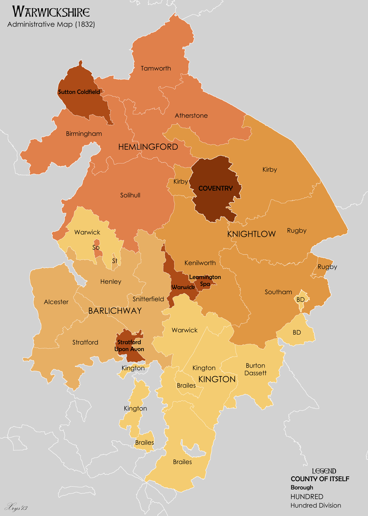
Hemlingford Hundred

Hemlingford Hundred was one of the four hundreds that the English county of Warwickshire was divided into, along with Kington, Knightlow and Barlichway...

Smith's Wood Academy

Smith's Wood Academy (formerly Smith's Wood School and then Smith's Wood Sports College) is a co-educational secondary school located in Smith's Wood in...

Park Hall Academy

Park Hall Academy (formerly Park Hall School) is a mixed secondary school and sixth form located in Castle Bromwich in the West Midlands of England.Previously...

Nearby Amenities

Located within 500m of 52.502489,-1.747212
Source: bing
Traffic Calming: bump
Lat/Long: 52.5058069/-1.7443956
Source: bing
Traffic Calming: bump
Lat/Long: 52.504374/-1.7433112
Source: bing
Traffic Calming: bump
Lat/Long: 52.501797/-1.7419977
Mini Roundabout
Direction: clockwise
Lat/Long: 52.5010353/-1.7415563
Give Way
Lat/Long: 52.5017885/-1.7412373
Crossing
Crossing Island: yes
Lat/Long: 52.5010154/-1.7417214
Smith's Wood
Is In: Solihull,west Midlands,England,UK
Place: village
Source: survey
Wikidata: Q9338662
Wikipedia: en:Smith's Wood
Lat/Long: 52.504544/-1.7502437
Mini Roundabout
Direction: clockwise
Lat/Long: 52.4995098/-1.7450222
Source: bing
Traffic Calming: bump
Lat/Long: 52.504722/-1.7465342
Turning Circle
Source: bing
Lat/Long: 52.5000104/-1.7504918
Turning Circle
Source: bing
Lat/Long: 52.4989328/-1.7512552
Post Office
Burtons Way Post Office
Addr City: Solihull
Addr Housenumber: 25
Addr Postcode: B36 0UG
Addr Street: Burtons Way
Opening Hours: Mo-Sa 06:00-22:00; Su 07:00-22:00
Ref Pol Id: 129309
Source: survey
Lat/Long: 52.503201/-1.7492658
Shop: convenience
Source: survey
Lat/Long: 52.5045727/-1.7472044
Bus Stop
Arran Way / Mull Croft
NaPTANAreaCode: 43000182901
Bus: yes
Naptan AtcoCode: 43000182901
Naptan Bearing: NE
Naptan BusStopType: MKD
Naptan CommonName: Mull Croft
Naptan Indicator: adj
Naptan NaptanCode: nwmagmag
Naptan PlusbusZoneRef: BHAMNWS
Naptan Status: ACT
Naptan StopType: BCT
Naptan Street: ARRAN WAY
Naptan Towards: Castle Bromwich
Naptan Verified: no
Public Transport: platform
Shelter: yes
Shelter Ref: 806407
Source: WMCA
Lat/Long: 52.5006051/-1.7430253
Bus Stop
Arran Way / Mull Croft
Bus: yes
Naptan AtcoCode: 43000182902
Naptan Bearing: SW
Naptan BusStopType: MKD
Naptan CommonName: Mull Croft
Naptan Indicator: opp
Naptan NaptanCode: nwmagmaj
Naptan PlusbusZoneRef: BHAMNWS
Naptan Status: ACT
Naptan StopType: BCT
Naptan Street: ARRAN WAY
Naptan Towards: Chelmsley Wood
Naptan Verified: no
Public Transport: platform
Source: WMCA
Lat/Long: 52.5003717/-1.7431592
Bus Stop
Auckland Dr / Greenfinch Rd
NaPTANAreaCode: 43000183101
Bus: yes
Naptan AtcoCode: 43000183101
Naptan Bearing: N
Naptan BusStopType: MKD
Naptan CommonName: Greenfinch Rd
Naptan Indicator: adj
Naptan NaptanCode: nwmagmam
Naptan PlusbusZoneRef: BHAMNWS
Naptan Status: ACT
Naptan StopType: BCT
Naptan Street: AUCKLAND DR
Naptan Towards: Castle Bromwich
Naptan Verified: no
Public Transport: platform
Route Ref: 94
Shelter: yes
Shelter Ref: 806406
Source: WMCA
Lat/Long: 52.5023654/-1.7425141
Bus Stop
Auckland Dr / Greenfinch Rd
NaPTANAreaCode: 43000183102
Bus: yes
Naptan AtcoCode: 43000183102
Naptan Bearing: S
Naptan BusStopType: MKD
Naptan CommonName: Greenfinch Rd
Naptan Indicator: opp
Naptan NaptanCode: nwmagmap
Naptan PlusbusZoneRef: BHAMNWS
Naptan Status: ACT
Naptan StopType: BCT
Naptan Street: AUCKLAND DR
Naptan Towards: Chelmsley Wood
Naptan Verified: no
Public Transport: platform
Route Ref: 94
Shelter: yes
Shelter Ref: 806405
Source: WMCA
Lat/Long: 52.5029687/-1.7426285
Bus Stop
Auckland Dr / Kingfisher Drive
NaPTANAreaCode: 43000183201
Asset Ref: 806403
Bus: yes
Location: Auckland Drive;Kingfisher Drive
Naptan AtcoCode: 43000183201
Naptan Bearing: N
Naptan BusStopType: MKD
Naptan CommonName: Kingfisher Drive
Naptan Indicator: adj
Naptan NaptanCode: nwmagmat
Naptan PlusbusZoneRef: BHAMNWS
Naptan Status: ACT
Naptan StopType: BCT
Naptan Street: AUCKLAND DR
Naptan Towards: Castle Bromwich
Public Transport: platform
Route Ref: 94
Shelter: yes
Shelter Ref: 806403
Source: WMCA
Towards: Castle Bromwich
Lat/Long: 52.5045185/-1.743462
Bus Stop
Auckland Dr / Kingfisher Drive
NaPTANAreaCode: 43000183202
Bus: yes
Naptan AtcoCode: 43000183202
Naptan Bearing: S
Naptan BusStopType: MKD
Naptan CommonName: Kingfisher Drive
Naptan Indicator: opp
Naptan NaptanCode: nwmagmaw
Naptan PlusbusZoneRef: BHAMNWS
Naptan Status: ACT
Naptan StopType: BCT
Naptan Street: AUCKLAND DR
Naptan Towards: Chelmsley Wood
Public Transport: platform
Route Ref: 94
Shelter: yes
Shelter Ref: 806404
Source: WMCA
Lat/Long: 52.5045536/-1.7433329
Bus Stop
Windward Way / Woodpecker Grove
Bus: yes
Naptan AtcoCode: 43000184201
Naptan Bearing: SE
Naptan BusStopType: MKD
Naptan CommonName: Woodpecker Grove
Naptan Indicator: adj
Naptan NaptanCode: nwmagmgt
Naptan PlusbusZoneRef: BHAMNWS
Naptan Status: ACT
Naptan StopType: BCT
Naptan Street: WINDWARD WAY
Naptan Towards: Chelmsley Wood
Naptan Verified: no
Public Transport: platform
Source: WMCA
Lat/Long: 52.501061/-1.7482964
Bus Stop
Windward Way / Woodpecker Grove
Bus: yes
Naptan AtcoCode: 43000184202
Naptan Bearing: NW
Naptan BusStopType: MKD
Naptan CommonName: Woodpecker Grove
Naptan Indicator: opp
Naptan NaptanCode: nwmagmgw
Naptan PlusbusZoneRef: BHAMNWS
Naptan Status: ACT
Naptan StopType: BCT
Naptan Street: WINDWARD WAY
Naptan Towards: Chelmsley Wood
Naptan Verified: no
Public Transport: platform
Source: WMCA
Lat/Long: 52.5008615/-1.7479743
Bus Stop
Windward Way / Buckingham Rd
Bus: yes
Naptan AtcoCode: 43000184301
Naptan Bearing: SE
Naptan BusStopType: MKD
Naptan CommonName: Buckingham Rd
Naptan Indicator: opp
Naptan NaptanCode: nwmagmja
Naptan PlusbusZoneRef: BHAMNWS
Naptan Status: ACT
Naptan StopType: BCT
Naptan Street: WINDWARD WAY
Naptan Towards: Chelmsley Wood
Naptan Verified: no
Public Transport: platform
Route Ref: 72
Source: WMCA
Lat/Long: 52.5018082/-1.7518586
Bus Stop
Buckingham Rd / Chester Rd
Bus: yes
Naptan AtcoCode: 43000186402
Naptan Bearing: SW
Naptan BusStopType: MKD
Naptan CommonName: Chester Rd
Naptan Indicator: before
Naptan NaptanCode: nwmagmwp
Naptan PlusbusZoneRef: BHAMNWS
Naptan Status: ACT
Naptan StopType: BCT
Naptan Street: BUCKINGHAM RD
Naptan Towards: Chelmsley Wood
Public Transport: platform
Route Ref: 72;966
Shelter: no
Source: WMCA
Lat/Long: 52.499528/-1.7526204
Power Historic: tower
Source: OS 1:25k
Lat/Long: 52.5018074/-1.7409868
Source: bing
Traffic Calming: bump
Lat/Long: 52.504818/-1.7453117
Source: bing
Traffic Calming: bump
Lat/Long: 52.5048495/-1.7448255
Source: bing
Traffic Calming: bump
Lat/Long: 52.504921/-1.7440823
Source: bing
Traffic Calming: bump
Lat/Long: 52.5052262/-1.7439224
Source: bing
Traffic Calming: bump
Lat/Long: 52.5063681/-1.7448564
Source: bing
Traffic Calming: bump
Lat/Long: 52.5064467/-1.7449198
Source: bing
Traffic Calming: bump
Lat/Long: 52.5012218/-1.7416158
Source: bing
Traffic Calming: bump
Lat/Long: 52.505025/-1.7451323
Source: bing
Traffic Calming: bump
Lat/Long: 52.5055673/-1.7452283
Crossing
Bicycle: designated
Crossing: zebra
Crossing Ref: tiger
Source: bing
Lat/Long: 52.5002403/-1.7435788
Source: bing
Traffic Calming: bump
Lat/Long: 52.5046559/-1.7476316
Source: bing
Traffic Calming: bump
Lat/Long: 52.5049103/-1.7492257
Source: bing
Traffic Calming: bump
Lat/Long: 52.5052744/-1.7463417
Source: bing
Traffic Calming: bump
Lat/Long: 52.50534/-1.7454159
Source: bing
Traffic Calming: bump
Lat/Long: 52.5036521/-1.7430315
Turning Circle
Lat/Long: 52.5034114/-1.7448312
Give Way
Lat/Long: 52.5016933/-1.7418312
Give Way
Lat/Long: 52.5021179/-1.7412545
Give Way
Lat/Long: 52.5019783/-1.7410225
Bus Stop
Burtons Way / Village Centre
NaPTANAreaCode: 43001316202
Bus: yes
Naptan AtcoCode: 43001316202
Naptan Bearing: S
Naptan BusStopType: MKD
Naptan CommonName: Village Centre
Naptan NaptanCode: nwmagpjm
Naptan Status: ACT
Naptan StopType: BCT
Naptan Street: BURTONS WAY
Public Transport: platform
Route Ref: 966
Shelter: yes
Shelter Ref: 1316202
Source: WMCA
Lat/Long: 52.5042588/-1.7489783
Bus Stop
Burtons Way / Village Centre
NaPTANAreaCode: 43001316201
Bus: yes
Naptan AtcoCode: 43001316201
Naptan Bearing: N
Naptan BusStopType: MKD
Naptan CommonName: Village Centre
Naptan NaptanCode: nwmadatd
Naptan Status: ACT
Naptan StopType: BCT
Naptan Street: BURTONS WAY
Public Transport: platform
Route Ref: 966
Shelter: yes
Shelter Ref: 1316201
Source: WMCA
Lat/Long: 52.5044861/-1.7491661
Bus Stop
Windward Way / Buckingham Rd
Bus: yes
Naptan AtcoCode: 43000184302
Naptan Bearing: NW
Naptan BusStopType: MKD
Naptan CommonName: Buckingham Rd
Naptan NaptanCode: nwmagmjd
Naptan Status: ACT
Naptan StopType: BCT
Naptan Street: WINDWARD WAY
Naptan Towards: Castle Bromwich
Public Transport: platform
Route Ref: 72
Source: WMCA
Lat/Long: 52.5016946/-1.7519012
Post Box
Ref: B36 1240
Lat/Long: 52.5021671/-1.7540098
Generator Method: photovoltaic
Generator Output Electricity: yes
Generator Source: solar
Generator Type: solar_photovoltaic_panel
Location: roof
Power: generator
Source: bing
Lat/Long: 52.5023448/-1.7490926
Generator Method: photovoltaic
Generator Output Electricity: yes
Generator Source: solar
Generator Type: solar_photovoltaic_panel
Location: roof
Power: generator
Source: bing
Lat/Long: 52.5019636/-1.7492039
Generator Method: photovoltaic
Generator Output Electricity: yes
Generator Source: solar
Generator Type: solar_photovoltaic_panel
Location: roof
Power: generator
Source: bing
Lat/Long: 52.505833/-1.746106
Generator Method: photovoltaic
Generator Output Electricity: yes
Generator Source: solar
Generator Type: solar_photovoltaic_panel
Location: roof
Power: generator
Lat/Long: 52.5019088/-1.7432883
Generator Method: photovoltaic
Generator Output Electricity: yes
Generator Source: solar
Generator Type: solar_photovoltaic_panel
Location: roof
Power: generator
Lat/Long: 52.5018958/-1.7434895
Generator Method: photovoltaic
Generator Output Electricity: yes
Generator Source: solar
Generator Type: solar_photovoltaic_panel
Location: roof
Power: generator
Lat/Long: 52.5007161/-1.7418909
Generator Method: photovoltaic
Generator Output Electricity: yes
Generator Source: solar
Generator Type: solar_photovoltaic_panel
Location: roof
Power: generator
Lat/Long: 52.5007675/-1.7417219
Generator Method: photovoltaic
Generator Output Electricity: yes
Generator Source: solar
Generator Type: solar_photovoltaic_panel
Location: roof
Power: generator
Lat/Long: 52.500779/-1.7416455
Generator Method: photovoltaic
Generator Output Electricity: yes
Generator Source: solar
Generator Type: solar_photovoltaic_panel
Location: roof
Power: generator
Lat/Long: 52.5004589/-1.7418104
Generator Method: photovoltaic
Generator Output Electricity: yes
Generator Source: solar
Generator Type: solar_photovoltaic_panel
Location: roof
Power: generator
Lat/Long: 52.5004989/-1.7416454
Generator Method: photovoltaic
Generator Output Electricity: yes
Generator Source: solar
Generator Type: solar_photovoltaic_panel
Location: roof
Power: generator
Lat/Long: 52.5005144/-1.7415651
Generator Method: photovoltaic
Generator Output Electricity: yes
Generator Source: solar
Generator Type: solar_photovoltaic_panel
Location: roof
Power: generator
Lat/Long: 52.5020525/-1.7510198
Generator Method: photovoltaic
Generator Output Electricity: yes
Generator Source: solar
Generator Type: solar_photovoltaic_panel
Location: roof
Power: generator
Lat/Long: 52.5029603/-1.7531186
Generator Method: photovoltaic
Generator Output Electricity: yes
Generator Source: solar
Generator Type: solar_photovoltaic_panel
Location: roof
Power: generator
Lat/Long: 52.5030028/-1.7525527
Generator Method: photovoltaic
Generator Output Electricity: yes
Generator Source: solar
Generator Type: solar_photovoltaic_panel
Location: roof
Power: generator
Lat/Long: 52.5030305/-1.7519626
Generator Method: photovoltaic
Generator Output Electricity: yes
Generator Source: solar
Generator Type: solar_photovoltaic_panel
Location: roof
Power: generator
Lat/Long: 52.5027366/-1.7522496
Generator Method: photovoltaic
Generator Output Electricity: yes
Generator Source: solar
Generator Type: solar_photovoltaic_panel
Location: roof
Power: generator
Lat/Long: 52.5023693/-1.7529792
Generator Method: photovoltaic
Generator Output Electricity: yes
Generator Source: solar
Generator Type: solar_photovoltaic_panel
Location: roof
Power: generator
Lat/Long: 52.5054624/-1.7505759
Generator Method: photovoltaic
Generator Output Electricity: yes
Generator Source: solar
Generator Type: solar_photovoltaic_panel
Location: roof
Power: generator
Lat/Long: 52.5047155/-1.7504458
Generator Method: photovoltaic
Generator Output Electricity: yes
Generator Source: solar
Generator Type: solar_photovoltaic_panel
Location: roof
Power: generator
Lat/Long: 52.5043342/-1.7515455
Generator Method: photovoltaic
Generator Output Electricity: yes
Generator Source: solar
Generator Type: solar_photovoltaic_panel
Location: roof
Power: generator
Lat/Long: 52.5006989/-1.741966
Generator Method: photovoltaic
Generator Output Electricity: yes
Generator Source: solar
Generator Type: solar_photovoltaic_panel
Location: roof
Power: generator
Lat/Long: 52.5043506/-1.7530033
Generator Method: photovoltaic
Generator Output Electricity: yes
Generator Source: solar
Generator Type: solar_photovoltaic_panel
Location: roof
Power: generator
Lat/Long: 52.5049138/-1.745654
Generator Method: photovoltaic
Generator Output Electricity: yes
Generator Source: solar
Generator Type: solar_photovoltaic_panel
Location: roof
Power: generator
Lat/Long: 52.5049212/-1.7455749
Generator Method: photovoltaic
Generator Output Electricity: yes
Generator Source: solar
Generator Type: solar_photovoltaic_panel
Location: roof
Power: generator
Lat/Long: 52.5047367/-1.7446616
Generator Method: photovoltaic
Generator Output Electricity: yes
Generator Source: solar
Generator Type: solar_photovoltaic_panel
Location: roof
Power: generator
Lat/Long: 52.5049816/-1.7447796
Generator Method: photovoltaic
Generator Output Electricity: yes
Generator Source: solar
Generator Type: solar_photovoltaic_panel
Location: roof
Power: generator
Lat/Long: 52.505011/-1.744372
Generator Method: photovoltaic
Generator Output Electricity: yes
Generator Source: solar
Generator Type: solar_photovoltaic_panel
Location: roof
Power: generator
Lat/Long: 52.5062126/-1.7461959
Generator Method: photovoltaic
Generator Output Electricity: yes
Generator Source: solar
Generator Type: solar_photovoltaic_panel
Location: roof
Power: generator
Lat/Long: 52.5066044/-1.7465982
Doctors
Green Lane Surgery
Healthcare: doctor
Lat/Long: 52.5037196/-1.7487497
Doctors
Arran Medical Centre
Healthcare: doctor
Lat/Long: 52.5039342/-1.7488214
Crossing
Bicycle: designated
Crossing: zebra
Crossing Ref: tiger
Lat/Long: 52.499294/-1.7448257
Give Way
Source: bing
Lat/Long: 52.4996204/-1.7449318
Generator Method: photovoltaic
Generator Output Electricity: yes
Generator Source: solar
Generator Type: solar_photovoltaic_panel
Location: roof
Power: generator
Lat/Long: 52.5058012/-1.7464641
Generator Method: photovoltaic
Generator Output Electricity: yes
Generator Source: solar
Generator Type: solar_photovoltaic_panel
Location: roof
Power: generator
Lat/Long: 52.5031987/-1.7475718
Generator Method: photovoltaic
Generator Output Electricity: yes
Generator Source: solar
Generator Type: solar_photovoltaic_panel
Location: roof
Power: generator
Lat/Long: 52.5044542/-1.7486903
Generator Method: photovoltaic
Generator Output Electricity: yes
Generator Source: solar
Generator Type: solar_photovoltaic_panel
Location: roof
Power: generator
Lat/Long: 52.5028803/-1.7430174
Generator Method: photovoltaic
Generator Output Electricity: yes
Generator Source: solar
Generator Type: solar_photovoltaic_panel
Location: roof
Power: generator
Lat/Long: 52.5028803/-1.7429625
Generator Method: photovoltaic
Generator Output Electricity: yes
Generator Source: solar
Generator Type: solar_photovoltaic_panel
Location: roof
Power: generator
Lat/Long: 52.5066003/-1.7466639
Give Way
Source: bing
Lat/Long: 52.5004802/-1.7411533
Give Way
Source: bing
Lat/Long: 52.4995462/-1.744832
Give Way
Source: bing
Lat/Long: 52.500423/-1.7411761
Give Way
Source: bing
Lat/Long: 52.5005357/-1.7412606
Give Way
Source: bing
Lat/Long: 52.5009733/-1.741683
Give Way
Source: bing
Lat/Long: 52.5010631/-1.7417528
Spar
Brand: Spar
Brand Wikidata: Q610492
Brand Wikipedia: en:SPAR (retailer)
Shop: convenience
Website: https://www.spar.co.uk/store-locator/afb15618-spar-smiths-wood/
Lat/Long: 52.5030964/-1.7492682
Fast Food
Pizza369
Cuisine: pizza
Delivery: yes
Takeaway: yes
Lat/Long: 52.5034966/-1.7493684
Fast Food
Bobby’s Fish Bar
Cuisine: fish_and_chips
Takeaway: yes
Lat/Long: 52.5036146/-1.7493873
Fast Food
Greggs
Brand: Greggs
Brand Wikidata: Q3403981
Brand Wikipedia: en:Greggs
Contact Website: https://www.greggs.co.uk/shop-finder?shop-code=2117
Cuisine: sandwich;bakery
Takeaway: yes
Lat/Long: 52.5037256/-1.7494147
Barrier: bollard
Lat/Long: 52.501675/-1.742459
The data included in this document is from www.openstreetmap.org. The data is made available under ODbL.

Have you been to Smith's Wood?

Leave your review of Smith's Wood below (or comments, questions and feedback).