Seckington

Civil Parish in Warwickshire North Warwickshire

England

Seckington

M42 Motorway at the accommodation bridge near Lodge Farm
M42 Motorway at the accommodation bridge near Lodge Farm Credit: Peter Whatley

The requested URL returned error: 429 Too Many Requests

If you have any feedback on the listing, please let us know in the comments section below.
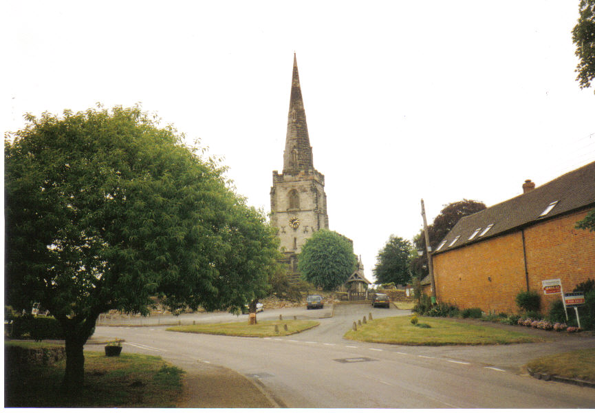
Seckington Images

Images are sourced within 2km of 52.661573/-1.612783 or Grid Reference SK2607. Thanks to Geograph Open Source API. All images are credited.

M42 Motorway at the accommodation bridge near Lodge Farm
M42 Motorway near Lodge Farm
Entrance to Composite Creations & Simply Stairs
The old Farmhouse, New Road, Shuttington
Looking along New Road Towards Shuttington
Fields waiting for Next Years Crop, New Road
Welcome to Shuttington Be sure to slow when entering the village from this direction.
Welcome to Shuttington
Be sure to slow when entering the village from this direction.
Across Recently Planted Crops to New Covert The fields are starting to look green again, now that the crops for next year are pushing through.
Across Recently Planted Crops to New Covert
The fields are starting to look green again, now that the crops for next year are pushing through.
Down the Road Towards Seckington In the middle distance, the church spire at Seckington can just be seen.
Down the Road Towards Seckington
In the middle distance, the church spire at Seckington can just be seen.
The Crossroads of Main Road and Hangmans Lane Main Road runs from Shuttington to Newton Regis, Hangmans Lane goes to Seckington.
The Crossroads of Main Road and Hangmans Lane
Main Road runs from Shuttington to Newton Regis, Hangmans Lane goes to Seckington.
Across freshly planted fields to Newton Regis This shot gives an idea how flat this side of Hangmans Lane is. Newton Regis church tower can be seen centre picture.
Across freshly planted fields to Newton Regis
This shot gives an idea how flat this side of Hangmans Lane is. Newton Regis church tower can be seen centre picture.
Farmyard Behind Gates, Seckington
Hangmans Lane junction with the B5493 Another chance to see the flat countryside towards the M42.
Hangmans Lane junction with the B5493
Another chance to see the flat countryside towards the M42.
Another View of Thorpegorse Cottages These cottages are on the B5493 road. A quick glance as you drive by gives the impression that they are made out of blocks of stone, but on closer inspection, it looks like building blocks. The middle one is for sale.
Another View of Thorpegorse Cottages
These cottages are on the B5493 road. A quick glance as you drive by gives the impression that they are made out of blocks of stone, but on closer inspection, it looks like building blocks. The middle one is for sale.
M42 passing Bramcote Covert The bridge ahead is just in <a href="https://www.geograph.org.uk/gridref/SK2706">SK2706</a>.  It carries a farm track and footpath
M42 passing Bramcote Covert
The bridge ahead is just in SK2706. It carries a farm track and footpath
Bramcote Covert The wood is seen from roughly the same direction in <a href="https://www.geograph.org.uk/photo/393423">SK2705 : Peace is shattered</a>, but from much further away; this is from the M42.
Bramcote Covert
The wood is seen from roughly the same direction in SK2705 : Peace is shattered, but from much further away; this is from the M42.
Farmland by the M42 A view towards the spire at Newton Regis <a href="https://www.geograph.org.uk/photo/1780992">SK2707 : Newton Regis village centre - 1</a>.
Farmland by the M42
A view towards the spire at Newton Regis SK2707 : Newton Regis village centre - 1.
Statfold Barn Railway - handing over the token Swapping the token at the entrance to the balloon loop that allows locomotives to turn round without the need of a turntable or triangle.
Statfold Barn Railway - handing over the token
Swapping the token at the entrance to the balloon loop that allows locomotives to turn round without the need of a turntable or triangle.
Show me another place!

Seckington is located at Grid Ref: SK2607 (Lat: 52.661573, Lng: -1.612783)

Administrative County: Warwickshire

District: North Warwickshire

Police Authority: Warwickshire

What 3 Words

///gloves.daytime.troll. Near Polesworth, Warwickshire

Nearby Locations

Seckington Seckington

Related Wikis

Seckington

Seckington is a village and civil parish in North Warwickshire, about 4 miles (6 km) northeast of Tamworth. The B4593 road between Tamworth and Appleby...

Newton Regis

Newton Regis is a village and civil parish in the North Warwickshire district of Warwickshire, England. It has a population of 599 at the 2011 Census....

Thorpe Constantine

Thorpe Constantine is a small village and civil parish in Staffordshire, England. It lies about 6 miles (10 km) north-east of Tamworth and 6 miles south...

Shuttington

Shuttington is a village and civil parish in North Warwickshire, England, situated north-east of Tamworth, Staffordshire. In the 2001 census, the parish...

Nearby Amenities

Located within 500m of 52.661573,-1.612783
The data included in this document is from www.openstreetmap.org. The data is made available under ODbL.

Have you been to Seckington?

Leave your review of Seckington below (or comments, questions and feedback).