Sawtry

Civil Parish in Huntingdonshire Huntingdonshire

England

Sawtry

Wheat field off Cook's Lane
Wheat field off Cook's Lane Credit: Jonathan Thacker

Sawtry is a civil parish located in the county of Huntingdonshire, in the eastern part of England. It is situated approximately 9 miles northwest of Huntingdon and 12 miles south of Peterborough. The parish covers an area of around 4 square miles and is home to a population of approximately 6,500 people.

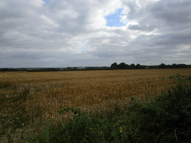
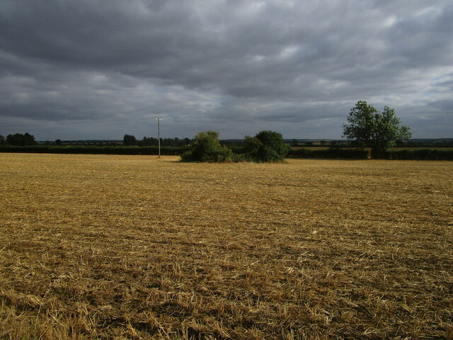
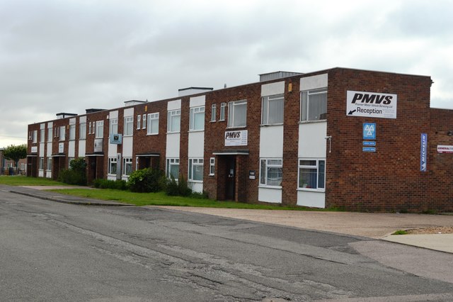
Sawtry is a predominantly rural area, characterized by its picturesque landscapes and charming countryside. The village itself is centered around the High Street, which features a range of local amenities including shops, pubs, and restaurants. The parish also boasts a primary school, a community center, and a number of sports facilities, including a cricket club and a football club.

Historically, Sawtry has been an agricultural community, with farming playing a significant role in the local economy. However, in recent years, the village has seen some development, with new housing estates being built to accommodate the growing population.

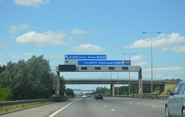
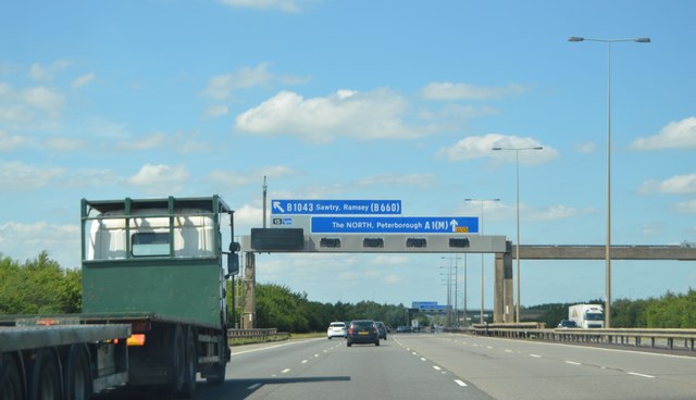
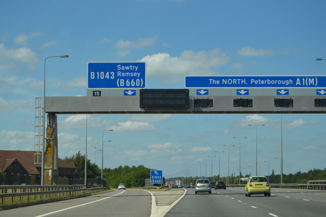
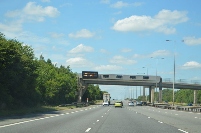
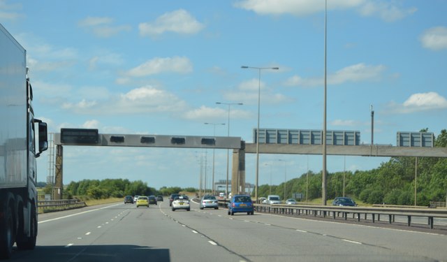
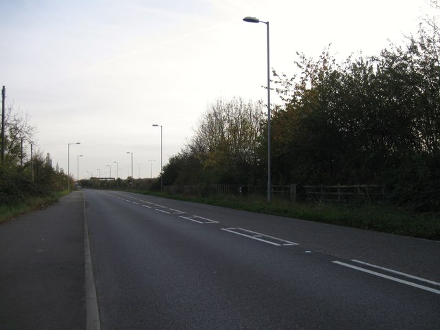
Transportation in Sawtry is primarily road-based, with the A1 road running through the parish, providing easy access to nearby towns and cities. The village is also served by regular bus services, connecting it to surrounding areas.

Overall, Sawtry offers a peaceful and idyllic lifestyle, with its rural setting and close-knit community. It provides a range of amenities for its residents, while also benefiting from its proximity to larger urban centers.

If you have any feedback on the listing, please let us know in the comments section below.

Sawtry Images

Images are sourced within 2km of 52.428341/-0.273086 or Grid Reference TL1782. Thanks to Geograph Open Source API. All images are credited.

Wheat field off Cook's Lane
Stubble field near Bruce's Castle Farm The bushes in the field hide a small pond.
Stubble field near Bruce's Castle Farm
The bushes in the field hide a small pond.
A1(M) approaching J15 The A1 is the longest numbered road in the UK at 410 miles long. It connects London with Edinburgh, via the east of England. 
For much of its path it follows the Great North Road the old coaching route between London and Edinburgh. Several sections of the route are classified as motorway A1(M). The modern A1 bypasses the towns the Great North Road passed through and is dual carriageway for most of its route through England.
A1(M) approaching J15
The A1 is the longest numbered road in the UK at 410 miles long. It connects London with Edinburgh, via the east of England. For much of its path it follows the Great North Road the old coaching route between London and Edinburgh. Several sections of the route are classified as motorway A1(M). The modern A1 bypasses the towns the Great North Road passed through and is dual carriageway for most of its route through England.
Gantry, A1(M) The A1 is the longest numbered road in the UK at 410 miles long. It connects London with Edinburgh, via the east of England. 
For much of its path it follows the Great North Road the old coaching route between London and Edinburgh. Several sections of the route are classified as motorway A1(M). The modern A1 bypasses the towns the Great North Road passed through and is dual carriageway for most of its route through England.
Gantry, A1(M)
The A1 is the longest numbered road in the UK at 410 miles long. It connects London with Edinburgh, via the east of England. For much of its path it follows the Great North Road the old coaching route between London and Edinburgh. Several sections of the route are classified as motorway A1(M). The modern A1 bypasses the towns the Great North Road passed through and is dual carriageway for most of its route through England.
J15, A1(M) The A1 is the longest numbered road in the UK at 410 miles long. It connects London with Edinburgh, via the east of England. 
For much of its path it follows the Great North Road the old coaching route between London and Edinburgh. Several sections of the route are classified as motorway A1(M). The modern A1 bypasses the towns the Great North Road passed through and is dual carriageway for most of its route through England.
J15, A1(M)
The A1 is the longest numbered road in the UK at 410 miles long. It connects London with Edinburgh, via the east of England. For much of its path it follows the Great North Road the old coaching route between London and Edinburgh. Several sections of the route are classified as motorway A1(M). The modern A1 bypasses the towns the Great North Road passed through and is dual carriageway for most of its route through England.
A1(M), northbound The A1 is the longest numbered road in the UK at 410 miles long. It connects London with Edinburgh, via the east of England. 
For much of its path it follows the Great North Road the old coaching route between London and Edinburgh. Several sections of the route are classified as motorway A1(M). The modern A1 bypasses the towns the Great North Road passed through and is dual carriageway for most of its route through England.
A1(M), northbound
The A1 is the longest numbered road in the UK at 410 miles long. It connects London with Edinburgh, via the east of England. For much of its path it follows the Great North Road the old coaching route between London and Edinburgh. Several sections of the route are classified as motorway A1(M). The modern A1 bypasses the towns the Great North Road passed through and is dual carriageway for most of its route through England.
Ordnance Survey Benchmark - Sawtry, Gidding Rd. Ordnance Survey Benchmark (OSBM) used for levelling height above Ordnance Datum (OD).
Height: 11.8354m OD (Newlyn).  Mark verified by the Ordnance Survey in 1966.  Description: NBM BLDG NW SIDE RD JUNC E ANG NE FACE.  0.5m above ground.  3rd Order BM.
This new benchmark (NBM) replaced one on the pub opposite, after it was demolished.

Context: <a href="https://www.geograph.org.uk/photo/4797753">TL1683 : Ordnance Survey Benchmark - Sawtry, Gidding Rd.</a>
Ordnance Survey Benchmark - Sawtry, Gidding Rd.
Ordnance Survey Benchmark (OSBM) used for levelling height above Ordnance Datum (OD). Height: 11.8354m OD (Newlyn). Mark verified by the Ordnance Survey in 1966. Description: NBM BLDG NW SIDE RD JUNC E ANG NE FACE. 0.5m above ground. 3rd Order BM. This new benchmark (NBM) replaced one on the pub opposite, after it was demolished. Context: TL1683 : Ordnance Survey Benchmark - Sawtry, Gidding Rd.
Ordnance Survey Benchmark - Sawtry, Gidding Rd. Ordnance Survey Benchmark (OSBM) used for levelling height above Ordnance Datum (OD).
Height: 11.8354m OD (Newlyn). Mark verified by the Ordnance Survey in 1966. Description: NBM BLDG NW SIDE RD JUNC E ANG NE FACE. 0.5m above ground. 3rd Order BM.
This new benchmark (NBM) replaced one on the pub opposite, after it was demolished.

Close-up: <a href="https://www.geograph.org.uk/photo/4797743">TL1683 : Ordnance Survey Benchmark - Sawtry, Gidding Rd.</a>
Ordnance Survey Benchmark - Sawtry, Gidding Rd.
Ordnance Survey Benchmark (OSBM) used for levelling height above Ordnance Datum (OD). Height: 11.8354m OD (Newlyn). Mark verified by the Ordnance Survey in 1966. Description: NBM BLDG NW SIDE RD JUNC E ANG NE FACE. 0.5m above ground. 3rd Order BM. This new benchmark (NBM) replaced one on the pub opposite, after it was demolished. Close-up: TL1683 : Ordnance Survey Benchmark - Sawtry, Gidding Rd.
Ordnance Survey Benchmark - Sawtry, Old School Hall Ordnance Survey Benchmark (OSBM) used for levelling height above Ordnance Datum (OD).
Height (1966): 14.6213m OD (Newlyn). Mark verified by the Ordnance Survey in 1966. Description: OLD SCHOOL HALL SW FACE 1.2M W ANG. 0.7m above ground. 3rd Order BM.

Context: <a href="https://www.geograph.org.uk/photo/4797830">TL1683 : Ordnance Survey Benchmark - Sawtry, Old School Hall</a>
Ordnance Survey Benchmark - Sawtry, Old School Hall
Ordnance Survey Benchmark (OSBM) used for levelling height above Ordnance Datum (OD). Height (1966): 14.6213m OD (Newlyn). Mark verified by the Ordnance Survey in 1966. Description: OLD SCHOOL HALL SW FACE 1.2M W ANG. 0.7m above ground. 3rd Order BM. Context: TL1683 : Ordnance Survey Benchmark - Sawtry, Old School Hall
Ordnance Survey Benchmark - Sawtry, Old School Hall Ordnance Survey Benchmark (OSBM) used for levelling height above Ordnance Datum (OD).
Height (1966): 14.6213m OD (Newlyn). Mark verified by the Ordnance Survey in 1966. Description: OLD SCHOOL HALL SW FACE 1.2M W ANG. 0.7m above ground. 3rd Order BM.

Close-up: <a href="https://www.geograph.org.uk/photo/4797816">TL1683 : Ordnance Survey Benchmark - Sawtry, Old School Hall</a>
Ordnance Survey Benchmark - Sawtry, Old School Hall
Ordnance Survey Benchmark (OSBM) used for levelling height above Ordnance Datum (OD). Height (1966): 14.6213m OD (Newlyn). Mark verified by the Ordnance Survey in 1966. Description: OLD SCHOOL HALL SW FACE 1.2M W ANG. 0.7m above ground. 3rd Order BM. Close-up: TL1683 : Ordnance Survey Benchmark - Sawtry, Old School Hall
Ordnance Survey Benchmark - Sawtry, The Bell Inn Ordnance Survey Benchmark (OSBM) used for levelling height above Ordnance Datum (OD).
Height: 7.0013m OD (Newlyn). Mark verified by the Ordnance Survey in 1966. Description: THE BELL INN S ANG SW FACE. 0.4m above ground. 3rd Order BM.

Context: <a href="https://www.geograph.org.uk/photo/4797961">TL1783 : Ordnance Survey Benchmark - Sawtry, The Bell Inn</a>
Ordnance Survey Benchmark - Sawtry, The Bell Inn
Ordnance Survey Benchmark (OSBM) used for levelling height above Ordnance Datum (OD). Height: 7.0013m OD (Newlyn). Mark verified by the Ordnance Survey in 1966. Description: THE BELL INN S ANG SW FACE. 0.4m above ground. 3rd Order BM. Context: TL1783 : Ordnance Survey Benchmark - Sawtry, The Bell Inn
Ordnance Survey Benchmark - Sawtry, The Bell Inn Ordnance Survey Benchmark (OSBM) used for levelling height above Ordnance Datum (OD).
Height: 7.0013m OD (Newlyn). Mark verified by the Ordnance Survey in 1966. Description: THE BELL INN S ANG SW FACE. 0.4m above ground. 3rd Order BM.

Close-up: <a href="https://www.geograph.org.uk/photo/4797912">TL1783 : Ordnance Survey Benchmark - Sawtry, The Bell Inn</a>
Ordnance Survey Benchmark - Sawtry, The Bell Inn
Ordnance Survey Benchmark (OSBM) used for levelling height above Ordnance Datum (OD). Height: 7.0013m OD (Newlyn). Mark verified by the Ordnance Survey in 1966. Description: THE BELL INN S ANG SW FACE. 0.4m above ground. 3rd Order BM. Close-up: TL1783 : Ordnance Survey Benchmark - Sawtry, The Bell Inn
Ordnance Survey Benchmark - Sawtry, Manor House Farm Ordnance Survey Benchmark (OSBM) used for levelling height above Ordnance Datum (OD).
Height: 10.4089m OD (Newlyn). Mark verified by the Ordnance Survey in 1966. Description: NBM BLDG MANOR HOUSE FM C NE FACE. 0.7m above ground. 3rd Order BM.

Context: <a href="https://www.geograph.org.uk/photo/4798324">TL1782 : Ordnance Survey Benchmark - Sawtry, Manor House Farm</a>
Ordnance Survey Benchmark - Sawtry, Manor House Farm
Ordnance Survey Benchmark (OSBM) used for levelling height above Ordnance Datum (OD). Height: 10.4089m OD (Newlyn). Mark verified by the Ordnance Survey in 1966. Description: NBM BLDG MANOR HOUSE FM C NE FACE. 0.7m above ground. 3rd Order BM. Context: TL1782 : Ordnance Survey Benchmark - Sawtry, Manor House Farm
Ordnance Survey Benchmark - Sawtry, Manor House Farm Ordnance Survey Benchmark (OSBM) used for levelling height above Ordnance Datum (OD).
Height: 10.4089m OD (Newlyn). Mark verified by the Ordnance Survey in 1966. Description: NBM BLDG MANOR HOUSE FM C NE FACE. 0.7m above ground. 3rd Order BM.

Close-up: <a href="https://www.geograph.org.uk/photo/4798314">TL1782 : Ordnance Survey Benchmark - Sawtry, Manor House Farm</a>
Ordnance Survey Benchmark - Sawtry, Manor House Farm
Ordnance Survey Benchmark (OSBM) used for levelling height above Ordnance Datum (OD). Height: 10.4089m OD (Newlyn). Mark verified by the Ordnance Survey in 1966. Description: NBM BLDG MANOR HOUSE FM C NE FACE. 0.7m above ground. 3rd Order BM. Close-up: TL1782 : Ordnance Survey Benchmark - Sawtry, Manor House Farm
Farmland near Archer's Wood
Brookside Industrial Estate
Old North Road
Old North Road
Show me another place!

Sawtry is located at Grid Ref: TL1782 (Lat: 52.428341, Lng: -0.273086)

Administrative County: Cambridgeshire

District: Huntingdonshire

Police Authority: Cambridgeshire

What 3 Words

///mailings.hardly.library. Near Sawtry, Cambridgeshire

Nearby Locations

Green End Sawtry

Related Wikis

Sawtry Village Academy

Sawtry Village Academy (formerly Sawtry Community College) is a mixed secondary school and sixth form located in the village of Sawtry, Cambridgeshire...

Sawtry

Sawtry () is a village and civil parish in Cambridgeshire, England. Sawtry lies approximately 8 miles (13 km) north of Huntingdon. Sawtry is situated within...

Church of All Saints, Sawtry

Church of All Saints is a Grade II listed building located in Sawtry, a village in Huntingdonshire, Cambridgeshire, England. It became a listed building...

Aversley Wood

Aversley Wood is a 62.3 hectares (154 acres) biological Site of Special Scientific Interest south-west of Sawtry in Cambridgeshire. It is owned and managed...

Huntingdonshire

Huntingdonshire (; abbreviated Hunts) is a local government district of Cambridgeshire and a historic county of England. The district council is based...

Sawtry Abbey

Sawtry Abbey was a Cistercian abbey located between Sawtry and Woodwalton in Cambridgeshire, England. The abbey was founded in 1147 by Simon II de Senlis...

Conington Castle

Conington Castle was a 16th-century house in Conington, Huntingdonshire, England, built for Sir Robert Cotton. It was demolished in 1956 by the then owner...

Coppingford

Coppingford is a village and former civil parish, now in the parish of Upton and Coppingford, in Cambridgeshire, England. Coppingford lies approximately...

Nearby Amenities

Located within 500m of 52.428341,-0.273086
Motorway Junction
Sawtry Interchange
Ref: 15
Lat/Long: 52.4259105/-0.2692804
Created By: Merkaartor 0.12
Lat/Long: 52.4265009/-0.279755
Created By: Merkaartor 0.12
Lat/Long: 52.426924/-0.279863
Created By: Merkaartor 0.12
Lat/Long: 52.4275017/-0.2800333
Created By: Merkaartor 0.12
Lat/Long: 52.4277929/-0.2799779
Created By: Merkaartor 0.12
Lat/Long: 52.4291307/-0.279014
Created By: Merkaartor 0.12
Lat/Long: 52.432262/-0.270765
Created By: Merkaartor 0.12
Lat/Long: 52.4314899/-0.270592
Created By: Merkaartor 0.12
Lat/Long: 52.42998/-0.2773858
Created By: Merkaartor 0.12
Lat/Long: 52.4321202/-0.2747976
Created By: Merkaartor 0.12
Lat/Long: 52.4323425/-0.2749424
Created By: Merkaartor 0.12
Lat/Long: 52.4316328/-0.2755433
Created By: Merkaartor 0.12
Lat/Long: 52.4317637/-0.2753743
Created By: Merkaartor 0.12
Lat/Long: 52.4318667/-0.2751972
Post Box
Brand: Royal Mail
Brand Wikidata: Q638098
Operator: Royal Mail
Operator Wikidata: Q638098
Lat/Long: 52.4314777/-0.2759949
Created By: Merkaartor 0.12
Lat/Long: 52.4314351/-0.2737811
Phone
Check Date: 2021-12-20
Emergency: phone
Lat/Long: 52.432675/-0.2716218
Phone
Check Date: 2021-08-24
Emergency: phone
Lat/Long: 52.4306374/-0.2704084
Phone
Check Date: 2021-08-24
Emergency: phone
Lat/Long: 52.430587/-0.2708506
Bus Stop
Cotton Close
Bus: yes
Naptan AtcoCode: 0500HSAWT001
Naptan Bearing: SE
Naptan BusStopType: CUS
Naptan CommonName: Cotton Close
Naptan Indicator: near
Naptan Landmark: Cotton Close
Naptan NaptanCode: cmbdptmt
Naptan ShortCommonName: Cotton Close
Naptan Street: Green End Road
Naptan Verified: no
Public Transport: platform
Source: naptan_import
Lat/Long: 52.4304671/-0.2743169
Bus Stop
Cotton Close
Bus: yes
Naptan AtcoCode: 0500HSAWT003
Naptan Bearing: NW
Naptan CommonName: Cotton Close
Naptan Indicator: opp
Naptan Landmark: Cotton Close
Naptan NaptanCode: cmbdptpa
Naptan ShortCommonName: Cotton Close
Naptan Street: Green End Road
Naptan Verified: no
Public Transport: platform
Source: naptan_import
Lat/Long: 52.4303409/-0.2742924
Power: pole
Lat/Long: 52.4267152/-0.2665605
Power: pole
Lat/Long: 52.4272909/-0.2660107
Power: pole
Lat/Long: 52.4260495/-0.2672364
Power: pole
Lat/Long: 52.4255702/-0.2680921
Power: pole
Lat/Long: 52.4291913/-0.273682
Power: pole
Lat/Long: 52.4256422/-0.271842
Power: pole
Lat/Long: 52.4273268/-0.272711
Power: pole
Lat/Long: 52.4255457/-0.2705894
Power: pole
Lat/Long: 52.4246861/-0.2700339
Power: pole
Lat/Long: 52.4263397/-0.2721582
Power: pole
Lat/Long: 52.430045/-0.2741353
Power: pole
Lat/Long: 52.4254835/-0.2705572
Power: pole
Lat/Long: 52.4283088/-0.2732338
Barrier: swing_gate
Lat/Long: 52.426413/-0.2705064
The data included in this document is from www.openstreetmap.org. The data is made available under ODbL.

Have you been to Sawtry?

Leave your review of Sawtry below (or comments, questions and feedback).