Saham Toney

Civil Parish in Norfolk Breckland

England

Saham Toney

St. John Evangelist: the parish church of Ovington This Norman church has hardly changed over the centuries and appears to have been left alone by the Victorian restorers.
St. John Evangelist: the parish church of Ovington Credit: Robert Edwards

Saham Toney is a civil parish located in the Breckland district of Norfolk, England. Situated approximately 6 miles northeast of the market town of Thetford, it covers an area of around 13 square miles. The parish is surrounded by picturesque countryside and is known for its idyllic rural charm.

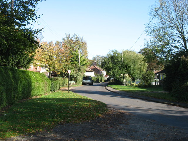
Saham Toney is home to a population of around 1,500 residents, according to the 2011 census. The village itself features a mix of traditional and modern architecture, with a range of residential properties, including thatched cottages and more contemporary houses. The parish also includes the nearby hamlets of Saham Hills and Saham Waite.

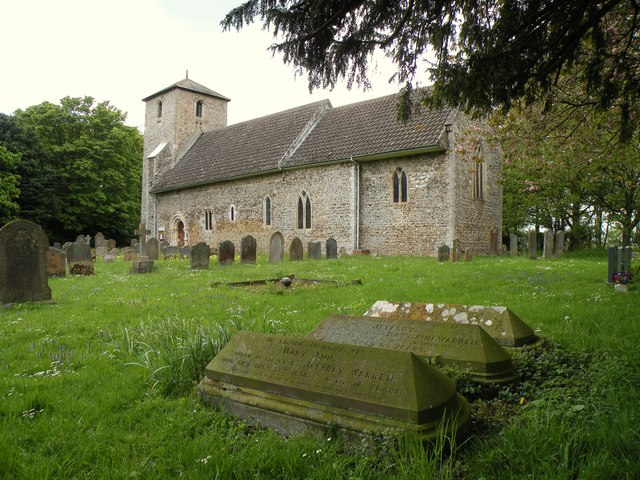
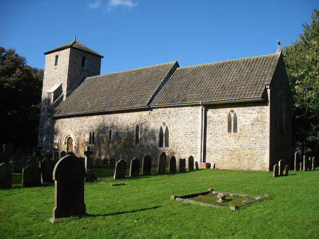
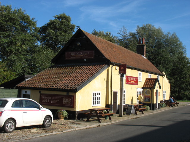
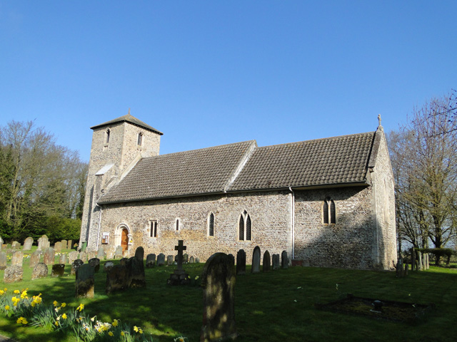
The village boasts several amenities and facilities to cater to the needs of its residents. These include a primary school, a village hall, a community center, and a local pub. The parish church, St. George's Church, is a prominent landmark and dates back to the 14th century.

Saham Toney is well-connected to nearby towns and cities, with good transport links. The A47 road runs close to the parish, providing convenient access to Norwich, which is approximately 25 miles to the east, and Kings Lynn, which is around 30 miles to the northwest.

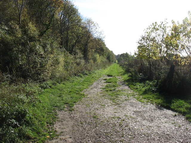
The surrounding countryside offers opportunities for outdoor activities such as walking, cycling, and horse riding, with several footpaths and bridleways crisscrossing the area. Overall, Saham Toney presents a peaceful and scenic setting for its residents, combining rural tranquility with convenient access to amenities and nearby urban centers.

If you have any feedback on the listing, please let us know in the comments section below.

Saham Toney Images

Images are sourced within 2km of 52.594943/0.814301 or Grid Reference TF9003. Thanks to Geograph Open Source API. All images are credited.

St. John Evangelist: the parish church of Ovington This Norman church has hardly changed over the centuries and appears to have been left alone by the Victorian restorers.
St. John Evangelist: the parish church of Ovington
This Norman church has hardly changed over the centuries and appears to have been left alone by the Victorian restorers.
St John the Evangelist church, Ovington
Farm track near Saham Toney This track (which is not a Right of Way) runs parallel to a disused railway, behind the trees on the left.
Farm track near Saham Toney
This track (which is not a Right of Way) runs parallel to a disused railway, behind the trees on the left.
In Saham Toney
In Saham Toney
The Old Bell, Saham Toney
Ovington St. John the evangelist This lovely church is little changed since it was built in the 12th c. In the south wall is a series of styles of window architecture. Beside the Norman entrance door looking right, a 15th c., then an Early English, a lancet, then two double lancets with Y tracery windows. Notice to the extension of the chancel. The tower with a later pyramidal cap is 13th c. Shields beneath the bell openings were once painted with the heraldic devices of the donors. Some minor restoration was done during the Victorian period but it hasn’t affected the overall charm. In the nave is the square font, originally from Watton (their loss) which is quite unique in having large carvings of the four Evangelists at the corners all cut from one solid block of stone. The floor of the chancel has been raised making the sedilia only a few inches from the floor.
Ovington St. John the evangelist
This lovely church is little changed since it was built in the 12th c. In the south wall is a series of styles of window architecture. Beside the Norman entrance door looking right, a 15th c., then an Early English, a lancet, then two double lancets with Y tracery windows. Notice to the extension of the chancel. The tower with a later pyramidal cap is 13th c. Shields beneath the bell openings were once painted with the heraldic devices of the donors. Some minor restoration was done during the Victorian period but it hasn’t affected the overall charm. In the nave is the square font, originally from Watton (their loss) which is quite unique in having large carvings of the four Evangelists at the corners all cut from one solid block of stone. The floor of the chancel has been raised making the sedilia only a few inches from the floor.
Play Equipment, Saham Toney In the grounds of the Wells Cole Community Centre.
Play Equipment, Saham Toney
In the grounds of the Wells Cole Community Centre.
Post Box at Pages Lane, Saham Toney Post Box IP25 3332.
Post Box at Pages Lane, Saham Toney
Post Box IP25 3332.
View from Ploughboy Lane Fine flat Norfolk countryside.
View from Ploughboy Lane
Fine flat Norfolk countryside.
Autumn Girl Having fun in the park.
Autumn Girl
Having fun in the park.
Autumn Girl 2 Having fun at the park.
Autumn Girl 2
Having fun at the park.
Trees by Ovington Road Taken at Wispy Meadows.
Trees by Ovington Road
Taken at Wispy Meadows.
A Glimpse of Norfolk Near Saham Hills.
A Glimpse of Norfolk
Near Saham Hills.
Post Box at The Oval, Saham Toney IP25 3434. Royal Mail list this box as 'The Oval'.
Post Box at The Oval, Saham Toney
IP25 3434. Royal Mail list this box as 'The Oval'.
Autumn Girl At Saham Toney, Norfolk.
Autumn Girl
At Saham Toney, Norfolk.
A Glimpse of Norfolk Taken from Pages Lane, Saham Toney.
A Glimpse of Norfolk
Taken from Pages Lane, Saham Toney.
St George's church, Saham Toney
The road to Great Cressingham
Show me another place!

Saham Toney is located at Grid Ref: TF9003 (Lat: 52.594943, Lng: 0.814301)

Administrative County: Norfolk

District: Breckland

Police Authority: Norfolk

What 3 Words

///spans.jeeps.rebounds. Near Ashill, Norfolk

Nearby Locations

Saham Hills Saham Toney

Related Wikis

Old Manor, Saham Toney

The Old Manor is a Grade II listed building, which stands in Pages Lane/Page's Place in the Norfolk village of Saham Toney. The building was owned by...

Saham Toney

Saham Toney is a village and a civil parish in the English county of Norfolk. The village is 14.5 miles (23.3 km) north of Thetford, 27.3 miles (43.9 km...

Ovington, Norfolk

Ovington is a civil parish in the English county of Norfolk. It covers an area of 6.44 km2 (2.49 sq mi) and had a population of 239 in 92 households at...

Loch Neaton

Loch Neaton is a freshwater lake near Watton in Norfolk, England. It was created after earth was excavated in 1875 to create a mile long embankment for...

Watton United F.C.

Watton United Football Club is an English football club based in Watton, Norfolk. The club are currently members of the Anglian Combination Division One...

Ashill, Norfolk

Ashill (pronounced Ash- ill ) is a village and civil parish in the English county of Norfolk. The village is between Watton and Swaffham. == Parish... ==

Wayland Hall

Wayland Hall, also known as Watton Town Hall, is a community events venue in Middle Street, Watton, Norfolk, England: the structure, which also accommodates...

Watton, Norfolk

Watton is a market town in the district of Breckland in the English county of Norfolk, about 25 miles (40 km) west-southwest of Norwich and 15 miles (24...

Nearby Amenities

Located within 500m of 52.594943,0.814301
Bus Stop
Hills Road, opp
Naptan AtcoCode: 2900S015
Naptan Bearing: NE
Naptan BusStopType: CUS
Naptan CommonName: Hills Road
Naptan Indicator: opp
Naptan Landmark: No. 106
Naptan Locality: Saham Hills
Naptan NaptanCode: nfodpwjd
Naptan ShortCommonName: Hills Road
Naptan Street: Hills Road
Naptan Verified: no
Source: naptan_import
Lat/Long: 52.5952677/0.8084178
Bus Stop
Hills Road, adj
Naptan AtcoCode: 2900S018
Naptan Bearing: SW
Naptan BusStopType: CUS
Naptan CommonName: Hills Road
Naptan Indicator: adj
Naptan Landmark: No. 106
Naptan Locality: Saham Hills
Naptan NaptanCode: nfodpwjp
Naptan ShortCommonName: Hills Road
Naptan Street: Hills Road
Naptan Verified: no
Source: naptan_import
Lat/Long: 52.5952483/0.8084757
Power: pole
Source: Bing
Lat/Long: 52.5924945/0.808888
Power: pole
Source: Bing
Lat/Long: 52.5916138/0.8100646
Power: pole
Source: Bing
Lat/Long: 52.5933362/0.8078291
Post Box
Collection Times: Mo-Fr 09:30; Sa 09:30
Post Box Type: lamp
Ref: IP25 3223
Royal Cypher: EIIR
Royal Cypher Wikidata: Q33102113
Lat/Long: 52.5951246/0.8083539
Booth: K6
Covered: booth
Disused Amenity: telephone
Man Made: telephone_box
Note: No phone inside
Lat/Long: 52.5951082/0.8083352
Saham Hills
Place: hamlet
Source: OS 1:25k
Lat/Long: 52.5963233/0.8072784
Bench
Backrest: yes
Material: wood
Seats: 3
Lat/Long: 52.5973338/0.8104245
Cafe
Penny's
Addr Hamlet: Saham Hills
Addr Housename: Ashdale
Addr Housenumber: 134
Addr Postcode: IP25 7EZ
Addr Street: Hills Road
Addr Village: Saham Toney
Fhrs Id: 833185
Source Addr: FHRS Open Data
Lat/Long: 52.5972873/0.8112129
Give Way
Lat/Long: 52.5972308/0.8104227
The data included in this document is from www.openstreetmap.org. The data is made available under ODbL.

Have you been to Saham Toney?

Leave your review of Saham Toney below (or comments, questions and feedback).