Runwell

Civil Parish in Essex Chelmsford

England

Runwell

Grazing near Wickford
Grazing near Wickford Credit: JThomas

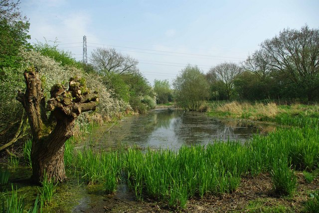
Runwell is a civil parish located in the county of Essex, England. It is situated approximately 30 miles east of London and covers an area of around 4.5 square miles. The parish is bordered by the River Crouch to the south and the A132 road to the west.

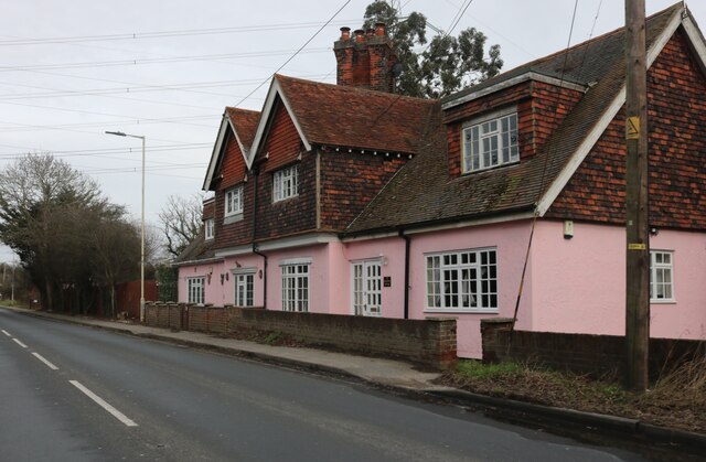
Runwell has a population of around 2,500 residents, according to the latest census data. The area is predominantly residential, with a mix of housing types including detached and semi-detached houses, as well as some apartment complexes. The parish also includes a small number of commercial and industrial areas.

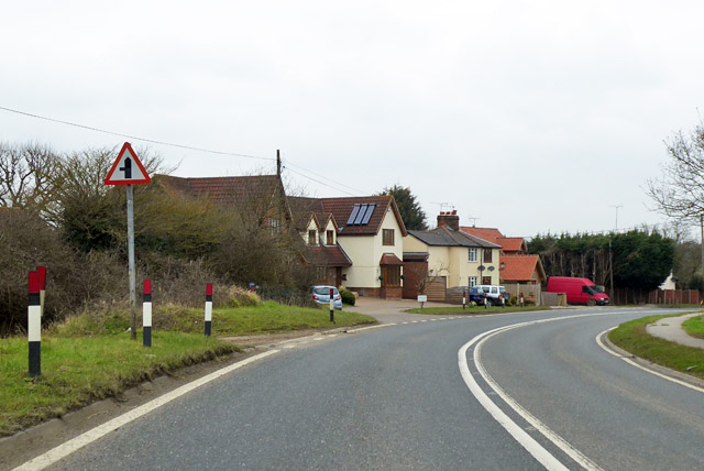
The local economy is diverse, with a range of businesses operating in the area, including shops, restaurants, and service providers. The parish is well-connected, with several major roads passing through or nearby, providing easy access to neighboring towns and cities.

Runwell is known for its natural beauty, with green spaces and parks scattered throughout the area. The parish is home to several sports clubs and facilities, including a cricket club and a football club. There are also a number of walking and cycling routes, allowing residents to enjoy the surrounding countryside.

The parish has a primary school that serves the local community, as well as several churches and community centers. Public transport options in Runwell include regular bus services and a nearby railway station, providing convenient links to other parts of Essex and London.

If you have any feedback on the listing, please let us know in the comments section below.

Runwell Images

Images are sourced within 2km of 51.63145/0.533557 or Grid Reference TQ7595. Thanks to Geograph Open Source API. All images are credited.

Grazing near Wickford
Service station on Runwell Road, Wickford
Rettendon, All Saints
St. Luke's Way, Runwell A fairly new development on the site of Runwell mental hospital.
St. Luke's Way, Runwell
A fairly new development on the site of Runwell mental hospital.
Block with clock tower, former Runwell Hospital A surviving building at the mental hospital site, which has been redeveloped with a large housing estate, Runwell Park.
Block with clock tower, former Runwell Hospital
A surviving building at the mental hospital site, which has been redeveloped with a large housing estate, Runwell Park.
Brock Hill, Runwell
Brock Hill, Runwell
Brock Hill, Runwell
Brock Hill, Runwell
Swan Lane, Runwell
Swan Lane, Runwell
Runwell Road
Runwell Road
Houses on Runwell Road, Wickford
Runwell Road
Runwell Road
Main Road entering Rettendon
Hawk Hill, Battlesbridge At Hawk Hill Roundabout
Hawk Hill, Battlesbridge
At Hawk Hill Roundabout
A130, southbound The A130 is a 30 mile long major road linking Little Waltham, near Chelmsford, the county town of Essex, with Canvey Island in the south of the county. It is a primary route for most of its length.
Wikipedia: <span class="nowrap"><a title="http://en.wikipedia.org/wiki/A130_road" rel="nofollow ugc noopener" href="http://en.wikipedia.org/wiki/A130_road">Link</a><img style="margin-left:2px;" alt="External link" title="External link - shift click to open in new window" src="https://s1.geograph.org.uk/img/external.png" width="10" height="10"/></span>
A130, southbound
The A130 is a 30 mile long major road linking Little Waltham, near Chelmsford, the county town of Essex, with Canvey Island in the south of the county. It is a primary route for most of its length. Wikipedia: LinkExternal link
A130, Rettendon Turnpike The A130 is a 30 mile long major road linking Little Waltham, near Chelmsford, the county town of Essex, with Canvey Island in the south of the county. It is a primary route for most of its length.
Wikipedia: <span class="nowrap"><a title="http://en.wikipedia.org/wiki/A130_road" rel="nofollow ugc noopener" href="http://en.wikipedia.org/wiki/A130_road">Link</a><img style="margin-left:2px;" alt="External link" title="External link - shift click to open in new window" src="https://s1.geograph.org.uk/img/external.png" width="10" height="10"/></span>
A130, Rettendon Turnpike
The A130 is a 30 mile long major road linking Little Waltham, near Chelmsford, the county town of Essex, with Canvey Island in the south of the county. It is a primary route for most of its length. Wikipedia: LinkExternal link
Main Road enters Rettendon Village Formerly this was a proper Main Road, the A130, before the current A130 route was built.
Main Road enters Rettendon Village
Formerly this was a proper Main Road, the A130, before the current A130 route was built.
Main Road, Rettendon Village Formerly this was a proper Main Road, the A130, before the current A130 route was built.
Main Road, Rettendon Village
Formerly this was a proper Main Road, the A130, before the current A130 route was built.
Houses, Main Road, Rettendon On the old road alignment before the bend was eased.
Houses, Main Road, Rettendon
On the old road alignment before the bend was eased.
Show me another place!

Runwell is located at Grid Ref: TQ7595 (Lat: 51.63145, Lng: 0.533557)

Administrative County: Essex

District: Chelmsford

Police Authority: Essex

What 3 Words

///innovate.deploying.dweller. Near Wickford, Essex

Nearby Locations

Runwell

Related Wikis

Runwell Hospital

Runwell Hospital was a hospital in the Chelmsford district of Essex. It was managed by the South Essex Partnership University NHS Foundation Trust. �...

Runwell

Runwell is a village near Wickford and a civil parish on the A132 road, in the Chelmsford District, in the English county of Essex. The village is surrounded...

A132 road (England)

The A132 road is a road in England connecting Pitsea and South Woodham Ferrers. == Route description == The A132 starts from a roundabout next to the A13...

Shotgate Thickets

Shotgate Thickets is a 3.2-hectare (7.9-acre) nature reserve east of Wickford in Essex. It is managed by the Essex Wildlife Trust.This site on the north...

Nearby Amenities

Located within 500m of 51.63145,0.533557
Power: tower
Lat/Long: 51.6291/0.5359483
Power: tower
Lat/Long: 51.6326241/0.5354711
Power: tower
Lat/Long: 51.6332157/0.5339152
Power: tower
Lat/Long: 51.6304087/0.5352134
Power: tower
Lat/Long: 51.6282509/0.5354387
Crossing
Crossing: uncontrolled
Lat/Long: 51.6309326/0.5405963
Bus Stop
Ryerson Drive
Naptan AtcoCode: 15000800204
Naptan BusStopType: CUS
Naptan NaptanCode: esxjptwp
Naptan Verified: no
Public Transport: platform
Source: naptan
Lat/Long: 51.633364/0.5394655
Turning Circle
Lat/Long: 51.6338567/0.5378087
NHS Covid19 Mass Vaccination Centre
Healthcare: vaccination_centre
Note: precise location in building required
Start Date: 18/01/2021
Vaccination: covid19
Lat/Long: 51.6309914/0.5401352
Entrance: yes
Lat/Long: 51.6309771/0.5402541
The data included in this document is from www.openstreetmap.org. The data is made available under ODbL.

Have you been to Runwell?

Leave your review of Runwell below (or comments, questions and feedback).