Brunswick Park

Settlement in Hertfordshire

England

Brunswick Park

Travelodge at Ye Olde Cherry Tree pub
Travelodge at Ye Olde Cherry Tree pub Credit: Rob Purvis

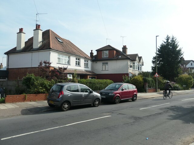
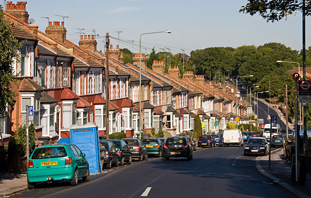
Brunswick Park is a picturesque village located in Hertfordshire, England. Situated just 10 miles north of central London, it offers a peaceful and charming atmosphere while still providing convenient access to the bustling city.

Surrounded by lush green countryside, Brunswick Park boasts stunning natural beauty. The village is known for its well-maintained parks and gardens, making it an ideal destination for nature lovers and outdoor enthusiasts. The park itself, after which the village is named, is a popular spot for locals and visitors alike. It features expansive lawns, vibrant flower beds, and a tranquil lake, creating a serene ambiance for leisurely strolls or picnics.

The village also offers a range of amenities and facilities to cater to its residents' needs. It has a thriving community center that hosts various events and activities throughout the year, fostering a strong sense of community spirit. Additionally, there are several shops, restaurants, and pubs in the area, providing a range of dining and shopping options.

Transportation in Brunswick Park is convenient, with easy access to major roads and public transport links. The village is well-connected to nearby towns and cities, making it an ideal location for commuters.

Overall, Brunswick Park in Hertfordshire is a charming village that combines natural beauty with modern amenities. With its peaceful atmosphere and proximity to London, it offers residents a relaxed lifestyle while still being within reach of the city's vibrant energy.

If you have any feedback on the listing, please let us know in the comments section below.

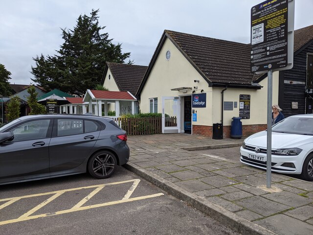
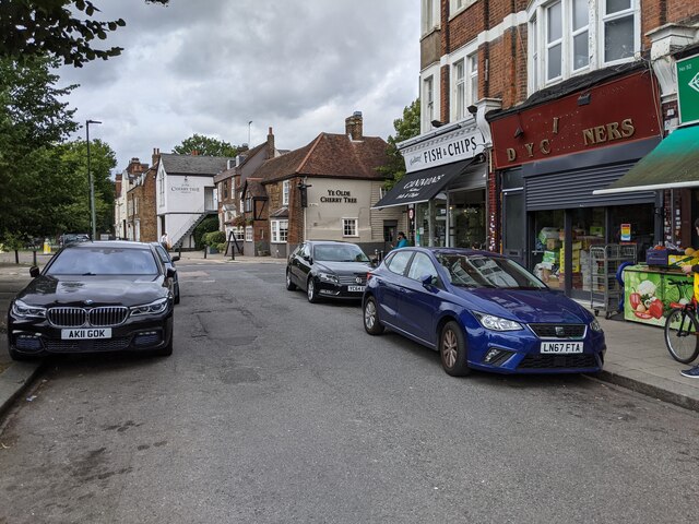
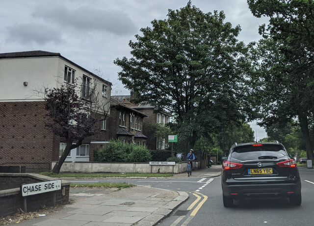
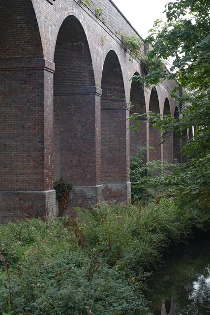
Brunswick Park Images

Images are sourced within 2km of 51.624334/-0.150111 or Grid Reference TQ2893. Thanks to Geograph Open Source API. All images are credited.

Travelodge at Ye Olde Cherry Tree pub
Shops on Cannon Hill
On Chase Side at the junction with Exeter Road
On Chase Side at the junction with Orchid Road
On The Green looking east towards Cannon Hill
Arnos Park : Railway viaduct arches This large brick built viaduct crossing Arnos Park carries the Piccadilly Line between Arnos Grove and Southgate Stations. It was constructed in the 1930s and was the last brick built viaduct to be constructed.
Arnos Park : Railway viaduct arches
This large brick built viaduct crossing Arnos Park carries the Piccadilly Line between Arnos Grove and Southgate Stations. It was constructed in the 1930s and was the last brick built viaduct to be constructed.
Arnos Grove : "The Arnos Arms" public house Built in the 1930s according to this <span class="nowrap"><a title="https://pubology.co.uk/pubs/7003.html" rel="nofollow ugc noopener" href="https://pubology.co.uk/pubs/7003.html">Link</a><img style="margin-left:2px;" alt="External link" title="External link - shift click to open in new window" src="https://s1.geograph.org.uk/img/external.png" width="10" height="10"/></span>.
Arnos Grove : "The Arnos Arms" public house
Built in the 1930s according to this LinkExternal link.
Arnos Grove Underground Station central information kiosk
Arnos Grove Underground Station The station building is Grade II* listed. Built to a design by architect Charles Holden in 1932. More at this <span class="nowrap"><a title="https://historicengland.org.uk/listing/the-list/list-entry/1358981" rel="nofollow ugc noopener" href="https://historicengland.org.uk/listing/the-list/list-entry/1358981">Link</a><img style="margin-left:2px;" alt="External link" title="External link - shift click to open in new window" src="https://s1.geograph.org.uk/img/external.png" width="10" height="10"/></span>.
Arnos Grove Underground Station
The station building is Grade II* listed. Built to a design by architect Charles Holden in 1932. More at this LinkExternal link.
New Southgate : new buildings, Montmorency Park
Cyclist on Alverstone Avenue Passing houses that have been extended, as many have in this part of North London. The houses were built in the 1920s or early 1930s.
Cyclist on Alverstone Avenue
Passing houses that have been extended, as many have in this part of North London. The houses were built in the 1920s or early 1930s.
Albemarle Road, off Alverstone Avenue Looking north towards the valley of Pymes Brook.
Albemarle Road, off Alverstone Avenue
Looking north towards the valley of Pymes Brook.
Parade of shops, Gallants Farm Road Shopping habits have changes since these shops were built in the 1950s. One is now being converted to a flat, one at least is out of use, and the others offer specialist, not daily, services and purchases.
Parade of shops, Gallants Farm Road
Shopping habits have changes since these shops were built in the 1950s. One is now being converted to a flat, one at least is out of use, and the others offer specialist, not daily, services and purchases.
Extending another house in Gallants Farm Road Already extended sideways, now extending into the roof space.
Extending another house in Gallants Farm Road
Already extended sideways, now extending into the roof space.
Southgate Methodist Church
New Southgate Cemetery New Southgate Cemetery view
New Southgate Cemetery
New Southgate Cemetery view
Offices on High Street, Southgate The Premier Inn Hotel is located behind this building.
Offices on High Street, Southgate
The Premier Inn Hotel is located behind this building.
Show me another place!

Brunswick Park is located at Grid Ref: TQ2893 (Lat: 51.624334, Lng: -0.150111)

Unitary Authority: Barnet

Police Authority: Metropolitan

What 3 Words

///hers.copies.rather. Near Wood Green, London

Nearby Locations

Osidge Brunswick Park

Related Wikis

St Andrew the Apostle Greek Orthodox School

St Andrew the Apostle Greek Orthodox School is an inclusive secondary school which opened in 2013 in the Brunswick Park area of the London Borough of Barnet...

Parks and open spaces in the London Borough of Barnet

The London Borough of Barnet, located on the northern periphery of London and having much of the area within its boundaries in the Metropolitan Green Belt...

London Borough of Barnet

The London Borough of Barnet () is a local authority area on the northern outskirts of London. The borough was formed in 1965 from parts of the ceremonial...

Brunswick Park

Brunswick Park is a neighbourhood, public park and electoral ward in the London Borough of Barnet. It is north of New Southgate and to the south of Oakleigh...

Nearby Amenities

Located within 500m of 51.624334,-0.150111
Mini Roundabout
Direction: clockwise
Lat/Long: 51.6251046/-0.1475838
Turning Circle
Lat/Long: 51.6223562/-0.1556922
Turning Circle
Lat/Long: 51.622421/-0.1547517
Turning Circle
Lat/Long: 51.6244964/-0.1542713
Crossing
Crossing: unmarked
Crossing Island: yes
Crossing Markings: no
Kerb: lowered
Tactile Paving: yes
Lat/Long: 51.6204175/-0.1509443
Bus Stop
Bawtry Road
Local Ref: BE
Naptan AtcoCode: 490003697E
Naptan Bearing: E
Naptan CommonName: Bawtry Road
Naptan Indicator: Stop BE
Naptan Verified: no
Public Transport: platform
Lat/Long: 51.6246175/-0.1560396
Bus Stop
Bawtry Road
Local Ref: BK
Naptan AtcoCode: 490003697W
Naptan Bearing: W
Naptan CommonName: Bawtry Road
Naptan Indicator: Stop BK
Naptan Verified: no
Public Transport: platform
Lat/Long: 51.6247261/-0.1566109
Bus Stop
Beaconsfield Road
Bench: yes
Bin: yes
Local Ref: BF
Naptan AtcoCode: 490003707E
Naptan Bearing: E
Naptan CommonName: Beaconsfield Road Oakleigh Rd
Naptan Indicator: Stop BF
Naptan Verified: no
Public Transport: platform
Shelter: yes
Lat/Long: 51.6227987/-0.1514938
Bus Stop
Beaconsfield Road
Bench: yes
Bin: yes
Local Ref: BJ
Naptan AtcoCode: 490003707N
Naptan Bearing: N
Naptan CommonName: Beaconsfield Road Oakleigh Rd
Naptan Indicator: Stop BJ
Naptan Verified: no
Public Transport: platform
Shelter: yes
Lat/Long: 51.6227263/-0.1518616
Bus Stop
Darwin Close
Local Ref: BZ
Naptan AtcoCode: 490016453S
Naptan Bearing: S
Naptan CommonName: Darwin Close
Naptan Indicator: Stop BZ
Naptan Street: BRUNSWICK PARK ROAD
Naptan Verified: no
Public Transport: platform
Lat/Long: 51.6215109/-0.1449549
Bus Stop
Brunswick Avenue
Local Ref: BU
Naptan AtcoCode: 490016454N
Naptan Bearing: N
Naptan CommonName: Brunswick Avenue
Naptan Indicator: Stop BU
Naptan Street: BRUNSWICK PARK ROAD
Naptan Verified: no
Public Transport: platform
Lat/Long: 51.6237416/-0.1473123
Bus Stop
Brunswick Avenue
Local Ref: BY
Naptan AtcoCode: 490016454S
Naptan Bearing: S
Naptan CommonName: Brunswick Avenue
Naptan Indicator: Stop BY
Naptan Street: BRUNSWICK PARK ROAD
Naptan Verified: no
Public Transport: platform
Lat/Long: 51.6241142/-0.1471737
Bus Stop
North London Business Park
Local Ref: BV
Naptan AtcoCode: 490016455N
Naptan Bearing: N
Naptan CommonName: Brunswick Park
Naptan Indicator: Stop BV
Naptan Street: BRUNSWICK PARK ROAD
Naptan Verified: no
Public Transport: platform
Lat/Long: 51.6262098/-0.1482945
Bus Stop
North London Business Park
Local Ref: BW
Naptan AtcoCode: 490016455S
Naptan Bearing: S
Naptan CommonName: Brunswick Park
Naptan Indicator: Stop BW
Naptan Street: BRUNSWICK PARK ROAD
Naptan Verified: no
Public Transport: platform
Lat/Long: 51.626786/-0.1483677
Entrance: yes
Lat/Long: 51.6253915/-0.1522458
Entrance: yes
Lat/Long: 51.6257604/-0.1526033
Conference Centre
The Emerald Suite
Lat/Long: 51.6272318/-0.1526823
Bicycle Parking
Lat/Long: 51.6263395/-0.1522101
Kindergarten
Little Leos Nursery
Phone: +44 20 8211 3199
Preschool: yes
Lat/Long: 51.6271403/-0.152532
Turning Circle
Lat/Long: 51.6244058/-0.1573115
Crossing
Crossing: uncontrolled
Lat/Long: 51.6266532/-0.1537836
Crossing
Crossing: uncontrolled
Lat/Long: 51.6265183/-0.1536441
Crossing
Crossing: uncontrolled
Lat/Long: 51.626384/-0.153506
Brunswick Park
Place: suburb
Wikidata: Q149665
Lat/Long: 51.6262191/-0.1481899
Crossing
Crossing: uncontrolled
Crossing Island: yes
Crossing Ref: zebra
Tactile Paving: yes
Lat/Long: 51.6227002/-0.1511398
Fixme: barrier/path?
Lat/Long: 51.6225741/-0.1503542
Fixme: barrier/path?
Lat/Long: 51.6230853/-0.1488414
Fixme: public access?
Lat/Long: 51.6262641/-0.1487691
Fixme: barrier/path?
Lat/Long: 51.6224408/-0.1500109
Waste Basket
Source: gps+mapnoter
Waste: dog_excrement
Lat/Long: 51.6203794/-0.1511197
Waste Basket
Source: gps+mapnoter
Lat/Long: 51.620348/-0.1517057
Fixme: fnc
Source: gps+mapnoter
Lat/Long: 51.620154/-0.1521456
Cemetery Station
Historic Railway: station
Railway: site
Lat/Long: 51.6252681/-0.1539447
Barrier: height_restrictor
Material: metal
Maxheight: 2
Lat/Long: 51.6227892/-0.1471196
Barrier: height_restrictor
Material: metal
Maxheight: 2
Lat/Long: 51.6228373/-0.1471637
Waste Basket
Waste: trash
Lat/Long: 51.620608/-0.1472405
Waste Basket
Waste: dog_excrement
Lat/Long: 51.6206646/-0.1472606
Bench
Lat/Long: 51.6211095/-0.1473928
Waste Basket
Waste: dog_excrement
Lat/Long: 51.6212879/-0.1472222
Waste Basket
Waste: trash
Lat/Long: 51.6216543/-0.1455543
Bench
Backrest: yes
Lat/Long: 51.6215871/-0.1456011
Bench
Backrest: yes
Lat/Long: 51.6220688/-0.1461276
Waste Basket
Waste: trash
Lat/Long: 51.6222586/-0.1464889
Bench
Backrest: yes
Lat/Long: 51.6224204/-0.1467593
Bench
Backrest: yes
Lat/Long: 51.6225012/-0.1476818
Waste Basket
Waste: dog_excrement
Lat/Long: 51.6226481/-0.1472633
Waste Basket
Waste: trash
Lat/Long: 51.6226455/-0.1472536
Entrance: yes
Lat/Long: 51.6221584/-0.152088
Entrance: yes
Lat/Long: 51.6223184/-0.1525056
Addr Flats: 11-30
Entrance: yes
Lat/Long: 51.6211348/-0.152756
Bicycle Parking
Bicycle Parking: stands
Capacity: 2
Ref GB Tflcid: RWG282065
Lat/Long: 51.6229961/-0.1500958
Crossing
Crossing: unmarked
Crossing Island: yes
Crossing Markings: no
Fixme: position
Lat/Long: 51.6219025/-0.1455599
Studio 45
Addr City: London
Addr Housenumber: 115a
Addr Postcode: N11 1EA
Addr Street: Brunswick Park Road
Dance Style: ballroom;latin
Dance Teaching: yes
Leisure: dance
Website: http://www.studio45.london/
Lat/Long: 51.6229323/-0.147396
Bird & Davis Ltd
Addr City: London
Addr Housenumber: 115a
Addr Postcode: N11 1EA
Addr Street: Brunswick Park Road
Description: Easel hire
Shop: craft
Website: https://birdanddavis.com/
Lat/Long: 51.6229663/-0.1472737
Cetuem
Description: Hair & Beauty Supplies
Office: yes
Lat/Long: 51.6231304/-0.1473145
Waste Basket
Waste: dog_excrement
Lat/Long: 51.6204185/-0.1507758
Street Lamp
Lat/Long: 51.6203844/-0.1512462
Street Lamp
Lat/Long: 51.620369/-0.1516772
Street Lamp
Lat/Long: 51.6203495/-0.1521255
Street Lamp
Lat/Long: 51.6203214/-0.1526116
Street Lamp
Lat/Long: 51.6204466/-0.1507166
Street Lamp
Lat/Long: 51.620466/-0.1503039
Entrance: yes
Lat/Long: 51.620493/-0.1513031
Entrance: yes
Lat/Long: 51.6204501/-0.1524924
Natural: tree_stump
Lat/Long: 51.6203829/-0.1530119
Shoghi Effendi
Historic: memorial
Inscription: Stone from the slopes of Mount Carmel, Haifa, Israel, site of the Bahá’í World Centre. Set here in honour of Shoghi Effendi (1897-1957) Guardian of the Bahá’í Faith, who resided on Mount Carmel and whose remains are laid to rest in this cemetery
Material: stone
Memorial: stone
Lat/Long: 51.6250334/-0.1471739
The data included in this document is from www.openstreetmap.org. The data is made available under ODbL.

Have you been to Brunswick Park?

Leave your review of Brunswick Park below (or comments, questions and feedback).