Ravenfield

Civil Parish in Yorkshire Rotherham

England

Ravenfield

Model of a boy on Main Street, Ravenfield Outside the village primary school or "academy". Several primary schools in the Rotherham area have similar model children on adjacent pavements to warn passing drivers to slow down and be more alert. There's a model girl further down the road. She is wearing red.
Model of a boy on Main Street, Ravenfield Credit: Neil Theasby

Ravenfield is a civil parish located in the county of Yorkshire, England. Situated approximately 8 miles east of the town of Rotherham, it is nestled in the scenic Rother Valley. The parish covers an area of approximately 6 square miles and is home to a small but vibrant community.

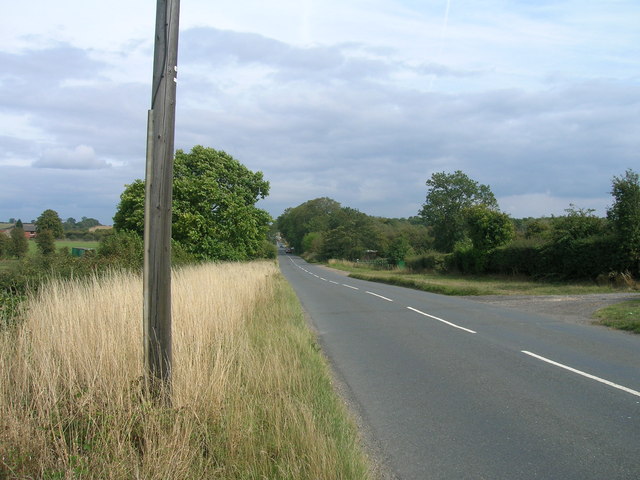
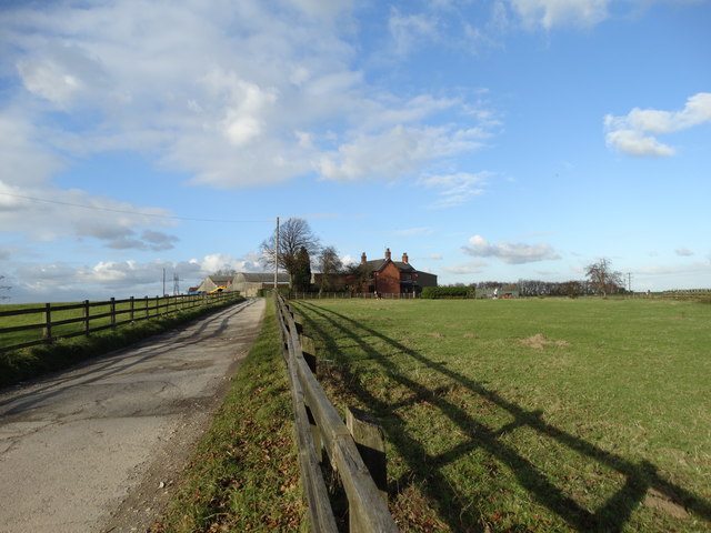
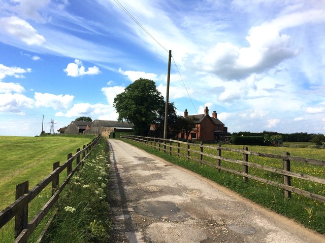
The village of Ravenfield itself is characterized by its charming rural setting, with picturesque countryside and rolling hills surrounding the area. It boasts a rich history, with evidence of human habitation dating back to the Roman era. The village is renowned for its well-preserved medieval church, St. James, which stands as a testament to its long-standing heritage.

Although predominantly rural, Ravenfield has seen some modern development in recent years, with a small number of new housing estates being built to accommodate the growing population. Despite these changes, the village has managed to retain its peaceful and idyllic atmosphere.

The local economy is primarily agricultural, with many residents involved in farming and related industries. The village also benefits from its proximity to Rotherham, with many residents commuting to work in nearby towns and cities.

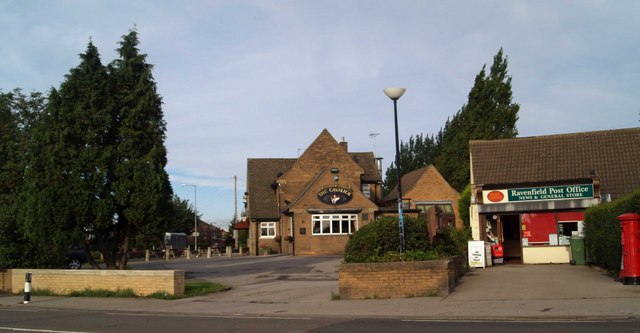
Ravenfield is well-served by amenities, including a village hall, primary school, and a few shops and pubs. It also has good transport links, with regular bus services connecting it to surrounding areas.

Overall, Ravenfield is a picturesque and tight-knit community, offering residents a tranquil and rural lifestyle within easy reach of larger towns and cities.

If you have any feedback on the listing, please let us know in the comments section below.

Ravenfield Images

Images are sourced within 2km of 53.448563/-1.26788 or Grid Reference SK4894. Thanks to Geograph Open Source API. All images are credited.

Model of a boy on Main Street, Ravenfield Outside the village primary school or "academy". Several primary schools in the Rotherham area have similar model children on adjacent pavements to warn passing drivers to slow down and be more alert. There's a model girl further down the road. She is wearing red.
Model of a boy on Main Street, Ravenfield
Outside the village primary school or "academy". Several primary schools in the Rotherham area have similar model children on adjacent pavements to warn passing drivers to slow down and be more alert. There's a model girl further down the road. She is wearing red.
Footpath to Church Farm A walk around Ravenfield.
Footpath to Church Farm
A walk around Ravenfield.
The Bungalows Nursery Nurseries on Braithwell Common, seen from Lidget Lane
The Bungalows Nursery
Nurseries on Braithwell Common, seen from Lidget Lane
Gate to bridleway near Birk Lodge
Bridleway SE of Firsby Hall Fm
Conisbrough Grange Farm
Common Lane heading east
Micklebring gorse. Path across farmland.
Micklebring gorse.
Path across farmland.
Park Lane at the junction with Braithwell Road The entrance to Park Lane from Braithwell Road with Conisbrough Grange Farm in the background.
Park Lane at the junction with Braithwell Road
The entrance to Park Lane from Braithwell Road with Conisbrough Grange Farm in the background.
Bridleway to Conisbrough at Conisbrough Grange Farm
Hellaby Brook at Priest's Bridge
Track to Conisbrough Grange Farm
View towards Conisbrough Grange Farm The parallel fences in the middle of the picture mark the boundary of the former Great Central and Midland Joint Railway which was built to serve local collieries.
View towards Conisbrough Grange Farm
The parallel fences in the middle of the picture mark the boundary of the former Great Central and Midland Joint Railway which was built to serve local collieries.
Bridleway to Park Lane Discernible through the early growth.
Bridleway to Park Lane
Discernible through the early growth.
Pole but no wires
Pole but no wires
View towards Conisbrough The keep of Conisbrough Castle just visible on the extreme right of the picture.
View towards Conisbrough
The keep of Conisbrough Castle just visible on the extreme right of the picture.
Conisbrough Grange Farm The access road to the farm is also forms the end of a 4-kilometre bridleway called Park Lane. It's a fine route over quiet countryside heading north-south into Conisbrough itself.
Conisbrough Grange Farm
The access road to the farm is also forms the end of a 4-kilometre bridleway called Park Lane. It's a fine route over quiet countryside heading north-south into Conisbrough itself.
Fenced footpath at Birk Lodge Farm
Show me another place!

Ravenfield is located at Grid Ref: SK4894 (Lat: 53.448563, Lng: -1.26788)

Division: West Riding

Administrative County: South Yorkshire

District: Rotherham

Police Authority: South Yorkshire

What 3 Words

///healers.menu.chimp. Near Hellaby, South Yorkshire

Nearby Locations

Ravenfield Gulling Wood

Related Wikis

Ravenfield

Ravenfield is a small village and civil parish in South Yorkshire, England. It is located in the Metropolitan Borough of Rotherham, 3.3 miles (5.3 km)...

Silverwood Colliery

Silverwood Colliery was a colliery situated between Thrybergh and Ravenfield in Yorkshire, England. Originally called Dalton Main, it was renamed after...

Silverwood Colliery platform

Silverwood Colliery platform, the original, was a wooden railway platform built for John Brown's Private Railway in order to operate Paddy Mail trains...

Thrybergh Country Park

Thrybergh Country Park is a reservoir and nature reserve in South Yorkshire. It is located between Thrybergh and Hooton Roberts on the outskirts of Rotherham...

Nearby Amenities

Located within 500m of 53.448563,-1.26788
Turning Circle
Source: Bing
Lat/Long: 53.4508554/-1.2706661
Bus Stop
Lat/Long: 53.449577/-1.2707319
Bus Stop
Lat/Long: 53.4497085/-1.2706484
Post Box
Collection Times: Mo-Fr 09:00; Sa 07:00
Post Box Type: wall
Ref: S65 72
Royal Cypher: GR
Royal Cypher Wikidata: Q33102273
Lat/Long: 53.4510641/-1.2712812
Old Ravenfield
Is In: Rotherham, South Yorkshire, England, UK
Place: village
Lat/Long: 53.4509075/-1.2713914
Bus Stop
Moor Lane North/Main Street
Alt Name: Moor Lane North/Main Street
Naptan AltCommonName: Moor Lane North/Main Street
Naptan AtcoCode: 370030349
Naptan Bearing: N
Naptan CommonName: Moor Lane North/Main Street
Naptan Indicator: 30349
Naptan Landmark: Streetlight No 15
Naptan PlusbusZoneRef: ROTHCEN
Naptan Street: Moor Lane North
Naptan Verified: no
Source: naptan_import
Lat/Long: 53.4462806/-1.2689852
Bus Stop
Moor Lane North/Main Street
Alt Name: Moor Lane North/Main Street
Naptan AltCommonName: Moor Lane North/Main Street
Naptan AtcoCode: 370030350
Naptan Bearing: N
Naptan CommonName: Moor Lane North/Main Street
Naptan Indicator: 30350
Naptan Landmark: 30350
Naptan PlusbusZoneRef: ROTHCEN
Naptan Street: Moor Lane North
Naptan Verified: no
Source: naptan_import
Lat/Long: 53.4460625/-1.2686125
Bus Stop
Main Street/Pingle Lane
Naptan AtcoCode: 370031115
Naptan Bearing: NW
Naptan CommonName: Main Street/Pingle Lane
Naptan Indicator: 31115
Naptan Landmark: Rose Bank
Naptan PlusbusZoneRef: ROTHCEN
Naptan Street: Main Street
Naptan Verified: no
Source: naptan_import
Lat/Long: 53.4494003/-1.2705428
Bus Stop
Main Street/Pingle Lane
Naptan AtcoCode: 370035436
Naptan Bearing: SE
Naptan CommonName: Main Street/Pingle Lane
Naptan Indicator: 35436
Naptan Landmark: Opposite Rose Bank
Naptan PlusbusZoneRef: ROTHCEN
Naptan Street: Main Street
Naptan Verified: no
Source: naptan_import
Lat/Long: 53.4494075/-1.2702566
Barrier: stile
Stile: stepover
Lat/Long: 53.4493967/-1.2698051
Barrier: stile
Stile: stepover
Lat/Long: 53.4524386/-1.2697202
Barrier: stile
Stile: stepover
Lat/Long: 53.4501217/-1.273024
Defibrillator
Access: yes
Check Date: 2023-03-09
Defibrillator Location: On outside wall. Available 24/7.
Emergency: defibrillator
Indoor: no
Opening Hours: 24/7
Lat/Long: 53.4501978/-1.2708782
Bench
Backrest: yes
Lat/Long: 53.449425/-1.2711957
Barrier: stile
Stile: stepover
Lat/Long: 53.4496331/-1.2730398
Barrier: stile
Stile: stepover
Lat/Long: 53.4508676/-1.2726135
Barrier: stile
Lat/Long: 53.448841/-1.2676277
Barrier: stile
Lat/Long: 53.4484942/-1.2661152
Parking
Capacity: 5
Lat/Long: 53.4454853/-1.2682847
The data included in this document is from www.openstreetmap.org. The data is made available under ODbL.

Have you been to Ravenfield?

Leave your review of Ravenfield below (or comments, questions and feedback).