Prescot

Civil Parish in Lancashire Knowsley

England

Prescot

Old Gents, Grosvenor Road, Prescot Writing on the wall.
Old Gents, Grosvenor Road, Prescot Credit: John Kelly

Prescot is a civil parish located in the metropolitan borough of Knowsley, in the county of Lancashire, England. It is situated approximately 8 miles east of the city of Liverpool, making it a part of the wider Liverpool urban area. The town has a population of around 11,000 people.

Historically, Prescot was known for its involvement in the watch and clockmaking industry, with several notable clockmakers operating in the area. This legacy is still evident today in the town's Coat of Arms, which features a watch and clock. Prescot also has a rich industrial past, with coal mining and textile manufacturing being prominent industries in the area.

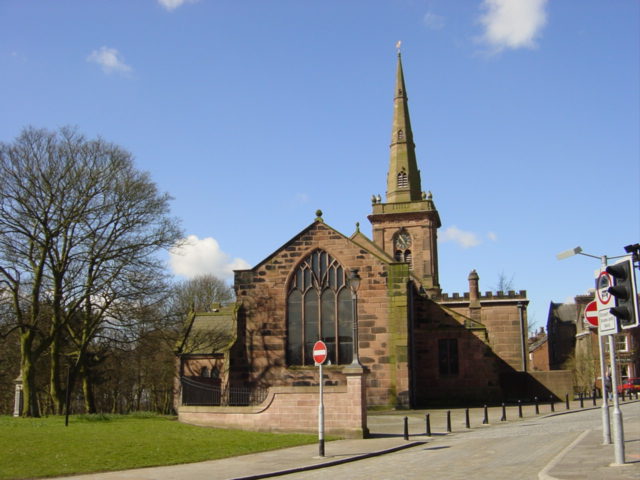
The town boasts a number of notable landmarks and attractions. Prescot Parish Church, dedicated to St Mary, is an architectural gem with a long history dating back to the 16th century. The Prescot Museum, housed in a former Georgian townhouse, offers visitors a glimpse into the town's industrial heritage and showcases local artifacts.

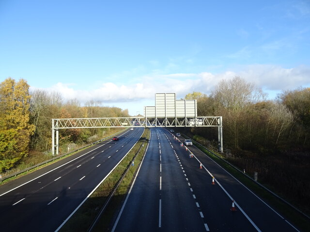
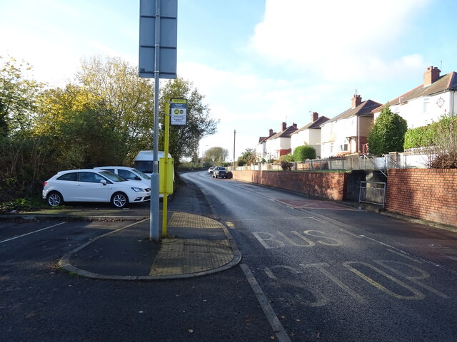
Prescot is well-served by transportation links, with the M62 motorway and several major roads passing nearby, providing easy access to Liverpool and other neighboring towns. The town also has a railway station, Prescot railway station, which connects it to Liverpool and Manchester.

In recent years, Prescot has undergone significant regeneration, with the development of new housing, retail, and leisure facilities. The town center has a range of shops, restaurants, and cafes, making it a vibrant and bustling place to visit.

Overall, Prescot is a historic town with a strong sense of community and a rich industrial heritage, offering a mix of heritage, modern amenities, and convenient transportation links.

If you have any feedback on the listing, please let us know in the comments section below.
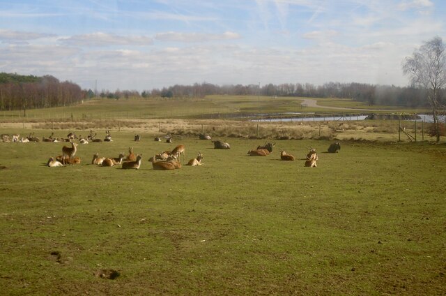
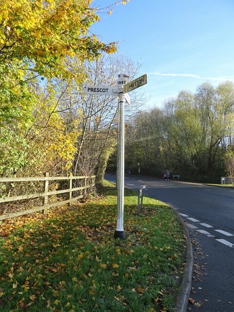
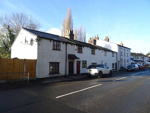
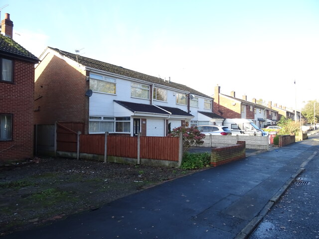
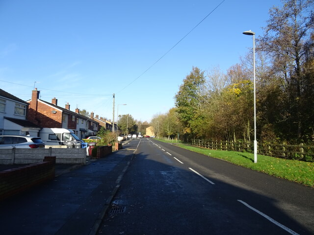
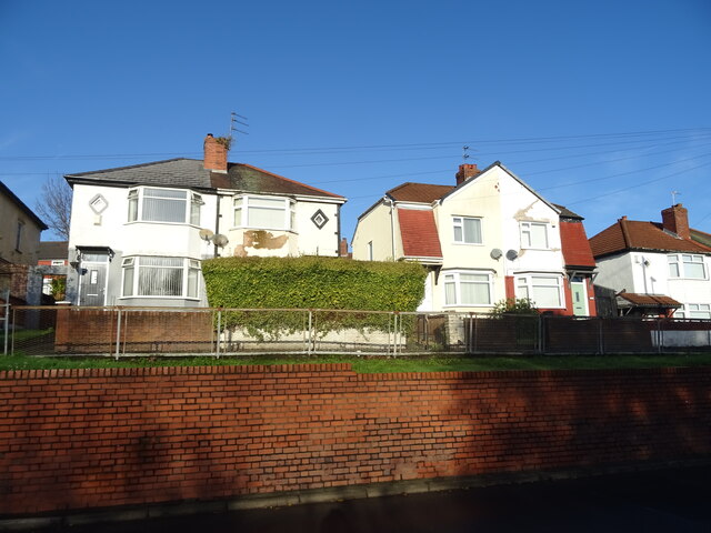
Prescot Images

Images are sourced within 2km of 53.427641/-2.80958 or Grid Reference SJ4692. Thanks to Geograph Open Source API. All images are credited.

Old Gents, Grosvenor Road, Prescot Writing on the wall.
Old Gents, Grosvenor Road, Prescot
Writing on the wall.
Knowsley Safari Park Knowsley Safari Park opened in 1971 and has over 550 acres of land.
Knowsley Safari Park
Knowsley Safari Park opened in 1971 and has over 550 acres of land.
Elephants at Knowsley Safari Park Knowsley Safari Park opened in 1971 and has over 550 acres of land.
Elephants at Knowsley Safari Park
Knowsley Safari Park opened in 1971 and has over 550 acres of land.
Snow on Hilary Close
Pussy Cat, Sewell Street From June until September 2022 two metre high sculptures of owls and pussy-cats were displayed across Knowsley Borough all individually decorated by artists and members of the local community. The trail commemorated the fact that Edward Lear actually wrote his world-famous poem, The Owl & the Pussy-Cat, while staying  at Knowsley Hall.
Pussy Cat, Sewell Street
From June until September 2022 two metre high sculptures of owls and pussy-cats were displayed across Knowsley Borough all individually decorated by artists and members of the local community. The trail commemorated the fact that Edward Lear actually wrote his world-famous poem, The Owl & the Pussy-Cat, while staying at Knowsley Hall.
Post Office and shop on Windy Arbor Road
Houses on Pottery Lane
Bus stop and shelter on Pottery Lane
The M57 Motorway Looking north from the bridge on Pottery Lane.
The M57 Motorway
Looking north from the bridge on Pottery Lane.
Old fingerpost on Pottery Lane Junction with Whiston Lane.
Old fingerpost on Pottery Lane
Junction with Whiston Lane.
Houses on Whiston Lane
Whiston Lane
Whiston Lane
Houses on Wood Lane
Houses on Wood Lane
Bus stop on Wood Lane
Car Park from Whiston Hospital
Prescot Railway Station
Footbridge, Prescot Railway Station
Show me another place!

Prescot is located at Grid Ref: SJ4692 (Lat: 53.427641, Lng: -2.80958)

Administrative County: Merseyside

District: Knowsley

Police Authority: Merseyside

What 3 Words

///fence.normal.moral. Near Prescot, Merseyside

Nearby Locations

Prescot Prescot

Related Wikis

Our Lady Immaculate and St Joseph Church, Prescot

Our Lady Immaculate and St Joseph Church is a Roman Catholic parish church in Prescot, Merseyside. It was built in 1856-57 by the Society of Jesus, and...

Prescot

Prescot is a town and civil parish within the Metropolitan Borough of Knowsley in Merseyside, United Kingdom. It lies about eight miles (13 km) to the...

Prescot Parish Church

Prescot Parish Church, also known as St Mary's Church, is in the town of Prescot, Merseyside, England. It is recorded in the National Heritage List for...

Shakespeare North

The Shakespeare North Playhouse in Prescot, Merseyside, in the north of England is a cultural and educational venue that opened in 2022. The development...
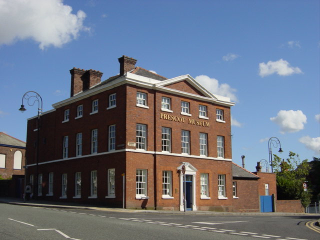
Prescot Museum

Prescot Museum is a local museum in Prescot, England. The museum focuses on topics relating to the history of Knowsley, its people and local industries...

The Prescot School

The Prescot School is a coeducational secondary school located in Prescot, Merseyside, England. It was previously called Prescot Grammar School. It was...

Prescot Urban District

Prescot Urban District was a local government district in the administrative county of Lancashire, England from 1895 to 1974.the main settlement of the...

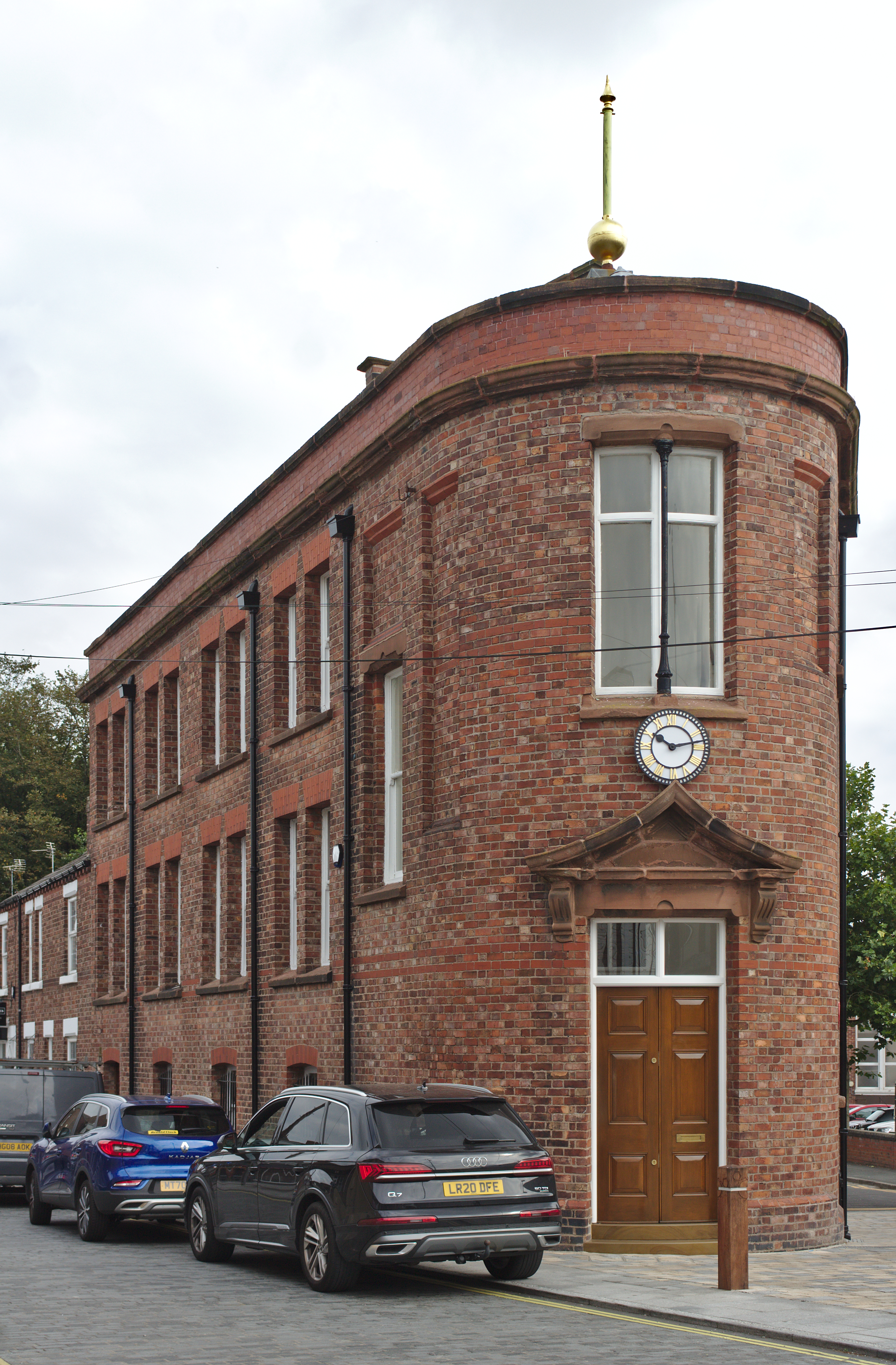
Flat Iron Building (Prescot)

Flat Iron Building, also known as 72 Ecclestone Street, is a historic building in Prescot, Merseyside. It was built in 1890 to service Prescot's extensive...

Nearby Amenities

Located within 500m of 53.427641,-2.80958
Prescot
Is In City: Knowsley
Place: town
Source: npe
Wikidata: Q1976655
Wikipedia: en:Prescot
Lat/Long: 53.4275807/-2.8042467
Bus Stop
PRESCOT BUS STATION
Bus: yes
Local Ref: 2
Naptan AtcoCode: 2800S51066C
Naptan CommonName: PRESCOT BUS STATION
Naptan Indicator: STAND C
Naptan Landmark: STAND C
Naptan NaptanCode: merdwjgm
Naptan Notes: No Notes
Naptan PlusbusZoneRef: LVRPLCH
Naptan ShortCommonName: Prescot Bus Stn-C
Naptan Street: PRESCOT BUS STATION
Naptan Verified: no
Public Transport: platform
Source: naptan_import
Lat/Long: 53.4288744/-2.806105
Pub
Dean's House
Lat/Long: 53.4287084/-2.8067016
Traffic Signals
Source: Bing
Traffic Signals: signal
Lat/Long: 53.428396/-2.8156344
Traffic Signals
Source: Bing
Traffic Signals: signal
Lat/Long: 53.4284538/-2.8148449
Crossing
Button Operated: yes
Crossing: traffic_signals
Crossing Island: no
Crossing Markings: dots
Crossing Ref: toucan
Tactile Paving: yes
Lat/Long: 53.4283065/-2.815151
Turning Circle
Lat/Long: 53.4282605/-2.8098758
Traffic Calming: hump
Lat/Long: 53.4255731/-2.8061049
Turning Circle
Lat/Long: 53.4272523/-2.8095908
Bus Stop
DERBY STREET/POLICE STATION
Bus: yes
Naptan AtcoCode: 2800S51148A
Naptan Bearing: E
Naptan CommonName: DERBY STREET/POLICE STATION
Naptan Indicator: DERBY STREET/POLICE STATION
Naptan Landmark: OPP POLICE STATION
Naptan NaptanCode: mergmtmj
Naptan Notes: No Notes
Naptan PlusbusZoneRef: LVRPLCH
Naptan ShortCommonName: Derby St
Naptan Street: DERBY STREET
Naptan Verified: no
Public Transport: platform
Source: naptan_import
Lat/Long: 53.4294513/-2.8093824
Bus Stop
DERBY STREET/ELM HOUSE
Bus: yes
Naptan AtcoCode: 2800S51148B
Naptan Bearing: W
Naptan CommonName: DERBY STREET/ELM HOUSE
Naptan Indicator: DERBY STREET/ELM HOUSE
Naptan Landmark: OUTSIDE ELM HOUSE
Naptan NaptanCode: mergmtmp
Naptan Notes: No Notes
Naptan PlusbusZoneRef: LVRPLCH
Naptan ShortCommonName: Derby St Police Stn
Naptan Street: DERBY STREET
Naptan Verified: no
Public Transport: platform
Shelter: yes
Source: naptan_import
Lat/Long: 53.4294709/-2.8103304
Bus Stop
Prescot Business Park
Bus: yes
Naptan AtcoCode: 2800S51234A
Naptan Bearing: SW
Naptan CommonName: Prescot Business Park
Naptan Indicator: In
Naptan Landmark: Carr Lane
Naptan NaptanCode: mertwpgt
Naptan ShortCommonName: Prescot Bus Park
Naptan Street: Manchester Road
Naptan Verified: no
Public Transport: platform
Source: naptan_import
Lat/Long: 53.4246044/-2.8056634
Bus Stop
Prescot Business Park
Bus: yes
Naptan AtcoCode: 2800S51234B
Naptan Bearing: NW
Naptan CommonName: Prescot Business Park
Naptan Indicator: In
Naptan Landmark: Manchester Road
Naptan NaptanCode: mertwpgw
Naptan ShortCommonName: Prescot Bus Park
Naptan Street: Carr Lane
Naptan Verified: no
Public Transport: platform
Source: naptan_import
Lat/Long: 53.4241434/-2.8073703
Bus Stop
Wood Lane
Bus: yes
Naptan AtcoCode: 2800S51235A
Naptan Bearing: NW
Naptan CommonName: Wood Lane
Naptan Indicator: Adj
Naptan Landmark: Carr Lane
Naptan NaptanCode: mertwpjp
Naptan ShortCommonName: Carr Lane
Naptan Street: Carr Lane
Naptan Verified: no
Public Transport: platform
Source: naptan_import
Lat/Long: 53.4252361/-2.815894
Bus Stop
LIVERPOOL ROAD/MITCHELL ROAD
Bus: yes
Naptan AtcoCode: 2800S51013A
Naptan Bearing: W
Naptan CommonName: LIVERPOOL ROAD/MITCHELL ROAD
Naptan Indicator: LIVERPOOL ROAD/WEST STREET
Naptan Landmark: CORNER MITCHELL ROAD O/S 5
Naptan NaptanCode: merdwdjd
Naptan Notes: No Notes
Naptan PlusbusZoneRef: LVRPLCH
Naptan ShortCommonName: Mitchell Rd
Naptan Street: LIVERPOOL ROAD
Naptan Verified: no
Public Transport: platform
Shelter: yes
Source: naptan_import
Lat/Long: 53.4288188/-2.8124727
Bus Stop
LIVERPOOL ROAD/MITCHELL ROAD
Bus: yes
Naptan AtcoCode: 2800S51013B
Naptan Bearing: E
Naptan CommonName: LIVERPOOL ROAD/MITCHELL ROAD
Naptan Indicator: LIVERPOOL ROAD/WEST STREET
Naptan Landmark: OPP DRIFFIELD RD AND MITCHELL ROAD
Naptan NaptanCode: merdwdjg
Naptan Notes: No Notes
Naptan PlusbusZoneRef: LVRPLCH
Naptan ShortCommonName: Mitchell Rd
Naptan Street: LIVERPOOL ROAD
Naptan Verified: no
Public Transport: platform
Source: naptan_import
Lat/Long: 53.4289072/-2.8132077
Bus Stop
LIVERPOOL ROAD/STANLEY CRESCENT
Bus: yes
Naptan AtcoCode: 2800S51014A
Naptan Bearing: E
Naptan CommonName: LIVERPOOL ROAD/STANLEY CRESCENT
Naptan Indicator: DERBY STREET/LIVERPOOL ROAD
Naptan Landmark: CORNER STANLEY CRESCENT
Naptan NaptanCode: merdwdjm
Naptan Notes: No Notes
Naptan PlusbusZoneRef: LVRPLCH
Naptan ShortCommonName: Stanley Cres
Naptan Street: DERBY STREET
Naptan Verified: no
Public Transport: platform
Source: naptan_import
Lat/Long: 53.4296481/-2.8081971
Bus Stop
HIGH STREET/HOPE & ANCHOR
Bus: yes
Departures Board: timetable
Naptan AtcoCode: 2800S51015A
Naptan Bearing: W
Naptan CommonName: HIGH STREET/HOPE & ANCHOR
Naptan Indicator: HIGH STREET/HOPE & ANCHOR
Naptan Landmark: NEAR HOPE & ANCHOR PH
Naptan NaptanCode: merdwdjp
Naptan Notes: No Notes
Naptan PlusbusZoneRef: LVRPLCH
Naptan ShortCommonName: High St/Hope&Anchor
Naptan Street: HIGH STREET
Naptan Verified: no
Public Transport: platform
Shelter: separate
Source: naptan_import
Lat/Long: 53.4302297/-2.8034915
Bus Stop
LIVERPOOL ROAD/BROOKBRIDGE GARAGE
Bus: yes
Naptan AtcoCode: 2800S51028A
Naptan Bearing: W
Naptan CommonName: LIVERPOOL ROAD/BROOKBRIDGE GARAGE
Naptan Indicator: LIVERPOOL ROAD/BROOKBRIDGE GARAGE
Naptan Landmark: NR BROOKBRIDGE PETROL STATION O/S 45
Naptan NaptanCode: merdwdwp
Naptan Notes: No Notes
Naptan PlusbusZoneRef: LVRPLCH
Naptan ShortCommonName: Liverpool Rd/Garage
Naptan Street: LIVERPOOL ROAD
Naptan Verified: no
Public Transport: platform
Shelter: yes
Source: naptan_import
Lat/Long: 53.4280099/-2.8170705
Bus Stop
LIVERPOOL ROAD/BROOKBRIDGE GARAGE
Bus: yes
Naptan AtcoCode: 2800S51028B
Naptan Bearing: E
Naptan CommonName: LIVERPOOL ROAD/BROOKBRIDGE GARAGE
Naptan Indicator: LIVERPOOL ROAD/BROOKBRIDGE GARAGE
Naptan Landmark: NRLY OPP BROOKBRIDGE PETROL STATION
Naptan NaptanCode: merdwdwt
Naptan Notes: No Notes
Naptan PlusbusZoneRef: LVRPLCH
Naptan ShortCommonName: Liverpool Rd/Garage
Naptan Street: LIVERPOOL ROAD
Naptan Verified: no
Public Transport: platform
Shelter: yes
Source: naptan_import
Lat/Long: 53.4283584/-2.8161239
Bus Stop
MANCHESTER ROAD/SOUTH AVENUE
Bus: yes
Naptan AtcoCode: 2800S51056A
Naptan Bearing: NW
Naptan CommonName: MANCHESTER ROAD/SOUTH AVENUE
Naptan Indicator: MANCHESTER ROAD/SOUTH AVENUE
Naptan Landmark: NEAR 106
Naptan NaptanCode: merdwgwg
Naptan Notes: No Notes
Naptan PlusbusZoneRef: LVRPLCH
Naptan ShortCommonName: Manchester Rd/S Av
Naptan Street: MANCHESTER ROAD
Naptan Verified: no
Public Transport: platform
Source: naptan_import
Lat/Long: 53.4256796/-2.8060777
Bus Stop
MANCHESTER ROAD/SOUTH AVENUE
Bus: yes
Naptan AtcoCode: 2800S51056B
Naptan Bearing: SE
Naptan CommonName: MANCHESTER ROAD/SOUTH AVENUE
Naptan Indicator: MANCHESTER ROAD/SOUTH AVENUE
Naptan Landmark: O/S 53
Naptan NaptanCode: merdwgwj
Naptan Notes: No Notes
Naptan PlusbusZoneRef: LVRPLCH
Naptan ShortCommonName: Manchester Rd/S Av
Naptan Street: MANCHESTER ROAD
Naptan Verified: no
Public Transport: platform
Shelter: no
Source: naptan_import
Lat/Long: 53.4257339/-2.805857
Bus Stop
PRESCOT BUS STATION
Bus: yes
Local Ref: 1
Naptan AtcoCode: 2800S51066B
Naptan CommonName: PRESCOT BUS STATION
Naptan Indicator: STAND B
Naptan Landmark: STAND B
Naptan NaptanCode: merdwjgj
Naptan Notes: No Notes
Naptan PlusbusZoneRef: LVRPLCH
Naptan ShortCommonName: Prescot Bus Stn-B
Naptan Street: PRESCOT BUS STATION
Naptan Verified: no
Public Transport: platform
Source: naptan_import
Lat/Long: 53.4290695/-2.806346
Bus Stop
PRESCOT BUS STATION
Bus: yes
Local Ref: 3
Naptan AtcoCode: 2800S51066D
Naptan CommonName: PRESCOT BUS STATION
Naptan Indicator: STAND D
Naptan Landmark: STAND D
Naptan NaptanCode: merdwjgp
Naptan Notes: No Notes
Naptan PlusbusZoneRef: LVRPLCH
Naptan ShortCommonName: Prescot Bus Stn-D
Naptan Street: PRESCOT BUS STATION
Naptan Verified: no
Public Transport: platform
Source: naptan_import
Lat/Long: 53.4289377/-2.8064347
Bus Stop
MANCHESTER ROAD/LIVERPOOL ROAD
Bus: yes
Naptan AtcoCode: 2800S51079A
Naptan Bearing: E
Naptan CommonName: MANCHESTER ROAD/LIVERPOOL ROAD
Naptan Indicator: MANCHESTER ROAD/LIVERPOOL ROAD
Naptan Landmark: CORNER WOOD LANE O/S 32
Naptan NaptanCode: merdwjta
Naptan Notes: No Notes
Naptan PlusbusZoneRef: LVRPLCH
Naptan ShortCommonName: Wood Ln
Naptan Street: MANCHESTER ROAD
Naptan Verified: no
Public Transport: platform
Source: naptan_import
Lat/Long: 53.4271154/-2.8118363
Bus Stop
MANCHESTER ROAD/LIVERPOOL ROAD
Bus: yes
Naptan AtcoCode: 2800S51079B
Naptan Bearing: W
Naptan CommonName: MANCHESTER ROAD/LIVERPOOL ROAD
Naptan Indicator: MANCHESTER ROAD/LIVERPOOL ROAD
Naptan Landmark: NR WOOD LANE O/S 30
Naptan NaptanCode: merdwjtd
Naptan Notes: No Notes
Naptan PlusbusZoneRef: LVRPLCH
Naptan ShortCommonName: Wood Ln
Naptan Street: MANCHESTER ROAD
Naptan Verified: no
Public Transport: platform
Source: naptan_import
Lat/Long: 53.4270768/-2.8122269
Bus Stop
MANCHESTER ROAD/LIVERPOOL ROAD
Bus: yes
Naptan AtcoCode: 2800S51106A
Naptan Bearing: NW
Naptan CommonName: MANCHESTER ROAD/LIVERPOOL ROAD
Naptan Indicator: MANCHESTER ROAD/LIVERPOOL ROAD
Naptan Landmark: O/S 7/9
Naptan NaptanCode: merdwmjw
Naptan Notes: No Notes
Naptan PlusbusZoneRef: LVRPLCH
Naptan ShortCommonName: Liverpool St
Naptan Street: MANCHESTER ROAD
Naptan Verified: no
Public Transport: platform
Source: naptan_import
Lat/Long: 53.4278191/-2.8141073
Bus Stop
HIGH STREET/CHURCH STREET
Bus: yes
Naptan AtcoCode: 2800S51126A
Naptan Bearing: SW
Naptan CommonName: HIGH STREET/CHURCH STREET
Naptan Indicator: HIGH STREET/CHURCH STREET
Naptan Landmark: ADJ CLOCK MUSEUM
Naptan NaptanCode: merdwmta
Naptan Notes: No Notes
Naptan PlusbusZoneRef: LVRPLCH
Naptan ShortCommonName: High St/Church St
Naptan Street: HIGH STREET
Naptan Verified: no
Public Transport: platform
Source: naptan_import
Lat/Long: 53.4293833/-2.8061451
Bus Stop
SEWELL STREET/Tesco
Bus: yes
Naptan AtcoCode: 2800S51143A
Naptan Bearing: S
Naptan CommonName: SEWELL STREET/Tesco
Naptan Indicator: SEWELL STREET/YATES COURT
Naptan Landmark: OPP Tesco
Naptan NaptanCode: merdwmtj
Naptan Notes: No Notes
Naptan PlusbusZoneRef: LVRPLCH
Naptan ShortCommonName: Sewell St/Tesco
Naptan Street: SEWELL STREET
Naptan Verified: no
Public Transport: platform
Shelter: yes
Source: naptan_import
Lat/Long: 53.4262962/-2.8050236
Bus Stop
SEWELL STREET/Tesco
Bus: yes
Naptan AtcoCode: 2800S51143B
Naptan Bearing: N
Naptan CommonName: SEWELL STREET/Tesco
Naptan Indicator: SEWELL STREET/STELY WAY
Naptan Landmark: O/S Tesco
Naptan NaptanCode: merdwmtm
Naptan Notes: No Notes
Naptan PlusbusZoneRef: LVRPLCH
Naptan ShortCommonName: Sewell St/Tesco
Naptan Street: SEWELL STREET
Naptan Verified: no
Public Transport: platform
Shelter: yes
Source: naptan_import
Lat/Long: 53.4262678/-2.8048078
Taxi
PRESCOT BUS STATION
Naptan AtcoCode: 2800TX00060
Naptan CommonName: PRESCOT BUS STATION
Naptan Indicator: PRESCOT BUS STATION
Naptan Landmark: RIGHT OF CAR PARK ENTRANCE NEAR JUNCTION OF ECCL
Naptan Notes: No Notes
Naptan PlusbusZoneRef: LVRPLCH
Naptan Street: ECCLESTON STREET
Naptan Verified: no
Source: naptan_import
Lat/Long: 53.4289673/-2.805174
Crossing
Button Operated: yes
Crossing: traffic_signals
Crossing Island: no
Crossing Markings: dots
Crossing Ref: toucan
Tactile Paving: yes
Lat/Long: 53.4287241/-2.8139396
Cycleway: asl
Direction: forward
Source: Bing
Lat/Long: 53.4282799/-2.8151114
Cycleway: asl
Source: Bing
Lat/Long: 53.428407/-2.815578
Crossing
Crossing: traffic_signals
Kerb: lowered
Tactile Paving: yes
Lat/Long: 53.429432/-2.8070965
Local Solutions
Office: company
Lat/Long: 53.4238516/-2.8068626
Crossing
Crossing: unmarked
Crossing Island: no
Tactile Paving: yes
Lat/Long: 53.428074/-2.8163311
Crossing
Crossing: unmarked
Crossing Island: yes
Tactile Paving: yes
Lat/Long: 53.4252441/-2.8050748
Crossing
Crossing: unmarked
Crossing Island: yes
Tactile Paving: yes
Lat/Long: 53.4251898/-2.8049591
Crossing
Crossing: unmarked
Crossing Island: yes
Tactile Paving: yes
Lat/Long: 53.4243266/-2.8141938
Crossing
Crossing: unmarked
Crossing Island: yes
Tactile Paving: yes
Lat/Long: 53.4233938/-2.8117284
Crossing
Crossing: unmarked
Crossing Island: yes
Tactile Paving: yes
Lat/Long: 53.4236103/-2.8112023
Crossing
Crossing: unmarked
Crossing Island: yes
Tactile Paving: yes
Lat/Long: 53.4235739/-2.8111027
Pixus Wed Design & SEO Agency
Addr City: Prescot
Addr Housenumber: 4
Addr Postcode: L34 1QL
Addr Street: Sinclair Way
Office: company
Opening Hours: Mo-Fr 09:00-17:30
Phone: +44 151 426 9977
Smoking: outside
Website: https://www.pixus.uk/
Wheelchair: yes
Lat/Long: 53.4240457/-2.8077504
Barrier: height_restrictor
Lat/Long: 53.4242949/-2.8144697
Waterfields
Addr City: Prescot
Addr Housenumber: 9 - 11
Addr Postcode: L34 5QA
Addr Street: Eccleston Street
Addr Village: Knowsley
Fhrs Id: 221092
Shop: bakery
Lat/Long: 53.4288131/-2.8051707
Life & Style Retail
Shop: department_store
Lat/Long: 53.4290543/-2.8045279
Soft Sofas
Shop: furniture
Lat/Long: 53.4289416/-2.8049645
Wardrobe Clothing
Shop: clothes
Lat/Long: 53.4289927/-2.8047392
TUI
Brand: TUI
Brand Wikidata: Q7795876
Brand Wikipedia: en:Thomson Travel Group
Shop: travel_agency
Lat/Long: 53.429119/-2.8043235
Cafe
Poco
Addr City: Prescot
Addr Housenumber: 30
Addr Postcode: L34 5QJ
Addr Street: Eccleston Street
Addr Village: Knowsley
Fhrs Id: 1671819
Lat/Long: 53.4289784/-2.8042001
Bank
Halifax
Brand: Halifax
Brand Wikidata: Q3310164
Brand Wikipedia: en:Halifax (bank)
Lat/Long: 53.4289272/-2.8043664
Bank
Lloyds Bank
Addr Country: GB
Brand: Lloyds Bank
Brand Wikidata: Q1152847
Brand Wikipedia: en:Lloyds Bank
Contact Website: https://branches.lloydsbank.com/prescot/12-eccleston-street
Lat/Long: 53.4288441/-2.8045864
Sweet Nothings
Shop: florist
Lat/Long: 53.4287866/-2.8047822
Pup Paws Grooming Studio
Shop: pet
Lat/Long: 53.4278372/-2.8030037
Betfred
Brand: Betfred
Brand Wikidata: Q4897425
Brand Wikipedia: en:Betfred
Shop: bookmaker
Lat/Long: 53.4278308/-2.8031888
Designer Kidz Boutique
Shop: clothes
Lat/Long: 53.4302169/-2.8037414
Geoff Atherton & Co.
Office: accountant
Lat/Long: 53.4302274/-2.803663
Cafe
M. Ray
Lat/Long: 53.430245/-2.8035303
Home Bargains
Addr City: Prescot
Addr Housename: The Prescot Centre
Addr Postcode: L34 5GA
Addr Street: Eccleston Street
Addr Unit: Unit MSU2
Brand: Home Bargains
Brand Wikidata: Q5888229
Contact Website: https://storelocator.homebargains.co.uk/store/A88/Prescot+Shopping+Centre,+Prescot
Fhrs Id: 221112
Shop: variety_store
Lat/Long: 53.4287509/-2.803302
Marketplace
Prescot Indoor Market
Lat/Long: 53.4285288/-2.8032296
Max Spielmann
Brand: Max Spielmann
Brand Wikidata: Q76221051
Shop: photo
Lat/Long: 53.4294291/-2.8029007
Age UK
Brand: Age UK
Brand Wikidata: Q4691850
Brand Wikipedia: en:Age UK
Shop: charity
Lat/Long: 53.4294171/-2.8030454
Girls on Top
Shop: hairdresser
Lat/Long: 53.4293795/-2.8031555
Yates & Greer
Addr City: Prescot
Addr Housenumber: 48
Addr Postcode: L34 5QJ
Addr Street: Eccleston Street
Addr Village: Knowsley
Fhrs Id: 220649
Shop: butcher
Lat/Long: 53.4293238/-2.8033182
Willowbrook Hospice Shop
Shop: charity
Lat/Long: 53.4293984/-2.8034466
Chicken Barbecue
Addr City: Prescot
Addr Housenumber: 49
Addr Postcode: L34 5QH
Addr Street: Eccleston Street
Addr Village: Knowsley
Fhrs Id: 221009
Shop: butcher
Lat/Long: 53.4293658/-2.8035388
Margaret Rose Fashions
Shop: clothes
Lat/Long: 53.4294738/-2.8032334
Ladbrokes
Brand: Ladbrokes
Brand Wikidata: Q1799875
Brand Wikipedia: en:Ladbrokes Coral
Shop: bookmaker
Lat/Long: 53.4297299/-2.803223
Enterprise Credit Union
Office: financial
Lat/Long: 53.4296372/-2.8031533
Just Sew
Shop: tailor
Lat/Long: 53.4296401/-2.8028806
Taxi
Lat/Long: 53.4263531/-2.8025151
Traffic Calming: cushion
Lat/Long: 53.4261662/-2.8074081
Cafe
Costa
Addr Housename: Cables Retail Park
Addr Postcode: L34 5NQ
Addr Street: Steley Way
Addr Unit: 4A
Brand: Costa
Brand Wikidata: Q608845
Brand Wikipedia: en:Costa Coffee
Cuisine: coffee_shop
Fhrs Id: 1377484
Takeaway: yes
Lat/Long: 53.4263258/-2.8032181
Barrier: bollard
Lat/Long: 53.4269516/-2.8062713
Give Way
Direction: backward
Lat/Long: 53.4289701/-2.8119704
Crossing
Crossing: marked
Lat/Long: 53.4260609/-2.803831
Crossing
Crossing: marked
Lat/Long: 53.4261471/-2.8033318
Crossing
Crossing: unmarked
Lat/Long: 53.424836/-2.8055191
Double Box Toys
Addr City: Prescot
Addr Housename: F1 Helsby Court
Addr Postcode: L34 1PB
Addr Street: Prescot Park Way
Email: pops@doubleboxedtoys.com
Opening Hours: Mo-Su 10:00-16:00
Operator: Double Box Toys Ltd
Payment Cash: yes
Payment Credit Cards: yes
Shop: collector
Website: https://doubleboxedtoys.com
Lat/Long: 53.4237948/-2.8068652
Crossing
Crossing: marked
Crossing Island: no
Tactile Paving: no
Lat/Long: 53.4236997/-2.8065541
Crossing
Crossing: marked
Lat/Long: 53.4237381/-2.8066511
Traffic Calming: bump
Lat/Long: 53.4238111/-2.8072094
Traffic Calming: hump
Lat/Long: 53.4236953/-2.8068219
Traffic Calming: hump
Lat/Long: 53.4237178/-2.8061478
Traffic Signals
Traffic Signals: signal
Traffic Signals Direction: forward
Lat/Long: 53.4282535/-2.8150713
Traffic Calming: cushion
Lat/Long: 53.4279062/-2.814439
Crossing
Crossing: unmarked
Lat/Long: 53.4279224/-2.8146463
Give Way
Direction: forward
Lat/Long: 53.4274766/-2.8114958
Give Way
Direction: backward
Lat/Long: 53.4274004/-2.8114988
Stop
Direction: backward
Stop: minor
Lat/Long: 53.4289306/-2.8118582
Give Way
Direction: forward
Lat/Long: 53.4289973/-2.811384
Crossing
Button Operated: yes
Crossing: traffic_signals
Crossing Island: no
Crossing Markings: dots
Crossing Ref: puffin
Tactile Paving: yes
Lat/Long: 53.4292632/-2.81132
Traffic Signals
Traffic Signals: crossing
Traffic Signals Direction: forward
Lat/Long: 53.4292789/-2.8112592
Crossing
Crossing: unmarked
Crossing Island: yes
Tactile Paving: yes
Lat/Long: 53.4272399/-2.812589
Direction: backward
Traffic Calming: cushion
Lat/Long: 53.4272573/-2.8126505
Direction: forward
Traffic Calming: cushion
Lat/Long: 53.4272276/-2.8125395
Traffic Calming: cushion
Lat/Long: 53.4275264/-2.8135239
Give Way
Direction: forward
Lat/Long: 53.4273449/-2.8123079
Give Way
Direction: forward
Lat/Long: 53.4272268/-2.8123656
Traffic Calming: cushion
Lat/Long: 53.4269904/-2.8114475
Give Way
Direction: backward
Lat/Long: 53.4276343/-2.8106229
Give Way
Direction: backward
Lat/Long: 53.4275613/-2.8106122
Crossing
Crossing: unmarked
Crossing Island: no
Tactile Paving: yes
Lat/Long: 53.428955/-2.8111083
Crossing
Crossing: unmarked
Crossing Island: no
Tactile Paving: yes
Lat/Long: 53.4288394/-2.8118176
Crossing
Crossing: unmarked
Crossing Island: yes
Tactile Paving: yes
Lat/Long: 53.4252023/-2.8043979
Crossing
Crossing: unmarked
Crossing Island: yes
Tactile Paving: yes
Lat/Long: 53.4251603/-2.8045177
Crossing
Crossing: traffic_signals
Crossing Island: yes
Crossing Ref: pelican
Tactile Paving: yes
Lat/Long: 53.4253756/-2.803879
Crossing
Crossing: traffic_signals
Crossing Island: yes
Crossing Ref: pelican
Tactile Paving: yes
Lat/Long: 53.4254232/-2.8038549
Crossing
Crossing: unmarked
Crossing Island: yes
Tactile Paving: yes
Lat/Long: 53.4257861/-2.8047515
Crossing
Crossing: unmarked
Crossing Island: yes
Tactile Paving: yes
Lat/Long: 53.4257913/-2.8046584
Crossing
Crossing: unmarked
Crossing Island: yes
Tactile Paving: yes
Lat/Long: 53.4255756/-2.8051339
Crossing
Crossing: unmarked
Crossing Island: yes
Tactile Paving: yes
Lat/Long: 53.4254974/-2.8051582
Crossing
Crossing: unmarked
Crossing Island: yes
Tactile Paving: yes
Lat/Long: 53.4257318/-2.8042721
Crossing
Crossing: unmarked
Crossing Island: yes
Tactile Paving: yes
Lat/Long: 53.4256783/-2.804202
Traffic Signals
Traffic Signals: signal
Traffic Signals Direction: forward
Lat/Long: 53.425991/-2.8048125
Traffic Signals
Traffic Signals: signal
Traffic Signals Direction: backward
Lat/Long: 53.426045/-2.8048395
Crossing
Crossing: traffic_signals
Crossing Island: no
Crossing Ref: pelican
Tactile Paving: yes
Traffic Calming: table
Lat/Long: 53.426018/-2.804826
Traffic Signals
Traffic Signals: signal
Traffic Signals Direction: forward
Lat/Long: 53.4258243/-2.8063085
Traffic Signals
Traffic Signals: signal
Traffic Signals Direction: backward
Lat/Long: 53.4258544/-2.8064035
Crossing
Crossing: traffic_signals
Crossing Island: no
Crossing Ref: pelican
Tactile Paving: yes
Lat/Long: 53.4258393/-2.806356
Traffic Calming: cushion
Lat/Long: 53.4264419/-2.8084322
Traffic Calming: cushion
Lat/Long: 53.4267192/-2.8097748
Crossing
Crossing: unmarked
Crossing Island: no
Tactile Paving: yes
Lat/Long: 53.4255866/-2.8058814
Traffic Signals
Traffic Signals: crossing_only
Traffic Signals Direction: forward
Lat/Long: 53.4285984/-2.8053985
Crossing
Crossing: traffic_signals
Crossing Island: no
Crossing Ref: pelican
Tactile Paving: yes
Lat/Long: 53.4286286/-2.8054193
Traffic Signals
Traffic Signals: crossing_only
Traffic Signals Direction: backward
Lat/Long: 53.4286579/-2.8054394
Crossing
Crossing: unmarked
Crossing Island: no
Tactile Paving: yes
Lat/Long: 53.4289462/-2.8066639
Crossing
Button Operated: yes
Crossing: traffic_signals
Crossing Island: no
Crossing Markings: dots
Crossing Ref: puffin
Tactile Paving: yes
Lat/Long: 53.4284449/-2.8148929
Crossing
Button Operated: yes
Crossing: traffic_signals
Crossing Island: no
Crossing Markings: dots
Crossing Ref: puffin
Tactile Paving: yes
Lat/Long: 53.4285207/-2.8150088
Crossing
Crossing: unmarked
Crossing Island: no
Crossing Markings: no
Tactile Paving: yes
Lat/Long: 53.4283204/-2.8148368
Crossing
Crossing: unmarked
Crossing Island: no
Tactile Paving: yes
Lat/Long: 53.4286921/-2.8126302
Give Way
Direction: backward
Lat/Long: 53.4279498/-2.8146268
Give Way
Direction: forward
Lat/Long: 53.428142/-2.8160527
Crossing
Crossing: unmarked
Lat/Long: 53.4285476/-2.8134131
Crossing
Crossing: unmarked
Crossing Island: no
Tactile Paving: no
Lat/Long: 53.4288314/-2.8136193
Crossing
Lat/Long: 53.4293102/-2.8114852
Crossing
Lat/Long: 53.4291316/-2.8120252
Stop
Direction: forward
Stop: minor
Lat/Long: 53.4300859/-2.8041474
Crossing
Crossing: traffic_signals
Crossing Island: no
Crossing Ref: pelican
Tactile Paving: yes
Lat/Long: 53.4301078/-2.8038439
Traffic Signals
Traffic Signals: crossing
Traffic Signals Direction: forward
Lat/Long: 53.4300978/-2.8038937
Traffic Signals
Traffic Signals: crossing
Traffic Signals Direction: backward
Lat/Long: 53.4301163/-2.8038019
Crossing
Crossing: unmarked
Crossing Island: no
Tactile Paving: no
Lat/Long: 53.4301405/-2.8041718
Waste Basket
Lat/Long: 53.4301238/-2.8040204
Crossing
Crossing: unmarked
Crossing Island: no
Tactile Paving: yes
Lat/Long: 53.4301206/-2.8033977
Barrier: cycle_barrier
Lat/Long: 53.4236734/-2.8125779
Crossing
Crossing: unmarked
Crossing Island: no
Tactile Paving: yes
Lat/Long: 53.423559/-2.812557
Bench
Backrest: no
Material: wood
Lat/Long: 53.4235879/-2.8127812
Bench
Backrest: no
Material: wood
Lat/Long: 53.4236061/-2.8128175
Bench
Backrest: no
Material: wood
Lat/Long: 53.4235739/-2.812744
Waste Basket
Lat/Long: 53.4240717/-2.8134129
Eye of newt and toe of frog
Artwork Type: sculpture
Tourism: artwork
Lat/Long: 53.4286742/-2.8053556
Adder’s fork and blind-worm sting
Artwork Type: sculpture
Tourism: artwork
Lat/Long: 53.4288035/-2.8051155
Access: yes
Entrance: main
Wheelchair: yes
Lat/Long: 53.4289843/-2.8057958
Bicycle Parking
Bicycle Parking: stands
Lat/Long: 53.4288018/-2.8054829
Crossing
Button Operated: yes
Crossing: traffic_signals
Crossing Island: no
Crossing Markings: dots
Crossing Ref: puffin
Tactile Paving: yes
Lat/Long: 53.4287157/-2.8142292
Crossing
Crossing: unmarked
Crossing Island: no
Crossing Markings: no
Tactile Paving: yes
Lat/Long: 53.4285668/-2.8135993
Crossing
Button Operated: yes
Crossing: traffic_signals
Crossing Island: no
Crossing Markings: dots
Crossing Ref: toucan
Tactile Paving: yes
Lat/Long: 53.428658/-2.8137701
Traffic Signals
Traffic Signals: signal
Lat/Long: 53.4286462/-2.8143466
Traffic Signals
Traffic Signals: signal
Lat/Long: 53.4286731/-2.8136892
Traffic Signals
Traffic Signals: signal
Traffic Signals Direction: backward
Lat/Long: 53.4287494/-2.8142481
Traffic Signals
Traffic Signals: crossing
Traffic Signals Direction: backward
Lat/Long: 53.4292426/-2.811384
Post Office
Prescot Post Office
Addr City: Prescot
Addr Postcode: L34 5GA
Addr Street: Eccleston Street
Brand: Post Office
Brand Wikidata: Q1783168
Check Date: 2023-09-27
Check Date Opening Hours: 2023-09-27
Opening Hours: Mo-Fr 08:30-17:30; Sa 09:00-13:30
Ref Pol Id: 128960
Website: https://www.postoffice.co.uk/branch-finder/4714202/prescot
Lat/Long: 53.4289211/-2.8037864
The data included in this document is from www.openstreetmap.org. The data is made available under ODbL.

Have you been to Prescot?

Leave your review of Prescot below (or comments, questions and feedback).