Potterne

Civil Parish in Wiltshire

England

Potterne

Ordnance Survey Flush Bracket S8910 This flush bracket can be found on the wall of the Infants School, Potterne.
For more details see : <span class="nowrap"><a title="http://www.bench-marks.org.uk/bm21288" rel="nofollow ugc noopener" href="http://www.bench-marks.org.uk/bm21288">Link</a><img style="margin-left:2px;" alt="External link" title="External link - shift click to open in new window" src="https://s1.geograph.org.uk/img/external.png" width="10" height="10"/></span>
Ordnance Survey Flush Bracket S8910 Credit: Peter Wood

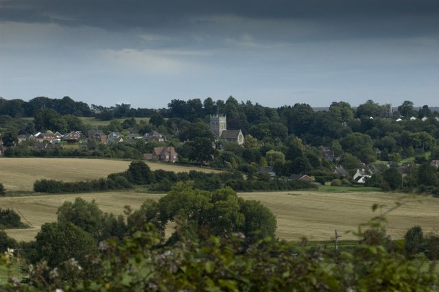
Potterne is a civil parish located in the county of Wiltshire, England. Situated about three miles southeast of the town of Devizes, Potterne covers an area of approximately 3.23 square miles. It has a population of around 2,000 residents.

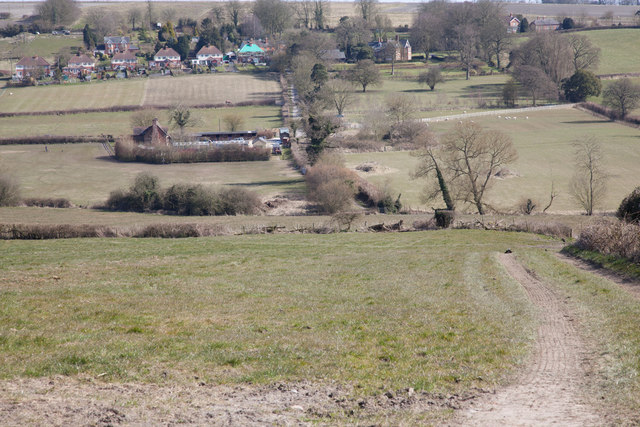
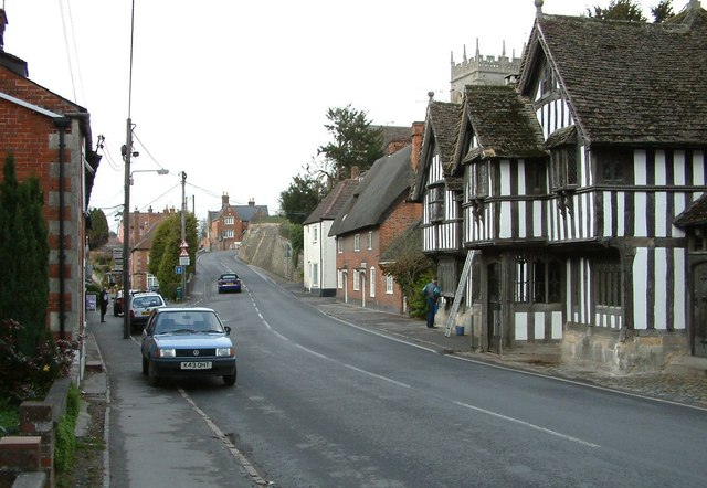
The village of Potterne is known for its picturesque countryside and charming rural setting. It is predominantly a residential area, with a mix of traditional cottages and more modern housing developments. The village retains a strong sense of community, with various local organizations and events contributing to its vibrant atmosphere.

Potterne is well-served by amenities, including a primary school, a public house, a village hall, and a post office. The village also has a cricket club, which hosts regular matches and events, attracting both locals and visitors.

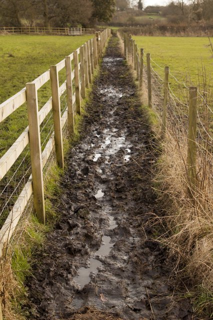
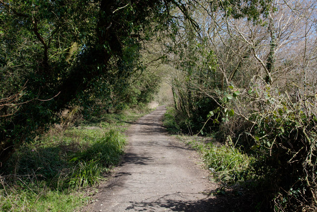
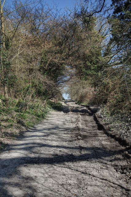
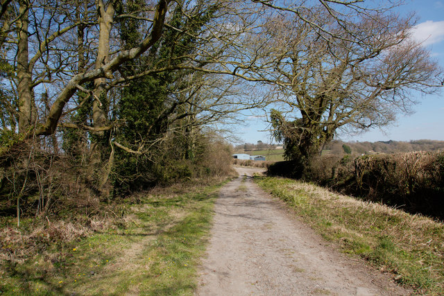
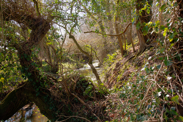
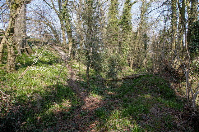
The surrounding area offers plenty of opportunities for outdoor activities, with several footpaths and bridleways providing access to the beautiful countryside. The Kennet and Avon Canal, which runs through the village, is a popular spot for walking, cycling, and boating.

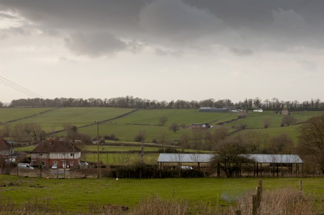
Historically, Potterne has strong ties to the agricultural industry, with farming playing a significant role in the village's economy. However, in recent years, the village has seen some diversification, with a range of small businesses and services catering to the local community.

Overall, Potterne is a charming and vibrant civil parish in Wiltshire, offering a peaceful rural lifestyle, a strong sense of community, and easy access to both natural beauty and nearby urban centers.

If you have any feedback on the listing, please let us know in the comments section below.
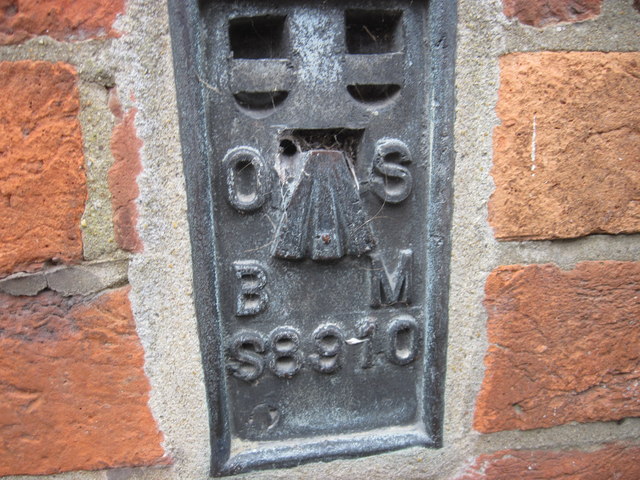
Potterne Images

Images are sourced within 2km of 51.326761/-2.007546 or Grid Reference ST9958. Thanks to Geograph Open Source API. All images are credited.

Ordnance Survey Flush Bracket S8910 This flush bracket can be found on the wall of the Infants School, Potterne.
For more details see : <span class="nowrap"><a title="http://www.bench-marks.org.uk/bm21288" rel="nofollow ugc noopener" href="http://www.bench-marks.org.uk/bm21288">Link</a><img style="margin-left:2px;" alt="External link" title="External link - shift click to open in new window" src="https://s1.geograph.org.uk/img/external.png" width="10" height="10"/></span>
Ordnance Survey Flush Bracket S8910
This flush bracket can be found on the wall of the Infants School, Potterne. For more details see : LinkExternal link
St Mary the Virgin, Potterne Across the field to St Mary's, Potterne as seen from Furze Hill Lane - this view would have been familiar to earlier travellers when Furze Hill Lane was one of the main routes to and from Devizes.
St Mary the Virgin, Potterne
Across the field to St Mary's, Potterne as seen from Furze Hill Lane - this view would have been familiar to earlier travellers when Furze Hill Lane was one of the main routes to and from Devizes.
Footpath to Potterne from Rangebourne Although I attempted to walk this path is beat me into submission on account of the dreadful, wet, sloppy mud - the result of heavy rain and run off from the neighbouring pastureland.  A case of wearing wellingtons rather than walking boots!
Footpath to Potterne from Rangebourne
Although I attempted to walk this path is beat me into submission on account of the dreadful, wet, sloppy mud - the result of heavy rain and run off from the neighbouring pastureland. A case of wearing wellingtons rather than walking boots!
View towards Furze Hill Lane The line of trees on the horizon mark an ancient route from the market town of Devizes south towards Potterne and then on to Salisbury - in regular use until the mid C18th.  The council houses in the mid-distance mark the current main Salisbury road from Devizes.
View towards Furze Hill Lane
The line of trees on the horizon mark an ancient route from the market town of Devizes south towards Potterne and then on to Salisbury - in regular use until the mid C18th. The council houses in the mid-distance mark the current main Salisbury road from Devizes.
Furze Hill Lane
Furze Hill Lane
Furze Hill Lane
Furze Hill Lane
Furze Hill Lane looking towards Furze Hill Farm In the centre of the image are the two most westerly buildings of Furze Hill Farm
Furze Hill Lane looking towards Furze Hill Farm
In the centre of the image are the two most westerly buildings of Furze Hill Farm
Southern side of the Park Pale The park pale (the bounding bank around the old royal hunting park) is thoroughly overgrown.  Here a ditch at the bottom of the park pale is filled with water
Southern side of the Park Pale
The park pale (the bounding bank around the old royal hunting park) is thoroughly overgrown. Here a ditch at the bottom of the park pale is filled with water
Overgrown Park Pale The park pale (the bounding bank of the old royal hunting park) is overgrown.  In a late spring, the wood anemones have just come into flower whilst the bluebells show no sign yet of flowering.
Overgrown Park Pale
The park pale (the bounding bank of the old royal hunting park) is overgrown. In a late spring, the wood anemones have just come into flower whilst the bluebells show no sign yet of flowering.
View towards Rangebourne The line of path shown in <a href="https://www.geograph.org.uk/photo/3320362">ST9959 : Footpath to Potterne from Rangebourne</a> is visible in this image as the fencing extending from the centre towards the right of the image.

The houses shown towards the top of the image are located on the A360 Devizes Road
View towards Rangebourne
The line of path shown in ST9959 : Footpath to Potterne from Rangebourne is visible in this image as the fencing extending from the centre towards the right of the image. The houses shown towards the top of the image are located on the A360 Devizes Road
Potterne High Street looking north On the right of this picture is the most memorable house in the village, but the cottages beyond included the home of my great grandparents.
Potterne High Street looking north
On the right of this picture is the most memorable house in the village, but the cottages beyond included the home of my great grandparents.
Electricity pylon and lane to Five Lanes Farm
Path to Parsonage Farm
Potterne:  Regent's Court Lodge
Potterne: Regent's Court Lodge
Potterne:  Church of St Mary the Virgin
Potterne: Church of St Mary the Virgin
Potterne:  Porch House and other old houses
Potterne: Porch House and other old houses
Potterne:  Old houses
Potterne: Old houses
Potterne:  Old houses
Potterne: Old houses
Show me another place!

Potterne is located at Grid Ref: ST9958 (Lat: 51.326761, Lng: -2.007546)

Unitary Authority: Wiltshire

Police Authority: Wiltshire

What 3 Words

///shelved.router.refilled. Near Potterne, Wiltshire

Related Wikis

Potterne

Potterne is a village and civil parish in the county of Wiltshire, England. The village is 2 miles (3.2 km) south of Devizes and lies on the A360 which...

Wick, Devizes

Wick is a suburb of Devizes in the English county of Wiltshire. Until around 1800, when expansion of Devizes turned it into a suburb, Wick was a village...

Roundway Hospital

Roundway Hospital was a psychiatric hospital in the parish of Roundway near Devizes, Wiltshire, England. It was originally called the Wiltshire County...

Wiltshire Football Association

The Wiltshire Football Association is the governing body of football in the English county of Wiltshire. Affiliated members pay a fee commensurate with...

Nearby Amenities

Located within 500m of 51.326761,-2.007546
Potterne
Is In: Wiltshire, England, UK
Place: village
Lat/Long: 51.3255495/-2.006549
Post Box
Brand: Royal Mail
Brand Wikidata: Q638098
Collection Times: Mo-Fr 16:30; Sa 11:30
Drive Through: no
Operator: Royal Mail
Operator Wikidata: Q638098
Post Box Type: wall
Ref: SN10 46
Royal Cypher: EIIR
Royal Cypher Wikidata: Q33102113
Lat/Long: 51.3254657/-2.008818
Mini Roundabout
Direction: clockwise
Lat/Long: 51.3275174/-2.004733
Mini Roundabout
Direction: clockwise
Lat/Long: 51.3292476/-2.0067477
Fixme: stub? noexit?
Lat/Long: 51.3264687/-2.0094132
Addr City: Devizes
Addr Country: GB
Addr County: Wiltshire
Addr Housenumber: 1
Addr Street: Blounts Court
Addr Village: Potterne
Building: yes
Lat/Long: 51.3230204/-2.006161
Addr City: Devizes
Addr Country: GB
Lat/Long: 51.3250525/-2.0057817
Addr City: Devizes
Addr Country: GB
Addr County: Wiltshire
Addr Housenumber: 18
Addr Street: Blackberry Lane
Addr Village: Potterne
Building: yes
Lat/Long: 51.3280311/-2.0073849
Village Pump
Tourism: attraction
Lat/Long: 51.3269335/-2.0108503
Building: guest house
Tourism: guest_house
Lat/Long: 51.3246398/-2.0137122
Community Centre
Porch House
Source: survey
Tourism: attraction
Lat/Long: 51.3250915/-2.0086508
Post Office
Potterne Post Office
Addr Postcode: SN10 5NG
Branch: Potterne
Brand: Post Office
Brand Wikidata: Q1783168
Check Date: 2020-02-20
Contact Website: https://www.postoffice.co.uk/branch-finder/4555481/potterne
Ref Pol Id: 130531
Source: survey
Lat/Long: 51.3273748/-2.0042664
Building: guest house
Tourism: guest_house
Lat/Long: 51.3250512/-2.0024738
Bus Stop
Potterne Bell Inn
Bus: yes
Naptan AtcoCode: 4600WIA10413
Naptan NaptanCode: wilatawg
Public Transport: platform
Lat/Long: 51.3288591/-2.0046337
Bus Stop
Potterne Porch House
Bus: yes
Naptan AtcoCode: 4600WIA10410
Naptan Bearing: N
Naptan CommonName: Porch House
Naptan Indicator: N-bound
Naptan NaptanCode: wilatajm
Naptan Street: High Street
Naptan Verified: no
Public Transport: platform
Source: mapilary;naptan;bing;naptan_compare_tool
Lat/Long: 51.3252642/-2.0088433
Church Corner
Junction: yes
Lat/Long: 51.3262731/-2.0081982
Defibrillator
Emergency: defibrillator
Ref GB The Circuit: 64DBBDE3-3BCB-42A4-A2B3-AD73009B352E
Lat/Long: 51.32487/-2.0089469
Defibrillator
Emergency: defibrillator
Ref GB The Circuit: DEC1AE80-704E-42A2-8FCD-AD8900FDA0FF
Lat/Long: 51.3265595/-2.0038185
Post Box
Brand: Royal Mail
Brand Wikidata: Q638098
Collection Times: Mo-Fr 16:45; Sa 11:30
Drive Through: no
Operator: Royal Mail
Operator Wikidata: Q638098
Post Box Type: lamp
Ref: SN10 83
Royal Cypher: EIIR
Royal Cypher Wikidata: Q33102113
Lat/Long: 51.3274151/-2.0043872
Post Box
Brand: Royal Mail
Brand Wikidata: Q638098
Collection Times: Mo-Fr 09:00; Sa 07:00
Drive Through: no
Operator: Royal Mail
Operator Wikidata: Q638098
Post Box Type: lamp
Ref: SN10 54D
Royal Cypher: EIIR
Royal Cypher Wikidata: Q33102113
Lat/Long: 51.3291885/-2.0068213
Post Box
Brand: Royal Mail
Brand Wikidata: Q638098
Collection Times: Mo-Fr 09:00; Sa 07:00
Drive Through: no
Operator: Royal Mail
Operator Wikidata: Q638098
Post Box Type: lamp
Ref: SN10 86D
Royal Cypher: EIIR
Royal Cypher Wikidata: Q33102113
Lat/Long: 51.3229939/-2.0072985
The data included in this document is from www.openstreetmap.org. The data is made available under ODbL.

Have you been to Potterne?

Leave your review of Potterne below (or comments, questions and feedback).