Pipe Aston

Civil Parish in Herefordshire

England

Pipe Aston

Gorsty Farm By the Whitcliffe Rd.
Gorsty Farm Credit: N Chadwick

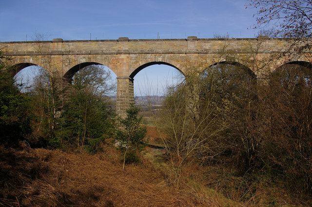
Pipe Aston is a civil parish located in the county of Herefordshire, England. It is situated in the West Midlands region, approximately 10 miles northeast of the city of Hereford. The parish covers an area of around 4 square miles and is surrounded by picturesque countryside, offering residents and visitors a peaceful and rural setting.

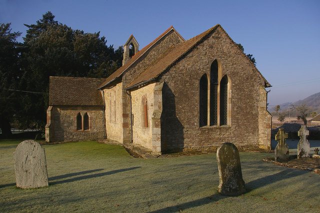
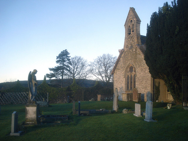
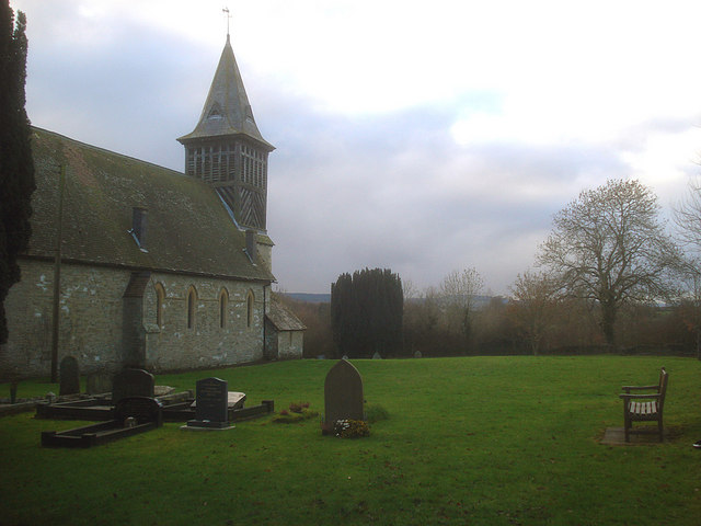
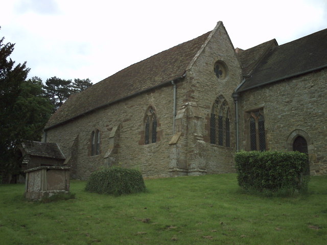
Pipe Aston is a small village within the civil parish, with a population of around 200 people. The village is characterized by its quaint and charming atmosphere, with traditional stone cottages and well-maintained gardens. The village church, St. Giles, is a prominent landmark and dates back to the 12th century, adding a historical touch to the area.

Although small in size, Pipe Aston benefits from a strong sense of community and a range of amenities. The village has a primary school, providing education for local children, as well as a village hall that serves as a hub for various social activities and events. Additionally, there is a local pub, The Pipe Aston Inn, where residents and visitors can enjoy a drink or a meal.

The surrounding countryside offers plenty of opportunities for outdoor activities, such as hiking, cycling, and horseback riding. The parish is also near the River Lugg, providing options for fishing and boating. Overall, Pipe Aston offers a tranquil and idyllic setting for those seeking a rural lifestyle in Herefordshire.

If you have any feedback on the listing, please let us know in the comments section below.

Pipe Aston Images

Images are sourced within 2km of 52.345243/-2.784598 or Grid Reference SO4672. Thanks to Geograph Open Source API. All images are credited.

Gorsty Farm By the Whitcliffe Rd.
Gorsty Farm
By the Whitcliffe Rd.
Footpath off Whitcliffe Rd near Gorsty The Mortimer Forest is the name given to the remnant of a Saxon Hunting forest on the Shropshire / Herefordshire border near Ludlow (Bringewood Forest). It is owned and managed by the Forestry Commission, who invented the name. The forest has car parks, information boards and trails.  The underlying rocks are Upper Silurian and the forest is the type site for these rocks (the Ludlovian).
Footpath off Whitcliffe Rd near Gorsty
The Mortimer Forest is the name given to the remnant of a Saxon Hunting forest on the Shropshire / Herefordshire border near Ludlow (Bringewood Forest). It is owned and managed by the Forestry Commission, who invented the name. The forest has car parks, information boards and trails. The underlying rocks are Upper Silurian and the forest is the type site for these rocks (the Ludlovian).
Footpath to Monstay Farm The Mortimer Forest is the name given to the remnant of a Saxon Hunting forest on the Shropshire / Herefordshire border near Ludlow (Bringewood Forest). It is owned and managed by the Forestry Commission, who invented the name. The forest has car parks, information boards and trails.  The underlying rocks are Upper Silurian and the forest is the type site for these rocks (the Ludlovian).
Footpath to Monstay Farm
The Mortimer Forest is the name given to the remnant of a Saxon Hunting forest on the Shropshire / Herefordshire border near Ludlow (Bringewood Forest). It is owned and managed by the Forestry Commission, who invented the name. The forest has car parks, information boards and trails. The underlying rocks are Upper Silurian and the forest is the type site for these rocks (the Ludlovian).
Disused quarry, Mortimer Forest Quarry into the Elton Beds.
Disused quarry, Mortimer Forest
Quarry into the Elton Beds.
Forestry Track, Mortimer Forest The Mortimer Forest is the name given to the remnant of a Saxon Hunting forest on the Shropshire / Herefordshire border near Ludlow (Bringewood Forest). It is owned and managed by the Forestry Commission, who invented the name. The forest has car parks, information boards and trails.  The underlying rocks are Upper Silurian and the forest is the type site for these rocks (the Ludlovian).
Forestry Track, Mortimer Forest
The Mortimer Forest is the name given to the remnant of a Saxon Hunting forest on the Shropshire / Herefordshire border near Ludlow (Bringewood Forest). It is owned and managed by the Forestry Commission, who invented the name. The forest has car parks, information boards and trails. The underlying rocks are Upper Silurian and the forest is the type site for these rocks (the Ludlovian).
Conifers, Mortimer Forest The Mortimer Forest is the name given to the remnant of a Saxon Hunting forest on the Shropshire / Herefordshire border near Ludlow (Bringewood Forest). It is owned and managed by the Forestry Commission, who invented the name. The forest has car parks, information boards and trails.  The underlying rocks are Upper Silurian and the forest is the type site for these rocks (the Ludlovian).
Conifers, Mortimer Forest
The Mortimer Forest is the name given to the remnant of a Saxon Hunting forest on the Shropshire / Herefordshire border near Ludlow (Bringewood Forest). It is owned and managed by the Forestry Commission, who invented the name. The forest has car parks, information boards and trails. The underlying rocks are Upper Silurian and the forest is the type site for these rocks (the Ludlovian).
Forestry track, Mortimer Forest The Mortimer Forest is the name given to the remnant of a Saxon Hunting forest on the Shropshire / Herefordshire border near Ludlow (Bringewood Forest). It is owned and managed by the Forestry Commission, who invented the name. The forest has car parks, information boards and trails.  The underlying rocks are Upper Silurian and the forest is the type site for these rocks (the Ludlovian).
Forestry track, Mortimer Forest
The Mortimer Forest is the name given to the remnant of a Saxon Hunting forest on the Shropshire / Herefordshire border near Ludlow (Bringewood Forest). It is owned and managed by the Forestry Commission, who invented the name. The forest has car parks, information boards and trails. The underlying rocks are Upper Silurian and the forest is the type site for these rocks (the Ludlovian).
Conifers between Monstay and Gorsty The Mortimer Forest is the name given to the remnant of a Saxon Hunting forest on the Shropshire / Herefordshire border near Ludlow (Bringewood Forest). It is owned and managed by the Forestry Commission, who invented the name. The forest has car parks, information boards and trails.  The underlying rocks are Upper Silurian and the forest is the type site for these rocks (the Ludlovian).
Conifers between Monstay and Gorsty
The Mortimer Forest is the name given to the remnant of a Saxon Hunting forest on the Shropshire / Herefordshire border near Ludlow (Bringewood Forest). It is owned and managed by the Forestry Commission, who invented the name. The forest has car parks, information boards and trails. The underlying rocks are Upper Silurian and the forest is the type site for these rocks (the Ludlovian).
Conifers, Mortimer Forest The Mortimer Forest is the name given to the remnant of a Saxon Hunting forest on the Shropshire / Herefordshire border near Ludlow (Bringewood Forest). It is owned and managed by the Forestry Commission, who invented the name. The forest has car parks, information boards and trails.  The underlying rocks are Upper Silurian and the forest is the type site for these rocks (the Ludlovian).
Conifers, Mortimer Forest
The Mortimer Forest is the name given to the remnant of a Saxon Hunting forest on the Shropshire / Herefordshire border near Ludlow (Bringewood Forest). It is owned and managed by the Forestry Commission, who invented the name. The forest has car parks, information boards and trails. The underlying rocks are Upper Silurian and the forest is the type site for these rocks (the Ludlovian).
Forest Track, Mortimer Forest The Mortimer Forest is the name given to the remnant of a Saxon Hunting forest on the Shropshire / Herefordshire border near Ludlow (Bringewood Forest). It is owned and managed by the Forestry Commission, who invented the name. The forest has car parks, information boards and trails.  The underlying rocks are Upper Silurian and the forest is the type site for these rocks (the Ludlovian).
Forest Track, Mortimer Forest
The Mortimer Forest is the name given to the remnant of a Saxon Hunting forest on the Shropshire / Herefordshire border near Ludlow (Bringewood Forest). It is owned and managed by the Forestry Commission, who invented the name. The forest has car parks, information boards and trails. The underlying rocks are Upper Silurian and the forest is the type site for these rocks (the Ludlovian).
Forestry Track, Mortimer Forest The Mortimer Forest is the name given to the remnant of a Saxon Hunting forest on the Shropshire / Herefordshire border near Ludlow (Bringewood Forest). It is owned and managed by the Forestry Commission, who invented the name. The forest has car parks, information boards and trails.  The underlying rocks are Upper Silurian and the forest is the type site for these rocks (the Ludlovian).
Forestry Track, Mortimer Forest
The Mortimer Forest is the name given to the remnant of a Saxon Hunting forest on the Shropshire / Herefordshire border near Ludlow (Bringewood Forest). It is owned and managed by the Forestry Commission, who invented the name. The forest has car parks, information boards and trails. The underlying rocks are Upper Silurian and the forest is the type site for these rocks (the Ludlovian).
Small disused quarry, Mortimer Forest An outcrop of the Elton Beds (Silurian).
Small disused quarry, Mortimer Forest
An outcrop of the Elton Beds (Silurian).
Footpath to Monstay The Mortimer Forest is the name given to the remnant of a Saxon Hunting forest on the Shropshire / Herefordshire border near Ludlow (Bringewood Forest). It is owned and managed by the Forestry Commission, who invented the name. The forest has car parks, information boards and trails.  The underlying rocks are Upper Silurian and the forest is the type site for these rocks (the Ludlovian).
Footpath to Monstay
The Mortimer Forest is the name given to the remnant of a Saxon Hunting forest on the Shropshire / Herefordshire border near Ludlow (Bringewood Forest). It is owned and managed by the Forestry Commission, who invented the name. The forest has car parks, information boards and trails. The underlying rocks are Upper Silurian and the forest is the type site for these rocks (the Ludlovian).
Forest track, Mortimer (Bringewood ) Forest An ancient hunting forest on the Ludlow Anticlyne. Traditionally an oak forest, coppiced for charcoal it is now a commercial conifer wood. It is managed, but not entirely owned by the Forestry Commission.
The charcoal used to supply the iron smelters at Bringewood Forge.
Since the late 1970s the forest has been opened up to recreational use and is now quite busy, with a dense path network. 
The forest carries a large herd of fallow deer including the long haired variety supposedly unique to Haye Park.
Forest track, Mortimer (Bringewood ) Forest
An ancient hunting forest on the Ludlow Anticlyne. Traditionally an oak forest, coppiced for charcoal it is now a commercial conifer wood. It is managed, but not entirely owned by the Forestry Commission. The charcoal used to supply the iron smelters at Bringewood Forge. Since the late 1970s the forest has been opened up to recreational use and is now quite busy, with a dense path network. The forest carries a large herd of fallow deer including the long haired variety supposedly unique to Haye Park.
Monstay Farm
Monstay Farm
Forestry plantation, Mortimer Forest An ancient hunting forest on the Ludlow Anticlyne. Traditionally an oak forest, coppiced for charcoal it is now a commercial conifer wood. It is managed, but not entirely owned by the Forestry Commission.
The charcoal used to supply the iron smelters at Bringewood Forge.
Since the late 1970s the forest has been opened up to recreational use and is now quite busy, with a dense path network. 
The forest carries a large herd of fallow deer including the long haired variety supposedly unique to Haye Park.
Forestry plantation, Mortimer Forest
An ancient hunting forest on the Ludlow Anticlyne. Traditionally an oak forest, coppiced for charcoal it is now a commercial conifer wood. It is managed, but not entirely owned by the Forestry Commission. The charcoal used to supply the iron smelters at Bringewood Forge. Since the late 1970s the forest has been opened up to recreational use and is now quite busy, with a dense path network. The forest carries a large herd of fallow deer including the long haired variety supposedly unique to Haye Park.
Monstay Farm
Monstay Farm
Track in Mortimer (Bringewood) Forest An ancient hunting forest on the Ludlow Anticlyne. Traditionally an oak forest, coppiced for charcoal it is now a commercial conifer wood. It is managed, but not entirely owned by the Forestry Commission.
The charcoal used to supply the iron smelters at Bringewood Forge.
Since the late 1970s the forest has been opened up to recreational use and is now quite busy, with a dense path network. 
The forest carries a large herd of fallow deer including the long haired variety supposedly unique to Haye Park.
Track in Mortimer (Bringewood) Forest
An ancient hunting forest on the Ludlow Anticlyne. Traditionally an oak forest, coppiced for charcoal it is now a commercial conifer wood. It is managed, but not entirely owned by the Forestry Commission. The charcoal used to supply the iron smelters at Bringewood Forge. Since the late 1970s the forest has been opened up to recreational use and is now quite busy, with a dense path network. The forest carries a large herd of fallow deer including the long haired variety supposedly unique to Haye Park.
Show me another place!

Pipe Aston is located at Grid Ref: SO4672 (Lat: 52.345243, Lng: -2.784598)

Unitary Authority: County of Herefordshire

Police Authority: West Mercia

What 3 Words

///lengthen.family.alert. Near Elton, Herefordshire

Nearby Locations

Monstay Rough Pipe Aston

Related Wikis

Have you been to Pipe Aston?

Leave your review of Pipe Aston below (or comments, questions and feedback).