Pinchbeck

Civil Parish in Lincolnshire South Holland

England

Pinchbeck

Glass cats eye An odd thing in the middle of the road.  A solid glass lump with a raised centre section.  This must be the modern version of the old fashioned catseye.  A tricky thing to image, I did not fancy bending any lower in the middle of a busy road.
Glass cats eye Credit: Bob Harvey

Pinchbeck is a civil parish located in the South Holland district of Lincolnshire, England. It is situated about 3 miles east of Spalding, a market town in the county. The parish covers an area of approximately 2.5 square miles and has a population of around 5,000 residents.

Historically, Pinchbeck was an agricultural village known for its fertile soil, which made it a prosperous farming area. Today, it remains predominantly rural, with a mix of residential areas and agricultural land. The village is surrounded by picturesque countryside, providing a peaceful and scenic environment for its residents.

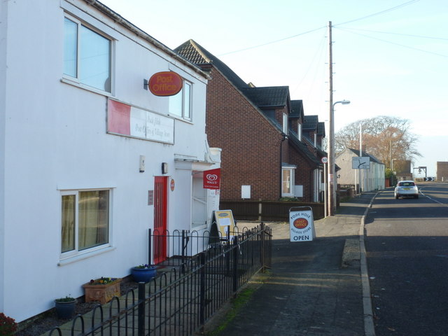
Pinchbeck has a range of amenities to cater to the needs of its population. It has a primary school, a medical practice, a post office, and several local shops and businesses. The village also has a community center, where various events and activities are organized for the locals.

Transportation in Pinchbeck is primarily reliant on road networks. The A16 road passes through the parish, connecting it to nearby towns and cities. Public transportation is available, with regular bus services connecting Pinchbeck to Spalding and other nearby areas.

The parish is also known for its historical landmarks. St Mary's Church, a Grade I listed building, is a notable feature of the village. It dates back to the 13th century and is known for its impressive architecture and stained glass windows.

Overall, Pinchbeck offers a rural and community-oriented lifestyle, with a blend of historical charm and modern amenities, making it an attractive place to live in Lincolnshire.

If you have any feedback on the listing, please let us know in the comments section below.
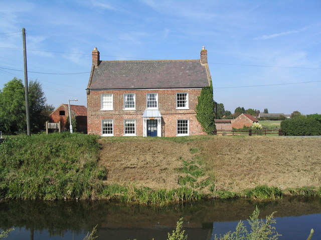
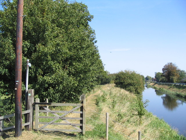
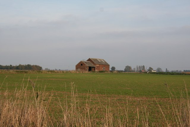
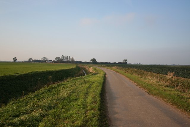
Pinchbeck Images

Images are sourced within 2km of 52.811403/-0.203456 or Grid Reference TF2125. Thanks to Geograph Open Source API. All images are credited.

Glass cats eye An odd thing in the middle of the road.  A solid glass lump with a raised centre section.  This must be the modern version of the old fashioned catseye.  A tricky thing to image, I did not fancy bending any lower in the middle of a busy road.
Glass cats eye
An odd thing in the middle of the road. A solid glass lump with a raised centre section. This must be the modern version of the old fashioned catseye. A tricky thing to image, I did not fancy bending any lower in the middle of a busy road.
Glass road reflector An odd thing in the middle of the road.  A solid glass lump with a raised centre section.  This must be the modern version of the old fashioned catseye.  A tricky thing to image, I did not fancy bending any lower in the middle of a busy road.
Glass road reflector
An odd thing in the middle of the road. A solid glass lump with a raised centre section. This must be the modern version of the old fashioned catseye. A tricky thing to image, I did not fancy bending any lower in the middle of a busy road.
Field at West Pinchbeck A 90 degree panorama of a fenland field.
Field at West Pinchbeck
A 90 degree panorama of a fenland field.
The Macmillan Way The footpath on the southern bank of the River Glen is part of a long distance footpath.  the bank, and the slipe below on the left, are a nature reserve managed by the Lincolnshire Wildlife Trust
The Macmillan Way
The footpath on the southern bank of the River Glen is part of a long distance footpath. the bank, and the slipe below on the left, are a nature reserve managed by the Lincolnshire Wildlife Trust
Glenside Mill, Pinchbeck West, Lincs built 1812, worked with wind until 1931 and by modern machinery until the late 1970s; has acquired a distinct lean <span class="nowrap"><a title="http://www.lincolnshire.gov.uk/windmills/section.asp?catId=3416" rel="nofollow ugc noopener" href="http://www.lincolnshire.gov.uk/windmills/section.asp?catId=3416">Link</a><img style="margin-left:2px;" alt="External link" title="External link - shift click to open in new window" src="https://s1.geograph.org.uk/img/external.png" width="10" height="10"/></span> .
Glenside Mill, Pinchbeck West, Lincs
built 1812, worked with wind until 1931 and by modern machinery until the late 1970s; has acquired a distinct lean LinkExternal link .
Stop that horse! Playground next to school off Leaves Lake Drove. Sign reads "No animals on this field"
Stop that horse!
Playground next to school off Leaves Lake Drove. Sign reads "No animals on this field"
Church of St Bartholomew, Pinchbeck West Built in the mid 19th century, in response to the Pinchbeck parish becoming too large.
Church of St Bartholomew, Pinchbeck West
Built in the mid 19th century, in response to the Pinchbeck parish becoming too large.
River Glen from bridge at Pinchbeck West View north-east. Roads run along both the north (left) and south banks. The former is much quieter.
River Glen from bridge at Pinchbeck West
View north-east. Roads run along both the north (left) and south banks. The former is much quieter.
The "Old Five Bells", Money Bridge, Pinchbeck West A fine Georgian? building, formerly an Inn
The "Old Five Bells", Money Bridge, Pinchbeck West
A fine Georgian? building, formerly an Inn
Macmillan Way along River Glen Part of the many miles of Macmillan Way along the River Glen
Macmillan Way along River Glen
Part of the many miles of Macmillan Way along the River Glen
Primitive Methodist Church, Northgate
Elmsford Archetypal fenland scene in South Lincolnshire. Fengate Road crosses the fen to Pinchbeck past a house called Elmsford
Elmsford
Archetypal fenland scene in South Lincolnshire. Fengate Road crosses the fen to Pinchbeck past a house called Elmsford
Guthram Tofts Isolated farm building near Guthram Tofts off Cross Lane
Guthram Tofts
Isolated farm building near Guthram Tofts off Cross Lane
Old Fen Lane Looking south west along Old Fen Lane towards Fenlands and Northgate
Old Fen Lane
Looking south west along Old Fen Lane towards Fenlands and Northgate
Northgate Mill Five storey tower mill built in 1848 on the site of a former post-mill, it ceased working in 1922 <span class="nowrap"><a title="http://www.lincolnshire.gov.uk/windmills/section.asp?catId=3417" rel="nofollow ugc noopener" href="http://www.lincolnshire.gov.uk/windmills/section.asp?catId=3417">Link</a><img style="margin-left:2px;" alt="External link" title="External link - shift click to open in new window" src="https://s1.geograph.org.uk/img/external.png" width="10" height="10"/></span>
Northgate Mill
Five storey tower mill built in 1848 on the site of a former post-mill, it ceased working in 1922 LinkExternal link
Peartree House, Money Bridge Lane
Northgate road and  Graft Drain Barrowby house on the right
Northgate road and Graft Drain
Barrowby house on the right
Little house at Cross Lane Farm Looking like a Doll's House next to the large barn and machinery.
Little house at Cross Lane Farm
Looking like a Doll's House next to the large barn and machinery.
Show me another place!

Pinchbeck is located at Grid Ref: TF2125 (Lat: 52.811403, Lng: -0.203456)

Administrative County: Lincolnshire

District: South Holland

Police Authority: Lincolnshire

What 3 Words

///catchers.powers.ordering. Near Pinchbeck, Lincolnshire

Nearby Locations

Pinchbeck

Related Wikis

Pinchbeck railway station

Pinchbeck railway station was a station in Pinchbeck, Lincolnshire, England on the line between Spalding and Sleaford. The station opened in 1882, closed...

Pinchbeck, Lincolnshire

Pinchbeck is a village and civil parish in the South Holland district of Lincolnshire, England. The civil parish population was 5,153 at the 2001 census...

Pode Hole

Pode Hole is a village in South Holland, Lincolnshire, England. It is 2 miles (3.2 km) from Spalding and a similar distance from Bourne. The village lies...

North Drove railway station

North Drove railway station was a station serving Pode Hole in Lincolnshire, England. It was on the route of the Spalding and Bourne Railway (opened 1866...

Nearby Amenities

Located within 500m of 52.811403,-0.203456
Bus Stop
Money Bridge Lane
Naptan AtcoCode: 270000010591
Naptan Bearing: NE
Naptan CommonName: Money Bridge Lane
Naptan Indicator: opp
Naptan Landmark: Money Bridge Lane
Naptan NaptanCode: linjpagd
Naptan Street: Glenside South
Naptan Verified: no
Source: naptan_import
Lat/Long: 52.8137087/-0.1985274
Bus Stop
Money Bridge Lane
Naptan AtcoCode: 2700LWPM5071
Naptan Bearing: SW
Naptan CommonName: Money Bridge Lane
Naptan Indicator: adj
Naptan Landmark: Money Bridge Lane
Naptan NaptanCode: lindpmpg
Naptan Street: Glenside South
Naptan Verified: no
Source: naptan_import
Lat/Long: 52.8135818/-0.1984585
Money Bridge Farm
Place: farm
Source: OS OpenData StreetView
Lat/Long: 52.8119569/-0.2023814
Addr Housename: Glen Lodge
Lat/Long: 52.8113728/-0.208744
Addr Housename: Glenside Cottage
Lat/Long: 52.8114937/-0.2040211
Glen Lodge
Place: isolated_dwelling
Lat/Long: 52.8113743/-0.2088261
The Rowans
Place: isolated_dwelling
Lat/Long: 52.8102589/-0.2094162
Demolished Power: tower
Material: wood
Lat/Long: 52.8148112/-0.2075064
The data included in this document is from www.openstreetmap.org. The data is made available under ODbL.

Have you been to Pinchbeck?

Leave your review of Pinchbeck below (or comments, questions and feedback).