Penistone

Civil Parish in Yorkshire Barnsley

England

Penistone

Disused quarry Disused quarry, off High Bank Lane, Thurlstone, South Yorkshire.
Disused quarry Credit: Dave Pickersgill

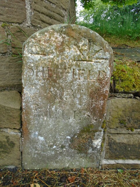
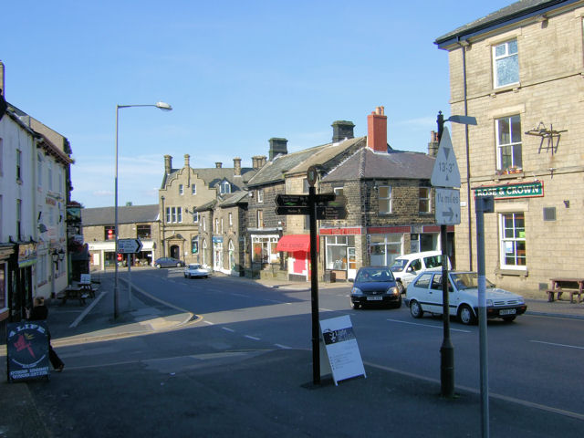
Penistone is a civil parish located in the metropolitan borough of Barnsley, South Yorkshire, England, in the historic county of Yorkshire. It is situated on the eastern edge of the Pennines, approximately 8 miles west of Barnsley and 17 miles north of Sheffield. The parish covers an area of about 17 square miles and has a population of around 10,000 people.

The area is known for its rich history, dating back to the Roman times, with evidence of settlements and mining activities. The name Penistone is believed to have derived from the Celtic word for "hill" or "fortress," reflecting the hilly nature of the terrain. The town is also famous for its historic market, which has been held every Thursday since 1699, attracting locals and visitors alike.

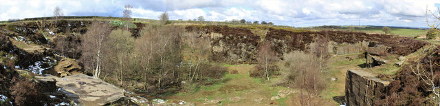
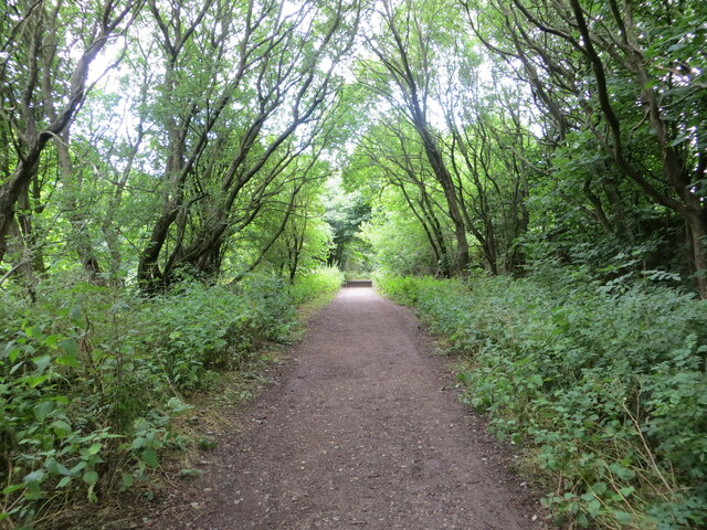
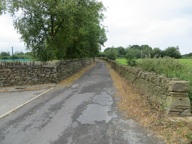
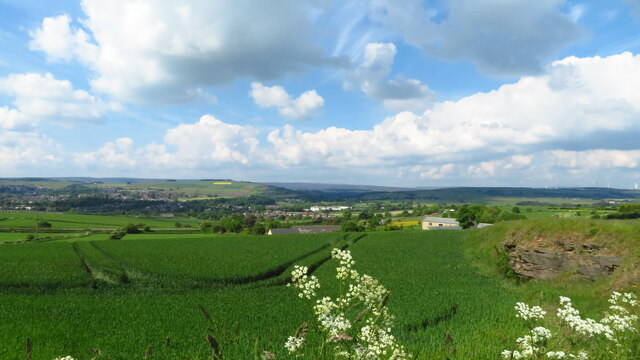
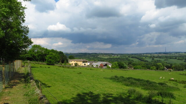
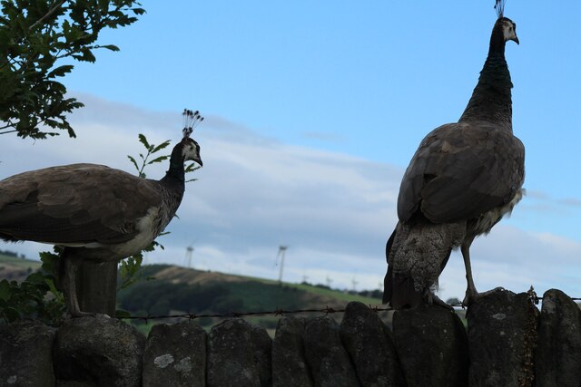
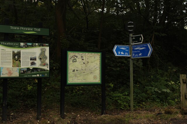
The landscape surrounding Penistone is characterized by rolling hills, picturesque countryside, and charming stone-built houses. The area offers numerous outdoor recreational activities, including walking, cycling, and hiking, with beautiful trails such as the Trans Pennine Trail passing through the town.

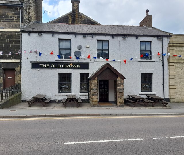
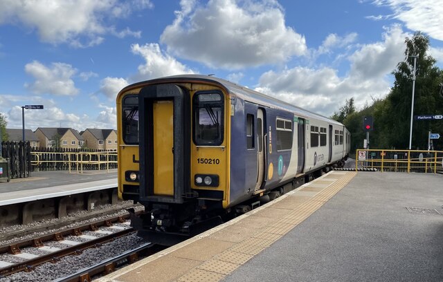
Penistone is well-connected to major cities in the region, with a railway station providing regular services to Sheffield, Huddersfield, and Leeds. The town also has a variety of amenities, including shops, pubs, restaurants, and schools, making it an attractive place to live.

Overall, Penistone is a vibrant and picturesque civil parish with a rich history, stunning landscapes, and a close-knit community. It offers a peaceful and idyllic setting for residents and visitors to enjoy the beauty of the Yorkshire countryside.

If you have any feedback on the listing, please let us know in the comments section below.
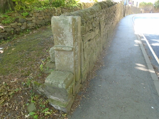
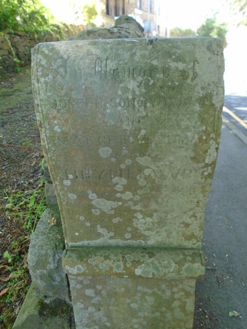
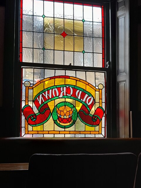
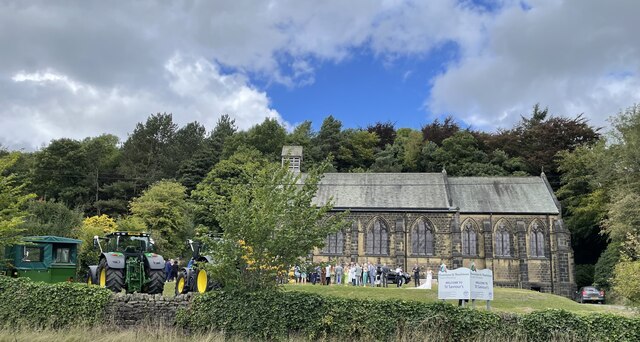
Penistone Images

Images are sourced within 2km of 53.529321/-1.640531 or Grid Reference SE2303. Thanks to Geograph Open Source API. All images are credited.

Disused quarry Disused quarry, off High Bank Lane, Thurlstone, South Yorkshire.
Disused quarry
Disused quarry, off High Bank Lane, Thurlstone, South Yorkshire.
Old milestone On the A628 approaching Penistone this 'listed' milestone from the 32 mile long Doncaster to Saltersbrook turnpike is next to the bus-stop.   A new town sign has recently been erected close by.  Repainted in 2016, it would now benefit from a good wash down to remove dirt thrown up by passing lorries and other heavy traffic.
Old milestone
On the A628 approaching Penistone this 'listed' milestone from the 32 mile long Doncaster to Saltersbrook turnpike is next to the bus-stop. A new town sign has recently been erected close by. Repainted in 2016, it would now benefit from a good wash down to remove dirt thrown up by passing lorries and other heavy traffic.
Old milestone This milestone is on the south side of the road on the one way system down Church Street in Penistone.  It is under a large tree and must have been painted very many years ago judging by the remnants of white paint.  It is similar to the old stone <a href="https://www.geograph.org.uk/photo/7199866">SK3099 : Old milestone</a> down the passageway in Wortley, but slightly wider.  It is another stone for the benchmark enthusiasts.

Milestone Society National ID: YS_SFPN13
Old milestone
This milestone is on the south side of the road on the one way system down Church Street in Penistone. It is under a large tree and must have been painted very many years ago judging by the remnants of white paint. It is similar to the old stone SK3099 : Old milestone down the passageway in Wortley, but slightly wider. It is another stone for the benchmark enthusiasts. Milestone Society National ID: YS_SFPN13
Old milestone The tollroad from Huddersfield to Penistone leaves West Yorkshire just north of Ingbirchworth on the A629.   It enters South Yorkshire and dips down into the town on the B6462, still called Huddersfield Road.   This original tollroad stone 12 miles from Huddersfield is at the top of the hill above the Grammar School.   Grade II listed 1315077.
Old milestone
The tollroad from Huddersfield to Penistone leaves West Yorkshire just north of Ingbirchworth on the A629. It enters South Yorkshire and dips down into the town on the B6462, still called Huddersfield Road. This original tollroad stone 12 miles from Huddersfield is at the top of the hill above the Grammar School. Grade II listed 1315077.
Old milestone The pre-turnpike era milestone on Huddersfield Road, B6462, can just be seen in the wall almost opposite the second spot of sunshine.  The eroded legends are LONDON/177/Miles/Huddersfield/12/Penistone/1½  (6044122).   However the turnpike milestone a little further north (7226692) has the legends Huddersfield 12, Penistone ½ so the datum points in Penistone are different. The end stone is a memorial stone.
Old milestone
The pre-turnpike era milestone on Huddersfield Road, B6462, can just be seen in the wall almost opposite the second spot of sunshine. The eroded legends are LONDON/177/Miles/Huddersfield/12/Penistone/1½ (6044122). However the turnpike milestone a little further north (7226692) has the legends Huddersfield 12, Penistone ½ so the datum points in Penistone are different. The end stone is a memorial stone.
Memorial stone The memorial stone on Huddersfield Road, B6462, is to Joseph son of William and Margaret ? late of BRYNMAWR.   A connection to Penistone or the stone transported from Wales for some reason.
Memorial stone
The memorial stone on Huddersfield Road, B6462, is to Joseph son of William and Margaret ? late of BRYNMAWR. A connection to Penistone or the stone transported from Wales for some reason.
Woodland footpath giving access to Royd Moor Reservoir Looking north-westward.
Woodland footpath giving access to Royd Moor Reservoir
Looking north-westward.
Wall enclosed Long Lane near Penistone Grammar School Looking westward. The school playing fields are on both sides of the road.
Wall enclosed Long Lane near Penistone Grammar School
Looking westward. The school playing fields are on both sides of the road.
In the Inn The Old Crown, Penistone is one of my favourite British pubs.
In the Inn
The Old Crown, Penistone is one of my favourite British pubs.
The Old Crown Been in here a few times!
The Old Crown
Been in here a few times!
The 12:19 arrives at Penistone railway station
St. Saviour's Church, Thurlstone
Kibble Brewery, Thurlstone Located in old stables in the car park of the Crystal Palace.
Kibble Brewery, Thurlstone
Located in old stables in the car park of the Crystal Palace.
Ordnance Survey Cut Mark This mark can be found on a gatepost beside Royd Moor Road, Royd Moor.
The recorded details give a height of 261.5855 metres above sea level.
For more detail see : <span class="nowrap"><a title="https://www.bench-marks.org.uk/bm91414" rel="nofollow ugc noopener" href="https://www.bench-marks.org.uk/bm91414">Link</a><img style="margin-left:2px;" alt="External link" title="External link - shift click to open in new window" src="https://s1.geograph.org.uk/img/external.png" width="10" height="10"/></span>
Ordnance Survey Cut Mark
This mark can be found on a gatepost beside Royd Moor Road, Royd Moor. The recorded details give a height of 261.5855 metres above sea level. For more detail see : LinkExternal link
View towards Penistone from Hoylandswaine Trig Point
On path leading west towards Cat Hill Farm, Cat Hill
Millhouse Green Some rather exotic birds at a farm at Millhouse Green looking towards the windmills on the hill.
Millhouse Green
Some rather exotic birds at a farm at Millhouse Green looking towards the windmills on the hill.
Trans Pennine Trail I'd forgotten the location of this image, luckily the council had kindly marked it on top of the signpost.
Trans Pennine Trail
I'd forgotten the location of this image, luckily the council had kindly marked it on top of the signpost.
Show me another place!

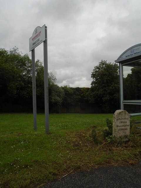
Penistone is located at Grid Ref: SE2303 (Lat: 53.529321, Lng: -1.640531)

Division: West Riding

Administrative County: South Yorkshire

District: Barnsley

Police Authority: South Yorkshire

What 3 Words

///richer.moisture.vegetable. Near Penistone, South Yorkshire

Related Wikis

Penistone Grammar School

Penistone Grammar School (PGS) is a co-educational comprehensive secondary school and sixth form located in Penistone, South Yorkshire, England. Founded...

Penistone Rural District

Penistone Rural District was a rural district in the West Riding of Yorkshire. It was named after but did not contain Penistone. The town itself was contained...

Saint John the Baptist Church, Penistone

Saint John the Baptist Church, Penistone Parish Church, or Penistone Church is a Church of England church in the Parish of Penistone, near Barnsley, in...

Penistone

Penistone ( PEN-iss-tən) is a market town and civil parish in the Metropolitan Borough of Barnsley, South Yorkshire, England, which had a population of...

Nearby Amenities

Located within 500m of 53.529321,-1.640531
Traffic Signals
Traffic Signals: signal
Traffic Signals Direction: forward
Lat/Long: 53.5288638/-1.6339534
Noexit: yes
Lat/Long: 53.528826/-1.6389178
Bus Stop
Thurlstone Road/Stottercliffe Road
Bench: yes
Bin: no
Bus: yes
Naptan AtcoCode: 370055130
Naptan Bearing: SW
Naptan CommonName: Thurlstone Road/Stottercliffe Road
Naptan Indicator: 55130
Naptan Landmark: 55130
Naptan PlusbusZoneRef: ROTHCEN
Naptan Street: Thurlstone Road
Naptan Verified: no
Public Transport: platform
Shelter: yes
Source: naptan_import
Lat/Long: 53.5274143/-1.6451031
Bus Stop
Thurlstone Road/Saunderson Road
Bench: yes
Bin: no
Bus: yes
Lit: no
Naptan AtcoCode: 370055132
Naptan Bearing: SW
Naptan CommonName: Thurlstone Road/Saunderson Road
Naptan Indicator: 55132
Naptan Landmark: ROAD JUCTION
Naptan PlusbusZoneRef: ROTHCEN
Naptan Street: Thurlstone Road
Naptan Verified: no
Public Transport: platform
Shelter: yes
Source: naptan_import
Tactile Paving: no
Lat/Long: 53.528588/-1.641022
Bus Stop
Thurlstone Road/Talbot Road
Bench: no
Bin: no
Bus: yes
Lit: yes
Naptan AtcoCode: 370055141
Naptan Bearing: W
Naptan CommonName: Thurlstone Road/Talbot Road
Naptan Indicator: 55141
Naptan Landmark: TRAFFIC LIGHTS
Naptan PlusbusZoneRef: ROTHCEN
Naptan Street: Thurlstone Road
Naptan Verified: no
Public Transport: platform
Shelter: no
Source: naptan_import
Tactile Paving: no
Lat/Long: 53.5287678/-1.6355023
Bus Stop
Thurlstone Road/Saunderson Road
Bench: no
Bin: no
Bus: yes
Lit: no
Naptan AtcoCode: 370051002
Naptan Bearing: NE
Naptan CommonName: Thurlstone Road/Saunderson Road
Naptan Indicator: 51002
Naptan Landmark: OPEN VIEWS
Naptan PlusbusZoneRef: ROTHCEN
Naptan Street: Thurlstone Road
Naptan Verified: no
Public Transport: platform
Shelter: no
Source: naptan_import
Tactile Paving: no
Lat/Long: 53.5287901/-1.6408145
Bus Stop
Thurlstone Road/Stottercliffe Road
Bench: no
Bin: no
Bus: yes
Naptan AtcoCode: 370051003
Naptan Bearing: NE
Naptan CommonName: Thurlstone Road/Stottercliffe Road
Naptan Indicator: 51003
Naptan Landmark: ROAD JUNCTION
Naptan PlusbusZoneRef: ROTHCEN
Naptan Street: Thurlstone Road
Naptan Verified: no
Public Transport: platform
Shelter: no
Source: naptan_import
Lat/Long: 53.5278166/-1.6443455
Bus Stop
Barnsley Road/Huddersfield Road
Alt Name: Barnsley Road/Huddersfield Road
Bus: yes
Naptan AltCommonName: Barnsley Road/Huddersfield Road
Naptan AtcoCode: 370051019
Naptan Bearing: NE
Naptan CommonName: Barnsley Road/Huddersfield Road
Naptan Indicator: 51019
Naptan Landmark: 51019
Naptan PlusbusZoneRef: ROTHCEN
Naptan Street: Barnsley Road
Naptan Verified: yes
Physically Present: no
Public Transport: platform
Source: naptan_import
Lat/Long: 53.5291919/-1.6340405
Bus Stop
Huddersfield Road/Barnsley Road
Alt Name: Huddersfield Road/Barnsley Road
Bench: no
Bin: no
Bus: yes
Departures Board: timetable
Lit: no
Naptan AltCommonName: Huddersfield Road/Barnsley Road
Naptan AtcoCode: 370056143
Naptan Bearing: NW
Naptan CommonName: Huddersfield Road/Barnsley Road
Naptan Indicator: 56143
Naptan Landmark: OPPOSITE NETHER CROFT/BELOW P.
Naptan PlusbusZoneRef: ROTHCEN
Naptan Street: Huddersfield Road
Naptan Verified: yes
Public Transport: platform
Shelter: no
Source: naptan_import
Tactile Paving: no
Lat/Long: 53.5303386/-1.6344814
Bus Stop
Thurlstone Road/Talbot Road
Bench: no
Bin: no
Bus: yes
Lit: no
Naptan AtcoCode: 370051022
Naptan Bearing: E
Naptan CommonName: Thurlstone Road/Talbot Road
Naptan Indicator: 51022
Naptan Landmark: CARAVANS PARKED
Naptan PlusbusZoneRef: ROTHCEN
Naptan Street: Thurlstone Road
Naptan Verified: no
Public Transport: platform
Shelter: no
Source: naptan_import
Tactile Paving: no
Lat/Long: 53.5288796/-1.6353594
Penistone Grammar School Bus Park
Naptan AtcoCode: 370055925
Naptan Bearing: NE
Naptan BusStopType: CUS
Naptan CommonName: Penistone Grammar School Bus Park
Naptan Indicator: 55925
Naptan Landmark: 55925
Naptan PlusbusZoneRef: ROTHCEN
Naptan Street: Penistone Grammar School Bus Park
Naptan Verified: no
Source: naptan_import
Lat/Long: 53.5329226/-1.6362695
Traffic Signals
Traffic Signals: signal
Traffic Signals Direction: forward
Lat/Long: 53.5289354/-1.6342233
Give Way
Direction: forward
Lat/Long: 53.5295604/-1.6336403
Barrier: stile
Lat/Long: 53.5297009/-1.6475643
Waterway: weir
Lat/Long: 53.5282074/-1.6433636
Entrance: secondary
Lat/Long: 53.5323243/-1.6358583
Bridge End
Place: suburb
Lat/Long: 53.529201/-1.6347211
Source: survey
Lat/Long: 53.5286258/-1.6341727
Source: survey
Lat/Long: 53.5285255/-1.6341692
Source: survey
Lat/Long: 53.5285283/-1.6339388
Source: survey
Lat/Long: 53.528564/-1.63394
Source: survey
Lat/Long: 53.5285647/-1.6338834
Source: survey
Lat/Long: 53.5284864/-1.6338807
Source: survey
Lat/Long: 53.5284888/-1.6336848
Source: survey
Lat/Long: 53.5284301/-1.6336828
Source: survey
Lat/Long: 53.5284313/-1.6335873
Source: survey
Lat/Long: 53.5284846/-1.6335891
Source: survey
Lat/Long: 53.5284849/-1.6335659
Source: survey
Lat/Long: 53.528551/-1.6335682
Source: survey
Lat/Long: 53.5285498/-1.6336621
Source: survey
Lat/Long: 53.5285479/-1.6338135
Source: survey
Lat/Long: 53.5286453/-1.6338169
Source: survey
Lat/Long: 53.5286466/-1.6337119
Source: survey
Lat/Long: 53.5287036/-1.6337139
Source: survey
Lat/Long: 53.5287002/-1.6339905
Source: survey
Lat/Long: 53.5286499/-1.6339887
Source: survey
Lat/Long: 53.5288405/-1.634216
Source: survey
Lat/Long: 53.528733/-1.634227
Source: survey
Lat/Long: 53.5288305/-1.6340376
Entrance: staircase
Lat/Long: 53.5298826/-1.6336937
Surface: sett
Traffic Calming: bump
Lat/Long: 53.5272331/-1.6349466
Post Box
Collection Plate Date: 2019-05-07
Collection Times: Mo-Fr 09:00; Sa 07:00
Operator: Royal Mail
Post Box Type: lamp
Ref: S36 157D
Royal Cypher: EIIR
Royal Cypher Wikidata: Q33102113
Source: survey
Lat/Long: 53.5287487/-1.6335377
Waste Basket
Check Date: 2023-09-19
Lat/Long: 53.528777/-1.633552
Bench
Backrest: yes
Check Date: 2023-09-19
Lat/Long: 53.528803/-1.6335601
Bench
Backrest: yes
Check Date: 2023-09-19
Lat/Long: 53.528855/-1.6335997
Defibrillator
Access: yes
Colour: yellow
Defibrillator Location: wall
Description: Penistone Leisure Centre
Emergency: defibrillator
Indoor: no
Opening Hours: 24/7
Ref: SCPAD047
Source: survey
Support: wall
Survey Date: 2021-12-12
Lat/Long: 53.5294836/-1.6384846
Compressed Air
Access: customers
Charge: 0.50 GBP
Covered: no
Currency GBP: yes
Fee: yes
Lit: yes
Notes: 4 minutes per transaction
Operator: Texaco
Payment Coins: yes
Lat/Long: 53.5296342/-1.6338918
Bench
Backrest: yes
Material: wood
Lat/Long: 53.5296427/-1.63369
Waste Basket
Material: metal
Lat/Long: 53.5296325/-1.6336546
Waste Basket
Material: metal
Lat/Long: 53.5325296/-1.6366847
Waste Basket
Material: metal
Lat/Long: 53.5317841/-1.6361622
Barrier: lift_gate
Motor Vehicle: designated
Lat/Long: 53.5287192/-1.634024
St Mary's Well
Covered: yes
Man Made: water_well
Pump: no
Lat/Long: 53.528491/-1.6332904
Power: substation
Substation: gas
Lat/Long: 53.5270996/-1.6354789
Crossing: informal
Lat/Long: 53.5286374/-1.6407019
CD Autos
Addr City: Sheffield
Addr Postcode: S36 6DT
Addr Street: St Mary's Street
Addr Suburb: Penistone
Shop: car_repair
Lat/Long: 53.526598/-1.6345935
Barrier: lift_gate
Motor Vehicle: private
Lat/Long: 53.5283754/-1.6437133
Barrier: lift_gate
Motor Vehicle: private
Lat/Long: 53.5278464/-1.6452285
Barrier: cycle_barrier
Lat/Long: 53.526673/-1.6349172
Entrance: yes
Lat/Long: 53.5324401/-1.6354272
Traffic Signals
Traffic Signals: signal
Traffic Signals Direction: backward
Lat/Long: 53.5290517/-1.634025
Barrier: stile
Material: stone
Step Count: 3
Stile: stepover
Lat/Long: 53.527996/-1.6450294
Power: pole
Lat/Long: 53.5249765/-1.6411091
Power: pole
Lat/Long: 53.5259351/-1.6418827
Power: pole
Lat/Long: 53.5254301/-1.6414782
Power: pole
Lat/Long: 53.5258216/-1.6443352
Power: pole
Lat/Long: 53.5258844/-1.6429794
Shelter
Bench: yes
Shelter Type: weather_shelter
Lat/Long: 53.5324362/-1.6367395
Recycling
Recycling Type: container
Lat/Long: 53.5322576/-1.6366966
Recycling
Recycling Type: container
Lat/Long: 53.532265/-1.6367
Noexit: yes
Lat/Long: 53.5281795/-1.6357888
Penistone Wire
Addr City: Sheffield
Addr Parentstreet: Talbot Road
Addr Postcode: S36 9ED
Addr Street: Stanley Mills
Addr Suburb: Penistone
Lat/Long: 53.5277901/-1.6360318
Entrance: main
Lat/Long: 53.529485/-1.6384489
Surface: paving_stones
Traffic Calming: table
Lat/Long: 53.5294544/-1.6384461
Entrance: emergency
Lat/Long: 53.5296751/-1.6387246
Barrier: stile
Stile: stepover
Lat/Long: 53.5307464/-1.6383548
Parking
Access: private
Lat/Long: 53.5261091/-1.6394863
Bench
Backrest: yes
Lat/Long: 53.5274521/-1.645607
Bench
Backrest: no
Lat/Long: 53.5256633/-1.6371532
Bench
Backrest: no
Lat/Long: 53.5266556/-1.6361404
Bench
Backrest: yes
Lat/Long: 53.5294385/-1.6408697
Bench
Backrest: yes
Lat/Long: 53.5274766/-1.6449806
Barrier: kissing_gate
Lat/Long: 53.5264945/-1.6395233
Watering Place
Lat/Long: 53.5285052/-1.6333193
Marker: aerial
Lat/Long: 53.5298239/-1.6367405
Marker: aerial
Lat/Long: 53.5289615/-1.636614
Marker: aerial
Lat/Long: 53.5300306/-1.6367661
Marker: aerial
Lat/Long: 53.5320123/-1.6383691
Bus: yes
Public Transport: stop_position
Lat/Long: 53.5284891/-1.6330925
Bus: yes
Public Transport: stop_position
Lat/Long: 53.5291845/-1.6339323
Bus: yes
Public Transport: stop_position
Lat/Long: 53.5303602/-1.6344293
Nicholas Saunderson
Artwork Type: relief
Tourism: artwork
Lat/Long: 53.5272806/-1.6446186
Source: survey
Lat/Long: 53.5286185/-1.6335823
Defibrillator
Access: yes
Defibrillator Location: On outside wall.
Emergency: defibrillator
Indoor: no
Lat/Long: 53.5284841/-1.6429718
Crossing: informal
Lat/Long: 53.5327459/-1.6397369
Parking
Access: private
Capacity: 2
Capacity Disabled: 2
Fee: no
Parking: surface
Surface: asphalt
Lat/Long: 53.5331235/-1.6381846
Crossing
Crossing: unmarked
Crossing Island: no
Crossing Markings: no
Tactile Paving: yes
Lat/Long: 53.5305464/-1.6345967
The data included in this document is from www.openstreetmap.org. The data is made available under ODbL.

Have you been to Penistone?

Leave your review of Penistone below (or comments, questions and feedback).