Partington

Civil Parish in Cheshire Trafford

England

Partington

The Black Swan
The Black Swan Credit: Mick Garratt

Partington is a civil parish located in the county of Cheshire, England. It is situated approximately 10 miles southwest of Manchester city centre and is bordered by the River Mersey to the north. With a population of around 7,000 residents, it is a relatively small parish covering an area of approximately 2 square miles.

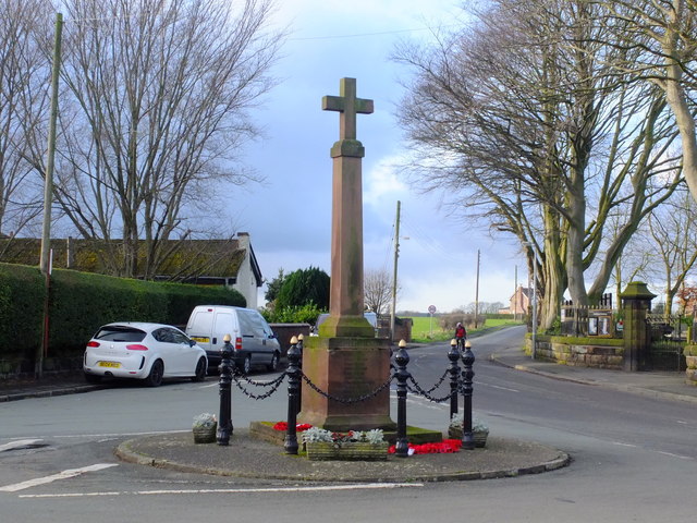
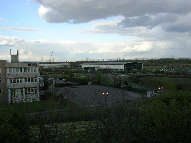
Partington has a rich history, with evidence of human settlement dating back to the Roman period. The parish was predominantly agricultural until the 19th century, when the construction of the Manchester Ship Canal brought industrial development to the area. The canal provided a vital transport link for the transportation of goods and raw materials, leading to the establishment of factories and warehouses.

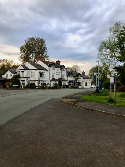
Today, Partington is a vibrant community with a range of amenities and services. The parish has several schools, including primary and secondary schools, as well as a library, community center, and sports facilities. There are also numerous shops, restaurants, and pubs, providing residents with a variety of options for shopping and socializing.

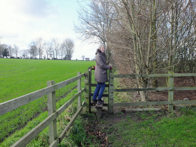
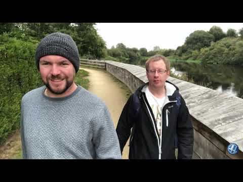
The natural beauty of the area is another highlight of Partington. The parish is surrounded by green spaces, including parks and nature reserves, providing opportunities for outdoor activities and leisure. The nearby Trans Pennine Trail offers scenic walking and cycling routes, while the proximity to the River Mersey allows for boating and fishing.

In summary, Partington is a picturesque civil parish in Cheshire, offering a balance of history, industry, and natural beauty. It is a welcoming community with a range of amenities and a strong sense of local pride.

If you have any feedback on the listing, please let us know in the comments section below.

Partington Images

Images are sourced within 2km of 53.41796/-2.427767 or Grid Reference SJ7191. Thanks to Geograph Open Source API. All images are credited.

The Black Swan
The Black Swan
Stile near Mount Pleasant Farm
Cross at Hollins Green
St Helen's Church St Helen's Church and Church Hall in Hollinfare.
St Helen's Church
St Helen's Church and Church Hall in Hollinfare.
The Black Swan The Black Swan public house in Hollinfare.
The Black Swan
The Black Swan public house in Hollinfare.
Old Milestone by Manchester Road, Hollins Green Carved stone post by the UC road (was A57), in parish of RIXTON WITH GLAZEBROOK (WARRINGTON District), Manchester Road, Hollins Green; opposite Ye Olde Red Lion in garden of No. 505, partially covered by shrubs, on East side of road. Warrington flat top, erected by the Warrington & Lower Irlam turnpike trust in the 19th century. 

Inscription reads:-
: TO / WARRINGTON / 8 / MILES : : TO / MANCHESTER / 12 :

Grade II Listed. List Entry Number: 1392448
<span class="nowrap"><a title="https://historicengland.org.uk/listing/the-list/list-entry/1392448" rel="nofollow ugc noopener" href="https://historicengland.org.uk/listing/the-list/list-entry/1392448">Link</a><img style="margin-left:2px;" alt="External link" title="External link - shift click to open in new window" src="https://s1.geograph.org.uk/img/external.png" width="10" height="10"/></span>

Milestone Society National ID: LA_WAMA06
Old Milestone by Manchester Road, Hollins Green
Carved stone post by the UC road (was A57), in parish of RIXTON WITH GLAZEBROOK (WARRINGTON District), Manchester Road, Hollins Green; opposite Ye Olde Red Lion in garden of No. 505, partially covered by shrubs, on East side of road. Warrington flat top, erected by the Warrington & Lower Irlam turnpike trust in the 19th century. Inscription reads:- : TO / WARRINGTON / 8 / MILES : : TO / MANCHESTER / 12 : Grade II Listed. List Entry Number: 1392448 LinkExternal link Milestone Society National ID: LA_WAMA06
Hollins Green - Ye Olde Red Lion Pub
Hollins Green Panorama
Hollins Green - The Black Swan Pub
Junction of the B5212 with the A57 at Hollinfare The OS map shows the junction in the next square to the east... but getamap shows it in this square.
Junction of the B5212 with the A57 at Hollinfare
The OS map shows the junction in the next square to the east... but getamap shows it in this square.
Hollins Green road junction on the A57
Road Junction This image was taken from SJ 728862 89926 looking west. At this junction three roads converge. Sinderland Lane comes in from the north (bottom right of picture), Gorsey Lane heads south (to the left of shot) and Moss Lane heads away east (top right of shot). The typical corn field can be seen to the left of Moss Lane.
Road Junction
This image was taken from SJ 728862 89926 looking west. At this junction three roads converge. Sinderland Lane comes in from the north (bottom right of picture), Gorsey Lane heads south (to the left of shot) and Moss Lane heads away east (top right of shot). The typical corn field can be seen to the left of Moss Lane.
Irlam Station From the Manchester bound platform
Irlam Station
From the Manchester bound platform
Irlam Railway Station
Northbank Industrial Estate, Cadishead, Irlam, Manchester This estate occupies the site of a former steelworks and covers about half of this square. The industrial units seen are typical of this sort of development. The photo shows the view to the NE, the distant hills are the Pennines above Tameside.
Northbank Industrial Estate, Cadishead, Irlam, Manchester
This estate occupies the site of a former steelworks and covers about half of this square. The industrial units seen are typical of this sort of development. The photo shows the view to the NE, the distant hills are the Pennines above Tameside.
Partington Oil Terminal and Manchester Ship Canal This oil terminal is situated on the south bank of the Manchester Ship Canal. The canal is the major feature of this square and has developed a large population of swans now large, ocean-going vessels   use the canal less frequently following the closure of Salford and Manchester Docks.
Partington Oil Terminal and Manchester Ship Canal
This oil terminal is situated on the south bank of the Manchester Ship Canal. The canal is the major feature of this square and has developed a large population of swans now large, ocean-going vessels use the canal less frequently following the closure of Salford and Manchester Docks.
Footbridge over Glaze Brook This bridge connects Cadishead, in Salford, with Glazebrook, Warrington. Taken from SJ 701 922
Footbridge over Glaze Brook
This bridge connects Cadishead, in Salford, with Glazebrook, Warrington. Taken from SJ 701 922
A6144 The view SW down the A6144. Broadoak School Entrance can be seen on the left.
A6144
The view SW down the A6144. Broadoak School Entrance can be seen on the left.
Show me another place!

Partington is located at Grid Ref: SJ7191 (Lat: 53.41796, Lng: -2.427767)

Administrative County: Greater Manchester

District: Trafford

Police Authority: Greater Manchester

What 3 Words

///mondays.pleaser.person. Near Partington, Manchester

Nearby Locations

Partington Partington

Related Wikis

Partington

Partington is a town and civil parish in the Metropolitan Borough of Trafford, Greater Manchester, England, ten miles (16 km) south-west of Manchester...

Broadoak School

Broadoak School is a coeducational secondary school with academy status located in Partington in the English county of Greater Manchester.Previously a...
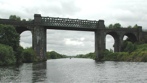
Cadishead Viaduct

Cadishead Viaduct is a disused railway viaduct of multi-lattice girder construction. It was built in 1892 by the Cheshire Lines Committee to clear the...

Partington railway station

Partington railway station was situated on the Cheshire Lines Committee route between Warrington and Stockport. It served the locality between 1874 and...

Cadishead

Cadishead is a village in the City of Salford in Greater Manchester, England, with a population of 10,739 in 2014. Within the historic county of Lancashire...

Cadishead railway station

Cadishead railway station was a railway station on the Cheshire Lines Committees Glazebrook East Junction to Skelton Junction Line serving the village...

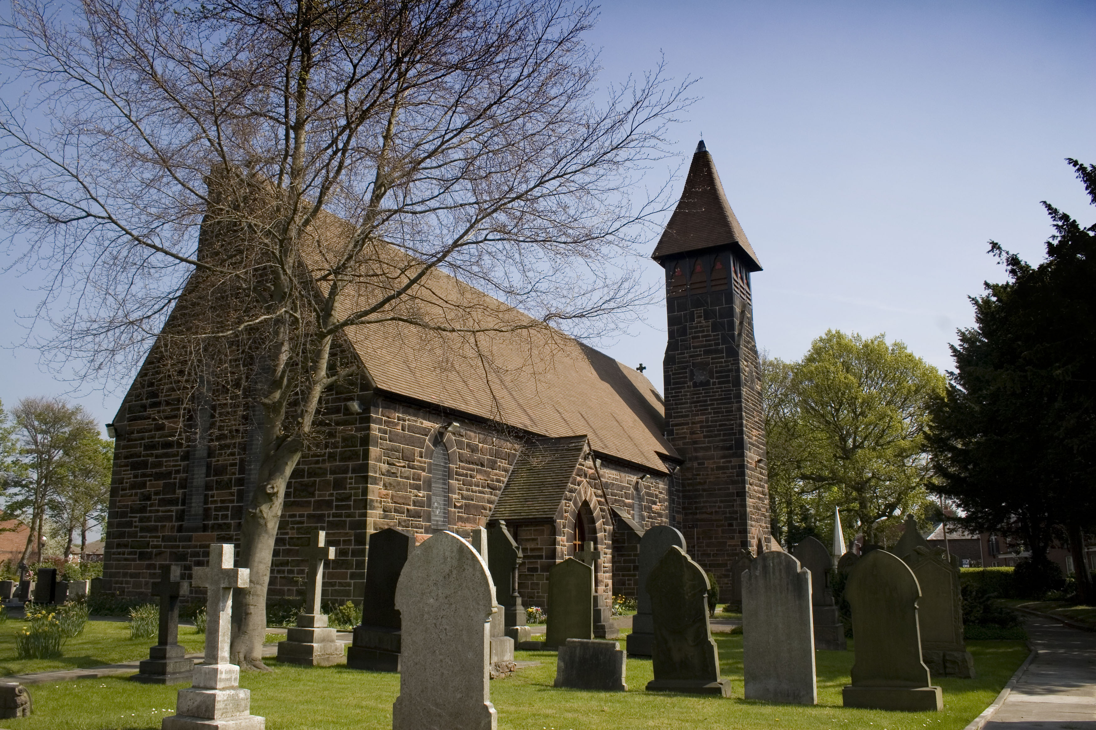
St George's Church, Carrington

St George's Church is in the village of Carrington, Trafford, Greater Manchester, England. It is recorded in the National Heritage List for England as...

Irlam railway station

Irlam railway station in Irlam, Greater Manchester, England, is 8+3⁄4 miles (14.1 km) west of Manchester Oxford Road on the Manchester to Liverpool Line...

Related Videos

Cadishead Beach

Cadishead Beach 🗺️ (53.4178954, -2.4491217) Walking distance from entrance 0.2 mile #cadisheadbeach #cadishead ...

Quick chat & run down of vlog | Vlog with the dog. Walking with Reggie. Irlam & Cadishead fields.

Just briefly chatting about what I will talk about in up and coming vlogs when it comes to my mental health. Nothing professional ...

Signal Yard and Signal Box at Irlam

A quick visit to Irlam to see the signal yard and box.

Nearby Amenities

Located within 500m of 53.41796,-2.427767
Partington
Is In: Trafford, Greater Manchester, England, UK
Name Ur: پارٹنگٹن
Place: town
Population: 7327
Source: npe
Wikidata: Q1615943
Wikipedia: en:Partington
Lat/Long: 53.4176692/-2.4297668
Mini Roundabout
Direction: clockwise
Lat/Long: 53.4199526/-2.4253787
Mini Roundabout
Direction: clockwise
Lat/Long: 53.4191807/-2.4271031
Bus Stop
Central Road/Health Centre
Bus: yes
Naptan AtcoCode: 1800SJ03671
Naptan Bearing: NW
Naptan CommonName: Central Road/Health Centre
Naptan Indicator: Health Centre
Naptan Landmark: HEALTH CENTRE
Naptan NaptanCode: manjpgtg
Naptan PlusbusZoneRef: MNCRPIC
Naptan ShortCommonName: Health Centre
Naptan Street: CENTRAL ROAD
Naptan Verified: no
Network: TfGM
Public Transport: platform
Route Ref: 260
Source: naptan_import
Lat/Long: 53.4187996/-2.4265735
Warburton Lane/Greyhound
Naptan AtcoCode: 1800SJ03691
Naptan Bearing: N
Naptan CommonName: Warburton Lane/Greyhound
Naptan Indicator: Os House 8
Naptan Landmark: OS HOUSE 8
Naptan NaptanCode: manjpgtm
Naptan PlusbusZoneRef: MNCRPIC
Naptan ShortCommonName: Greyhound
Naptan Street: WARBURTON LANE
Naptan Verified: no
Note: NaPTAN bus stop not present on ground
Source: naptan_import
Lat/Long: 53.4195084/-2.4277439
Bus Stop
Partington, Warburton Lane / near Redbrook Road
Bus: yes
Naptan AtcoCode: 1800SJ47981
Naptan Bearing: N
Naptan CommonName: Warburton Lane/Redbrook Road
Naptan Indicator: Os House 17
Naptan Landmark: HOUSE 17
Naptan NaptanCode: manjtpma
Naptan PlusbusZoneRef: MNCRPIC
Naptan ShortCommonName: Redbrook Road
Naptan Street: WARBURTON LANE
Naptan Verified: no
Network: TfGM
Operator: TfGM
Public Transport: platform
Route Ref: 247
Source: naptan_import
Lat/Long: 53.4148392/-2.4307012
Bus Stop
Partington, Wood Lane / opposite Langdale Road
Bus: yes
Naptan AtcoCode: 1800SJ47991
Naptan Bearing: W
Naptan CommonName: Wood Lane/Paintworks
Naptan Indicator: House 17
Naptan Landmark: House 31
Naptan NaptanCode: manjtpmd
Naptan Notes: INDICATOR AMENDED
Naptan PlusbusZoneRef: MNCRPIC
Naptan ShortCommonName: Paintworks
Naptan Street: WOOD LANE
Naptan Verified: no
Network: TfGM
Operator: TfGM
Public Transport: platform
Route Ref: 241;243;247;252;255;290
Source: naptan_import
Lat/Long: 53.4167523/-2.4329876
Bus Stop
Partington, Wood Lane / near Langdale Road
Bus: yes
Naptan AtcoCode: 1800SJ48071
Naptan Bearing: NE
Naptan CommonName: Wood Lane/Paintworks
Naptan Indicator: Victoria House
Naptan Landmark: VICTORIA HOUSE
Naptan NaptanCode: manjtptg
Naptan PlusbusZoneRef: MNCRPIC
Naptan ShortCommonName: Paintworks
Naptan Street: WOOD LANE
Naptan Verified: no
Network: TfGM
Operator: TfGM
Public Transport: platform
Route Ref: 247;252;255
Source: naptan_import
Lat/Long: 53.4172062/-2.4321071
Bus Stop
Partington, Warburton Lane / opposite Methodist Church
Bus: yes
Naptan AtcoCode: 1800SJ48081
Naptan Bearing: NE
Naptan CommonName: Warburton Lane/Methodist Church
Naptan Indicator: O/s Chemist
Naptan Landmark: CHURCH
Naptan NaptanCode: manjtptj
Naptan PlusbusZoneRef: MNCRPIC
Naptan ShortCommonName: Methodist Church
Naptan Street: WARBURTON LANE
Naptan Verified: no
Network: TfGM
Operator: TfGM
Public Transport: platform
Route Ref: 241;243;247;252;255
Source: naptan_import
Lat/Long: 53.4182052/-2.4295082
Bus Stop
Partington, Manchester New Road / near Central Road
Bus: yes
Naptan AtcoCode: 1800SJ48261
Naptan Bearing: SW
Naptan CommonName: Manchester New Road/Greyhound
Naptan Indicator: Opp Greyhound
Naptan Landmark: OPP GREYHOUND
Naptan NaptanCode: manjtwda
Naptan PlusbusZoneRef: MNCRPIC
Naptan ShortCommonName: Greyhound
Naptan Street: M/CR NEW ROAD
Naptan Verified: no
Network: TfGM
Operator: TfGM
Public Transport: platform
Route Ref: 241;243;247;252;255;290
Shelter: yes
Source: naptan_import
Lat/Long: 53.4194207/-2.4264898
Bus Stop
Moss Lane/Hardwick Road
Bus: yes
Naptan AtcoCode: 1800SJ48271
Naptan Bearing: SE
Naptan CommonName: Moss Lane/Hardwick Road
Naptan Indicator: O/s House 61
Naptan Landmark: HOUSE 61
Naptan NaptanCode: manjtwdg
Naptan PlusbusZoneRef: MNCRPIC
Naptan ShortCommonName: Hardwick Road
Naptan Street: MOSS LANE
Naptan Verified: no
Network: TfGM
Public Transport: platform
Route Ref: 260
Source: naptan_import
Lat/Long: 53.4176744/-2.4228324
Bus Stop
Central Road/Columbine Walk
Bus: yes
Naptan AtcoCode: 1800SJ48281
Naptan Bearing: W
Naptan CommonName: Central Road/Columbine Walk
Naptan Indicator: O/s House 134
Naptan Landmark: HOUSE 134
Naptan NaptanCode: manjtwdj
Naptan PlusbusZoneRef: MNCRPIC
Naptan ShortCommonName: Columbine Walk
Naptan Street: CENTRAL ROAD
Naptan Verified: no
Network: TfGM
Public Transport: platform
Route Ref: 260
Source: naptan_import
Lat/Long: 53.4161221/-2.422604
Bus Stop
Central Road/Community Centre
Bus: yes
Naptan AtcoCode: 1800SJ48291
Naptan Bearing: NW
Naptan CommonName: Central Road/Community Centre
Naptan Indicator: Bucklow House
Naptan Landmark: BUCKLOW HOUSE
Naptan NaptanCode: manjtwdm
Naptan PlusbusZoneRef: MNCRPIC
Naptan ShortCommonName: Community Centre
Naptan Street: CENTRAL ROAD
Naptan Verified: no
Network: TfGM
Public Transport: platform
Route Ref: 260
Source: naptan_import
Lat/Long: 53.4168395/-2.4255734
Bus Stop
Partington, Warburton Lane / outside Methodist Church
Bus: yes
Naptan AtcoCode: 1800SJ48301
Naptan Bearing: SW
Naptan CommonName: Warburton Lane/Methodist Church
Naptan Indicator: Methodist Chur
Naptan Landmark: CHURCH
Naptan NaptanCode: manjtwdp
Naptan PlusbusZoneRef: MNCRPIC
Naptan ShortCommonName: Methodist Church
Naptan Street: WARBURTON LANE
Naptan Verified: no
Network: TfGM
Operator: TfGM
Public Transport: platform
Route Ref: 241;247;252;255
Source: naptan_import
Lat/Long: 53.4182305/-2.4291223
Bus Stop
Partington, Warburton Lane / opposite Redbrook Road
Bus: yes
Naptan AtcoCode: 1800SJ48311
Naptan Bearing: S
Naptan CommonName: Warburton Lane/Redbrook Road
Naptan Indicator: Nr House 2
Naptan Landmark: NR HOUSE 2
Naptan NaptanCode: manjtwdt
Naptan PlusbusZoneRef: MNCRPIC
Naptan ShortCommonName: Redbrook Road
Naptan Street: WARBURTON LANE
Naptan Verified: no
Network: TfGM
Operator: TfGM
Public Transport: platform
Route Ref: 247
Source: naptan_import
Lat/Long: 53.4145883/-2.4305704
Barrier: bollard
Lat/Long: 53.4149902/-2.4260605
Barrier: bollard
Lat/Long: 53.4153008/-2.426926
Barrier: bollard
Lat/Long: 53.4152997/-2.423353
Turning Circle
Lat/Long: 53.4201806/-2.4228011
Barrier: bollard
Lat/Long: 53.4156388/-2.426517
Barrier: bollard
Lat/Long: 53.4152011/-2.4242131
Care Home
Beech House Care Home
Phone: +44 161 775 2287
Shelter: yes
Lat/Long: 53.4208936/-2.4222694
Old Phone: +44 161 775 3384
Postal Code: M31 4EB
Removed Amenity: telephone
Lat/Long: 53.4174847/-2.4226058
Power: substation
Ref: 171040
Lat/Long: 53.4152359/-2.4249011
Post Box
Operator: Royal Mail
Operator Wikidata: Q638098
Post Box Type: pillar
Ref: M31 694
Royal Cypher: EIIR
Royal Cypher Wikidata: Q33102113
Lat/Long: 53.4174668/-2.4225849
Crossing
Button Operated: yes
Crossing: traffic_signals
Crossing Markings: dots
Crossing Signals: yes
Crossing Ref: pelican
Tactile Paving: yes
Lat/Long: 53.4189258/-2.4279057
Post Box
Ref: M31 657
Lat/Long: 53.4143194/-2.4291348
Barrier: bollard
Lat/Long: 53.4147612/-2.4281407
Turning Circle
Lat/Long: 53.4170956/-2.4294028
Barrier: bollard
Lat/Long: 53.413985/-2.4275651
Barrier: bollard
Lat/Long: 53.4173781/-2.4243559
Barrier: bollard
Lat/Long: 53.4174983/-2.4246171
Recycling
Lat/Long: 53.4182964/-2.4249115
Barrier: bollard
Lat/Long: 53.4158958/-2.4215331
Place Of Worship
Our Lady of Lourdes
Denomination: catholic
Religion: christian
Lat/Long: 53.4177199/-2.4280445
Barrier: bollard
Lat/Long: 53.4217673/-2.4254514
Turning Circle
Lat/Long: 53.421195/-2.4302218
Traffic Calming: hump
Lat/Long: 53.4209863/-2.4281447
Traffic Calming: hump
Lat/Long: 53.4214939/-2.4281935
Mini Roundabout
Direction: clockwise
Lat/Long: 53.4200918/-2.4274076
Traffic Calming: table
Lat/Long: 53.4198247/-2.4290392
Barrier: bollard
Lat/Long: 53.4166397/-2.4322484
Social Club
The Partington
Lat/Long: 53.4190623/-2.4283082
Barrier: bollard
Lat/Long: 53.4138569/-2.4279903
Bus Stop
Partington, Manchester New Road / opposite Central Road
Bus: yes
Naptan AtcoCode: 1800SJ03691
Naptan Bearing: NE
Naptan Landmark: LAYBY
Naptan NaptanCode: MANJPGTM
Naptan Street: Mcr New Road
Network: TfGM
Operator: TfGM
Public Transport: platform
Route Ref: 241;247;255
Shelter: yes
Lat/Long: 53.4194774/-2.4268287
Place Of Worship
The Peoples Church
Denomination: baptist
Phone: +44 161 775 1934
Religion: christian
Lat/Long: 53.4159524/-2.4277455
Barrier: bollard
Lat/Long: 53.4158427/-2.427766
Barrier: bollard
Lat/Long: 53.415907/-2.4256481
Power: substation
Lat/Long: 53.4149662/-2.4293595
School
Partington & Carrington Children's Centre
Lat/Long: 53.4180891/-2.4259145
Barrier: cycle_barrier
Lat/Long: 53.415986/-2.4213244
Westwood Garage
Phone: +44 161 775 2107
Shop: car_repair
Lat/Long: 53.4162389/-2.429991
Barrier: cycle_barrier
Lat/Long: 53.414292/-2.426029
Post Box
Ref: M31 665
Lat/Long: 53.4186227/-2.4263812
Townhall
Partington Town Council
Lat/Long: 53.4185817/-2.4264967
Cafe
Charcoal Grill
Check Date: 2023-08-12
Lat/Long: 53.4193249/-2.4255686
Barrier: bollard
Lat/Long: 53.4160523/-2.4229172
Barrier: bollard
Lat/Long: 53.4151059/-2.4270515
Barrier: bollard
Lat/Long: 53.4141767/-2.4297457
Barrier: bollard
Lat/Long: 53.4147509/-2.4289366
Place Of Worship
Partington Methodist Church
Denomination: methodist
Religion: christian
Lat/Long: 53.4180626/-2.4292787
Barrier: bollard
Lat/Long: 53.4155664/-2.4278141
Barrier: bollard
Lat/Long: 53.4157318/-2.4266474
Barrier: bollard
Lat/Long: 53.4153705/-2.422572
Barrier: bollard
Lat/Long: 53.414745/-2.4291524
Power: tower
Lat/Long: 53.4166836/-2.4232122
Garage Foodstore
Shop: convenience
Lat/Long: 53.4161933/-2.4302018
Man Made: surveillance
Surveillance: outdoor
Lat/Long: 53.4144953/-2.4262879
Express Shop
Shop: convenience
Lat/Long: 53.4193761/-2.4253721
Partington Sports Village
Leisure: sports_centre
Lat/Long: 53.4136062/-2.4282664
Man Made: surveillance
Surveillance: outdoor
Lat/Long: 53.4184541/-2.4262224
Car Wash
Wash 4 You
Lat/Long: 53.4160749/-2.4302446
Barrier: bollard
Lat/Long: 53.4142751/-2.428071
Barrier: bollard
Lat/Long: 53.4150926/-2.4279202
Barrier: bollard
Lat/Long: 53.4159851/-2.4281683
Power: tower
Lat/Long: 53.4158326/-2.4269159
Police
Partington Police Station
Lat/Long: 53.4178218/-2.4261696
Crossing
Button Operated: yes
Crossing: traffic_signals
Crossing Markings: dots
Crossing Signals: yes
Crossing Ref: pelican
Tactile Paving: yes
Lat/Long: 53.4196353/-2.4261679
Barrier: bollard
Lat/Long: 53.4150961/-2.427686
Old Phone: +44 161 775 2497
Removed Amenity: telephone
Lat/Long: 53.4141202/-2.4306748
Barrier: bollard
Lat/Long: 53.4151541/-2.4277666
Barrier: cycle_barrier
Lat/Long: 53.4168755/-2.4222204
Barrier: bollard
Lat/Long: 53.4165313/-2.4253526
Barrier: bollard
Lat/Long: 53.4142246/-2.4288822
Barrier: bollard
Lat/Long: 53.4158805/-2.423674
Barrier: bollard
Lat/Long: 53.4151479/-2.4323866
Wood Lane Stores
Shop: convenience
Lat/Long: 53.4163581/-2.4346498
Power: tower
Lat/Long: 53.4148763/-2.4310033
Man Made: surveillance
Surveillance: outdoor
Lat/Long: 53.4144237/-2.4308675
Man Made: surveillance
Surveillance: outdoor
Lat/Long: 53.4152386/-2.4321529
Catering Butchers
Phone: +44 161 775 3103
Shop: butcher
Lat/Long: 53.4163571/-2.4345424
Old Phone: +44 161 775 3060
Removed Amenity: telephone
Lat/Long: 53.4167002/-2.432494
Barrier: cycle_barrier
Lat/Long: 53.4149039/-2.4313009
Hall
182 Detached Flight Partington
Lat/Long: 53.4175664/-2.4303401
Barrier: bollard
Lat/Long: 53.4147303/-2.4311996
Post Box
Operator: Royal Mail
Operator Wikidata: Q638098
Post Box Type: pillar
Ref: M31 668
Royal Cypher: EIIR
Lat/Long: 53.4164194/-2.4347799
Barrier: bollard
Lat/Long: 53.4158974/-2.433471
Barrier: bollard
Lat/Long: 53.4153017/-2.4307445
Barrier: bollard
Lat/Long: 53.4157697/-2.4321085
Barrier: bollard
Lat/Long: 53.4158729/-2.4341652
Wood Lane News
Addr Housenumber: 51
Addr Street: Wood Lane
Shop: newsagent
Lat/Long: 53.4163588/-2.4344336
Man Made: surveillance
Surveillance: outdoor
Lat/Long: 53.4165888/-2.4348637
Barrier: bollard
Lat/Long: 53.4162228/-2.4321711
Barrier: bollard
Lat/Long: 53.4159428/-2.4333954
Manchester Wasp Control & Nest Removal Manchester, Bolton
Man Made: works
Surveillance: outdoor
Website: https://waspcontrolmanchester.co.uk/
Lat/Long: 53.4187215/-2.4322636
Barrier: bollard
Lat/Long: 53.4147271/-2.4312979
Barrier: cycle_barrier
Lat/Long: 53.4152995/-2.4312313
Barrier: bollard
Lat/Long: 53.4161228/-2.4334037
Power: substation
Lat/Long: 53.4187899/-2.4285192
Historic: memorial
Lat/Long: 53.4191295/-2.4278455
Man Made: surveillance
Surveillance: outdoor
Lat/Long: 53.419988/-2.4255945
Bargain Booze
Brand: Bargain Booze
Brand Wikidata: Q16971315
Brand Wikipedia: en:Bargain Booze
Shop: alcohol
Lat/Long: 53.4203394/-2.4274529
Post Office
Partington Post Office
Addr Postcode: M31 4PY
Branch: Partington
Brand: Post Office
Brand Wikidata: Q1783168
Check Date: 2020-02-20
Contact Website: https://www.postoffice.co.uk/branch-finder/3314227/partington
Ref Pol Id: 13056
Lat/Long: 53.4202862/-2.4273588
XIVth Century Stocks
Historic: stocks
Lat/Long: 53.4201286/-2.4276238
Kindergarten
Gillitots Day Nursery
Lat/Long: 53.4199579/-2.4276018
Fast Food
Village Green
Cuisine: chinese
Lat/Long: 53.4204136/-2.4276257
Post Box
Ref: M31 452
Lat/Long: 53.4202412/-2.4274388
Clock
Lat/Long: 53.4199695/-2.4256564
Man Made: surveillance
Surveillance: outdoor
Lat/Long: 53.4181684/-2.425061
M.A. Mhar
Shop: car_repair
Lat/Long: 53.4192052/-2.4254119
Social Club
Partington Working Mens Club
Lat/Long: 53.4171931/-2.4244961
Community Centre
Partington Community Centre
Lat/Long: 53.4168685/-2.4251565
Barrier: bollard
Lat/Long: 53.4176643/-2.4230503
Power: substation
Lat/Long: 53.417676/-2.4231706
Power: tower
Lat/Long: 53.4193607/-2.4211665
Defibrillator
Emergency: defibrillator
Lat/Long: 53.417974/-2.425999
Heron Foods
Addr City: Manchester
Addr Country: GB
Addr Housenumber: 10,10A
Addr Place: Partington
Addr Postcode: M31 4EL
Brand: Heron Foods
Brand Wikidata: Q5743472
Brand Wikipedia: en:Heron Foods
Check Date: 2023-08-12
Contact Website: https://heronfoods.com/store/partington/
Fhrs Id: 724072
Shop: supermarket
Lat/Long: 53.418446/-2.4256643
Tesco Express
Addr Postcode: M31 4EL
Addr Street: Central Road
Brand: Tesco Express
Brand Wikidata: Q98456772
Check Date: 2023-08-12
Contact Website: https://www.tesco.com/store-locator/partington/central-rd
Fhrs Id: 634870
Shop: convenience
Lat/Long: 53.4185178/-2.4256392
Cafe
The Coffee House
Check Date: 2023-08-12
Lat/Long: 53.4186081/-2.425612
Sayers
Check Date: 2023-08-12
Shop: bakery
Lat/Long: 53.4188771/-2.4256933
William Hill
Brand: William Hill
Brand Wikidata: Q4053147
Brand Wikipedia: en:William Hill (bookmaker)
Shop: bookmaker
Lat/Long: 53.4189356/-2.425744
Fast Food
Michael's Partington Fish Bar
Check Date: 2023-08-12
Operator: Partington Fish Bar
Lat/Long: 53.4191118/-2.4259115
Addr City: Manchester
Addr Housenumber: 2
Addr Postcode: M31 4PF
Addr Street: Grasmere Road
Lat/Long: 53.4186451/-2.4321004
Generator Method: photovoltaic
Generator Output Electricity: yes
Generator Source: solar
Generator Type: solar_photovoltaic_panel
Location: roof
Power: generator
Lat/Long: 53.4165058/-2.4329956
Generator Method: photovoltaic
Generator Output Electricity: yes
Generator Source: solar
Generator Type: solar_photovoltaic_panel
Location: roof
Power: generator
Lat/Long: 53.4192665/-2.4344199
Generator Method: photovoltaic
Generator Output Electricity: yes
Generator Source: solar
Generator Type: solar_photovoltaic_panel
Location: roof
Power: generator
Lat/Long: 53.4192824/-2.4342724
Generator Method: photovoltaic
Generator Output Electricity: yes
Generator Source: solar
Generator Type: solar_photovoltaic_panel
Location: roof
Power: generator
Lat/Long: 53.4181579/-2.4341477
Generator Method: photovoltaic
Generator Output Electricity: yes
Generator Source: solar
Generator Type: solar_photovoltaic_panel
Location: roof
Power: generator
Lat/Long: 53.417859/-2.4339921
Generator Method: photovoltaic
Generator Output Electricity: yes
Generator Source: solar
Generator Type: solar_photovoltaic_panel
Location: roof
Power: generator
Lat/Long: 53.4170965/-2.4330211
Generator Method: photovoltaic
Generator Output Electricity: yes
Generator Source: solar
Generator Type: solar_photovoltaic_panel
Location: roof
Power: generator
Lat/Long: 53.417194/-2.4333859
Generator Method: photovoltaic
Generator Output Electricity: yes
Generator Source: solar
Generator Type: solar_photovoltaic_panel
Location: roof
Power: generator
Lat/Long: 53.4171956/-2.433166
Generator Method: photovoltaic
Generator Output Electricity: yes
Generator Source: solar
Generator Type: solar_photovoltaic_panel
Location: roof
Power: generator
Lat/Long: 53.4170725/-2.4335629
Generator Method: photovoltaic
Generator Output Electricity: yes
Generator Source: solar
Generator Type: solar_photovoltaic_panel
Location: roof
Power: generator
Lat/Long: 53.4157089/-2.4325383
Generator Method: photovoltaic
Generator Output Electricity: yes
Generator Source: solar
Generator Type: solar_photovoltaic_panel
Location: roof
Power: generator
Lat/Long: 53.4152533/-2.4299822
Generator Method: photovoltaic
Generator Output Electricity: yes
Generator Source: solar
Generator Type: solar_photovoltaic_panel
Location: roof
Power: generator
Lat/Long: 53.4189843/-2.4311543
Generator Method: photovoltaic
Generator Output Electricity: yes
Generator Source: solar
Generator Type: solar_photovoltaic_panel
Location: roof
Power: generator
Lat/Long: 53.4190387/-2.4309129
Generator Method: photovoltaic
Generator Output Electricity: yes
Generator Source: solar
Generator Type: solar_photovoltaic_panel
Location: roof
Power: generator
Lat/Long: 53.4190579/-2.430811
Generator Method: photovoltaic
Generator Output Electricity: yes
Generator Source: solar
Generator Type: solar_photovoltaic_panel
Location: roof
Power: generator
Lat/Long: 53.4191666/-2.429671
Generator Method: photovoltaic
Generator Output Electricity: yes
Generator Source: solar
Generator Type: solar_photovoltaic_panel
Location: roof
Power: generator
Lat/Long: 53.4189124/-2.4294592
Generator Method: photovoltaic
Generator Output Electricity: yes
Generator Source: solar
Generator Type: solar_photovoltaic_panel
Location: roof
Power: generator
Lat/Long: 53.418914/-2.4293653
Generator Method: photovoltaic
Generator Output Electricity: yes
Generator Source: solar
Generator Type: solar_photovoltaic_panel
Location: roof
Power: generator
Lat/Long: 53.4144028/-2.4282008
Generator Method: photovoltaic
Generator Output Electricity: yes
Generator Source: solar
Generator Type: solar_photovoltaic_panel
Location: roof
Power: generator
Lat/Long: 53.4152117/-2.424655
Generator Method: photovoltaic
Generator Output Electricity: yes
Generator Source: solar
Generator Type: solar_photovoltaic_panel
Location: roof
Power: generator
Lat/Long: 53.4154787/-2.4219915
Generator Method: photovoltaic
Generator Output Electricity: yes
Generator Source: solar
Generator Type: solar_photovoltaic_panel
Location: roof
Power: generator
Lat/Long: 53.4153574/-2.4229882
Generator Method: photovoltaic
Generator Output Electricity: yes
Generator Source: solar
Generator Type: solar_photovoltaic_panel
Location: roof
Power: generator
Lat/Long: 53.4162237/-2.4231368
Generator Method: photovoltaic
Generator Output Electricity: yes
Generator Source: solar
Generator Type: solar_photovoltaic_panel
Location: roof
Power: generator
Lat/Long: 53.4174785/-2.4219164
Generator Method: photovoltaic
Generator Output Electricity: yes
Generator Source: solar
Generator Type: solar_photovoltaic_panel
Location: roof
Power: generator
Lat/Long: 53.422154/-2.4272728
Generator Method: photovoltaic
Generator Output Electricity: yes
Generator Source: solar
Generator Type: solar_photovoltaic_panel
Location: roof
Power: generator
Lat/Long: 53.422114/-2.427415
Generator Method: photovoltaic
Generator Output Electricity: yes
Generator Source: solar
Generator Type: solar_photovoltaic_panel
Location: roof
Power: generator
Lat/Long: 53.4213165/-2.4310494
Generator Method: photovoltaic
Generator Output Electricity: yes
Generator Source: solar
Generator Type: solar_photovoltaic_panel
Location: roof
Power: generator
Lat/Long: 53.4213117/-2.4311218
Generator Method: photovoltaic
Generator Output Electricity: yes
Generator Source: solar
Generator Type: solar_photovoltaic_panel
Location: roof
Power: generator
Lat/Long: 53.4211486/-2.4326801
Generator Method: photovoltaic
Generator Output Electricity: yes
Generator Source: solar
Generator Type: solar_photovoltaic_panel
Location: roof
Power: generator
Lat/Long: 53.4211087/-2.4327901
Generator Method: photovoltaic
Generator Output Electricity: yes
Generator Source: solar
Generator Type: solar_photovoltaic_panel
Location: roof
Power: generator
Lat/Long: 53.4210655/-2.432892
Generator Method: photovoltaic
Generator Output Electricity: yes
Generator Source: solar
Generator Type: solar_photovoltaic_panel
Location: roof
Power: generator
Lat/Long: 53.4211806/-2.4326131
Generator Method: photovoltaic
Generator Output Electricity: yes
Generator Source: solar
Generator Type: solar_photovoltaic_panel
Location: roof
Power: generator
Lat/Long: 53.4209568/-2.4331495
Generator Method: photovoltaic
Generator Output Electricity: yes
Generator Source: solar
Generator Type: solar_photovoltaic_panel
Location: roof
Power: generator
Lat/Long: 53.420797/-2.4335063
Generator Method: photovoltaic
Generator Output Electricity: yes
Generator Source: solar
Generator Type: solar_photovoltaic_panel
Location: roof
Power: generator
Lat/Long: 53.4206707/-2.4330074
Generator Method: photovoltaic
Generator Output Electricity: yes
Generator Source: solar
Generator Type: solar_photovoltaic_panel
Location: roof
Power: generator
Lat/Long: 53.42061/-2.4331254
Generator Method: photovoltaic
Generator Output Electricity: yes
Generator Source: solar
Generator Type: solar_photovoltaic_panel
Location: roof
Power: generator
Lat/Long: 53.4205732/-2.433238
Generator Method: photovoltaic
Generator Output Electricity: yes
Generator Source: solar
Generator Type: solar_photovoltaic_panel
Location: roof
Power: generator
Lat/Long: 53.4203846/-2.4337342
Generator Method: photovoltaic
Generator Output Electricity: yes
Generator Source: solar
Generator Type: solar_photovoltaic_panel
Location: roof
Power: generator
Lat/Long: 53.4206419/-2.4322081
Generator Method: photovoltaic
Generator Output Electricity: yes
Generator Source: solar
Generator Type: solar_photovoltaic_panel
Location: roof
Power: generator
Lat/Long: 53.4200809/-2.4336752
Generator Method: photovoltaic
Generator Output Electricity: yes
Generator Source: solar
Generator Type: solar_photovoltaic_panel
Location: roof
Power: generator
Lat/Long: 53.4200457/-2.4334017
Generator Method: photovoltaic
Generator Output Electricity: yes
Generator Source: solar
Generator Type: solar_photovoltaic_panel
Location: roof
Power: generator
Lat/Long: 53.4200473/-2.4332193
Generator Method: photovoltaic
Generator Output Electricity: yes
Generator Source: solar
Generator Type: solar_photovoltaic_panel
Location: roof
Power: generator
Lat/Long: 53.4200777/-2.4326158
Generator Method: photovoltaic
Generator Output Electricity: yes
Generator Source: solar
Generator Type: solar_photovoltaic_panel
Location: roof
Power: generator
Lat/Long: 53.4197884/-2.4335277
Generator Method: photovoltaic
Generator Output Electricity: yes
Generator Source: solar
Generator Type: solar_photovoltaic_panel
Location: roof
Power: generator
Lat/Long: 53.419782/-2.4333936
Generator Method: photovoltaic
Generator Output Electricity: yes
Generator Source: solar
Generator Type: solar_photovoltaic_panel
Location: roof
Power: generator
Lat/Long: 53.419774/-2.4329296
Generator Method: photovoltaic
Generator Output Electricity: yes
Generator Source: solar
Generator Type: solar_photovoltaic_panel
Location: roof
Power: generator
Lat/Long: 53.4197756/-2.4327901
Generator Method: photovoltaic
Generator Output Electricity: yes
Generator Source: solar
Generator Type: solar_photovoltaic_panel
Location: roof
Power: generator
Lat/Long: 53.4198011/-2.4325863
Generator Method: photovoltaic
Generator Output Electricity: yes
Generator Source: solar
Generator Type: solar_photovoltaic_panel
Location: roof
Power: generator
Lat/Long: 53.4198475/-2.4323341
Generator Method: photovoltaic
Generator Output Electricity: yes
Generator Source: solar
Generator Type: solar_photovoltaic_panel
Location: roof
Power: generator
Lat/Long: 53.4199514/-2.4267954
Generator Method: photovoltaic
Generator Output Electricity: yes
Generator Source: solar
Generator Type: solar_photovoltaic_panel
Location: roof
Power: generator
Lat/Long: 53.4191422/-2.4320816
Generator Method: photovoltaic
Generator Output Electricity: yes
Generator Source: solar
Generator Type: solar_photovoltaic_panel
Location: roof
Power: generator
Lat/Long: 53.4170741/-2.4233005
Generator Method: photovoltaic
Generator Output Electricity: yes
Generator Source: solar
Generator Type: solar_photovoltaic_panel
Location: roof
Power: generator
Lat/Long: 53.4185495/-2.4211118
Generator Method: photovoltaic
Generator Output Electricity: yes
Generator Source: solar
Generator Type: solar_photovoltaic_panel
Location: roof
Power: generator
Lat/Long: 53.4188469/-2.4208865
Generator Method: photovoltaic
Generator Output Electricity: yes
Generator Source: solar
Generator Type: solar_photovoltaic_panel
Location: roof
Power: generator
Lat/Long: 53.4216388/-2.4238544
Traffic Calming: table
Lat/Long: 53.4198303/-2.4290004
Card Factory
Brand: Card Factory
Brand Wikidata: Q5038192
Brand Wikipedia: en:Card Factory
Check Date: 2023-08-12
Shop: gift
Lat/Long: 53.4190458/-2.425842
Extra Care
Check Date: 2023-08-12
Shop: charity
Lat/Long: 53.418988/-2.4257898
Brand: Martin's
Brand Wikidata: Q116779207
Brand Wikipedia: en:McColl's
Check Date: 2023-08-12
Shop: newsagent
Lat/Long: 53.4188166/-2.4256415
Partington War Memorial
Historic: memorial
Memorial: war_memorial
Lat/Long: 53.4203351/-2.4279336
Bus Stop
Redbrook Road
Bus: yes
Naptan AtcoCode: 1800SJH0421
Naptan Bearing: W
Naptan CommonName: Redbrook Road
Naptan Indicator: W-bound
Naptan Street: Redbrook Road
Naptan Verified: no
Network: TfGM
Operator: TfGM
Public Transport: platform
Source: naptan;bing;naptan_compare_tool
Lat/Long: 53.4142946/-2.4318162
Bus Stop
Central Road
Bus: yes
Naptan AtcoCode: 1800SJH0661
Naptan Bearing: S
Naptan CommonName: Central Road
Naptan Indicator: S-bound
Naptan Street: Central Road
Naptan Verified: no
Network: TfGM
Operator: TfGM
Public Transport: platform
Source: naptan;bing;naptan_compare_tool
Lat/Long: 53.4173322/-2.4257103
Bus Stop
Central Road
Bus: yes
Naptan AtcoCode: 1800SJH0461
Naptan Bearing: E
Naptan CommonName: Central Road
Naptan Indicator: E-bound
Naptan Street: Central Road
Naptan Verified: no
Network: TfGM
Operator: TfGM
Public Transport: platform
Source: naptan;bing;naptan_compare_tool
Lat/Long: 53.4161431/-2.4229269
Bus Stop
Moss Lane
Bus: yes
Naptan AtcoCode: 1800SJH0521
Naptan Bearing: NW
Naptan CommonName: Moss Lane
Naptan Indicator: N-bound
Naptan PlusbusZoneRef: MNCRPIC
Naptan Street: Moss Lane
Naptan Verified: no
Network: TfGM
Operator: TfGM
Public Transport: platform
Source: naptan;bing;naptan_compare_tool
Lat/Long: 53.4182122/-2.4235375
Bus Stop
Chapel Lane
Bus: yes
Naptan AtcoCode: 1800SJH0531
Naptan Bearing: SE
Naptan CommonName: Chapel Lane
Naptan Indicator: S-bound
Naptan Street: Chapel Lane
Naptan Verified: no
Network: TfGM
Public Transport: platform
Source: naptan;bing;naptan_compare_tool
Lat/Long: 53.4166737/-2.4284167
Bus Stop
Lock Lane
Bus: yes
Naptan AtcoCode: 1800SJH0221
Naptan Bearing: E
Naptan CommonName: Lock Lane
Naptan Indicator: E-bound
Naptan Street: Lock Lane
Naptan Verified: no
Network: TfGM
Public Transport: platform
Source: naptan;bing;naptan_compare_tool
Lat/Long: 53.4193844/-2.4319949
Bus Stop
Cross Lane West
Bus: yes
Naptan AtcoCode: 1800SJH1131
Naptan Bearing: W
Naptan CommonName: Cross Lane West
Naptan Indicator: W-bound
Naptan Street: Cross Lane West
Naptan Verified: no
Network: TfGM
Public Transport: platform
Source: naptan;bing;naptan_compare_tool
Lat/Long: 53.4142102/-2.4286025
Bus Stop
Cross Lane West
Bus: yes
Naptan AtcoCode: 1800SJH5071
Naptan Bearing: E
Naptan CommonName: Cross Lane West
Naptan Indicator: E-bound
Naptan Street: Cross Lane West
Naptan Verified: no
Network: TfGM
Public Transport: platform
Source: naptan;bing;naptan_compare_tool
Lat/Long: 53.4143179/-2.4286337
Bicycle Parking
Bicycle Parking: stands
Capacity: 8
Covered: no
Fee: no
Lat/Long: 53.4192338/-2.426056
Motorcycle Parking
Covered: no
Lat/Long: 53.4191489/-2.4261719
Crossing
Crossing: uncontrolled
Crossing Markings: yes
Lat/Long: 53.4189361/-2.4265184
Parking Space
Capacity: 3
Parking Space: disabled
Lat/Long: 53.4186675/-2.4258057
Parking Space
Capacity: 3
Parking Space: disabled
Lat/Long: 53.4190727/-2.4260974
Washing Machine
Lat/Long: 53.4192662/-2.4256449
Dryer
Lat/Long: 53.4192745/-2.4256527
Partington Health Centre
Healthcare: yes
Lat/Long: 53.4175233/-2.4252834
Traffic Calming: cushion
Lat/Long: 53.4196785/-2.4301796
Traffic Calming: cushion
Lat/Long: 53.4194599/-2.4312413
Traffic Calming: cushion
Lat/Long: 53.4192387/-2.4330033
Traffic Calming: cushion
Lat/Long: 53.4191341/-2.4345839
Traffic Signals
Traffic Signals: crossing
Traffic Signals Direction: backward
Lat/Long: 53.4189471/-2.4278552
Traffic Signals
Traffic Signals: crossing
Traffic Signals Direction: forward
Lat/Long: 53.4189014/-2.4279601
Traffic Calming: island
Lat/Long: 53.4200261/-2.4252315
Traffic Signals
Traffic Signals: crossing
Traffic Signals Direction: forward
Lat/Long: 53.4196169/-2.4262133
Traffic Signals
Traffic Signals: crossing
Traffic Signals Direction: backward
Lat/Long: 53.4196571/-2.4261138
The data included in this document is from www.openstreetmap.org. The data is made available under ODbL.

Have you been to Partington?

Leave your review of Partington below (or comments, questions and feedback).