Brown's Bank

Settlement in Cheshire

England

Brown's Bank

Audlem Cemetery: memorial marking unmarked pauper graves Between 1876 and 1951 this area was used to bury persons who died too poor to pay for their own funeral and whose burial fees were met by the parish.  The unmarked graves were discovered in 2003 and as a result this monument, listing those commemorated, was erected in 2012.
Audlem Cemetery: memorial marking unmarked pauper graves Credit: Christopher Hilton

Brown's Bank is a small village located in the county of Cheshire, England. Situated on the eastern bank of the River Dee, it is nestled amidst the picturesque countryside of this rural county. The village is part of the larger civil parish of Farndon, and it lies approximately 6 miles south of the historic city of Chester.

The origins of Brown's Bank can be traced back to the medieval period, and it has a rich history that is evident in its charming architecture and historic landmarks. One notable feature is the village church, St. Chad's, which dates back to the 12th century. This beautiful church is a Grade II listed building and is known for its striking stained glass windows and intricate stone carvings.

The village is predominantly residential, with a small population of around 300 people. The community is tight-knit and friendly, and there is a strong sense of pride in preserving the village's heritage. At the heart of Brown's Bank is the local pub, The Dee Inn, which serves as a gathering place for both residents and visitors alike.

Nature enthusiasts are drawn to Brown's Bank due to its idyllic setting. The surrounding countryside offers plenty of opportunities for outdoor activities such as hiking, cycling, and fishing. The nearby River Dee is renowned for its trout and salmon fishing, attracting anglers from far and wide.

Overall, Brown's Bank is a quaint and picturesque village, steeped in history and natural beauty. Its peaceful ambiance and close-knit community make it an ideal destination for those seeking a relaxing getaway in the charming English countryside.

If you have any feedback on the listing, please let us know in the comments section below.
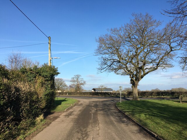
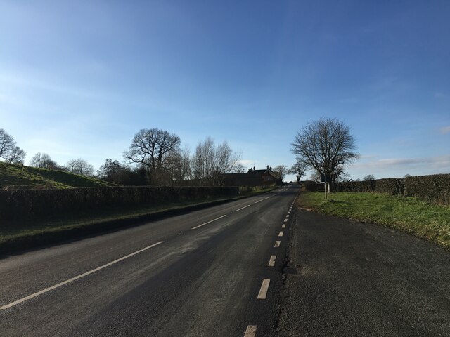
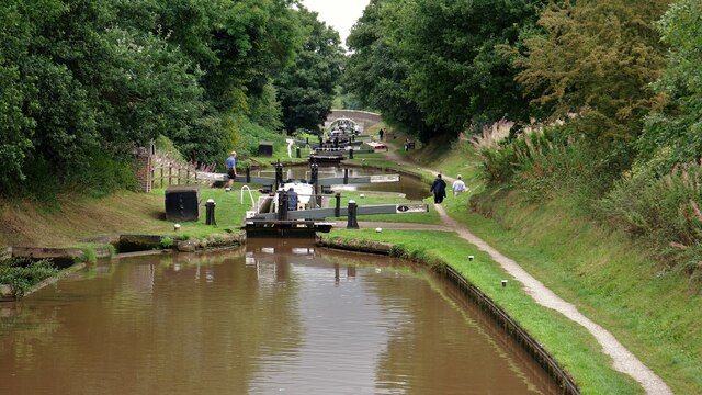
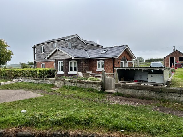
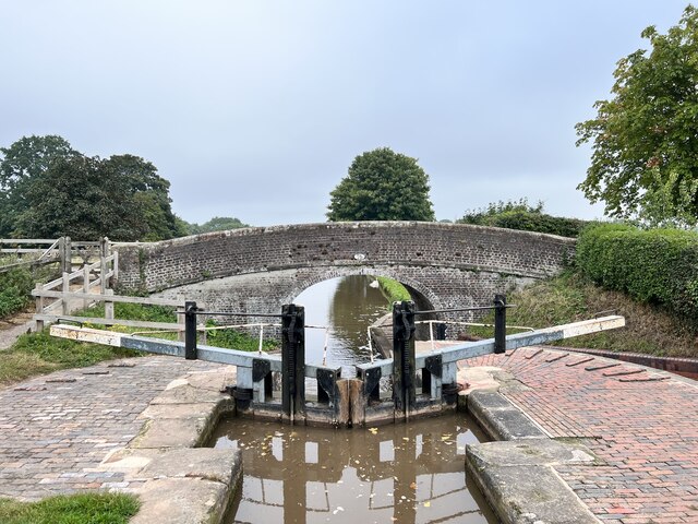
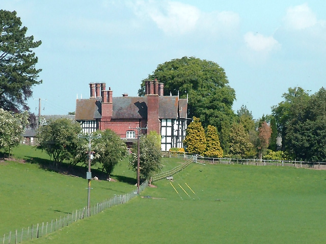
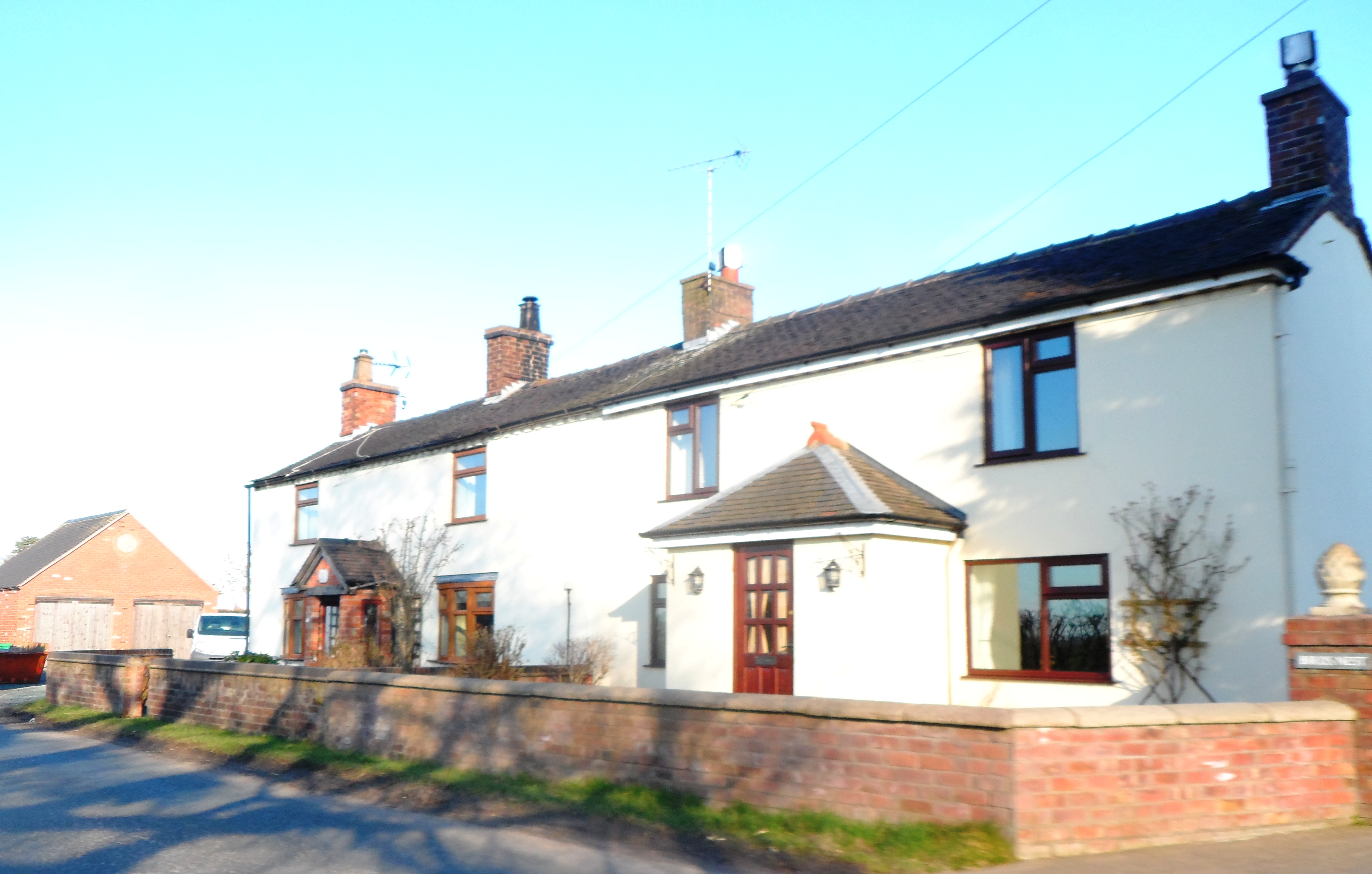
Brown's Bank Images

Images are sourced within 2km of 52.983608/-2.525765 or Grid Reference SJ6443. Thanks to Geograph Open Source API. All images are credited.

Audlem Cemetery: memorial marking unmarked pauper graves Between 1876 and 1951 this area was used to bury persons who died too poor to pay for their own funeral and whose burial fees were met by the parish.  The unmarked graves were discovered in 2003 and as a result this monument, listing those commemorated, was erected in 2012.
Audlem Cemetery: memorial marking unmarked pauper graves
Between 1876 and 1951 this area was used to bury persons who died too poor to pay for their own funeral and whose burial fees were met by the parish. The unmarked graves were discovered in 2003 and as a result this monument, listing those commemorated, was erected in 2012.
Audlem Cemetery: memorial marking unmarked pauper graves Between 1876 and 1951 this area was used to bury persons who died too poor to pay for their own funeral and whose burial fees were met by the parish. The unmarked graves were discovered in 2003 and as a result this monument, listing those commemorated, was erected in 2012.
Audlem Cemetery: memorial marking unmarked pauper graves
Between 1876 and 1951 this area was used to bury persons who died too poor to pay for their own funeral and whose burial fees were met by the parish. The unmarked graves were discovered in 2003 and as a result this monument, listing those commemorated, was erected in 2012.
Former canal company stables and winding hole, bottom of Audlem locks The Shropshire Union Canal (from Autherley to Nantwich) was engineered by Thomas Telford and opened in 1835. There are long straight sections of this canal which required either embankments or cuttings to avoid the need for locks. Although this was a more difficult procedure, the end route was shorter and the progress for horse drawn working boats could be maintained with (hopefully) no stoppages. The canal (formerly the Birmingham and Liverpool Junction Canal) was opened at a time when railways were making serious inroads into the canal companies' businesses. 

The current Shroppie north of Nantwich was formerly the Chester Canal, opened in 1779, and has wider locks and bridges. Boats up to nine feet in beam can still navigate this section; Telford's canal accommodates only narrowboats up to seven feet in beam.
Former canal company stables and winding hole, bottom of Audlem locks
The Shropshire Union Canal (from Autherley to Nantwich) was engineered by Thomas Telford and opened in 1835. There are long straight sections of this canal which required either embankments or cuttings to avoid the need for locks. Although this was a more difficult procedure, the end route was shorter and the progress for horse drawn working boats could be maintained with (hopefully) no stoppages. The canal (formerly the Birmingham and Liverpool Junction Canal) was opened at a time when railways were making serious inroads into the canal companies' businesses. The current Shroppie north of Nantwich was formerly the Chester Canal, opened in 1779, and has wider locks and bridges. Boats up to nine feet in beam can still navigate this section; Telford's canal accommodates only narrowboats up to seven feet in beam.
Shropshire Union Canal, approaching Audlem lock 14
Lightwood Green Avenue
A525 Whitchurch Road
Shropshire Union Canal View north over locks to Snow's Bridge from Bagley Lane Bridge
Shropshire Union Canal
View north over locks to Snow's Bridge from Bagley Lane Bridge
Towpath on Shropshire Union Canal by Audlem The canal run south-east at this point. This section of the Canal is known as the "Main Line" and runs between Nantwich and Autherley Junction. Audlem Mill, a two-storey gift shop, is visible on the left.
Towpath on Shropshire Union Canal by Audlem
The canal run south-east at this point. This section of the Canal is known as the "Main Line" and runs between Nantwich and Autherley Junction. Audlem Mill, a two-storey gift shop, is visible on the left.
Audlem Lock 14 on the Shropshire Union Canal near Audlem The 14th of a flight of 15 locks on the Shropshire Union Canal near Audlem. This section of the Canal is known as the "Main Line" and runs between Nantwich and Autherley Junction.
Audlem Lock 14 on the Shropshire Union Canal near Audlem
The 14th of a flight of 15 locks on the Shropshire Union Canal near Audlem. This section of the Canal is known as the "Main Line" and runs between Nantwich and Autherley Junction.
Former Audlem Police Station Dating from 1901 by the architect Henry Beswick, Cheshire County Architect.
Former Audlem Police Station
Dating from 1901 by the architect Henry Beswick, Cheshire County Architect.
Former Audlem Primitive Methodist Chapel Built in 1871 replacing an earlier chapel on the same site. Open for worship until the 1930s when it merged with the Wesleyan Methodist congregation.
Former Audlem Primitive Methodist Chapel
Built in 1871 replacing an earlier chapel on the same site. Open for worship until the 1930s when it merged with the Wesleyan Methodist congregation.
Moss Hall, Audlem Grade I listed. Listing number 1138519. Manor House. Early 17th century. Timber framed with rendered infill and brick with a plain tile roof. Two storeys with attics. Entrance front: of 5 bays near-symmetrically disposed in E-shaped arrangement.
Moss Hall, Audlem
Grade I listed. Listing number 1138519. Manor House. Early 17th century. Timber framed with rendered infill and brick with a plain tile roof. Two storeys with attics. Entrance front: of 5 bays near-symmetrically disposed in E-shaped arrangement.
Over Water Marina On the Shropshire Union Canal.
Over Water Marina
On the Shropshire Union Canal.
The Old Stables, Audlem At the bottom of the Audlem lock flight on the Shropshire Union Canal.
The Old Stables, Audlem
At the bottom of the Audlem lock flight on the Shropshire Union Canal.
Audlem: canal bridge and lock 12 beyond
Ivy House and Holly House, Nantwich Grade II listed. Listing number 1241935. House, now subdivided into three houses. Mid/late C18. Whitewashed Flemish bond brick with a plain tile roof. Three storeys.
Ivy House and Holly House, Nantwich
Grade II listed. Listing number 1241935. House, now subdivided into three houses. Mid/late C18. Whitewashed Flemish bond brick with a plain tile roof. Three storeys.
Former lock keeper's cottage At bridge 74 on the Shropshire Union Canal
Former lock keeper's cottage
At bridge 74 on the Shropshire Union Canal
Bridge 75 on the Shropshire Union Canal Grade II listed. Listing number 1115818. Accommodation bridge. C1827-30 and later Telford design. Brick, with stone band and copings. Single elliptical arch. Slightly cambered solid parapet, and piers. Parapets partly rebuilt at later date. 2 iron rope fenders. Brick paved towpath beneath bridge.
Bridge 75 on the Shropshire Union Canal
Grade II listed. Listing number 1115818. Accommodation bridge. C1827-30 and later Telford design. Brick, with stone band and copings. Single elliptical arch. Slightly cambered solid parapet, and piers. Parapets partly rebuilt at later date. 2 iron rope fenders. Brick paved towpath beneath bridge.
Show me another place!

Brown's Bank is located at Grid Ref: SJ6443 (Lat: 52.983608, Lng: -2.525765)

Unitary Authority: Cheshire East

Police Authority: Cheshire

What 3 Words

///photo.banter.lighters. Near Audlem, Cheshire

Nearby Locations

Brown's Bank

Related Wikis

Audlem railway station

Audlem railway station was a station on the former Great Western Railway between Market Drayton and Nantwich, opened in 1863. It served the village of...

Moss Hall, Audlem

Moss Hall, Audlem, is a manor house 0.5 miles (1 km) north-west of Audlem, Cheshire, England. It is recorded in the National Heritage List for England...

St James' Church, Audlem

St James' Church is in the village of Audlem in south Cheshire, England. It is recorded in the National Heritage List for England as a designated Grade...

Audlem

Audlem ( ORD-ləm) is a village and civil parish located in the unitary authority of Cheshire East and the ceremonial county of Cheshire in North West England...

Coxbank Halt railway station

Coxbank Halt railway station was located in Audlem, Cheshire, England. The station was opened by the Great Western Railway, the station closed on 9 September...

Audlem Baptist Church

Audlem Baptist Church is in Woore Road, Audlem, Cheshire, England. It is an active Baptist church, and is recorded in the National Heritage List for England...

Little Heath, Cheshire East

Little Heath is a village in the civil parish of Audlem, Cheshire, England. It is located to the north of Audlem, between Lonk Land and Audlem Road, the...

Barnett Brook

Barnett Brook is a hamlet in the Newhall and Dodcott cum Wilkesley civil parishes in the Cheshire East area of Cheshire, England. The hamlet is situated...

Nearby Amenities

Located within 500m of 52.983608,-2.525765
Bus Stop
Browns Bank, Whitchurch Road / Coole Lane
Bus: yes
Naptan AtcoCode: 0600CRIM1700
Naptan Bearing: NW
Naptan BusStopType: CUS
Naptan CommonName: Coole Lane
Naptan Crossing: Coole Lane
Naptan Indicator: opp
Naptan Landmark: Coole Lane
Naptan LocalityName: Browns Bank
Naptan NaptanCode: chewmga
Naptan ShortCommonName: Coole Lane
Naptan Street: Whitchurch Road
Naptan Verified: no
Network: Cheshire East Council
Operator: Ansa Transport
Public Transport: platform
Source: naptan_import
Lat/Long: 52.9838503/-2.5297665
The data included in this document is from www.openstreetmap.org. The data is made available under ODbL.

Have you been to Brown's Bank?

Leave your review of Brown's Bank below (or comments, questions and feedback).