Owthorpe

Civil Parish in Nottinghamshire Rushcliffe

England

Owthorpe

Former road to Owthorpe This is now reduced to the status of a bridleway and provides access to Wolds Farm. The road was diverted when the A46 was dualled.
Former road to Owthorpe Credit: Jonathan Thacker

Owthorpe is a small civil parish located in the county of Nottinghamshire, England. Situated approximately 9 miles southeast of Nottingham city, the village is set in a rural area surrounded by picturesque countryside. It covers a land area of around 1.5 square miles and has a population of around 100 residents.

The village of Owthorpe is known for its peaceful and idyllic atmosphere, making it an attractive place to live for those seeking a tranquil rural lifestyle. It is characterized by charming old cottages, traditional farmhouses, and well-preserved historic buildings, giving it a distinct sense of heritage.

The parish is also home to the St. Margaret of Antioch Church, a Grade II* listed building dating back to the 12th century. The church is a significant landmark and attracts visitors interested in its architectural beauty and historical importance.

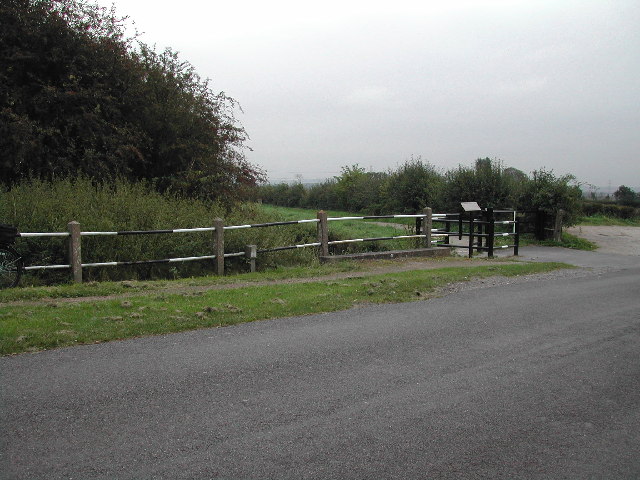
The surrounding countryside offers opportunities for outdoor activities such as walking, cycling, and horse riding, with many scenic trails and bridleways nearby. The River Smite, a tributary of the Trent, flows through the parish, providing a picturesque backdrop for nature enthusiasts.

Although Owthorpe is a small village, it benefits from being in close proximity to larger towns and cities such as Nottingham and Melton Mowbray, where residents can access a wider range of amenities and services.

Overall, Owthorpe offers a charming and peaceful rural lifestyle, making it an appealing location for those seeking a slower-paced community in the heart of the Nottinghamshire countryside.

If you have any feedback on the listing, please let us know in the comments section below.

Owthorpe Images

Images are sourced within 2km of 52.887712/-1.006775 or Grid Reference SK6632. Thanks to Geograph Open Source API. All images are credited.

Former road to Owthorpe This is now reduced to the status of a bridleway and provides access to Wolds Farm. The road was diverted when the A46 was dualled.
Former road to Owthorpe
This is now reduced to the status of a bridleway and provides access to Wolds Farm. The road was diverted when the A46 was dualled.
Road sign at the top of the bank Seen from the former road to Owthorpe.
Road sign at the top of the bank
Seen from the former road to Owthorpe.
Vimy Ridge Farm perhaps named after that infamous ridge from WWI
Vimy Ridge Farm
perhaps named after that infamous ridge from WWI
Chestnut Tree on Kinoulton Lane looks like it will be a good season for konkers
Chestnut Tree on Kinoulton Lane
looks like it will be a good season for konkers
Walnut Tree Farm, Owthorpe
Junction of Kinouton Lane and Swab's Lane
Mackley's Bridge over the Grantham Canal Being a disused canal, the old original bridge is long gone.
Mackley's Bridge over the Grantham Canal
Being a disused canal, the old original bridge is long gone.
A farm in the hamlet of Owthorpe time seems to have stood still here
A farm in the hamlet of Owthorpe
time seems to have stood still here
Owthorpe Church taken from Park Lane
Owthorpe Church
taken from Park Lane
The Old Farm House on Swab's Lane, near Cropwell Bishop
The Old Farm House
on Swab's Lane, near Cropwell Bishop
A Steel Sentinal on the Owthorpe Road near Spencer's Bridge
A Steel Sentinal
on the Owthorpe Road near Spencer's Bridge
Wynnstay Wood, Leicestershire Looking West from A46
Wynnstay Wood, Leicestershire
Looking West from A46
A46 Junction to Cotgrave & Owthorpe
Farmland near Cropwell Bishop Cropwell Wolds Farm is in the centre of this square surrounded by a very large open field system designed for large machinery.
Farmland near Cropwell Bishop
Cropwell Wolds Farm is in the centre of this square surrounded by a very large open field system designed for large machinery.
Reservoir near Cropwell Bishop An underground reservoir with a small square pump house.
Reservoir near Cropwell Bishop
An underground reservoir with a small square pump house.
Farm Road near the A46, Fosse Way Looking towards Wolds Farm, one of three with the same name within a few miles of each other. Cotgrave Forest is on the left. The forest is divided up into "plantations". This one is called Newark Gate.
Farm Road near the A46, Fosse Way
Looking towards Wolds Farm, one of three with the same name within a few miles of each other. Cotgrave Forest is on the left. The forest is divided up into "plantations". This one is called Newark Gate.
Access path to the Grantham Canal This leads from Colston Road down to the Grantham Canal linking the towpath from one side to the other as the old bridge was demolished and culverted in the 1950s.
Access path to the Grantham Canal
This leads from Colston Road down to the Grantham Canal linking the towpath from one side to the other as the old bridge was demolished and culverted in the 1950s.
Yellow iris  (Iris pseudacorus) The section of the Grantham Canal to the west of Colston Road near to the old Blue Hill Bridge, has only about 12 inches of water which is ideal for all sorts of water margin plants. Growing in the marshy bottom of the canal, this native iris is also known as 'segg', which derives from an Anglo-Saxon word meaning 'short sword' and refers to the shape of the leaves; and yellow flag because of the fluttering of the flowers. The flowers can produce a yellow dye, and the rhizome, a black dye.
Yellow iris (Iris pseudacorus)
The section of the Grantham Canal to the west of Colston Road near to the old Blue Hill Bridge, has only about 12 inches of water which is ideal for all sorts of water margin plants. Growing in the marshy bottom of the canal, this native iris is also known as 'segg', which derives from an Anglo-Saxon word meaning 'short sword' and refers to the shape of the leaves; and yellow flag because of the fluttering of the flowers. The flowers can produce a yellow dye, and the rhizome, a black dye.
Show me another place!

Owthorpe is located at Grid Ref: SK6632 (Lat: 52.887712, Lng: -1.006775)

Administrative County: Nottinghamshire

District: Rushcliffe

Police Authority: Nottinghamshire

What 3 Words

///catapult.migrants.twice. Near Cotgrave, Nottinghamshire

Related Wikis

Owthorpe

Owthorpe is a small English village and civil parish in the Wolds of the East Midland county of Nottinghamshire. The population of about 90 was included...

St Margaret's Church, Owthorpe

St Margaret's Church, Owthorpe is a Grade II* listed parish church in the Church of England in Owthorpe, Nottinghamshire, England. Owthorpe has an unusual...

Scunthorpe Mudstone

The Scunthorpe Mudstone is a geologic formation in England. It preserves plesiosaur fossils dating back to the Late Triassic (Rhaetian) to Early Jurassic...

St Luke's Church, Kinoulton

St Luke's Church, Kinoulton is a Grade II* listed parish church in the Church of England in Kinoulton. == History == The church dates from 1793 and was...

Nearby Amenities

Located within 500m of 52.887712,-1.006775
Material: wood
Operator: BT
Power: pole
Lat/Long: 52.8887074/-1.0076387
Barrier: stile
Lat/Long: 52.8874669/-1.0072255
Material: wood
Operator: BT
Power: pole
Lat/Long: 52.8900602/-1.0063855
Traffic Sign: yes
Lat/Long: 52.8840733/-1.003187
The data included in this document is from www.openstreetmap.org. The data is made available under ODbL.

Have you been to Owthorpe?

Leave your review of Owthorpe below (or comments, questions and feedback).