Otley

Civil Parish in Suffolk East Suffolk

England

Otley

Pond at Otley Hall Part of the "H" shaped ponds at Otley Hall - marked as "fish ponds" on the OS Map
Pond at Otley Hall Credit: Chris Holifield

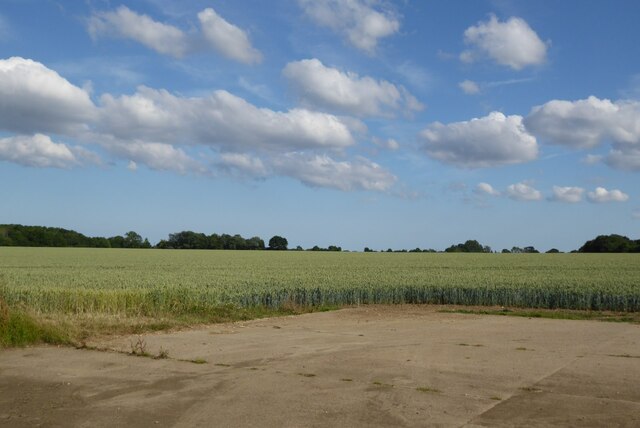
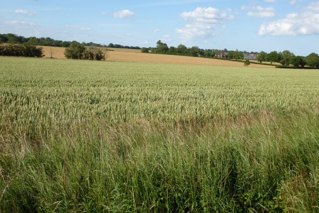
Otley is a civil parish located in the county of Suffolk, in the eastern part of England. It is situated approximately five miles north of the town of Ipswich and covers an area of about 10 square kilometers. The parish is predominantly rural, characterized by open fields, farmland, and a few scattered residential properties.

The village of Otley itself is small and charming, with a population of around 500 residents. It has a rich history, dating back to medieval times, and is known for its picturesque landscapes and tranquil atmosphere. The village is centered around a traditional English village green, where local events and gatherings take place throughout the year.

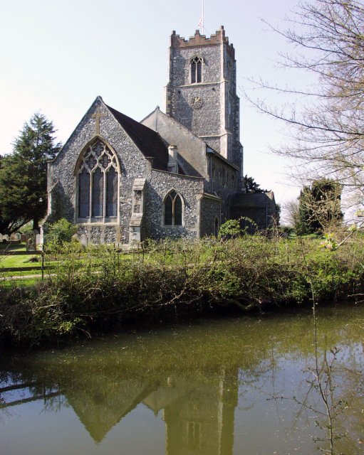
Despite its small size, Otley offers a range of amenities and services to its residents. These include a primary school, a village hall that serves as a community center, a post office, and a local pub. The parish also has a church, St. Mary's, which dates back to the 13th century and is known for its historic architecture.

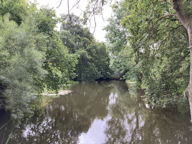
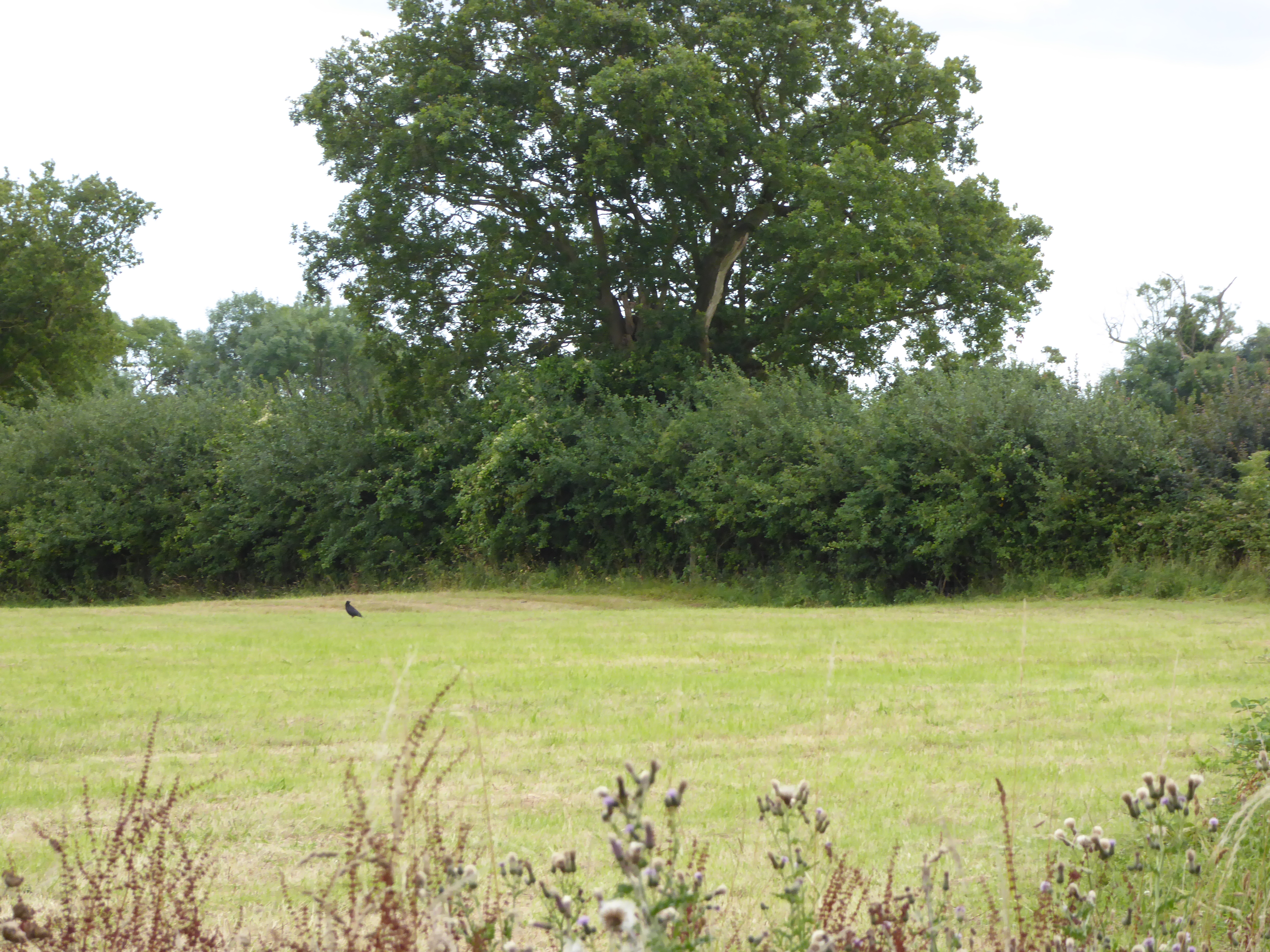
The surrounding countryside of Otley is perfect for outdoor enthusiasts, with plenty of walking and cycling routes to explore. The area is also home to several nature reserves and wildlife habitats, offering opportunities for birdwatching and nature photography.

In summary, Otley is a charming and idyllic civil parish in Suffolk, offering a peaceful rural lifestyle and a strong sense of community.

If you have any feedback on the listing, please let us know in the comments section below.

Otley Images

Images are sourced within 2km of 52.15312/1.220806 or Grid Reference TM2055. Thanks to Geograph Open Source API. All images are credited.

Pond at Otley Hall Part of the "H" shaped ponds at Otley Hall - marked as "fish ponds" on the OS Map
Pond at Otley Hall
Part of the "H" shaped ponds at Otley Hall - marked as "fish ponds" on the OS Map
The moat at Otley Hall
Puddles on the path near Round Wood
House on the Otley Road
Otley, St Mary
Otley, St Mary
A wheat field near Gibraltar
Arable fields near Otley Wheat fields near Otley.
Arable fields near Otley
Wheat fields near Otley.
Cottage on Ipswich Road, Otley from a nearby footpath
View towards Otley Church
Derelict tin tabernacle next to the B1078, Clopton A Clopton village website (<span class="nowrap"><a title="http://clopton.onesuffolk.net/clopton-village/history-and-heritage/" rel="nofollow ugc noopener" href="http://clopton.onesuffolk.net/clopton-village/history-and-heritage/">Link</a><img style="margin-left:2px;" alt="External link" title="External link - shift click to open in new window" src="https://s1.geograph.org.uk/img/external.png" width="10" height="10"/></span> ) implies that these are the former Mission Rooms, which were replaced by a new village hall in the early 1990s.
Derelict tin tabernacle next to the B1078, Clopton
A Clopton village website (LinkExternal link ) implies that these are the former Mission Rooms, which were replaced by a new village hall in the early 1990s.
Derelict tin tabernacle next to the B1078, Clopton As can just be made out, the roof of the chapel has collapsed at the north-west end (liturgical east end) and the window at that end can be seen from the "inside" side.
A Clopton village website (<span class="nowrap"><a title="http://clopton.onesuffolk.net/clopton-village/history-and-heritage/" rel="nofollow ugc noopener" href="http://clopton.onesuffolk.net/clopton-village/history-and-heritage/">Link</a><img style="margin-left:2px;" alt="External link" title="External link - shift click to open in new window" src="https://s1.geograph.org.uk/img/external.png" width="10" height="10"/></span> ) implies that these are the former Mission Rooms, which were replaced by a new village hall in the early 1990s.
Derelict tin tabernacle next to the B1078, Clopton
As can just be made out, the roof of the chapel has collapsed at the north-west end (liturgical east end) and the window at that end can be seen from the "inside" side. A Clopton village website (LinkExternal link ) implies that these are the former Mission Rooms, which were replaced by a new village hall in the early 1990s.
View out of the valley from the B1078
Former school, Clopton, Suffolk According to a Clopton village website (<span class="nowrap"><a title="http://clopton.onesuffolk.net/clopton-village/history-and-heritage/" rel="nofollow ugc noopener" href="http://clopton.onesuffolk.net/clopton-village/history-and-heritage/">Link</a><img style="margin-left:2px;" alt="External link" title="External link - shift click to open in new window" src="https://s1.geograph.org.uk/img/external.png" width="10" height="10"/></span> ), Clopton school closed in the late 1930s.
Former school, Clopton, Suffolk
According to a Clopton village website (LinkExternal link ), Clopton school closed in the late 1930s.
Fish  Ponds  in  the  grounds  of  Otley  Hall Building on the left over the reeds is the cafe and entrance to the gardens of the hall
Fish Ponds in the grounds of Otley Hall
Building on the left over the reeds is the cafe and entrance to the gardens of the hall
Otley  Hall  c15  and  early  c16  House Pevsner states it is one of the most interesting houses in Suffolk
Otley Hall c15 and early c16 House
Pevsner states it is one of the most interesting houses in Suffolk
Otley  Primary  School  and  Under  5s  Centre.  Chapel  Road
Otley Primary School and Under 5s Centre. Chapel Road
Otley  Post  Office  and  Store.  Chapel  Road
Otley Post Office and Store. Chapel Road
Road  junction  in  Otley  village The village name sign is to the left of the Stop sign
Road junction in Otley village
The village name sign is to the left of the Stop sign
Show me another place!

Otley is located at Grid Ref: TM2055 (Lat: 52.15312, Lng: 1.220806)

Administrative County: Suffolk

District: East Suffolk

Police Authority: Suffolk

What 3 Words

///mercy.proved.deform. Near Grundisburgh, Suffolk

Nearby Locations

Otley Otley

Related Wikis

Otley, Suffolk

Otley is a village and civil parish in the East Suffolk district, in the English county of Suffolk. It is around 7 miles (11 km) north-east of Ipswich...
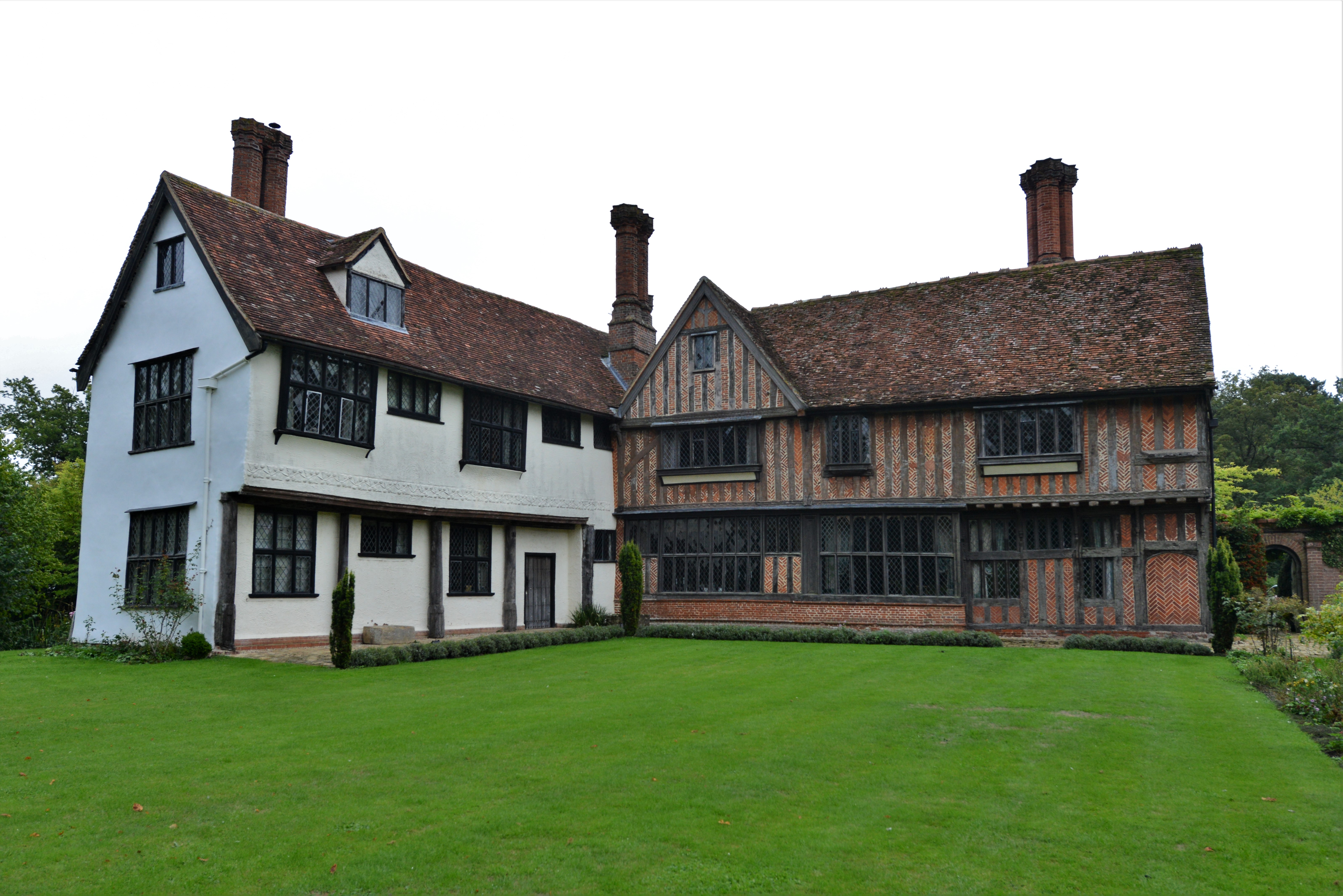
Otley Hall

Otley Hall is a 16th-century English manor house in the civil parish of Otley, in the East Suffolk district, Suffolk, England. It is a Grade I listed building...

Suffolk Rural College

Suffolk Rural College is an English further education college in the village of Otley, Suffolk. The college was founded in 1970 as Otley College of Agriculture...

Moat Farm Meadows

Moat Farm Meadows is a 3.3-hectare (8.2-acre) biological Site of Special Scientific Interest north-east of Otley in Suffolk.These calcareous meadows are...

Nearby Amenities

Located within 500m of 52.15312,1.220806
Otley
Is In Country Code: GB
Is In County: Suffolk
Is In Municipality: Suffolk Coastal
Place: village
Postal Code: IP6
Wikidata: Q2775138
Wikipedia: en:Otley, Suffolk
Lat/Long: 52.1512935/1.2213734
Bus Stop
Shop
Local Ref: opp
Naptan AtcoCode: 390060318
Naptan Bearing: SW
Naptan CommonName: Shop
Naptan Indicator: opp
Naptan Landmark: Shop
Naptan NaptanCode: sufgpgdp
Naptan Street: Chapel Road
Naptan Verified: no
Public Transport: platform
Shelter: yes
Source: naptan_import
Lat/Long: 52.1512807/1.2203727
Bus Stop
Shop
Local Ref: o/s
Naptan AtcoCode: 390060319
Naptan Bearing: NE
Naptan CommonName: Shop
Naptan Indicator: o/s
Naptan Landmark: Shop
Naptan NaptanCode: sufgpgdt
Naptan Street: Chapel Road
Naptan Verified: no
Public Transport: platform
Source: naptan_import
Lat/Long: 52.1514542/1.2204952
Pub
The White Hart
Source: OS_OpenData_StreetView
Lat/Long: 52.1557706/1.2173547
Post Office
Otley Post Office
Addr City: Ipswich
Addr Postcode: IP6 9NT
Addr Street: Chapel Road
Addr Village: Otley
Brand: Post Office
Brand Wikidata: Q1783168
Contact Website: https://www.postoffice.co.uk/branch-finder/0941301/otley
Fhrs Id: 659741
Opening Hours: Mo,We 09:00-17:00; Tu,Fr 09:00-12:30,13:00-17:00; Th 09:00-13:00; Sa 09:00-12:00
Ref Pol Id: 1107
Source: OS_OpenData_StreetView
Source Addr: pol_branch_list_2018-01
Source Opening Hours: pol_branch_list_2018-01
Lat/Long: 52.1513902/1.2202972
Crossing
Crossing: zebra
Crossing Island: no
Tactile Paving: yes
Lat/Long: 52.1514536/1.2199607
Telephone
Booth: K6
Covered: booth
Phone: +44 1473 890388
Lat/Long: 52.1513889/1.2203682
Post Box
Post Box Design: ludlow
Post Box Type: wall
Royal Cypher: GR
Royal Cypher Wikidata: Q33102273
Lat/Long: 52.1513648/1.2202828
Otley Village Store
Shop: convenience
Lat/Long: 52.1514366/1.2203856
Stop
Direction: forward
Lat/Long: 52.1512127/1.2202163
Man Made: village_sign
Lat/Long: 52.1511637/1.2203423
Bench
Lat/Long: 52.1512465/1.2204124
Defibrillator
Access: yes
Defibrillator Location: outside Otley Village Hall
Emergency: defibrillator
Indoor: no
Ref GB The Circuit: F580D0AD-0EB3-4006-B8B2-AE1D00C7CE74
Lat/Long: 52.1531168/1.2226667
Recycling
Recycling Type: container
Lat/Long: 52.1531461/1.223116
The data included in this document is from www.openstreetmap.org. The data is made available under ODbL.

Have you been to Otley?

Leave your review of Otley below (or comments, questions and feedback).