Onecote

Civil Parish in Staffordshire Staffordshire Moorlands

England

Onecote

Morridge, view Looking from the viewpoint across grazing land, with Hen Cloud and the Roaches in the distance.
Morridge, view Credit: Mike Faherty

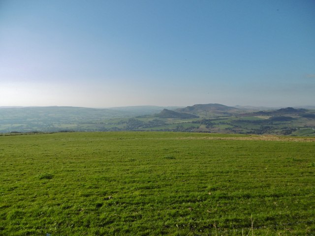
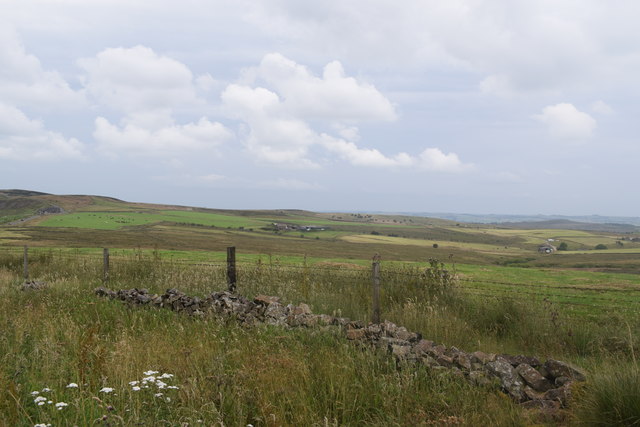
Onecote is a civil parish located in the county of Staffordshire, England. It is situated in the picturesque Peak District National Park, surrounded by stunning natural landscapes and scenic beauty. The parish is part of the Staffordshire Moorlands district and is approximately 10 miles north of the market town of Leek.

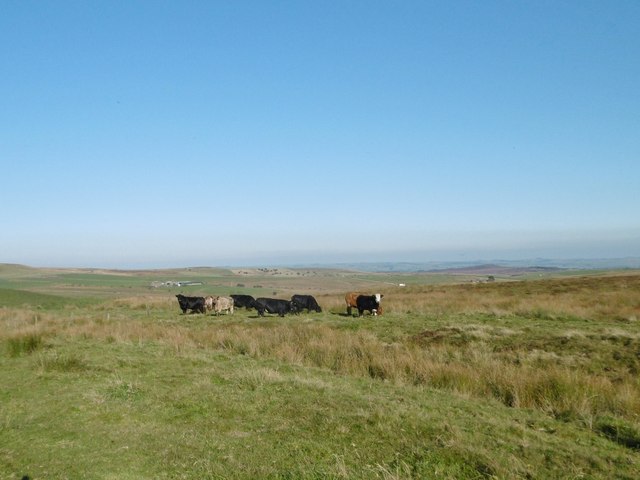
Onecote is a small and charming village with a population of around 200 residents. The parish is known for its rural setting and tranquil atmosphere, attracting visitors who seek peace and relaxation amidst nature. The village is characterized by traditional stone-built houses, giving it a unique and timeless appeal.

The area offers plenty of opportunities for outdoor activities, such as hiking, cycling, and birdwatching. The nearby Manifold Valley is a popular destination for walkers, as it provides access to the Manifold Way, a scenic trail that follows the route of a disused railway line.

The village has a close-knit community, with a local pub being the hub of social activity. The pub serves as a meeting place for locals and visitors alike, providing a warm and friendly atmosphere.

Although small in size, Onecote has a rich history, with evidence of human settlement dating back to prehistoric times. The parish is home to several listed buildings, including the Grade II listed Anglican Church of St. Luke, which sits prominently in the village.

Overall, Onecote offers a peaceful retreat in the heart of the Staffordshire countryside, with its idyllic setting and natural beauty making it a desirable destination for those seeking a rural escape.

If you have any feedback on the listing, please let us know in the comments section below.

Onecote Images

Images are sourced within 2km of 53.117199/-1.948988 or Grid Reference SK0357. Thanks to Geograph Open Source API. All images are credited.

Morridge, view Looking from the viewpoint across grazing land, with Hen Cloud and the Roaches in the distance.
Morridge, view
Looking from the viewpoint across grazing land, with Hen Cloud and the Roaches in the distance.
Morridge, cattle grazing On the ridge above Upper Hulme.
Morridge, cattle grazing
On the ridge above Upper Hulme.
The Stable at Harvey Gate
Blackshaw Moor Road on the edge of Blackshaw Moor.
Blackshaw Moor
Road on the edge of Blackshaw Moor.
Triangle Road junction near The Triangle Farm.
Triangle
Road junction near The Triangle Farm.
Former Ford at Onecote This point is marked on the OS 1:25000 map as a ford but is now culverted with a substantial pipe.
Former Ford at Onecote
This point is marked on the OS 1:25000 map as a ford but is now culverted with a substantial pipe.
The viewpoint on Morridge The camera makes it look much clearer than it seemed at the time. 
See <a href="https://www.geograph.org.uk/photo/4437827">SK0259 : The view point on Morridge</a> for the view I missed.
The viewpoint on Morridge
The camera makes it look much clearer than it seemed at the time. See SK0259 : The view point on Morridge for the view I missed.
Fingerpost by a gate The path indicated is leaving Blakelow Road, heading down Morridge for Stile House Farm.
Fingerpost by a gate
The path indicated is leaving Blakelow Road, heading down Morridge for Stile House Farm.
View by Blakelow Road The signs are on Easing Lane which drops from Morridge towards Easing Farm.
View by Blakelow Road
The signs are on Easing Lane which drops from Morridge towards Easing Farm.
Roadside, Blakelow Road Looking across the wall and signs towards the lane to Clough House Farm.
Roadside, Blakelow Road
Looking across the wall and signs towards the lane to Clough House Farm.
View from Morridge Looking east south-east from the road a short distance from the more popular viewpoint which looks west off the ridge.
View from Morridge
Looking east south-east from the road a short distance from the more popular viewpoint which looks west off the ridge.
The track to Mixon From Onecote Grange
The track to Mixon
From Onecote Grange
At Mixon - junction of tracks
Young bull above The River Hamps He was guarding the public right of way, causing me to divert into the adjacent field.
Young bull above The River Hamps
He was guarding the public right of way, causing me to divert into the adjacent field.
Building at  Mixon's former copper mine
Building at Mixon's former copper mine
View to Brund Hays from Black Brook
Footbridge over The River Hamps
Approaching Black Brook When another Geograph member passed by here in 2011, the farm appeared to be abandoned but it has clearly enjoyed rejuvenation since then:- <a title="https://www.geograph.org.uk/photo/2515522" href="https://www.geograph.org.uk/photo/2515522">Link</a>
Approaching Black Brook
When another Geograph member passed by here in 2011, the farm appeared to be abandoned but it has clearly enjoyed rejuvenation since then:- Link
Show me another place!

Onecote is located at Grid Ref: SK0357 (Lat: 53.117199, Lng: -1.948988)

Administrative County: Staffordshire

District: Staffordshire Moorlands

Police Authority: Staffordshire

What 3 Words

///bangle.envoy.years. Near Leek, Staffordshire

Nearby Locations

Onecote

Related Wikis

Thorncliffe, Staffordshire

Thorncliffe is a small village in Staffordshire, England, straddling the Staffordshire Moorlands and Peak District National Park. By 1600 the name Thorncliffe...

River Hamps

The River Hamps is a river in Staffordshire, England. It is a tributary of the River Manifold, which itself flows into the River Dove near Ilam. For much...

Morridge

Morridge is a geographical feature, a few mile east of Leek, in Staffordshire, England. It is in the local government district of Staffordshire Moorlands...
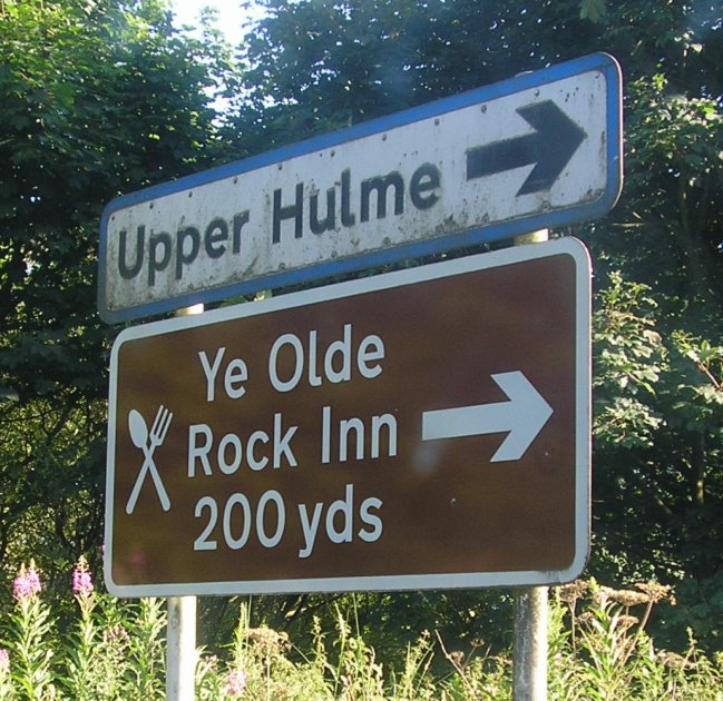
Upper Hulme

Upper Hulme is a hamlet in North Staffordshire, between the historic market town of Leek and the spa town of Buxton. It is clustered around a redundant...

Nearby Amenities

Located within 500m of 53.117199,-1.948988
Barrier: stile
Material: wood
Source: survey;gps
Stile: stepover
Lat/Long: 53.1169098/-1.9461532
Barrier: stile
Material: wood
Source: survey;gps
Stile: stepover
Lat/Long: 53.1182071/-1.9466758
Barrier: stile
Material: wood
Source: survey;gps
Stile: stepover
Lat/Long: 53.1202608/-1.9486863
Barrier: cattle_grid
Bicycle: yes
Foot: yes
Lat/Long: 53.1204434/-1.9486393
Onecoat Morridge Airstrip
Aeroway: aerodrome
Source: http://www.airfieldcards.com/php/courtesy_card.php?id=258
Lat/Long: 53.1162796/-1.9453816
The data included in this document is from www.openstreetmap.org. The data is made available under ODbL.

Have you been to Onecote?

Leave your review of Onecote below (or comments, questions and feedback).